
The leading cloud-native spatial analysis platform, empowering all teams with insights directly in their data warehouse for faster, more accessible decisions.
Joined January 2011
- Tweets 13,698
- Following 5,599
- Followers 31,108
- Likes 6,627
4,644 Photos and videos


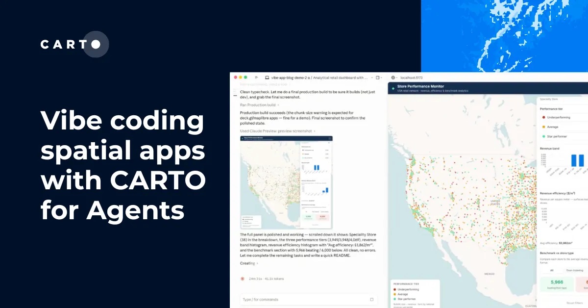


Following our announcement at #SDSC26, we are introducing CARTO for Agents 🚀
Powered by our new CLI, Agent Skills, and MCP Server, models like Claude and Gemini can now drive your spatial analysis and build maps end-to-end.
Read the announcement:
tinyurl.com/yk4v2uf2
1
373
Spatial analytics should not be limited by who has a license. 🗺️
Consumption pricing helps teams expand access, scale Agentic GIS, and align costs with actual usage.
Read more: hubs.ly/Q04lJt2p0
154
Better site selection starts with better place context. 📍
Join CARTO Google Maps Platform to see how Places Insights can help financial services teams analyze market opportunity, customer access, and site performance.
Register now: hubs.ly/Q04lxc3c0
1
235
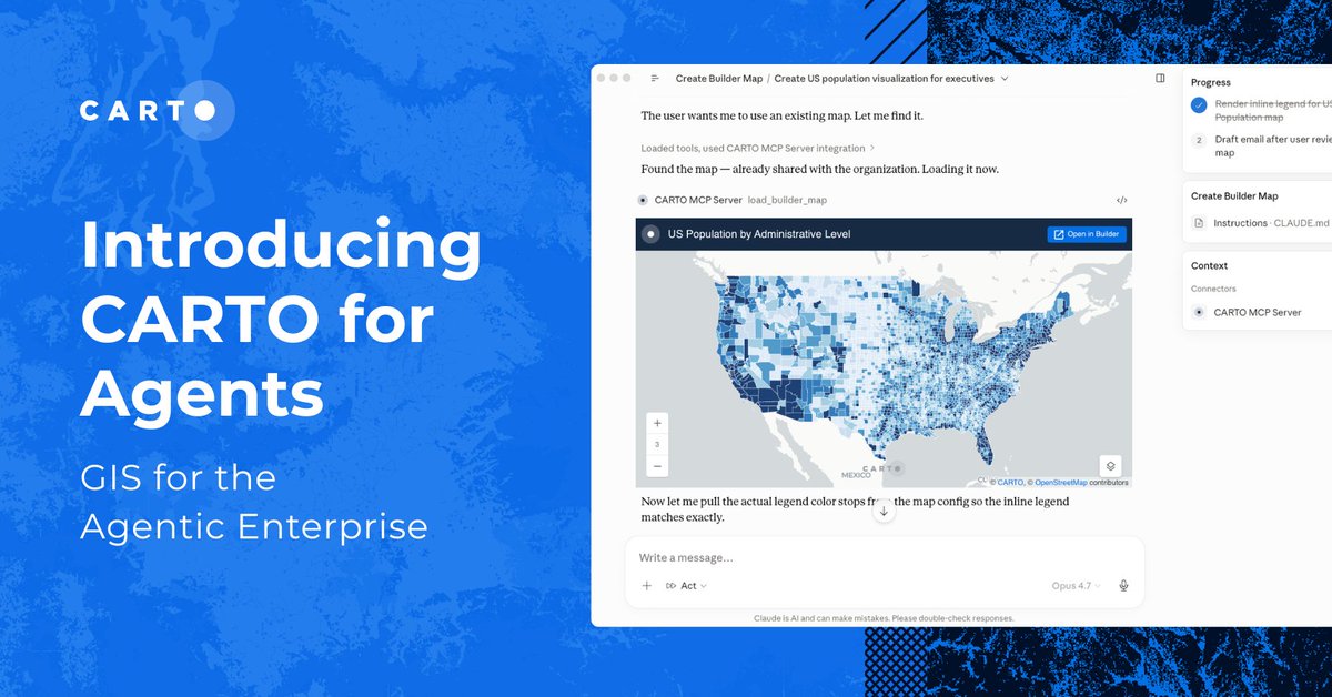
With CARTO for Agents, developers can use coding tools like Claude Code or Copilot to generate and run custom CARTO deck. gl apps in minutes.
See how to securely connect your data warehouse and build interactive story maps.
Read how: hubs.ly/Q04lnKht0
278
Where should World Cup sponsors activate? ⚽🏟️
We mapped all 16 host cities and scored 31,000 locations to find the strongest activation hotspots.
Explore the interactive map: hubs.ly/Q04lb2hx0
228
Tomorrow is your last chance to submit a talk for #SDSC26 New York. 🚨
Built something interesting or learned a lesson worth sharing? Send us your proposal before the CFP closes tomorrow:
hubs.ly/Q04l1mqt0
197
AI agents can write code and answer questions.
But can they create maps, run spatial analysis, and build geospatial workflows?
Join our July 7th webinar to see CARTO for Agents in action.
Register here: hubs.ly/Q04kGxNW0
1
201
🎤 The Call for Papers officially closes this Friday.
We are looking for data leaders pushing the boundaries of GeoAI and Location Intelligence to share their work with the global spatial community.
Submit your proposal before the deadline:
hubs.ly/Q04ks-KJ0
313
Prompt your coding agent. Get a fully auditable spatial workflow. 🤖🗺️
See how to pair agents like Claude and Copilot with CARTO to build complex spatial analyses in minutes, directly inside your data warehouse.
Read the blog: hubs.ly/Q04k4MYh0
1
203
Missed #SDSC26 London? We’ve got you covered. 🍿
We just published all the session recordings on demand. Learn how organizations are using everything from cloud-native GIS to deploying AI for Location Intelligence.
Watch the talks here: hubs.ly/Q04jT0wt0
241
Thinking about speaking at #SDSC26 New York? 🎤
The call for papers closes on June 12th, and we’re looking for practical talks on spatial analytics, AI, cloud data platforms, and real-world geospatial work.
Submit your proposal: hubs.ly/Q04jJKNc0

409
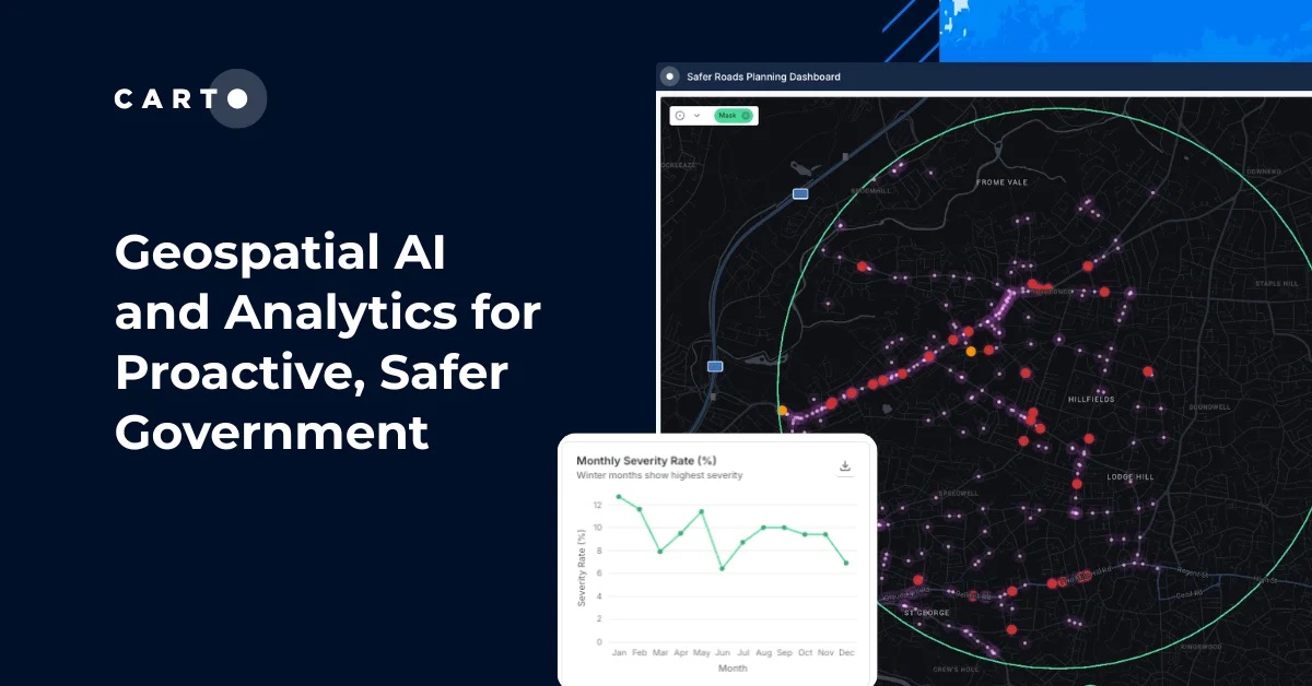
Geospatial AI and Analytics for Proactive, Safer Government 🚦
Explore how public agencies are using live road data, cloud-native geospatial analytics, and AI agents to improve transportation planning, road safety, and infrastructure decisions.
🔗 tinyurl.com/4pvu9c6m
302
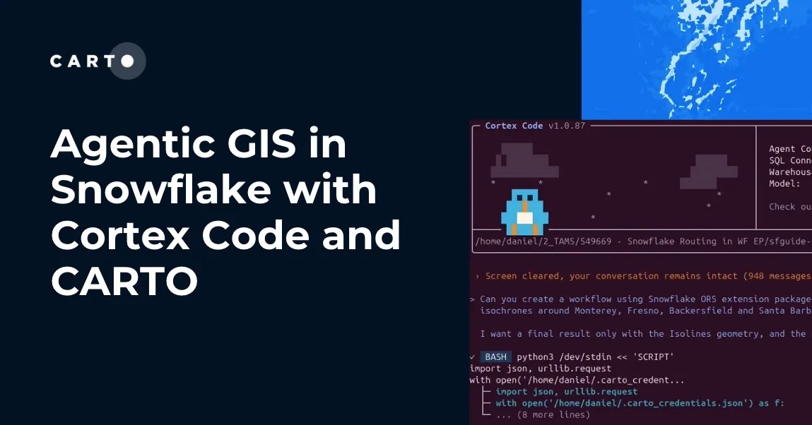
Agentic GIS in Snowflake with Cortex Code and CARTO ❄️🤖
Prompt Snowflake Cortex Code to securely inspect your data, handle cartography, and drop a fully interactive CARTO map directly into your chat.
Learn more: hubs.ly/Q04jysK00
198
Ask CARTO AI Agents which bank branches are best to consolidate, and get an answer in minutes. 💬
See how teams can assess overlap, service impact, and cost savings directly in their cloud data warehouse.
Explore CARTO for Financial Services: tinyurl.com/tauwxkdn
219
On-site in Helsinki for @opengeospatial Connect? 🇫🇮
If you want to talk cloud-native, Geo-AI, and modern spatial infrastructure, book a meeting with our Founder & CSO, Javier de la Torre, here: hubs.ly/Q04jwT2Q0
(And catch his AI workshop on Wed @ 15:30 in Rm 519!)

222
Prompt your maps with CARTO 🗺️
Ask a coding agent like Claude, Copilot, or Cursor to inspect your data, style the map, and return an interactive CARTO map directly in chat.
See how it works: hubs.ly/Q04jcgf60

2
224
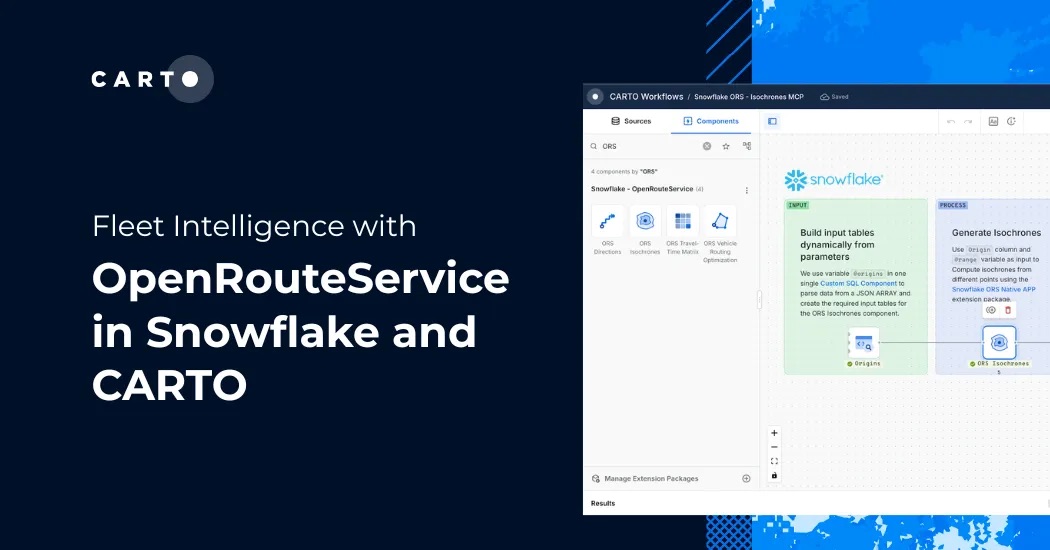
Routing and fleet optimization no longer have to live outside your database. 🚛
With the OpenRouteService Native App for @Snowflake and CARTO, you can calculate isochrones, matrices, and optimal routes directly where your data lives.
Read how: hubs.ly/Q04j09B_0
196
Where should road safety investments go next? 🚧
With CARTO for Agents, AI agents can turn requests like this into governed spatial workflows: querying data, building maps, and rendering results directly in the conversation.
See how it works: hubs.ly/Q04hSZdv0
330
Data-driven decisions are paramount, but geospatial data shouldn't be locked away from the leaders who need it most. 📍
Modern location intelligence enables teams to access cloud-native insights directly. Join us on June 30 to see it in action: hubs.ly/Q04hSBrW0
279
The photos from #SDSC26 London are now available! 📸
You can browse the full gallery and find shots of the sessions, speakers, and networking here:
hubs.ly/Q04hCCMK0

1
214
Going to #CloudAILive Madrid? 📍
We’re making spatial data "agent-ready" so you can talk to your data instead of building dashboards. Come see how we’re automating spatial analysis with @GoogleCloud.
Find us at booth Foundation 7 or book a slot:hubs.ly/Q04hsdHs0

212