
Real-time flood intelligence for Emergency Managers. Improve safety, prevent damage. #GIS #AI #climatetech #emergencymanagement #resilience
Joined February 2017
- Tweets 1,980
- Following 3,354
- Followers 3,304
- Likes 2,073
836 Photos and videos


🌧️ Dangerous flash flooding is unfolding across Texas, with vehicles stranded, roadways inundated, and water rescues reported along I-35 near Waco.
Several inches of rain fell within hours across parts of the state, demonstrating how quickly familiar routes can become life-threatening. With additional heavy rainfall possible in the days ahead, conditions may continue to change rapidly across Central and Southeast Texas.
Read the article: hubs.ly/Q04lq8W80
🚧 For the public: never drive through floodwater, obey road closures, and continue monitoring guidance from local authorities. Turn around, don’t drown.
For emergency managers and transportation teams, events like this reinforce the need to translate weather forecasts into clear, localized impacts:
▪️ Which roads are flooding now?
▪️ Where could conditions worsen next?
▪️ Which communities, facilities, and critical assets may be affected?
Real-time and forecast impact-based flood intelligence can support earlier closures, more targeted resource deployment, and clearer public communication when every minute matters.
Learn more: hubs.ly/Q04lpZgF0
Our thoughts are with the affected communities and the first responders working to keep people safe across Texas.
#TexasFloods #FloodSafety #EmergencyManagement #PublicSafety #WeatherTech #FloodForecasting #FloodPreparedness #flooding
1
141

Jun 11
🛣️ When #flooding impacts roads, even a single crossing can become a critical decision point.
This NowCast animation shows inundation at the Mary River near Tiaro on 9 March, where flooding resulted in road impacts and challenging travel conditions.
Localized flood impact information like this is critical for helping emergency managers, transport teams, and the public understand where road hazards are occurring in real time.
It also demonstrates why clearer, more accessible communication of flood-related road impacts is essential for community safety.
➡️ When roads flood, better information can support safer decisions. Learn how FloodMapp can help: hubs.ly/Q04l35010
#FloodSafety #FloodIntelligence #EmergencyManagement #PublicSafety #RoadSafety #DisasterResponse #GIS #Queensland
43
Jun 10
➡️ Flood risk is an operational problem.
When roads flood, shipments stall.
When stores close, revenue halts.
When critical assets go offline, the disruption spreads fast.
According to First Street Foundation, 25% of U.S. critical infrastructure, 23% of road segments, and 20% of commercial properties face operational flood risk.
Our latest blog explores why asset owners need more than regional weather alerts, and how site-level flood visibility can help protect inventory, facilities, routes, employees, and operations before water arrives.
👉 Read the blog: hubs.ly/Q04kPl-N0
#FloodRisk #BusinessContinuity #AssetProtection #SupplyChainResilience #ClimateRisk
25
Jun 9
💬 What does the future of flood resilience look like?
Next week, FloodMapp CEO and cofounder Juliette Murphy will join leaders from IAG, AWS, and others across the insurance sector at the Australian Financial Review Insurance Summit to discuss how technology is changing the way organizations prepare for climate-related risks.
🌧️ From flood forecasting and impact intelligence to #AI and resilience planning, the conversation will focus on one of the biggest challenges facing communities, businesses, and insurers today: understanding risk before it becomes loss.
Looking forward to an important discussion on the future of resilience in Australia.
📍 Sydney
🗓️ 16 June 2026
Learn more about FloodMapp: hubs.ly/Q04ky1bt0
#InsuranceSummit #ClimateResilience #FloodRisk #Insurance #FloodPreparedness #Resilience
1
48
Jun 8
You already have sensors, models, and historical studies... but can your tools keep up when flood conditions shift quickly?
FloodMapp delivers the operational flood intelligence you need to act early and confidently, from planning to response to recovery.
✅ Predict how and where floodwaters will rise—before it happens
✅ Maintain live situational awareness of flood impacts as conditions evolve
✅ Strengthen coordination across teams and partners
And do it all in your existing systems, no new tools required. Because in flood response, clarity isn’t optional, it’s lifesaving.
📍 See how operational flood intelligence empowers faster, smarter decisions: hubs.ly/Q04kvcgB0
#EmergencyManagement #FloodPreparedness #FloodForecasting #Resilience #flood #ClimateTech #TechForGood #GIS
40
Jun 4
A question we're hearing more often: If Australia is moving into El Niño, does that mean flood risk is lower?
It's a reasonable assumption.
But some of Queensland and New South Wales' most notable flood events occurred during neutral conditions or periods transitioning toward El Niño.
🌧️ Climate patterns matter. Complacency matters too.
One of the risks of any long-range outlook is that it can create a false sense of security, just when communities have the time and space to improve preparedness, review lessons learned, and strengthen response capabilities.
We explored this in more detail in an old blog post, and the findings are particularly relevant given current discussions around El Niño:
🔗 hubs.ly/Q04k7H520
➡️ Curious to hear from others: Do you think El Niño changes how organizations approach flood preparedness?
#ElNino #FloodPreparedness #EmergencyManagement #FloodRisk #Resilience
24
Jun 2
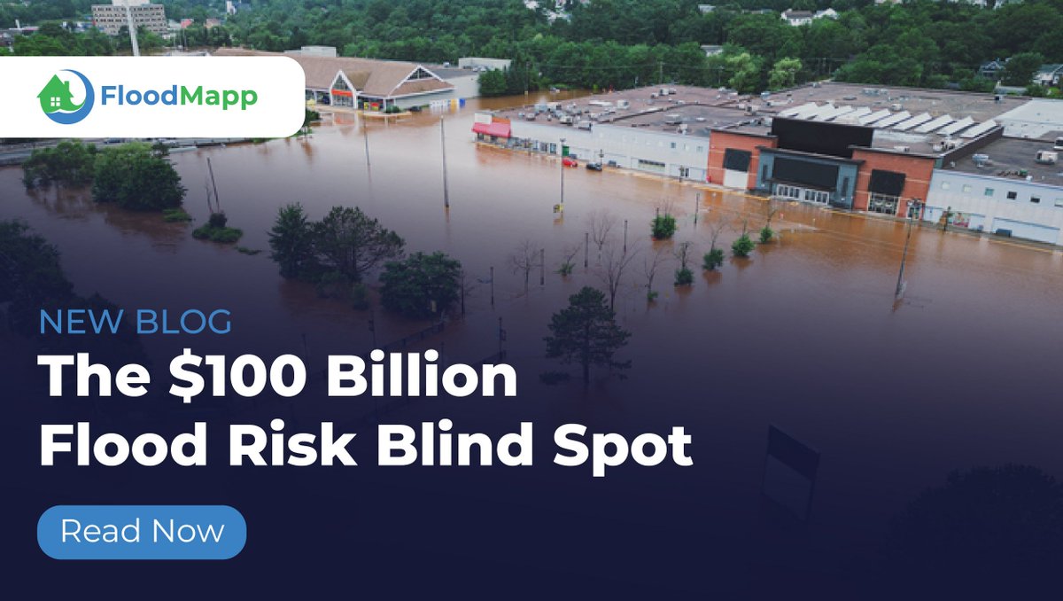
Static flood risk maps don't protect inventory. Lead time does.
Most retailers rely on broad weather alerts to manage flood response across hundreds of locations.
The problem: those alerts tell you a region is at risk. They don't tell you which store floods first, which distribution center loses road access, or whether you have 6 hours or 6 minutes to act.
💸 In 2024, U.S. climate disasters cost $182.7B.
🌀 Hurricanes Helene and Milton alone: $100B in two weeks.
The organizations that limit losses aren't the ones with the best cleanup crews. They're the ones who moved inventory, rerouted trucks, and shut down equipment before water arrived.
That window is everything. And right now, most companies are flying blind.
What does your flood response actually trigger on? 👇
hubs.ly/Q04jLY0X0
#SupplyChain #EmergencyManagement #FloodForecasting #FloodPreparedness #flooding #RiskManagement
26
Jun 2
Heavy rain and severe storms are expected across the Jacksonville area today, with forecasters warning of widespread rainfall, strong winds, and localized flooding. hubs.ly/Q04jMjPC0
🌧️ When storms like this develop, rainfall totals only tell part of the story.
The real questions are often:
• Which roads are likely to become unsafe?
• Where could water accumulate first?
• Which facilities or assets may be affected if conditions worsen?
Understanding how weather translates into real-world impacts is what turns a forecast into a plan. That's the role of impact-based flood intelligence: helping teams understand not just what the weather is doing, but what it means for the communities, infrastructure, and operations they are responsible for protecting. 🔗 hubs.ly/Q04jMrl90
Our thoughts are with everyone across northeast Florida monitoring conditions today. Stay safe, and remember:
🚘 Turn Around, Don't Drown.
#Jacksonville #FloridaWeather #FloodPreparedness #EmergencyManagement #PublicSafety #Flooding #Resilience
35
May 26
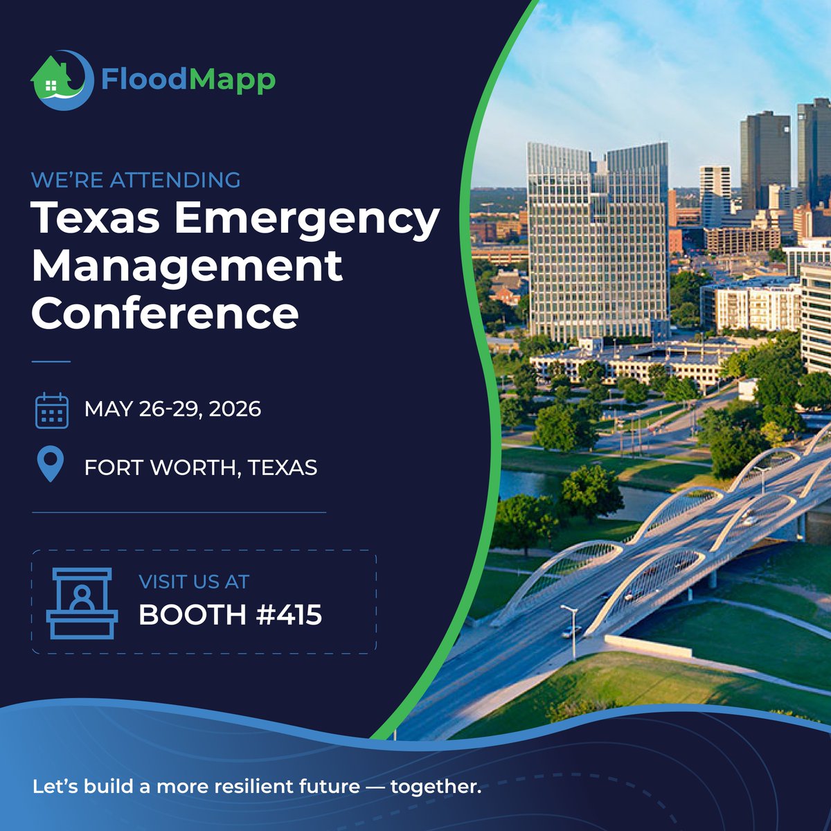
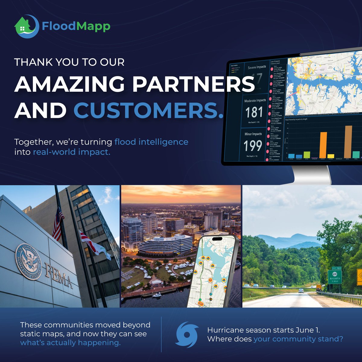
We’re heading to the Texas Emergency Management Conference this week!
FloodMapp will be on-site in Fort Worth at booth 415, where our team will be sharing how operational flood intelligence helps emergency managers and public safety teams make faster, more confident decisions before, during, and after flood events.
Stop by our booth to learn how FloodMapp supports:
▪️Real-time flood impact monitoring
▪️Impact-based flood forecasting
▪️Faster situational awareness
▪️More targeted response and recovery planning
If you’re attending TEMC, come visit us at booth 415.
We’d love to connect: hubs.ly/Q04hWSmb0
#TEMC2026 #EmergencyManagement #FloodPreparedness #FloodForecasting #PublicSafety #DisasterResponse #FloodMapp
37
May 21
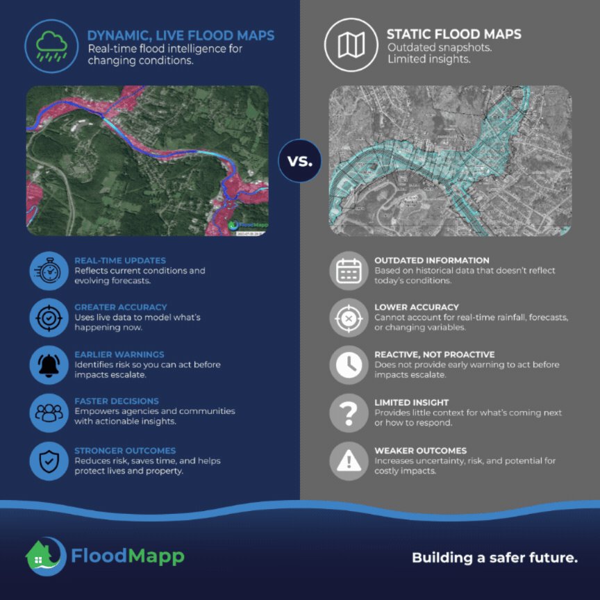
Flood impacts can escalate quickly, especially on roads, in low-lying neighborhoods, and around critical infrastructure.
That’s why emergency managers need more than static flood maps or delayed post-event imagery. They need a live, impact-based view of what is happening now, what may happen next, and who or what could be affected.
FloodMapp helps teams support faster, more confident decisions during flood events, including:
🚧 Closing roads,
🚨 Coordinating rescues, or
🏘️ Protecting people and infrastructure
🔗 Learn more: hubs.ly/Q04hzKz10
#EmergencyManagement #DisasterResponse #SituationalAwareness #flooding #FloodPreparedness #PublicSafety #FloodForecasting #WeatherTech
1
36
May 20
What’s unfolding in #Atlanta today shows how fast a road can go from passable to dangerous.
🛣️ Flash flooding on the Downtown Connector left vehicles stranded in standing water, with one driver forced onto the roof of their car before being rescued.
👀 hubs.ly/Q04hq_b40
For emergency managers, DOTs, and public safety teams, moments like this highlight the operational challenge: knowing exactly where flood impacts are happening, which routes are unsafe, and how to communicate that clearly before more drivers are put at risk.
🚨 Real-time, location-specific flood intelligence can help teams move faster, from targeted road closures and rerouting to coordinated response and public alerts.
Flooding moves quickly. Decision-makers need information that can keep up.
Explore FloodMapp's solutions: hubs.ly/Q04hrlNL0
#FloodSafety #EmergencyManagement #PublicSafety #FloodPreparedness #Transportation #FloodForecasting #AtlantaFlooding
102
May 20
We’re heading to the Texas Emergency Management Conference next week!
FloodMapp will be on-site in Fort Worth from May 26–29 at booth 415, where our team will be sharing how operational flood intelligence helps emergency managers and public safety teams make faster, more confident decisions before, during, and after flood events.
Stop by to connect with Matt Larson and Peter Indovino to learn how FloodMapp supports:
▪️Real-time flood impact monitoring
▪️Impact-based flood forecasting
▪️Faster situational awareness
▪️More targeted response and recovery planning
If you’re attending TEMC, come visit us at booth 415.
We’d love to connect: hubs.ly/Q04hmV710
#TEMC2026 #EmergencyManagement #FloodPreparedness #FloodForecasting #PublicSafety #DisasterResponse #FloodMapp
37
May 20
You already have sensors, models, and historical studies... but can your tools keep up when flood conditions shift quickly?
FloodMapp delivers the operational flood intelligence you need to act early and confidently, from planning to response to recovery.
✅ Predict how and where floodwaters will rise—before it happens
✅ Maintain live situational awareness of flood impacts as conditions evolve
✅ Strengthen coordination across teams and partners
And do it all in your existing systems, no new tools required. Because in flood response, clarity isn’t optional, it’s lifesaving.
📍 See how operational flood intelligence empowers faster, smarter decisions: hubs.ly/Q04hltv70
#EmergencyManagement #FloodPreparedness #FloodForecasting #Resilience #flood #ClimateTech #TechForGood #GIS
21
May 19
➡️ Flood risk is an operational problem.
When roads flood, shipments stall.
When stores close, revenue halts.
When critical assets go offline, the disruption spreads fast.
According to First Street Foundation, 25% of U.S. critical infrastructure, 23% of road segments, and 20% of commercial properties face operational flood risk.
Our latest blog explores why asset owners need more than regional weather alerts, and how site-level flood visibility can help protect inventory, facilities, routes, employees, and operations before water arrives.
👉 Read the blog: hubs.ly/Q04h7LkN0
#FloodRisk #BusinessContinuity #AssetProtection #SupplyChainResilience #ClimateRisk
1
1
27
May 18
Every hurricane season brings the same pressure for emergency managers, utilities, transportation teams, and local governments: making decisions quickly as conditions change on the ground.
The challenge is that flooding today is often faster-moving, more localized, and more disruptive to roads, infrastructure, and operations than many traditional planning approaches were designed for.
That’s driving a broader shift toward more operational approaches to flood preparedness: improving visibility into where impacts may occur, how conditions are changing in real time, and what that means for public safety and continuity of operations.
Our latest release explores how communities and organizations are rethinking flood preparedness ahead of hurricane season.
🔗 Read more: hubs.ly/Q04g_vLQ0
#FloodForecasting #PublicSafety #FloodPreparedness #flooding #ClimateTech #EmergencyManagement #HurricaneSeason
28
May 15
A new study published in Science Advances found that more than 17 million people along the U.S. Atlantic and Gulf coasts are at the highest level of flood risk, with cities like New York, New Orleans, Houston, and Miami standing out.
hubs.ly/Q04gT8640
In addition to flood hazard, researchers evaluated:
• infrastructure exposure
• social vulnerability
• aging urban environments
• drainage limitations
• past damages and recovery impacts
Because flood risk isn’t only about where water goes. It’s about who and what is in its path—and how prepared communities are when conditions change quickly.
For emergency managers, retailers, utilities, and local governments, this is becoming one of the defining resilience challenges of the next decade.
➡️ The question is no longer whether flooding will affect major population centers. It’s whether communities have the visibility and coordination needed to understand impacts early enough to act.
🔗 Read the AP coverage here: hubs.ly/Q04gT8640
#FloodPreparedness #Resilience #EmergencyManagement #ClimateRisk #Infrastructure #Flooding #GIS
43
May 15
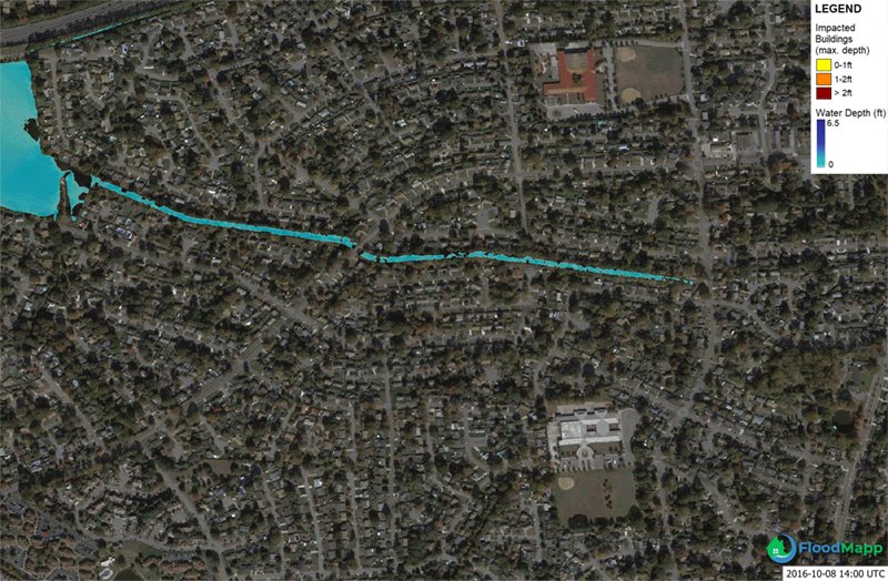
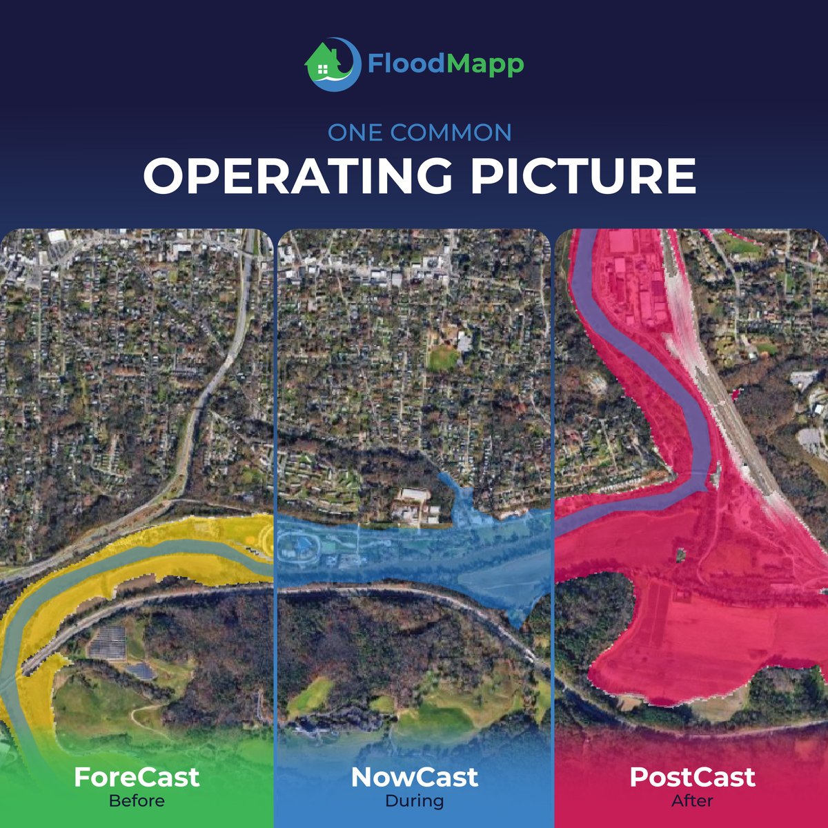
After major flooding, the first question is: what was impacted?
Following the July 2025 floods in Texas Hill Country, teams faced the challenge of quickly understanding impacts across multiple counties, assets, and communities.
This short walkthrough highlights how post-event flood intelligence can bring that picture into focus, combining flood extent, depth, and building-level impacts into a single, consistent view.
When that information is available early, it helps teams:
• align on the scale and distribution of impacts
• support faster, more structured preliminary damage assessments
• provide clearer inputs for reporting, claims, and funding processes
It’s a different way of approaching recovery, one grounded in shared, location-specific understanding rather than fragmented information.
▶️ Watch the dashboard walkthrough: hubs.ly/Q04gQ1CP0
#FloodRecovery #EmergencyManagement #DisasterResponse #TexasFloods #GIS #Resilience #HillCountry #Texas
1
50
May 14
As hurricane season approaches, communities and businesses across the U.S. are facing a growing challenge: understanding flood impacts in real time as storms become faster, more localized, and more disruptive.
New approaches to flood monitoring and operational preparedness are helping organizations improve visibility, response, and decision-making during rapidly evolving events.
🔗 Read more: hubs.ly/Q04gFsxW0
#FloodForecasting #PublicSafety #FloodPreparedness #flooding #ClimateTech #EmergencyManagement #HurricaneSeason
21
May 12
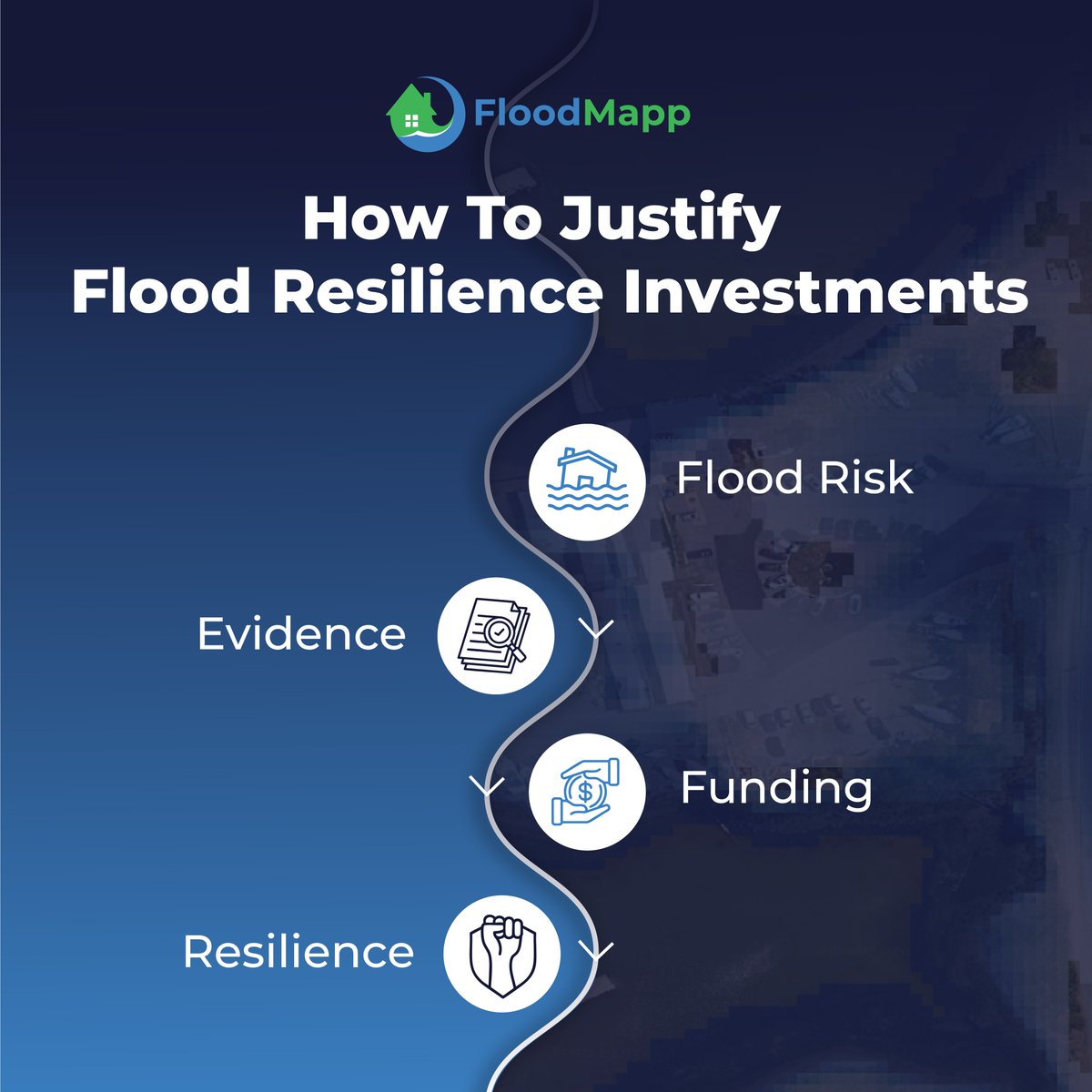
The hardest time to justify flood resilience investment is the most important time to make it. When the headlines fade, so does urgency.
hubs.ly/Q04gd4fd0
🌧️ But flood risk doesn’t disappear. It accumulates quietly.
- New development.
- Aging infrastructure.
- Changing catchments.
- Shifting weather patterns.
In our latest blog, we explore how emergency managers, capital planners, and infrastructure leaders can:
• Quantify exposure
• Document service disruption risk
• Strengthen funding applications
• Align resilience investments with executive priorities
Quiet years aren’t a pause.
They’re an opportunity.
🔗 Read the full article: hubs.ly/Q04gd4fd0
#FloodResilience #CapitalPlanning #InfrastructureRisk #EmergencyManagement #FloodForecasting #DisasterPreparedness #FloodPreparedness #RiskManagement #ClimateTech
1
23
May 11
Hurricane Preparedness Week is over. But preparation doesn’t stop here.
🌀 Hurricane season runs June 1 – November 30. That’s six months where any community along the Atlantic or Gulf coast—and hundreds of miles inland—could face life-threatening flooding.
Here’s your checklist:
✔️ Know your flood risk (not just your FEMA zone)
✔️ Have an evacuation plan
✔️ Understand your community’s warning systems
✔️ Ask your local officials: are we using real-time flood intelligence?
That last one matters more than most people realize.
At FloodMapp, our mission is to build a safer future; a world where no lives are lost in flood events. That starts with preparation. If your agency, utility, or organization is responsible for protecting people and assets from flooding, now is the time to explore what’s possible.
💬 Let’s talk: hubs.ly/Q04g5Rbt0
#HurricaneSeason2026 #HurricanePrep #FloodReady #FloodMapp
23