
Preserving NASA’s ocean and climate data and making these universally accessible and meaningful.
Joined June 2012
- Tweets 607
- Following 27
- Followers 845
- Likes 32
485 Photos and videos


Pinned Tweet

12 Jan 2021
We’ve moved! For the latest updates on NASA’s ocean and climate data, please go to x.com/NASAEarthData
11 Sep 2020
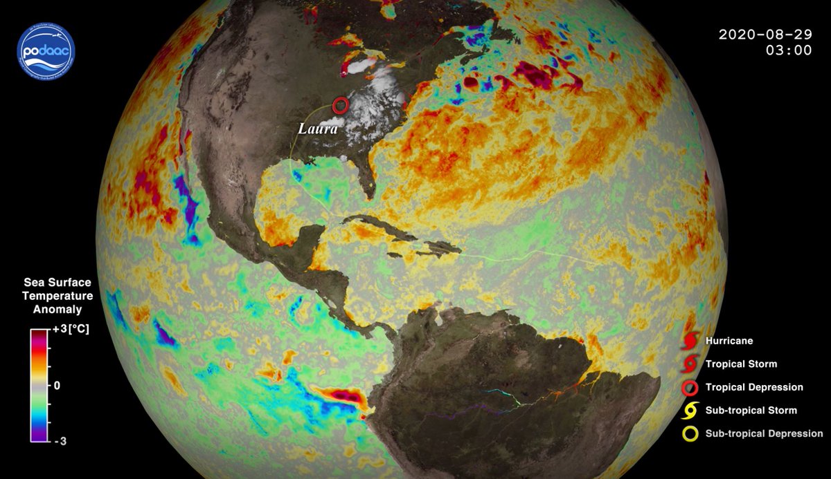
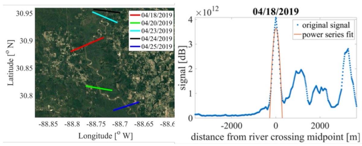
New #PODAAC Data in Action: A Tale of Two Hurricanes in the Gulf of Mexico! podaac.jpl.nasa.gov/SST_Resp…
1
2
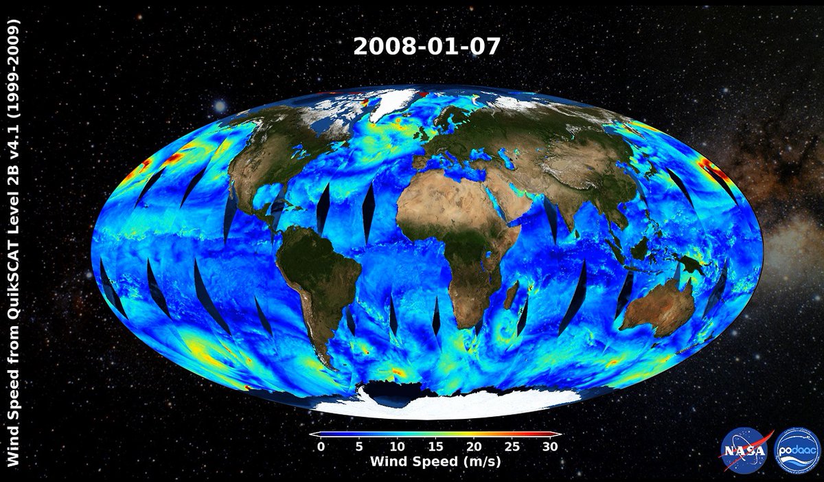
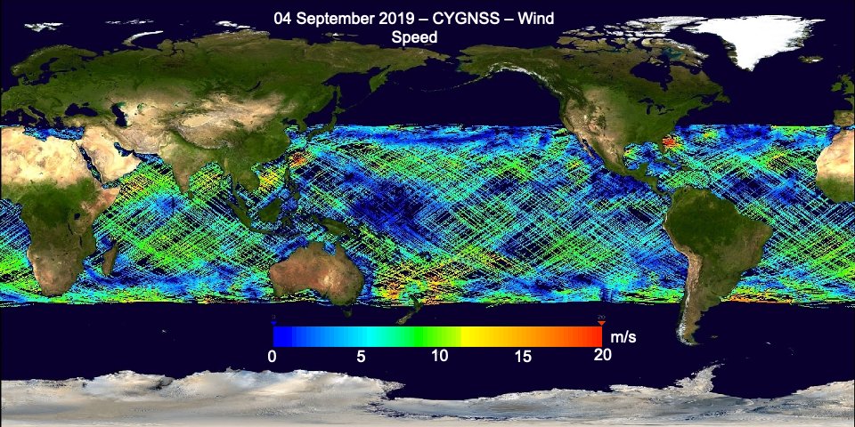
New #PODAAC animation of wind speed from QuikSCAT Level 2B Version 4.1 dataset from 27 October 1999 to 22 November 2009. podaac.jpl.nasa.gov/animatio…
4
4
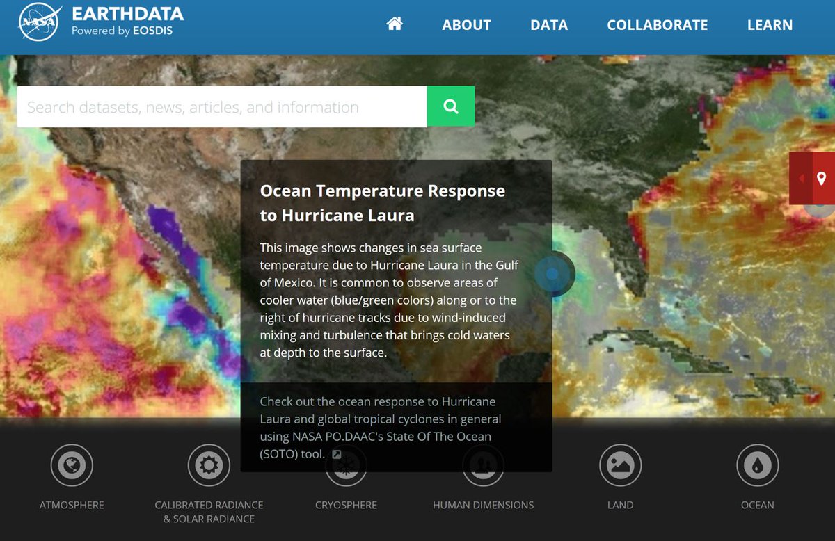
#PODAAC featured this week on the #NASA #EarthData website! Ocean Temperature Response to Hurricane Laura - For additional information, please visit: earthdata.nasa.gov
#data #seasurfacetemperature
1
5
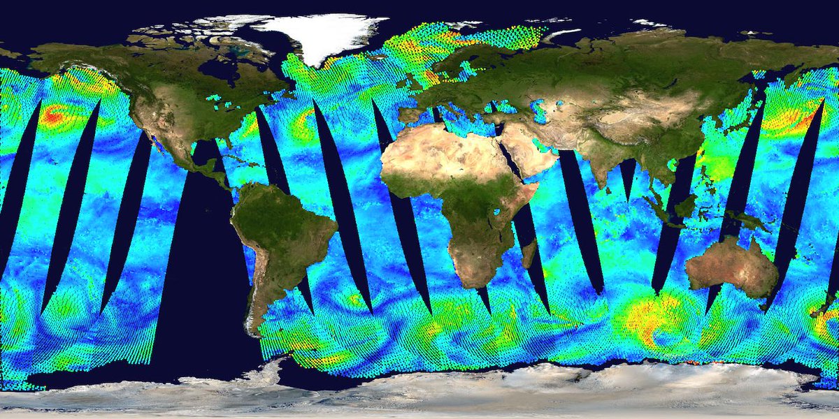
#PODAAC is pleased to announce the public release of the QuikSCAT Level 2B Ocean Wind Vectors in 12.5km Slice Composites version 4.1 dataset!
podaac.jpl.nasa.gov/announce…
1
2
27 Aug 2020
Scientists have gained new insights into the processes that have driven ocean level variations for over a century, helping us prepare for the rising seas of the future.
sealevel.nasa.gov/news/191/n…
26 Aug 2020
#PODAAC is pleased to announce the public release of the Oceans Melting Greenland (OMG) Conductivity, Temperature and Depth (CTD) Level 2 (L2) Version 1 dataset.
#data #NASAOMG
podaac.jpl.nasa.gov/announce…
1
21 Aug 2020
Greenland set a new record for ice loss in 2019, shedding the most mass from its giant ice sheet in any year since at least 1948. sealevel.nasa.gov/news/190/s…
1
21 Aug 2020
#PODAAC is pleased to announce the public release of the #CYGNSS Level 1 (L1) Raw Intermediate Frequency (IF) and Full Delay Doppler Map (DDM) datasets from the Delay Doppler Mapping Instrument (DDMI) aboard the CYGNSS satellite constellation. podaac.jpl.nasa.gov/announce…
1
Stunning forecast: a century of ice loss for nearly 100,000 glaciers - Glaciers in the High Mountain Asia region could lose substantial amounts of ice over the coming decades, a new modeling study shows.
sealevel.nasa.gov/news/189/s…
30 Jul 2020
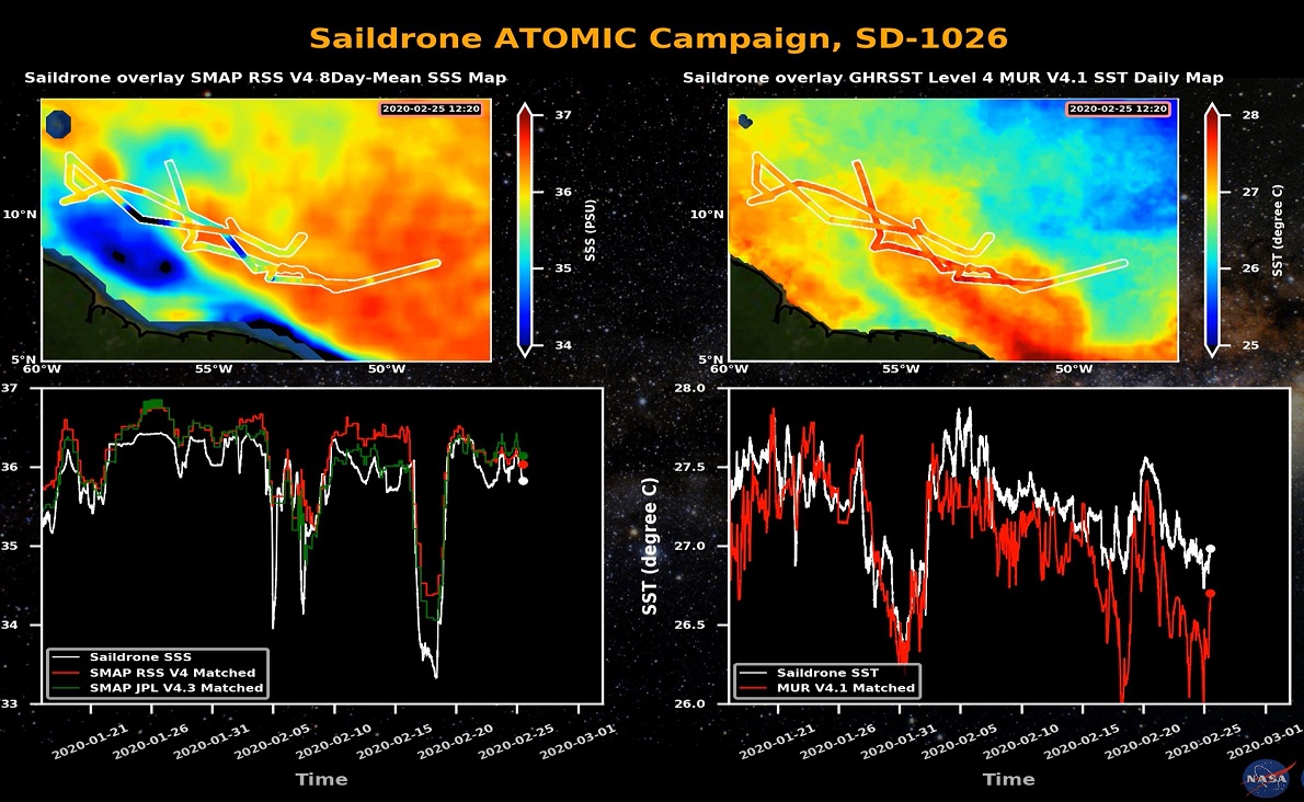
New #PODAAC animations of the #Saildrone ATOMIC field campaign along-track measurement data in relation to satellite #SST and #SSS observations (SD1026, SD1060, SD1061) now available online!
podaac.jpl.nasa.gov/resource…
1
2
4
29 Jul 2020
Three new #PODAAC animations of the #GHRSST L2P AVHRR MetOp-A/B/C #SST v2.0 from NAVO datasets now available! podaac.jpl.nasa.gov/resource…
3
27 Jul 2020
Keeping a steady eye on sea level change from space:
The Sentinel-6/Jason-CS satellite mission will add to a long-term sea level dataset that's become the gold standard for climate studies from orbit.
sealevel.nasa.gov/news/188/k…
1
1
24 Jun 2020
Sea Change: Why Long Records of Coastal Climate Matter - A Monitoring Station off the Coast of Spain Is Giving Scientists a Front-Row Seat to Understanding the Region’s Long-Term Climate Change.
climate.nasa.gov/blog/2997/s…
2
38
73
10 Jun 2020
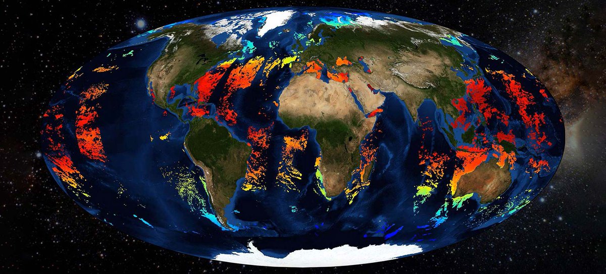
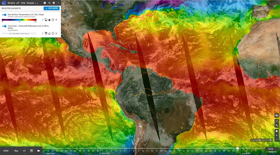
Use the latest version of SOTO 4.5.0 to see the #ocean response to the 2020 Hurricane Season!
podaac.jpl.nasa.gov/announce…
1
5
26 May 2020
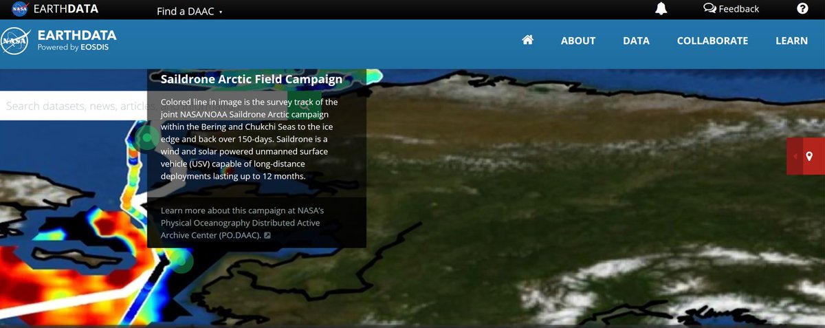
#PODAAC featured this week on the #NASA #EarthData website! #Saildrone Arctic Field Campaign - For additional information, please visit: earthdata.nasa.gov #seasurfacesalinity
1
7
22 May 2020
#PODAAC is pleased to announce the public release of the #CYGNSS Climate #Data Record (CDR) Version 1.0 dataset.
podaac.jpl.nasa.gov/announce…
1
22 May 2020
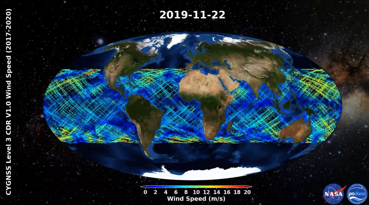
New #PODAAC animation of the #CYGNSS Level 3 Climate #Data Record Version 1.0 dataset from 2017 to 2020.
podaac.jpl.nasa.gov/animatio…
2
2
21 May 2020
#PODAAC is pleased to announce the public release of the #GHRSST #NOAA GOES-17 (G17) L2P/L3C version 2.71 and Himawari-8 (H08) L2P/L3C version 2.70 datasets.
podaac.jpl.nasa.gov/announce…
4
21 May 2020
New #PODAAC #SST animation of the #GHRSST #NOAA GOES-17 ABI L3C v2.71 dataset now available!
podaac.jpl.nasa.gov/animatio…
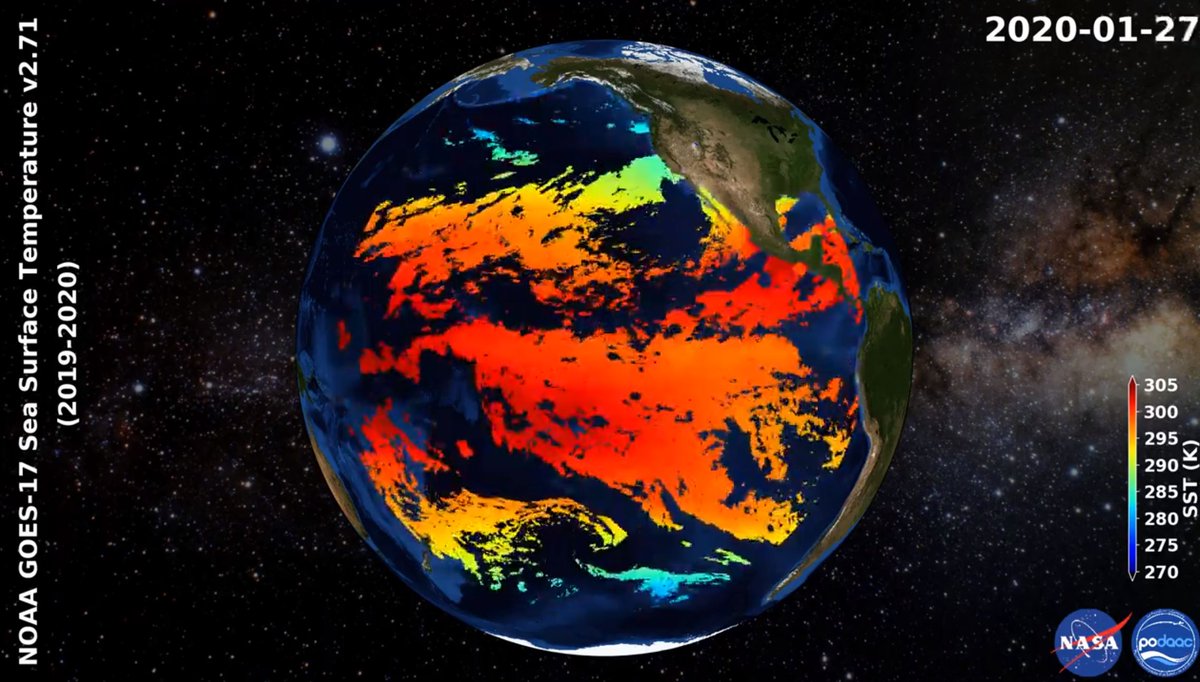
1
4