
One would need to use several platforms to get what you describe.
County GIS sites,
state geological survey portals,
NOAA coastal viewers,
USGS 3DEP downloads,
academic datasets,
old clunky map servers,
and files that make normal humans go, “What the hell is a LAZ?”
41
VIVI retweeted

10 Nov 2024
#CarcelParaCatalinaPerez
ÑATA, VAS A PAGAR CON CARCEL TE VAMOS A PERSEGUIR, TE QUEDAN 492 DÍAS !!!🪓👊☠️

1
13
6
197
Spotlessdog retweeted

Feb 7
Curious how to look yourself?
USGS National Map (3DEP LiDAR viewer):
apps.nationalmap.gov/viewer/
USGS EarthExplorer (download LiDAR point clouds):
earthexplorer.usgs.gov/
OpenTopography (research LiDAR portal):
opentopography.org/
Indiana statewide LiDAR portal (excellent for Midwest mound work):
indianamap.org/
Ohio OGRIP LiDAR downloads:
ogrip.oit.ohio.gov/
NOAA Coastal LiDAR (Digital Coast):
coast.noaa.gov/dataviewer/
28
171
1,193
132,042


May 20
Python can render river landscapes in rich 3D.
This Snake River Relative Elevation Model near Grand Teton shows braided channels, floodplain traces, and subtle terrain scars using USGS 3DEP elevation data, OSM waterways, and forge3d.
Check out forge3d:
github.com/milos-agathon/for…

1
7
64
3,392

May 15
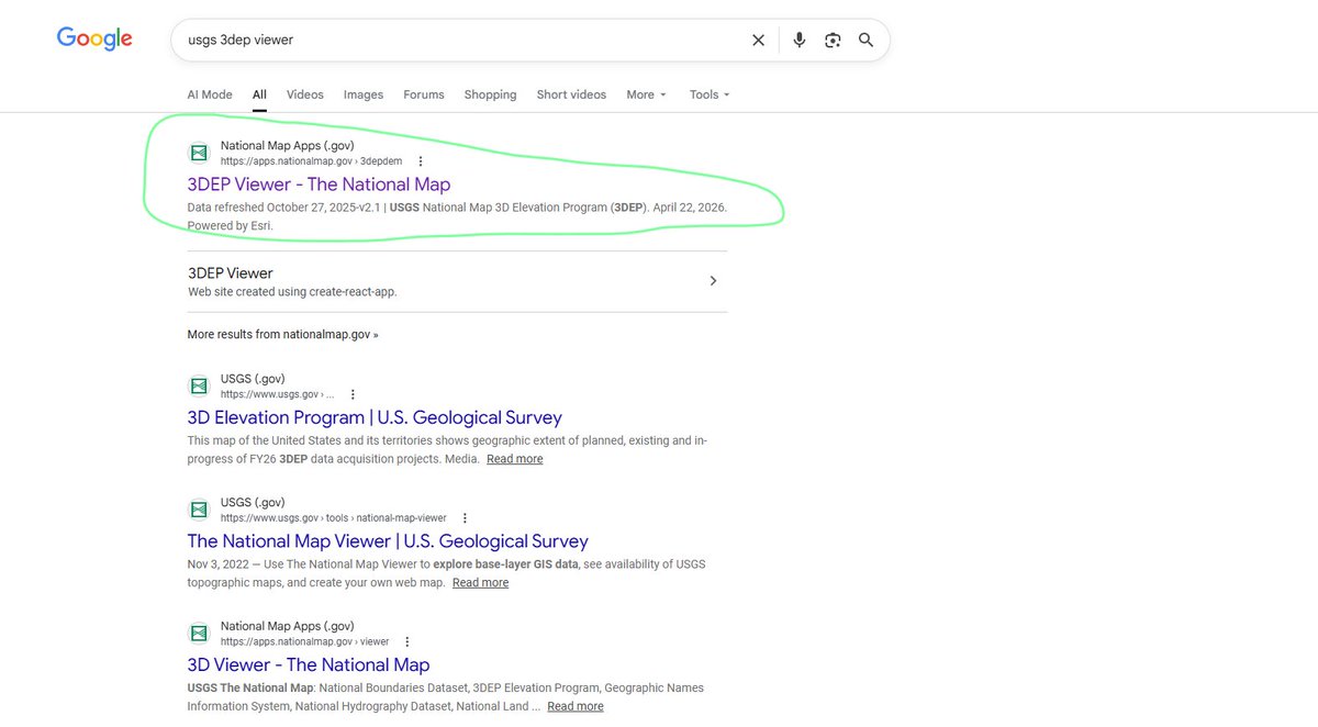
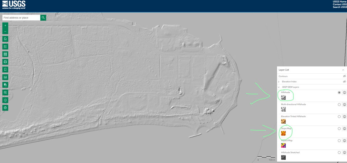
Google USGS 3DEP viewer and click on the first link. You'll have to zoom in very close up to the area you want to search and switch between the Hillshade map and the Slope map (slope shows you things a lot better)
3
70

Apr 19
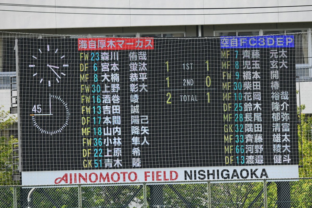
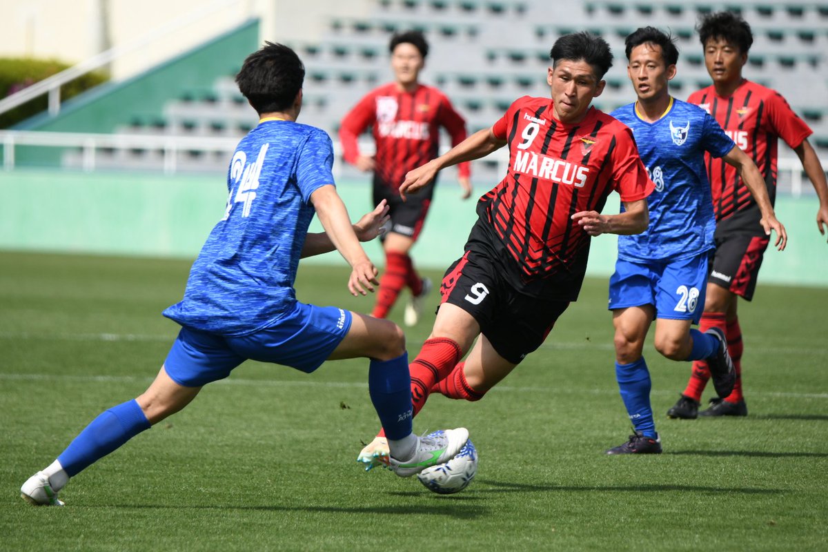
全国自衛隊サッカー大会
海自厚木マーカスvs空自FC 3DEP
3DEPの最後の猛攻も惜しくも特典に繋がらず。マーカスの6連覇!
勝っても王者の風格で落ち着いてるマーカス。しかし、昨年が8-2だったのを考えると来年は更に油断ならない?
選手の皆さんお疲れ様でした。
海自厚木マーカス 2 - 1 空自FC 3DEP


2
4
1,171
Apr 19
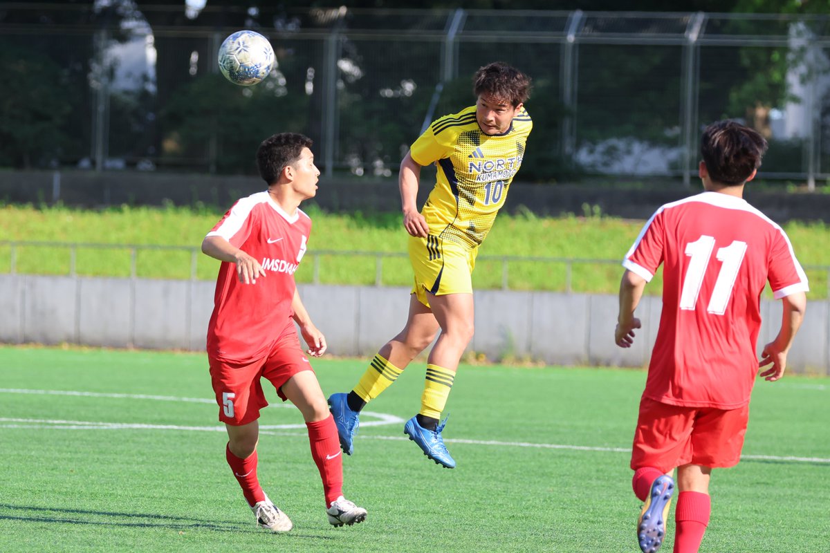
全国自衛隊サッカー大会
海自厚木マーカスvs空自FC 3DEP
うーん!3DEP同点決めたと思ったんだけどなあ!ハンドだそうで。


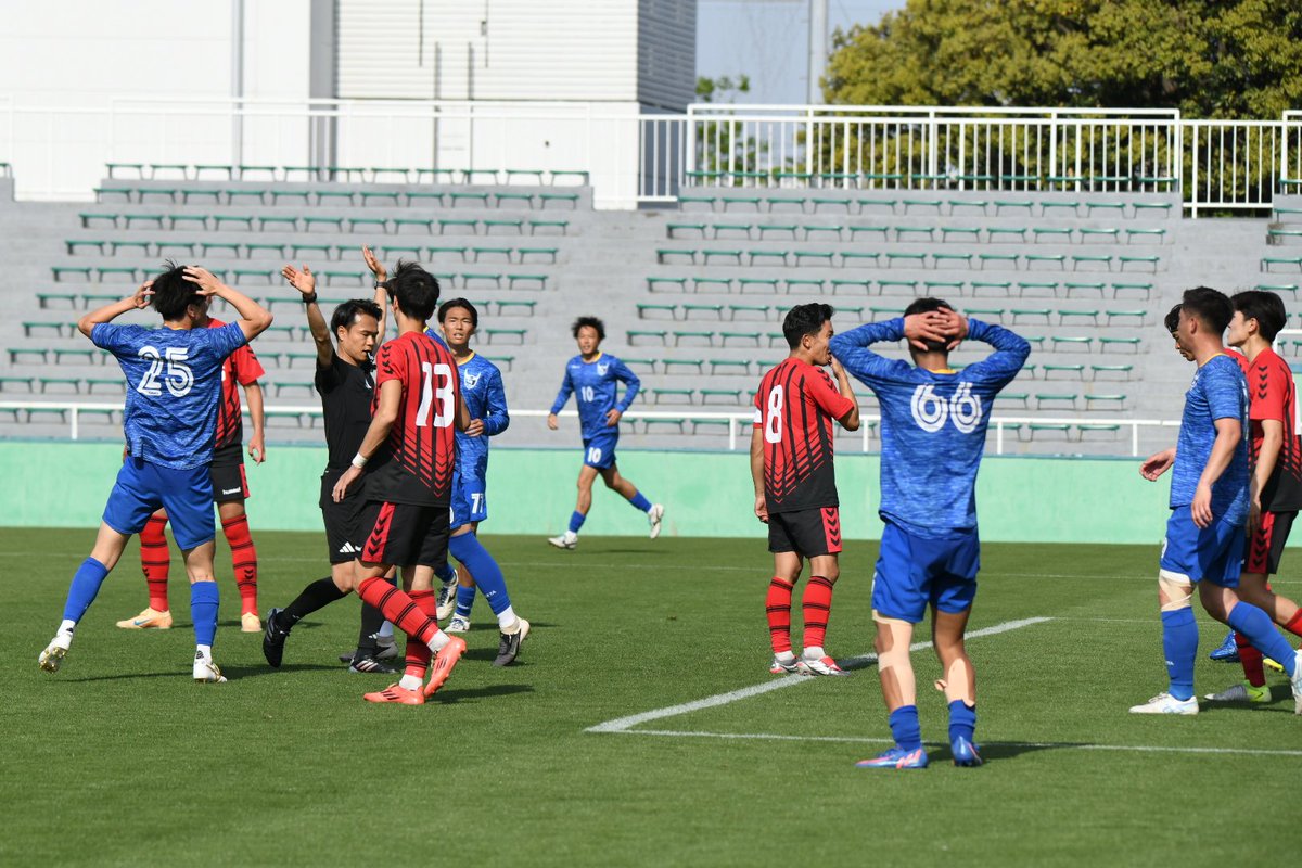
3
976


Apr 19
全国自衛隊サッカー大会
海自厚木マーカスvs空自FC 3DEP
1 - 1の同点で前半終了。
マーカスはいよいよエンジンかかって鬼のように攻めてきたけど、3DEPもめっちゃ守ってる。両チームとも応援が熱い。後半は体力と気力面の勝負。


6
991


Apr 19
全国自衛隊サッカー大会
海自厚木マーカスvs空自FC 3DEP
王者マーカスにどこまで攻めることができるか、と思いきや、キックオフ早々になんと3DEPが先制!!


1
7
890

【取材】第59回全国自衛隊サッカー大会・第3日
予選ラウンドH組
「陸自北熊本(黄) 1-0 海自那覇(赤)」
空自3DEPが突破を決めたH組の最終戦は、陸自北熊本が競り勝った。


1
1
3
2,099
【取材】第59回全国自衛隊サッカー大会・第3日
予選ラウンドが終了。明日4/17の準々決勝のカードは、以下。
海自厚木マーカス vs 海自八戸
海自厚木なかよし vs 海自下総
-----------------------------------------------
空自浜松 vs 空自ASHIYA
空自那覇 vs 空自3DEP
決勝は、海自vs空自になる。
2
8
16
4,286

Apr 14
Hey is anyone really good at real life height data? Stuff that uses 3DEP/USGS Lidar Height Data scans. I'm having issues filling in missing height information and I think I might be doing something wrong. Please only reply if you are.
1
7
626

Apr 10
@APWAGovAffairs host a 3DEP Coalition meeting, @APWATWEETS has collaborated with the coalition to emphasis the emergency management/first responder role of public works professionals @ASCETweets @pewtrusts @iaem @nardotrealtor @USGS @DOI_BUSA


1
3
76

Apr 4
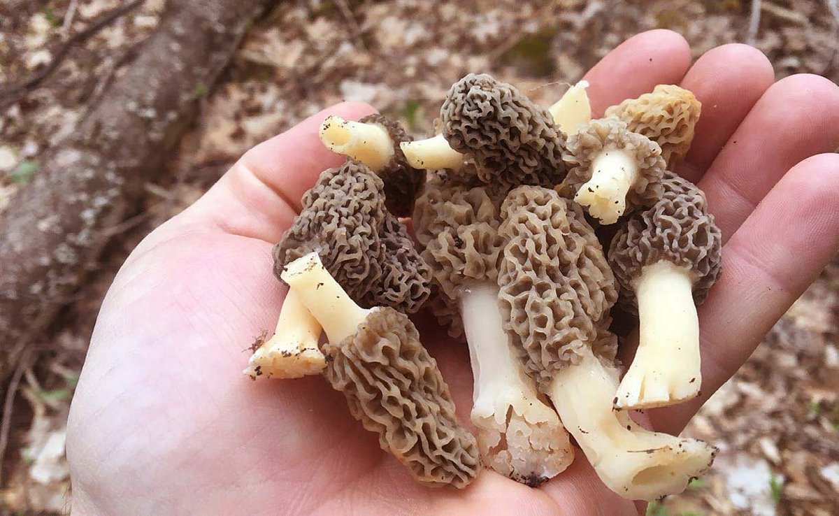
I've always wanted to find morel mushrooms. Never had luck before, so built a tool using AI to find them.
Pretty sure this is going to work!
The tool is a Mind from @ethoswarm and I'm sharing how because it's such a short window of time that they're out and they're starting to pop up now.
Morels like very specific conditions like soil temp at a specific depth, moisture, amount of daily sunlight, pH, and they grow around certain types of trees.
Lots more to it, but this is all info that's available online. It's fragmented, so people pay subscriptions for mushroom finder apps.
Basically the Mind taps into a bunch of live data, aggregates it, and because it's agentic, it can smartly and precisely find spots that I should check.
Here's what I have my Mind checking
- For soil temperature and moisture I use @open_meteo.
- For the soil drainage and pH levels it queries the @USDA SSURGO database directly with SQL.
- Terrain details like slope and aspect come from the @USGS 3DEP elevation data.
- It checks for nearby streams and rivers through the USGS National Hydrography Dataset.
- Scans for recent fire perimeters using the @NIFC_Fire data and maps.
It's all agency-level data that my Mind verifies first, then checks against maps.
Daily and as often as I want, I get a report that tells me how far north morels are starting to show up based on current weather, soil temp, moisture levels, people's reports, etc.
Since it knows the perfect conditions and spots for morels, it tells me where they are growing now, and where to expect them next.
It gets VERY specific. Like, exact GPS coordinates where I should be able to find morels, since it knows current conditions on the ground and the weather.
I actually have it cross referencing the GPS coordinates with Google Maps too, just so I know it's accurate.
Morels haven't reached my area yet, but my Mind tells me they'll be here in 3-14 days most likely. It's given me coordinates to 5 public spots I should expect to find Morels.
Next I'll be asking it to find obscure locations by looking at a map first, then analyzing the other data points.
Let's see if I can find a secret spot nobody has found yet.
If you want to test this out and hunt some mushrooms with me, launch your own Mind and you can basically just copy/paste this entire post into the email. It will understand what to connect to
Or you can just tell it you want it to help you find morels tell it this
"Equip yourself with the app "MorelScout" (ID: 33C0B169-552F-F111-AD1D-0EA9A5017E89)"
That's it!
I'll record and share when I go out hunting.
Attached screenshots in replies of what the reports look like when I asked for a few spots I should check by me.
3
1
19
2,955