
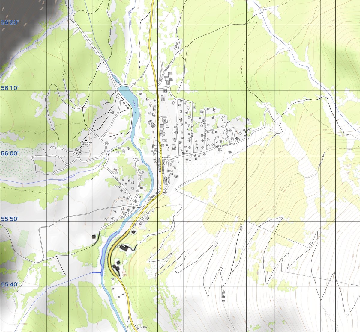
Jun 3
We have also introduced new mapping tools to better assist when searching areas where children go missing.
The system allows us to search by address, place name, or latitude and longitude, then compare multiple imagery sources side by side.
It includes Google satellite imagery, Esri World Imagery, Esri Clarity, OpenStreetMap, USGS imagery for U.S. based aerial views, OpenTopoMap for terrain context, and NASA MODIS for broader cloud and weather patterns.
These tools help us look at nearby roads, wooded areas, ponds, rivers, drainage areas, trails, fields, terrain changes, and other location based risk factors more quickly when every minute matters.
mapping.nerdbirdmafia.com
11
40
2,377


Mar 11
指示
任意の地点の日の出と日の入りの時刻を知るためのWebサイトを作ってください。
・地図で位置を指定。経緯度から日の出と日の入りの時刻を計算して、その地点のローカル時刻にする。
・地図表示はLeafletを使用。日本国内なら国土地理院タイル、国外ならOpenStreetMapをデフォルト表示。国土地理院、OpenStreetMap、OpenTopoMapで選択可能にする。
・経緯度、住所、今日の日の出と日の入り時刻、日照時間、翌日の日の出と日の入り時刻、日照時間を表示。
・日付を変更する機能を入れる。
・地名で検索してその地点に飛び、その地点の日の出と日の入り時刻を表示する機能を入れる。
・デザインは日の出と日の入りを意識したオレンジ系で、現代的な使いやすいものにしてください。
1
2
576


おでかけ航路マップ
見ているだけで楽しい
searoute.info/
残念なのはデフォルトの地図がOpenStreetMap(北方領土をロシア領と誤表示)なこと
OpenTopoMapやTransportMapは竹島を韓国領と誤表示するので日本の領土を正しく表示する地理院地図をデフォルトにすべき
#地理院地図
2
139
3 Dec 2025
ジオグラフィカを海外で使う場合は、メニュー→地図でOpenStreetMapかOpenTopoMapを選ぶといいかもです。


1
1
12
1,996

24 Nov 2025
Best Places to View Interactive/High-Res Topography Maps
Google Earth (best 3D experience)
NASA SRTM or ASTER DEM visualizations
ArcGIS Online “World Topographic Map” layer
Natural Earth Data (free downloadable raster maps)
OpenTopoMap - zoomable online
1
385

20 Nov 2025
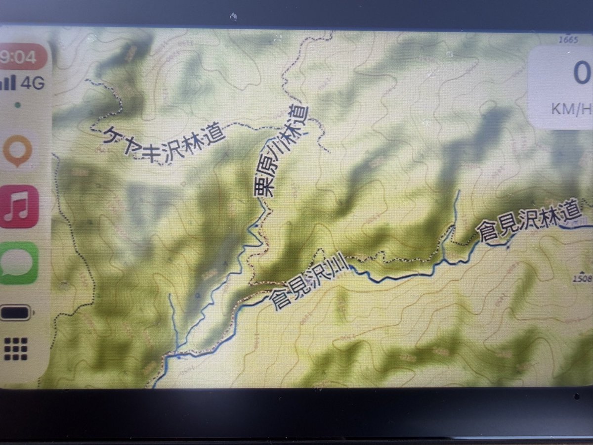
Carplayで使える林道の地図。海外のアプリだけどOsmAndがよさそう。OpenTopoMapを重ねて使ってるけど、等高線と林道の区別がしやすいし、林道の名前も出る。これでもう迷わないかな?👍
5
258

25 Oct 2025
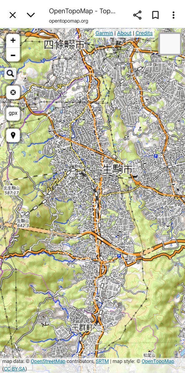
opentopomapの存在を教えてもらったけど、ニュータウンに山が覆い隠された感じを見るのに最適でいいな
opentopomap.org/#map=13/34.6…
1
8
1,213

27 Jul 2025
Thunderforestの地図はアカウントを作ってダッシュボードに表示されるAPIキー入りのURLをジオグラフィカの地図のカスタムタイルのURLとして設定すれば使えます。OpenCycleMapとかOutdoorsとかの地図もなかなか良い。
カスタムタイル分からんという方は、普通にジオグラフィカの地図のOpenStreetMapかOpenTopoMapを使ってください。
thunderforest.com/
4
1,001

27 Apr 2025
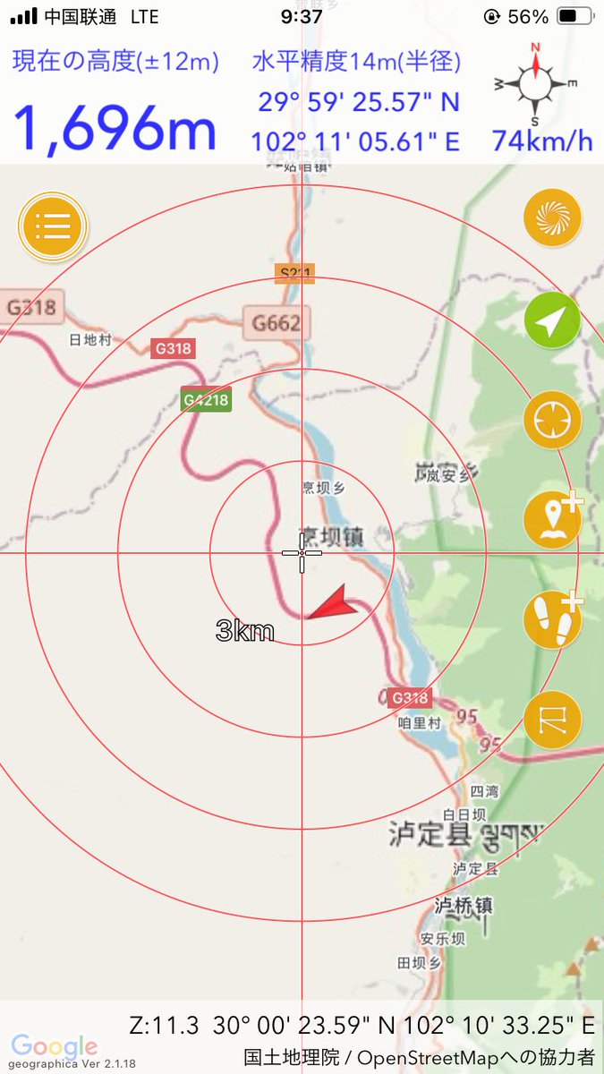
ちなみにOpenTopoMap、OpenStreetMapどちらでもジオグラフィカ稼働OKですね。ちうごく奥地も行けると。ふむ。標高をイッパツ把握できるのが今回とりわけ役に立つだろな。。。あと百度地图老师よりはるかに慣れてるぶん、やっぱり使いやすい☺️
1
2
100

اكتشف OpenTopoMap
خريطة طبوغرافية مفتوحة المصدر تعرض التضاريس بدقة ووضوح، وتعتمد على بيانات OpenStreetMap.
مثالية للدراسات الجغرافية، الرحلات، والتخطيط الميداني.
جرّبها الآن: opentopomap.org/

2
32
1,350


20 Mar 2025
🚀 ¡Actualización en RadarSpain!
✅ Nueva capa satélite para una mejor visualización.
⚡ Animación del radar optimizada para mayor fluidez.
❌ Se elimina la capa OpenTopoMap por su exceso de información.
¡Explóralo ahora y disfruta de una mejor experiencia! 🌍📡
🌐 radarspain.es

4
40
6,989


10 Jun 2024
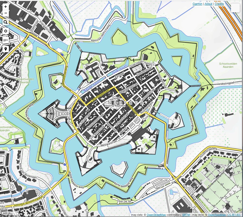
日本の五稜郭のような星型要塞はヨーロッパを中心にたくさんありますが、オランダ・ナールデン(Naarden)の形がとても綺麗でした。画像はオープントポマップ(OpenTopoMap)より。
9
83
9,445
8 Jun 2024
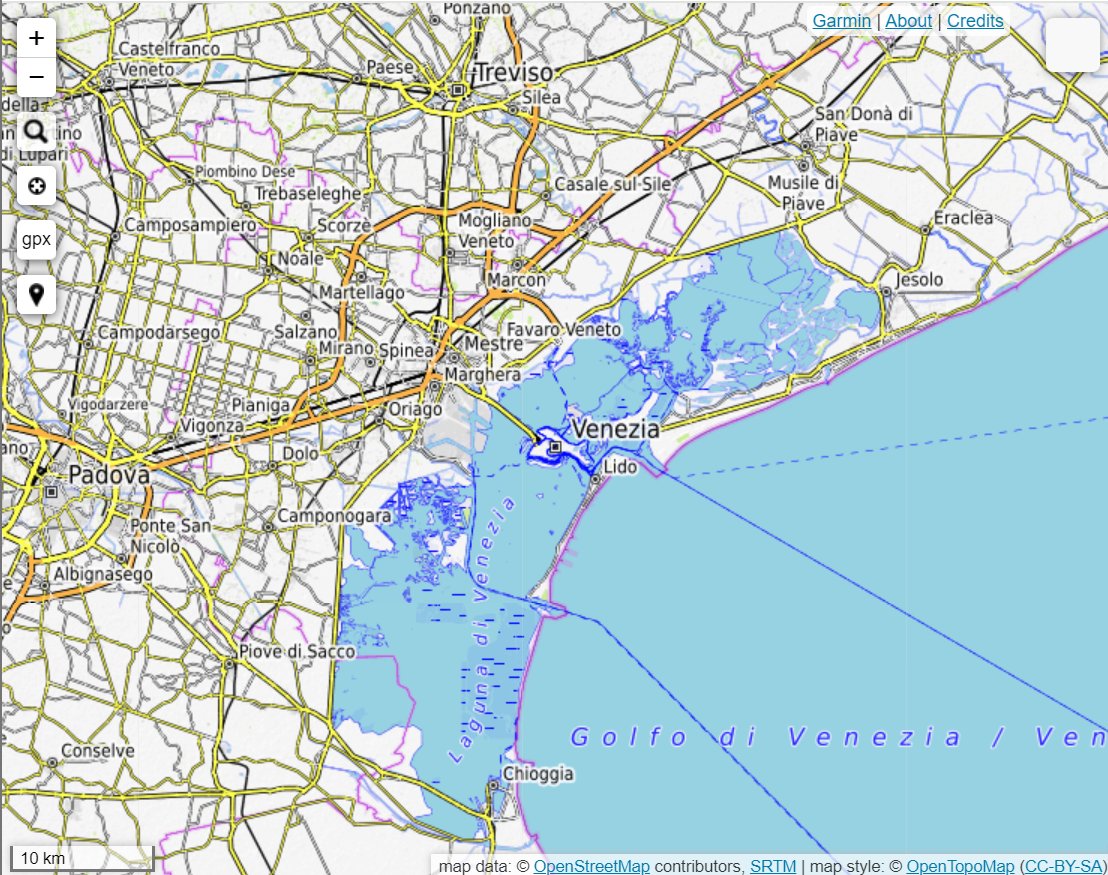
イタリア北部のヴェネツィアは「水の都」と呼ばれますが、地形から考えると、日本の天橋立や海の中道のような砂の堆積による海岸地形が面白いですね。画像はOpenTopoMapより。
1
8
88
9,549