
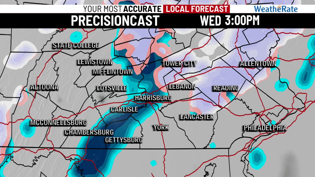
10 Dec 2025
#SNOW & #RAIN:
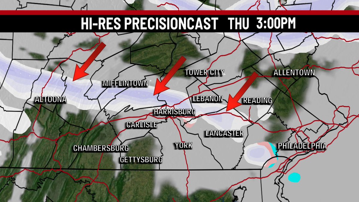
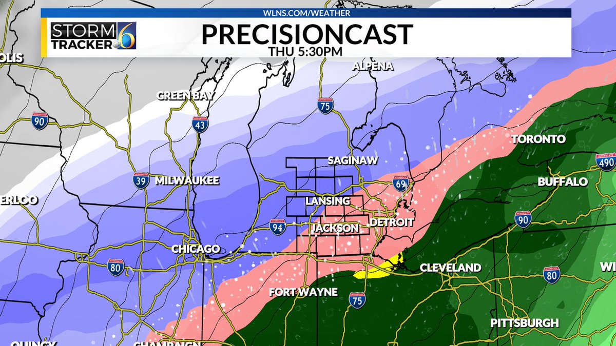
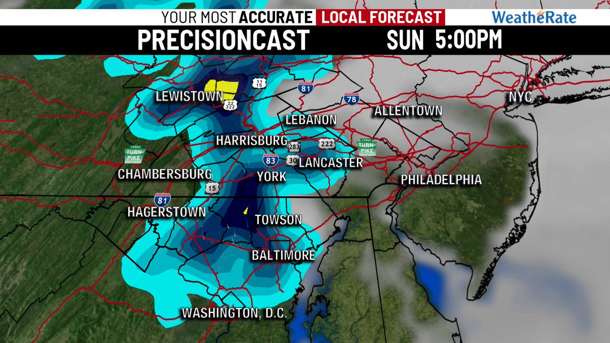
Today will bring a weak wave producing light snow & rain showers through the day, mainly this afternoon. The winds pick up tonight as cold air reloads. Expect a blustery Thursday with potential for snow squalls as our hi-res precisioncast shows. #27Weather #PAwx
6
344

29 Sep 2025
By integrating specialist rapid #prototyping with #CMMinspection, we deliver #precisioncast and #machined #components (like the ones below) on timelines that keep your projects moving forward.
Let's discuss how we can help you meet your deadlines.
#BritishSME #UKEng #GBMfg

3
57

23 Dec 2024
PRECISIONCAST: COLD
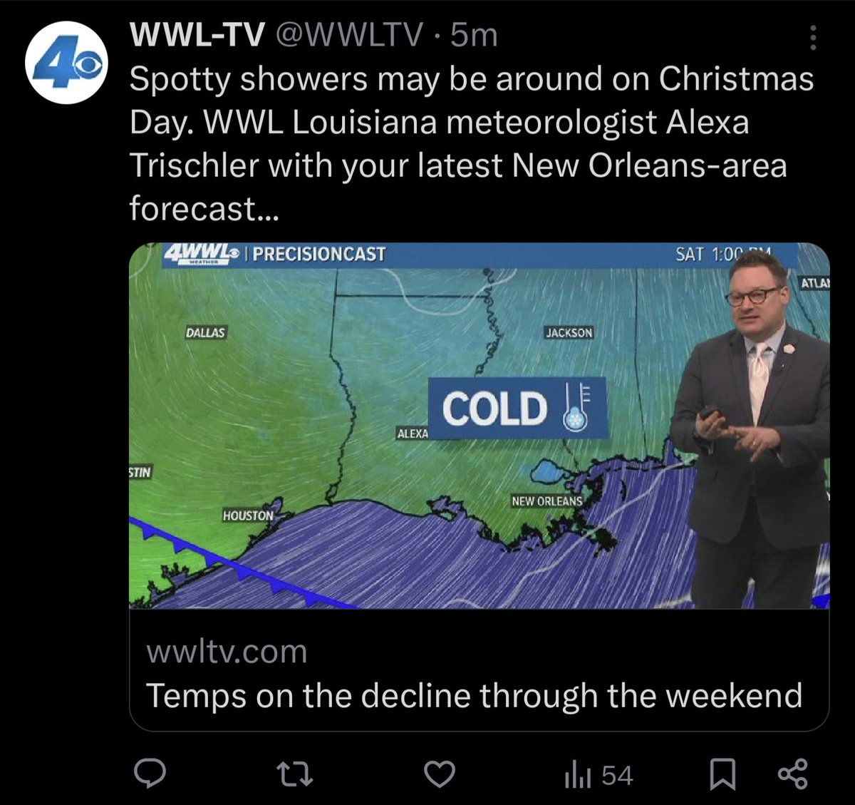
ALT local new orleans weather forecast just says COLD
2
19
711
27 May 2024
ANOTHER TAKE:
Here's our PrecisionCast hi-res model. This keeps the main threat east of our region, giving many of us a nice, summer-like afternoon. This is banking on our morning clouds keeping things stable locally. We will see. Stay alert, but enjoy the day! #27Weather #PAwx
2
503
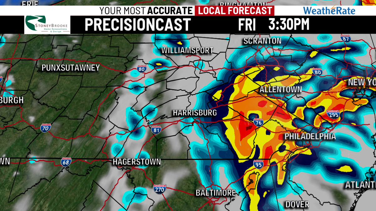
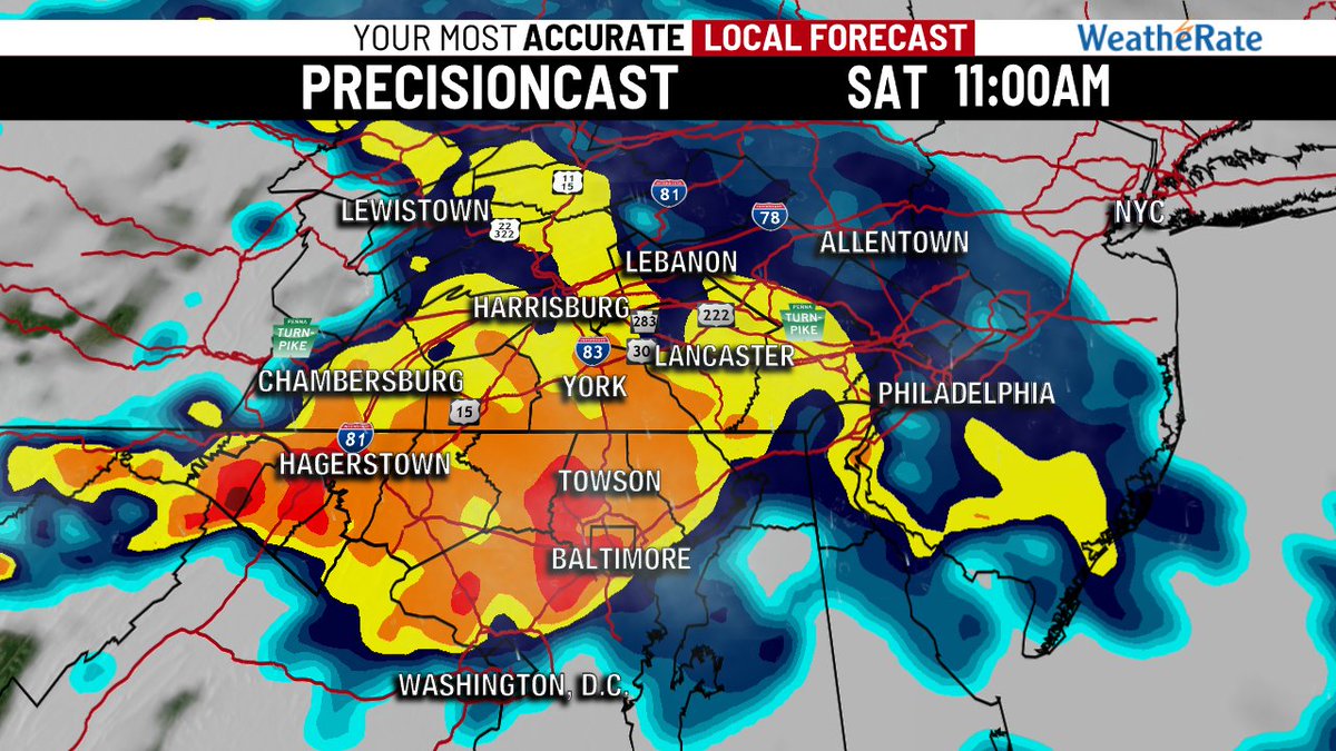
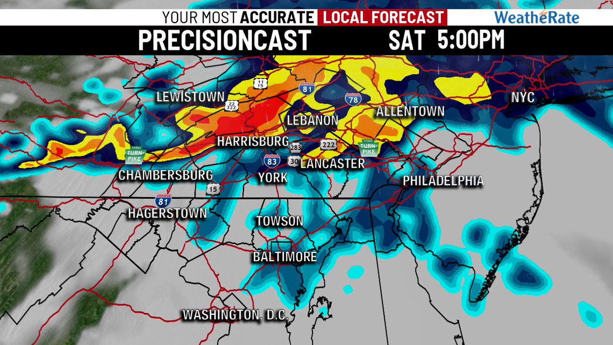
25 May 2024
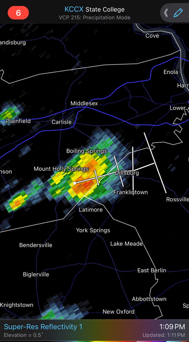
TODAY’S #STORM FORECAST:
Current radar shows brief heavy showers already forming ahead of the main line. Nice downpour near Boiling Springs & Dillsburg. The main line later could produce some hail and gusty winds. PrecisionCast shows timing is late evening. #27Weather #PAwx

3
427


22 Jun 2023
Precisioncast had .13 storm total last night. Abysmal fail!
2
384

15 Feb 2022
Good morning, Mid-Michigan. All eyes are on the winter storm for Thursday. Precisioncast shows the potential for a very messy mix of sleet, freezing rain, and snow. The chance of seeing moderate to major travel impacts on Thursday is increasing.
2
4
14
21 Sep 2021
A Flood Watch has been issued for much of southeast Michigan through Thursday. Several inches of heavy, soaking rains are expected over the next few days. Our precisioncast shows simulated radar overnight tonight... simply put, check those sump pumps today!! @WLNS

1
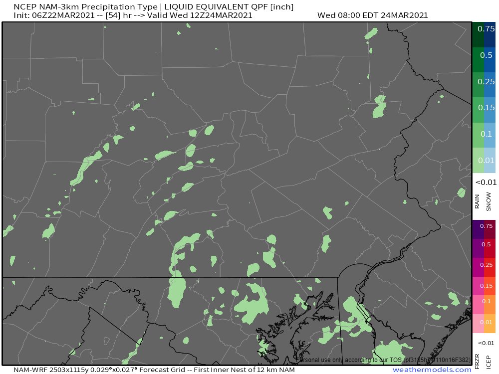
24 Mar 2021
RAINFALL AMOUNTS:
My gut says rain totals will be between 0.25-0.50" today. PrecisionCast is a tad higher in certain spots. There will be higher amounts in eastern counties, I'm just not so sure anybody gets 1" today. #27Weather #PAwx
1
3
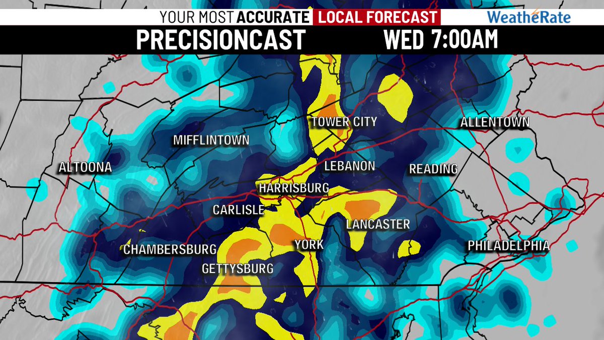
22 Mar 2021
RAINY WEDNESDAY?
Wednesday will be dreary with some showers, but the question is how much rain? The NAM only depicts a drizzly day, while our PrecisionCast favors steady rainfall in the morning. Something to watch. #27Weather #PAwx
3
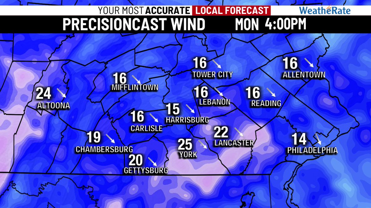
1 Mar 2021
TURNING WINDY & COLDER
March is coming in like a lion! With highs near 50° this afternoon, temperatures will tumble into the mid-20s tonight (Precisioncast is too cold). Winds pick up later today ushering in this colder air, gusts to 40 mph! #27Weather #PAwx

1
1
3

30 Dec 2020
Latest run of our in-house PrecisionCast model continues to show optimism for *low* ice threat Friday. Temps should be just above freezing, if not a little higher as the bulk of the moisture arrives. Later start time with precip a big help too. More next on @abc27News at Noon
6

16 Dec 2020
This is quite the sequence showing up in the IBM GRAF (PrecisionCast) model. Very cold air goes nowhere and any sleet should be brief. The atmospheric column air will stay cold, especially as the snow comes down harder and faster. #27Weather
1
5
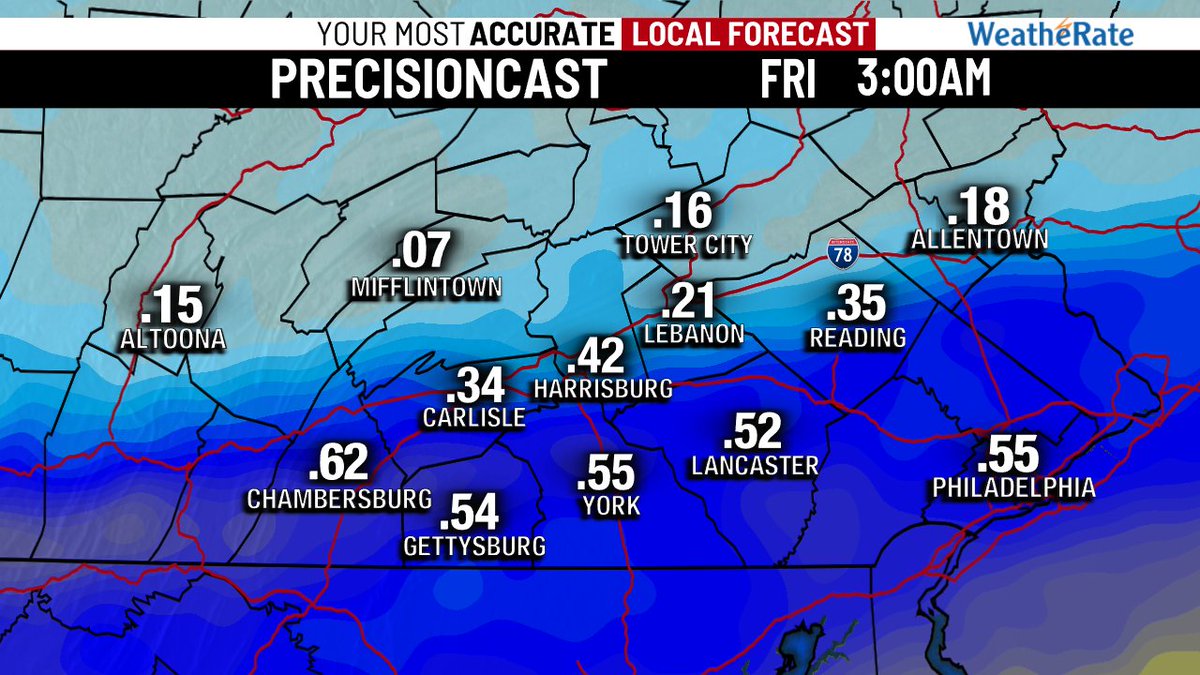
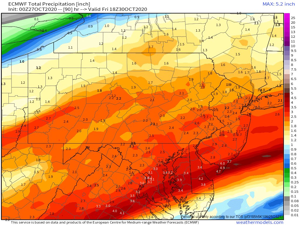
27 Oct 2020
RAINFALL FROM #ZETA:
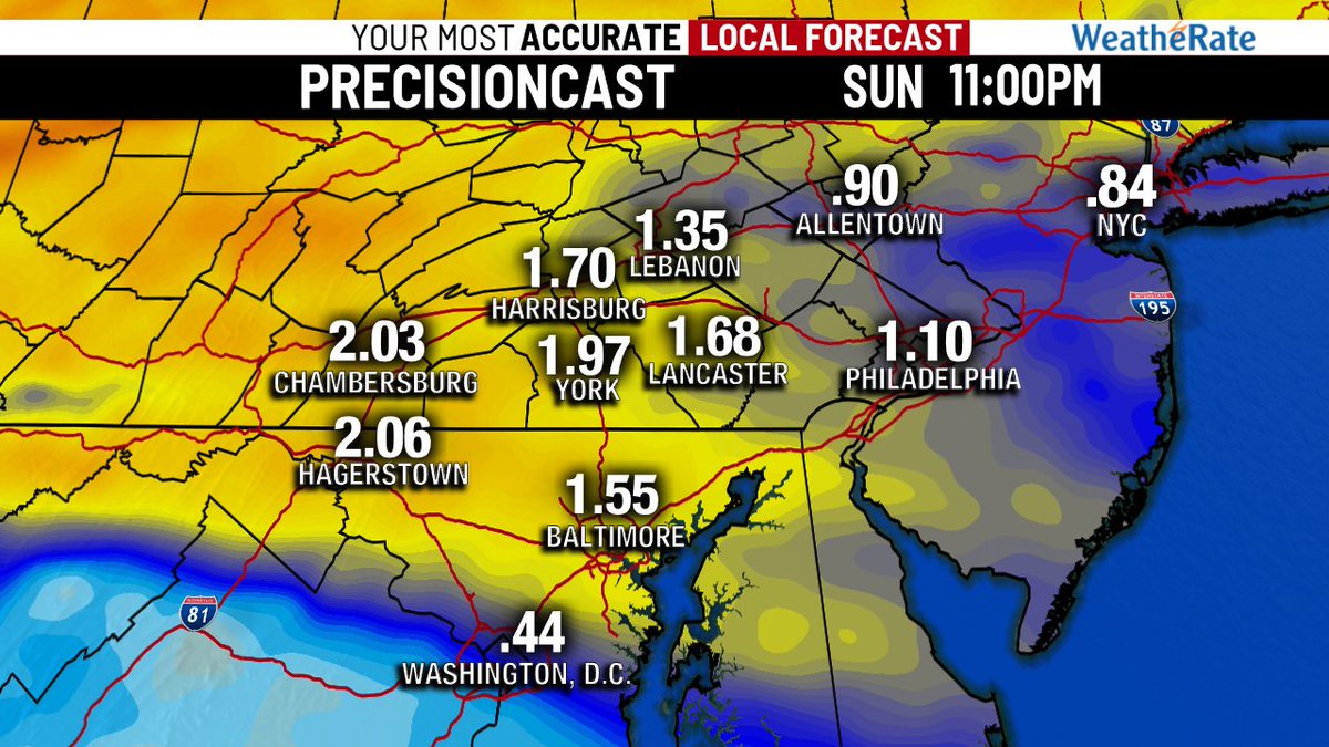
2 models, 2 solutions. Both suggest rain is coming. PrecisionCast keeps most of the heavy rain south of Central PA and gives our region around 0.50". The EURO model brings significant rainfall to the area of 2-3". I say 1-2" if a good bet. #27Weather #PAwx
2
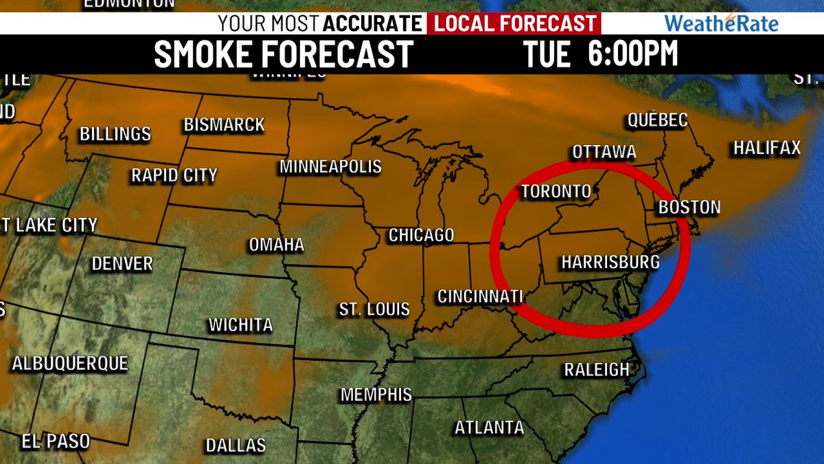
15 Sep 2020
SMOKY SUNSHINE:
While PrecisionCast says clear blue skies, I say...Not So Fast My Friend! There will be a smoke layer in the air for the next few days despite high pressure sitting overhead. The sun may appear filtered by smoke particulates from the west coast. #27Weather #PAwx
2

10 Jul 2020
The PrecisionCast is the most generous for rainfall tomorrow. The general consensus in models guidance keeps the bulk of the rain to our east. In either case, hard to get much rain west of Harrisburg from Tropical Storm Fay.
5

13 May 2020
Precisioncast doesn't look as intense as yesterday but we could still see some thunderstorm activity later today. This would mean periods of heavy rain, hail, gusty winds and lightning.
1
4
27 Mar 2020
Interesting trends in PrecisionCast (RPM). Showing heavier periods of rain, including the chance of a line of PM storms tomorrow. Not as much activity on Sunday. If both days break through the cool air, thunderstorms are a strong possibility. 1-2" for highest amounts. #27Weather
4