
Jun 9
@artfletch The ghosting on Raven LiDAR → RealityScan is likely a coordinate-frame mismatch between the scanner's onboard SLAM and RealityScan's SfM. Quick test: export the LiDAR ply and the SfM sparse cloud separately, run an ICP alignment in CloudCompare, then re-import. If the error drops, the issue is the handoff, not the sensor.
23

May 31
16:00 CloudCompareを使った編集と展開図の作成
16:45 質疑応答
17:00 閉会
17:30 機材等撤収完了
18:30ごろから 懇親会
※雨天の場合は、海蔵庵での撮影は取りやめ、RTK-GNSSデモのみ実施して、11:15から石巻市博物館の屋内で三次元計測用撮影実習を行います。
2
98
May 31
13:30 石巻市博物館にて三次元計測概説の後半座学とソフトインストール
14:00 Metashape Standard版を使った解析実習(墨出し器デモ)
14:45 休憩(個別質問タイム)
15:00 CloudCompareを使った座標(縮尺)の付与とソリッドモデル(サーフェイスモデル)の作成
2
76


May 25
iPhone17 ProのLiDARで断面図を取る|Scaniverse×CloudCompareで現場を安く点群化する手順 norimen.net/iphone17-lidar-s…
3
8
85
4,101

May 24
3DGSを点群に変換するツール
ワザワザ3DGSを経由して点群にするメリットはあると思う
・3DGS経由の方が再現力が高そう(穴とか開かない)
・3DGSより点群の方がビュワーの互換性が高い
(CloudCompare、Potreeとか)
Codexにインストール丸投げしたら結構やってくれる。
github.com/Lewis-Stuart-11/3…
1
9
83
4,179

カナダの点群オープンデータ(canadiangis.com/free-canada-…)より、Alberta州 Beaver Hills のLiDAR点群を使用しました。
#CloudCompare の「Edit > Scalar fields > Filter By Value」を用いて処理しています。
画像はclassificationの値に基づいて点群をフィルタリングし、可視化した結果です
1
6
496

May 23
Testa CloudCompare (gratis) – dra in LAZ-filen direkt, öppnas oftast. Funkar inte det: plas.io i webbläsaren, bara dra och släpp. Ska du jobba med datan i GIS: QGIS 3.34 med PDAL-plugin. Är filen LAS 1.4/COPC krävs senaste versionerna.
1
3
212

May 11
Yeah I use the evilest softwares for it too. AgiSoft Metashape, CloudCompare and QGIS. The great Satans
1
11
1,436
#CloudCompare にて .tif形式のオルソ画像を読み込みました。また同時にMMSにより取得された点群も読み込んでいます。Translate機能にてオルソ画像のZの値を手動で変更できます。オルソ画像と地上の点群の差分を比較するときなどに便利です。山梨県から公開されているデータを利用しています。
2
11
852

Apr 23
略測図をパッと出すだけなら #Scaniverse → #CloudCompare → 生成AIで最短30分かからないですね。ポイントはフルカラーのオルソをそのまま食わせるより、ノーマルや(必要なら)高さなどで最適な可視化をするということでしょう。火曜日の技術講習会に間に合わなくてスマソ
1
9
699
Apr 23
以下私見
・入力ソースはフォトグラでもiPhone LiDARでも変わらないと思う
・遺構確認ライン、上端、角度が急な下端ラインはexplicitなので即実用レベルじゃないですか?
・緩やかな傾斜の下端ラインや「中端」は角度でも曲率でもいいから基準を決めたらいいんじゃね?
・これ全部 #CloudCompare でOK→
1
1
11
770
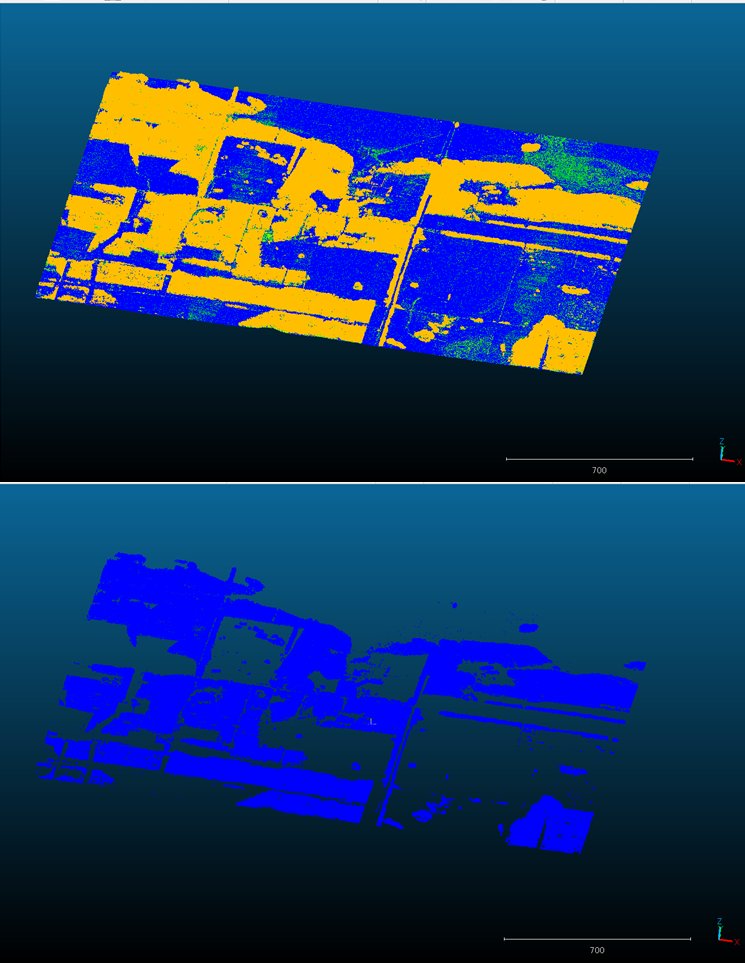
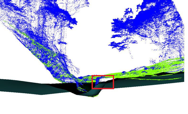
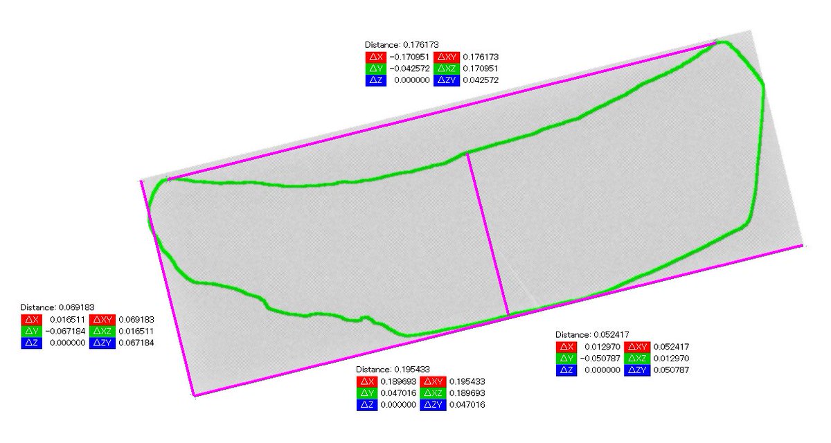
点群から地表面を抽出する手法である #CSF を #CloudCompare にて利用し、地表面(緑)とその他(青)に分類しました。基準となる「布」の面と重ね合わせて示しています。赤枠の部分は布のメッシュと青の部分が離れていて地表面ではないと判断されたことがわかります
データ
geospatial.jp/ckan/dataset/2…
23
1,412
Apr 19
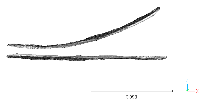
1枚目:展開無し(上段)と展開(平面化)後(下段)。展開後は法線再計算済み。
2枚目:展開後(上段)と0.2mmメッシュ再サンプリング(z=高さ)。これで単位と幅を比較できそう。続きは後ほど #CloudCompare


1
9
1,074
Apr 19
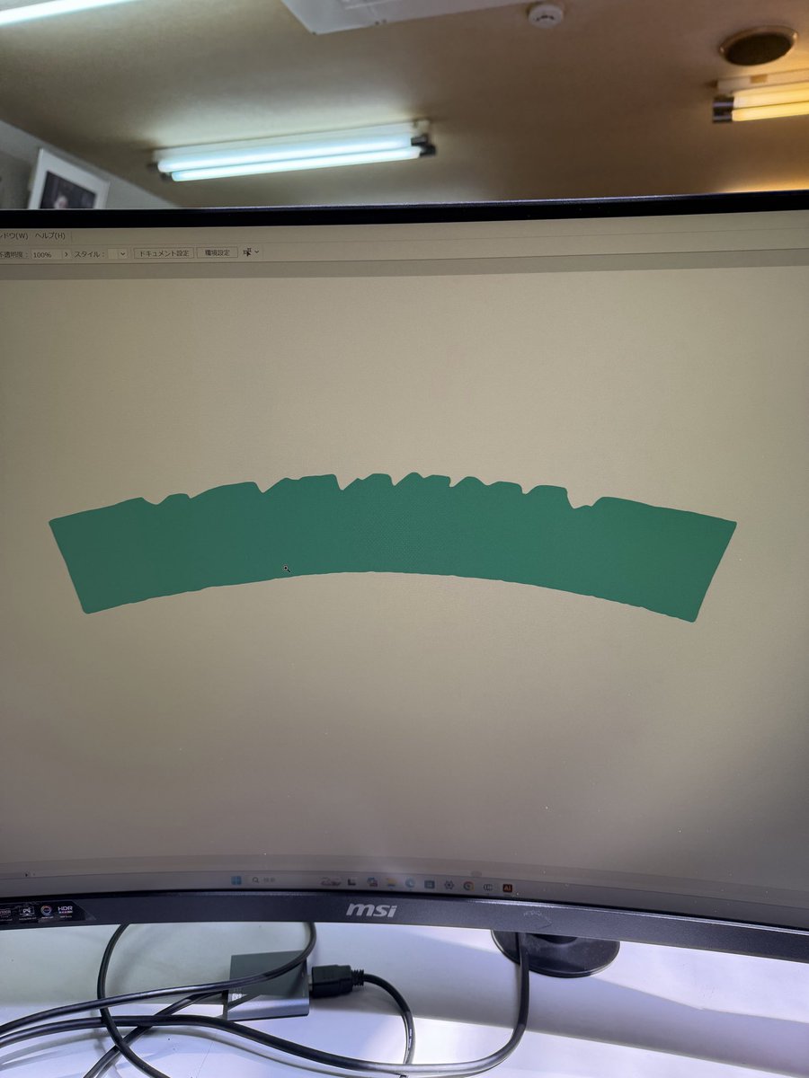
円弧の復元はFit Circleの方が良いようですね #CloudCompare

Apr 18
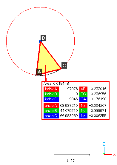
1.瓦当面の輪郭のenvelopeを作成
2.polylineの再サンプリングで点群化
3.点群化した輪郭にFitするPlane作成
4.Planeの幅・厚さ(高さ)取得
5.輪郭から弧長と矢高を取得
6.半径と中心角を計算
これをPythonで半自動化すればいいんですね? わかりません
#CloudCompare
1
2
23
1,254
Apr 18
1.瓦当面の輪郭のenvelopeを作成
2.polylineの再サンプリングで点群化
3.点群化した輪郭にFitするPlane作成
4.Planeの幅・厚さ(高さ)取得
5.輪郭から弧長と矢高を取得
6.半径と中心角を計算
これをPythonで半自動化すればいいんですね? わかりません
#CloudCompare
1
2
14
2,061

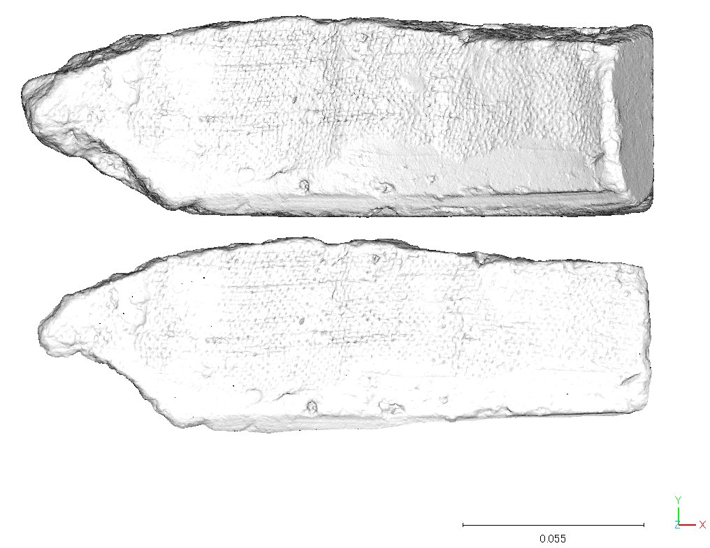
【学芸員の活動:展示の準備】
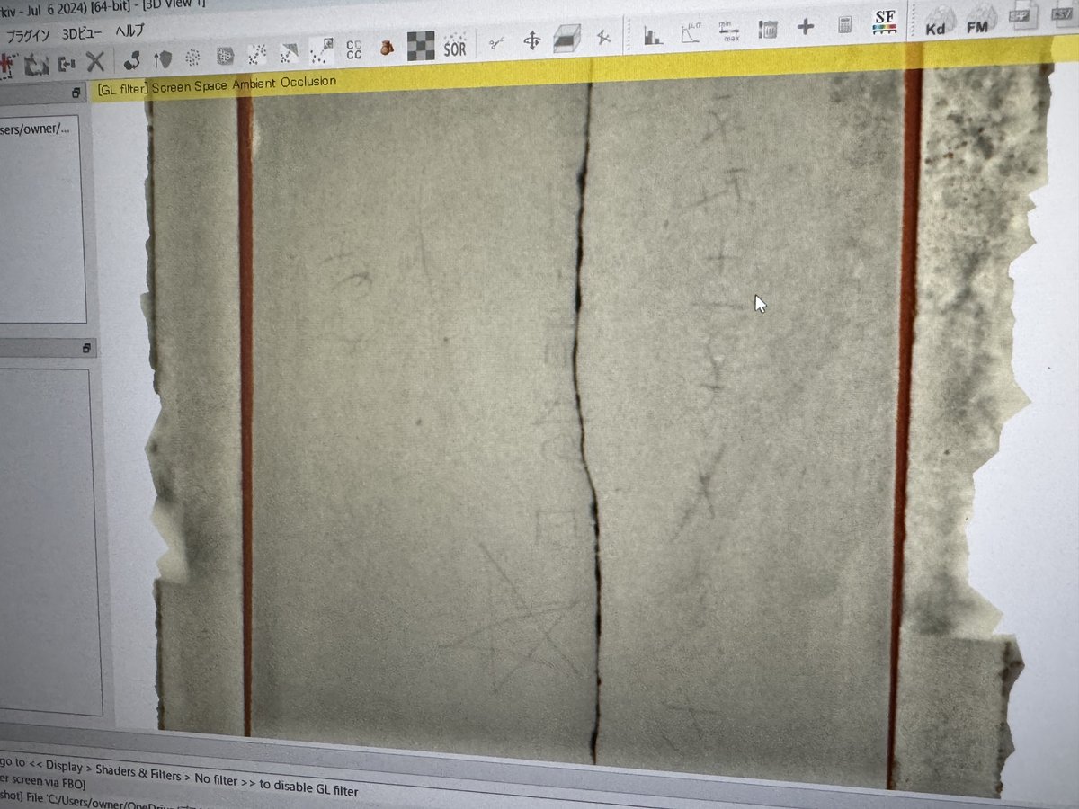
まだ4月ですが夏や秋の展示に向けて準備を開始しています。写真は上永原城遺跡から出土した永禄11年銘がある硯です。銘文が見やすいよう「#Cloudcompare」で3Dデータの処理をしています。
夏には戦国時代と関連した展示を開催予定です。お楽しみに!
#銅鐸博物館

1
16
969

Apr 4
In addtion that Metashape and CloudCompare and LFS or Postshot are needed for this workflow
4
810