Carol Roe retweeted

6 Oct 2025
There are 175 international triple borders or tripoints but only one international quadripoint.
One of the most famous tripoints is the one bewteen Brazil, Argentina and Paraguay.
x.com/MarchUnofficial/status…
13
36
239
58,892

Jun 1
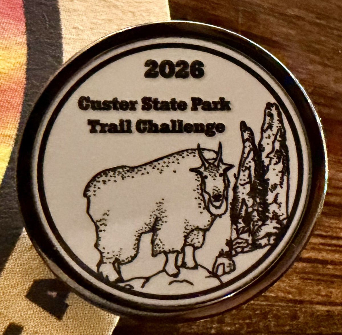
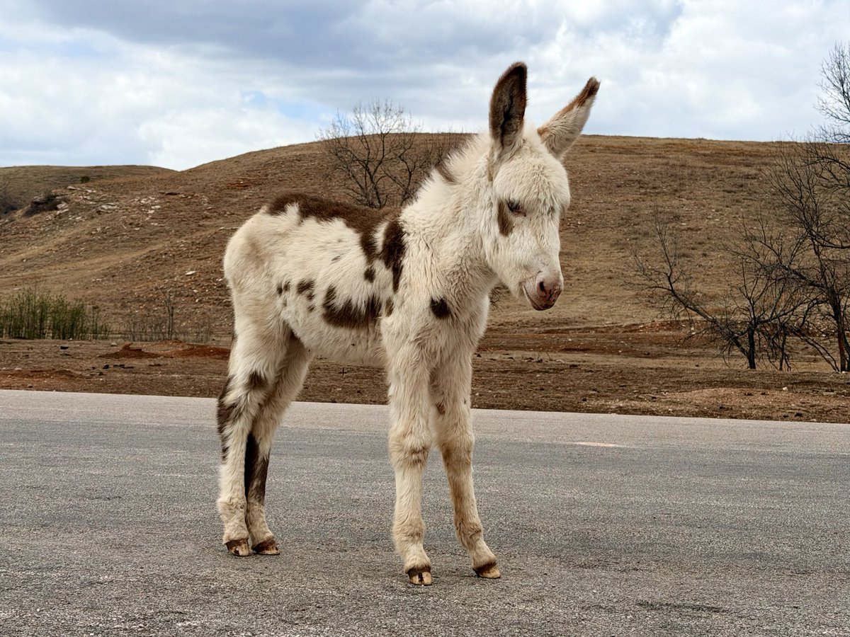
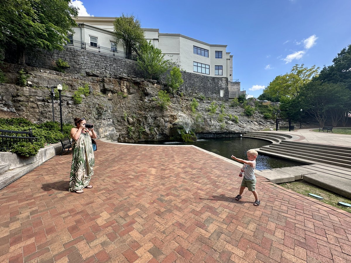
Oh gosh. The baby burro at Custer SP, SD; visiting 2 tripoints; seeing new birds, wildlife galore… but the best has been adding to my circle here. This is such a great crew!
May 31

As May comes to a close, I’m thankful for the moments I experienced. What were your favorite moments from the month of May?

3
2
27
406


I love lil tidbits like this, posting them myself, just happy someone sees them no matter who posts them.
All tripoints in the US
Land-Based Tripoints (38)
AL-FL-GA: East of Malone, Florida (31.0009°N, 85.0033°W)
AL-GA-TN: Near South Pittsburg, Tennessee (34.9847°N, 85.6058°W)
AR-LA-TX: Near Arkana, Louisiana (33.0182°N, 94.0430°W)
AR-MO-OK: Southwest of South West City, Missouri (36.4997°N, 94.6179°W)
AZ-NV-UT: North of Littlefield, Arizona (37.0003°N, 114.0506°W)
CA-NV-OR: South of New Pine Creek, Oregon (42.0000°N, 120.0000°W)
CO-KS-NE: Northeast of Wray, Colorado (40.0031°N, 102.0518°W)
CO-KS-OK: 8 Mile Corner, south of Elkhart, Kansas (37.0001°N, 102.0418°W)
CO-NE-WY: North of Peetz, Colorado (41.0024°N, 104.0531°W)
CO-NM-OK: Preston Monument, Oklahoma Panhandle (36.9991°N, 103.0024°W)
CO-UT-WY: North of Brown’s Park, Colorado (41.0007°N, 109.0509°W)
CT-MA-NY: Slope of Mount Frissell (42.0498°N, 73.4831°W)
CT-MA-RI: Near Douglas State Forest (42.0122°N, 71.7981°W)
DE-MD-PA: The Arc Corner near Newark, Delaware (39.7214°N, 75.7885°W)
GA-NC-SC: Ellicott’s Rock, Chattooga River (35.0002°N, 83.1077°W)
GA-NC-TN: Near McCaysville, Georgia (34.9848°N, 84.3461°W)
ID-MT-WY: Northwest corner of Yellowstone National Park (45.0000°N, 111.0468°W)
ID-NV-OR: South of Three Forks, Idaho (42.0000°N, 117.0354°W)
ID-NV-UT: Near the Pilot Range (42.0000°N, 114.0507°W)
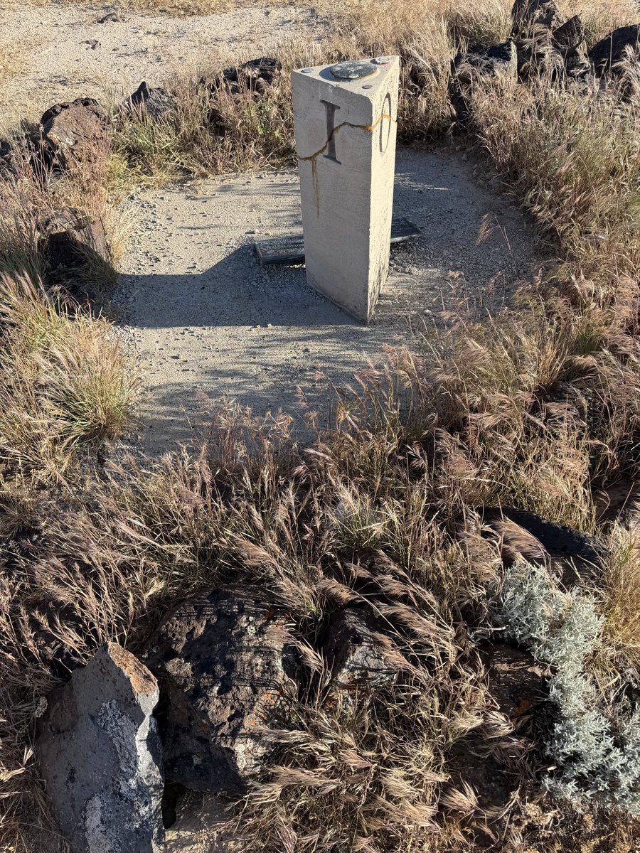
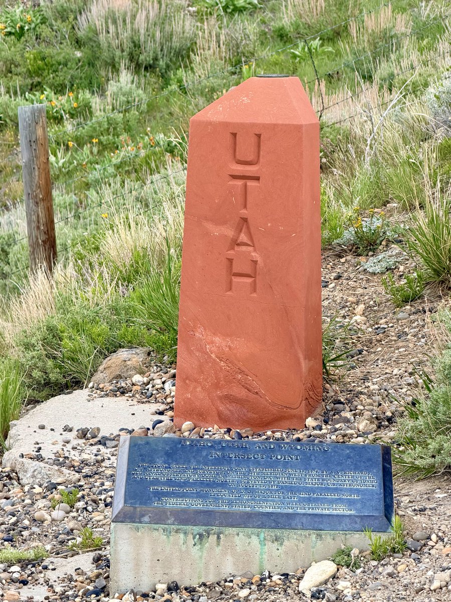
ID-UT-WY: South of Bear Lake (41.9967°N, 111.0467°W)
IA-MN-SD: The Iron Pillar near Larchwood, Iowa (43.5007°N, 96.4517°W)
KS-MO-OK: Southwest of Galena, Kansas (36.9989°N, 94.6180°W)
KY-TN-VA: Tri-State Peak, Cumberland Gap (36.6009°N, 83.6756°W)
MA-NY-VT: Southern end of the Taconic Range (42.7451°N, 73.2782°W)
MD-PA-WV: Near Mason-Dixon Line, Corriganville (39.7201°N, 78.8501°W)
MN-ND-SD: Near White Rock, South Dakota (45.9351°N, 96.5631°W)
MO-KS-NE: Northwest of White Cloud, Kansas (40.0000°N, 95.3080°W)
MT-ND-SD: Rural field near Marmarth, North Dakota (45.9351°N, 104.0453°W)
MT-SD-WY: South of Alzada, Montana (44.9998°N, 104.0573°W)
NC-TN-VA: Ridge of Iron Mountain (36.5843°N, 81.6756°W)
NE-SD-WY: West of Harrison, Nebraska (43.0016°N, 104.0532°W)
NM-OK-TX: Texhomex marker (36.5003°N, 103.0024°W)
NV-OR-UT: Remote high desert (42.0000°N, 114.0507°W)
NJ-NY-PA: High Point State Park, Delaware River (41.3562°N, 74.6931°W)
NY-PA-VT: Near the Mettawee River (43.5828°N, 73.2427°W)
OH-PA-WV: East Liverpool, Ohio (40.6406°N, 80.5186°W)
PA-WV-MD: South of Addison, Pennsylvania (39.7199°N, 79.4566°W)
TN-VA-WV: Near Bluefield, West Virginia (37.2023°N, 81.2778°W)
Water-Based Tripoints (23)
AL-MS-TN: Tennessee River (34.9958°N, 88.1650°W)
AR-LA-MS: Mississippi River (33.0035°N, 91.1717°W)
AR-MS-TN: Mississippi River (35.0000°N, 90.1333°W)
AR-OK-TX: Red River/Little River confluence (33.6441°N, 94.4842°W)
AZ-CA-NV: Colorado River, Laughlin (35.1228°N, 114.5886°W)
CT-NY-RI: Long Island Sound (41.2583°N, 71.9014°W)
DE-NJ-PA: Delaware River, Marcus Hook (39.8153°N, 75.4244°W)
IA-IL-WI: Mississippi River, Dubuque (42.5031°N, 90.6403°W)
IA-MO-NE: Missouri River confluence (40.5833°N, 95.7833°W)
IA-NE-SD: Missouri River, Sioux City (42.4833°N, 96.4500°W)
ID-OR-WA: Snake River/Grande Ronde confluence (46.0000°N, 116.9167°W)
IL-IN-KY: Wabash River/Ohio River confluence (37.8106°N, 88.0267°W)
IL-IN-MI: Lake Michigan (41.7611°N, 86.9036°W)
IL-KY-MO: Ohio River/Mississippi River confluence (36.9833°N, 89.1333°W)
IL-MI-WI: Lake Michigan (42.4917°N, 87.1111°W)
IN-KY-OH: Ohio River, Lawrenceburg (39.1053°N, 84.8211°W)
IN-MI-OH: Near Clear Lake (41.6961°N, 84.8050°W)
KY-OH-WV: Ohio River, Kenova (38.4144°N, 82.5978°W)
LA-MS-TX: Sabine River (30.0000°N, 93.8050°W)
MD-VA-WV: Potomac River/Shenandoah River confluence (39.3228°N, 77.7289°W)
MI-MN-WI: Lake Superior (47.9861°N, 89.1556°W)
MN-WI-IA: Mississippi River (43.5003°N, 91.2750°W)
NH-VT-QC: Hall’s Stream (45.0133°N, 71.5050°W)
Apr 26

Happy Blessed and Good Sunday morning
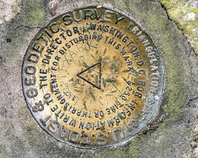
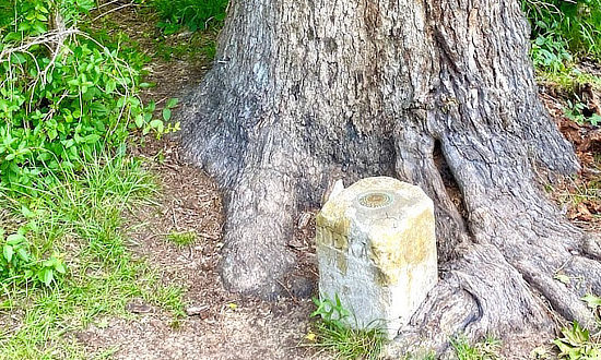
Most folks don’t realize you can stand in Arkansas, Texas, and Louisiana at the same time.
The Ark-La-Tex tripoint is near the tiny community of Three States, right along TX-77 / LA-1, at about 33.01922° N, 94.04311° W.
And don’t go expecting a Four Corners tourist circus. The “monument” is basically a little survey marker tucked up by a tree like it’s hiding from property taxes.
Only in the South can three states meet and still look like nobody told the welcoming committee.
Would you stop for this, or drive right past it?
1
2
185

Apr 26
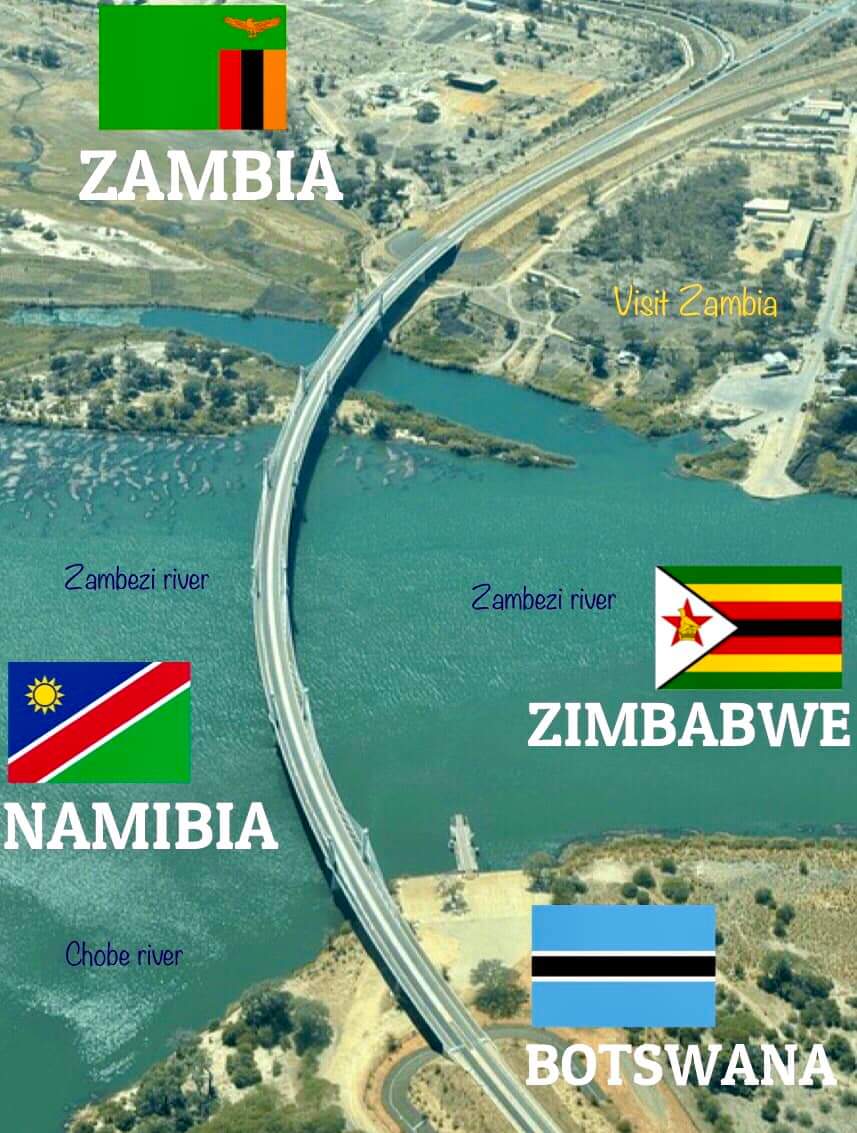
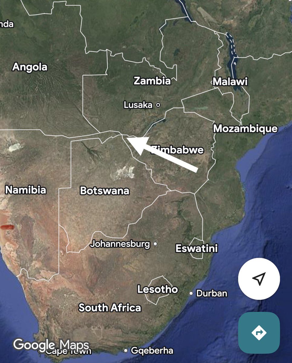
Fascinating location at the Kazungula confluence on the Zambezi River, where Botswana, Namibia, Zambia, and Zimbabwe's borders come remarkably close
While often described as the world's only quadripoint, precise surveys confirm a brief ~150-meter border between Botswana and Zambia, creating two adjacent tripoints instead.
The 2021 Kazungula Bridge, spanning this short segment, has significantly enhanced regional trade and connectivity.
#RiseAgainstCorruption #RiseAfrica #africa
2
424


Feb 28
As you zoom it you start to see that the borders don’t exactly touch at one point. We have two tripoints rather than one quadripoint. This aesthetically displeasing border isn’t accidental, however.
2/6


5
4
66
22,832
Feb 28
There are quite a few tripoints in the world, where three countries come together to meet at a single location. Only at one point on Earth do four countries meet; Kazangula, on the Zambezi river (Zambia, Botswana, Zimbabwe, Namibia). But, there’s a big catch.
1/6
18
21
489
141,430

Feb 7
How many of those tripoints have you visited? I’ve only been to Cumberland Gap.
2
2
275

Feb 7
Antwoord 4332; Oostenrijk heeft 9 internationale drielandenpunten (tripoints) waar de grenzen van drie verschillende landen samenkomen, dat is het hoogste aantal van alle Europese landen. Goede antwoorden door o.a @ben_overbeek @Pubquiz_Cheater
4
123

Jan 25
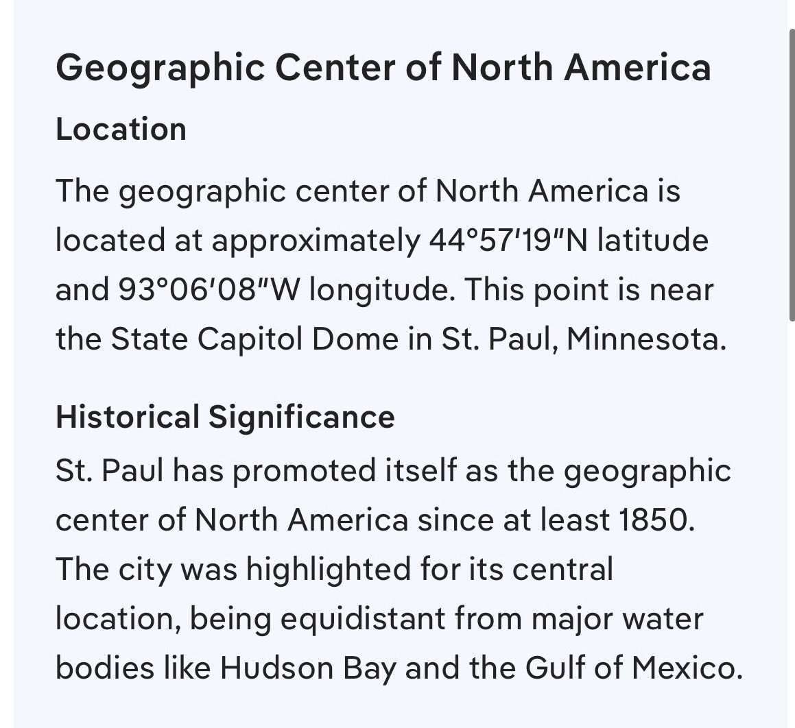
Twin Cities are often considered to be the geographic center of North America, tho there is no universally agreed upon location.
Linking a thread below this post on importance of centerpoints, tripoints, quadrapoints, etc., powerful manifestation spots. Geomancy in action.

Jan 24

Twin Cities, Twin Protests, Twinning of simultaneous symbolically similar world events.
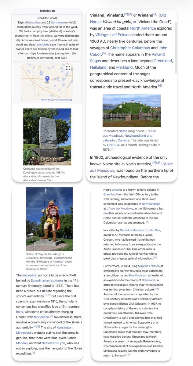
Additionally, Minnesota and Greenland are tied together historically, mainly through the Kensington Runestone, discovered in Minnesota, which allegedly links Vikings to the area as far back as the 14th century, traveling there from Greenland and Vinland, although many consider it to be a hoax.
Some even mentioned blond native Americans as generational proof of their travels to the area.
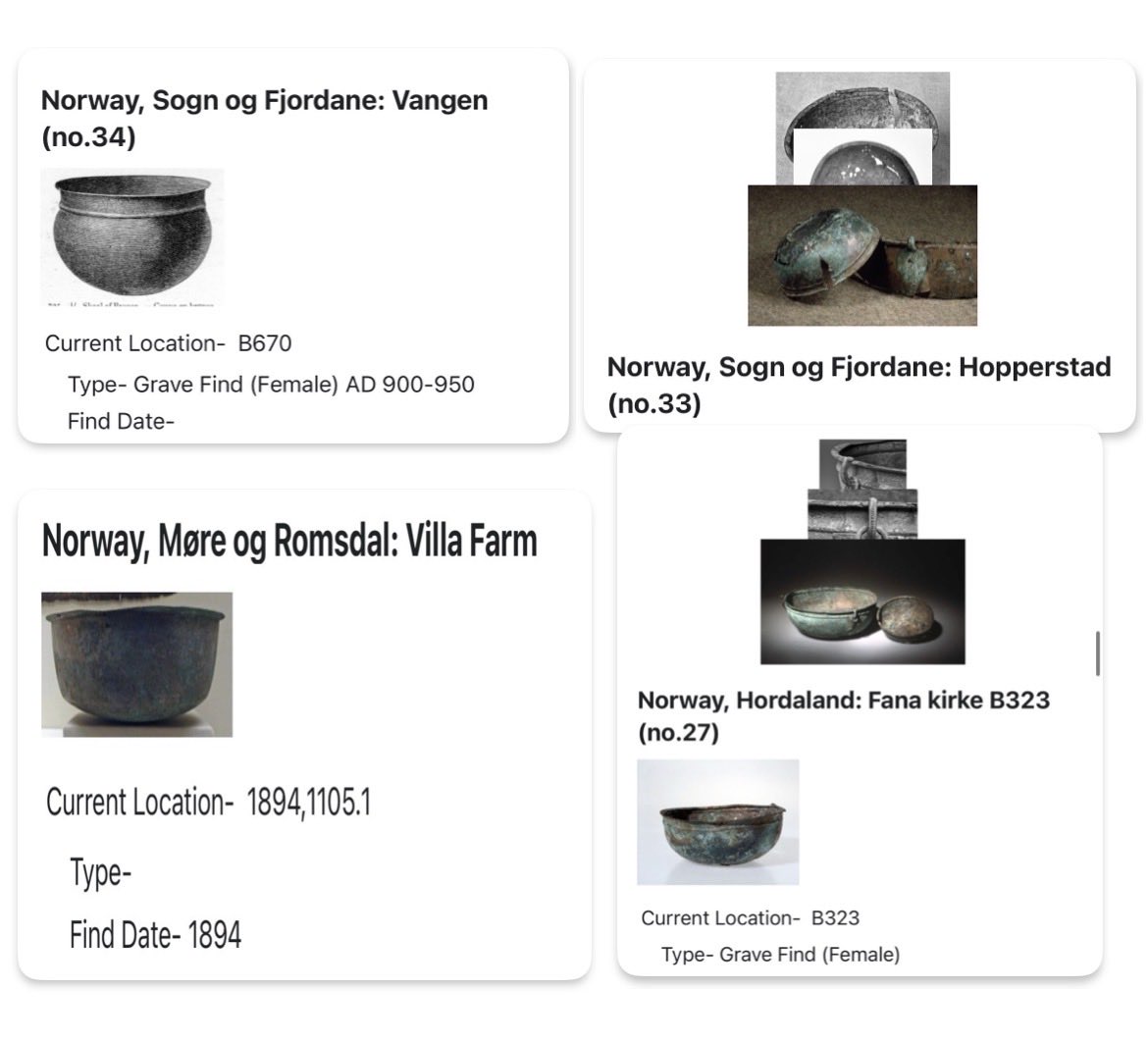
Several years ago now, I read in a historical archive that some explorers came across Indians in this general region of the US, who had somehow acquired a huge copper cauldron, a few feet wide, and it seemed to be a very big anomaly for them. They used copper, but mainly for smaller items. They were asked about it and they said they had come across it almost entirely buried in the ground. I’ve forgotten a lot of history that I’ve read over the years, but that unusual tale stuck with me. And I can’t find it at all now, but it makes me wonder if it was a leftover artifact from a Viking adventure, like these found at other ancient Viking sites -
2
12
1,903
Jan 25
Tripoints/center points as a Terminus:
26 Aug 2025
Terminus:
in western mythology, a crossroads can be used to summon a demon in order to make a deal.
Also an ancient milestone marker, typically shown with crossed arms.

3
262

20 Dec 2025
Thank you everyone for 309 Tripoints!! We will see you soon with a new local in the new year! :)

3
5
39
1,078

13 Dec 2025
Made a great losers run to get 2nd/28 at Tripoint
What I'm most happy about though is that I got to play Ravenking in grands. This was very common in many late 2021-early 2022 Tripoints
It meant so much to me that we could go back to that one last time before the venue closes
1
7
325

5 Dec 2025
De alguna forma me duele menos comprar bits que gastar tripoints 🧍♀️
5
644

5 Dec 2025
Tengo 647.4 K de tripoints y aún así me duele un chingo el codo para gastar 50 K en un TTS. . .

1
71
25,204

7 Nov 2025
The last ever NASB2 tripoint is tonight I'm sorry Illinois ): due to work I can't make it to any of the last few Tripoints after tonight. If you've never played nasb2 or wanted to this is probably the last time I'll be around for quite awhile!
start.gg/tournament/tripoint…
4
165

5 Nov 2025
Gosh if only tripoints were the only thing that the EU had to worry about 🤣🤣🤡
2
690