
Sianel ddarlledu’n unig. Cysylltwch â ni ar Messenger neu WhatsApp/ This is a broadcast‑only channel. Please contact us on Messenger or WhatsApp 👉07790 952 507
- Tweets 164,873
- Following 174
- Followers 26,058
- Likes 3,679


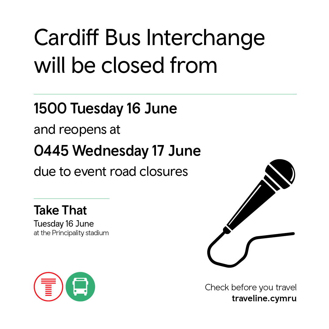
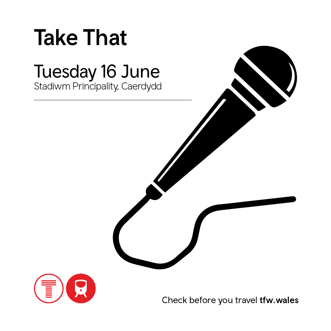


ALT Graphic showing details for the Take That event on Tuesday 16 June at the Principality Stadium in Cardiff. Includes a microphone illustration, transport icons, and a reminder to check travel information at tfw.wales.
ALT Graffig yn dangos manylion y digwyddiad Take That ar ddydd Mawrth 16 Mehefin yn Stadiwm y Principality, Caerdydd. Mae’n cynnwys llun o feicroffon, eiconau trafnidiaeth, a nodyn i wirio gwybodaeth teithio ar trc.cymru.
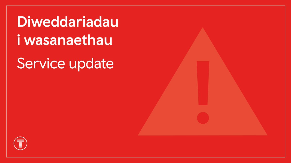
ALT A notice from Transport for Wales about a service update The text says "Diweddariadau i wasanaethau Service update" The red graphic also shows an icon of a warning sign
ALT Hysbysiad gan Drafnidiaeth Cymru am ddiweddariadau i wasanaethau Mae'r testun yn dweud "Diweddariadau i wasanaethau Service update" Mae'r graffeg coch hefyd yn dangos eicon arwydd rhybudd
ALT A notice from Transport for Wales about a service update. The text says "Diweddariadau i wasanaethau Service update". The red graphic also shows an icon of a warning sign.
ALT Hysbysiad gan Drafnidiaeth Cymru am ddiweddariadau i wasanaethau. Mae'r testun yn dweud "Diweddariadau i wasanaethau Service update". Mae'r graffeg coch hefyd yn dangos eicon arwydd rhybudd.
ALT Graphic showing details for the Take That event on Tuesday 16 June at the Principality Stadium in Cardiff. Includes a microphone illustration, transport icons, and a reminder to check travel information at tfw.wales.
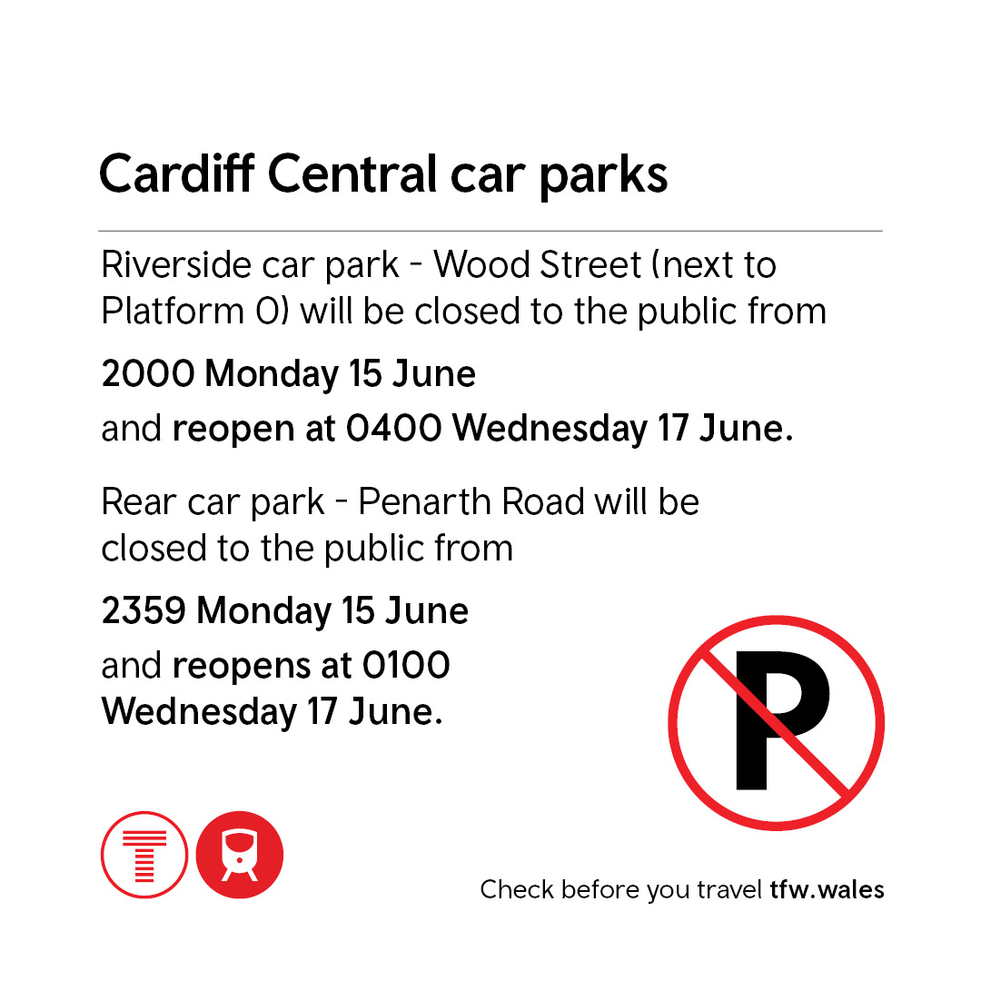
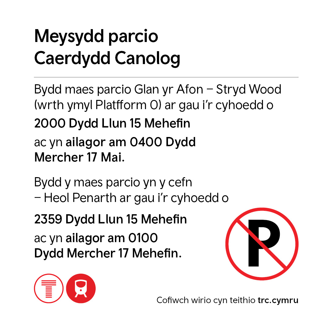
ALT Graphic showing closure information for Cardiff Central car parks. Riverside car park on Wood Street (next to Platform 0) is closed from 20:00 on Monday 15 June until 04:00 on Wednesday 17 June. The rear car park on Penarth Road is closed from 23:59 on Monday 15 June until 01:00 on Wednesday 17 June. Includes a no‑parking symbol and transport icons, with a reminder to check travel information at tfw.wales.
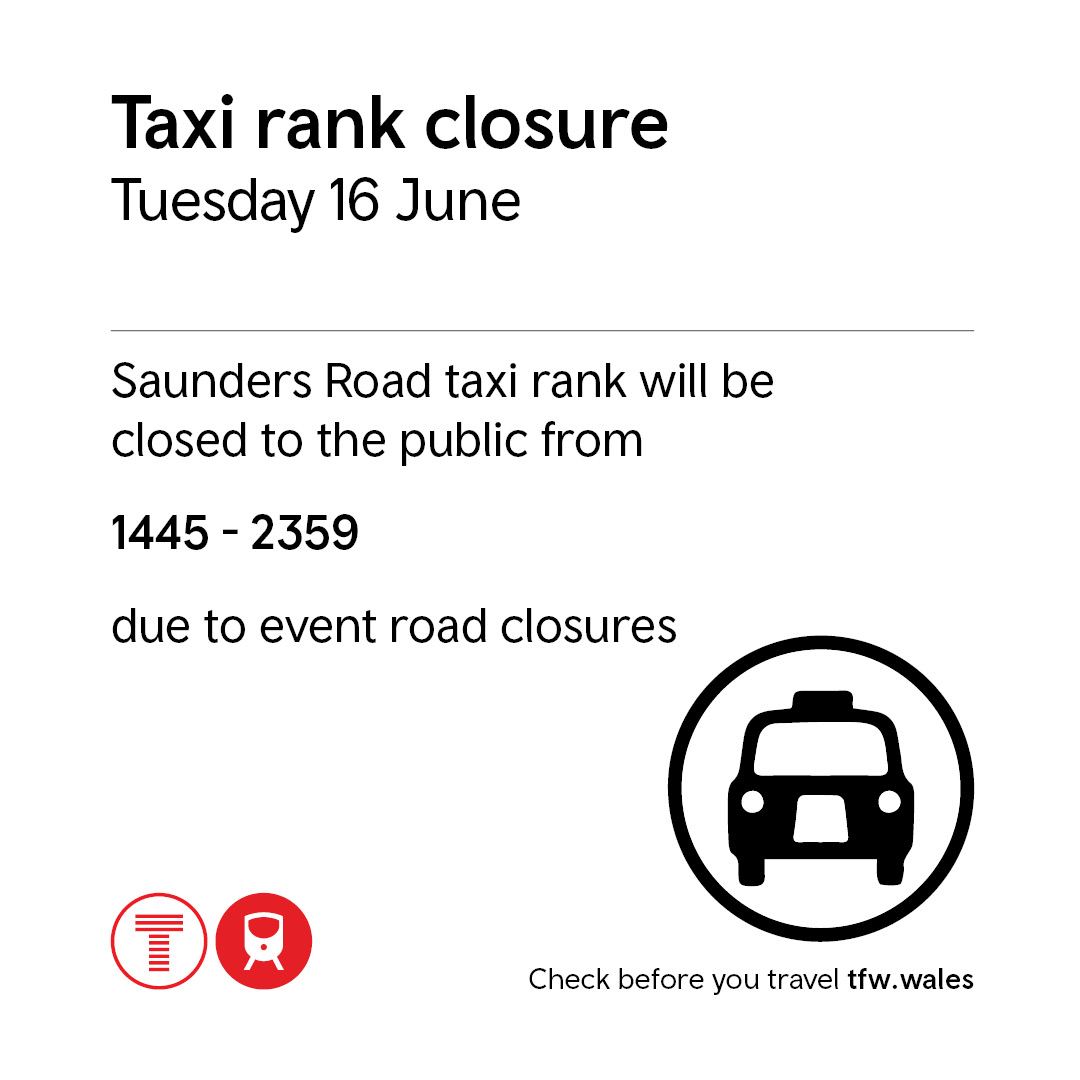
ALT Graphic showing that the Saunders Road taxi rank will be closed to the public from 14:45 until 23:59 on Tuesday 16 June due to event road closures. Includes a taxi symbol and transport icons, with a reminder to check travel information at tfw.wales.
ALT Graffig yn dangos manylion y digwyddiad Take That ar ddydd Mawrth 16 Mehefin yn Stadiwm y Principality, Caerdydd. Mae’n cynnwys llun o feicroffon, eiconau trafnidiaeth, a nodyn i wirio gwybodaeth teithio ar trc.cymru.
ALT Graffig yn dangos gwybodaeth cau meysydd parcio Caerdydd Canolog. Mae maes parcio Glan yr Afon – Stryd Wood (wrth ymyl Platform 0) ar gau o 20:00 ddydd Llun 15 Mehefin tan 04:00 ddydd Mercher 17 Mehefin. Mae’r maes parcio cefn ar Heol Penarth ar gau o 23:59 ddydd Llun 15 Mehefin tan 01:00 ddydd Mercher 17 Mehefin. Mae’r graffig yn cynnwys symbol dim parcio ac eiconau trafnidiaeth, gyda nodyn i wirio gwybodaeth teithio ar trc.cymru.
ALT Graffig yn dangos y bydd safle tacsis Heol Saunders ar gau i’r cyhoedd rhwng 14:45 a 23:59 ddydd Mawrth 16 Mehefin oherwydd cau ffyrdd ar gyfer y digwyddiad. Mae’n cynnwys eicon tacsis ac eiconau trafnidiaeth, gyda nodyn i wirio gwybodaeth teithio ar trc.cymru.
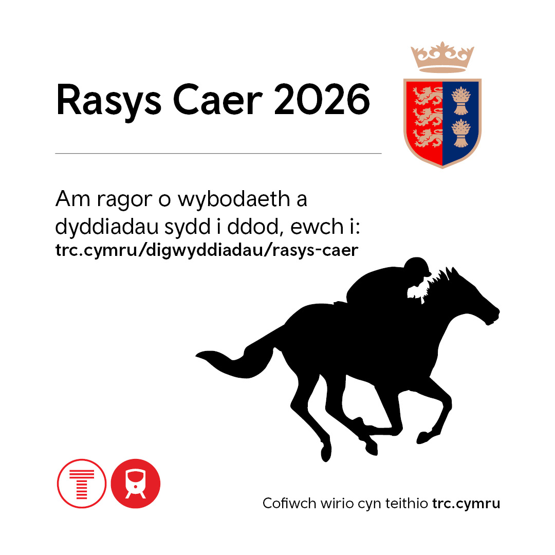
ALT Graphic ‘Chester Races 2026’ with a logo and a silhouette of a jockey on a horse. The text reads: “For more information and upcoming dates visit: tfw.wales/events/chester-races. Check before you travel tfw.wales”.
ALT Graffig ‘Rasys Caer 2026’ gyda logo a’r testun 'Am ragor o wybodaeth a dyddiadau sydd i ddod, ewch i: trc.cymru/digwyddiadau/rasys-caer. Cofiwch wirio cyn teithio trc.cymru”.
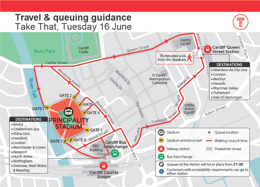
ALT Graphic showing a map of central Cardiff with the Principality Stadium shown in orange and gates labelled Gate 1 to Gate 7. Red walking‑route arrows link the stadium to Cardiff Queen Street Station, with a note reading “15 minutes walk from the Stadium”. Also shown: Cardiff Central Station, Cardiff Bus Interchange, Bute Park, Cardiff Castle, St David’s Metropolitan Cathedral, and the Utilita Arena. Streets including Westgate Street, Wood Street, Scott Road, Bridge Street, and pedestrianised areas are outlined. Text blocks list train destinations from Cardiff Central (Bristol, Cheltenham Spa, Ebbw Vale, Hereford, London, Manchester & Crewe, Newport, North Wales, Nottingham, Swansea, West Wales & Maesteg) and from Queen Street (Aberdare via City Line, Coryton, Merthyr, Penarth, Rhymney Valley, Treherbert, Vale of Glamorgan). Symbols indicate stations, walking routes, queue locations, and pedestrian streets.
ALT Graphic showing post‑event queuing arrangements at Cardiff Central Station for the Take That concert. The map highlights queue zones for trains towards Bristol, Cheltenham Spa, Ebbw Vale, Hereford, London, Manchester & Crewe, North Wales, Nottingham, Swansea, West Wales and Maesteg. It shows station entrances and exits, ticket gates, accessible routes, lifts, and the Cardiff Bus Interchange. Closed areas, including the taxi rank and nearby car parks, are marked. Text on the graphic reads: “Queues will be in place from 21:45”.
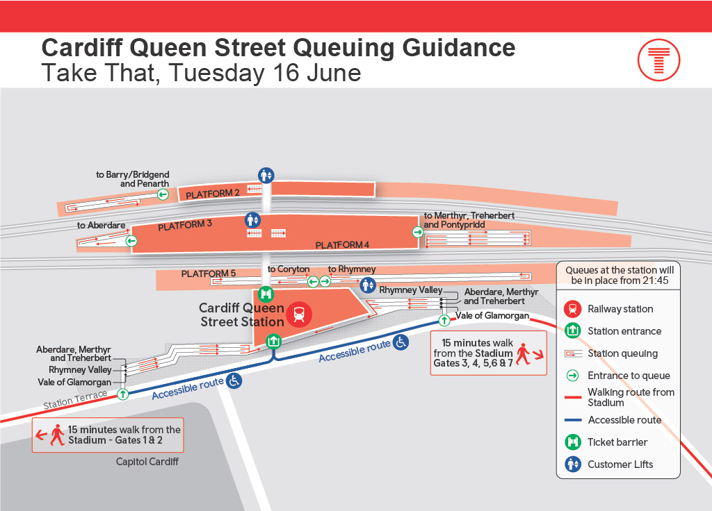
ALT Cardiff Queen Street Station queuing guidance graphic for the Take That concert. Shows the station layout with 15‑minute walking routes from the stadium, queue entry points, accessible routes, and platforms for different destinations. Labels indicate trains towards Aberdare, Merthyr, Treherbert, Rhymney Valley, Coryton, Penarth and the Vale of Glamorgan. Includes icons for the railway station, walking routes, and key surrounding streets. (Background text: “Queues will be in place from 21:45”).