
Published 6x per year in: Raleigh, Brier Creek, Leesville, Apex, Holly Springs, North Raleigh, Wake Forest, Wakefield, Morrisville, Cary, RTP We #fuelcommunity
Joined February 2012
- Tweets 15,588
- Following 5,183
- Followers 5,377
- Likes 5,574
2,678 Photos and videos


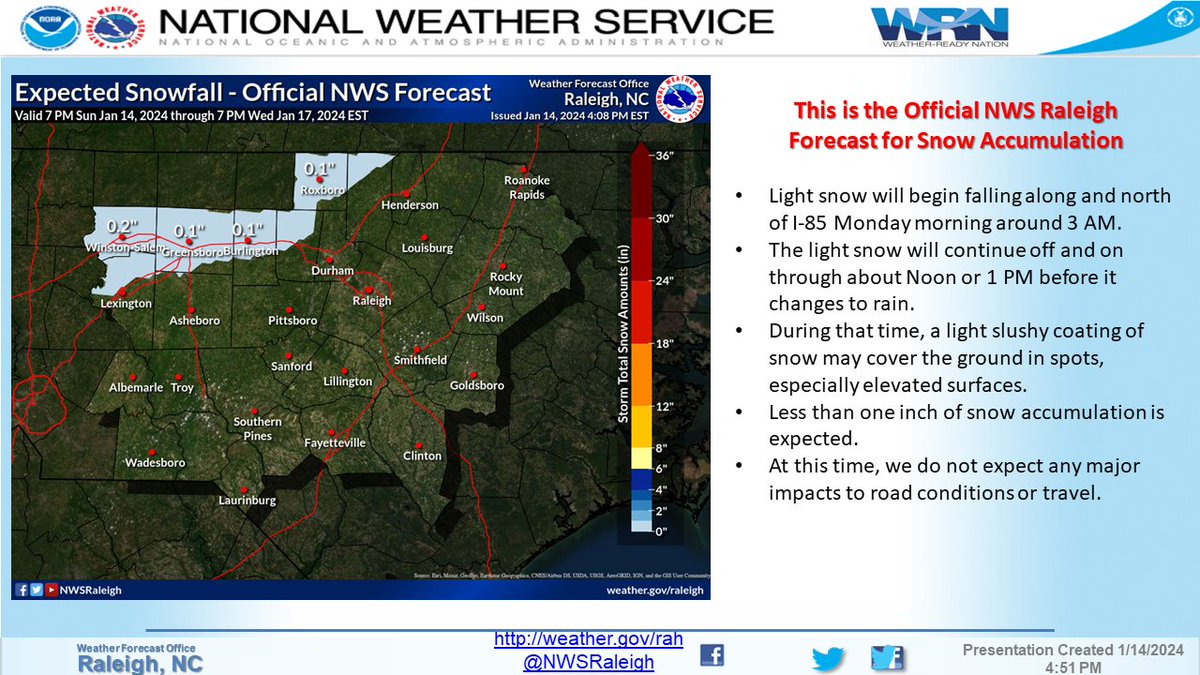
14 Jan 2024
919 weather
14 Jan 2024

Light snow is expected along and north of I-85 overnight tonight, before transitioning to rain by midday Monday. Less than an inch of accumulation is expected, with no major impacts to road conditions. #NCwx
1
1
578
25 Dec 2023
#BREAKING: Thousands are reporting a Mysterious Sightings of a Man in Red Sleigh has been Spotted Soaring Over Multiple Cities Across the Nation
📌#UnitedStates | #USA
1
2
452
12 Nov 2023
From the 9️⃣1️⃣9️⃣ Kitchen- a look back at some of our favorite FALL recipes issuu.com/dreamlakemedia/doc…
1
276
6 Nov 2023
You escape for a couples staycation, what’s your choice?
25%
Washington Duke Inn
75%
Thé Umstead Resort & Spa
8 votes • Final results
302
23 Sep 2023
💫
23 Sep 2023

Apex wins a thriller over Cary. 52 yard game winner by Caleb Willis. Old Wake Rivalry Champs!
308
18 Sep 2023
Watching our hometown 919’r @HNYNUT_BERRIOS 🏈 tonight and he just caught a pass for 1st DOWN!!! Go Braxton!! 🔥
227
919Magazine retweeted

15 Sep 2023
It’s almost time for BLUEGRASS! IBMA Bluegrass Live! powered by @PNCBank is 9/29-9/30 in Downtown Raleigh.
Big Banjo Clocks are up and counting down!
1
3
14
5,775
8 Aug 2023
Important weather message
8 Aug 2023
Those in the Coastal Plain, heads up! These storms continue to produce damaging wind gusts, knocking trees down and causing thousands of power outages. Take cover now! #NCwx
350
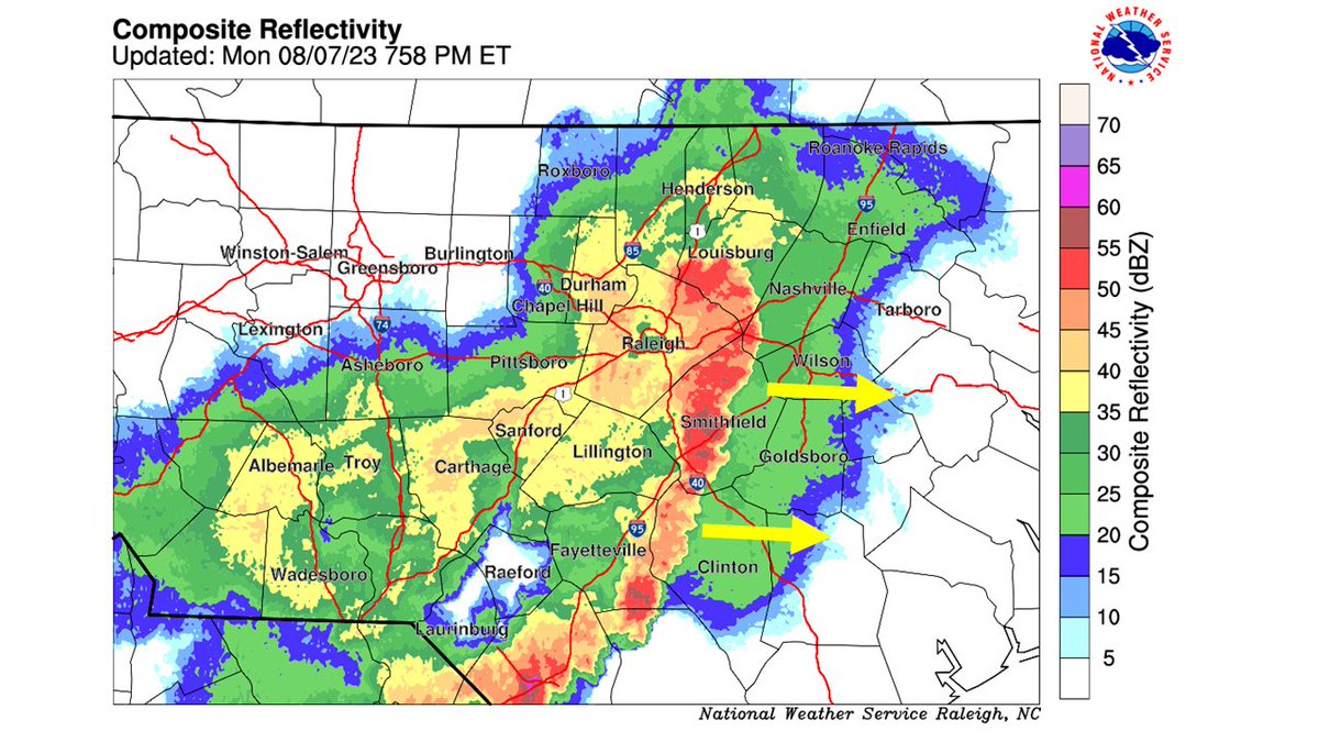
7 Aug 2023
Heads up today in the 919
7 Aug 2023
🚨 Multi-Hazard day with dangerous heat and damaging storms!
A heat advisory is in effect for most of central NC through 7PM this evening. Stay hydrated!
An enhanced risk (level 3 out of 5) for severe storms this afternoon/evening. Damaging winds will be the main threat! #NCwx
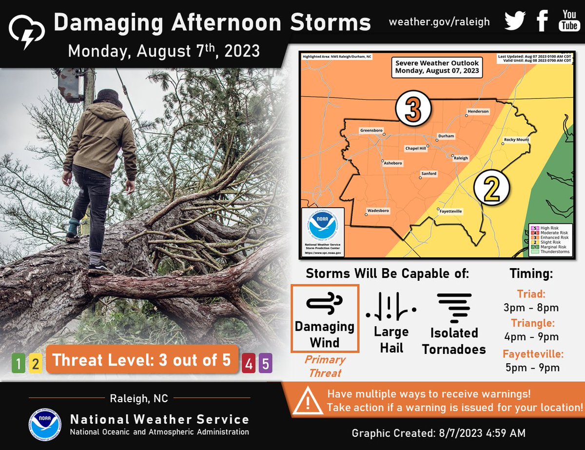
ALT Damaging afternoon storms possible Monday afternoon into the early evening hours. The threat level is a 3 out of 5 for locations west of I-95 and a level 2 along and east of I-95. Damaging straight-line winds will be the primary threat. Make sure you have multiple ways to receive warnings!
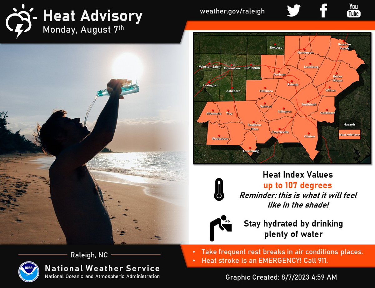
ALT A heat advisory has been expanded to include Orange, Durham, Granville, Vance and Warren counties. Heat index values will reach up to 107 degrees across the advisory area. Take frequent breaks and stay hydrated by drinking water. Heat stroke is an emergency! Call 911!
325
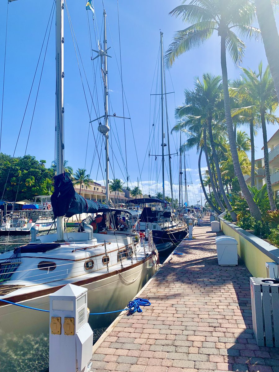
4 Aug 2023
Summer is in full swing-- get out in the great outdoors. #919magazinesummer2023 #yearofthetrail #allthingscarolina #nctravel #gotobenc #visitnc
Read our travel special right here: issuu.com/919magazine/docs/9…
1
1
153
919Magazine retweeted

1 Aug 2023
🍎 Thank you to all our families and staff who are supporting the welcoming of our international teacher! 🍎


1
1
14
745

919Magazine retweeted

31 Jul 2023
Great first day! Guys look great in their new gear! We Train Together!”
“Be the Change!”
3
31
2,560
919Magazine retweeted

24 Jul 2023
1245pm - A few isolated showers have popped up between Rocky Mount, Henderson and Roanoke Rapids. More showers and storms may develop this afternoon, mainly over eastern NC. #ncwx
1
2
12
3,878
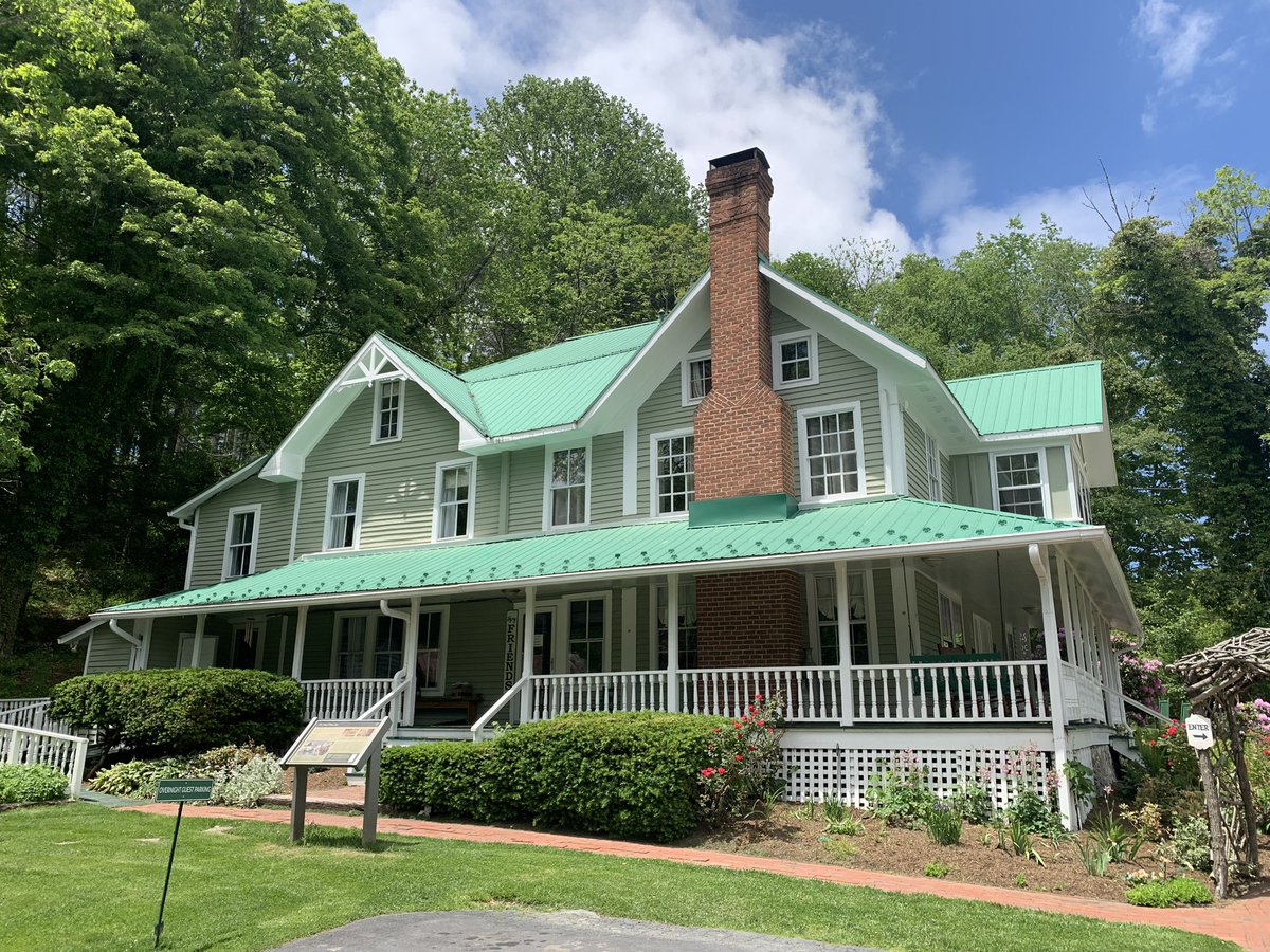
1 Jun 2023
Escape to the mountains this summer. Tour packages and hotel accommodations at @BiltmoreEstate #allthingscarolina #919magazine
1
162
23 May 2023
Sad news in the 919 today. Rest in peace Chef Walter
issuu.com/dreamlakemedia/doc…
5
513