
A part of ArenaC Storm Tracking Service and will post regular updates daily for the WNY and CNY regions
Joined April 2026
- Tweets 75
- Following 16
- Followers 17
- Likes 17
44 Photos and videos


Pinned Tweet

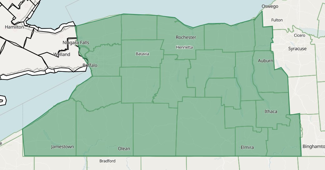
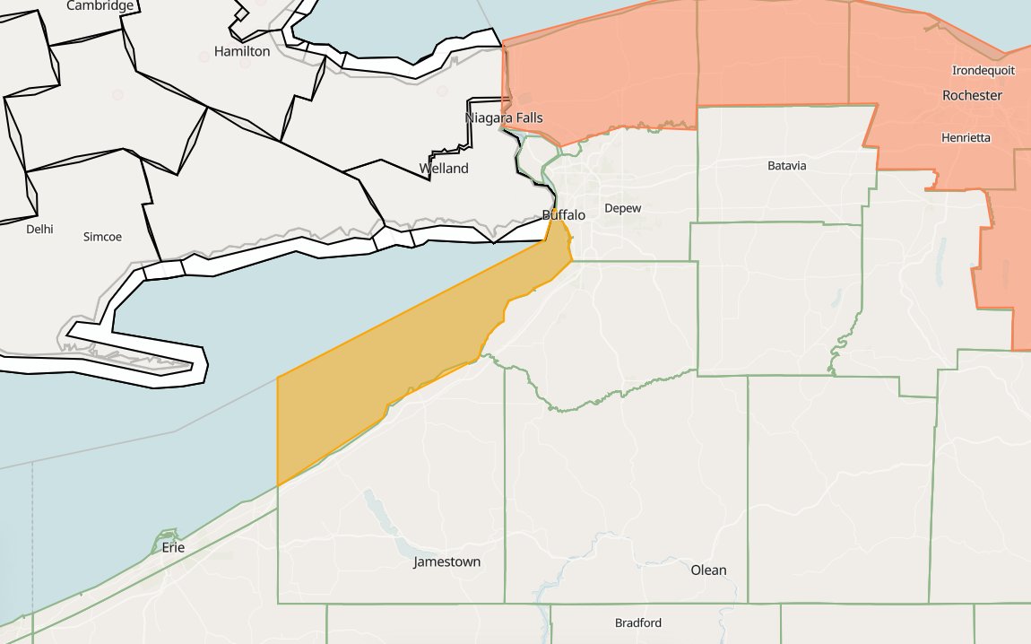
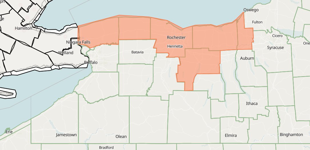
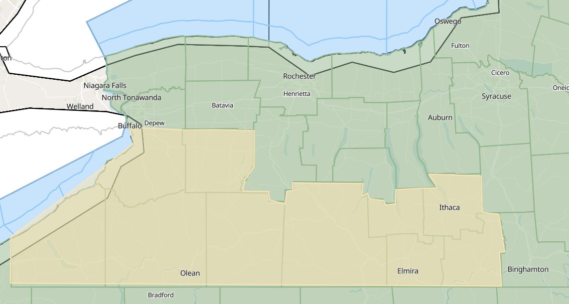
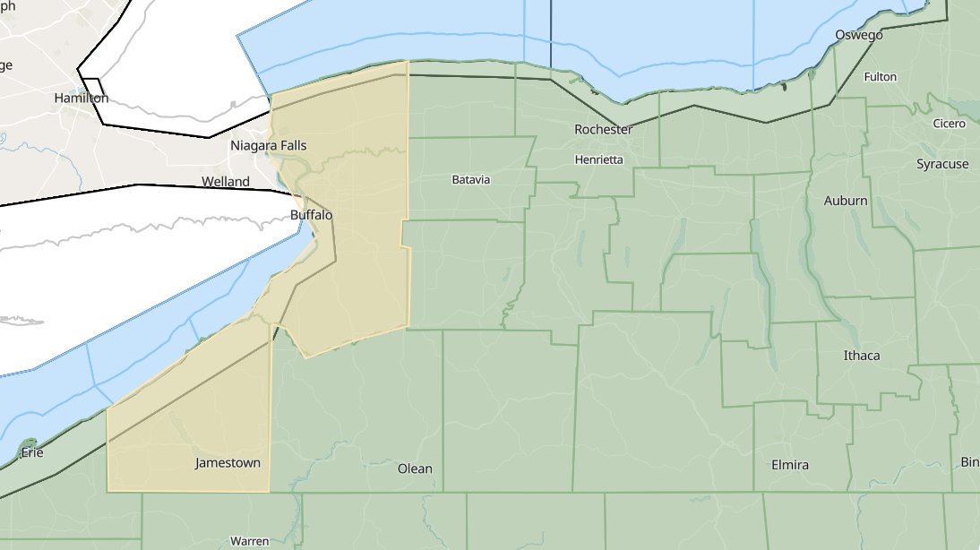
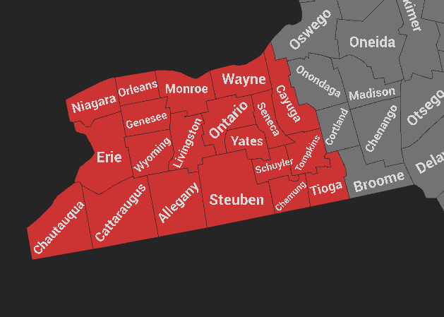
Hello! This the official office ACSTS Buffalo, NY. The office will serve WNY and cites like Buffalo NY and Rochester NY. Map below will serve a base line as to what are county warning area (CWA) is. Please feel free to ask questions if have any!
1
3
66
The ArenaC Storm Tracking Service in Erie has issued a
* Tornado Warning for...
Southwestern Cattaraugus County in western New York...
Southeastern Chautauqua County in western New York...
* Until 545 PM EST.
54
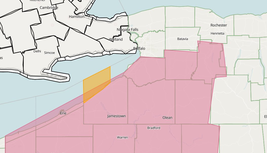
Flood Watch for Entire Buffalo CWA * Until 6:00 PM EDT. Intense bands of thunderstorms capable of 1-1.5"/hr was observed moving towards the lake Erie watershed, MUCAPEs of 1000-1500 J/kg are already observed across N OH, but are likely to expand into W NY over the next few...
26
* Special Marine Warning for... Lake Ontario from Sunset Beach to Braddock Bay...HAZARD...Wind gusts to nearly 50 knots and small hail.* Locations impacted include... Sunset Beach and Hamlin Beach.
31
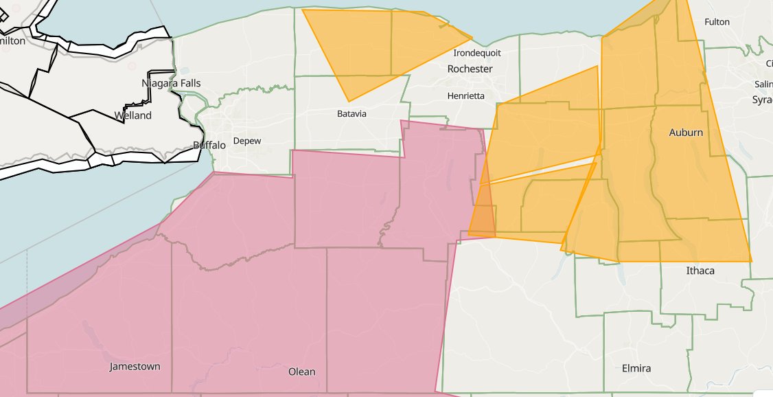
Severe Thunderstorm Warning for... Wayne County in western New York... Seneca County in western New York... Cayuga County in western New York... Northern Schuyler County In central New York...HAZARD...60 mph wind gusts and penny sized hail.
10
Severe Thunderstorm Warning for... Southeastern Orleans County in western New York... North central Genesee County in western New York... Northwestern Monroe County in western New York...HAZARD...60 mph wind gusts and penny sized hail.*
8
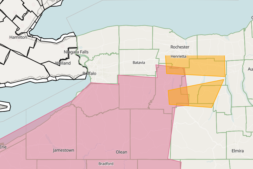
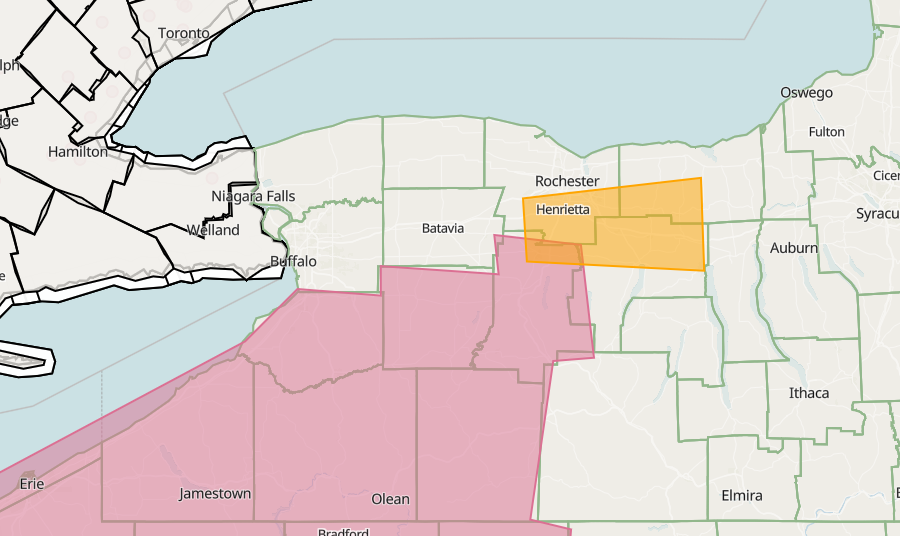
Severe Thunderstorm Warning for... Southeastern Livingston County in western New York... Southern Ontario County in western New York... Until 4:15 PM EDT.
HAZARD...60 mph wind gusts and penny size hail.
Locations impacted include... Naples, Rushville, Springwater
16
Severe Thunderstorm Warning for... Southwestern Wayne County in western New York... Northeastern Livingston County in western New York... Southeastern Monroe County in western New York...
* Until 4:15 PM EDT.
HAZARD...60 mph wind gusts and quarter size hail.
10
Storm has weaken below severe limits. Severe Thunderstorm remains watch in effect
7
ACSTS Buffalo, NY retweeted

Jun 11
Severe Thunderstorm Watch for portions of
Southwest/central New York
Eastern Ohio
portions of Pennsylvania
Until 8pm EDT.
Primary threats include...
Scattered damaging wind gusts up to 70 mph possible
Scattered large hail events to 2 inches in diameter likely.
a tornado or two
1
1
5
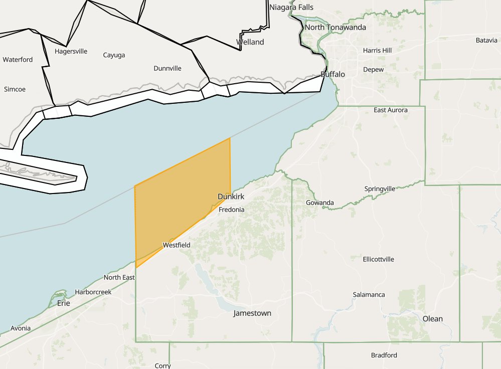
* Severe Thunderstorm Warning for... Northwestern Cattaraugus County in western New York... Southwestern Erie County in western New York... Northeastern Chautauqua County in western New York.HAZARD...60 mph wind gusts and penny size hail.
13
* Special Marine Warning for...
Lake Erie from Ripley to Dunkirk...
(until 2pm EDT)
HAZARD...Wind gusts 34 knots or greater and penny size hail.
* Locations impacted include...
Van Buren Point, Dunkirk, Barcelona, and Ripley.
14
ACSTS Eri has issued svr thunderstorm warning for Chautauqua, Cattaraugus and Erie. with quarter size and 60mph. expect minor damages. Buffalo thanks Erie for its service

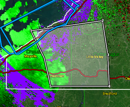
Severe Thunderstorm Warning for... Chautauqua County in western New York... * Until 1145 PM EDT. * At 10:46 PM EDT, a severe thunderstorm was located over Northwest Harborcreek, or near Erie, moving east at 45 mph. HAZARD...60 mph wind gusts and penny size hail.
5
Severe Thunderstorm Warning for... Chautauqua County in western New York... * Until 1145 PM EDT. * At 10:46 PM EDT, a severe thunderstorm was located over Northwest Harborcreek, or near Erie, moving east at 45 mph. HAZARD...60 mph wind gusts and penny size hail.
15
* Special Marine Warning for... * Until midnight EDT. * At 10:36 PM EDT, a strong thunderstorm was located near Erie, moving northeast at 45 knots. HAZARD...Wind gusts to 40 knots. IMPACT...Small craft could be damaged in briefly higher winds and suddenly higher waves.
10
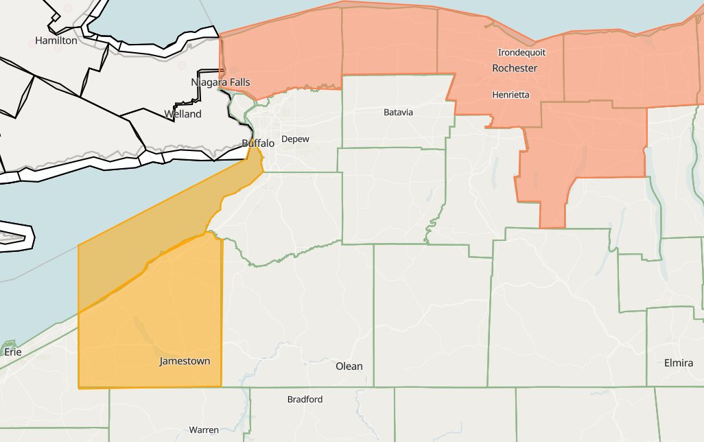
* Heat Advisory for Niagara, Orleans, Monroe, Wayne, Northern Cayuga, Livingston, and Ontario Counties. * Until 8:00pm EDT Thursday. HAZARD... Heat index values in the mid 90s expected. with little relief at night with combination of high humidity
6
Special Marine Warning for
Lake Erie nearshore waters strong thunderstorm to impact the waters of our CWA and could some strong gusts and small hail. (until 11;30 EDT)
7
ACSTS Buffalo 4:44 EDT
With this heat we will have episodic severe weather this week including some higher end severe weather on Friday with all storm mode possible. please be alert from @ACSTS_MFC for potential watches and warning from us!
1
20
Heat index will reach upper 80s to lower 90s tomorrow, This is below Heat advisory criteria and too short to issue an special weather statement as it will be slightly cooler on Wednesday but expect heat headlines later in the work week.
7
ACSTS Buffalo: There is gonna be an heat risk for our CWA that will probably produce heat related headlines please have water and AC. This applys to most of the US even if you are not in our CWA.
1
15
(delayed) SWS canceled
Special Weather Statement until further notice for the southern and western portions for thunderstorms and flooding risk, few of these storms can be strong and could reach severe limits
13