
Forecasting Excellence for your tomorrow. Serving Southern Ontario with the latest weather alerts and information.
Joined January 2019
- Tweets 5,268
- Following 813
- Followers 711
- Likes 3,786
2,664 Photos and videos
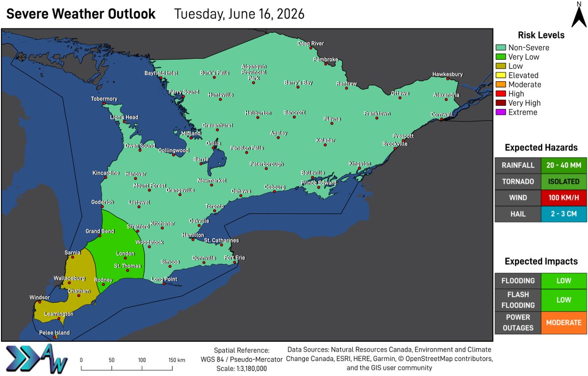


**Low Risk for Severe Weather Tuesday**
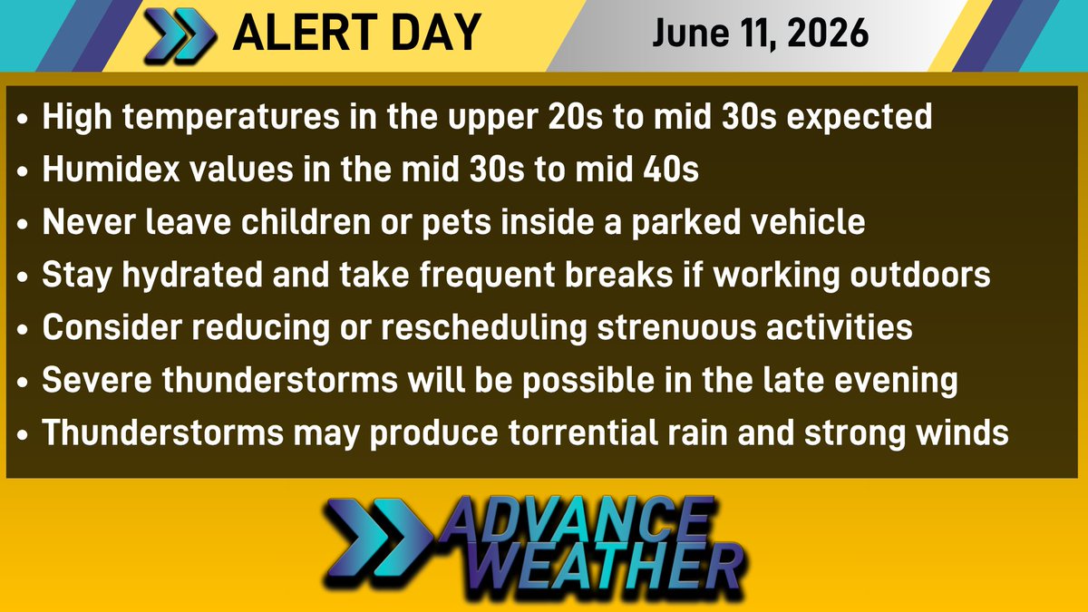
As showers and thunderstorms move across the region today, there will be a Low risk for severe weather to develop, mainly in Deep Southwestern Ontario. Some uncertainty remains as thunderstorms may weaken before moving into the area.
1
1
78
There will be a Moderate risk for power outages due to the strong wind gusts expected within thunderstorms.
The Very Low risk area is likely to see rainfall of 20 to 40 millimetres and wind gusts up to 90 km/h are possible.
1
1
64
The Non-Severe risk area is likely to see rainfall of 20 to 40 millimetres and the potential for wind gusts of 70 to 80 km/h.
1
1
37
**Very High UV Index Tuesday**
With sun and clouds in the forecast for Tuesday, the UV Index is forecasted to be in the Very High category in Deep Southwestern Ontario. The rest of the region will be in the High category.
1
2
4
213
The higher the UV Index, the stronger the sun's rays, meaning you need to take more precautions to protect your skin. The sun is at it's peak between 10 AM and 4 PM. Ensure you wear sunscreen and cover up with a hat and sunglasses.
1
1
142

Jun 15
Tuesday will bring a mix of sun and cloud to much of the region, with mainly sunny skies expected in portions of Central and Eastern Ontario.
It will be a breezy day across much of the area, with wind gusts of 40 km/h likely throughout the day.
1
1
3
143
Jun 15
There will be rain showers around throughout the day, and there may be a thunderstorm at any time. Any passing shower or thunderstorm may produce torrential rainfall and strong wind gusts. Be mindful of flooded areas.
1
1
2
106
Jun 15
We are currently monitoring the potential for some strong to severe thunderstorms Wednesday evening, as well as strong wind gusts that are likely across much of the region on Tuesday. Stay tuned for further updates.
Temperatures in yellow represent forecasted Humidex values.
1
2
81
Jun 15
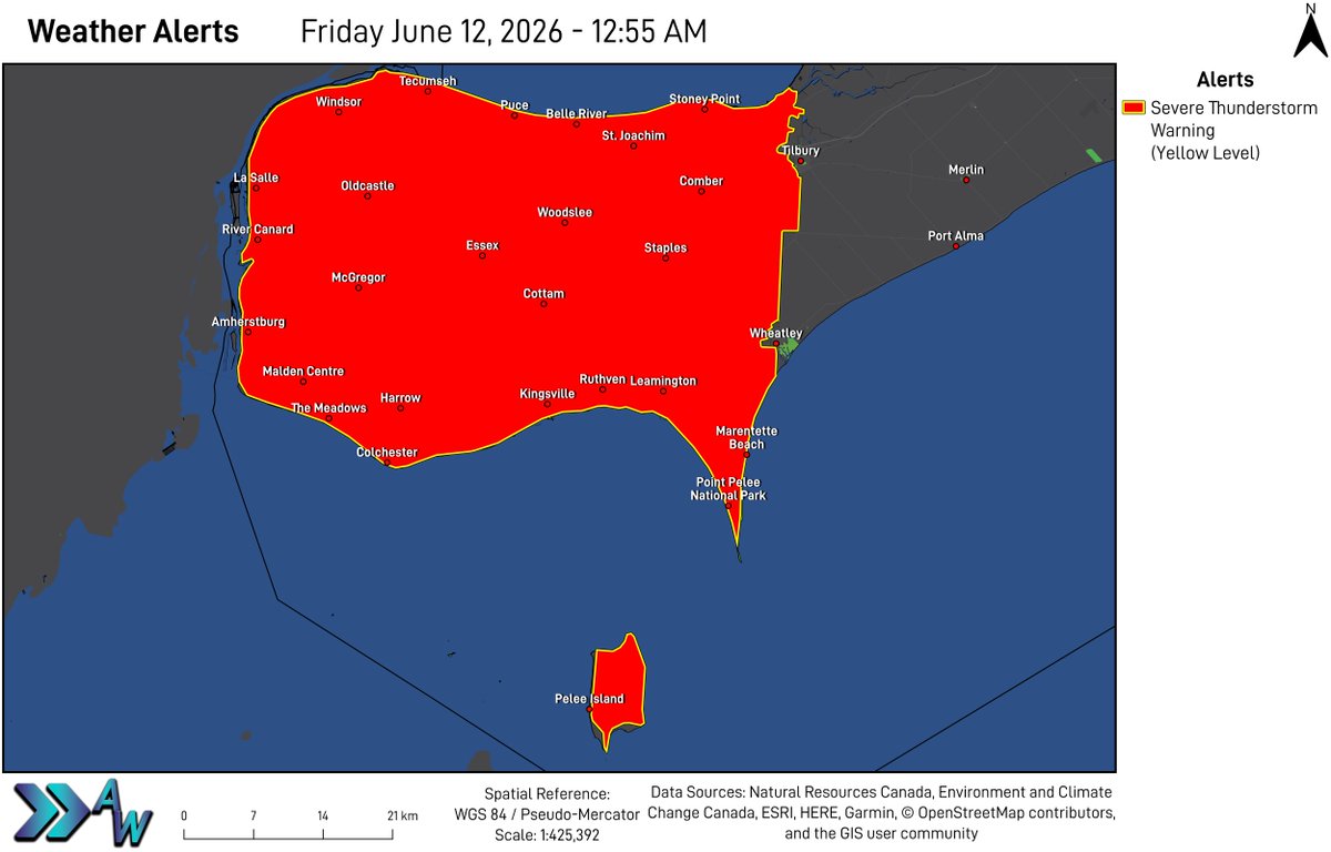
**1 Confirmed Tornado and 2 Confirmed Downbursts from Friday, June 12, 2026**
The Northern Tornadoes Project at Western University has confirmed 3 events during the early morning hours of June 12, 2026.
Croton - EF0 Tornado
Blenheim - EF0 Downburst
1
3
3
286
Jun 15
Walpole Island - EF0 Downburst
Further detailed information will be released by the Northern Tornadoes Project at a later time.
#ONwx
1
1
177
Jun 14
Monday will bring a mix of sun and clouds to the area, with warm temperatures, however humidity is expected to remain quite low.
The new work week is looking much more comfortable than what we experienced last week, with temperatures remaining in the 20s for many areas.
1
4
91
Jun 14
The next chance of rain is expected late Wednesday into Thursday. Some windy conditions may develop Thursday.
2
51
Jun 14
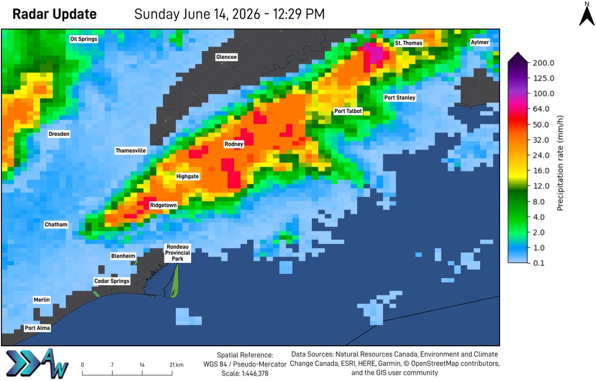
RADAR UPDATE - 12:30 PM ET:
We are currently monitoring this thunderstorm that is nearly stationary and affecting portions of Chatham-Kent and #Elgin County.
Torrential rainfall is likely. Watch for flooding on streets and highways, and in low-lying and poor drainage areas.
1
2
62
Jun 14
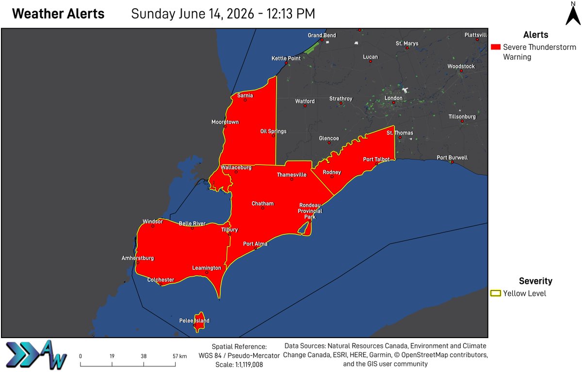
Sunday will bring rounds of rain to the region, which will be heavy at times. There may be a thunderstorm at any time over any area.
There will be a risk for some severe thunderstorms tomorrow, mainly between 10 AM and 4 PM.
1
2
2
141
Jun 14
The expected hazards will be torrential downpours, strong wind gusts, and the risk for an isolated tornado. We will be monitoring the data tomorrow morning and will prepare an update if necessary.
Monday is expected to bring mainly sunny skies to the area.
1
1
2
125
Jun 14
The next chance of rain is likely during the middle of next week.
1
1
82
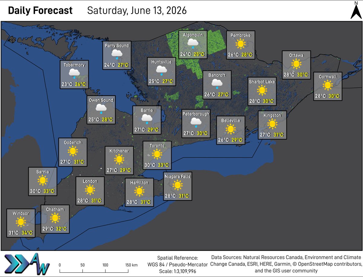
Jun 12
Mainly sunny skies are in the forecast across much of the region for Saturday, however some showers will persist in Central and portions of Eastern Ontario.
Some isolated thunderstorms will be possible tomorrow, with the main hazard expected to be torrential downpours.
1
102
Jun 12
Sunday is expected to bring rain to much of the region, with torrential downpours and thunderstorms possible. Further details will be posted in a Rainfall Outlook tomorrow night.
Temperatures in yellow represent forecasted Humidex values.
82