
Development Economist @OSU_AEDE . Randomista but I love any good regression. Mom. Concerned Citizen. she/her
Joined March 2012
- Tweets 6,226
- Following 1,319
- Followers 2,319
- Likes 51,221
430 Photos and videos


Pinned Tweet

29 Feb 2024
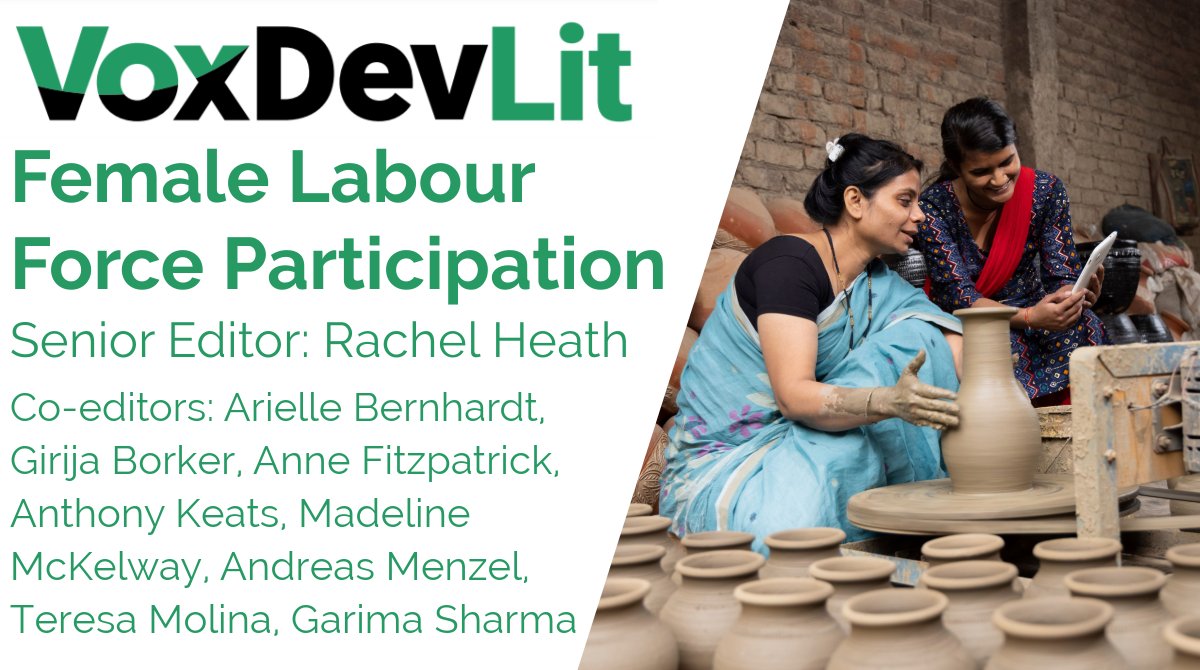
Want to know a summary of the literature on factors affecting female labor force participation? See below 👇

Our new #VoxDevLit on Female Labour Force Participation is out now!
Senior Editor @rachelmheath synthesises evidence on the barriers to women's labour supply in low- and middle-income countries & evaluates policies to increase women’s labour supply: voxdev.org/voxdevlit/female-…
3
18
6,274
26 Jun 2025
I'd like to share this list of urgent and vetted projects that USAID awarded grants for that were then terminated: airtable.com/appeewGHRQqibkO…
1
1
141
26 Jun 2025
While all projects listed need funding, I'd like to highlight our project in Uganda with Health Access connect. In partnership with the MoH, they coordinate outreaches of gov health workers to rural Uganda (>5km from the public health facilities). healthaccessconnect.org/
1
100
Dr Anne Fitzpatrick retweeted

27 Nov 2024
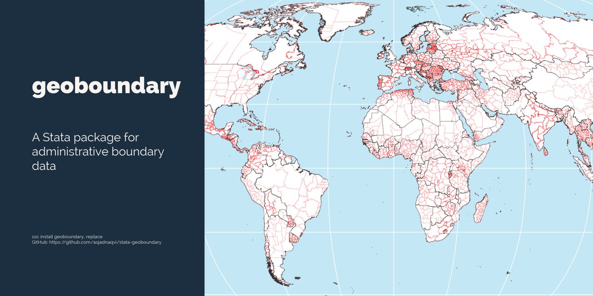
🚀Launching the @Stata #geoboundary 🌎🌍🌏 package that allows users to pull #administrative ADM0-ADM5 (availability can vary) #boundaries for any #country, or for the whole #world. 🗺️
The package pull data from the geoboundaries.org/ database using its API. This package allows users to quickly setup the spatial data without having to hunt for #GIS information from random websites.
The syntax is fairly straightforward:
geoboundary ISO3 list, level(ADMx list)
The syntax can also convert shapefiles to Stata format and clean up the folder if specified. This can be useful if downloading data in bulk.
See below for installation instructions and examples:
github.com/asjadnaqvi/stata-…
Please test it out and report bug/feature requests!
Note that the boundary data is provided as it without guarantees or accuracies. Boundary data is also subject to change. Please check notes and meta data and use official sources if the most recent information is required.
Up soon on SSC.
1
39
166
11,732
Dr Anne Fitzpatrick retweeted

Columbus I was unfamiliar with your game

ALT In body camera footage Columbus police released Monday, the neo-Nazis told police they had never experienced a response like the one they received in Columbus. They said people pulled guns on them and threw cans and vegetables as they marched, waved flags and yelled racial slurs. One of the officers noted the men were “covered in” pepper spray.
25 Nov 2024

The neo-Nazis told police they had never received such a violent response as the one they received in Columbus, and claimed people threw cans and veggies. dispatch.com/story/news/crim…
338
7,967
96,567
3,558,194
26 Nov 2024
Hello AshEcon development/global health people-
Someone is looking for other papers to join their session. Their paper is about access to primary health care in Nigeria.
Keywords are access; acute care; geographic proximity.
If interested lmk thanks! 🫡
1
2
302
Dr Anne Fitzpatrick retweeted

25 Nov 2024
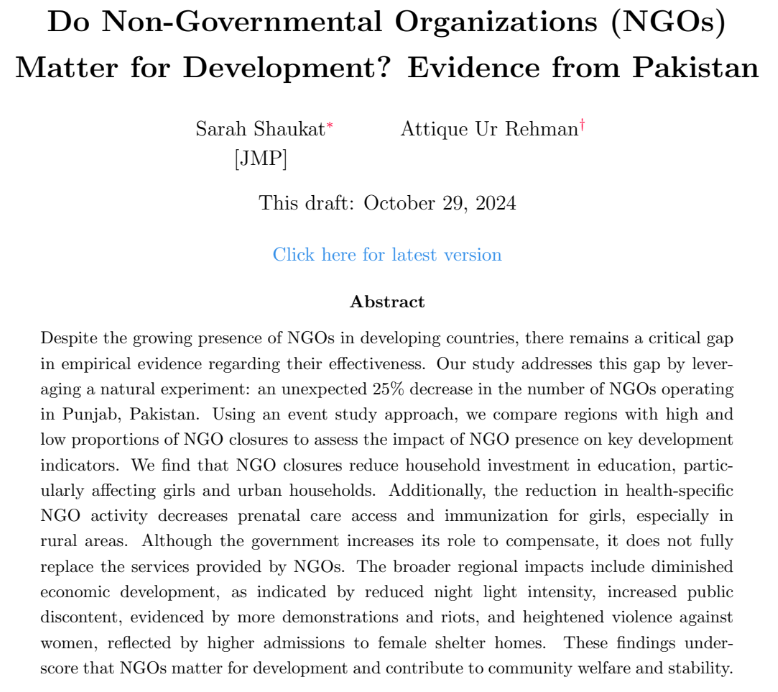
My excellent student
@_sarahshaukat is on the job market! Check out her great JMP: "Do NGOs Matter for Development? Evidence from Pakistan"!
25 Nov 2024

🚨Excited to share my #JMP!
"Do NGOs Matter for Development? Evidence from Pakistan"
NGOs often fill gaps left by limited public spending on health, education, etc.📚🏥But do NGOs truly move the needle on development? Let’s dive in!👇
🧵[/10]
🔗dropbox.com/scl/fi/pe7ozsno4…
1
6
33
4,777
Dr Anne Fitzpatrick retweeted

25 Nov 2024
Great coverage of our 2024 Outlook & Policy Conference
20 Nov 2024

There are lingering #farmlabor concerns around the #H2Aprogram. Details @brownfield below
brownfieldagnews.com/news/po…
1
3
373
Dr Anne Fitzpatrick retweeted
25 Nov 2024
Great coverage of our 2024 Outlook & Policy Conference - insights from our experts
19 Nov 2024
An @OhioState professor is concerned about the impact of potential #tariffs on #exports in 2025. Details & full interview @brownfield.
brownfieldagnews.com/news/th…
2
5
894
Dr Anne Fitzpatrick retweeted

22 Nov 2024
A Toronto man ran 1,105 kilometers (687 miles) over a year, carefully planning his routes to form the shape of a dancing figure
257
3,050
25,269
3,251,867
Dr Anne Fitzpatrick retweeted

22 Nov 2024

3
32
2,308
Dr Anne Fitzpatrick retweeted

22 Nov 2024
Our department, @OSU_AEDE, is hiring! We have a very well-resourced endowed chair available at either the Associate or Full Professor rank, 50/25/25% research/teaching/outreach, working on economics of "rural and urban interface”.
2
6
20
1,820
22 Nov 2024
🚨Exciting job alert @OSU_AEDE 🚨
aeaweb.org/joe/listings?q=eN…,,
I’m not on the search committee but happy to answer questions 😃
Plz apply! And encourage your friends to apply!
1
259
Dr Anne Fitzpatrick retweeted

22 Nov 2024
I have two fantastic students on the market this year. Anyone looking to hire in development labor should take a serious look at them. First up, Varun Kapoor sites.google.com/view/varunk…
4 Nov 2024

Labor markets in LMICs have high turnover & unemployment, even with high demand. Through 3 field experiments, Varun K examines how limited commitment liquidity constraints on both sides of the market cause mismatch in labor supply-demand, which partly explains this phenomenon.
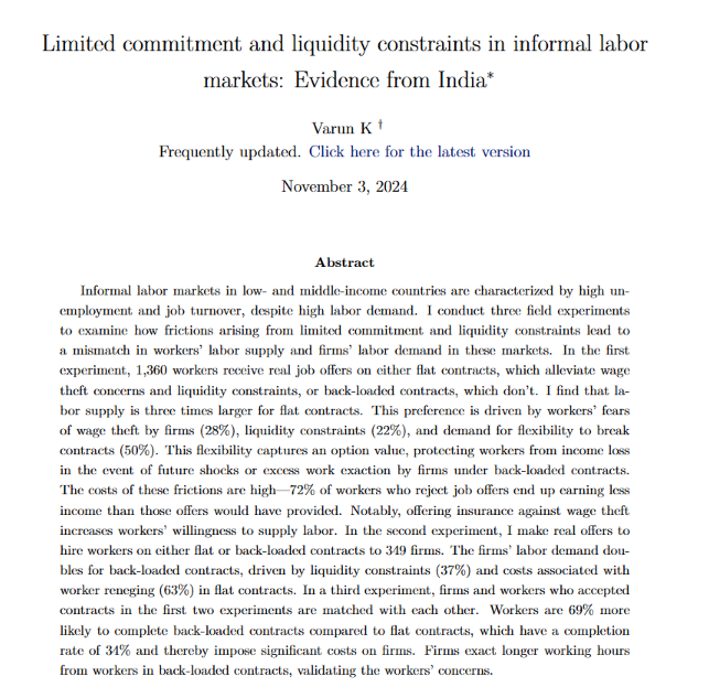
ALT Screenshot of Varun K's Job Market Paper Abstract, "Limited commitment and liquidity constraints in informal labor markets: Evidence from India"
1
7
22
5,701
Dr Anne Fitzpatrick retweeted

21 Nov 2024
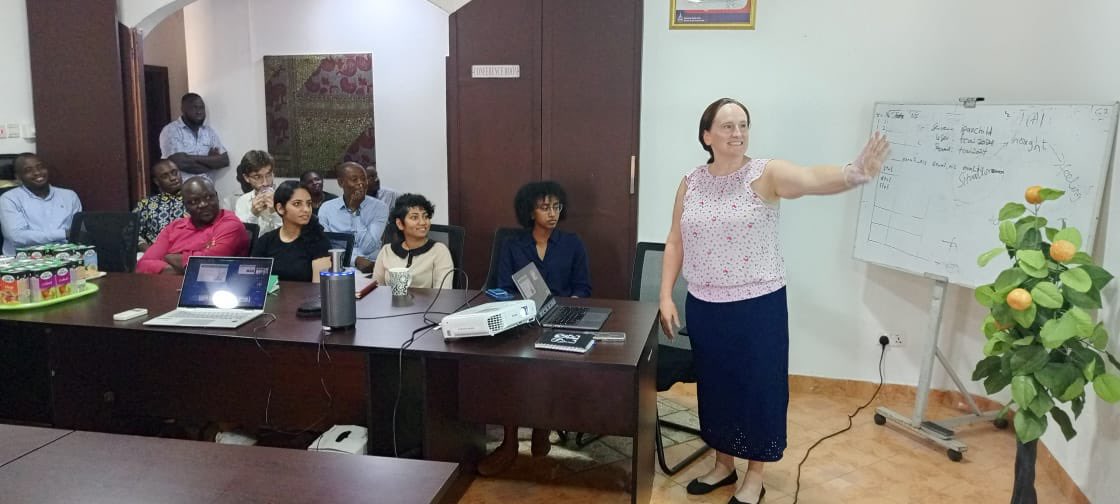
Amazing week in Ghana presenting at the Ministry of Education’s National Education Week (w/@kanandubal) on the importance of in-person refresher trainings for the implementation of Differentiated Learning - joint work with @ProfALucas, @AnneFitz13, @sabrinbeg, & @poverty_action!


3
10
1,530
Dr Anne Fitzpatrick retweeted

19 Nov 2024
LEGENDARY: #Bengals WR Ja’Marr Chase is the FIRST #NFL PLAYER with 70 catches, 1,000 yards, and 12 TDs in 11 games since 2007 Randy Moss.
🤯🤯🤯
Chase, Randy Moss, Marvin Harrison, and Terrell Owens are the only players in NFL history to do this.
(@doug_clawson)

38
410
4,802
185,605
Dr Anne Fitzpatrick retweeted

20 Nov 2024
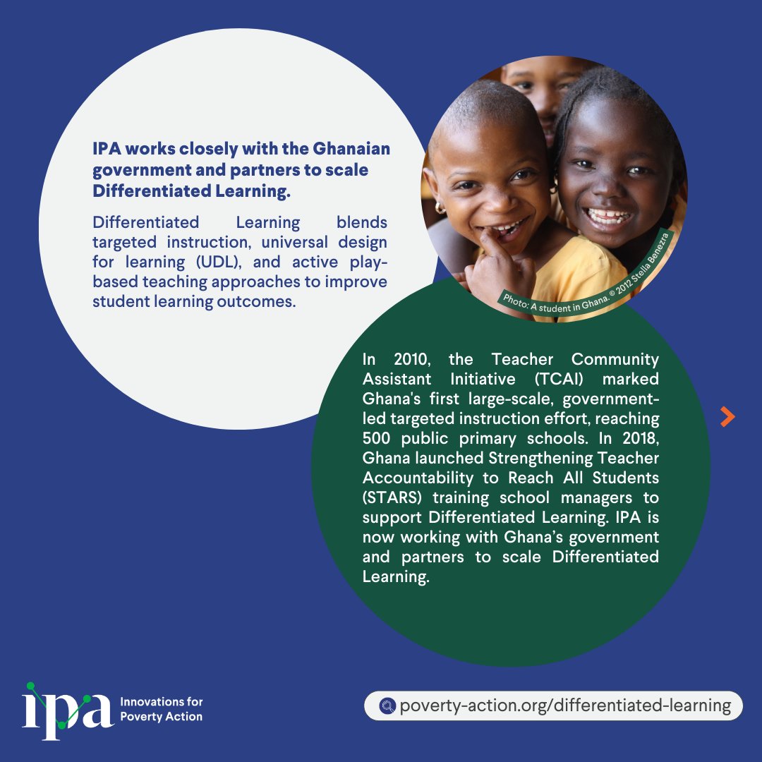
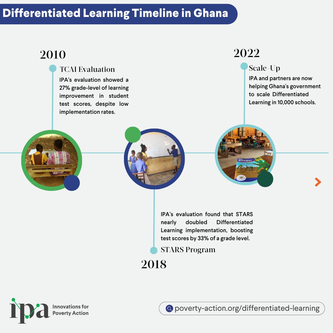
Check out our dedicated Differentiated Learning webpage for all of our research on Differentiated Learning in Ghana: bit.ly/ipadlgh
@sabrinbeg @duflo_annie @AnneFitz13 #JessicaKiesel @ProfALucas
2
3
2,613
Dr Anne Fitzpatrick retweeted
20 Nov 2024
Happy World Children’s Day!
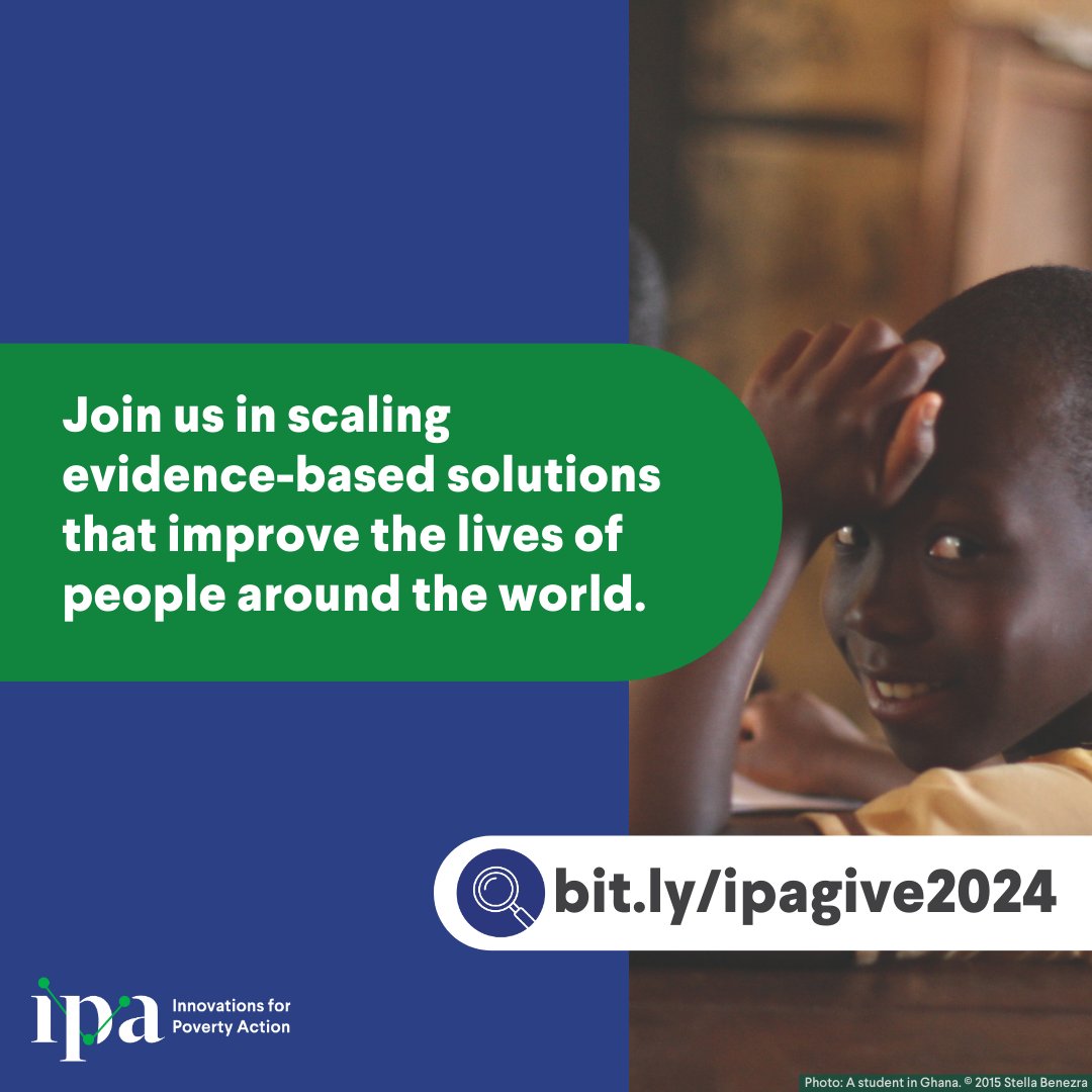
Nine out of 10 children in sub-Saharan Africa can’t read or do basic math by age 10–the traditional way of teaching isn’t working for many students. In Ghana, Differentiated Learning shows promise in boosting learning outcomes. Support IPA in scaling evidence-based solutions → bit.ly/ipagive2024⤵️

1
1
3
574
21 Nov 2024
Differentiated learning holds so much promise for improving learning around the world.
See link below for research on this method
(me, with @ProfALucas @sabrinbeg and follow up work with @stephbonds )
20 Nov 2024

Check out our dedicated Differentiated Learning webpage for all of our research on Differentiated Learning in Ghana: bit.ly/ipadlgh
@sabrinbeg @duflo_annie @AnneFitz13 #JessicaKiesel @ProfALucas
4
9
1,881
Dr Anne Fitzpatrick retweeted

19 Nov 2024
#EconTwitter Calling on all health economists working on infant and children's health! Come party with us at @ashecon annual conference in Nashville in June 2025. Submit your abstract and session proposal here: ashecon.org/2025-nashville/2…
1
11
36
4,840