Tracking storms for a hobby, with a particular interest on NOVA
- Tweets 5,520
- Following 1,483
- Followers 960
- Likes 107,774


ALT A 3 day forecast showing thunderstorm chances today and sunshine Monday and Tuesday.


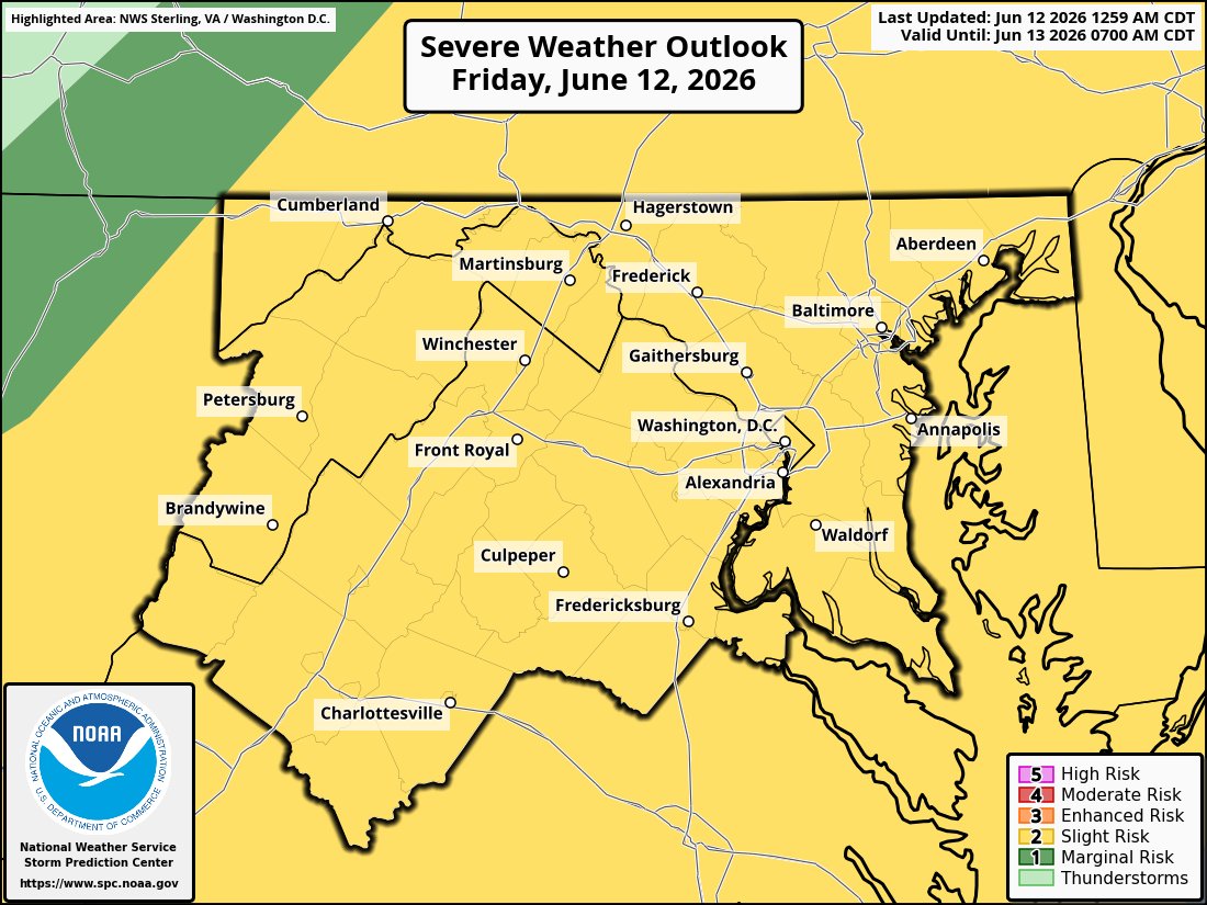
ALT Image of Storm Prediction Center level 2 out of 5 slight risk.

ALT Storm Prediction Center wind probability graphic. 15 to 44% across the region.


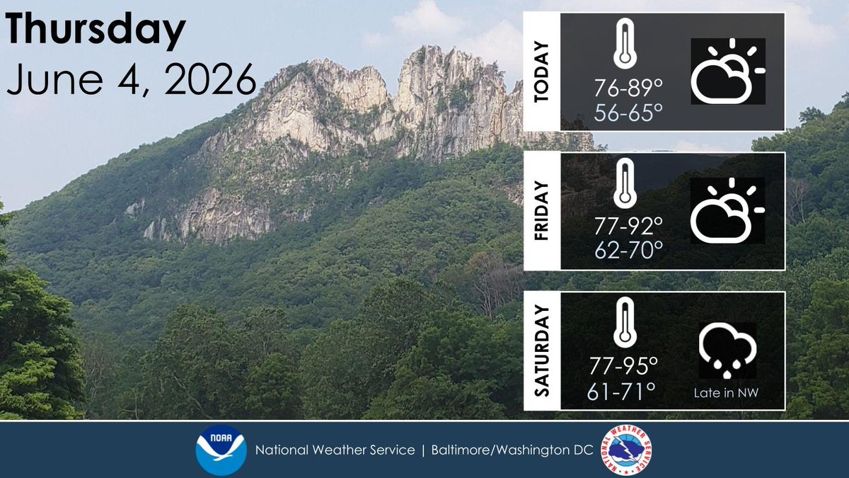
ALT A weather outlook, depicting weather conditions and temperatures over the next 3 days. The background photo is a picture of Seneca Rocks, WV on a mostly sunny day.

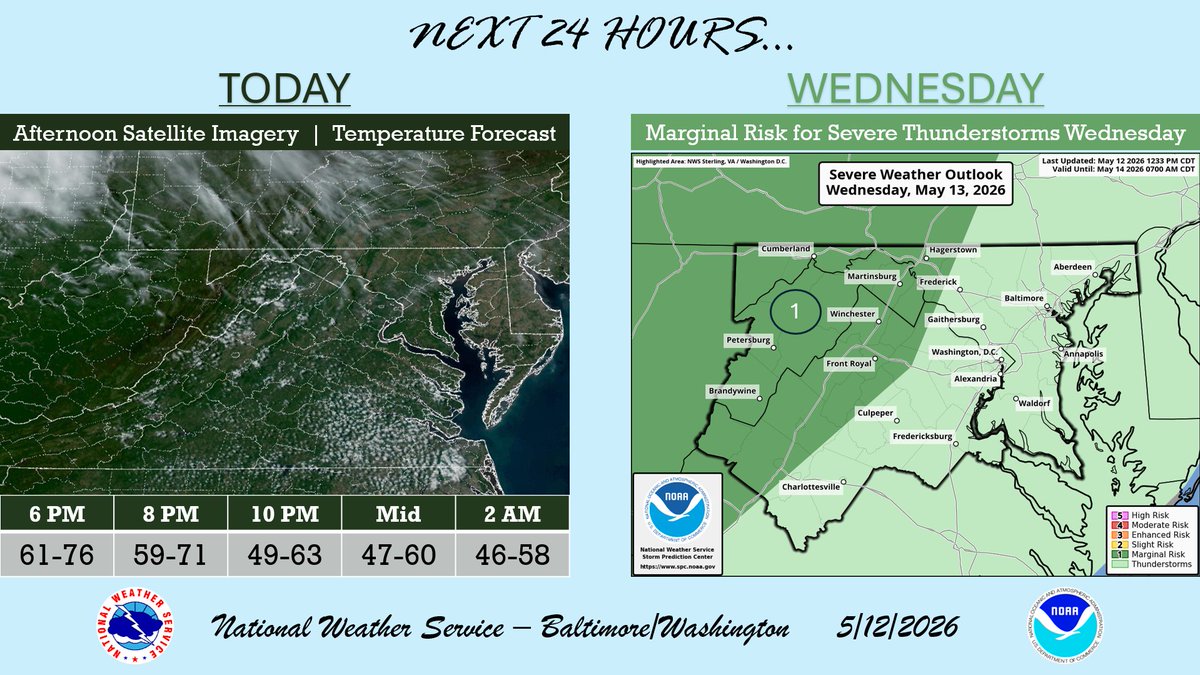
ALT A weather graphic of the Washington DC/Baltimore area showing satellite imagery of clear skies with a few high-level clouds on the left, with a temperature forecast for the evening on the bottom, and a thunderstorm risk outlook on the right for Wednesday, May 13. The thunderstorm outlook shows a Marginal risk for severe thunderstorms over the western portion of the region with a general thunderstorm risk for the rest of the area.