Welcome to the Town of Barnstable's official Twitter page! Follow us to get updates about the town.
- Tweets 5,273
- Following 112
- Followers 4,536
- Likes 316


ALT A map of southern New England showing projected wind gusts. The strongest gusts are across the eastern coast of Massachusetts and southern Rhode Island where gusts may exceed 60 to 65mph. Further inland wind gust are less intense, 45 to 55mph from Hartford to Providence to Boston.
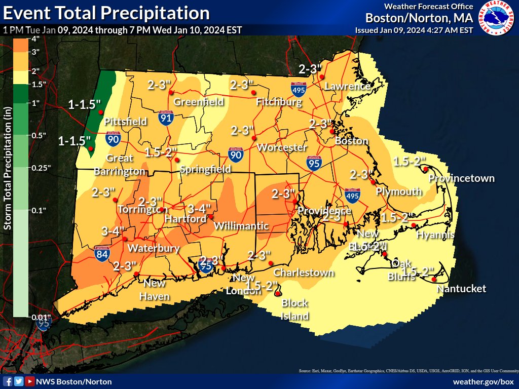
ALT A map of forecast rainfall across southern New England, widespread 2-3 inches of rain with locally higher amounts of 4 inches is possible.
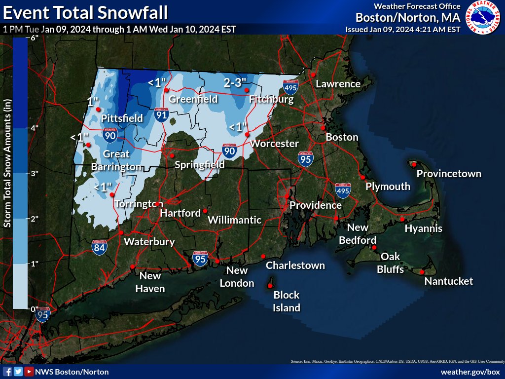
ALT Snowfall forecast across southern New England. Quick burst of snow, ranging from 2-4 inches on the east slopes of the Berkshires to locally 5 inches along the southern Vermont border. Northern hills of Worcester County may see 1-2 inches, mainly north of the city of Worcester, with the best chance of 3 inches along the New Hampshire border.