
AMS Certified Broadcast Meteorologist. Florida State University & Mississippi State University Alum. Pensacola, Florida native.
Joined February 2025
- Tweets 17
- Following 2
- Followers 3
- Likes 1
17 Photos and videos


🌕 The #BloodMoon Total Lunar Eclipse begins at 6:04 AM. For those along the East Coast, the moon will be setting along the western horizon during totality.
2
4
113
Crazy scenes in South Florida the last couple days. TONS of cold-stunned iguanas immobilized after this historic cold snap. Because green iguanas invasive and harmful to the environment, groups are out humanely euthanizing them after the state relaxed rules.
📹: Isabella Martin
48
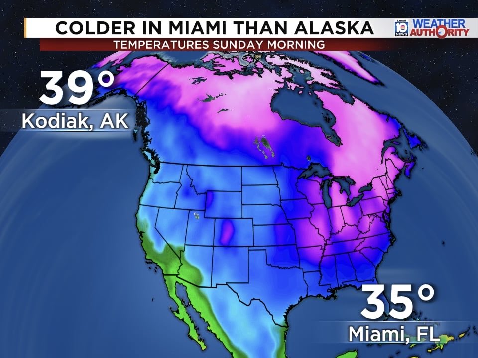
Colder in Miami than parts of Alaska! 🥶
Sunday morning temperatures dropped to 35° in Miami—colder than Kodiak, Alaska at 39°. A rare setup as Arctic air pushes deep into South Florida.
27

23 Sep 2025
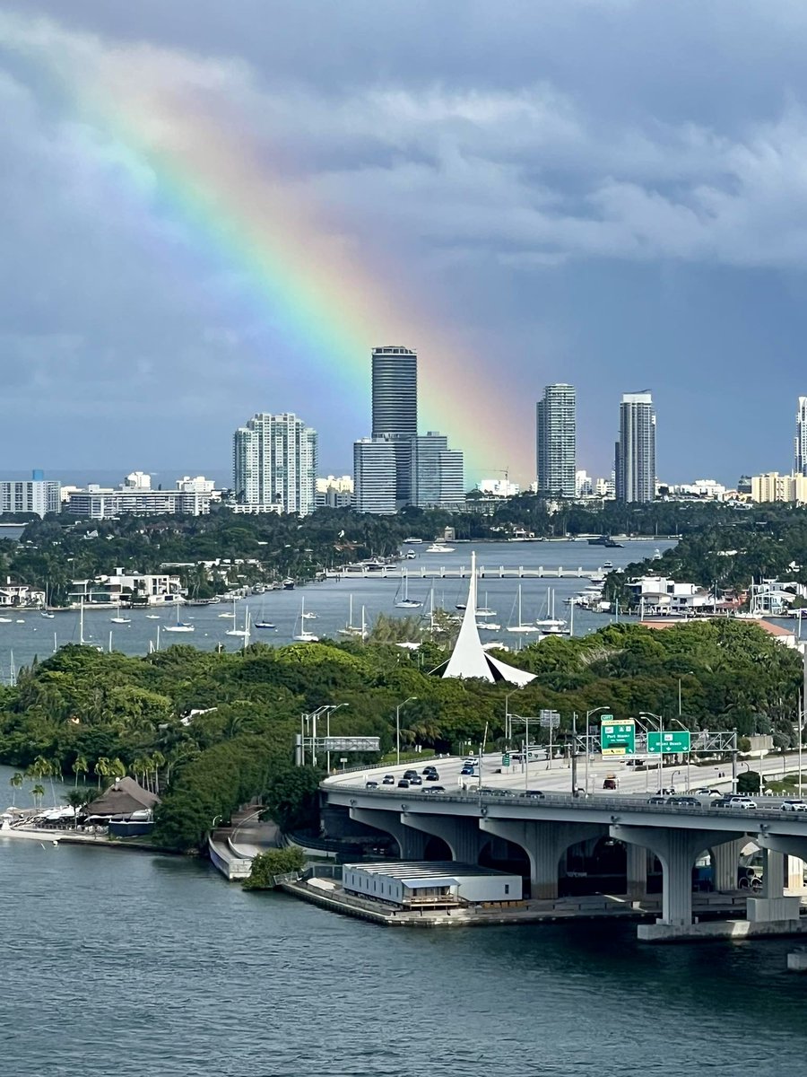
A pop of color over Miami Beach! Thanks to Anthony Emanate for capturing this stunning rainbow.
20
16 Aug 2025
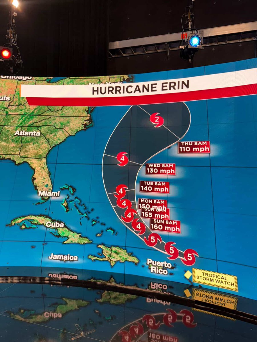
🌀 #Hurricane Erin has rapidly intensified into an extremely powerful Category 5 with 160 mph winds and 190 mph gusts. The forecast track keeps #Erin clear of land, with a northerly turn expected between the Bahamas and Bermuda early next week.
10
28 Jul 2025
On Sunday, Tampa, Florida hit 100°F for the first time since records began in 1890. The heat index or "feels like" temperature peaked at 113°F!
9
24 Jun 2025
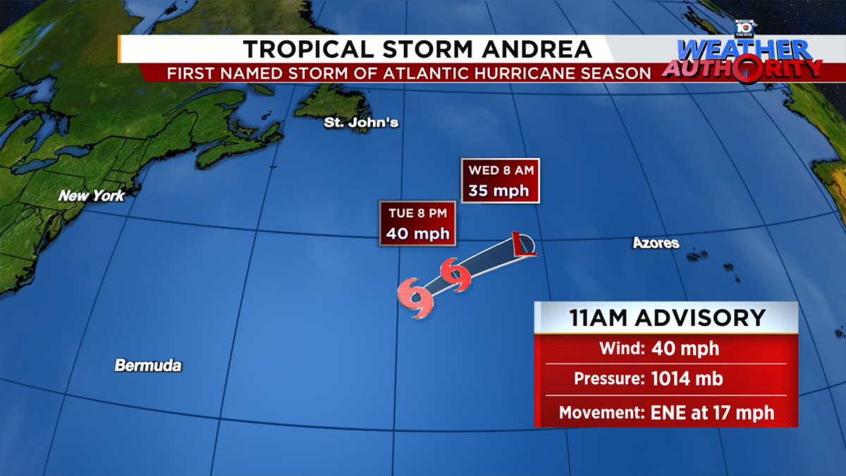
🌀Tropical Storm Andrea has formed, becoming the first named storm of the 2025 Atlantic Hurricane Season.
The storm poses no threat and will weaken as it remains over open water for the next 24 hours or so.
10
16 Jun 2025
Waterspout near Fort Lauderdale today. Video courtesy of Dr. Russ Posner.
13
3 Jun 2025
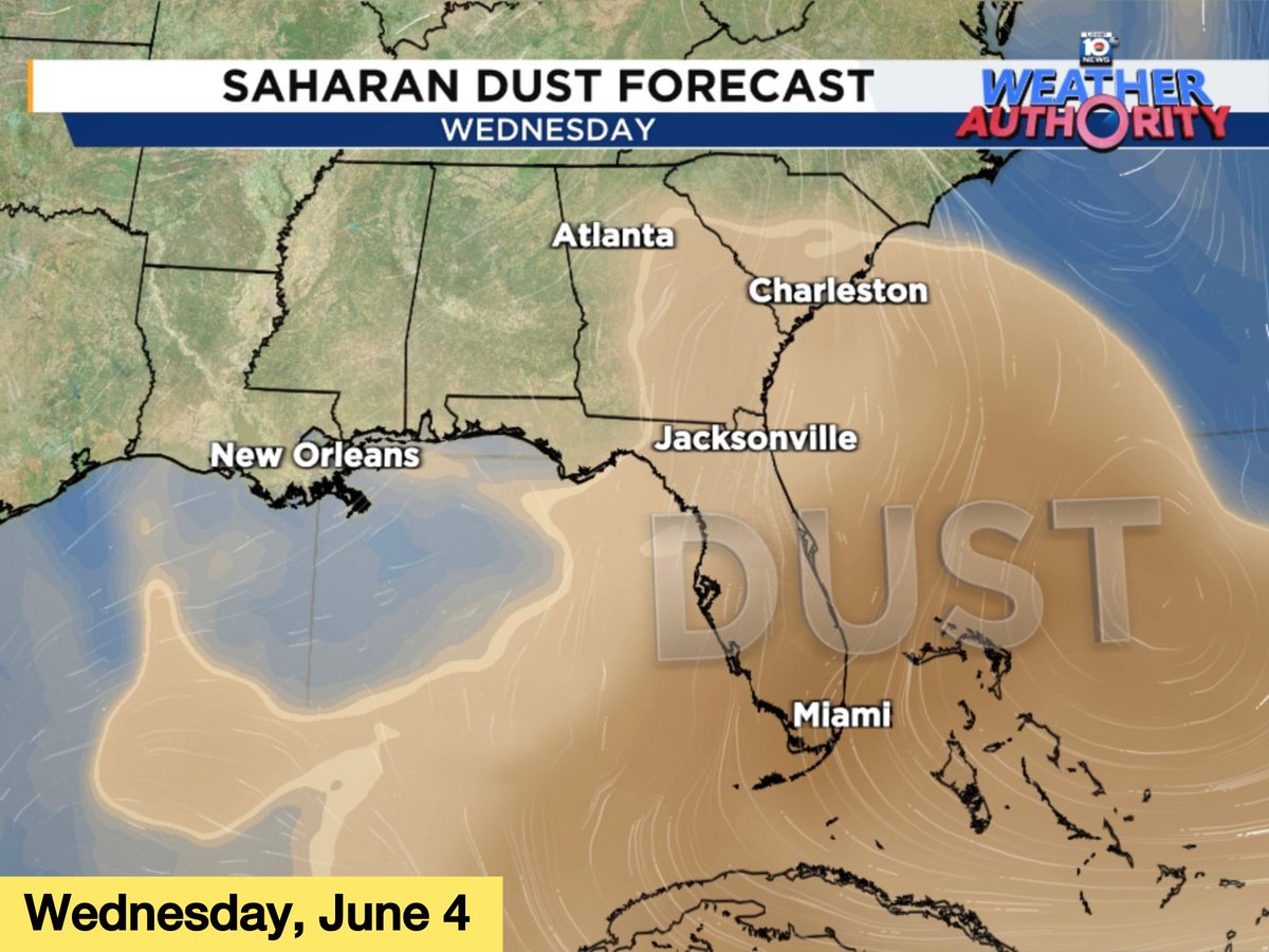
A thick plume of Saharan dust is forecast to move over Florida, Georgia, and the Carolinas on Wednesday and Thursday. Expect milky skies & vibrant red/orange sunrises and sunsets for a couple days.
10
29 May 2025
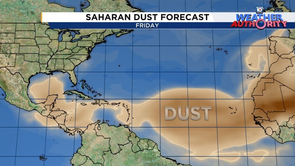
Saharan dust is moving across the Atlantic, Caribbean, and Gulf. This will help keep activity in the tropics quiet for the next week or so. 💨
7
7 May 2025
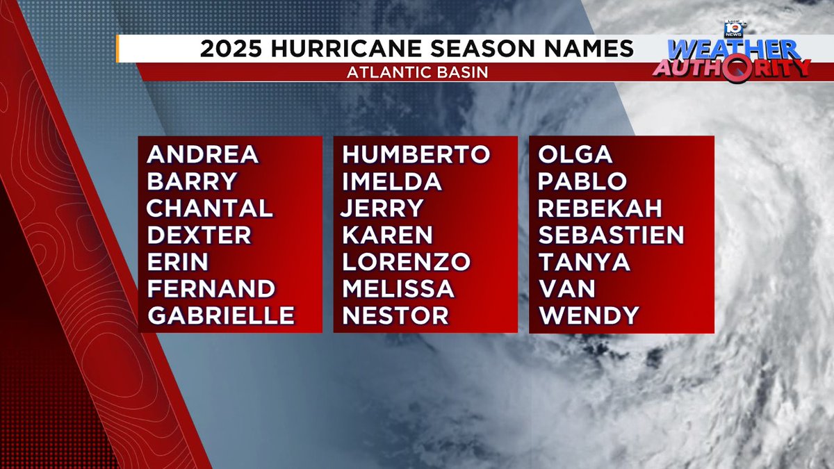
Do these hurricane names seem familiar to you? It's because we recycle the list every six years, unless a name is retired. These names were used back in 2019, with the exception of Dorian, which was retired and replaced with Dexter.
10
5 May 2025
Severe Thunderstorm Watch for South Florida until 9 PM. Main threats are large hail of 1 to 2 inches in diameter and damaging wind gusts in excess of 70 mph. An isolated tornado or two cannot be ruled out.
1
2
144
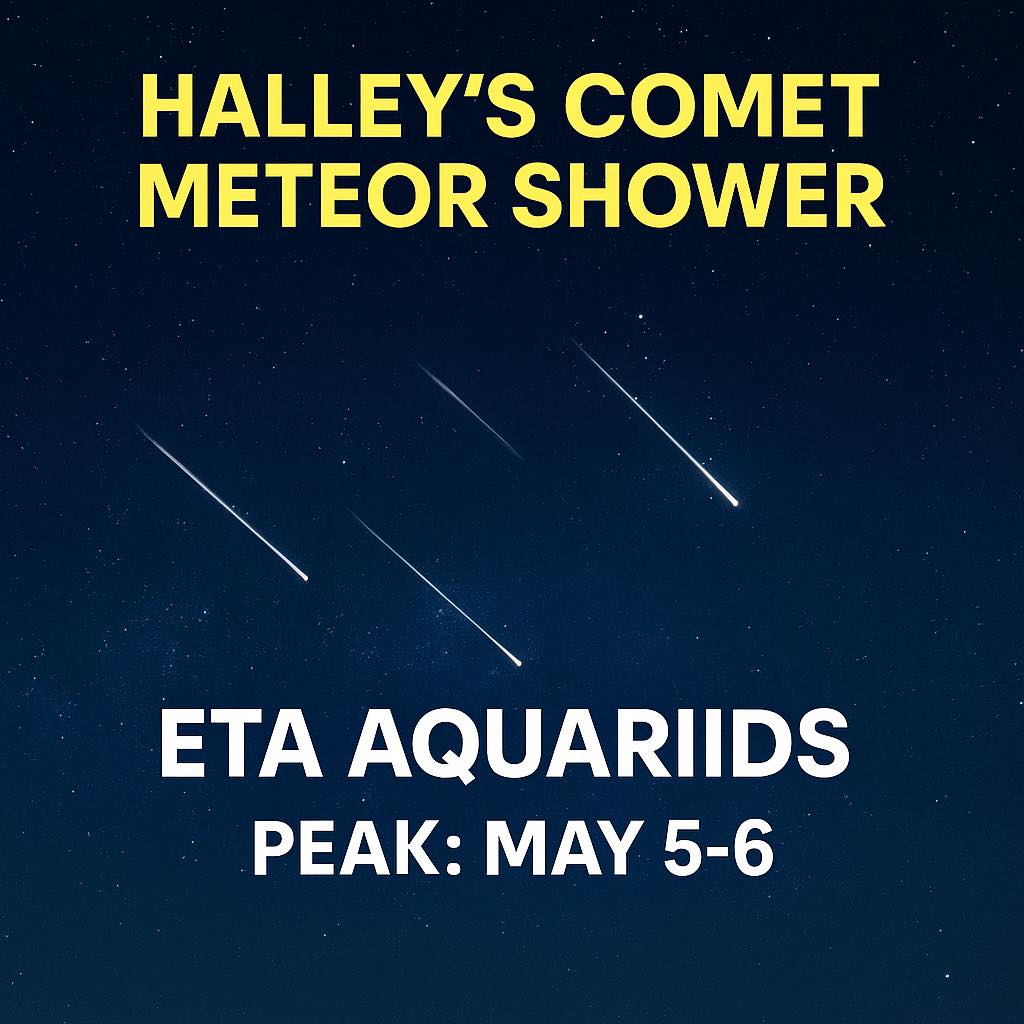
5 May 2025
The Eta Aquariids peak May 5‑6, with dust from Halley’s Comet lighting up the sky. For best viewing, head outside after 2 a.m. and let your eyes adjust!
29
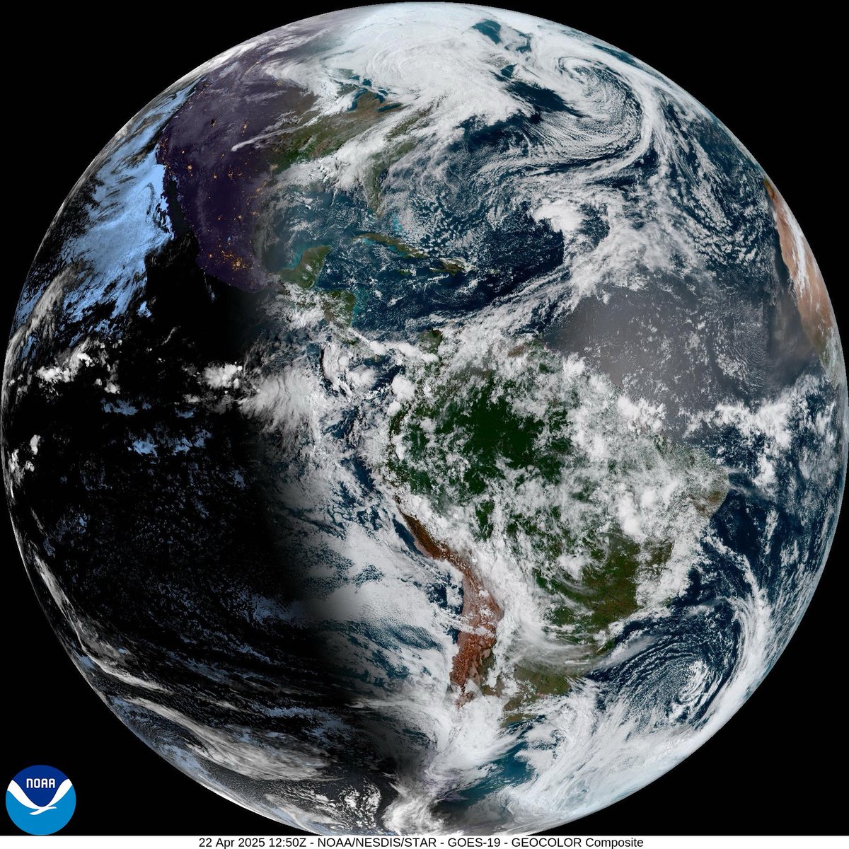
22 Apr 2025
A peek at our planet on this Earth Day. 🌎 Anyone else notice the dust moving off Africa across the Atlantic? 👀
12
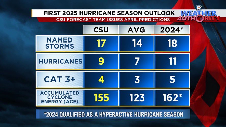
3 Apr 2025
🌀 Colorado State University has released their first outlook for the 2025 Atlantic hurricane season.
➡️ CSU is calling for 17 named storms. They expect 9 of those storms to become hurricanes, of which 4 are predicted to strengthen into major hurricanes (Category 3 or higher).
29