
The CBS19 Weather Authority Team gives you accurate forecasts and weather information for central Virginia. This account is a secondary source of information.
Joined February 2009
- Tweets 47,890
- Following 159
- Followers 5,207
- Likes 387
20,383 Photos and videos


RLX issues Severe Thunderstorm Warning [wind: 60 MPH (RADAR INDICATED), hail: <.75 IN (RADAR INDICATED)] for Buchanan [VA] and McDowell, Raleigh, Wyoming [WV] till 9:30 AM EDT mesonet.agron.iastate.edu/vt…
10
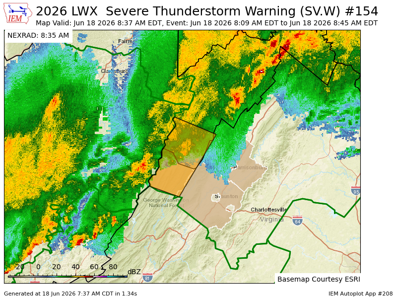
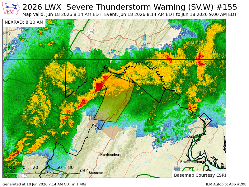
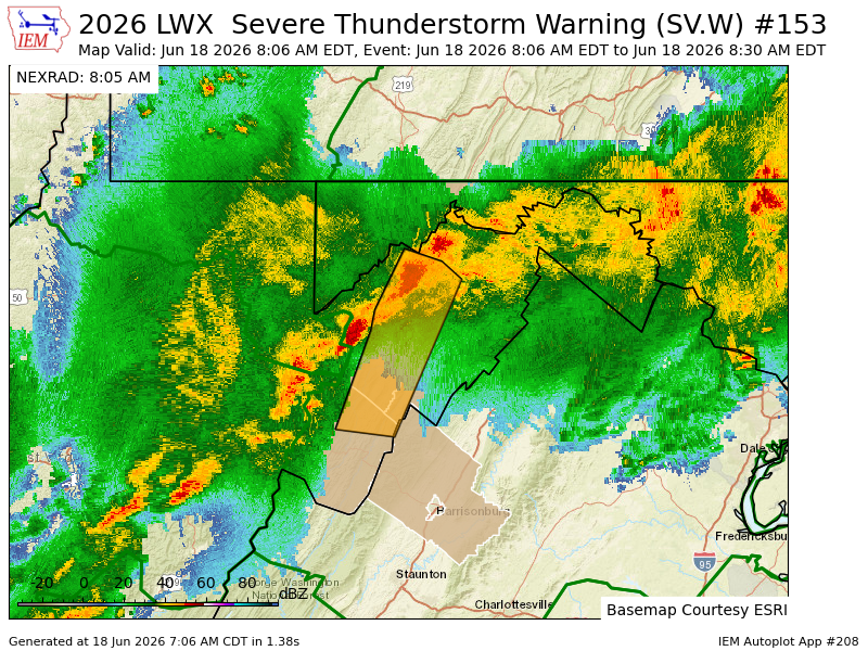
LWX expires Severe Thunderstorm Warning for Augusta, Highland, Rockingham [VA] and Pendleton [WV] mesonet.agron.iastate.edu/vt…
23
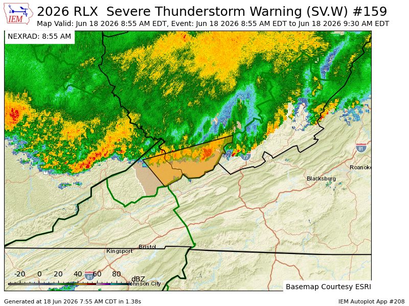
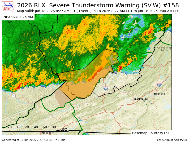
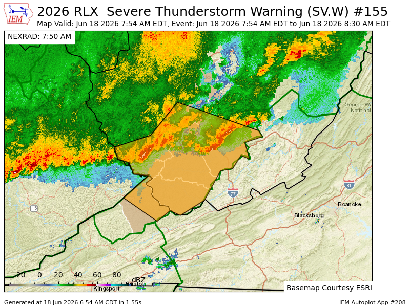
RLX issues Severe Thunderstorm Warning [tornado: POSSIBLE, wind: 60 MPH (RADAR INDICATED), hail: <.75 IN (RADAR INDICATED)] for Buchanan [VA] and Fayette, Logan, McDowell, Mingo, Raleigh, Wyoming [WV] till 9:00 AM EDT mesonet.agron.iastate.edu/vt…
55
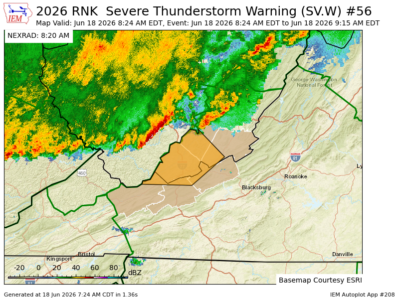
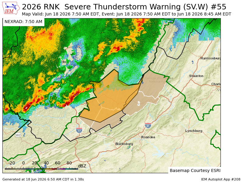
RNK issues Severe Thunderstorm Warning [wind: 60 MPH (RADAR INDICATED), hail: <.75 IN (RADAR INDICATED)] for Bland, Giles, Tazewell [VA] and Mercer, Monroe, Summers [WV] till 9:15 AM EDT mesonet.agron.iastate.edu/vt…
13
LWX issues Severe Thunderstorm Warning [wind: 60 MPH (RADAR INDICATED), hail: <.75 IN (RADAR INDICATED)] for Frederick, Shenandoah [VA] and Hampshire, Hardy, Mineral [WV] till 9:00 AM EDT mesonet.agron.iastate.edu/vt…
15
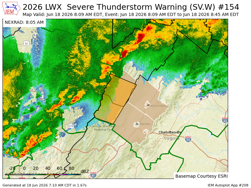
LWX issues Severe Thunderstorm Warning [wind: 60 MPH (RADAR INDICATED), hail: <.75 IN (RADAR INDICATED)] for Augusta, Highland, Rockingham [VA] and Pendleton [WV] till 8:45 AM EDT mesonet.agron.iastate.edu/vt…
9
LWX issues Severe Thunderstorm Warning [wind: 60 MPH (RADAR INDICATED), hail: <.75 IN (RADAR INDICATED)] for Allegany [MD] and Rockingham [VA] and Grant, Hampshire, Hardy, Mineral, Pendleton [WV] till 8:30 AM EDT mesonet.agron.iastate.edu/vt…
12
RLX issues Severe Thunderstorm Warning [tornado: POSSIBLE, wind: 60 MPH (RADAR INDICATED), hail: <.75 IN (RADAR INDICATED)] for Buchanan [VA] and Boone, Fayette, Kanawha, Logan, McDowell, Mingo, Raleigh, Wyoming [WV] till 8:30 AM EDT mesonet.agron.iastate.edu/vt…
60
RNK issues Severe Thunderstorm Warning [wind: 60 MPH (RADAR INDICATED), hail: <.75 IN (RADAR INDICATED)] for Alleghany, Bath [VA] and Greenbrier, Monroe, Summers [WV] till 8:45 AM EDT mesonet.agron.iastate.edu/vt…
14
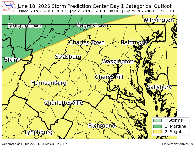
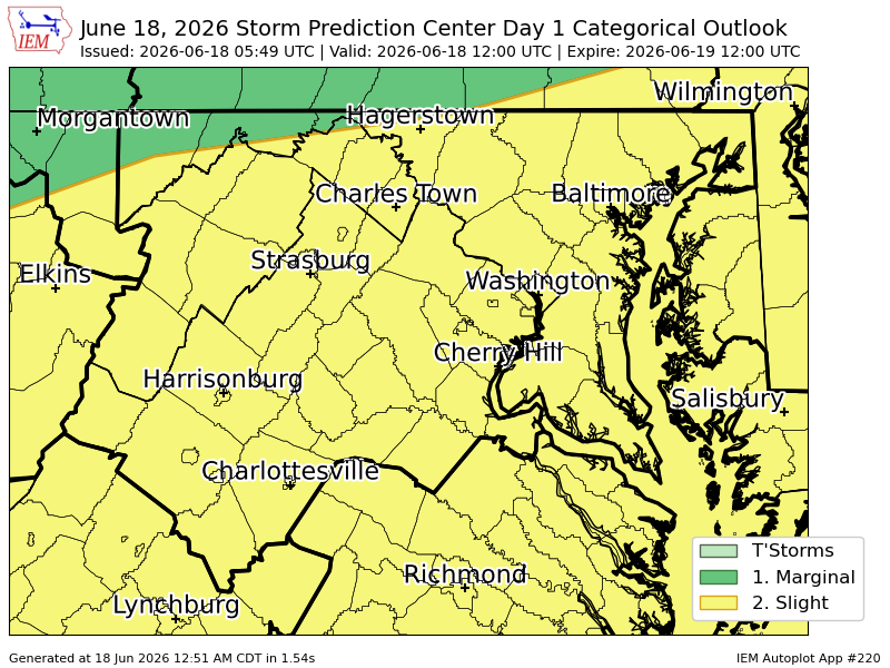
LWX issues Severe Thunderstorm Watch for Albemarle, Augusta, City of Charlottesville, City of Harrisonburg, City of Staunton, City of Waynesboro, Greene, Highland, Nelson, Rockingham [VA] and Pendleton [WV] till Jun 18, 12:00 PM EDT mesonet.agron.iastate.edu/vt…
24
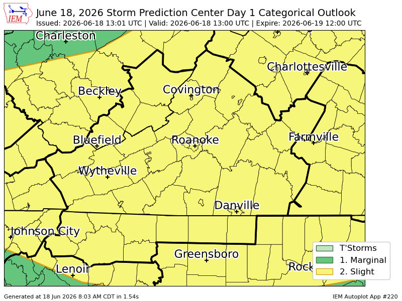
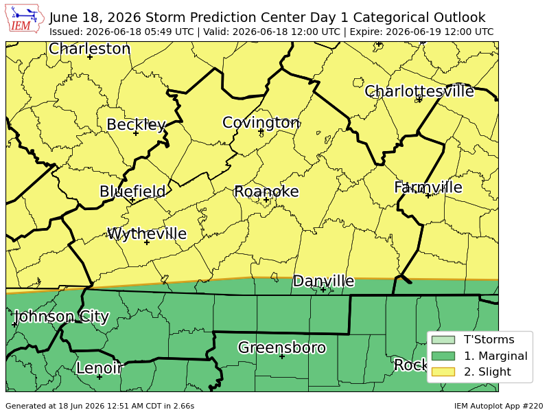
RNK issues Severe Thunderstorm Watch for 37 counties in [VA] and Greenbrier, Mercer, Monroe, Summers [WV] till Jun 18, 12:00 PM EDT mesonet.agron.iastate.edu/vt…
20
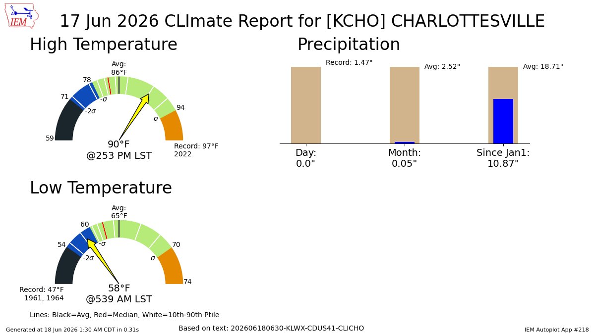
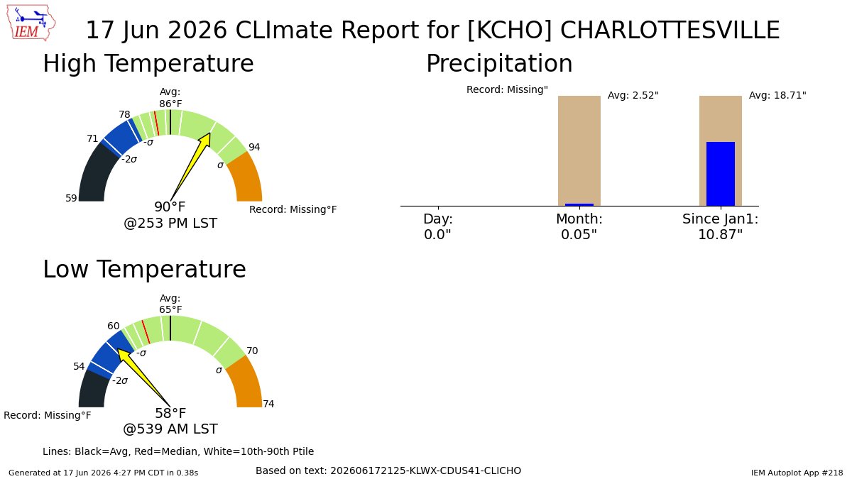
CHARLOTTESVILLE VA Jun 17 Climate: High: 90 Low: 58 Precip: 0.0" Snow: Missing mesonet.agron.iastate.edu/p.…
20
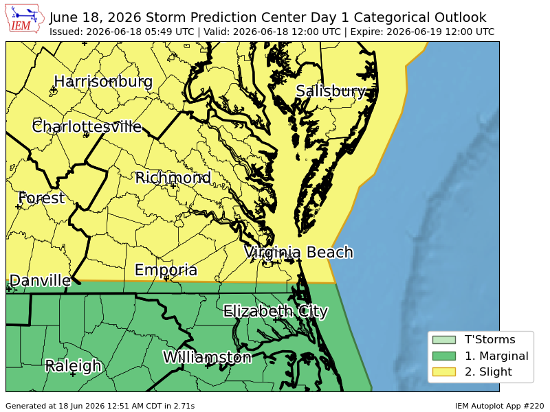
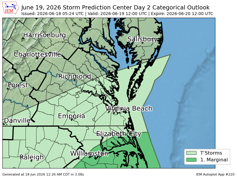
#SPC issues Day 2 Marginal Convective Risk at Jun 18, 5:24z for AKQ spc.noaa.gov/products/outloo…
22
CHARLOTTESVILLE VA Jun 17 Climate: High: 90 Low: 58 Precip: 0.0" Snow: Missing mesonet.agron.iastate.edu/p.…
44