
Founded in 2003, CHC Navigation (CHCNAV) is a publicly-listed company creating Innovative GNSS Navigation and Positioning Solutions.
Joined October 2015
- Tweets 547
- Following 85
- Followers 835
- Likes 77
504 Photos and videos


3 days to go until CSPI-EXPO 2026.
Meet CHCNAV at Booth 12-61, Makuhari Messe, Chiba, Japan, from June 17–20, and explore solutions for construction, surveying, mapping, machine control, reality capture, and marine applications.
#CHCNAV #CSPIEXPO #Geospatial #Surveying
27

Jun 10
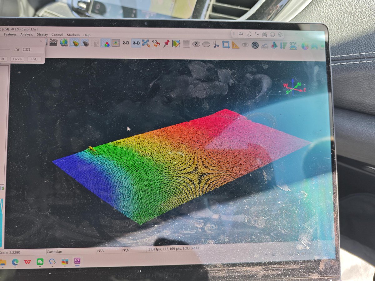
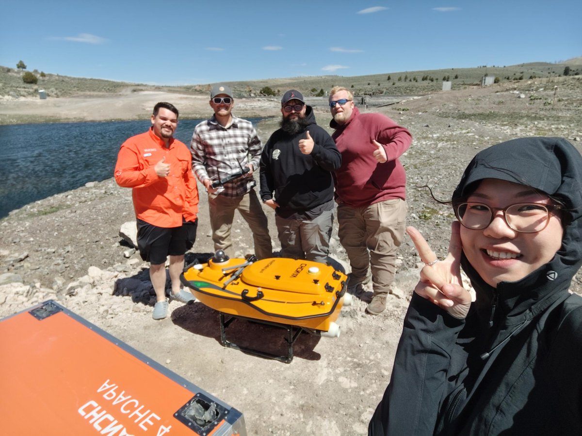
At Panguitch Lake, USA, CHCNAV demonstrated the APACHE 4 Pro USV with HQ-400 MBES in challenging conditions: around 10,000 ft altitude, ~0.5 m waves, strong wind, and no network or RTK corrections.
Learn more: geospatial.chcnav.com/produc…
#CHCNAV #USV #Bathymetry #MarineSurvey

41
Jun 10
Survey farther with the upgraded CHCNAV i85 Laser GNSS Receiver.
Enhanced long-range laser module, remote point measurement up to 150 m, 2 cm accuracy within 5 m, and improved performance on low-reflectivity targets.
#CHCNAV #i85 #LaserGNSS #GNSS #Surveying
50
Jun 10
Built for large-area airborne mapping, AA15 Pro supports long-range LiDAR data capture, high-density point clouds, and professional applications such as terrain mapping, corridor surveys, and city-scale 3D modeling.
Learn more: geospatial.chcnav.com/produc…
1
23
500 m² captured in just 10 minutes.
Using the CHCNAV RS7, a multi-level coffee shop was captured in a single indoor scanning workflow, supporting immersive 3D visualization through CoCloud and HPGS 2.0.
#CHCNAV #RS7 #RealityCapture #3DScanning #GaussianSplatting
1
58
Get familiar with the CHCNAV AA6 LiDAR System.
With a 2,100 m range, improved point density and data completeness, and a lightweight 1.35 kg design, AA6 is built for efficient aerial surveying and mapping workflows.
#CHCNAV #AA6 #LiDAR #UAVMapping
45
No GNSS fix? Your survey does not have to stop.
With SFix 2.0, the CHCNAV ViLi i100 supports surveying in GNSS-denied environments, delivering 5 cm accuracy at up to 20 m for challenging sites such as pipeline works.
#CHCNAV #ViLii100 #GNSS #Surveying
94
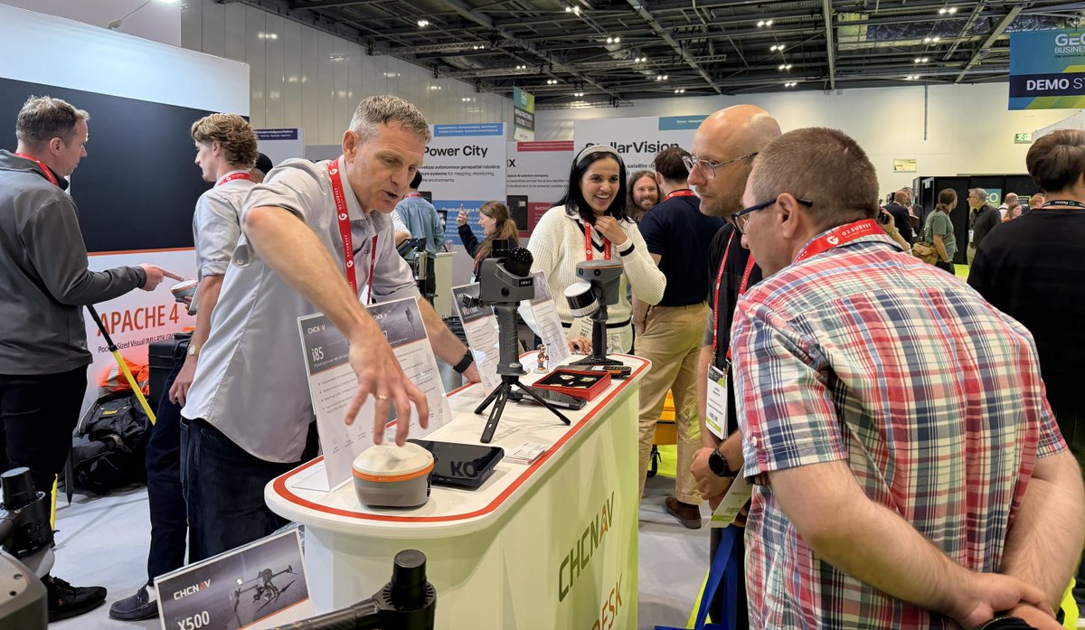
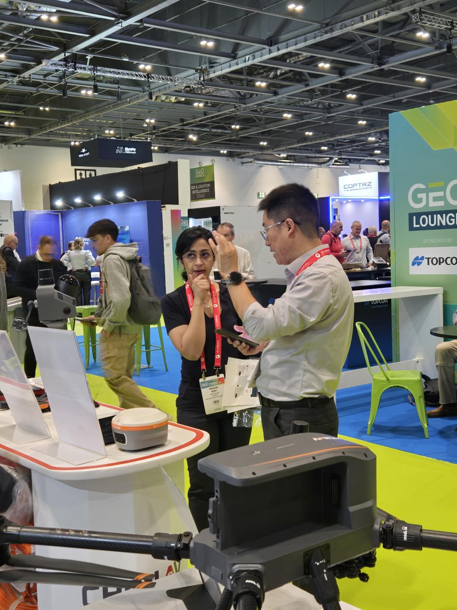
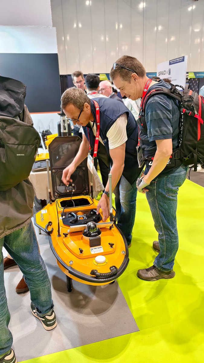
A busy and inspiring first day at GEO Business 2026.
We look forward to more conversations on geospatial innovation, positioning technology, and real-world applications.
See you in London at Booth G360.
#CHCNAV #GEOBusiness #Geospatial #GNSS #Mapping
3
96
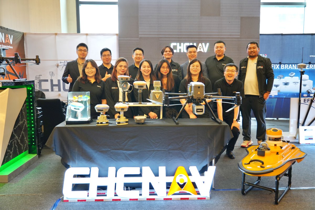
📍 Shanghai Calling: CHCNAV Partners are gathering!
Over the coming days, we will exchange market insights, product updates, and explore the future of Geospatial technologies.
#CHCNAV #Geospatial
2
216
24 Dec 2025
Happy New Year 2026 from CHCNAV.
Thank you for your continued trust and partnership. As we begin a new year, we remain committed to providing efficient geospatial solutions for your projects worldwide.
Wishing you a productive and successful year ahead.
201
15 Dec 2025
🎉 LandStar Turns 10!
Today, 500,000 surveyors and GIS professionals worldwide trust LandStar every day. 🌍
Thank you for being part of the journey.
Learn more: bit.ly/3R5a3DW
#CHCNAV #LandStar #Surveying #GNSS #LandStar10thAnniversary
205
2 Jul 2025
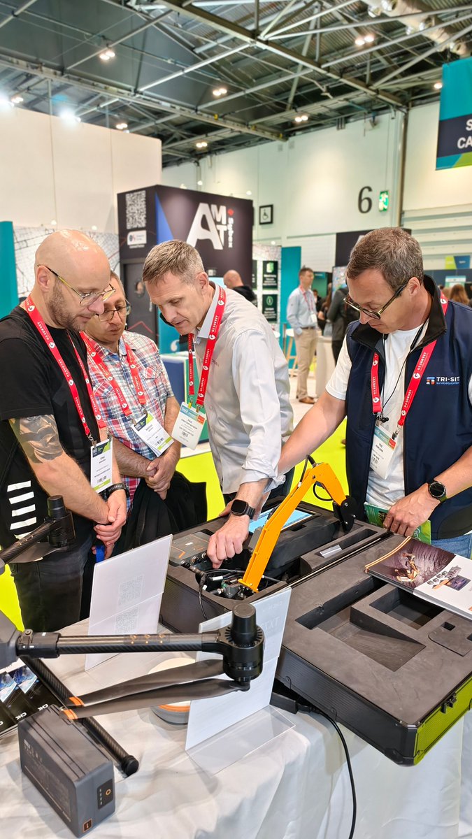
⏰One week left to our UK Open Day!
🚀 CHC Navigation is excited to invite you to a full-day geospatial tech showcase, in partnership with Tri-Site, in Burnley, UK🇬🇧!
Register here: bit.ly/4lmpVz6
373
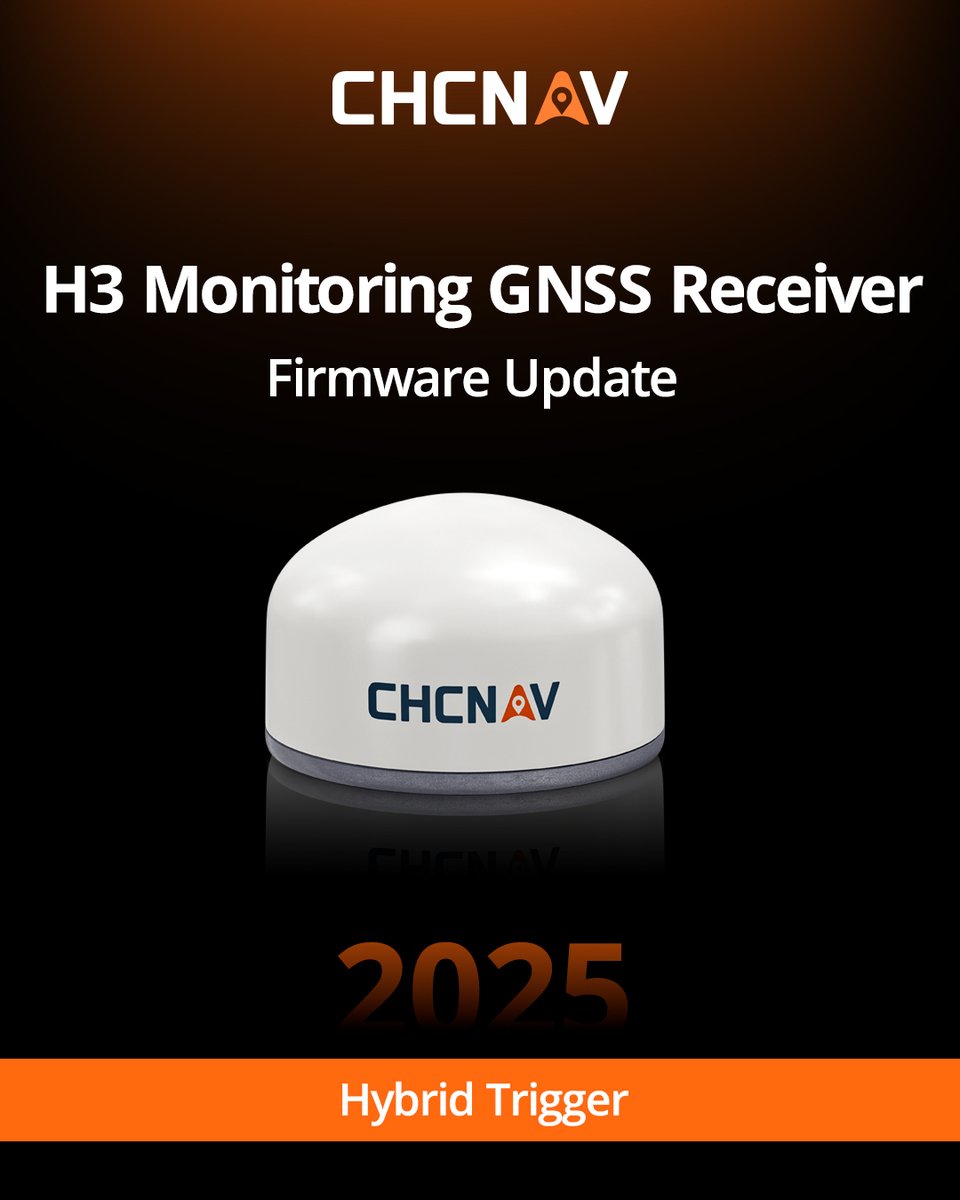
27 Jun 2025
In the latest firmware update for H3 monitoring GNSS receivers, we have introduced a brand new Hybrid Trigger feature.
Learn more: geospatial.chcnav.com/produc…
#mining #monitoring #chcnav
324
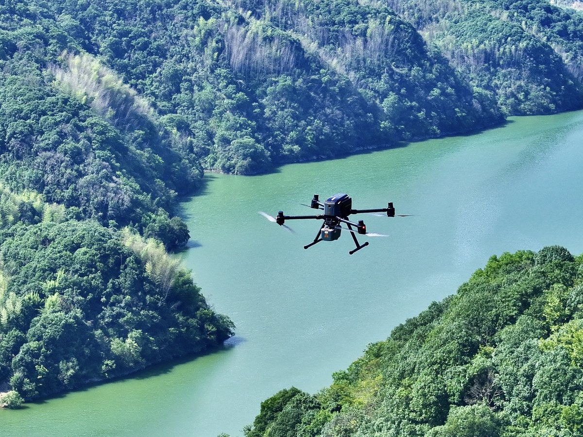
25 Jun 2025
The X500 UAV is engineered for data acquisition in complex environments. Equipped with payloads such as the AA10 LiDAR RGB system, the X500 delivers high-precision mapping results even over challenging topographies like mountainous regions.
Learn more: bit.ly/4krwW1Y
260
23 Jun 2025
🚀 CHC Navigation is excited to invite you to a full-day geospatial tech showcase, in partnership with Tri-Site, in Burnley, UK🇬🇧!
1
233
13 Jun 2025
At the GEP Golden Jubilee, CHCNAV had the opportunity to connect with Geospatial experts from across the Philippines. 🌏
#CHCNAV #Geospatial #Surveying #Philippines #GEPGoldenJubilee #Technology #Partnership


1
242
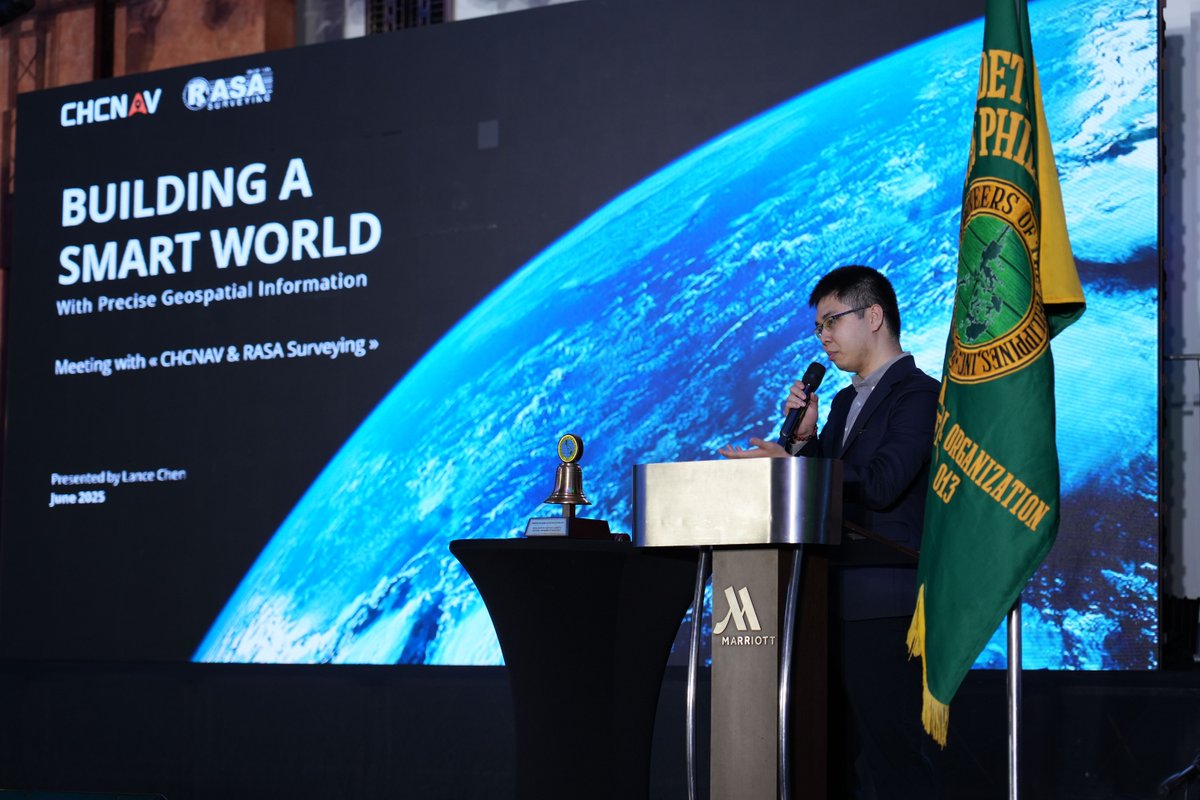
13 Jun 2025
Special thanks to our partner, RASA, and sincere appreciation to G-Surv for their support. 🤝Together, we showcased advanced Geospatial solutions that address the evolving needs of the industry.
180
12 Jun 2025
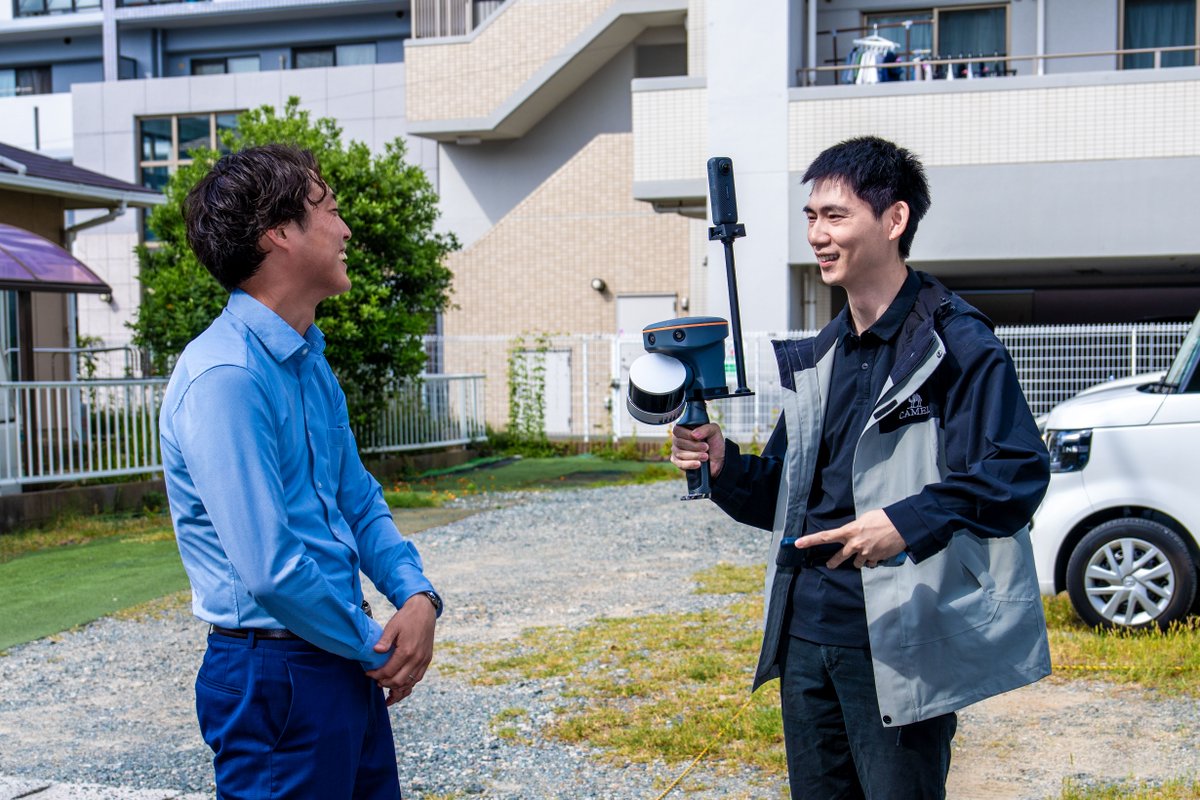
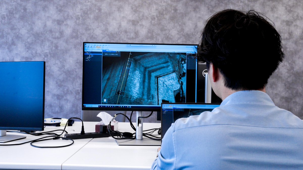
Ahead of CSPI, our Japan team visited our partner WAKITA CSS.
During the visit, WAKITA CSS engineers shared their experience with CHCNAV solutions, demonstrating how the RS10 SLAM scanner helps them complete their work efficiently.

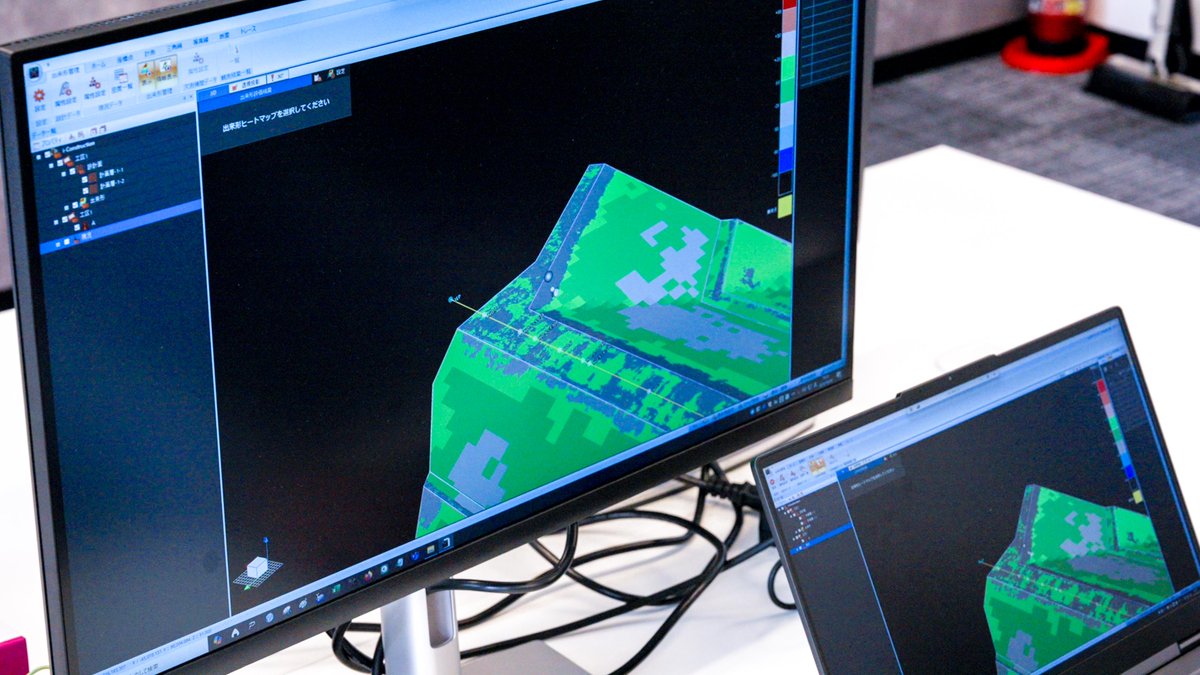
1
262
12 Jun 2025
Visit us at booth 12-41 during CSPI-EXPO to explore CHCNAV's latest geospatial and machine control solutions and discover how our technologies can enhance the accuracy and efficiency of your projects.
#CHCNAV #WAKITACSS #RS10 #SLAM #Geospatial #MachineControl #Surveying #Japan
332