A mobile app that explores the history of Cleveland, Ohio through location-based essays, oral history, archival images, and documentary films.
- Tweets 1,020
- Following 79
- Followers 4,246
- Likes 258
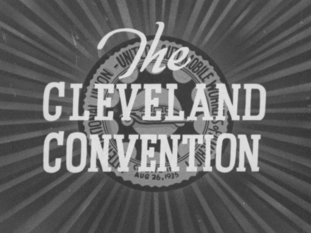


ALT Grainy black and white title screen of 1939 newsreel. Over the seal of the United Automobile Workers, the text reads "The Cleveland Convention"
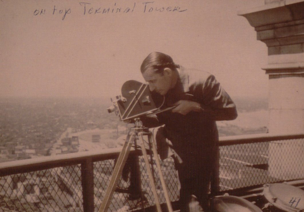
ALT Ray Culley shooting a film scene from atop the Terminal Tower in 1941 | Image courtesy of Hagley Museum and Library, Cinecraft Productions Collection
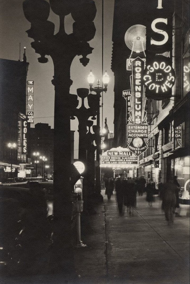
ALT Nighttime view of "New Mall" marquee with decorative street lights and other electric signs along the Euclid Avenue sidewalk | Creator: Arthur Gray | Source: Cleveland Public Library Photograph Collection | Date: 1937
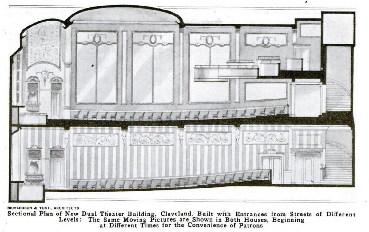
ALT Cross-section view of Mall Theaters double-deck cinemas | Creator: Richardson & Yost, Architects | Source: Popular Mechanics | Date: May 1917
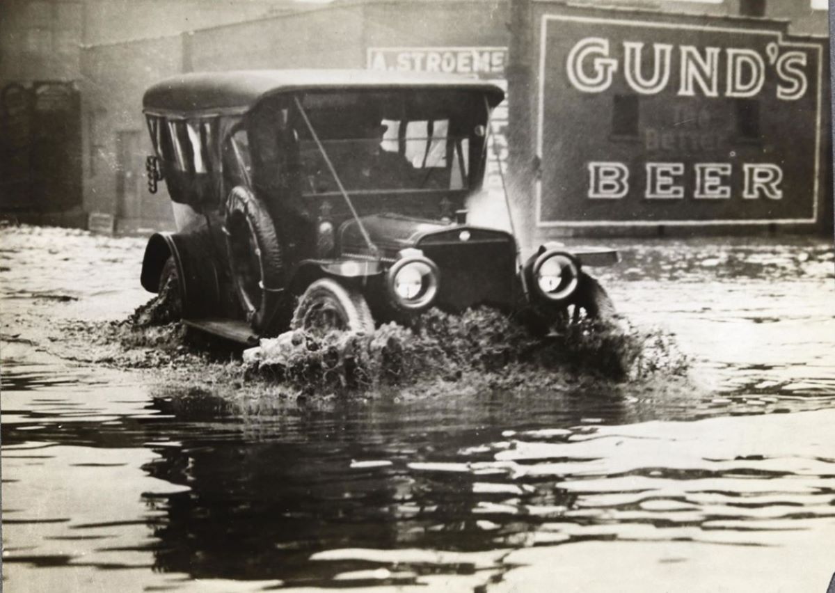
ALT A car driving through floodwaters on W. 3rd St. in downtown Cleveland. A "Gund's Beer" sign is visible on the side of a building. (Source: Cleveland Public Library Photograph Collection)
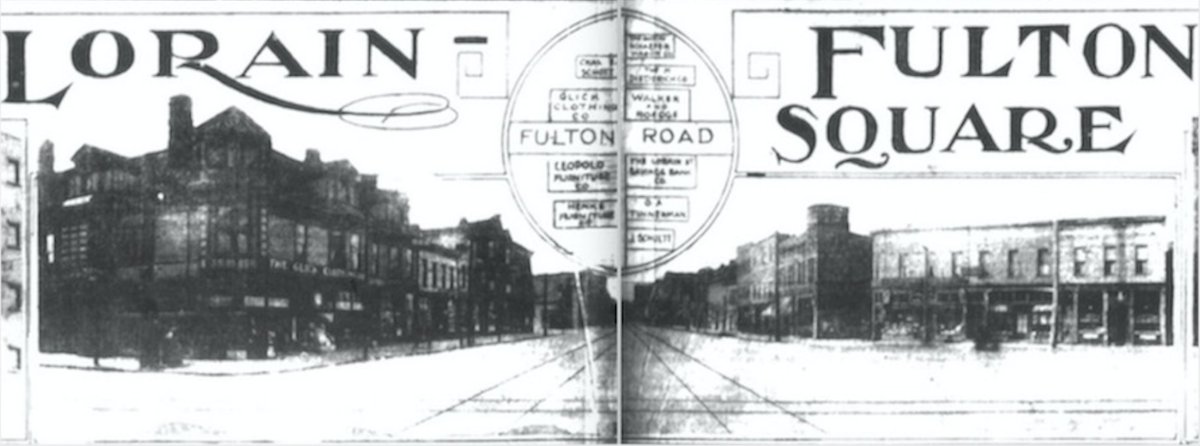
ALT Ad titled "Lorain-Fulton Square" and showing a view facing west on Lorain Avenue from Fulton Road with commercial buildings on either side. Source: Cleveland News, December 21, 1914
ALT Kathy Blackman (right) co-founded the Grog Shop in 1992. | Source: Grog Shop
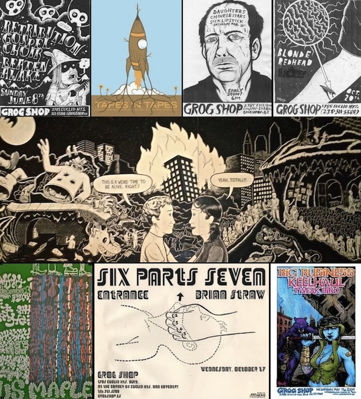
ALT The center row in this image is a scene from a wall mural by Jake Kelly, located on the south wall of the Grog Shop. Flier artists represented in the top and bottom rows include Tyler Fortney, John Greiner, Jon Hicks, Seri Pop and Jake Kelly. | Source: Grog Shop
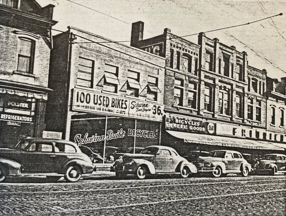
ALT Early 1940s photo showing old cars parked on Lorain Avenue in front of the storefronts housing Fridrich Bicycle. Signs read "100 Used Bikes," "Schwinn Built Bicycles $36," and "Bicycles | Wheel Goods | FRIDRICH." Photo courtesy of Nancy Todd Paris, descendant of Joseph Fridrich
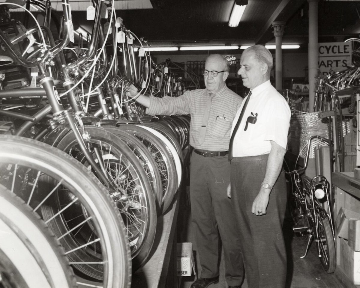
ALT Joseph J. Fridrich (right) talks with longtime employee Fred Kidd as they look at new bicycles inside the store in 1968. Photo: Cleveland Public Library, Photograph Collection
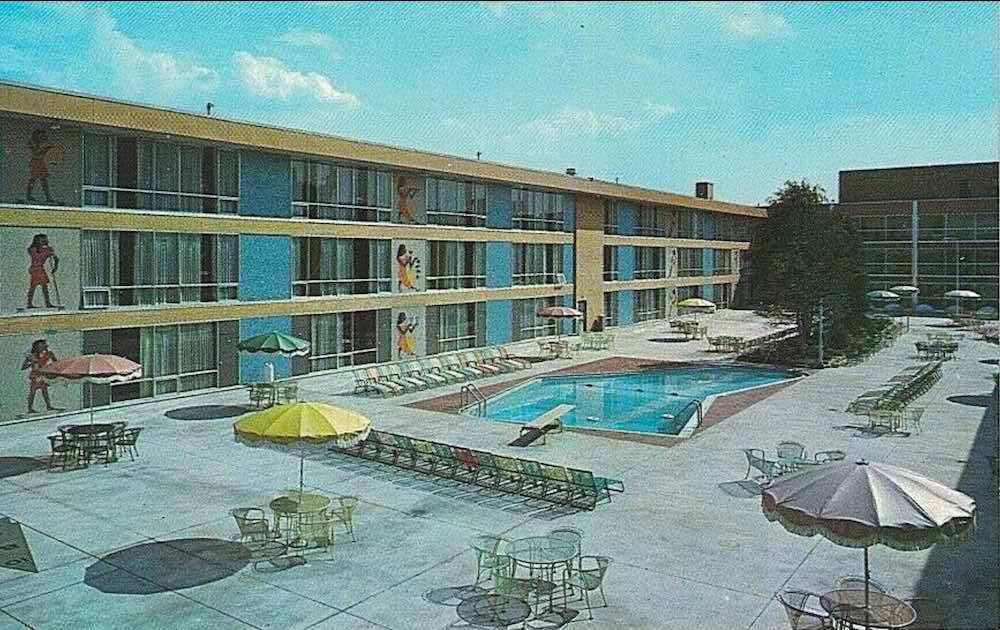
ALT Courtyard view of Sahara Motor Hotel. An arrow-shaped swimming pool with low diving pool is in the center of a concrete courtyard and surrounded by rows of lounge chairs. Widely spaced multicolored umbrellas over tables and chairs line the perimeter of the courtyard. Egyptian figures are painted on the walls of the motel at regular intervals on all three floors. There is a single tree beyond the pool.

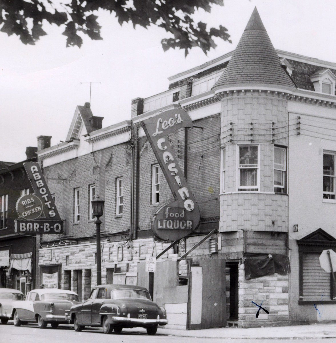
ALT A corner commercial building faced with brick on the second story and formstone on the first story with a pointed turret on the near corner. Large signs are mounted on the second level: At center is a musical eighth-note shaped neon sign that reads “Leo’s CASINO food LIQUOR.” To the left is a checkmark shaped sign that reads “ABBOTT’S BAR-B-Q” with a circular seal-like medallion sign reading “Ribs—Chicken.” Three 1950s cars are parked in front and the leaves of a tree above the photographer appear at the top just inside the field of view.

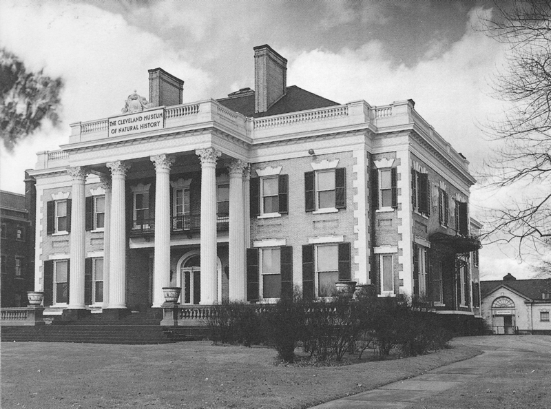
ALT Previous home of the Cleveland Museum of Natural History on Euclid Avenue
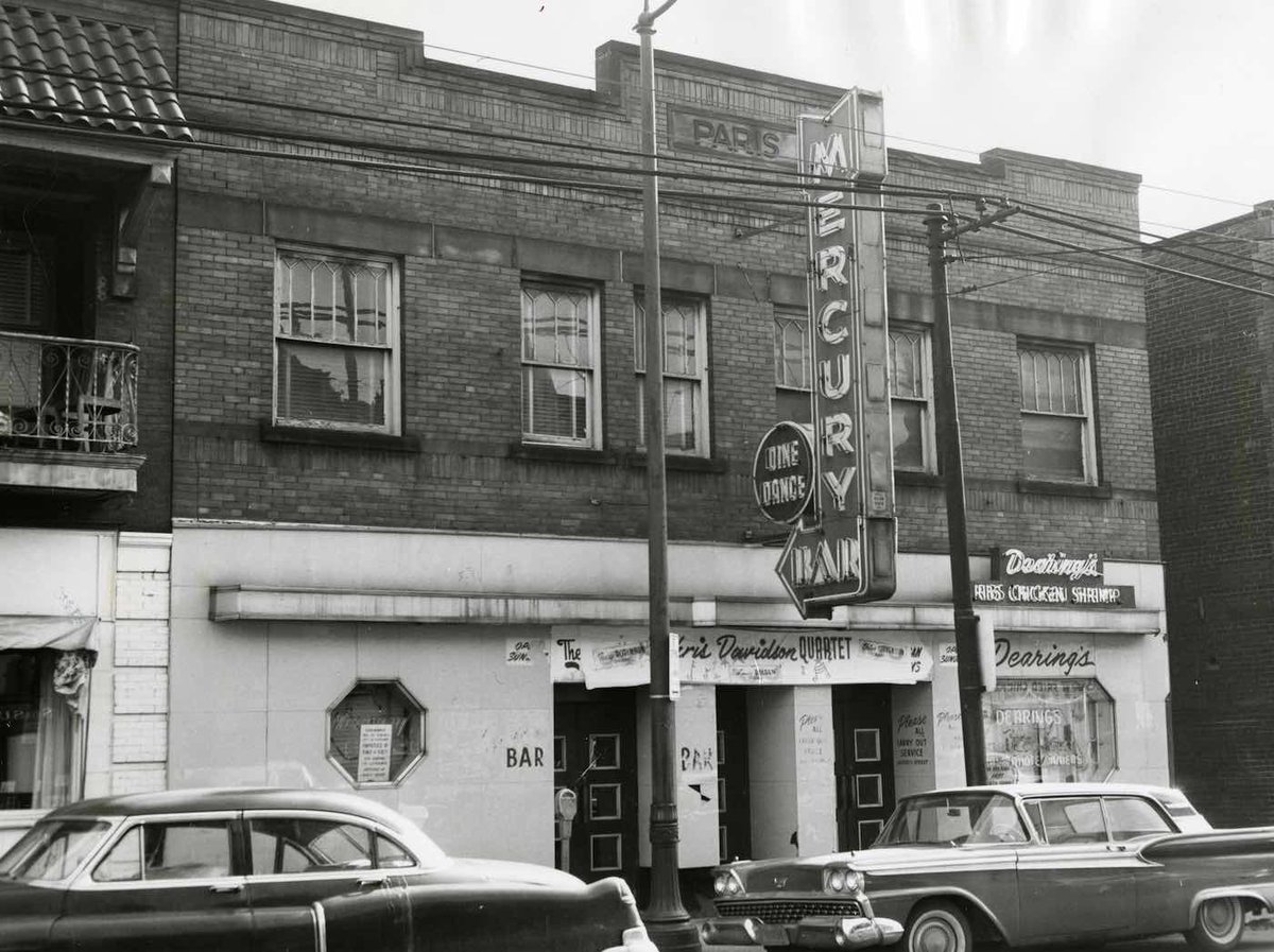
ALT 1940s-50s cars parked in front of an old commercial building with a blade sign reading "Mercury Bar Dine Dance" and a smaller sign reading "Dearing's Ribs Chicken Shrimp." An iron balcony to the left is sheltered by a tile-roofed awning supported by brackets. The building itself has the name "Paris" carved in a stone nameplate set in the brick facade just below its roofline.