
Geologist in central Australia. 🇺🇸 in 🇦🇺 linkedin.com/in/charlieverde…
Joined October 2020
- Tweets 888
- Following 4,397
- Followers 3,505
- Likes 11,690
492 Photos and videos


Pinned Tweet

28 Nov 2020
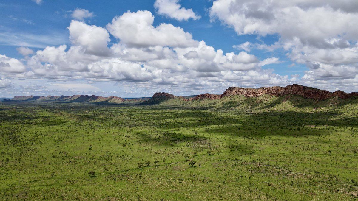
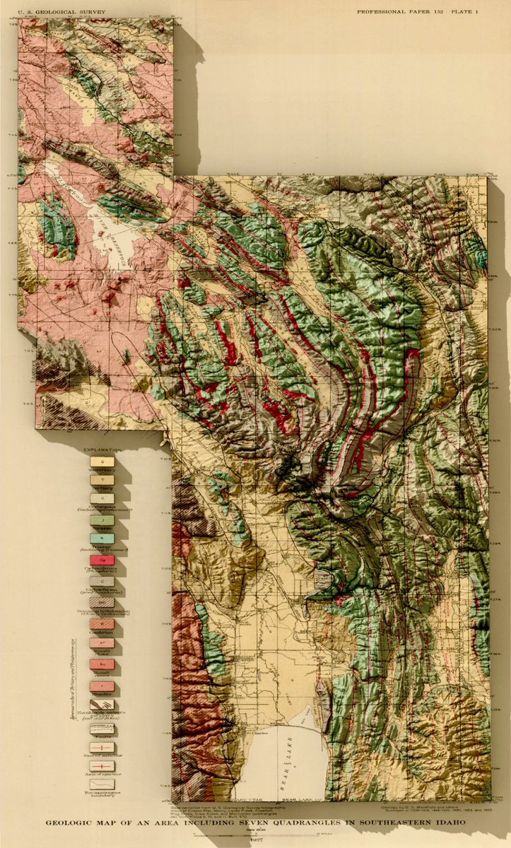
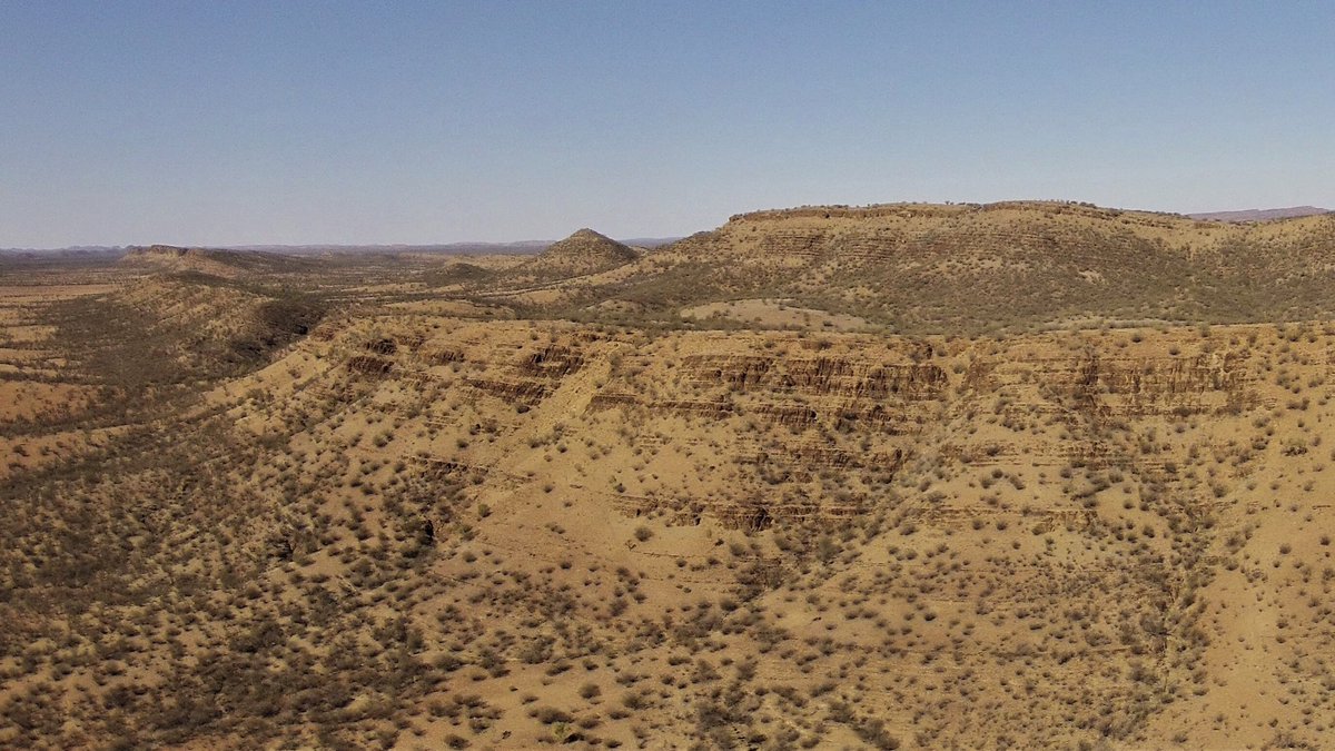
#Cryogenian carbonate succession of the eastern Amadeus Basin, Northern Territory
5
4
108
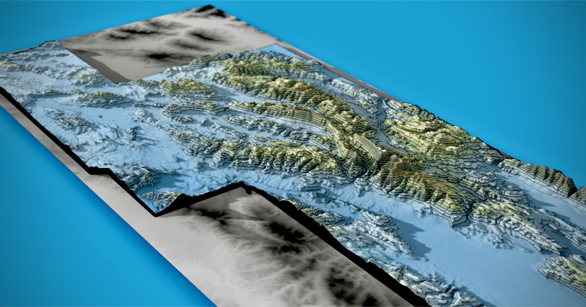
13 Feb 2025
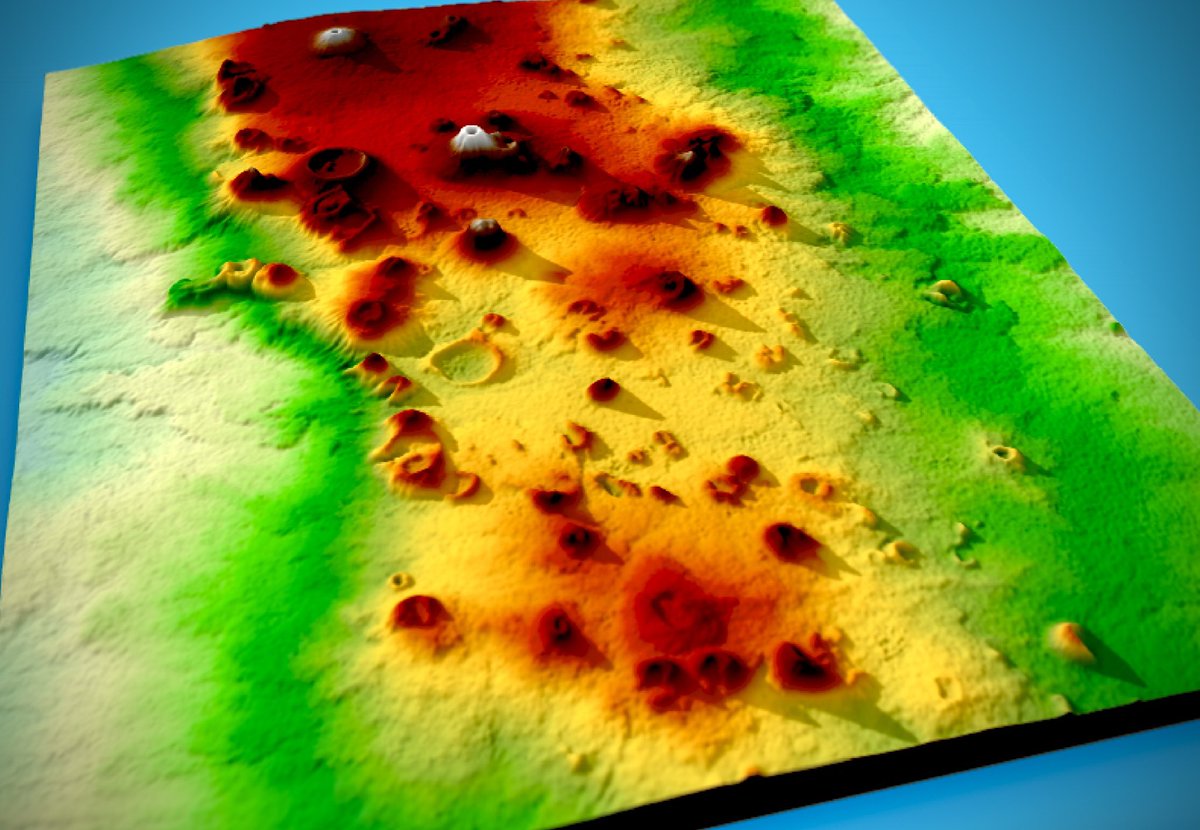
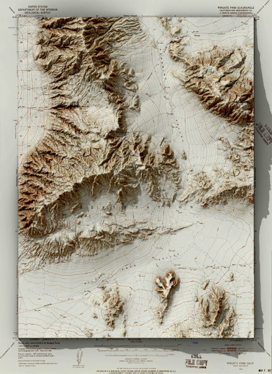
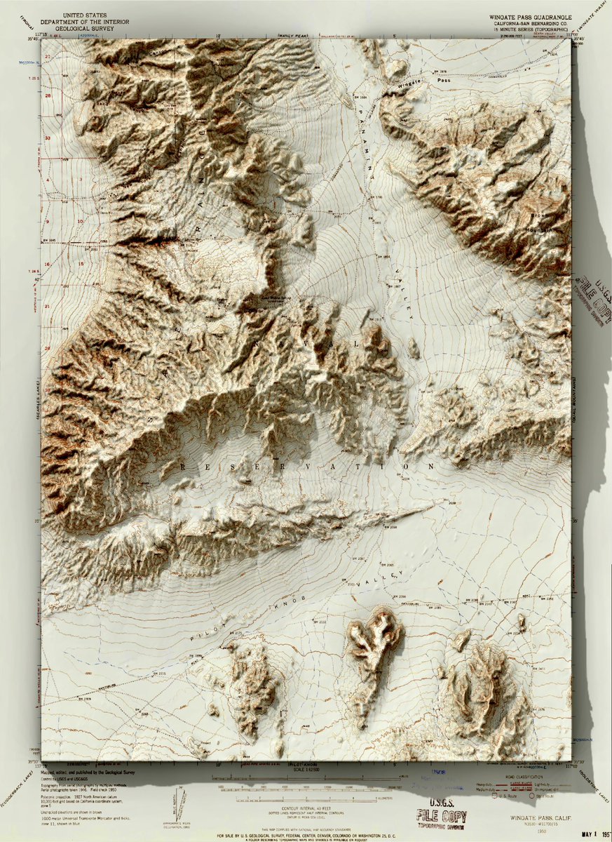
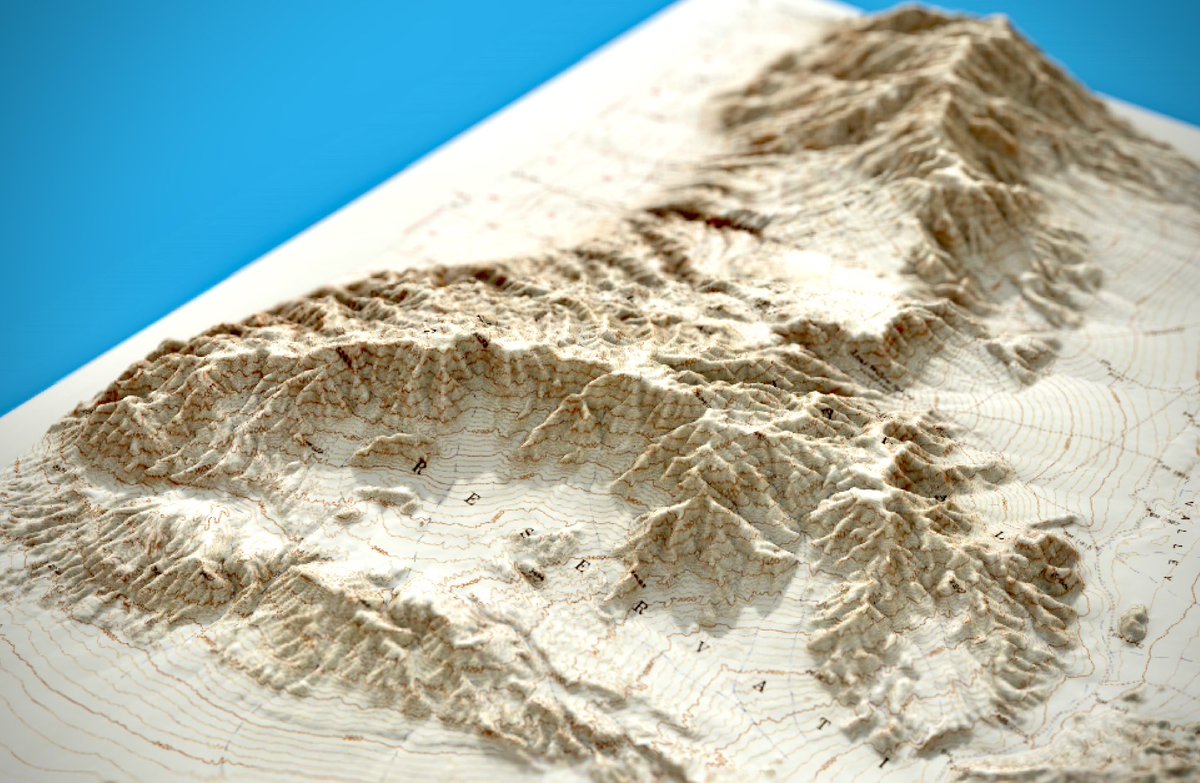
USGS topographic map from the Death Valley region of eastern California #rayshader #QGIS
2
2
60
2,868
25 Jan 2025
Mascot, New South Wales
Magnificent
Astonishing
Superb
Commendable
Outstanding
Terrific
@branksomehotel
2
195
Charlie Verdel retweeted

22 Jan 2025
🆕 #3Dpainting #MapArt: 𝐌𝐭. 𝐓𝐚𝐫𝐚𝐧𝐚𝐤𝐢 & 𝐏𝐨𝐮𝐚𝐤𝐚𝐢 𝐓𝐚𝐫𝐧.
Inspired by my trip to the area last month. I didn’t get to see the mountain or the reflection due to heavy fog! So, I created this as a way to imagine it—and I’m hoping for clear skies next time. #blender
13 Jan 2025

🆕 #3Dpainting #MapArt
𝐂𝐚𝐩𝐞 𝐏𝐚𝐥𝐥𝐢𝐬𝐞𝐫 𝐋𝐢𝐠𝐡𝐭𝐡𝐨𝐮𝐬𝐞 & 𝐖𝐚𝐯𝐞𝐬
I'm recently exploring recreating smaller scenes featuring detailed landmarks, and this is the first piece. inspired by my visit to Cape Palliser last year.
created in #blender #b3d #deeppaint
3
14
87
16,719
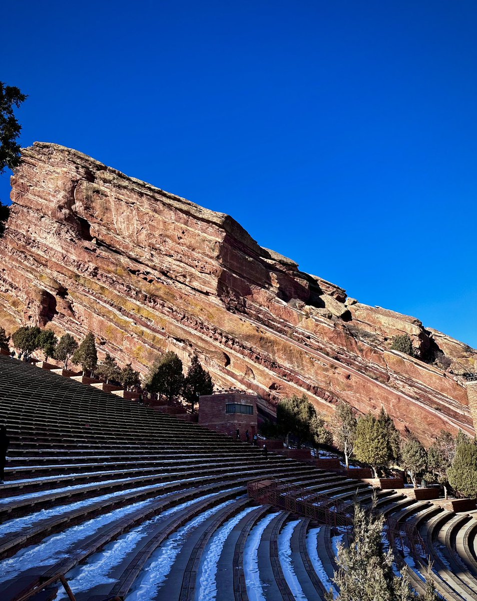
17 Jan 2025
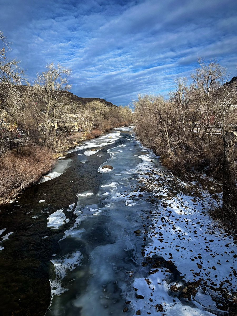
Pennsylvanian Fountain Formation at Red Rocks Amphitheatre. Morrison, Colorado
1
9
264
2 Jan 2025
36
1,161
Charlie Verdel retweeted

28 Dec 2024
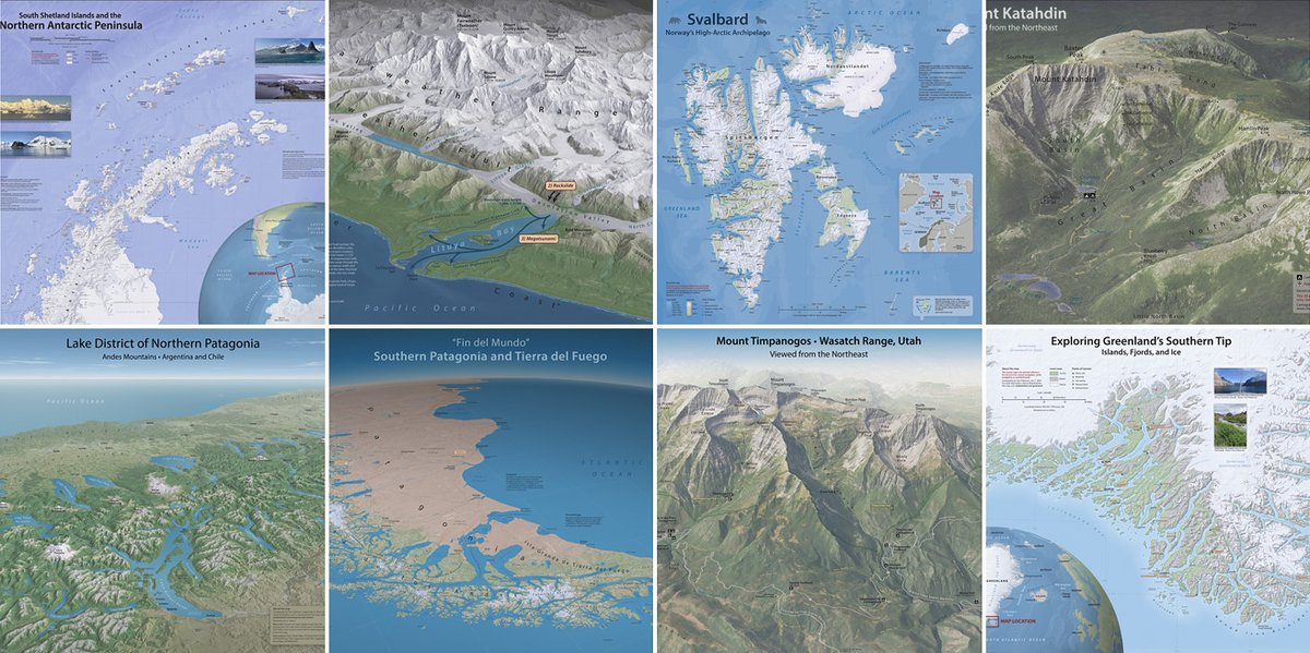
Big maps that I made in 2024. You can download them for free at: shadedrelief.com
3
32
231
11,872
25 Dec 2024
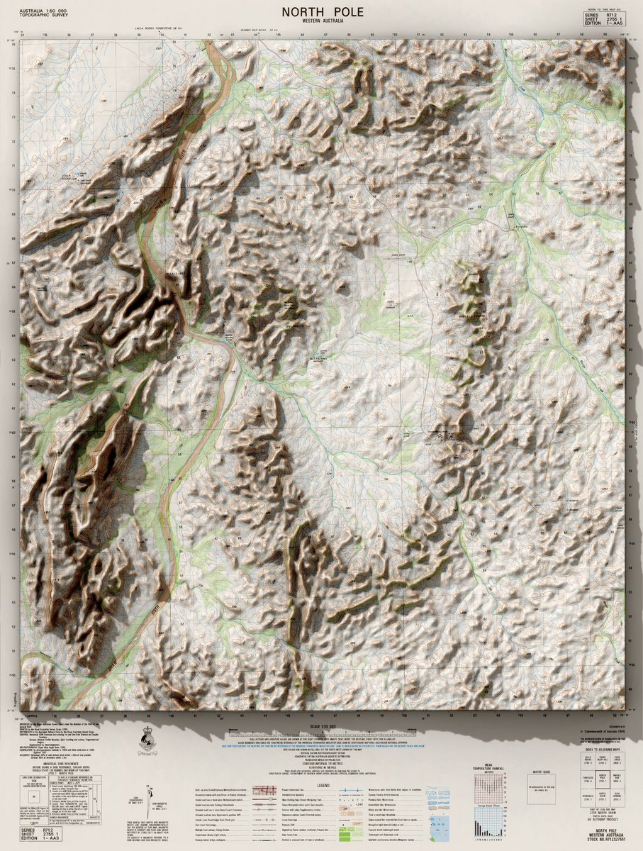
Topographic map from North Pole Dome, Western Australia. Original map from ga.gov.au/scientific-topics/…
#rayshader #QGIS
1
13
395