
Weather forecaster: NW England | Site Investigator: @TorroUK | Weekly Blog @ oldhamweather.blog/ 📰 @OldhamChronicle 🗣️@OldhamCR ⚽ #oafc forecasts
Joined August 2012
- Tweets 144,535
- Following 824
- Followers 15,078
- Likes 132,827
23,848 Photos and videos


Pinned Tweet

1 Sep 2025
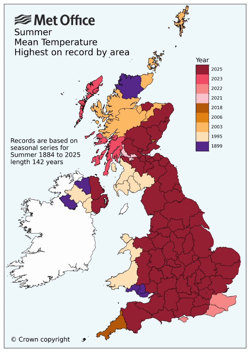
This will send the 1976 brigade into meltdown.
Note: the mean temperature includes nighttime temperatures and this year the nights were particularly warm.
#WarmestSummerEver
10
8
38
100,152
Not here, not yet anyway (unless you live in the SE). Horrendous in France/Spain though.
Not a fan of the words "heat dome" either. 🙄🔥

@ChadWeather what’s all this about a heat dome and warming up again next week? Getting hot again?
47
Oldham Weather retweeted

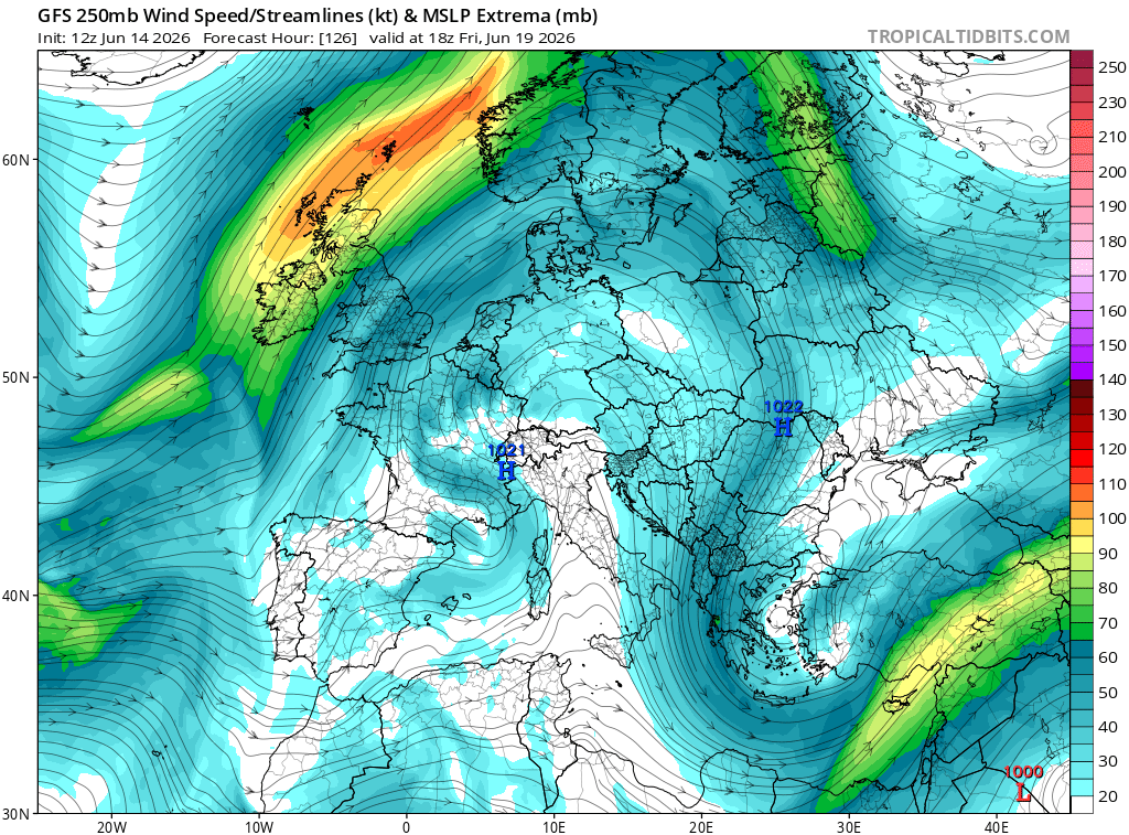
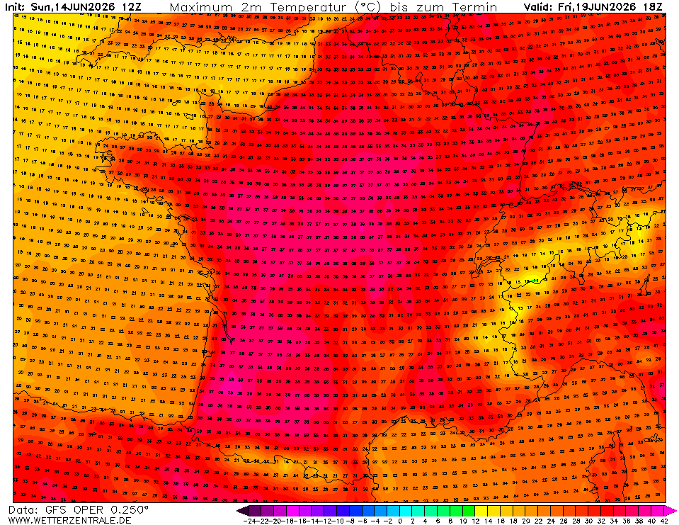
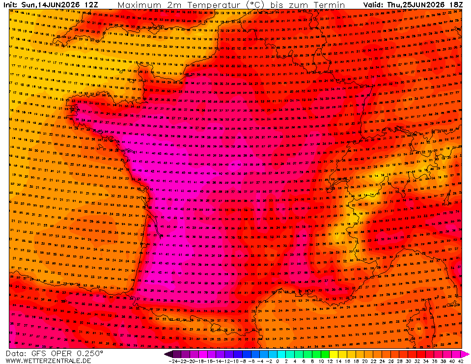
Increasing Risk of Dangerous, widespread and prolonged heat building over France, parts of Iberia, and spreading NE into Central Europe over the coming week which over France may last into the following week with temperatures approaching or exceeding 40C for a significant period of time.
A large ridge of high pressure is going to develop through the Tropopsphere , there will be both the strong advection of air from the south at 850mb but also there will be strong descent through the troposphere this under the ridge. The Ridge essentially maintained by two right exit regions of an Atlantic Jet and a NW Jet diving down into Russia
The Trajectory on the right, shows where the air will originate from at 500m on Friday at Bordeaux and takes it back to today. You can see it orignates in the Mid Atlantic, but the key is it is at well over 3000m nearly 4000m up - that is 13,000ft up. This shows the air is sinking (descent) and thus warming. The Sun is at its peak height in the Northern Hemisphere and Daylight is shortest. Its going to get very hot in this type of scenario.
The GFS Operational run shows 38-40C by Friday in the SW , W and Central France which has the potential to last well over the weekend and throughout the following week. The other chart is the following Thursday, that is a week of temperatures around or exceeding 40C . That is a long time of dangerous levels of heat. The GFS is a Global Model and will generally not pick up the local extreme temperatures.
This could be a very significant heatwave and should now be monitored closely over the next few days. This links to my other post which discusses the dry and anticyclonic theme likely the w/c 22nd June, with some runs of MOGREPS and GFS Suggesting temperatures into the 30s across Esp. Southern Parts of England by that time.
** This is a longer range discussion and doesn't represent a specific forecast ** but it important to flag it.

1
6
54
4,524
MONDAY
Some hazy bright spells, with the risk of a shower throughout the day as a weak weather-front moves NE. Feeling warm enough and muggy into the afternoon. Mild overnight.
Max 20°C Min 12°C
1
15
919
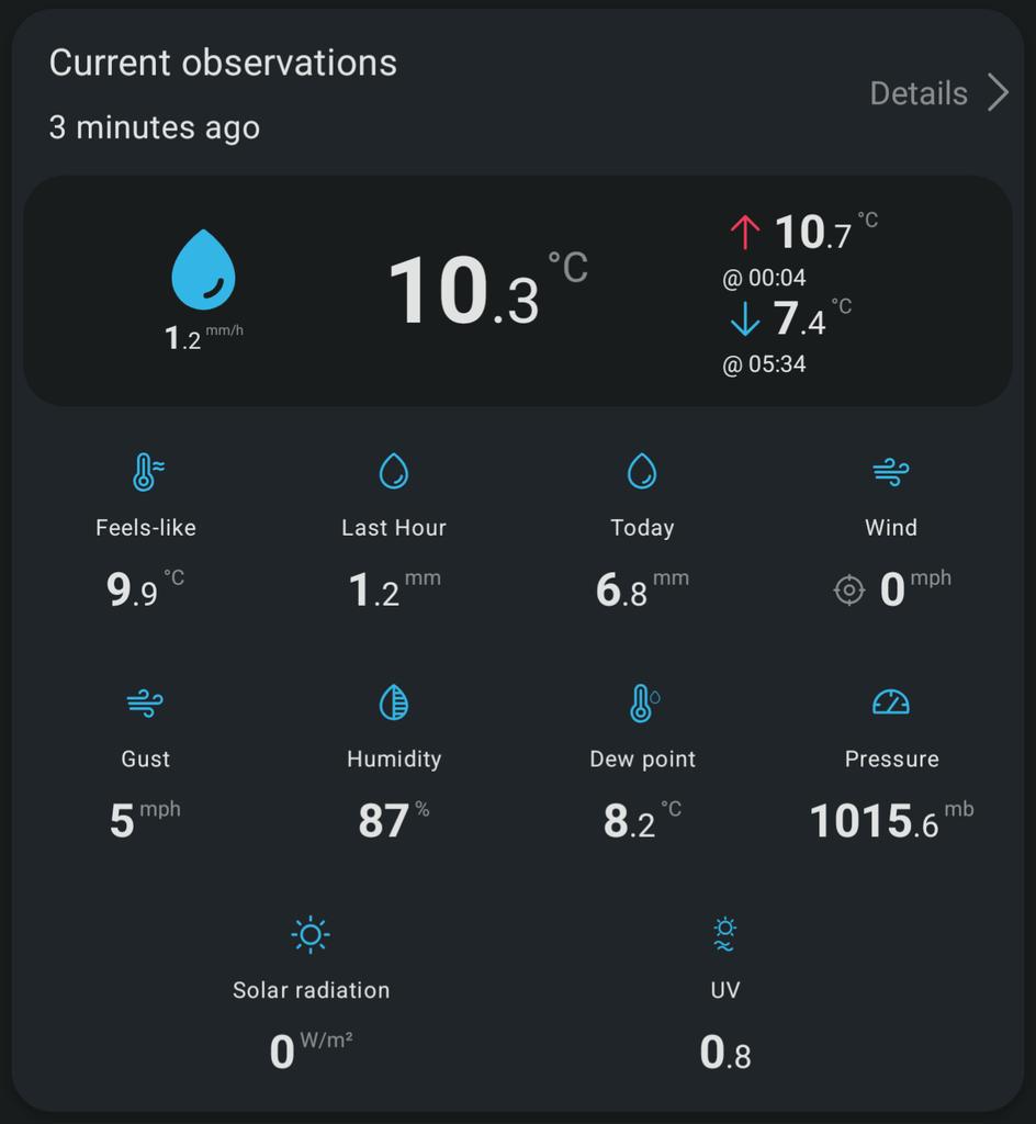
We're in some warmer air today so temperatures are not too bad. Shame about the cloud cover, quite extensive. Some sunny spells here and there and the chance of a shower later.
16
1,078
Jun 13
Raining. But won't last long.
Jun 13

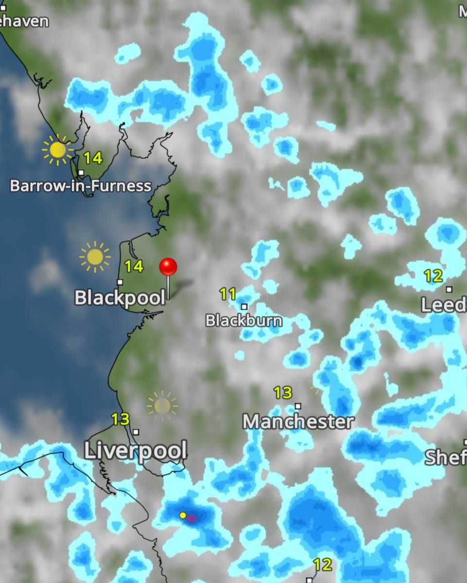
Aye should have been further north. Hopefully dry for Publife this afternoon 🎵🍺😎. Chance of a shower 7-8pm. 🙄
Would have preferred 20°C and ☀️.
8
2,210
Jun 13
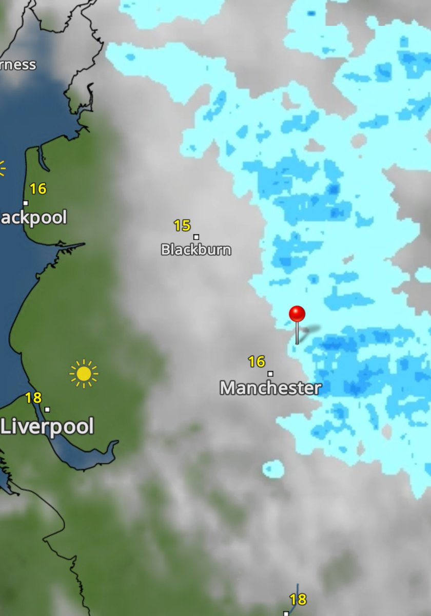
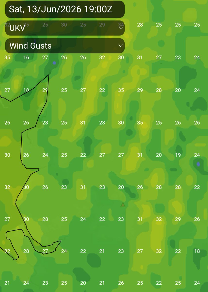
A windy one at times today, especially after this morning's rain moves on.
Expecting 30-35mph for a time this morning, strongest out west, but easing a little later towards the evening.
1
1
10
1,006
Jun 13
REST OF SATURDAY
Rain that's currently over the region (below) will move away to the SE soon.
After that, mostly cloudy skies, a brisk wind, some brightness, esp. out W. Dry for most but we still have the risk of a fleeting shower throughout.
Max 16°C Min 10°C Max Gusts 25mph
2
2
18
1,009
Jun 13
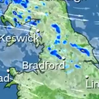
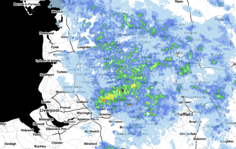
Organised streamer of showers this morning, heavy too, moving SE over the next couple of hours. Bit further south than forecast. 🙄
3
13
2,252
Jun 13
The Met Office video forecast had them further north. Let's hope they become confined to the NE as planned as we head through the afternoon.
3
1,194
Oldham Weather retweeted
Jun 12
SATURDAY
Bright spells, mostly later on, but a cool breeze. Pleasant in any sunshine and sheltered from the wind. Just the chance of an isolated fleeting shower into the afternoon. especially in the northern half of the region.
Max 17°C Min 9°C Max Gusts 25mph
2
15
1,716
Oldham Weather retweeted
Jun 12
SUNDAY
Mostly cloudy with some bright spells. Small chance of a shower. Winds much lighter so not feeling as fresh and temperatures up a notch.
Max 19°C Min 10°C
1
4
11
1,476
Oldham Weather retweeted

Jun 12
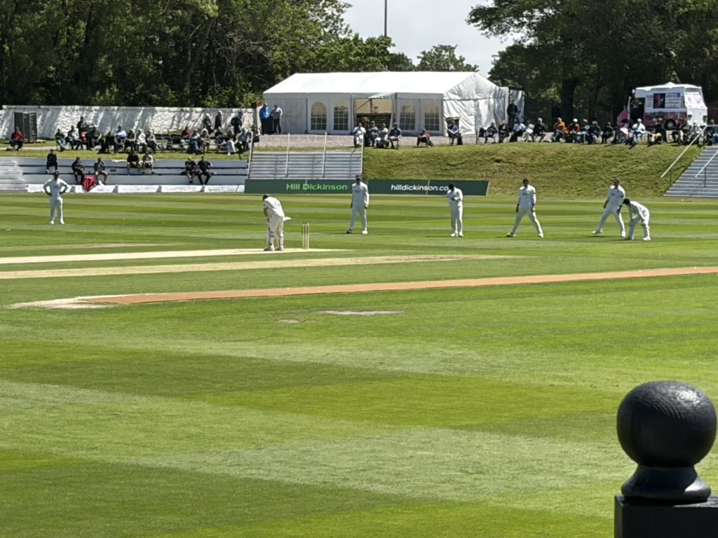
Had a wonderful afternoon watching the cricket at Blackpool -Not a cloud on the sky
1
1
1
1,217
Oldham Weather retweeted
Jun 12
For those off to the Publife Festival tomorrow, I'm hoping the risk of afternoon light rain/showers eases away or at least stays away to our north 🤞. After that it should be a dry and bright evening but breezy. 👍🍻🎶
1
13
1,145
Jun 12
Rain ➡️ Cloud ➡️ Wind ➡️ Sun.
The washing line is open.......
2
3
23
1,615
Jun 12
The sun has arrived along the Flyde coast. It's a start.
2
1
18
1,469