
Joined January 2015
- Tweets 16,511
- Following 570
- Followers 2,184
- Likes 85,055
3,695 Photos and videos


Pinned Tweet

2 Nov 2024
Normally don't do a post like this, but wanted to say happy 27th birthday to my (Twitterless) wife, Kristin.☺️
WAIT, did I mention we got married?!
This was back on Sept 14th...😅
I want to prioritize my marriage, so I'll remain less active on SM. Much love to you all🙏💙


8
1
72
10,000
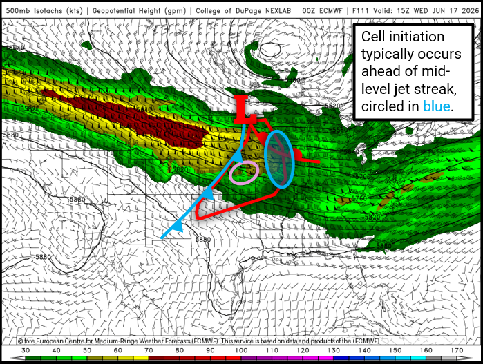
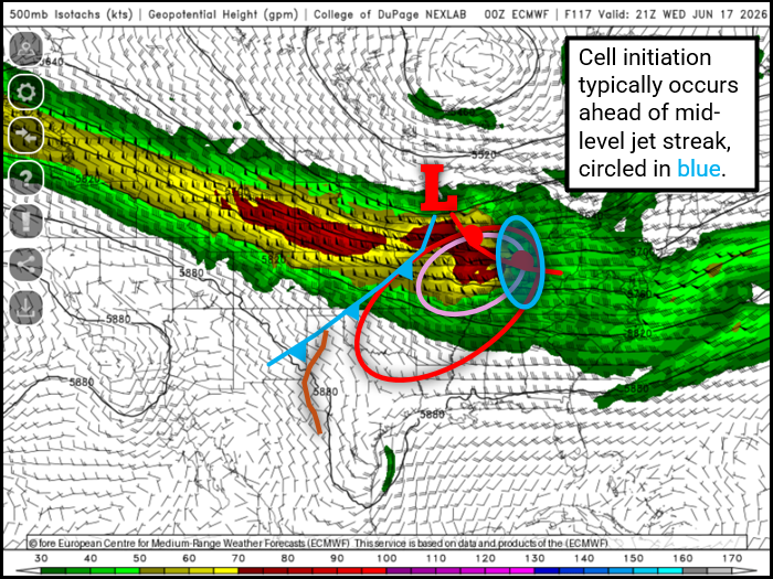
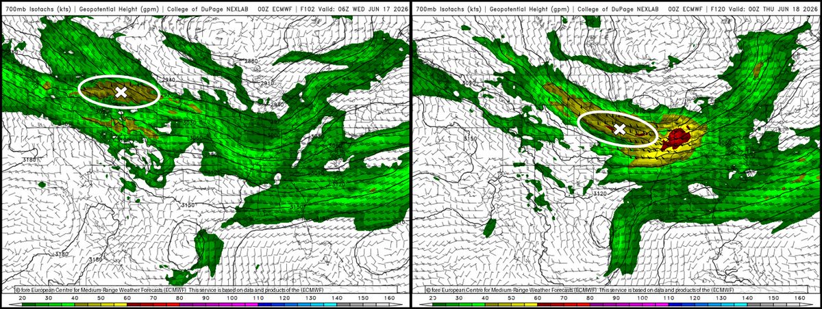
June 17, 2026 🧵:
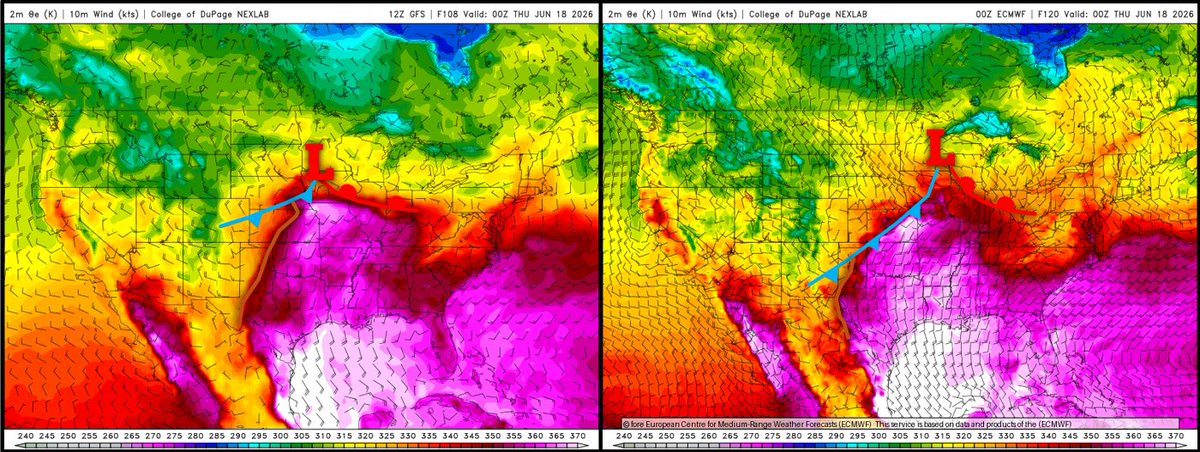
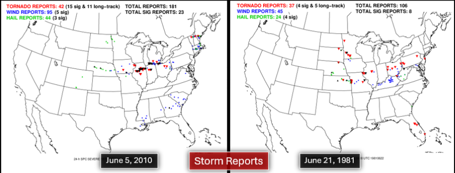
My top 2 analogs for Wednesday's severe weather setup are June 5, 2010 & June 21, 1981.
Compare their regimes to the 12Z GFS forecast:
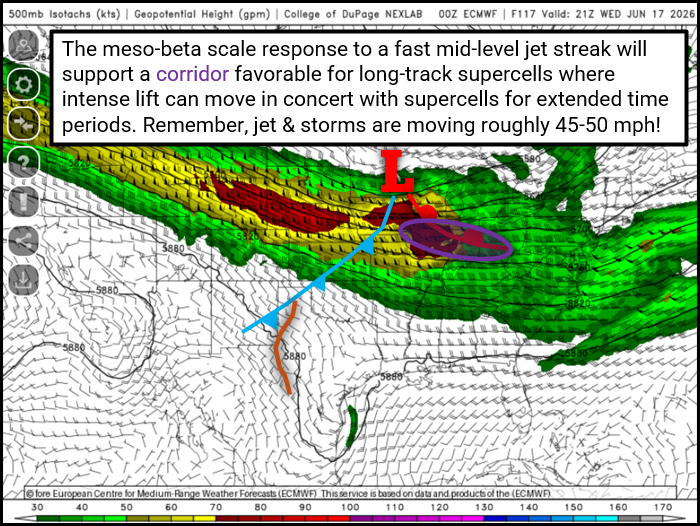
I'm seeing longwave troughing E of Rockies with an embedded (strong fast) NWerly jet streak upstream of trough base.
1/12
3
5
46
5,531
In summary:
-A potent mid-level jet will accelerate SEward into the Midwest Wednesday
-Low-level mass response will induce an intense low-level jet
-A localized corridor of long-track tornadic supercells may evolve from MO/IA eastward to IL/IN/OH
-Failure modes exist
11/12
1
2
367
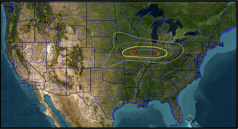
Given current pattern recognition & model data, here's my hypothetical tornado probability outlook for June 17.
The ceiling is certainly high with this jet ejection, & unfortunately it'll be over areas that were ravaged by severe weather this past Wednesday & Thursday.
12/12
1
4
411
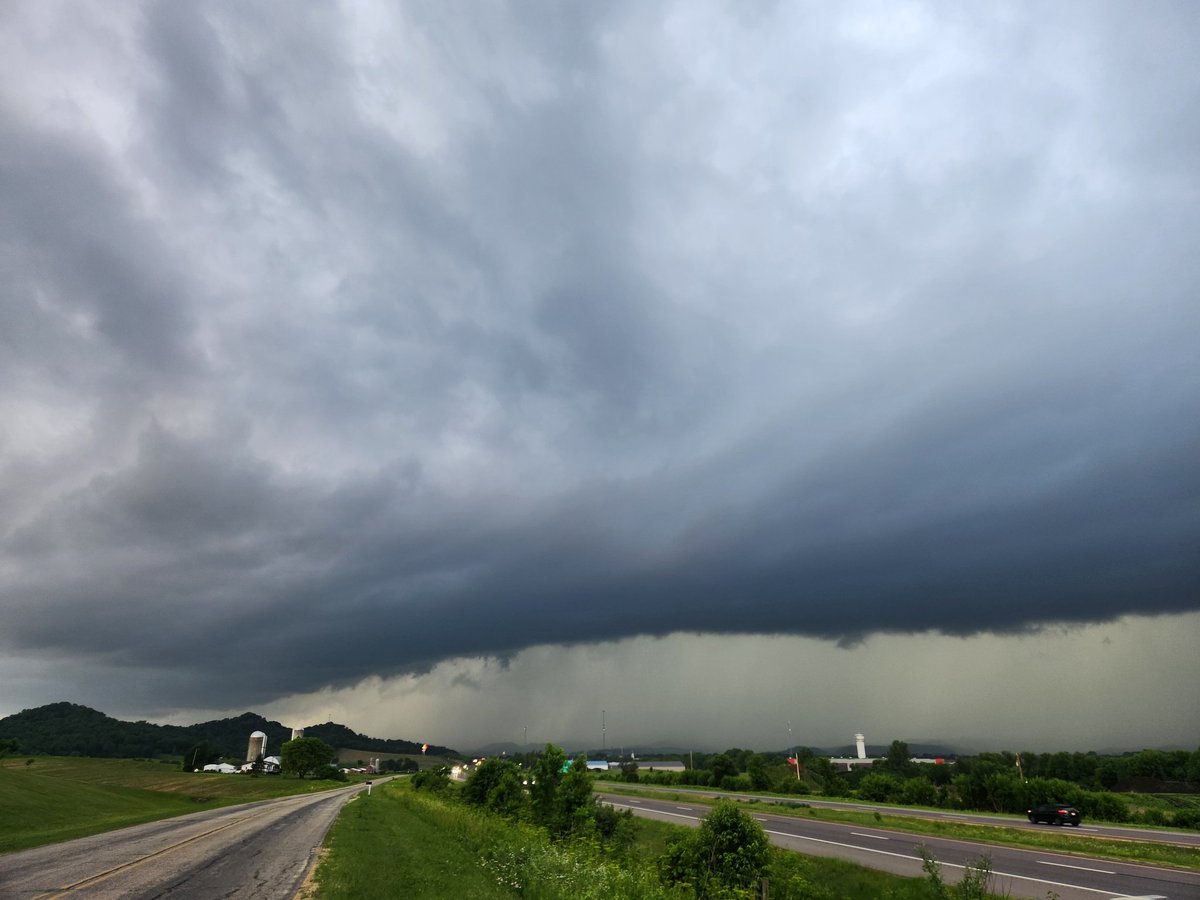
Little SkyDrama before my shift tonight.
Every year has those 1 or 2 defining tornado events. Those setups that one simply cannot miss out on.
They feature numerous photogenic tornadoes of all shapes & sizes.
2023 was March 31
2024 was April 26
2025 was May 16
2026 was June 11
1
1
27
1,274
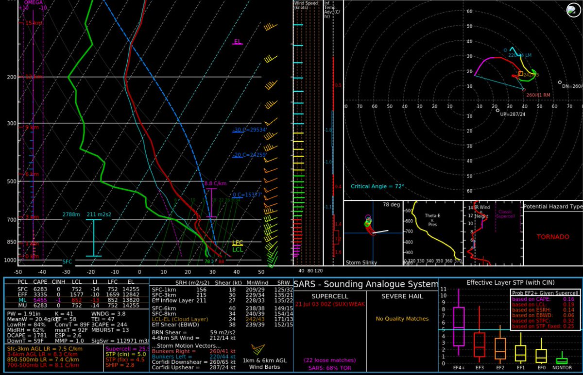
Descending reflectivity core experts:
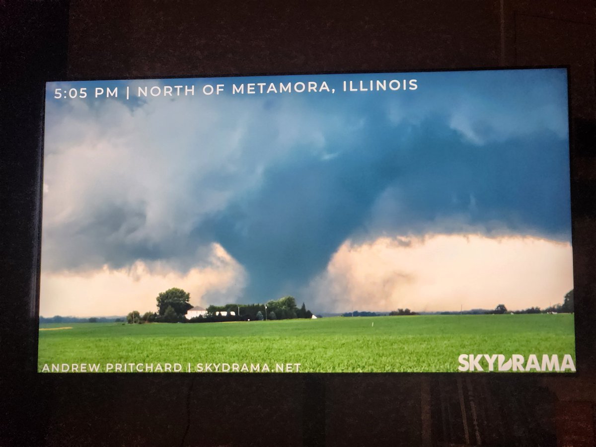
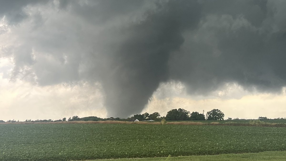
Does this qualify as a DRC? I haven't looked at cross sections yet, but there's insurmountable evidence this played a role in significant tornadogenesis near Pontiac-Odell-Dwight, IL this evening. #ilwx
Eff inflow layer SRI ~30 kts.

A descending reflectivity core (DRC) was noted on base reflectivity. This feature is often seen prior to (significant) tornadogenesis.
Watch the weak echoes NW of Sherburn move into the rear of the (non-tornadic) supercell, then collapse. This likely aided rapid torgen. #mnwx
3
22
7,599
"Please explain the June 11, 2026 storm chase evolution in NBA terms."
Jun 12

Today's chase was just like the Spurs Knicks game last night. When that storm near Keokuk had 60K tops and a couplet, while the initial stuff in C. IL was STRUGGLING, we had that 29 point lead and thought it was ballgame......and then the lead got down to 15 as everything started to get messy and the Chillocothe storm started getting bigger. By the end of the 4th quarter as we tried to hold on to the lead with the Ipava tornado, wedgefest was occurring in NE IL and we took the L. 🙃😡 @AaronRigsbyOSC @SimonStormRider
1
15
1,402
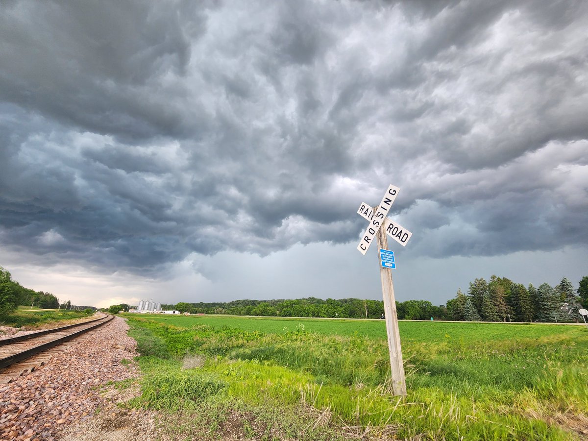
Much more visible tornadoes so far today than I'd originally think. Prefrontal confluence supercells for the win. Hoping everyone stays safe.
Great shot from Daniel, & thank you for tagging the WFO! #ilwx

15
1,046

For those who are interested, my hypothetical probabilistic convective outlooks vs SPC's (Chris Broyles) initial 06Z outlook valid for Wednesday, June 10, 2026.
I'll compare how we did vs practically perfect after a couple days of accumulating severe report entries.


...conversely, if the EML is stronger, & deep convective initiation is delayed until ~20Z or later, then I expect a corridor of significant severe, including EF2 tornadoes, from S MN northeastward into N WI. Mode should transition from supercellular to QLCS. #mnwx #wiwx
6/6
1
9
1,899
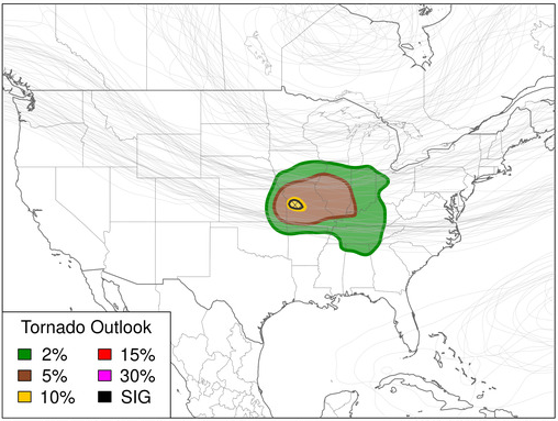
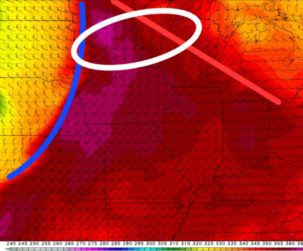
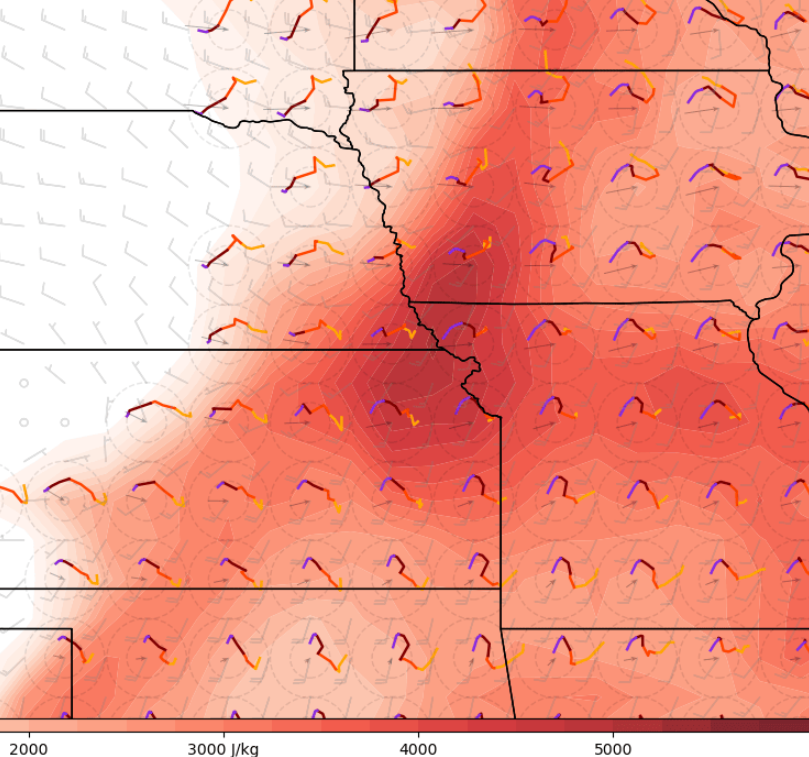
Some of the latest guidance supports an upgrade to tornado probabilities in NW Missouri, where strong low-level shear (inflow layer SRH from 200-300 m2/s2 with pure streamwiseness) should overlap with strong to extreme instability (3000-4000 J/kg of MLCAPE).
Adding a 5%.


4
454

3
36
5,096