The global premier provider of weather decision support solutions helping minimize risk, optimize efficiencies & boost decision-making confidence. #ThinkWeather
Weather data is everywhere. Actionable weather intelligence is what matters.
The DTN Weather Hub for Outdoor Safety helps event operators monitor weather risks for confident decisions when conditions change.
#EventSafety#DTNWeatherIntelligencedtn.link/kpcvsu7p
5/22 Morning Atlantic Tropical Planner: No tropical systems are forecast to develop over the next several days due to widespread unfavourability.
dtn.link/ba7q20#ThinkWeather
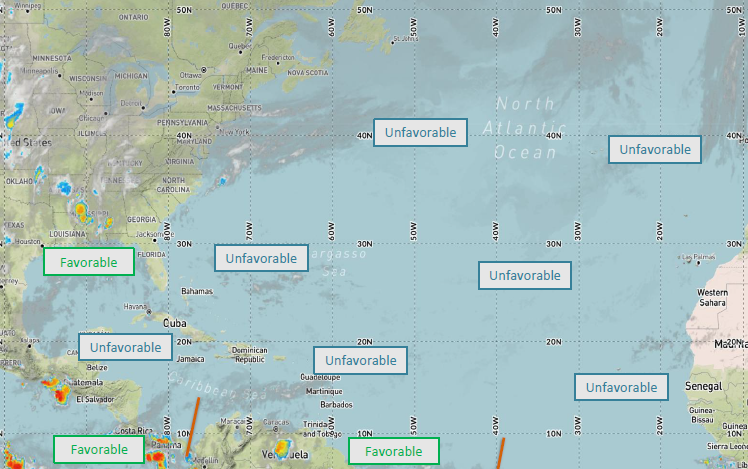
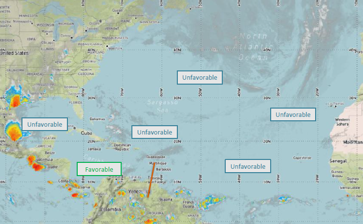
ALT 25.21.26 -@DTNWeather Atlantic Tropical Planner morning update
5/22 - Strong to severe storms are likely today across E. NM/NW TX/W. OK and E. NE/W. IA. Wind gusts to 50-60 mph, hail possible. Strong to severe storms possible in central KY/central TN/E. MS/W. AL/N. GA. Wind gusts to 50-60 mph, tornadoes possible.
dtn.link/nb0z7w
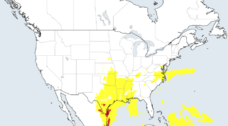
ALT 05.22.2026 -@DTNWeather Thunderstorm and Rainfall Planner, U.S. and Canada
Weather decisions at live events rarely happen on a calm timeline. On @EventSafety4All Podcast, Danielle Hernandez & Tami Richter talk with @RennyV about how event teams make weather calls, often within 48 hours or in the moment: dtn.link/2z66h49n#WeatherIntelligence
5/21 - Strong to severe thunderstorms are likely today/into this evening across SE WY/W. NE/E. CO/E. NM/W. OK/W. KS/W. TX, with the greatest risk being along the Rockies in CO. Wind gusts to 50-60 mph and hail likely. A few isolated tornadoes possible.
dtn.link/nb0z7w
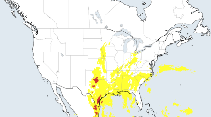
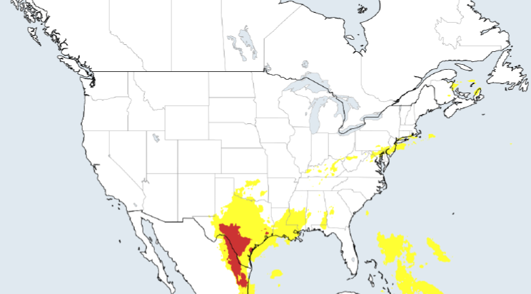
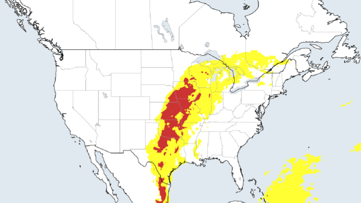
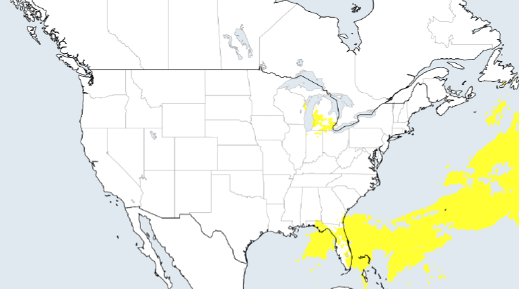
ALT 05.21.2026 -@DTNWeather Thunderstorm and Rainfall Planner, U.S. and Canada
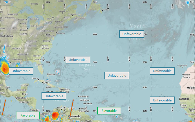
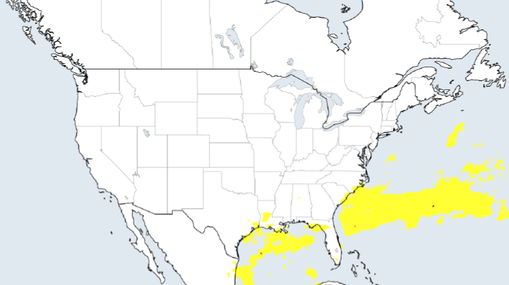
5/20 - Strong thunderstorms likely today/tonight across E. KY/WV/VA/central and E. PA/MD/NJ/DE/S. NY/CT/RI/MA. Wind gusts to 60 mph and hail will be likely. Severe t-storms likely across W. TX/SE NM. Wind gusts to 65 mph and very large hail likely. dtn.link/nb0z7w
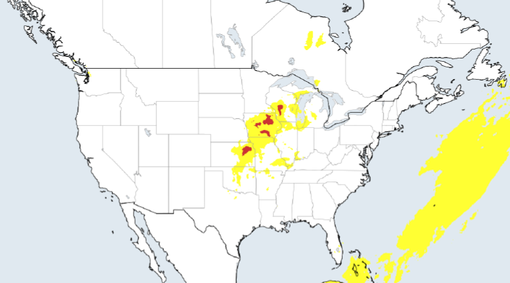
ALT 05.20.2026 -@DTNWeather Thunderstorm and Rainfall Planner, U.S. and Canada
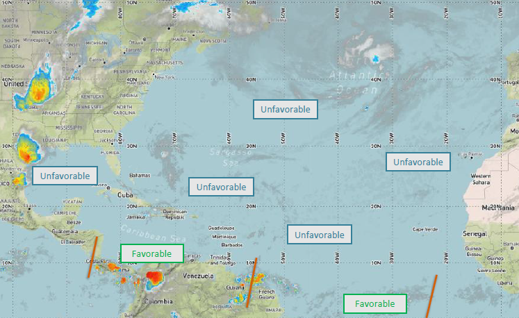
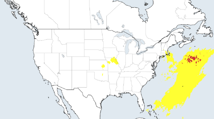
Live events don't get to pause when weather changes. DTN GM @RennyV shares why the hardest part is not getting the forecast, but turning it into consistent action when people & operations are already in motion: dtn.link/3so8ayoh#EventSafety#WeatherIntelligence
5/19 - Severe thunderstorms will be likely today/into tonight across the S. Plains north into the Middle Mississippi Valley and Great Lakes. Wind gusts to 60-65 mph and large hail likely. Very large hail likely across parts of TX. An isolated tornado poss.
dtn.link/nb0z7w
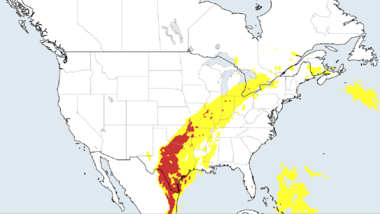
ALT 05.19.2026 -@DTNWeather Thunderstorm and Rainfall Planner, U.S. and Canada
5/18 - Severe thunderstorms likely today/tonight across northern TX/OK/MO/KS/SE NE/IA/S. MN/WI/IL/IN/MI. Wind gusts of 65-75mph likely, with very large hail poss. Tornadoes possible as well. The strongest thunderstorms will favor N. OK/KS/N. MO/SE NE/IA.
dtn.link/nb0z7w
ALT 05.18.2026 -@DTNWeather Thunderstorm and Rainfall Planner, U.S. and Canada
Cold Comfort (@highwaysmag) is almost here, and our 1:1 meeting slots are limited. If you’ll be in Coventry 20–21, May, book time now to talk snow, ice, flooding risk, smarter forecasting, and turning weather uncertainty into clearer operational decisions. dtn.link/jf3apb9f
Storm chasing is not just driving toward the #tornado. It is forecasting, logistics, and real-time risk communication. In this #DTNsights episode, DTN @Renny Vandewege, Brad Nelson, and Kevin Mahoney Jr. go behind the scenes on modern storm chasing. Watch: dtn.link/umi26vqg
5/15 - Severe thunderstorms likely today and tonight across western OK/central KS/northern MO/southeast NE/IA/western IL. Wind gusts to 65-75 mph and very large hail likely. An isolated tornado possible. The strongest thunderstorms across IA. dtn.link/nb0z7w#ThinkWeather
ALT 05.15.2026 -@DTNWeather Thunderstorm and Rainfall Planner, U.S. and Canada
90% of weather decisions happen in the last 48 hours before an event. Our new report shows why the real challenge is not getting a forecast, but knowing when to act when safety, operations, & financial impact collide: dtn.link/40i890qb#EventSafety#WeatherIntelligence
5/14 - Severe thunderstorms likely today and into tonight across k/southern NE/western OK/northwest TX/much of MO/southern IA/western IL. Wind gusts to 60-65 mph, large hail with very large hail across KS likely. An isolated tornado possible.
dtn.link/nb0z7w#ThinkWeather
ALT 05.14.2026 -@DTNWeather Thunderstorm and Rainfall Planner, U.S. and Canada
5/14 - A high pressure across the northern portions of the gulf will lead to dry conditions across the basin both today and tomorrow. Western areas will see light and variable winds today with eastern areas seeing gentle northerly winds.
dtn.link/qv17yo#ThinkWeather