
Certified Broadcast & Consulting TV Meteorologist. I love weather & everything about it. I report on all things Meteorology, Astronomy, Geology & Geography.
Joined July 2014
- Tweets 33,155
- Following 774
- Followers 1,875
- Likes 31,740
10,790 Photos and videos


Jun 14
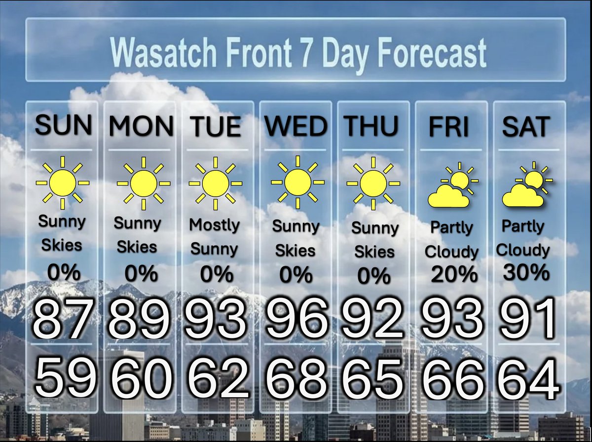
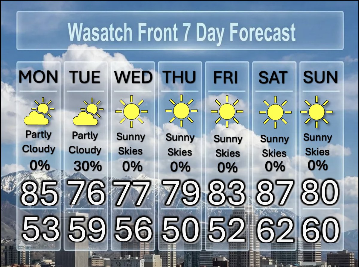
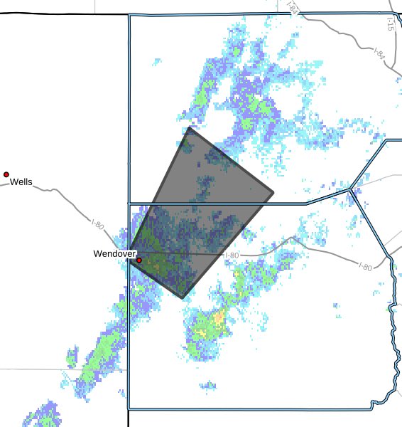
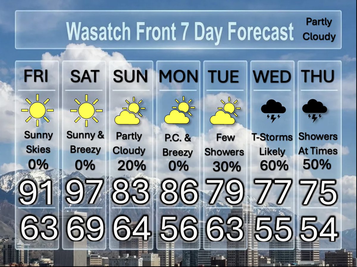
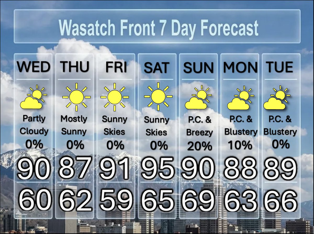
Hotter than Usual For This Time of The Year
The average high for this time of the year is in the low 80s, but we will find temperatures ranging from 5 to 15 degrees hotter than averge. It turns a little breezy, as a weak front moves through on Saturday. This will also bring widely scattered thunderstorms. @weathercaster #utwx
1
4
66
Jun 13
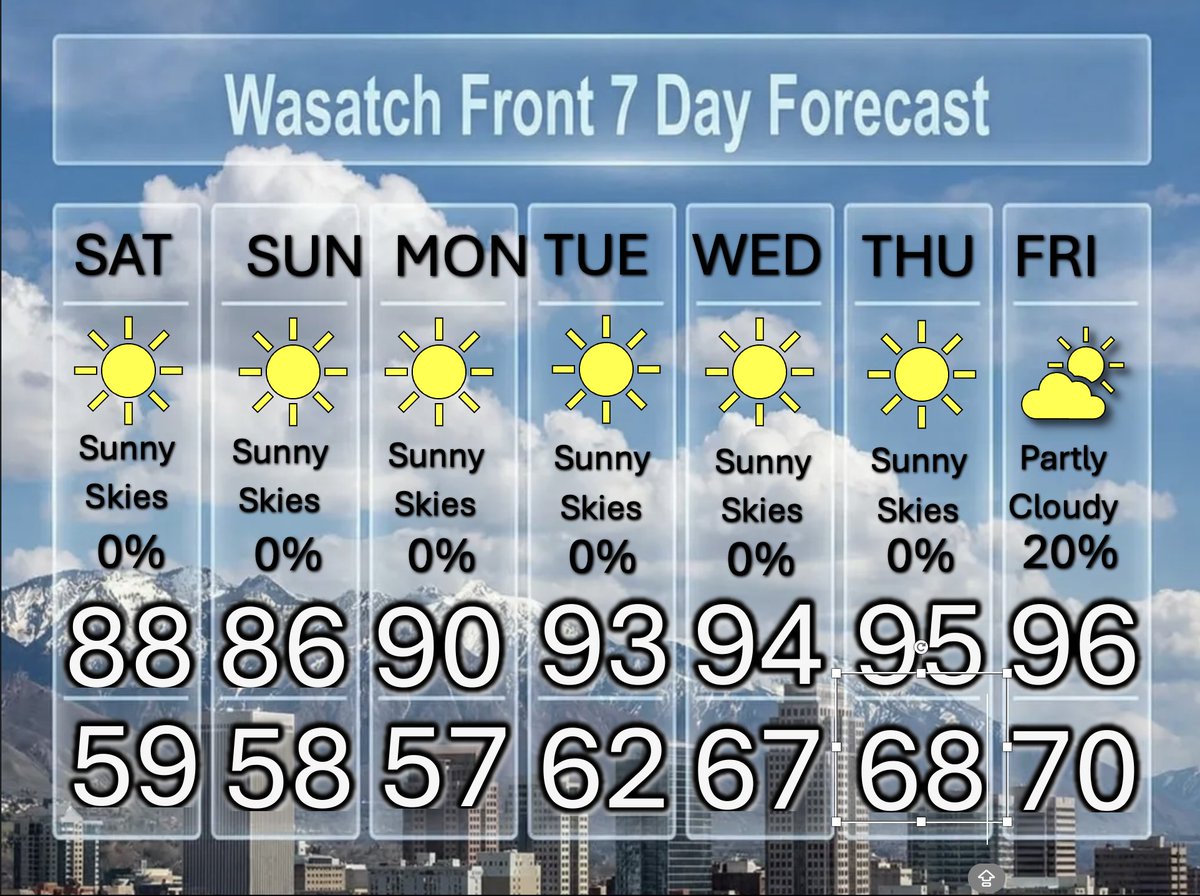
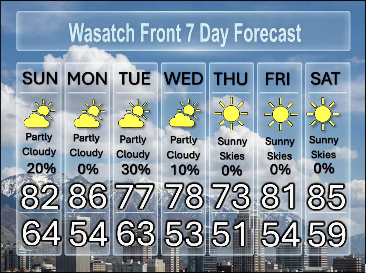
Lots of Hot Weather Ahead, a Trickle of Tropical Moisture Later
With high a strong high pressure system overhead (and strengthening) temperatures will continue their climb through Wednesday, but a slight cooling (if you can call it that) and a slight chance for afternoon and evening thunderstorms later in the week. @weathercaster #utwx
1
2
74
Jun 12
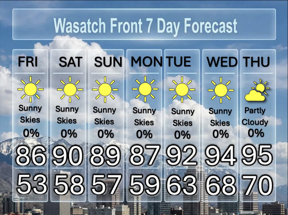
Heading Into The Heat of Summer
There will be plenty of sunshine as we head into the driest time of the year climatologically in Salt Lake City. We will have a slight chance for isolated thunderstorms towards the end of the week. Temperatures will rise into the mid 90s. @weathercasster #utwx
1
2
50
Jun 11
The Heat is on, Hottest Temperatures of The Season so Far
Skies will be sunny, so get your sunscreen ready to slather those exposed areas of your body. The UV-Index is running very high all week. Temperatures climb to summer levels with the hottest day of the year coming on Thursday. @weathercaster #utwx
1
2
62
Jun 11
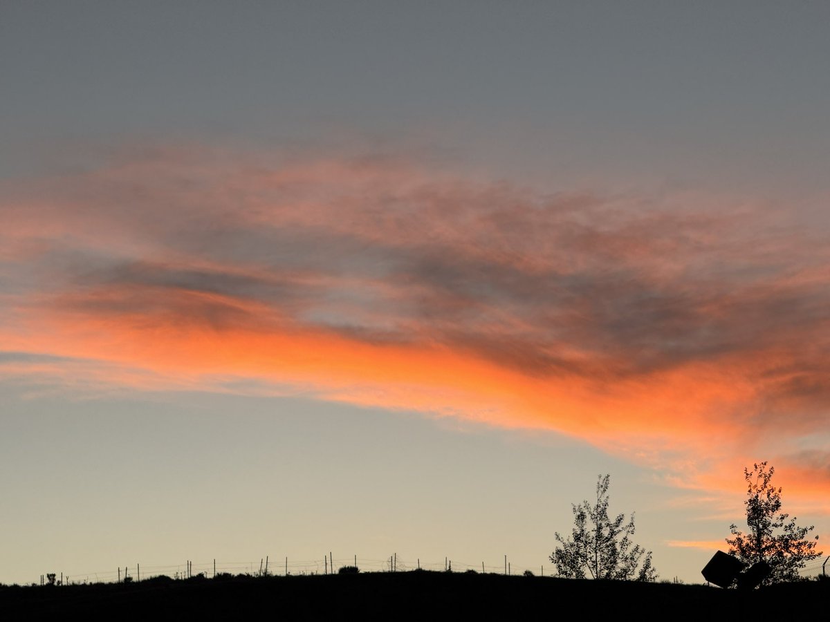
Lots of blowing dust with gusty northerly winds this evening. The sun reflecting off the dusty skies gives more of a blob of sun than the actual orb. Turning cool tonight once the winds die down. @weathercaster #utwx
2
84
Jun 10
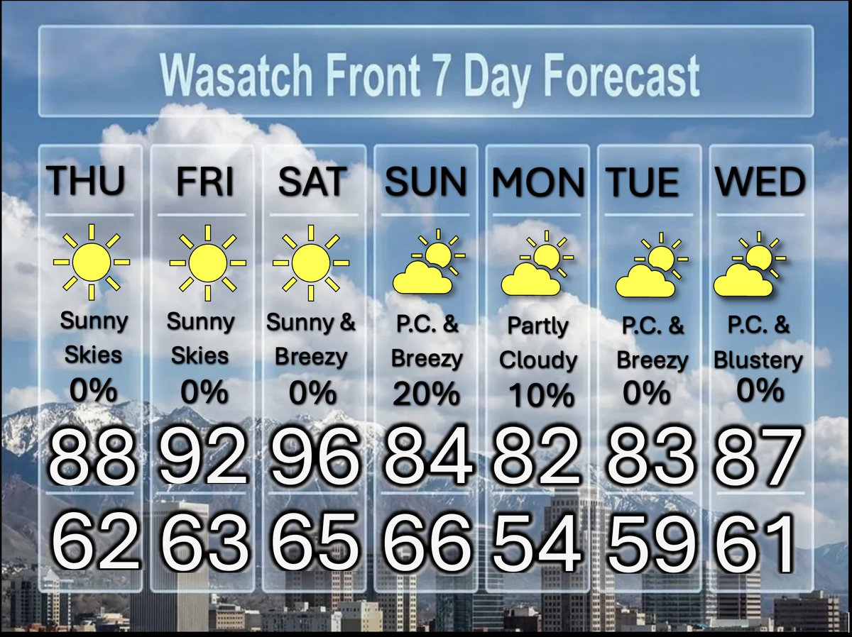
A Little Spring & Summer; I Call it "Sprummer"
Temperatures will be very spring-ike tomorrow, then some summer heat on Saturday. Spring-like again Sunday and Monday, before summer returns Tuesday Wednesday. Sunny skies throughout the next seven days. @weathercaster #utwx
1
1
59
Jun 9
Lots of Sunshine....With up and Down Temperatures
The sunshine is here to stay, while temperatures will be in the 70s for a couple of days, then jump to near 90, before returning to the 80s. Summer weather at its best. @weathercaster #utwx
1
3
93
Jun 8
vWeak Storm Tomorrow, Then Sunny Dry Weather
There will be a few showers tomorrow morning and early aftrenoon; then afternoon clearing. No significant rainfall is expected. The front brings cooler air for several days, before the 80s return. Skies will also be sunny from Wednesday throuogh Monday. @weathercaster #utwx
1
4
45
Jun 7
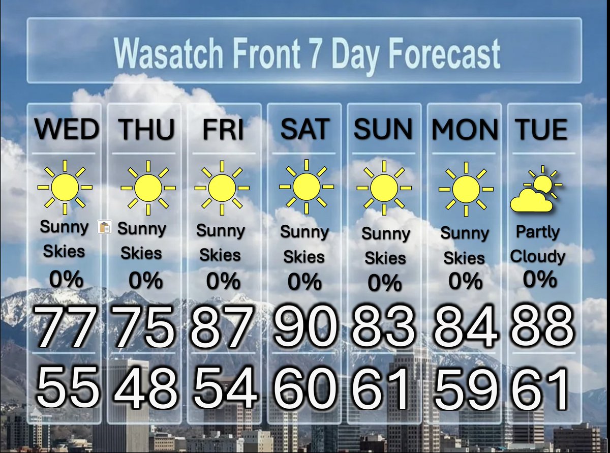
A Cooler Weather Pattern, Possible Spotty Showers Tuesday
After the very hot weather yesterday, cooler temperatures are on tap for much of this week. Highs on Tuesday through Thursday will hold in the mid to upper 70's. On Tuesday a cold front will bring a few showers and isolated thundershowers. Sunny skies are forecast for the remainder of the week and weekend. @weathercaster #utwx
1
1
55
Jun 7
New event. Severe Thunderstorm Warning from 6/6/2026 6:07 PM to 6:45 PM MDT for Box Elder County, UT, Tooele ... inws.ncep.noaa.gov/a/a.php?i…
76
Jun 6
New event. Severe Thunderstorm Warning from 6/6/2026 5:46 PM to 6:45 PM MDT for Tooele County, UT. inws.ncep.noaa.gov/a/a.php?i…
55
Jun 6
Cooler With Spotty Showers, Then Sunny & Dry
A weak cold front brings isolated showers and cooler temperatures on Sunday. Another cold front arrives on Tuesday with scattered showers and thundershowers possible. For the remainder of the week, dry, sunny and seasonal. @weathercaster #utwx
1
3
52
Jun 5
Record Tying Heat Saturday, Approaching Storm & Cooldown
Sunny and record tying heat tomorrow. The record high for tomorrow is 97, set in 2016. Saturday will be a summer day with southerly winds 15 to 25 mph with some gusts over 30 mph. It will be 15 degrees cooler on Sunday, with isolated thunderstorms. Increasing winds again on Monday, ahead of what looks like widespread rainfall by Tuesday afternoon through Wednesday. The remainder of the week will be near perfect, with highs in the 70s, and sunny skies. @weathercaster #utwx
1
57

Jun 4
Next Two Days Hot, Then two Cool Fronts Bring Changes
It will turn very hot and a bit breezy for the next two days, then a weak cool front brings isolated thunderstorms and cooler weather on Sunday. Another cool front brings a bigger change by next week. Scattered to likely thunderstorms will develop, along with cooler highs in the 70s. @weathercaster #utwx
1
1
57
Jun 3
Hottest Day of the Year Ahead, Plus the Winds Return
The temperatures rise during the first week of "Meteorological" summer. By Saturday, we arrive at the "Hottest day of the Year". There is a very slight chance for a thunderstorm on Sunday. Blustery southerly winds return and temperatures fall a little next week. @weathercaster #utwx
1
1
57
Jun 2
No Suprise That The Heat is on, Then Turning Blustery
Temperatures over the next several days will range from the upper 80s to the mid 90s. Beginning on Sunday, and continuing into next week, those pesky blustery southerly winds will increase once again. @weathercaster #utwx
1
1
4
95
Jun 1
The June Heat is on!
Hotter temperatures will be the weather toppic this week, as we move into the first and probably the second week of June. It will be in the 80s to near 90 for the next several days, then mid 90s by Saturday, before it cools a little early next week. Expect sunny to partly cloudy skies and only a slight chance for a stray thunderstorm on Sunday. @weathercaster #utwx

1
5
67
May 31
Summer Heat, Here We Come!
After slightly cooler temperatures and a good spring rain, the tide will turn to dry and hotter temperatures for the entire week. Highs will be in the 80s and 90s and skies will be sunny to partly cloudy. Southerly winds pick up over the coming weekend. @weathercaster #utwx

1
3
69