
Our vision is to create and nurture a ready, responsive, and resilient Eaton County.
- Tweets 1,323
- Following 392
- Followers 399
- Likes 410


ALT A yellow road sign reads "Tornado Warning". In the background, a dark and ominous sky with a large tornado touching down in an open field. A caption at the bottom reads "WARNING: A Tornado Warning is issued when a tornado is imminent. When a tornado warning is issued, SEEK SHELTER NOW, and stay away from windows!"

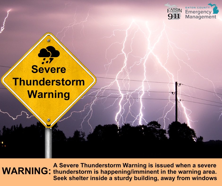
ALT A yellow road sign reads "Severe Thunderstorm Warning" with a cloud and lightning icon. In the background, a dark sky is lit up by multiple lightning strikes over a tree line and power lines. A caption at the bottom reads "WARNING: A Severe Thunderstorm Warning is issued when a severe thunderstorm is happening/imminent in the warning area. Seek shelter inside a sturdy building, away from windows."
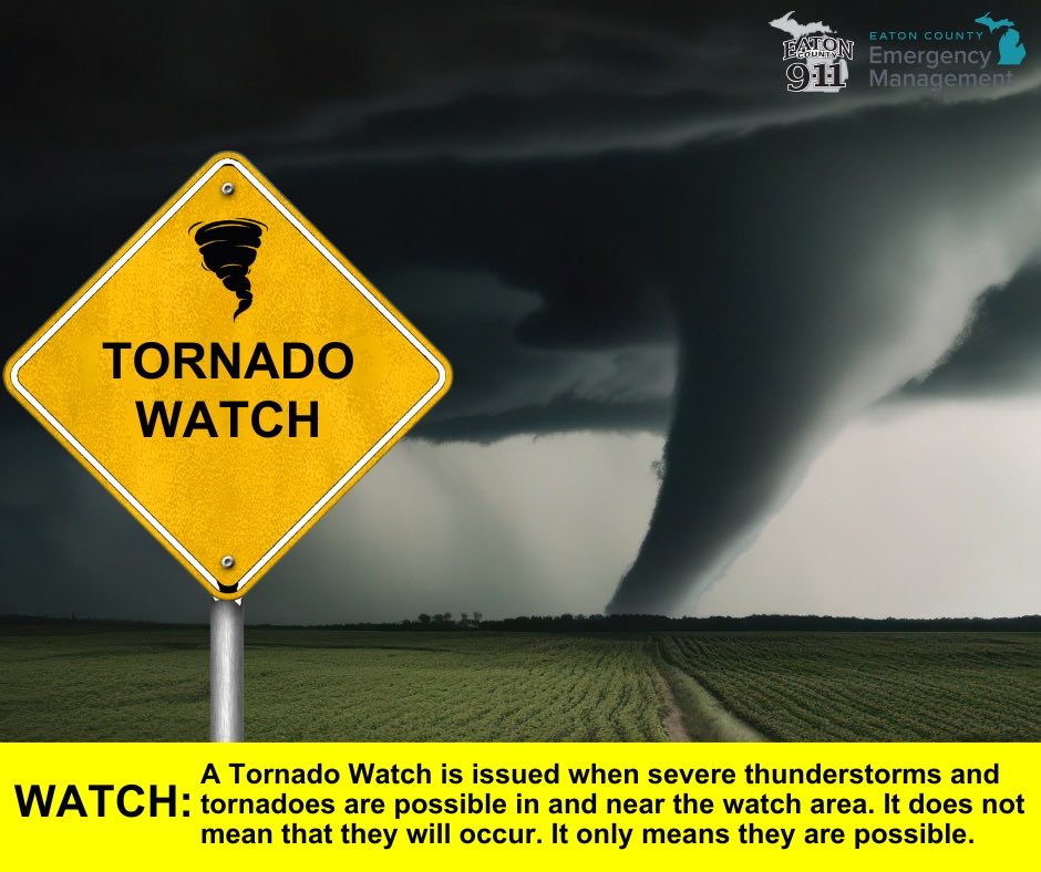
ALT A yellow road sign reads "Tornado Watch". In the background, a dark and ominous sky with a large tornado touching down in an open field. A caption at the bottom reads "WATCH: A Tornado Watch is issued when severe thunderstorms and tornadoes are possible in and near the watch area. It does not mean that they will occur. It only means they are possible."
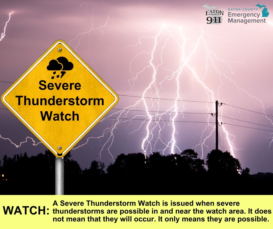
ALT A yellow road sign reads "Severe Thunderstorm Watch" with a cloud and lightning icon. In the background, a dark sky is lit up by multiple lightning strikes over a tree line and power lines. A caption at the bottom reads "WATCH: A Severe Thunderstorm Watch is issued when severe thunderstorms are possible in and near the watch area. It does not mean that they will occur. It only means they are possible."
ALT A yellow road sign reads "Severe Thunderstorm Warning" with a cloud and lightning icon. In the background, a dark sky is lit up by multiple lightning strikes over a tree line and power lines. A caption at the bottom reads "WARNING: A Severe Thunderstorm Warning is issued when a severe thunderstorm is happening/imminent in the warning area. Seek shelter inside a sturdy building, away from windows."
ALT A yellow road sign reads "Severe Thunderstorm Watch" with a cloud and lightning icon. In the background, a dark sky is lit up by multiple lightning strikes over a tree line and power lines. A caption at the bottom reads "WATCH: A Severe Thunderstorm Watch is issued when severe thunderstorms are possible in and near the watch area. It does not mean that they will occur. It only means they are possible."
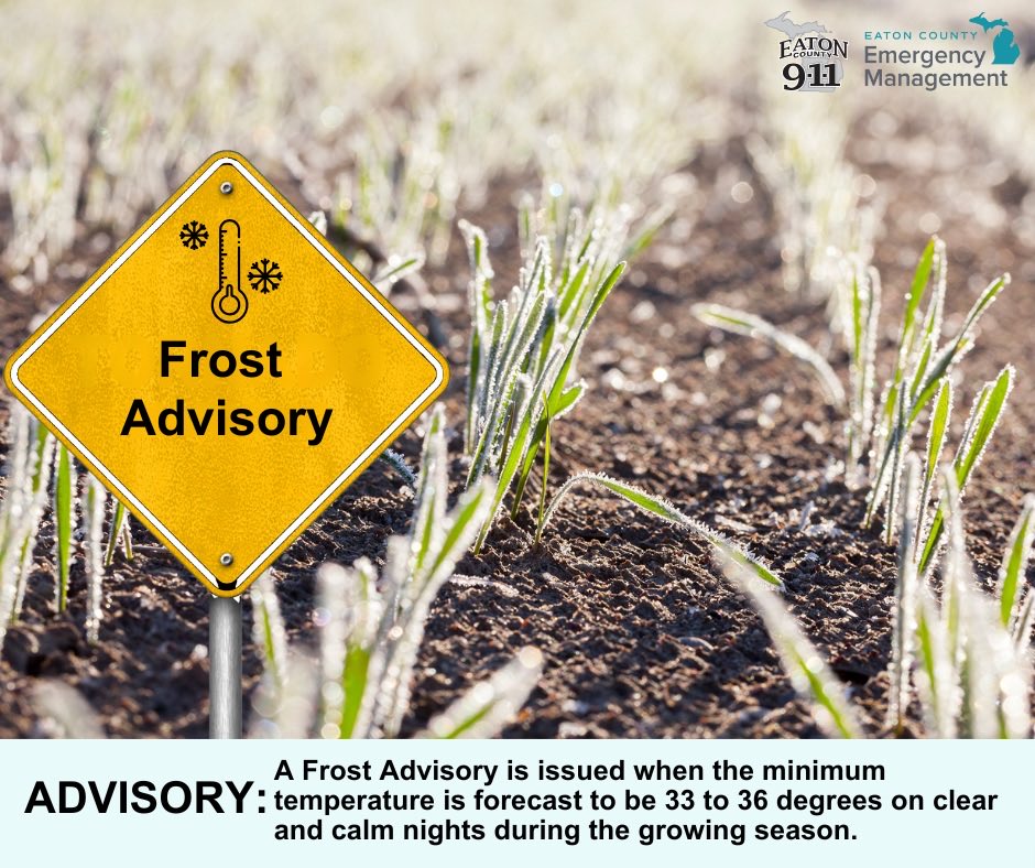
ALT A yellow road sign reads "Frost Advisory". In the background, green crops grow in a frost-covered field under early morning light. A caption at the bottom reads "ADVISORY: A Frost Advisory is issued when the minimum temperature is forecast to be 33 to 36 degrees on clear and calm nights during the growing season."
ALT A yellow road sign reads "Freeze Warning". In the background, green crops grow in a frost-covered field under early morning light. A caption at the bottom reads "WARNING: A Freeze Warning is issued when significant, widespread freezing temperatures are expected."