
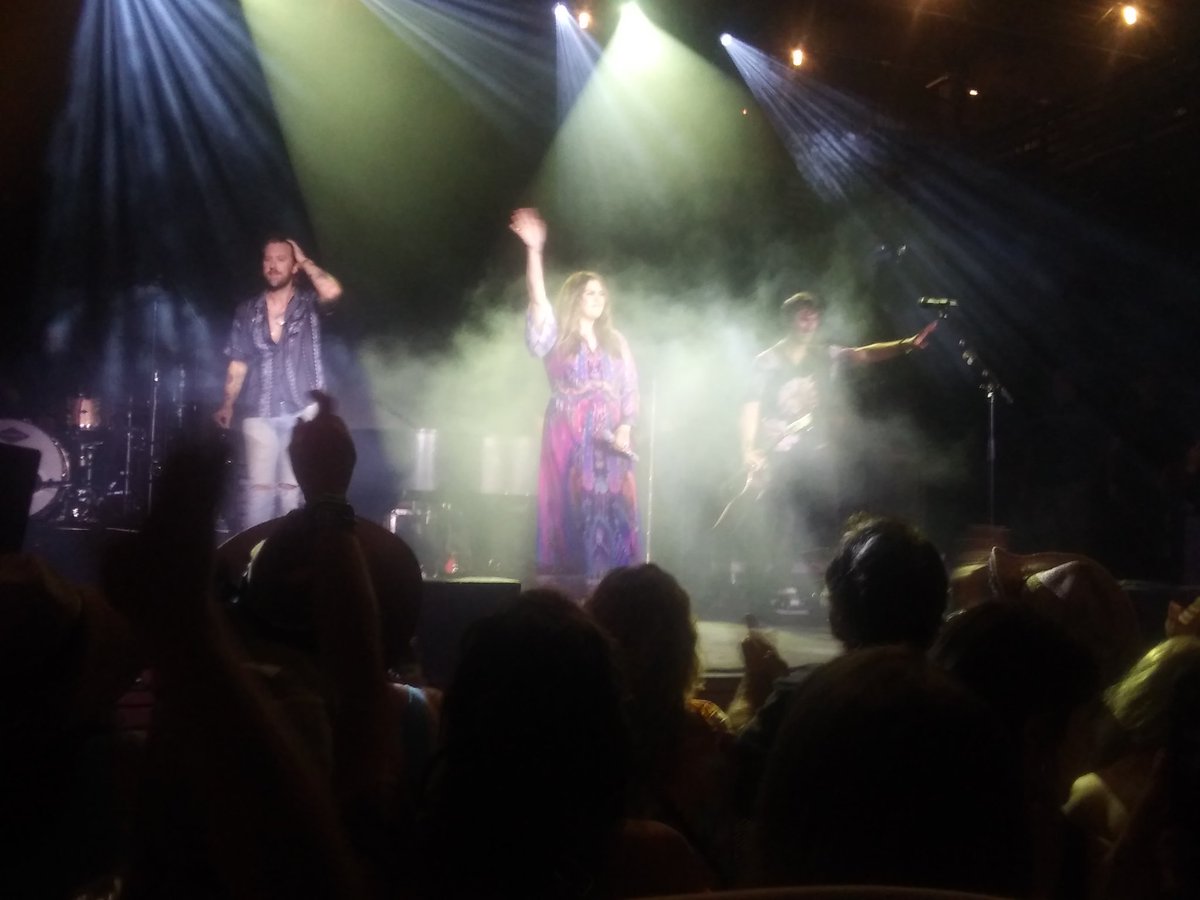
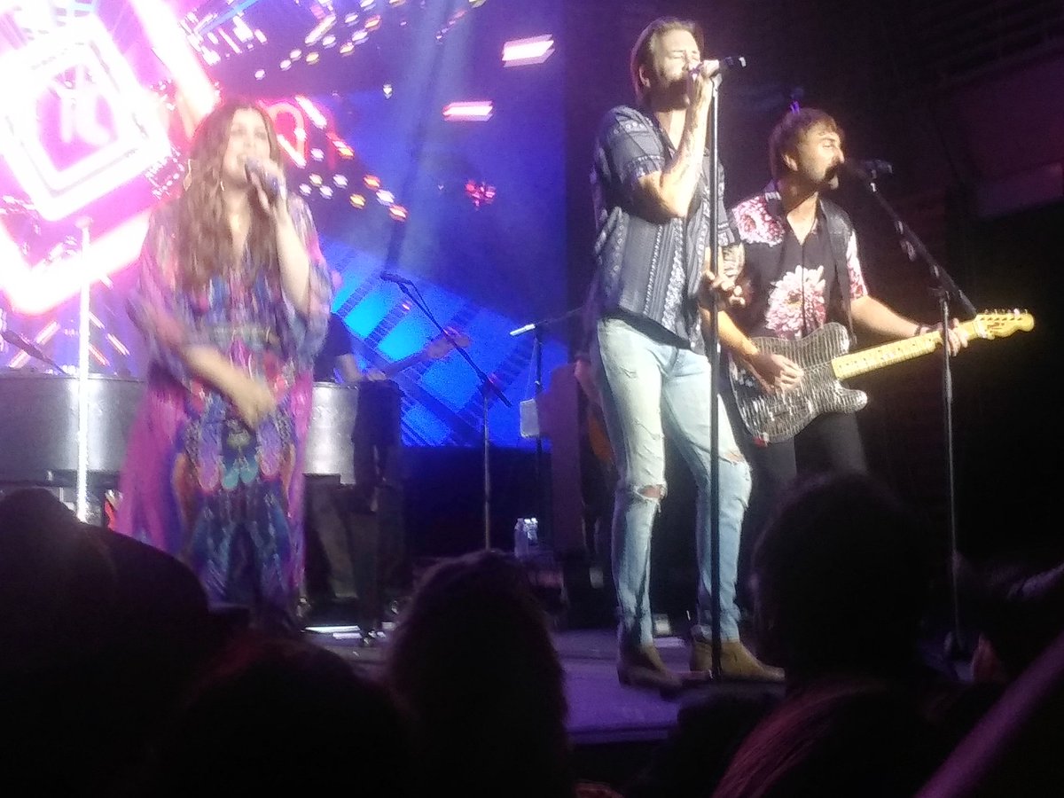
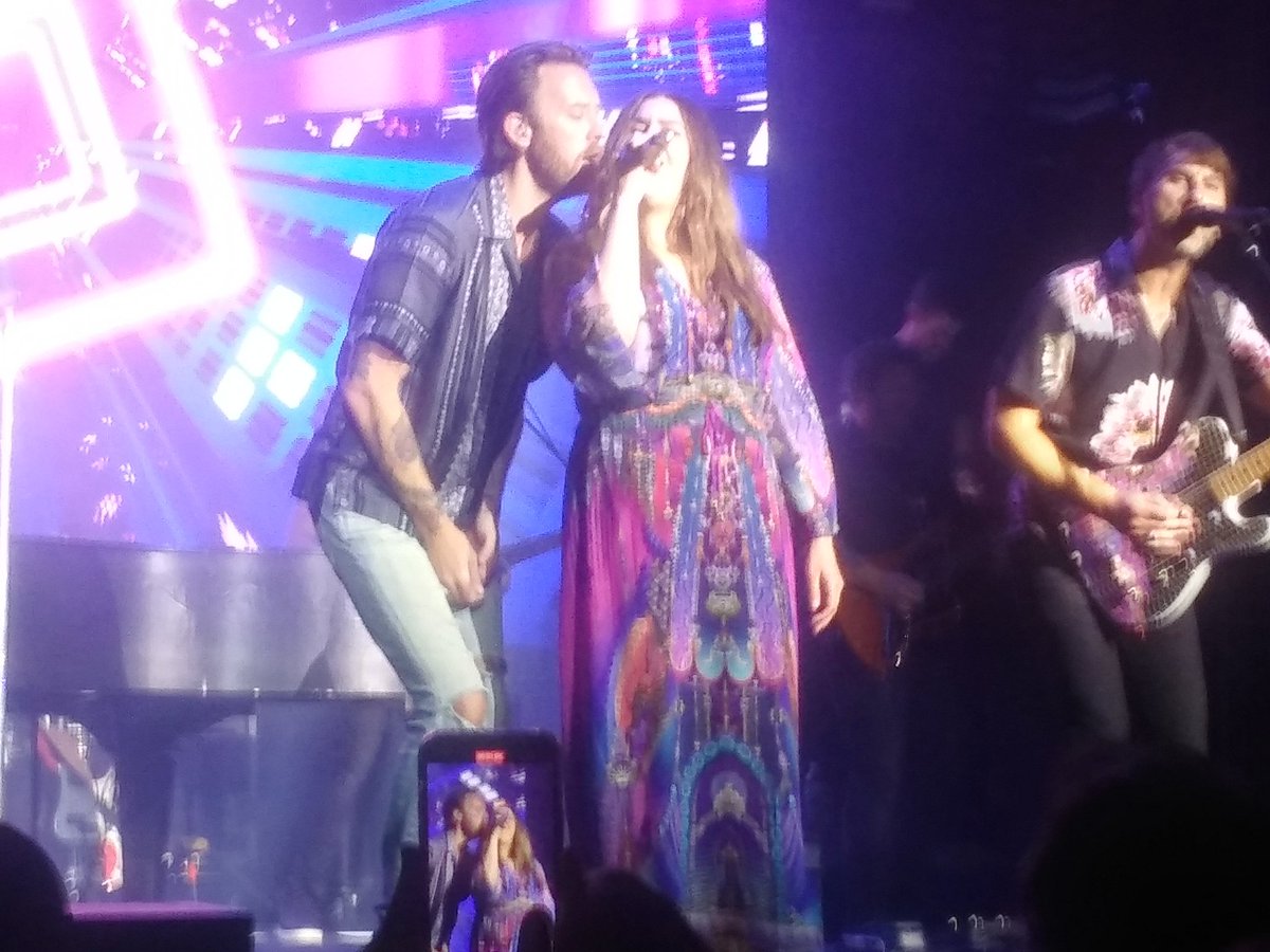
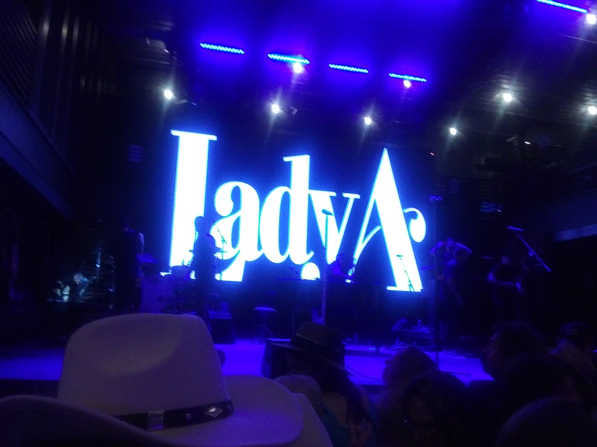
Lady A Fan Forever. Will always be there to support them. Met them at the 2013 FC Party - 2/22/14, SC - TMD Tour 8/7/15, NC - WU Tour 10/8/19 FE 10/23/19 🌊PE
Joined March 2009
- Tweets 6,615
- Following 605
- Followers 223
- Likes 7,543
778 Photos and videos


Pinned Tweet

22 Oct 2019

1
11
Jun 14
Another black person put in his place! More to come!!

5
Eric Hansen retweeted

Jun 10
On Tuesday evening, a 16-year-old carriage horse named Deniz collapsed and died in Central Park. He had two passengers in his carriage at the time. Witnesses watched him struggle to breathe before he stopped breathing entirely.
Deniz died roughly one week after Ryder's Law, a New York City bill that would have banned horse-drawn carriages, was set to take effect. The City Council's health committee voted in November not to advance it. Opponents said the bill was rushed and poorly considered. Supporters argued the committee was protecting the carriage industry over animal welfare.
Now, a petition is calling on the City Council to vote on the bill again and end horse-drawn carriages once and for all. To read or sign, go to Change.org/NYCHorses.
📸: @nyclass
#horses #nyc #horsecarriages #newyork #animals

12
75
104
6,763
Jun 9
When "Averages" and "Estimations" are used, that's a signal it was!
Jun 9

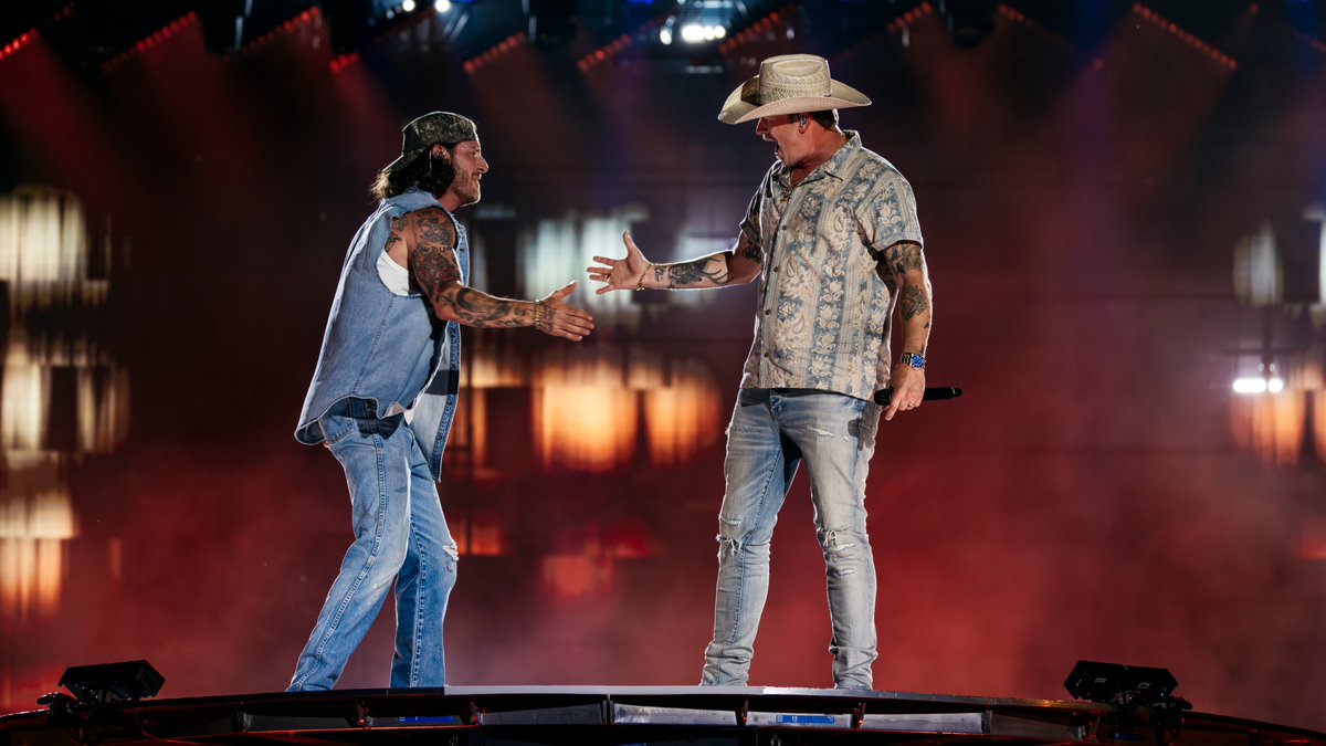
Don’t let anyone tell you it was poorly attended. #CMAFEST
9
Jun 9
🤔🙄😂

UPDATE: The Artemis III event will start at 11:30am ET (1530 UTC) on Tuesday, June 9!
18
Eric Hansen retweeted

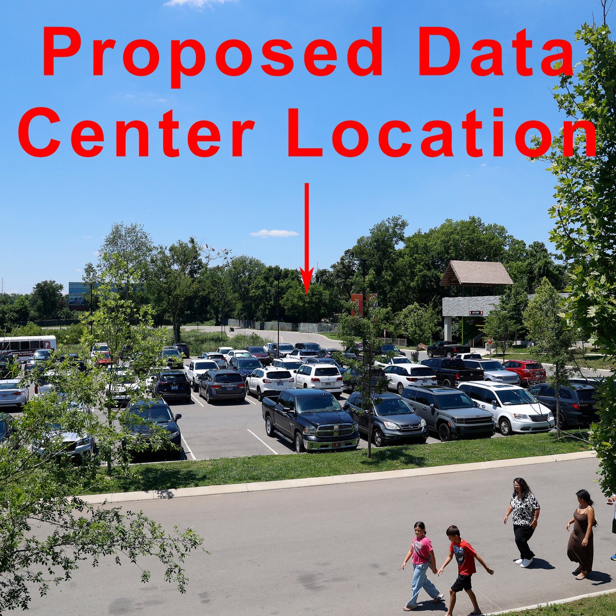
Stand with us to protect the future of Nashville Zoo.
A proposed 69,000-square-foot data center is planned next to the Zoo, but no environmental impact studies have been conducted. Sign our petition to help protect the animals in our care ➡️ c.org/KxhXznzBcD
252
11,637
32,400
3,113,925
Jun 7
Good Lord🙄!! #SomeoneSaveCountryMusic

Need a little good news? @ShaboozeysJeans is the @CountryMusic Fest Artist of the Day! 😍 Don’t get stuck singing the blues… Grab a seat by the #FanFairX CloseUp Stage at 1:30p. #DowntownNashville #CMAFest #GoodNews

ALT CMA Fest presented by SoFi / CMA Close Up Stage Fan Fair X / Shaboozey / Saturday, June 6
19
Jun 7
This is what all Country Artists need to stand up to and protect the Genre!! This is a disgrace and doesn't belong anywhere near Country Music! Start protecting what you value by not accepting this! #NotAllowed🚫

Wyoming rapper Ryan Charles throwing it down, jumping country music fences at the ASCAP Music Takeover at 6th and Peabody at #CMAFest
9
Jun 7
one Hit wonder is more like it!!😂😂

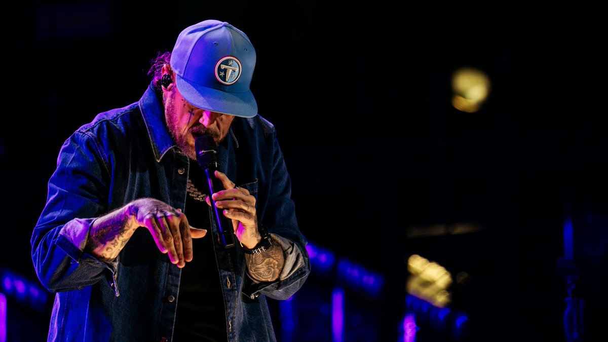
There’s just nothing like a guy and his guitar! 🎶 This #CMAfest crowd loved @ShaboozeysJeans performance!
#Nashville #MusicCity #Shaboozey @CountryMusic
7
Jun 7
Where are all the other Country artists standing up for the @NashvilleZoo against the #DataCenter? @BradPaisley can't be the only one against it! They need to quit being silent about things that affect @visitmusiccity and the Genre itself! #StartStandingUp #StopAcceptingIt
10


Apr 25
Her son is already screwed and he's not even born yet!!
Apr 24

A mother posted on TikTok that she’s playing “gay” music next to her baby bump hoping that it will make her son gay.
The entire comment section is FLOODED with to-be mothers and mothers sharing techniques they used or are using to make their own kids gay.
This is DISGUSTING.
11
Mar 25
I have many names for them!!

What do you call
someone who does this?? 😡
13
Mar 24
No reason to for someone who intervened in a situation they shouldn't have!!
Mar 24

Renee Good. Say her name.
16
Eric Hansen retweeted

Jan 25
Metro Government Opens Cold Weather Warming Locations ocv.im/DIMDtqQ

4
49
131
63,496
Eric Hansen retweeted

Jan 25
First Alert Weather Days: Crippling winter storm continues in Middle Tennessee wsmv.com/2026/01/24/first-al…
2
5
3,728
Eric Hansen retweeted

Jan 24
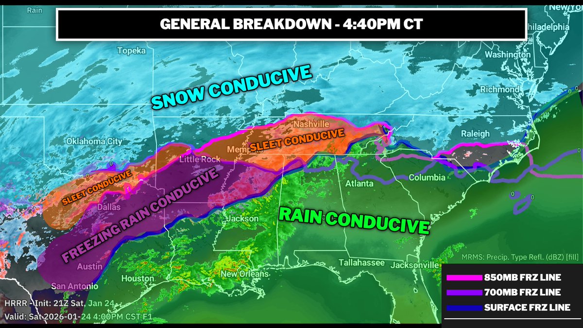
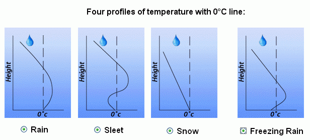
Using HRRR initiation and current temps from RTMA, we can estimate conducive precipitation types.
Areas below freezing at the surface level, 700mb level, and 850mb level are mostly all snow.
Areas that are below freezing at the surface and at the 700mb level are mostly sleet.
Areas that are below freezing at the surface but not at the 700mb or 800mb level are likely mostly freezing rain.
Areas above freezing are all rain.
This isn't 100% accurate, but gives you an idea of what we are dealing with. This warm nose will continue to push north.
16
15
146
36,057
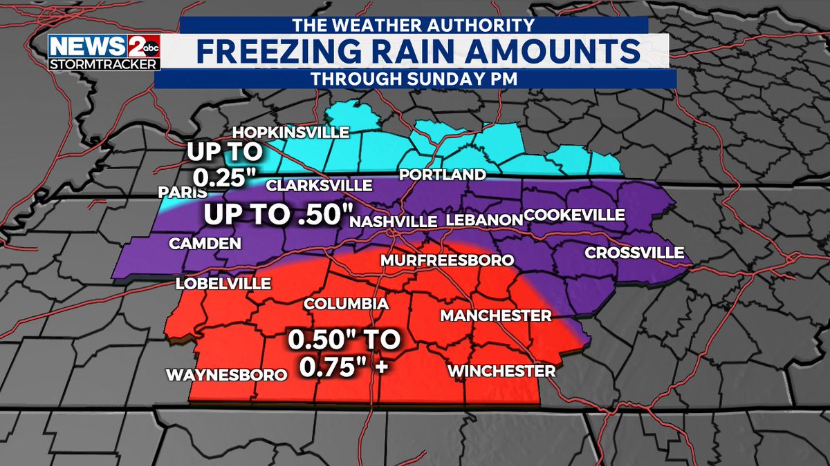
Eric Hansen retweeted

VERY CONCERNING PLEASE SHARE! Ice totals are growing as we are already seeing freezing rain in our southern counties! This will lead to severe impacts including making travel nearly impossible, downed trees, and power outages! Watch @wkrn now for the latest!
7
33
142
39,406
Eric Hansen retweeted

Jan 22
Despite uncertainty still regarding precipitation type, we are still confident that significant impacts will be felt this weekend.
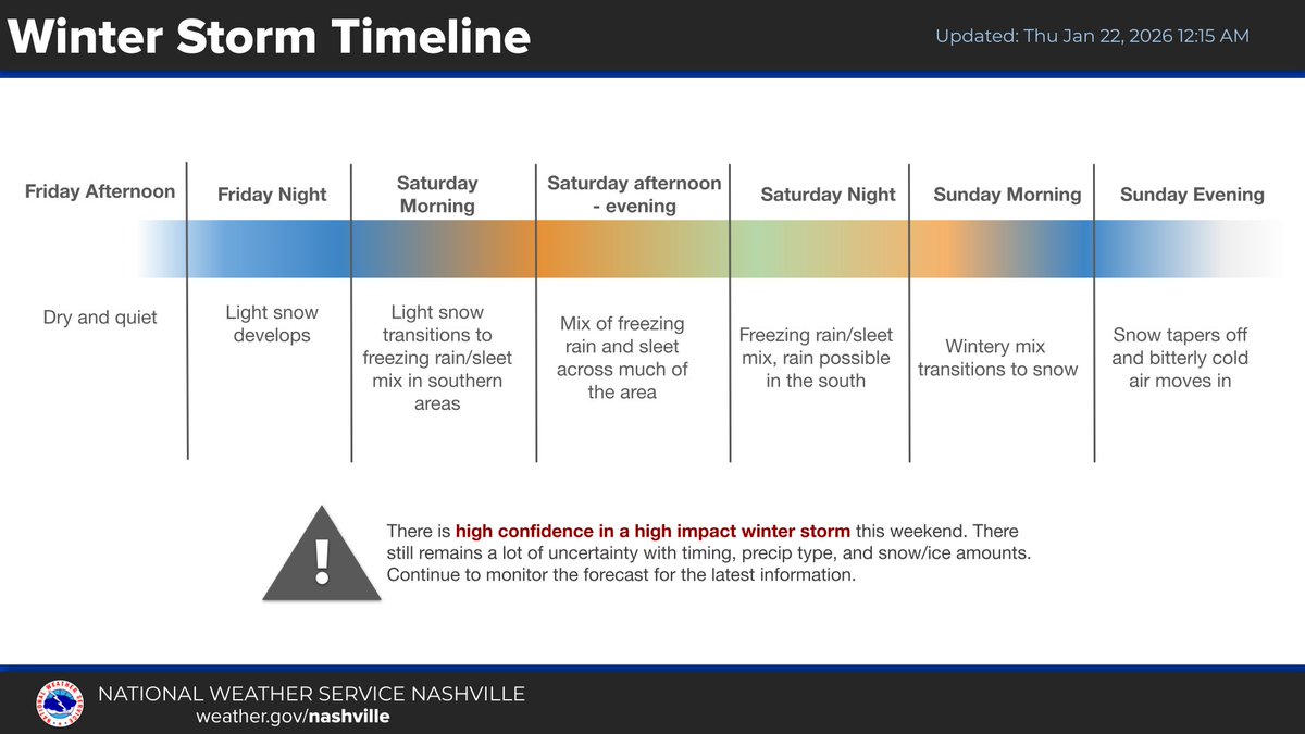
ALT Winter Storm Timeline. Light snow develops Friday night. Saturday morning and into Saturday night, snow will transition to freezing rain and sleet, and then transition back to snow Sunday morning. There is high confidence in a high impact winter storm this weekend. There still remains a lot of uncertainty with timing, precipitation type, and snow and ice amounts. Continue to monitor the forecast for the latest information.
2
3
38
19,419
Eric Hansen retweeted

Jan 16
Democrats do not want our borders secured, and they do not want criminal illegal aliens deported from our country.
That's why Democrats have dangerous sanctuary policies in place that block local and state law enforcement from working with the Administration to remove violent illegal aliens.
That's why Democrats demonize and put a target on the backs of federal law enforcement officers who are simply doing their jobs to keep Americans safe.
And that's why Democrats are recklessly calling to defund federal law enforcement and abolish ICE.
Democrats will not keep the American people safe.
2,026
2,811
14,441
181,584