
Meteorologist - WESH 2/Hearst TV Design. Central Florida native; Private Pilot, Space nerd. Always trying to 'be the sunshine'.
Joined March 2009
- Tweets 142,958
- Following 3,419
- Followers 41,394
- Likes 12,774
86,226 Photos and videos


Pinned Tweet

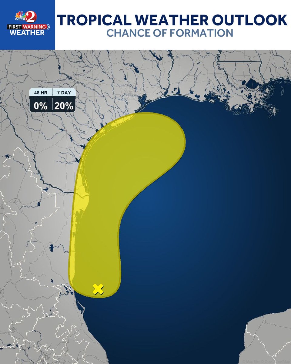
Southwestern Gulf low still expected to move inland over eastern Mexico soon. Possible re-emergence over the northwestern Gulf Tue-Wed, but conditions only marginally favorable. Formation odds remain low at 10% (48hr) and 20% (7-day).
1
5
1,097
Southwestern Gulf disturbance now near 0% development in 48 hrs (down from 10%) as the low moves inland over eastern Mexico. Could re-emerge over the northwestern Gulf Tue or Wed, but conditions only marginally favorable. 7-day odds remain 20%.
2
167
Flash Flood Warning until midnight for Orange and Seminole Counties. 2–4 inches already fell, more coming. Streets and underpasses flooding now in Orlando, Winter Park, Maitland and Altamonte Springs. Stay off the roads.
6
871
60 mph wind gusts are moving through Longwood right now, pushing toward Sanford and Apopka. Get away from windows and move to an interior room. Roof and tree damage is likely with this storm.
1
2
793
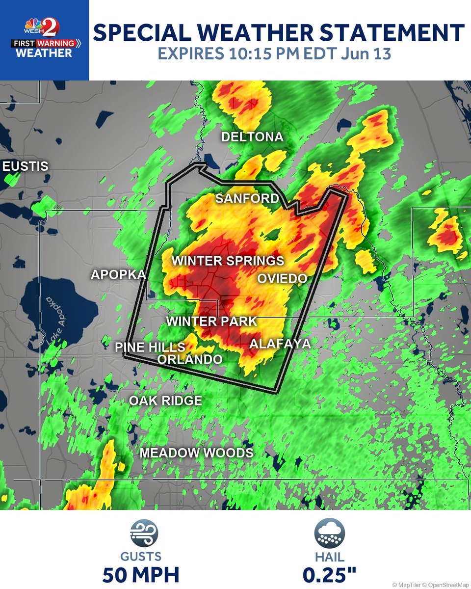
A strong thunderstorm near Longwood is moving north toward Orlando, Sanford, and Altamonte Springs with wind gusts up to 50 mph and pea-size hail. Secure any loose items outside and watch for falling tree limbs.
4
742
Heavy rain is pushing up to 2.5 inches across Orange and Seminole Counties, with another 2 inches still possible. Low-lying roads in Orlando, Sanford, Altamonte Springs, and Winter Park are seeing ponding now. Avoid flooded streets and never drive through standing water.
2
8
1,122
This puppy in Seminole is throwing a TONNNNN of lightning.
1.8" so far at my house and going...
Pool is happy...
2
3
744
Wind gusts to 50 mph and pea size hail are possible right now near Auburndale and Fussels Corner, with that storm nearly sitting still. Lakeland, Winter Haven, and Bartow should secure any loose outdoor items immediately.
728
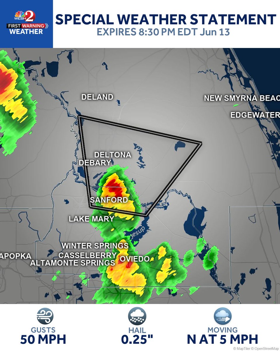
Gusty winds up to 50 mph and penny size hail are possible as a strong storm moves through Deltona and Orange City toward DeLand and New Smyrna Beach. Secure anything loose outside before this one arrives.
4
693
Gusty winds up to 50 mph and small hail are moving through Sanford right now, pushing slowly north toward Deltona. Secure any loose items outside and stay away from windows until this passes.
4
713
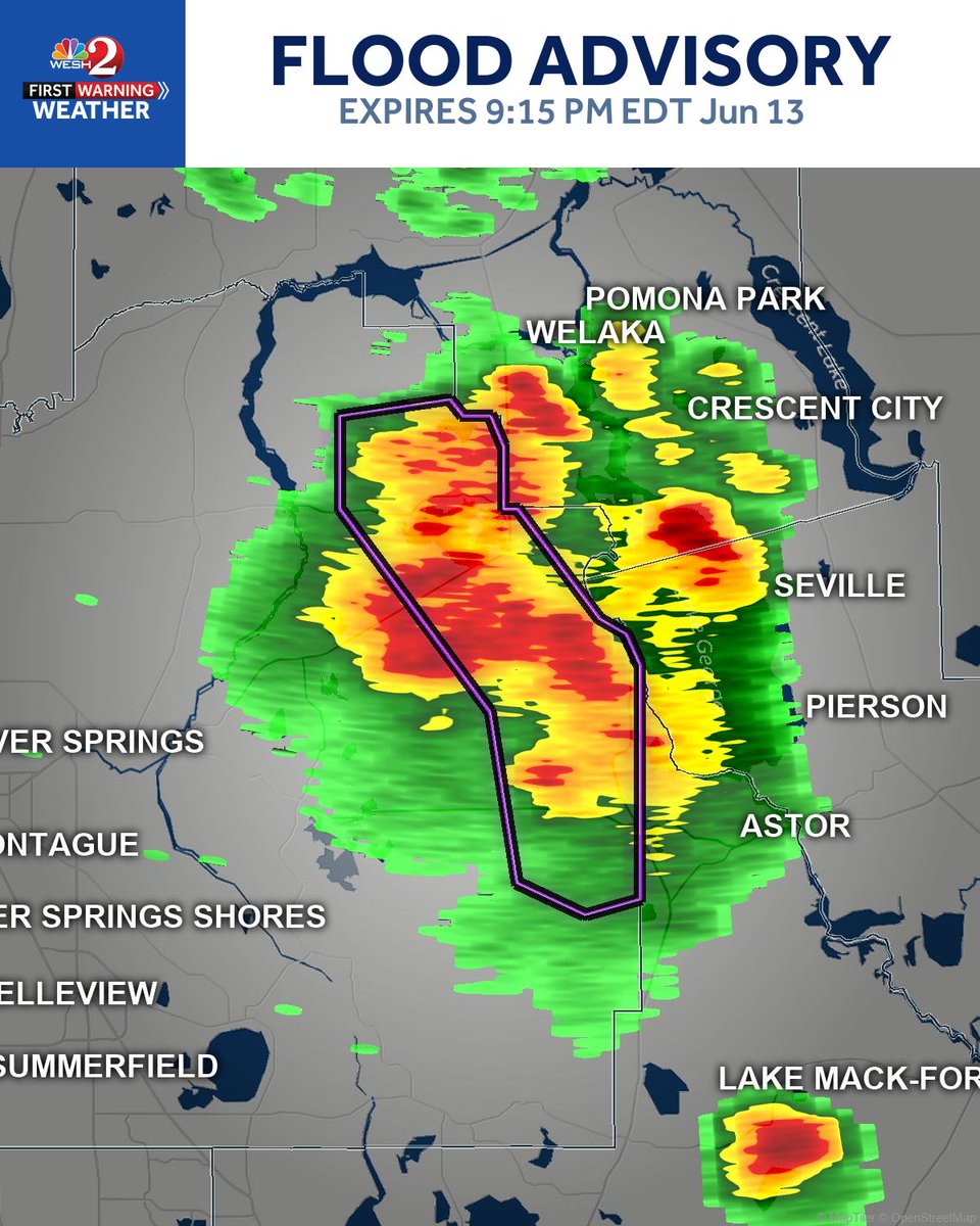
Heavy rain has already dropped 1 to 3 inches across Marion County, and low-lying areas near Salt Springs, Juniper Springs, and Lake Delancy are seeing flooding right now. Avoid any standing water on roadways and move to higher ground if needed.
1
656
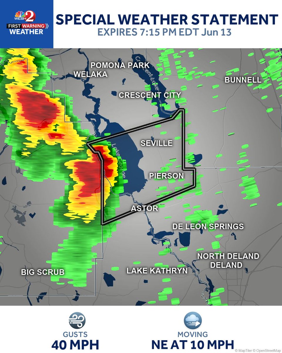
Gusty winds up to 40 mph are possible near Pierson, Lake George, and Seville as a strong storm pushes northeast at just 10 mph. Secure any loose items outside and watch for falling tree limbs.
612
A strong thunderstorm near Wauchula is nearly stationary, packing wind gusts to 50 mph and half inch hail. Unsecured objects could blow around and tree limbs may come down across Fort Meade and Bowling Green. Move inside now if you are in those areas.
575
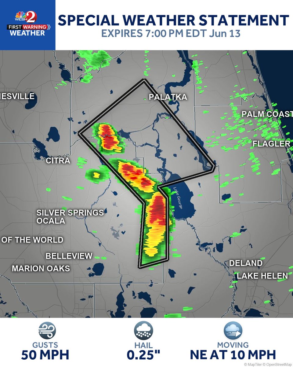
Strong storms packing wind gusts up to 50 mph and pea-size hail are pushing northeast through Palatka, Crescent City, and Interlachen. Secure any loose objects outside and watch for falling limbs.
679
Gusty winds around 40 mph are possible near Orange Springs and Hog Valley as a strong storm moves east at just 10 mph. Loose items outside could be tossed around and tree limbs may come down.
1
1
565
Strong thunderstorms near Juniper Springs could bring wind gusts of 40 to 45 mph, enough to snap tree limbs and toss around anything left unsecured. Move loose items inside now if you're in eastern Marion County.
1
621
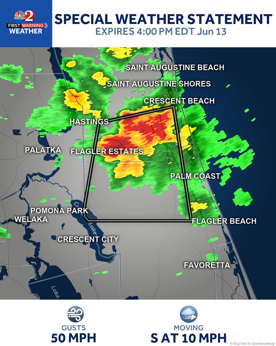
Gusty winds up to 50 mph are possible in Palm Coast and Bunnell as a strong storm pushes south through the area. Secure any loose items outside now, and watch for falling tree limbs.
1
612
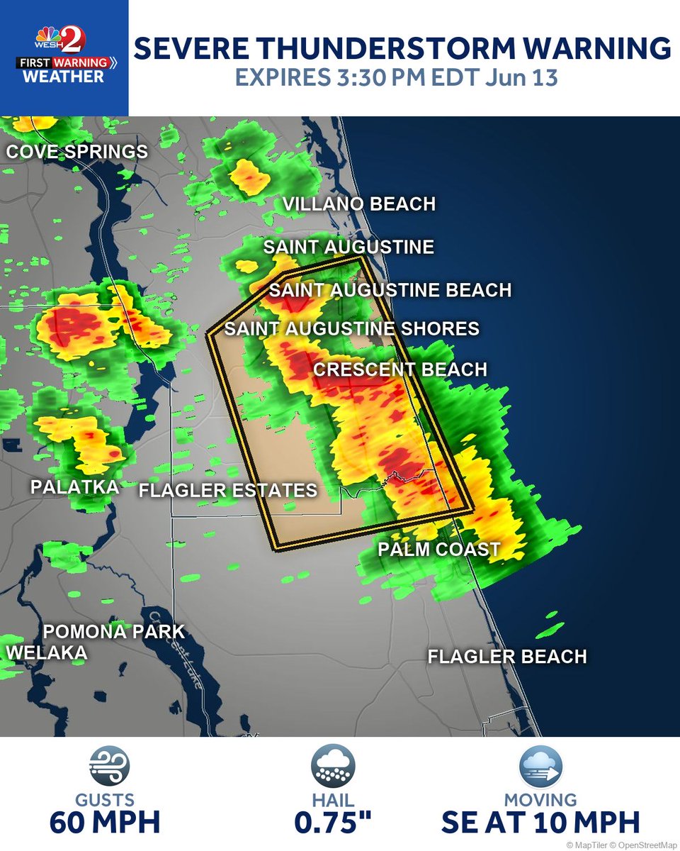
Sixty mph wind gusts and penny size hail are moving through Saint Augustine Shores right now, tracking southeast toward Saint Augustine Beach and Crescent Beach. Get inside and away from windows immediately.
1
3
603
Gusty winds around 40 mph are possible near Crescent Beach and Saint Augustine Beach as a strong storm pushes south. Loose items could get tossed around and tree limbs may come down, so bring in anything unsecured outside.

721
Tropical outlook update for the SW Gulf. Development odds cut in half (20%→10%) as the low nears eastern Mexico and is expected to move inland by Sunday. A 20% 7-day chance remains if it re-emerges near a frontal boundary Tuesday or Wednesday.

7
673