
Esri builds #ArcGIS, the leading location intelligence and spatial analytics software for mapping, 3D GIS, imagery, and geospatial app development.
Joined September 2008
- Tweets 21,181
- Following 64,899
- Followers 188,745
- Likes 12,471
9,530 Photos and videos


Inspire your future self with this stunning 2027 wall calendar! 🤩 This 16-month calendar features maps made by some of your favorite Esri cartographers.
🔸Take a peek at each month’s map: ow.ly/nIKu50YVl2s
3
862
Movement isn’t just eye-catching—it can shape how your story is understood. Maps that move reveal where things go, how they get there, and what changes along the way. 🗺️
Explore stories and learn techniques for adding dynamic movement to your own maps. bit.ly/4vbKu6K
8
17
1,668
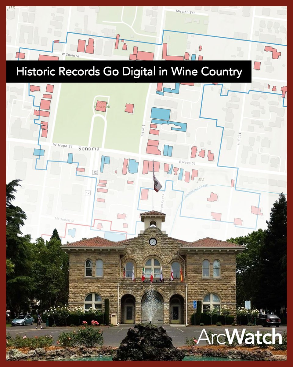
Sonoma’s architecture reflects layers of history from Indigenous communities to Spanish, Mexican, and early American eras. A new ArcGIS Experience Builder app helps staff manage historic sites with data that is easier to access and maintain.
Read more: bit.ly/3PMuBny
1
3
918
Most of our planet is ocean, and most of that is still a mystery! 🌊
Dr. Sylvia Earle shows us how GIS and Esri software are helping scientists uncover powerful patterns hidden deep below the surface.
#WorldOceanDay
2
12
34
2,492
Headed to @EsriUC?🌎Get the inside scoop before it starts! Don't miss the UC Attendee Orientation live stream on June 23.
#EsriUC2026
Jun 4

Get the most out of your UC experience! 🙌
Join the UC Attendee Orientation live stream on June 23 at 8:30 AM PT. We'll share key tips and helpful info for both virtual and in-person attendees.
🔹Add to your schedule: bit.ly/4uecANe
#EsriUC2026
2
5
1,673
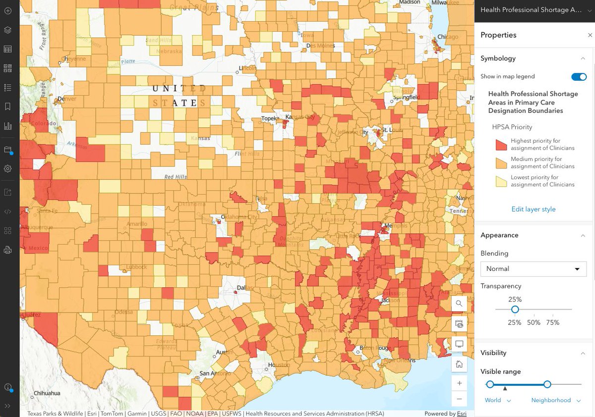
Health Professional Shortage Areas are now in ArcGIS Living Atlas. Access Primary Care, Dental Health, and Mental Health HPSA layers for smarter policy mapping. Included:
🔸Simple symbology
🔸Clear pop-ups
🔸Built-in metadata monthly updates
Details: bit.ly/4vw1QLl
1
5
1,001
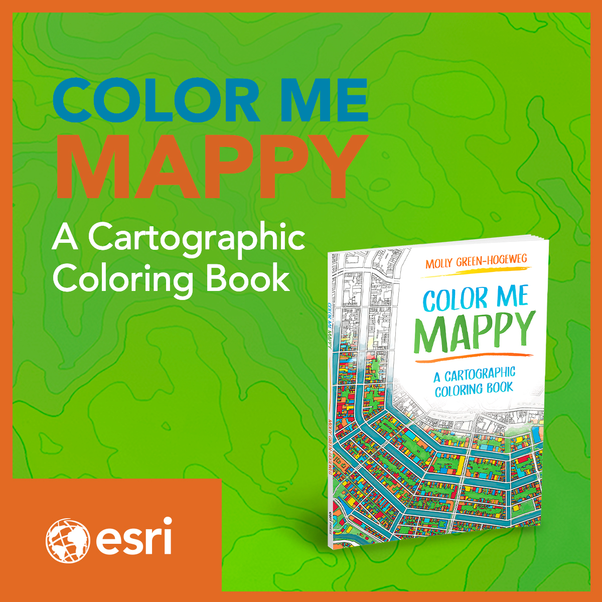
Discover the world - one line at a time. 🖍️
“Color Me Mappy” is the perfect coloring book for cartographers, map lovers, travel enthusiasts, and anyone who enjoys a little screen-free creativity.
Don’t worry, get mappy. 😁🗺️ ow.ly/hnbf50Z5Pbb
ALT Cover of 'Color Me Mappy,' a cartographic coloring book featuring a colorful street map illustration on a green topographic background.
2
11
2,487
How do you manage a museum campus at scale? The Henry Ford uses 3D GIS with ArcGIS Indoors to improve operations, safety, and visitor experience. Explore the story: bit.ly/3S4wQ6q
1
2
2
1,362
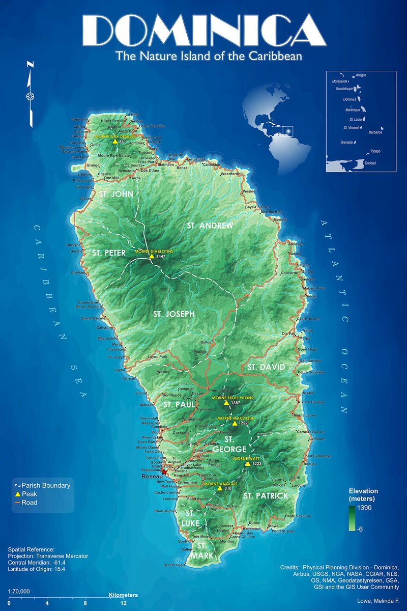
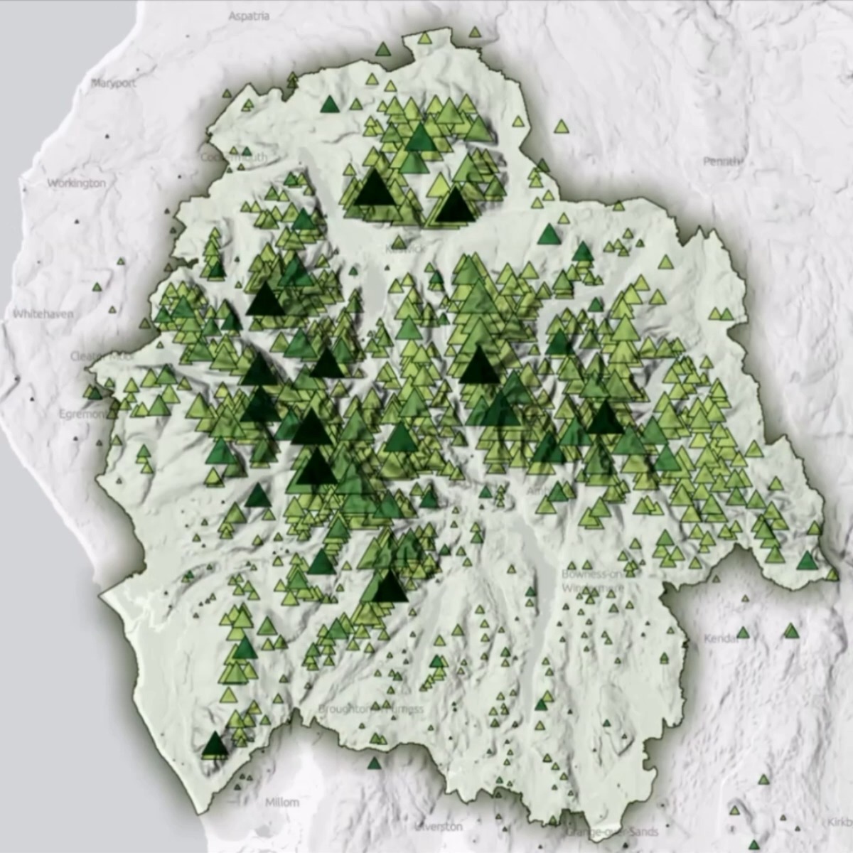
Discover Dominica! 🏝️
This Eastern Caribbean island has it all. Rugged terrain, lush forests, and incredible biodiversity, beautifully shown in this map. Learn more: bit.ly/4ffswLv
🗺️ Melinda Felicia Lowe, Western Illinois University
3
11
1,302
Ready for some inspiration? ✨
Hear from visionary leaders, watch live demos, and experience GIS in action through real-world stories of teams delivering meaningful results.
🔹Learn more: bit.ly/4v0AkFp
#EsriUC2026
4
1,258
Esri retweeted

🎨Alternative text. Color contrast. Headings and repeatable structure.
Little choices have big impacts on a story's #accessibility. Learn the basics in this NEW tutorial series—Foundations of accessible storytelling with #maps. ow.ly/vbo750Z2FUQ
#GAAD #StoryMaps
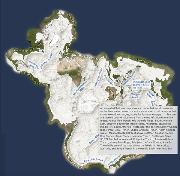
ALT A screengrab showing alt text describing a complex Spilhaus map from a story made with ArcGIS StoryMaps
6
16
2,186

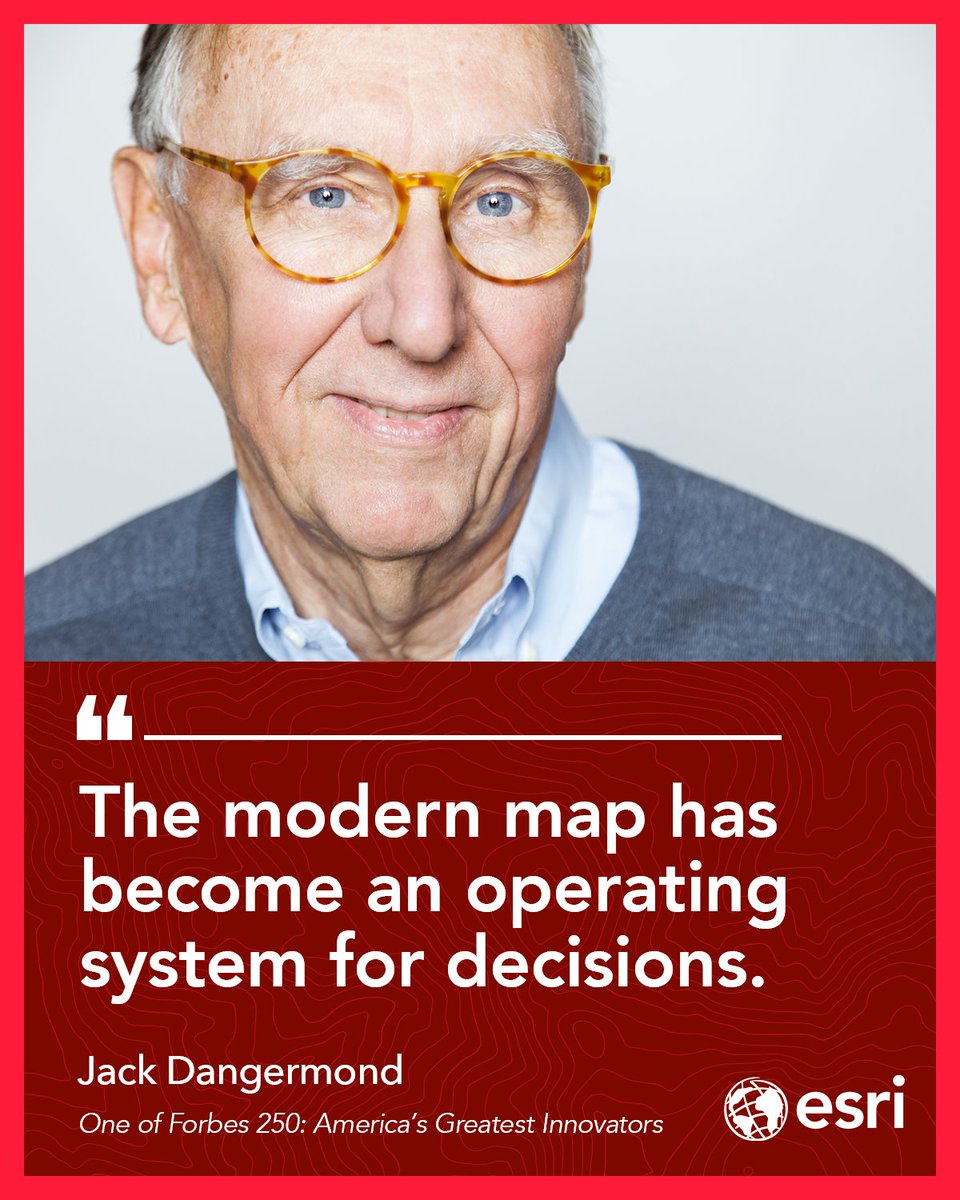
From the @america250 x Forbes America Innovates stage, Jack Dangermond, president of Esri, the mapping software company behind modern digital maps, and a Forbes 250 America’s Greatest Living Innovators honoree, spoke on AI and building a “nervous system for the planet.
⠀
#Forbes250 #America250
5
8
21
10,450
Ocean currents are vital to life on Earth, regulating climate and transporting nutrients and organisms. This animated map from @NASA’s Scientific Visualization Studio (SVS) highlights ocean currents at different depths. 🌊 bit.ly/4dmGete
5
50
140
7,762
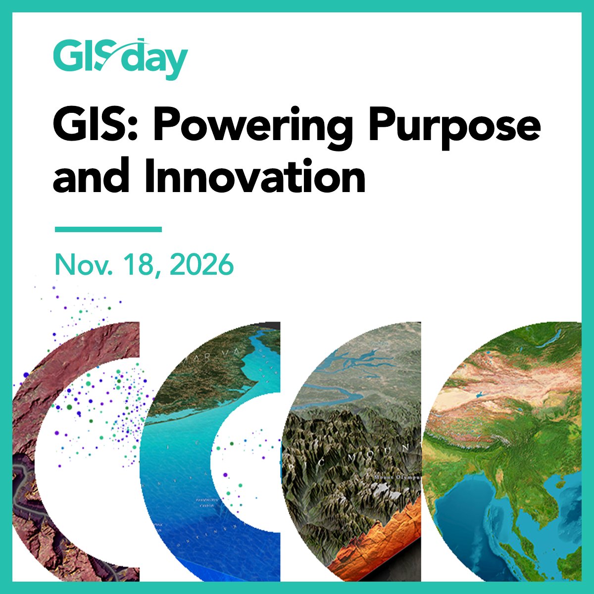
Mark your calendar for #GISDay2026! 🌎 Check out these great resources to plan your event.

The #GISDay2026 theme is here! Celebrate 𝐆𝐈𝐒: 𝐏𝐨𝐰𝐞𝐫𝐢𝐧𝐠 𝐏𝐮𝐫𝐩𝐨𝐬𝐞 𝐚𝐧𝐝 𝐈𝐧𝐧𝐨𝐯𝐚𝐭𝐢𝐨𝐧 on November 18. 🌎😍
Start planning your event with our media kit! There are stickers, social graphics, and videos to help you get started. ow.ly/pgzb50YZGpA
1
3
10
2,089
Put your map skills to work. 🗺️
Learn how visual structure, interaction, and layout come together to build powerful web maps. bit.ly/4f8KiQh
12
48
2,778
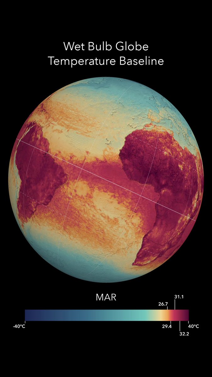
Global Wet Bulb Globe Temperature Baseline combines temp, humidity, wind, sun angle, and clouds to provide a 30‑year view of global heat stress, supporting safer outdoor work, heat risk planning, and nighttime cooling trends. Explore the dataset: bit.ly/42fYZcU
2
16
34
2,755
Coming soon! 📘 Learn ArcGIS basics, how to create and edit spatial data, the advantages of geocoding, and more in 𝘎𝘦𝘵𝘵𝘪𝘯𝘨 𝘵𝘰 𝘒𝘯𝘰𝘸 𝘈𝘳𝘤𝘎𝘐𝘚 𝘗𝘳𝘰 3.6. ow.ly/VY5E50YRvzh
ALT Book cover for "Getting to Know ArcGIS Pro 3.6" featuring geometric blue and orange design elements on a dark background.
3
13
1,228
Maps used to show us where things were. Now, they help us understand what’s happening and where to act.
In @Forbes, Jack Dangermond explores how modern maps are becoming dynamic, AI-enabled systems for decision-making across industries. bit.ly/4d7arxG
1
11
49
2,468
City to countrywide, mapped in jaw-dropping detail. 🗺️🤯
See how drone imagery and ArcGIS Reality Studio are redefining large area reality mapping with stunning 2D and 3D results. bit.ly/4nfVo8a
8
32
3,041
Discover the beauty of geography and maps with this 2027 wall calendar! 💚🌏 Each month features a beautiful map, fun facts, and more. ow.ly/8FiN50YT1aH
ALT 2027 Esri Press wall calendar featuring a colorful topographic map of South America on the cover.
2
18
3,121