
European Storm Forecast Experiment - A complete archive of ESTOFEX forecasts can be found at estofex.org
Joined April 2011
- Tweets 2,981
- Following 0
- Followers 19,114
- Likes 4
1,233 Photos and videos

A large area may experience severe storms tomorrow across Europe. It's a pretty complex setup as well, so make sure you read the text about the uncertainties and different scenarios at estofex.org
5
37
146
25,129
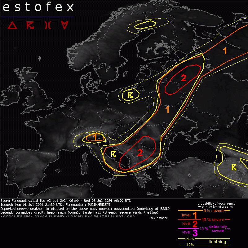
On Tuesday, severe weather shifts further E with the main threat being very heavy rainfall. Large hail and some downbursts will be likely as well. Read more at estofex.org
38
142
18,924
A Level 2 has been issued primarily for damaging wind gusts in a belt from N France towards Netherlands. Read more at estofex.org
4
68
198
33,537
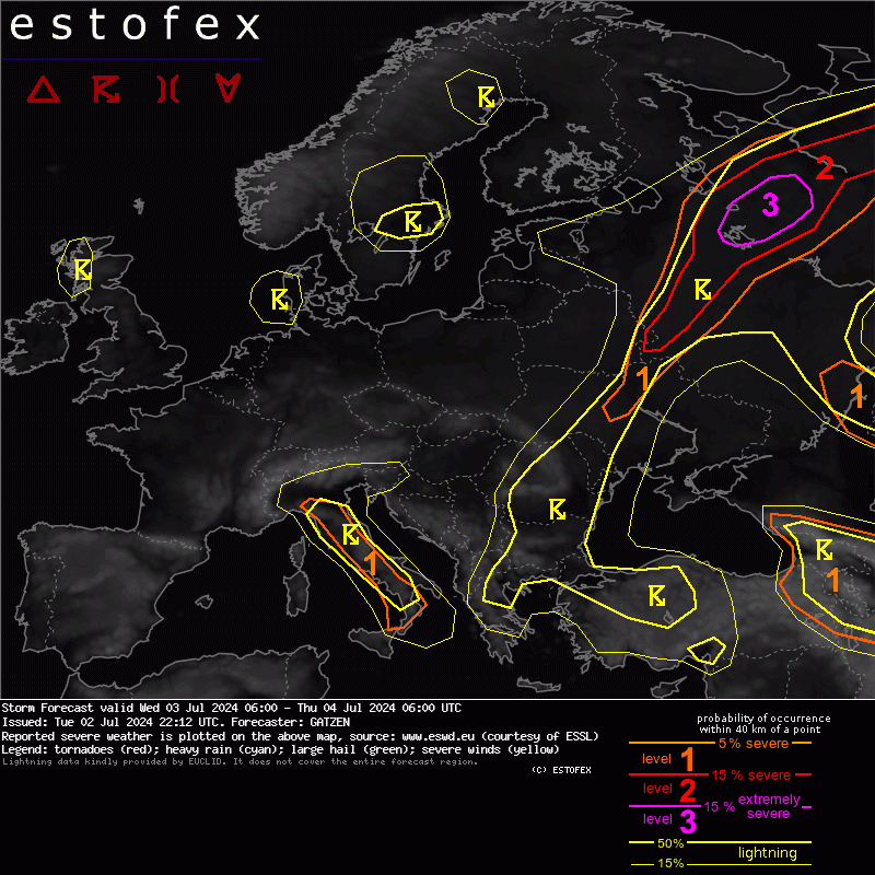
An outbreak of severe storms is expected over N Russia with strong tornadoes and swaths of severe to extremely severe winds possible. Read more at estofex.org
2
23
120
17,599
Severe weather continues across parts of S/SE and E Europe on Tuesday. The highest risk are is across S Serbia/SW Romania/NW Bulgaria, where severe to extremely severe wind gusts and very large hail will be possible. Situation over Russia is uncertain, see estofex.org
1
28
109
10,084
Reminder about likely severe weather outbreak across parts of Europe! Southern Lvl 3 (NW Italy) will feature especially destructive hail, while the Northern Lvl 3 (France to Germany) will feature a transition to damaging wind gusts. Read more at estofex.org
6
110
377
46,133
Potentially high-end severe weather situation is forecast across E France, NW Italy, Switzerland and W Germany. Read more at estofex.org
74
259
23,740
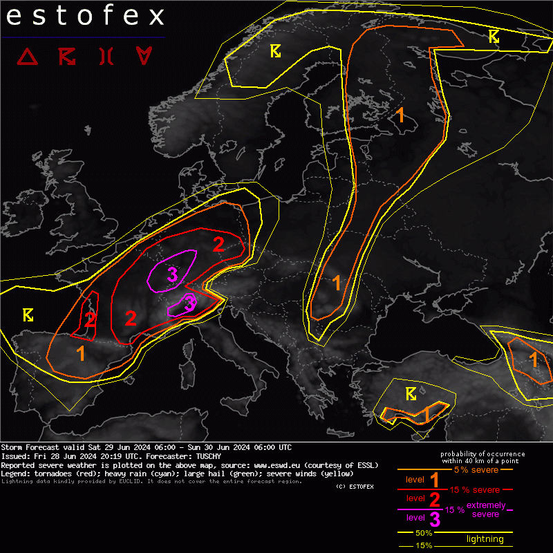
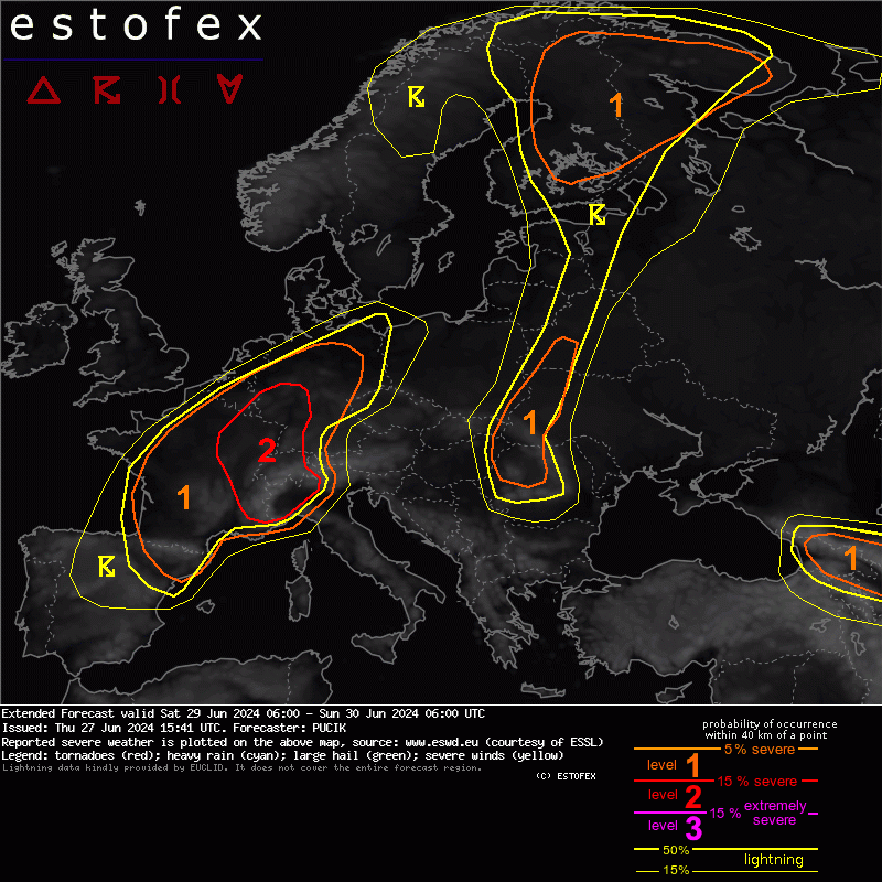
Severe weather continues throughout the weekend! Today, the highest risk will be in a belt from Bosnia through Serbia, Hungary, and Romania into E Slovakia and SE Poland. However, N Italy is also not out of the woods yet. Read more at estofex.org
8
52
190
25,718
Dangerous situation ahead for much of central Europe and northern Italy! Read more at estofex.org
11
140
493
114,106
Active severe weather pattern continues across Europe. The highest risk of severe storms is forecast across the flank of N Alps with threats of very large hail and severe wind gusts. Read more at estofex.org
3
50
241
24,354
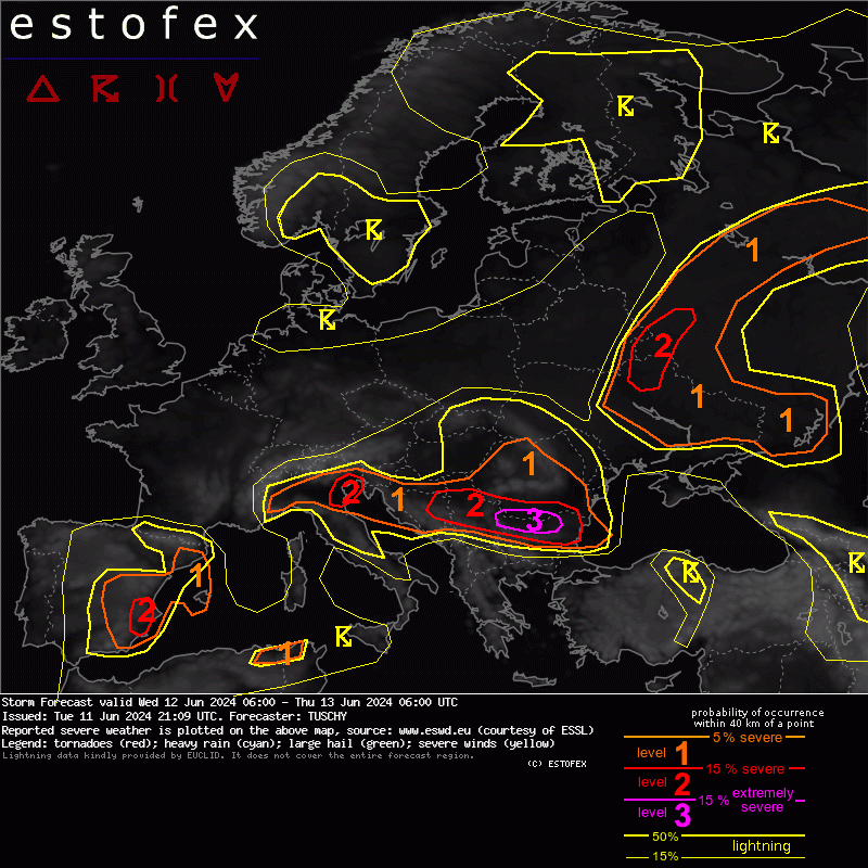
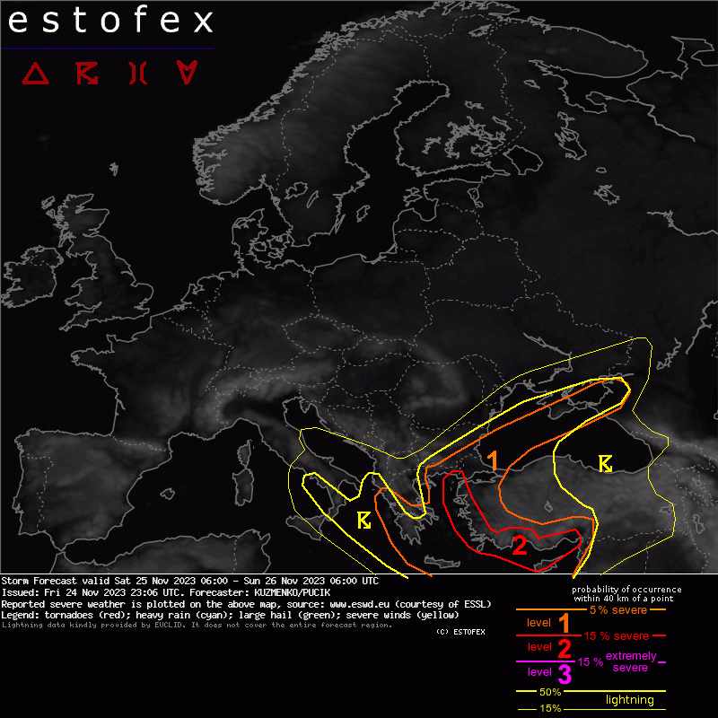
Active severe weather pattern continues over Europe! The highest severe weather risk is forecast in a belt from Serbia through S Romania and N Bulgaria with risks of very large hail and extremely severe wind gusts. Read more at estofex.org
9
63
227
49,618
Severe weather outbreak likely on Sunday from N Italy through Austria into W Hungary. The highest risk of destructive hail will be in N Italy, while the highest risk of damaging wind gusts and tornadoes in E Austria/extreme W Hungary. Read more at estofex.org
9
130
440
264,000
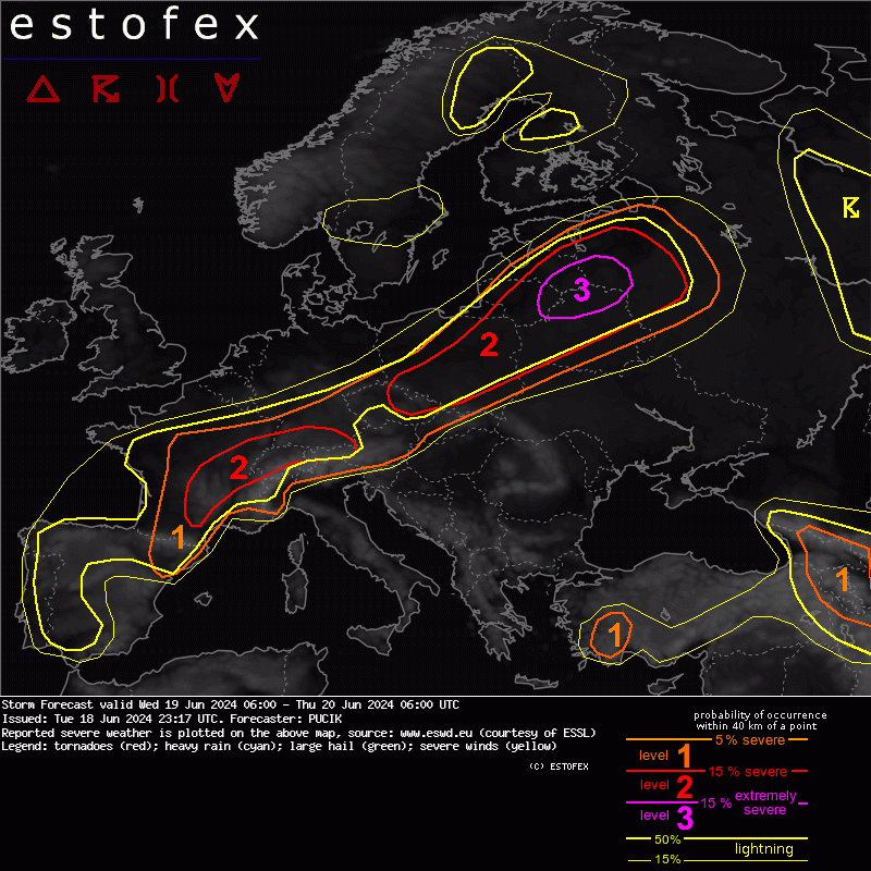
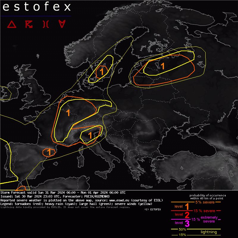
Severe weather outbreak possible tomorrow across parts of SE Europe. There are some uncertainties though, so make sure to read the full text at estofex.org
2
42
204
22,085
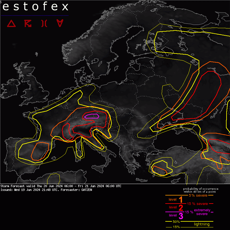
Due to the kinematically very impressive environment, a level 2 was issued across N Germany and NW Poland mainly for (strong) tornadoes and damaging wind gusts
Read more here: estofex.org/cgi-bin/polygon/…
3
37
146
13,728
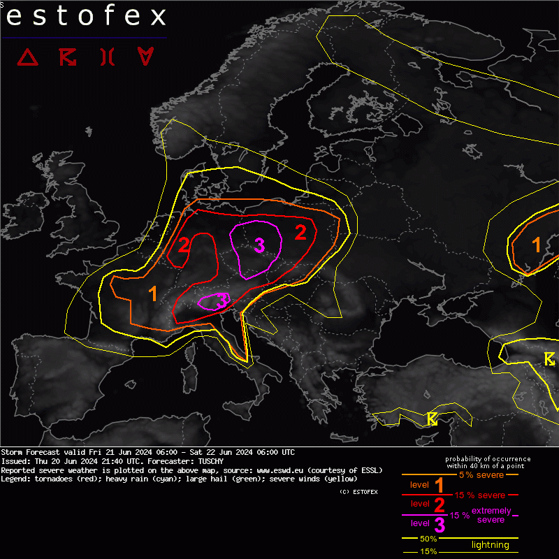
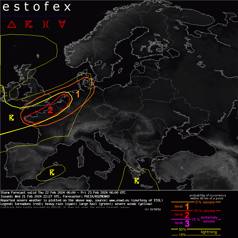
An active severe weather situation is expected on Thursday with tornadoes and severe wind gust being the primary threats. Read more here: estofex.org/cgi-bin/polygon/…
62
198
18,980
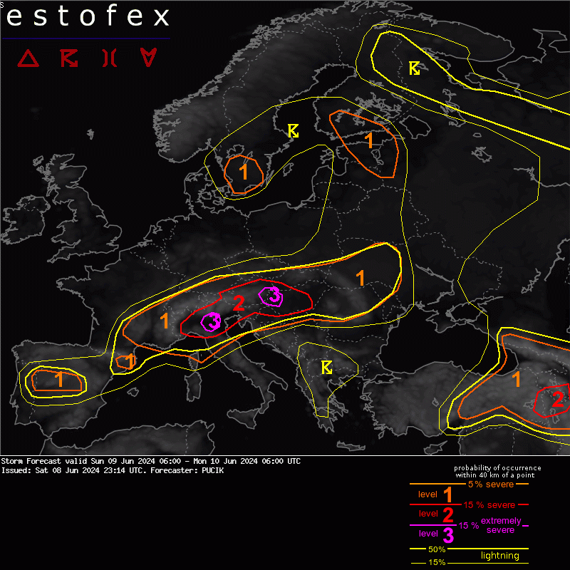
Numerous areas with potential for severe weather are forecast on Sunday. There are a number of uncertainties in many areas, including the effects of the dust on the solar insolation. Read more here: estofex.org/cgi-bin/polygon/…
2
44
137
19,662
Lvl 2 has been issued for damaging wind gusts and tornadoes across NW France and BENELUX. Read more at estofex.org Please also note that ESTOFEX covers the contribution of convective storms to severe weather.
4
66
190
31,723
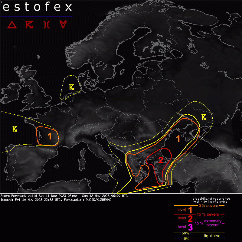
A late-season severe weather outbreak is forecast across the E Aegean Sea, W and S Turkey and possibly also over Cyprus. Numerous rounds of storms are forecast with multiple different hazards. Read more here: estofex.org/cgi-bin/polygon/…
28
128
48,840
Another Saturday, another severe weather situation over parts of Greece, Turkey and Bulgaria. Read more here: estofex.org/cgi-bin/polygon/…
1
23
106
18,387