Official X profile account for the Fort Worth Office of Emergency Management. This page is not monitored 24/7. If you have an emergency call 911.
- Tweets 2,851
- Following 497
- Followers 11,945
- Likes 2,281


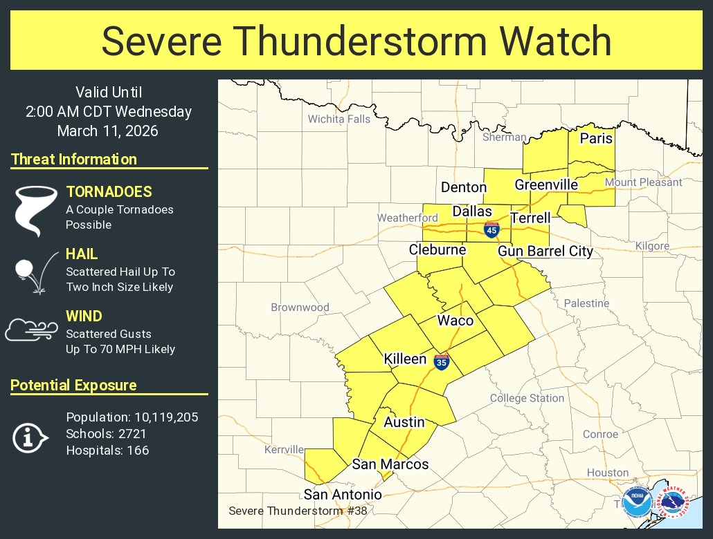
ALT This graphic displays Severe Thunderstorm watch number 38 plotted on a map. The watch is in effect until 2:00 AM CDT. The watch includes parts of Texas. The threats associated with this watch are a couple tornadoes possible, scattered hail up to two inch size likely and scattered gusts up to 70 mph likely. There are 10,119,205 people in the watch along with 2721 schools and 166 hospitals.


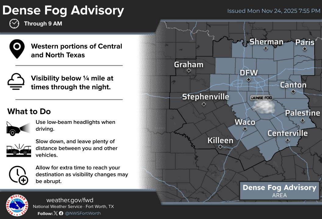
ALT A Dense Fog Advisory is in effect for parts of Central and North Texas through 9 am. Visibility may drop to less than 1/4 mile at times through the night. Slow down and drive with extreme caution in the fog.
ALT A Dense Fog Advisory is in effect for parts of Central and North Texas through 9 am. Visibility may drop to less than 1/4 mile at times through the night. Slow down and drive with extreme caution in the fog.