
Joined November 2025
- Tweets 221
- Following 237
- Followers 599
- Likes 296
33 Photos and videos


Pinned Tweet

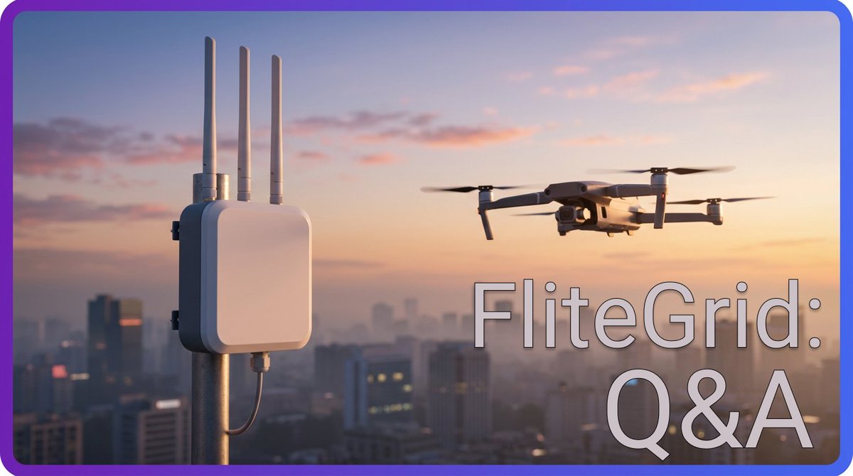
Mar 11
FliteGrid: Q&A Thread
Q: What is FliteGrid?
FliteGrid is a decentralized physical infrastructure network (DePIN) that detects, tracks, and identifies unmanned aerial vehicles. Its sensors monitor airways and read Remote ID data from passing drones, documenting their flight paths and capturing key identifying information. This data is then compiled on a platform for monitoring American drone traffic, which government and commercial entities pay to access.
23
6
118
8,623
Jun 11
Q: How will hex value be determined?
A: A hex's value is determined by the number of potential and existing customers inside of it.
"We've basically built out a nationwide map of all of the different types of industries that care about airspace. So that's critical infrastructure, public safety, prisons, airports.
Any hex that is covering or adjacent to any of those types of industries, we're adding that up and that creates the multiplier. So the more types of customers who care about this data that are in that area, the more valuable that hex is."
1
13
293
Jun 11
Want to join us in monitoring the skies?
Order your FliteNode with a $50 deposit today:
bit.ly/43q0K7T
1
2
89
Jun 10
Q: How do I know my location's value?
A: The hex grid is coming!
"Sometime within the next two weeks, we're going to be rolling out a hex grid map on the site.
So you can look where you're going to deploy systems, and you can look at what the rough value of that is."
2
1
15
253
Jun 10
Want to join us in monitoring the skies?
Order your FliteNode with a $50 deposit today: bit.ly/4uqkmUo
1
2
82
FliteGrid retweeted

Jun 10
"Who actually pays for drone data?"
@skysafe does the selling, already serving big customers like the PGA Tour, Motorola Solutions, and even the state of Rhode Island.
FliteGrid is how that coverage scales. Deploy a sensor, feed the network that customers rely on, get rewarded.
Jun 8

Q: How do I know if my location is good for FliteGrid deployment?
A: It's probably better than you think!
"If you live in any major city in America, you live near critical infrastructure like airports, stadiums, borders, or ports.
All of those are critical areas, and customers for us at SkySafe right now."
1
1
5
612

So I've been looking into @FliteGrid lately and i'm actually impressed, It's the world's first DePIN drone tracking network, built by @SkySafe (the team already trusted by DHS, FAA, military & PGA Tour).
There are 100k drones in the US broadcasting Remote ID right now… and most go completely unseen. The FAA wants nationwide visibility and is willing to pay for real data. SkySafe has already proven the tech (1M flights tracked).
You deploy a plug-and-play sensor → detect drones in real time → earn rewards (points converting to $FLITE tokens on launch in 2027).
Making our skies safe from rogue drones, blind spots, and invisible threats... while getting paid for it.
This isn’t some random crypto miner. It’s real critical infrastructure backed by a $50M venture backed company with battle tested enterprise tech.
Real revenue, verifiable revenue.
If you’re in the US, position yourself early in the drone intelligence economy.
Pre-order here: flitegrid.io?sca_ref=1150945…
Who’s grabbing a node?
(US only for now, international orders will be cancelled. Japan & EU expansion planned for 2027.)

1
5
208
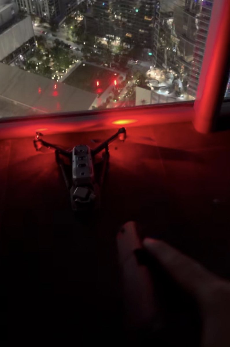
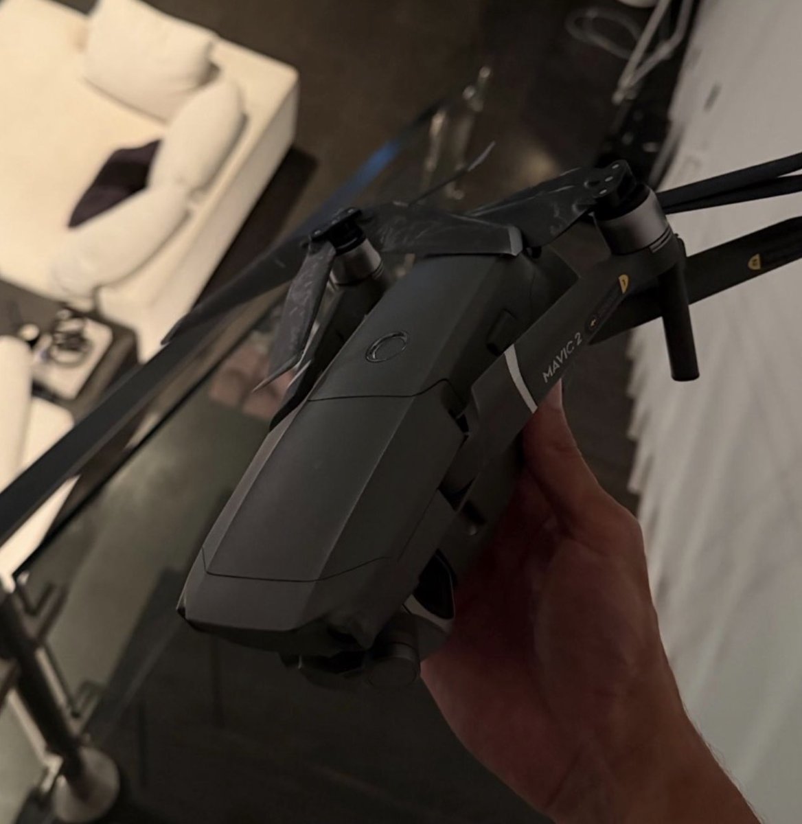
Jun 9
Not a big news story, just a casual drone crash.
Maybe UTM could prevent this type of thing.
Maybe you could get paid to help.

Someone crashed his drone into the condo I own in Miami, FL
Restricted airspace, at night, above 400 feet. What are the odds?
The recovered SD card contains flight footage and possible images of the pilot. Was it targeted or not?
Either way, this is EXACTLY why we need domestic counter-UAS interceptor capabilities. @FAADroneZone @DHSgov
1
10
249
Jun 8
Q: How do I know if my location is good for FliteGrid deployment?
A: It's probably better than you think!
"If you live in any major city in America, you live near critical infrastructure like airports, stadiums, borders, or ports.
All of those are critical areas, and customers for us at SkySafe right now."
2
2
16
1,078
Jun 8
Curious about FliteGrid? You're not alone!
Check out the video from last week's AMA with @gjordan, and if we didn't touch on your questions, let us know in Discord and we'll get them next time:
youtube.com/watch?v=D3CACg3P…
1
2
146
Jun 8
Motorolla is paying $1.5B for a counter-UAS company because they know drone traffic is about to go parabolic.
And FliteGrid is the only network building comprehensive, nationwide detection capable of handling it.

Motorola Solutions targets rogue drones with $1.5 billion D-Fend deal reut.rs/4dKiDnK reut.rs/4dKiDnK
3
2
15
747
FliteGrid retweeted

After today’s FliteGrid AMA, I’m seriously paying attention.
This is not just another “DePIN idea”.
FliteGrid is backed by SkySafe, a company that has been building drone detection and airspace intelligence for years.
The thesis is simple:
Drones are exploding.
Remote ID creates the data layer.
Airspace needs visibility.
Community sensors can scale faster than centralized infrastructure.
That is a monster DePIN setup.
Hardware in the real world.
Data with enterprise value.
A clear regulatory tailwind.
And a token model coming later on Solana.
This is exactly how serious DePIN should look.
@FliteGrid

1
2
18
589
FliteGrid retweeted

Jun 4
Tune in now to hear the latest from @FliteGrid 🚁
First bit of alpha - a Hex map is coming soon!
May 27
Join us on Discord for the first FliteGrid AMA!
CEO @gjordan will be answering your questions next Thursday, June 4th at 1:00pm EST.
Any questions you have can be posted in the # ama-questions channel, just let us know if you need an invite 👇
1
12
617
FliteGrid retweeted

A new #DePIN is launching and holding their first AMA.
They are already a successful business, which is more than you can say for 99% of DePIN startups. They going DePIN route to expand.
$FLITE TGE confirmed for operators.
Worth joining the Discord and tuning in.
May 27
Join us on Discord for the first FliteGrid AMA!
CEO @gjordan will be answering your questions next Thursday, June 4th at 1:00pm EST.
Any questions you have can be posted in the # ama-questions channel, just let us know if you need an invite 👇
2
2
13
1,183
Jun 4
Two hours until the first AMA with our CEO @gjordan!
Join us on Discord at 1:00pm EST to hear your FliteGrid questions answered.
May 27
Join us on Discord for the first FliteGrid AMA!
CEO @gjordan will be answering your questions next Thursday, June 4th at 1:00pm EST.
Any questions you have can be posted in the # ama-questions channel, just let us know if you need an invite 👇
1
1
10
398
Jun 2
Two days left to submit questions for the FliteGrid AMA!
Our CEO @gjordan will speak on:
- Which locations are most valuable
- How to earn USDC for referring customers
- How non-deployers can participate
Any questions you have, submit them on Discord. Now is your chance!
May 27
Join us on Discord for the first FliteGrid AMA!
CEO @gjordan will be answering your questions next Thursday, June 4th at 1:00pm EST.
Any questions you have can be posted in the # ama-questions channel, just let us know if you need an invite 👇
1
3
15
791
Jun 2
Questions can be submitted in the # ama-questions channel on Discord.
This invite will be good for 7 days:
discord.gg/Cx672vZg
4
90
Jun 1
A new week, a new drone story!
In this case, California firefighters used Remote ID to catch drones entering unauthorized airspace.
These are the types of customers you serve when you deploy for FliteGrid. Today in America, tomorrow the world.
May 26

OCFA Tracks Rogue Drone Pilots By Remote ID At Garden Grove Chemical Tank Crisis: ift.tt/6rCShIz
1
12
244
FliteGrid retweeted

May 29
This is a perfect opportunity to learn anything you want to know about FliteGrid.
- Which locations will earn the most
- What kind of customers are already paying into the network
- How drones will be used in the future
Don't miss it!
May 27
Join us on Discord for the first FliteGrid AMA!
CEO @gjordan will be answering your questions next Thursday, June 4th at 1:00pm EST.
Any questions you have can be posted in the # ama-questions channel, just let us know if you need an invite 👇
1
6
273
May 28
A drone's flight path can tell you a lot about what it's doing.
This kind of orbit in a residential area is often real estate photography - perhaps an agent taking photos for an upcoming Zillow listing.
1
12
276