
Associate Professor @UConnNRE, Director of Global Environmental Remote Sensing Laboratory, Associate & Special Issue Editors of RSE & SRS.
Joined October 2012
- Tweets 1,947
- Following 2,190
- Followers 4,424
- Likes 1,620
133 Photos and videos


Pinned Tweet

May 19
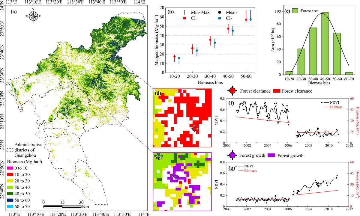
While total area loss is still dominated by gradual sea level rise, the acceleration of this loss is actually driven by extreme weather. Check out the our full paper in Nature Communications: nature.com/articles/s41467-0…
1
13
363
Jun 9
Scientists can now measure the “urban pulse” from space, via @EurekAlert! @@UConn eurekalert.org/news-releases…
1
153
Zhe Zhu 🌎🛰️ retweeted

May 20
A new study from researchers in the @GERSLab in the Department of Natural Resources and the Environment found that tidal wetland areas have been shrinking globally and the loss is accelerating in the U.S., driven by extreme weather events.
today.uconn.edu/2026/05/extr…
2
3
154
Apr 13
AI takes whatever they can get, but humans are the ones that makes decisions and takes responsibilities.

This researcher created a fictional illness, and fake studies funded by the Professor Sideshow Bob Foundation and University of the Fellowship of the Ring and the Galactic Triad.
LLMs warned people the illness was real.
go.nature.com/48nvUzs
342

Nature research paper: Satellite imagery reveals increasing volatility in human night-time activity
go.nature.com/3NS4KtL
1
27
93
16,271
Apr 8
New GERS Laboratory study shows that global artificial nighttime light is getting more volatile based on daily Black Marble data. You can check our paper here: rdcu.be/fcoMP
NASA has also made some nice videos to visualize our results here: svs.gsfc.nasa.gov/5634/
3
19
492
Zhe Zhu 🌎🛰️ retweeted

Mar 20
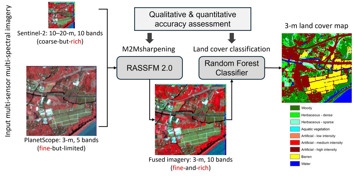
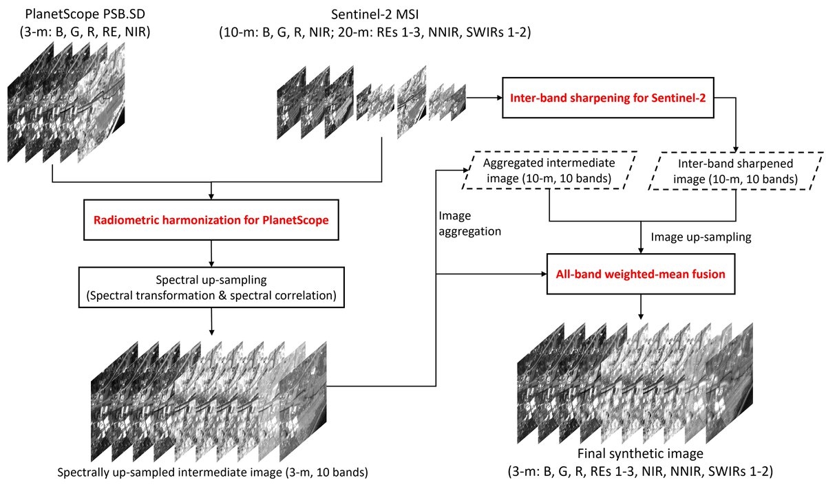
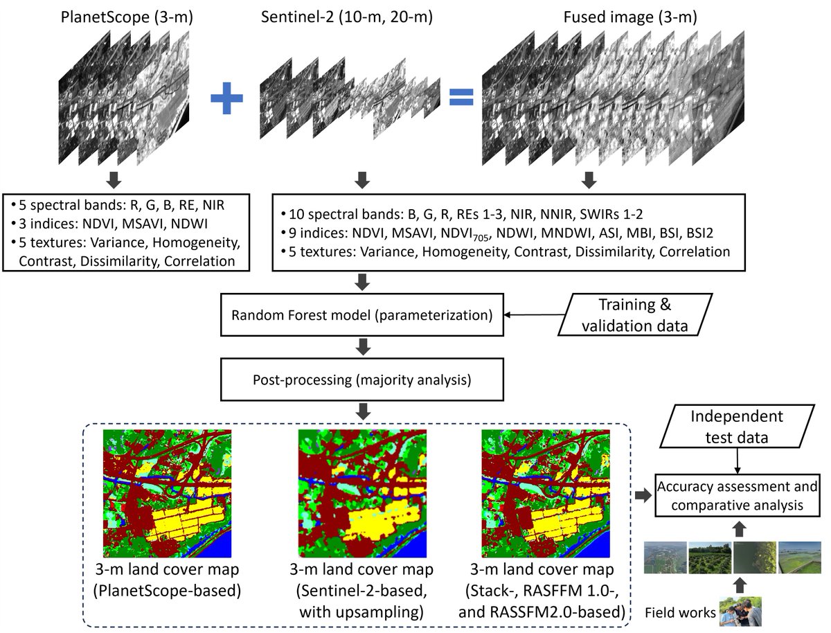
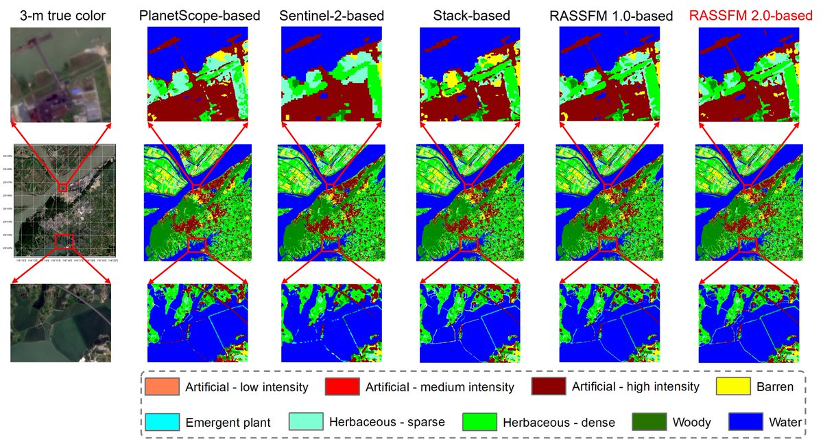
Can image fusion really improve downstream tasks? Yes! Better fusion yields better applications.
Our #RSE paper introduces RASSFM 2.0, an enhanced MS-to-MS fusion model newly defined as M2Msharpening, that delivers advanced 3-m land cover classification.
authors.elsevier.com/c/1mnuJ…
5
18
1,001
Zhe Zhu 🌎🛰️ retweeted
Mar 1
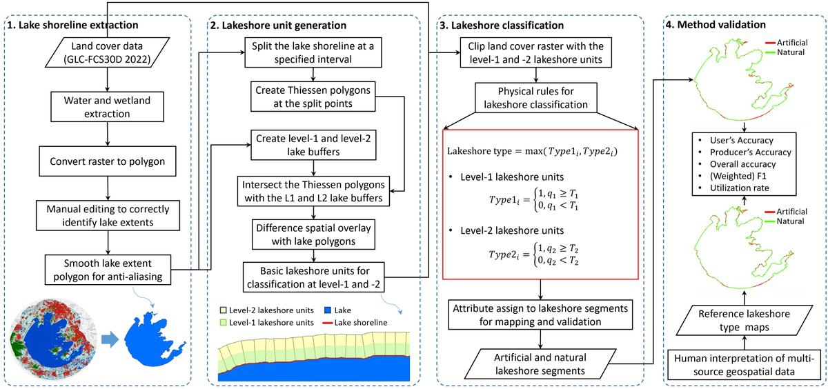
Lakeshores support critical ecological and socioeconomic functions. How can we efficiently identify artificial vs. natural lakeshores and assess their utilization at large scales? RoLaSTIM answers, enabling consistent and scalable lakeshore monitoring.
tandfonline.com/doi/full/10.…
2
10
599
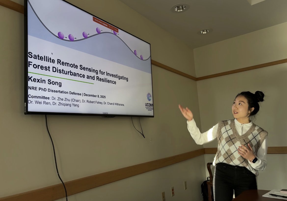
8 Dec 2025
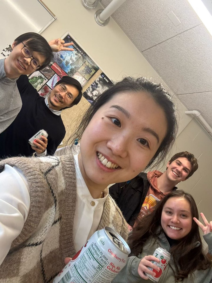
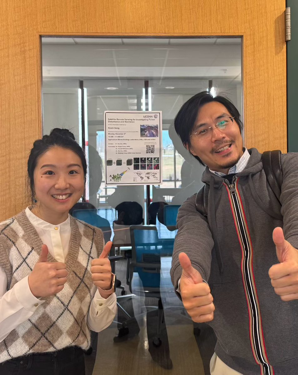
Third PHD from GERS Laboratory! Congratulations Dr. Kexin Song. We are very fortunate to have you in the past five years and looking forward to your next chapter at Yale.
1
22
967
6 Dec 2025
A new postdoctoral researcher position available in Remote Sensing & Global Environmental Change, at Global Environmental Remote Sensing (GERS) Laboratory
Start Date: Flexible and the earliest date is Feb. 1st (Review begins in Dec. 20th)
Salary Range: $62,232~$70,344
4
7
22
1,698
7 Dec 2025
To Apply
Please submit the following materials as a single PDF file to Dr. Zhe Zhu at: zhe@uconn.edu, in include (i) Cover Letter describing your research interests, qualifications and why you are interested. (ii) CV, and (iii) Contact Information for three references.
2
305

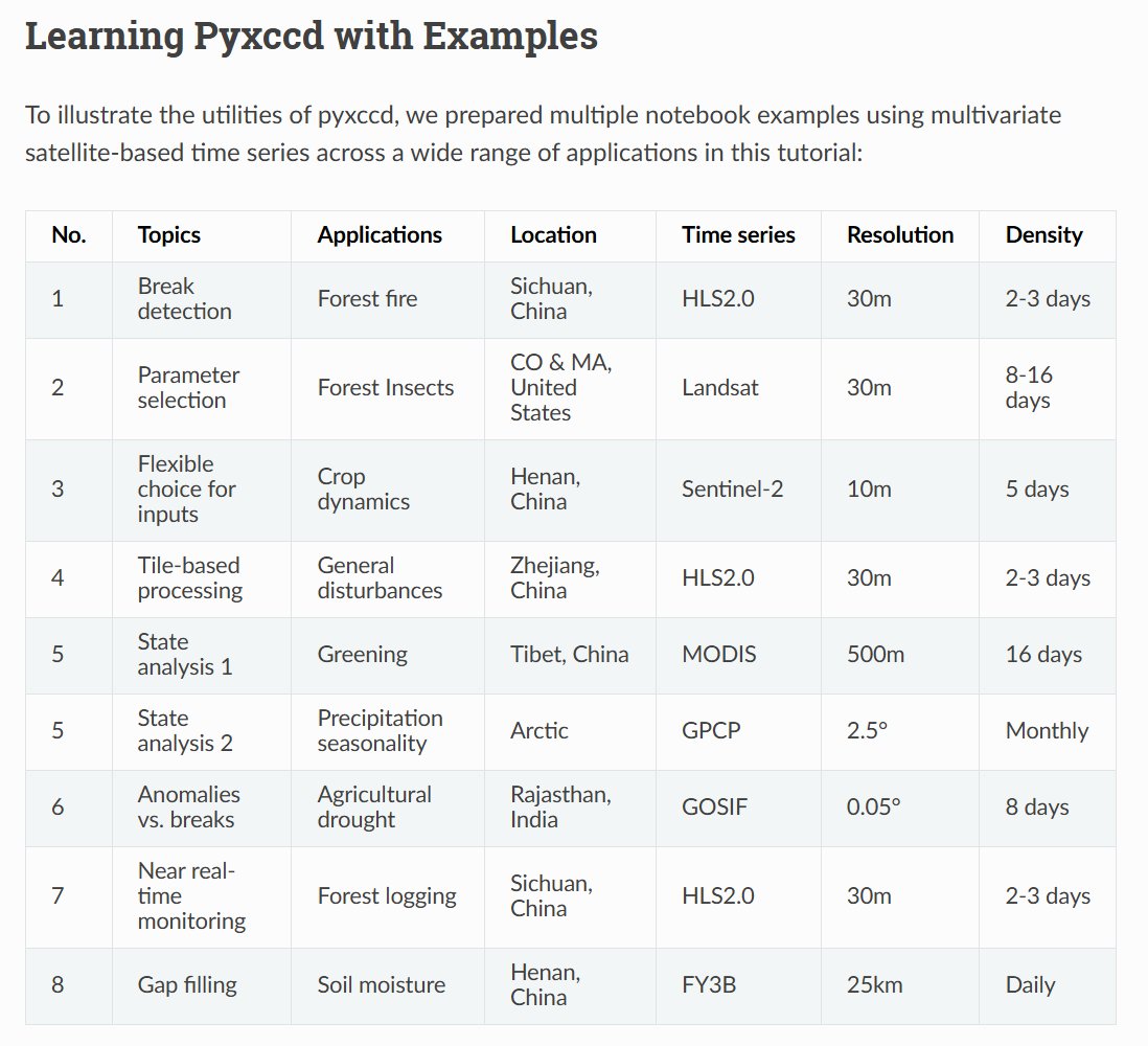
I am thrilled to announce the release of the python package "pyxccd" for latest CCDC algorithm (COLD) and its state-space form (S-CCD), supporting CCDC-like analysis for any band combination and any sensor. @GERSLab
$pip install pyxccd
Tutorial: pyxccd.readthedocs.io/en/lat…
1
1
2
286
10 Oct 2025
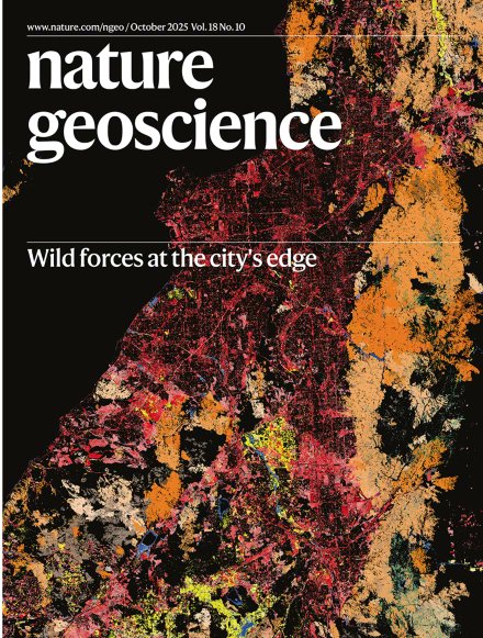
Art or science? GERS Laboratory is proud to contributing to this beautiful cover.
9 Oct 2025

October issue out now: including content on soil nitrogen loss from thawing permafrost, oceanic plate delamination, land disturbances in the USA, and more!
nature.com/ngeo/volumes/18/i…

ALT Wild forces at the city's edge Map of 35 years of land disturbance around Los Angeles in California derived from Landsat imagery Image: courtesy of Shi Qiu & Zhe Zhu, University of Connecticut Cover design: Alex Wing
8
627
9 Oct 2025
Our US disturbance paper has been selected as the featured cover paper for Volume 18, Issue 10, October 2025 (lnkd.in/e7-pSCPu), by Nature Geoscience. We have seen many photo or satellite image-based covers, but using remotely sensed thematic maps is rare.
3
20
622
Zhe Zhu 🌎🛰️ retweeted

4 Oct 2025
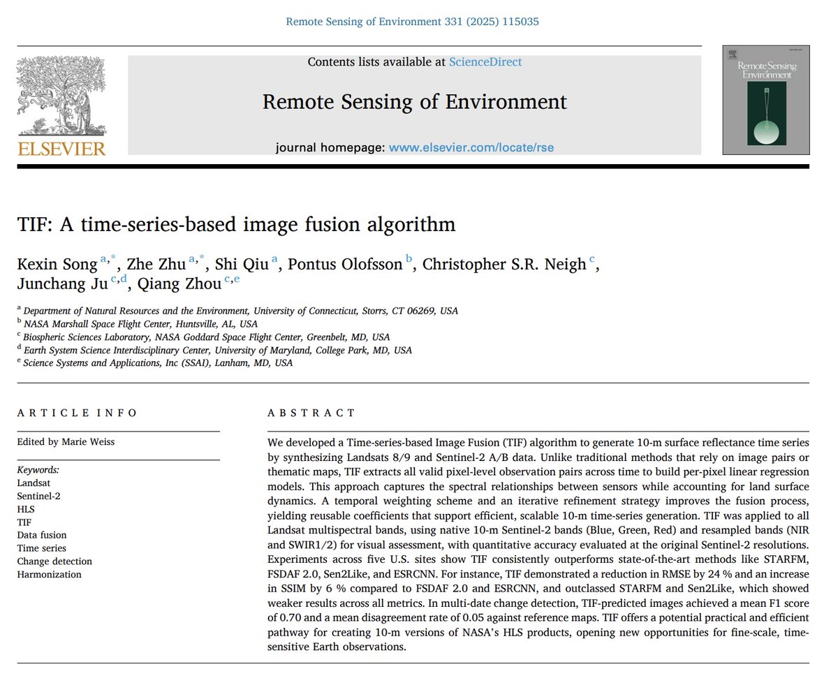
I'm thrilled to share that my first RSE paper, the Time-series Image Fusion (TIF) algorithm is published online!
🔗 Read the [paper]: sciencedirect.com/science/ar…
💻 Explore the [code]: github.com/GERSL/TIF
More on threads..
4
4
24
1,105
2 Oct 2025
This piece provides a lot of background information on how this work was started and the major challenge we have gone through (temporal consistency!), as well as the vital support from the USGS-NASA Landsat Science Team. @Shi60604194
2 Oct 2025
Research briefing summarising this paper:
nature.com/articles/s41561-0…
3
6
2,142
Zhe Zhu 🌎🛰️ retweeted

18 Sep 2025
Article: Direct human impact on land disturbances in the US is declining, while less controllable undirected wild disturbances are increasing
@Shi60604194 @GERSLab
nature.com/articles/s41561-0…
1
5
11
2,513
Zhe Zhu 🌎🛰️ retweeted
18 Sep 2025
A 40-year satellite study led by UConn @GERSLab director Zhe Zhu of the Department of Natural Resources & the Environment reveals disturbances from logging and construction are waning, but events like mega-fires and extreme storms are becoming more common
today.uconn.edu/2025/09/ucon…
3
1
300
18 Sep 2025
Our new @NatureGeosci study, led by @Shi60604194, reveals a major shift in what's reshaping the USA.
After analyzing 35 years of satellite data, we found that while human-led disturbances are declining, "wild" forces are surging. Check our paper 👇
nature.com/articles/s41561-0…
8
28
2,515
17 Sep 2025
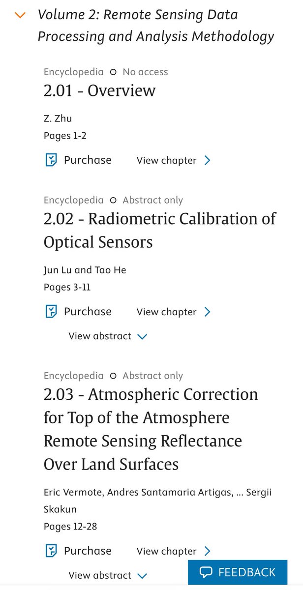
Finally, the second version of Comprehensive Remote Sesing book series is done. If you are teaching remote sensing image processing or are interested in this topic, you can read the second volume edited by me, in which we provided lots of classical and new techniques.

3
30
1,108