
GISCorps coordinates short-term, volunteer-based GIS services to communities in need worldwide. BlueSky: bsky.app/profile/giscorps.bs…
Joined April 2011
- Tweets 1,429
- Following 1,813
- Followers 3,437
- Likes 2,285
254 Photos and videos


URISA's GISCorps retweeted

23 Apr 2025
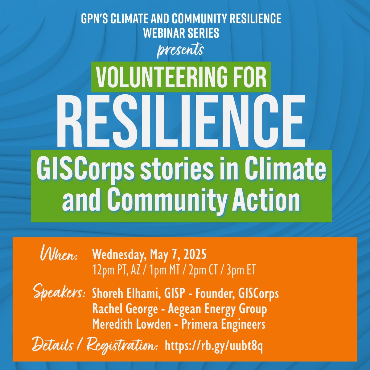
Come learn about the amazing @GISCorps, some of their recent projects, and maybe join! #GISChat @URISA Registration Link: rb.gy/uubt8q
1
4
384

Residents impacted by the Southern California wildfires can now access information about the status of their property through CAL FIRE's damage inspection maps. While inspections are ongoing, information—including images—is being uploaded daily to keep communities informed.
These resources can help residents begin working with insurers and planning their next steps.
#PalisadesFire details | fire.ca.gov/incidents/2025/1…
#EatonFire details | fire.ca.gov/incidents/2025/1…
We’re here to support you on the road to recovery. Stay safe and informed!
#CALFIRE #DamageInspection #WildfireRecovery #FireSafety #LAfires
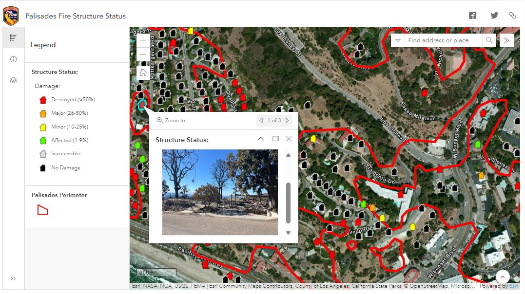
ALT The image shows damage inspection maps from the Palisades Fire.
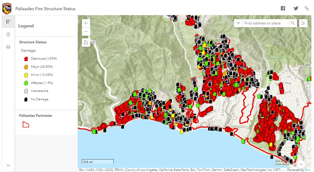
ALT The image shows damage inspection maps from the Palisades Fire.
27
144
271
30,154
URISA's GISCorps retweeted

27 Dec 2024
@xyHt recently featured GISCorps in the Dec. 2024/Jan. 2025 issue of their digital magazine. Thank you to the author, Marc Delgado, for showing the ways that our volunteers do #GISforGood around the world!Read the article here: xyht.com/spatial-itgis/goodw…
2
2
146
21 Nov 2024
Wishing all of our amazing volunteers, partners, and friends a Mappy GIS Day! Thank you for all of the #GISforGood you do around the world!
2
4
203
11 Oct 2024
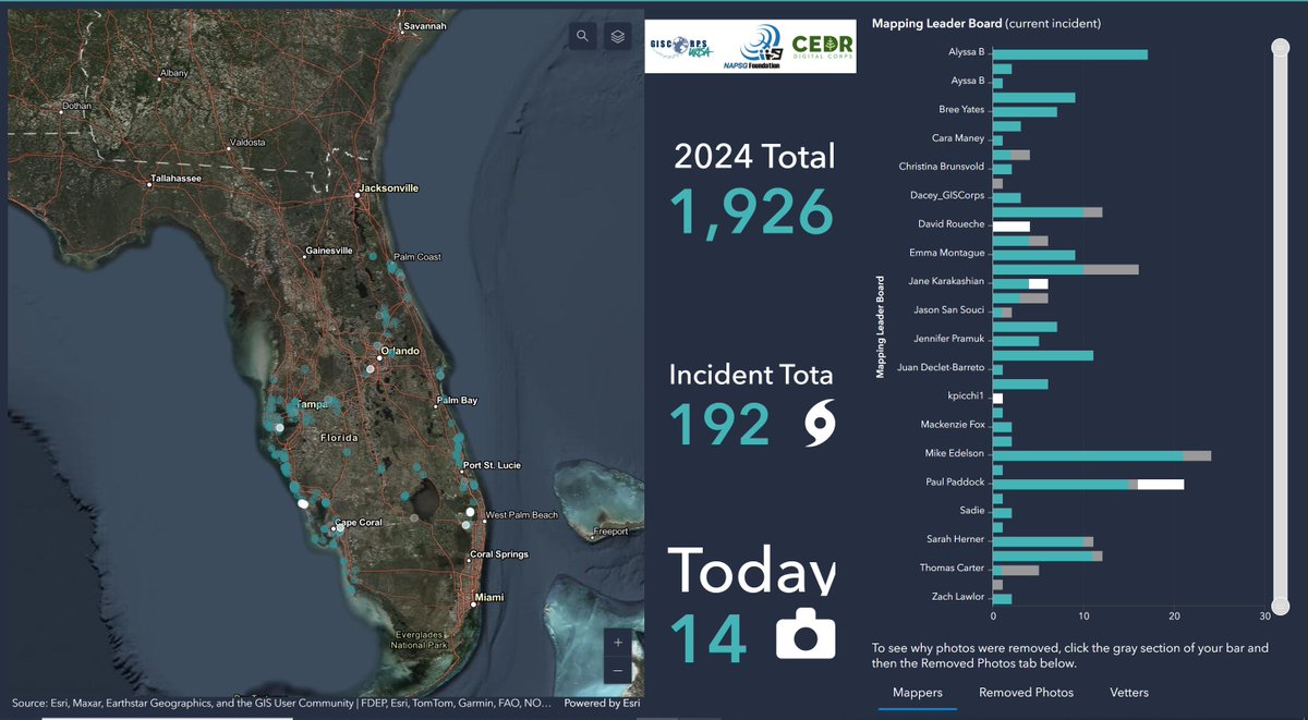
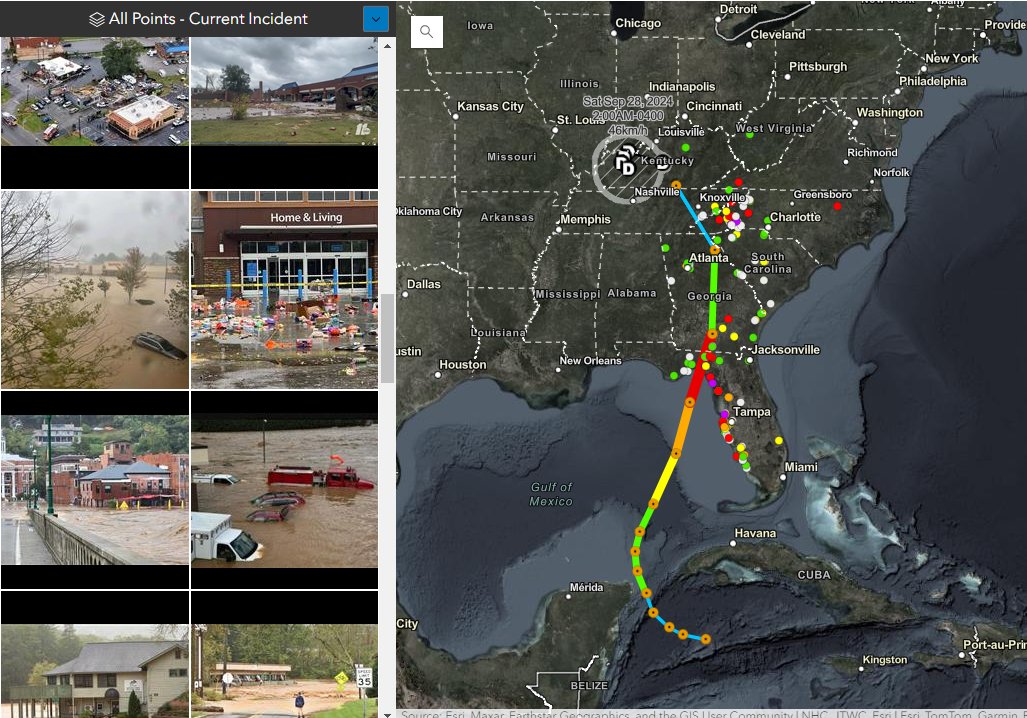
PhotoMappers has activated in response to Hurricane Milton and is currently working to map photos from around Florida documenting its damage! Thank you to over 50 PhotoMappers volunteers who have stepped up to help during this hurricane season. #hurricanemilton #GISforGood
6
7
412
URISA's GISCorps retweeted

8 Oct 2024
Go Team Go! Photomappers help fill gaps in situational awareness before response teams are able to safely access impacted areas. Join us @GISCorps. #PhotoMappers #VirtualVolunteers #GISforGood #GISCorps
8 Oct 2024

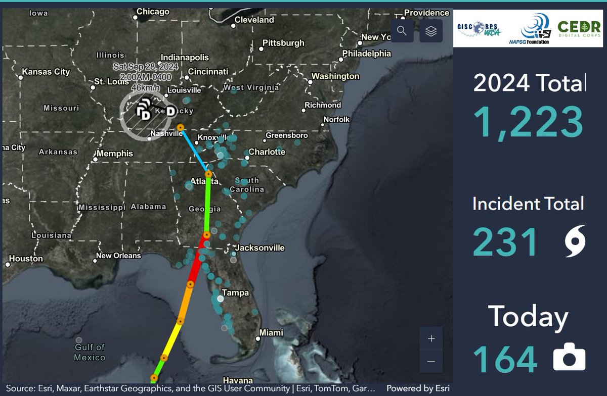
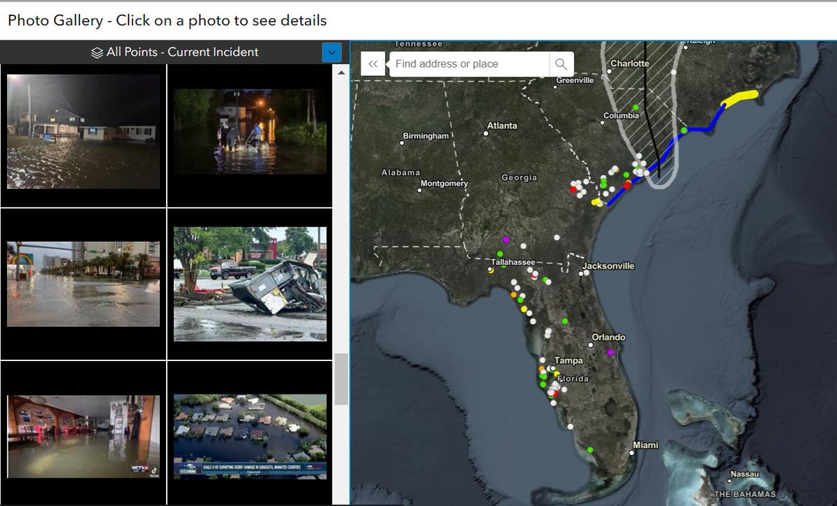
FEMA NRCC GIS group produced the map showing in the background displaying #PhotoMappers images overlayed with accumulated precip for TC Helene. These maps were used to brief Administrator Criswell and VP Harris. Amazing work by URISA @GISCorps vols mapping 660 photos of damage!
5
9
462
URISA's GISCorps retweeted

8 Oct 2024
FEMA NRCC GIS group produced the map showing in the background displaying #PhotoMappers images overlayed with accumulated precip for TC Helene. These maps were used to brief Administrator Criswell and VP Harris. Amazing work by URISA @GISCorps vols mapping 660 photos of damage!
6 Oct 2024

This weekend, Vice President Harris traveled to North Carolina to meet with state and local officials, first responders, impacted families, and volunteers and reaffirmed our Administration’s commitment to every community affected by Hurricane Helene.

ALT Vice President Harris meets with state and local officials in North Carolina in the wake of Hurricane Helene.
7
13
977
URISA's GISCorps retweeted

6 Oct 2024
This weekend, Vice President Harris traveled to North Carolina to meet with state and local officials, first responders, impacted families, and volunteers and reaffirmed our Administration’s commitment to every community affected by Hurricane Helene.
ALT Vice President Harris meets with state and local officials in North Carolina in the wake of Hurricane Helene.
738
535
1,908
149,278
URISA's GISCorps retweeted
28 Sep 2024
These photos of damage from #Helene are devastating. It is inspiring to see everyone coming together to help these communities & support the response, including digital vols who have mapped over 230 photos of damage across 8 states. @GISCorps @CEDRdigital #PhotoMappers
6
4
663
27 Sep 2024
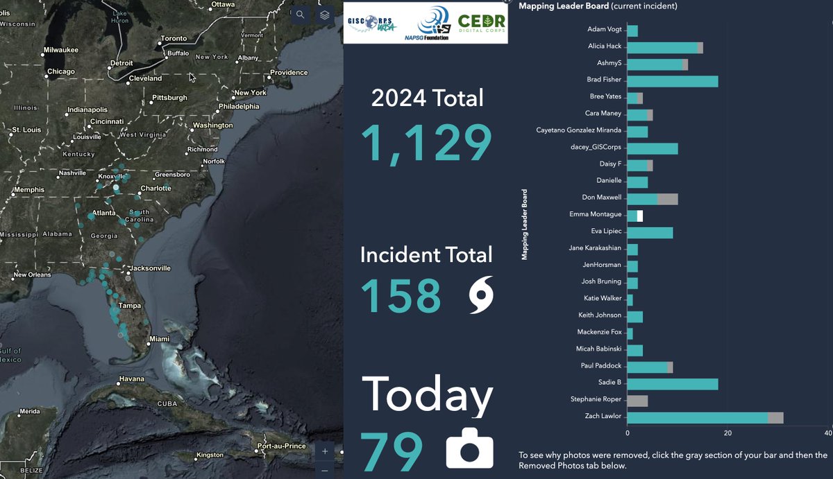
PhotoMappers has activated for Hurricane Helene, and 24 volunteers are working diligently to geolocate and validate images of the damage in FL, GA, and the Carolinas to assist in disaster response as Helene moves across the Southeastern U.S.! #GISforGood #disasterresponse
3
8
431
14 Sep 2024
During Hurricane Francine, our PhotoMappers volunteers geolocated & validated 92 images in 24 hours to provide early situational awareness to first responders & emergency personnel. Thank you to all of our amazing PhotoMappers volunteers who joined this activation! #GISforGood
3
4
184
URISA's GISCorps retweeted

12 Sep 2024
This week I’m volunteering with the #PhotoMappers & @GISCorps in response to TC Francine! Anyone can join by signing up: giscorps.org/join-giscorps/
1
3
5
524
12 Sep 2024
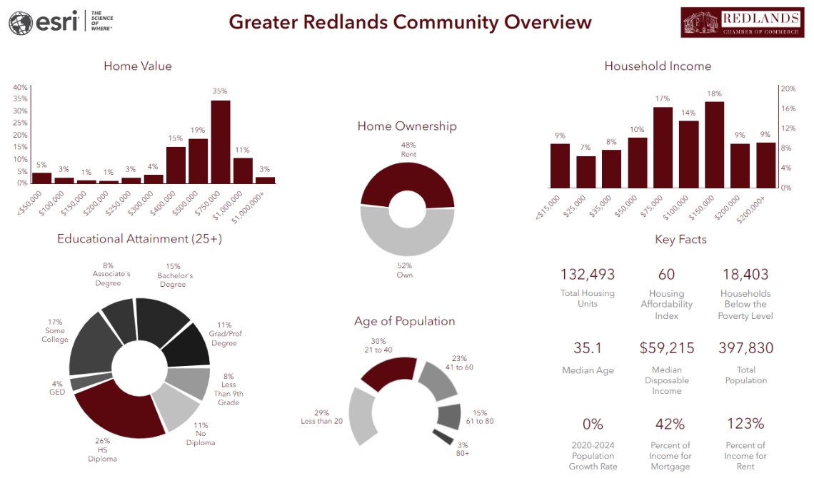
Volunteer Hannah Ritter helped @redlandschamber use GIS to drive local business growth by creating an interactive map of the Chamber's member businesses and developing Business Analyst reports about Redlands' residents. 📷📷 Read more: bit.ly/3SRdhMu #GISforGood

1
2
165
11 Sep 2024
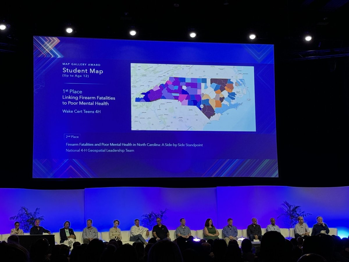
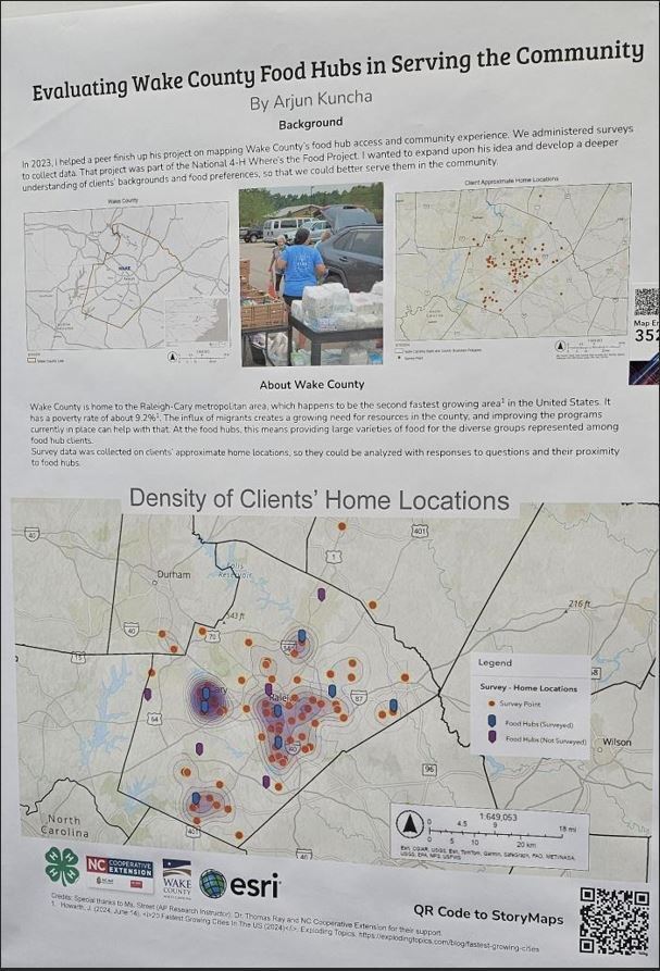
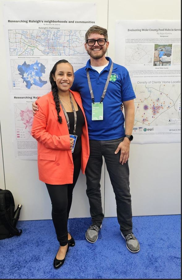
Volunteers Samantha Olivieri & Meredith Lowden mentored 4-H students on how to make high-quality GIS products using tools like ArcGIS Pro and ArcGIS Online. Students won an award for their maps at the 2024 #Esri User Conference! 📷Read more: bit.ly/4elieFT #GISforGood
1
5
230
URISA's GISCorps retweeted
8 Aug 2024
#PhotoMappers have been hard at work. 170 photos of damage from #HurricaneDebby mapped and counting. @GISCorps @CEDRdigital @napsgfoundation
7
9
435
13 Jul 2024
Volunteer Emilie Pratt (@KF5BKM) is helping the @URISA Climate and Community Resiliency Committee (& @napsgfoundation) to refresh their AGO Experience Builder app to enhance guidance and documentation on climate and social science indices! 📷
Read more: giscorps.org/urisa_ccrc_388/
3
7
311
13 Jul 2024
Will you be at the Esri User Conference next week? Connect with us at the Map Gallery Reception on Mon. evening or join us for our annual meeting on Wed., Jul. 17 from 11:30 AM -12:30 PM PT in Room 12! #esri #esriuc2024 #gisforgood
6
6
412
URISA's GISCorps retweeted

12 Jul 2024
How will you contribute to #GIS4Good? Stop by the @GISCorps display in the #EsriUC Map Gallery and find out about projects, volunteer opportunities, and ways that you can make an impact. (If you miss us there, drop by URISA's booth in the exhibit hall: #107)

3
5
262
URISA's GISCorps retweeted
11 Jul 2024
Three weeks remain for #GISPro2024 early bird registration and exhibit booth space discounts. Make your plans soon! urisa.org/page/GIS-Pro2024 @EsriPartners @URISAVC @NEURISA @MaineGIS @GISCorps

2
2
167
URISA's GISCorps retweeted
11 Jul 2024
Add it to your schedule! Don't miss the @GISCorps annual update on Wednesday, July 17 from 11:30 AM to 12:30 PM PT in Room 12 during the #EsriUC. GISCorps’ Founder, Shoreh Elhami, will provide a brief update, followed by a meet and greet with attendees. We hope you can join us!

2
3
214