
Esri GIS Education - news, curriculum, software, tools and more
Joined April 2009
- Tweets 4,522
- Following 675
- Followers 21,707
- Likes 1,900
3,048 Photos and videos
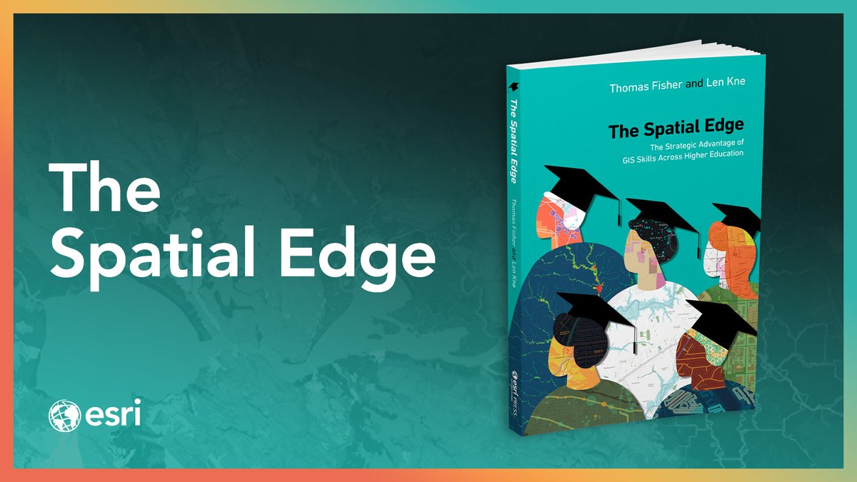


Bring your campus together academically and operationally.
“The Spatial Edge” shows how integrating a geographic approach can unite campuses and address challenges by fostering spatial thinking across academic disciplines and university operations.
🏫➡️ ow.ly/83ZZ50Zb7lr
1
2
6
279

Jun 12
How do you connect Missouri students to global watersheds and climate data? 🌊🌱
See how the Litzsinger Road Ecology Center uses ArcGIS Online to bring place-based environmental science to life and make students future-ready.
Read the case study: ow.ly/6Sgu50Zb8sT
136
Jun 12
Congratulations to this year's EIP Students of the Year! These students were recognized for their innovative projects that are guiding new breakthroughs in GIS research to support industry and workforce needs.
Check out their work👇
ow.ly/48Rb50ZaJJJ
3
6
237
Jun 12
Students are bringing their stories to life to address environmental challenges in their local communities through this externship with National Geographic Society and TNC 🌱
Read about it 👉ow.ly/gZvG50ZaIXH
4
118
Jun 12
How do rivers and streams shape our world? In this activity, middle school students use MapMaker to explore the water cycle, trace major watersheds, and analyze local water pollution issues.
Explore the free resource:
ow.ly/6ili50Z9Iwv
1
3
224
Jun 11
Ready to take your GIS program to new heights? 🛸📉
This guide shows you how to incorporate drones into your classroom, from flight planning to mapping with ArcGIS Drone2Map. Equip your students with career-ready skills.
Get started: ow.ly/mzc050Z9IAC
1
1
169
Jun 10
Want to use digital maps in your classroom? 🗺️🎒
Explore this FREE, beginner-friendly web course for teachers: "Use a Map for Classroom Instruction."
🔹 ~4 hours, self-paced
🔹 No prior GIS experience needed
🔹 Uses free, login-free web tools
👇ow.ly/A4Uf50Z9IrZ
6
15
600
Jun 10
Want a leg up in urban planning? 🏙️🚀
Explore this 1.5-hour hands-on guide to mastering GIS for city planning.
Learn how real cities grow, explore 3D urban models, and design a resilient neighborhood yourself. Perfect for students and educators!
ow.ly/VYRq50Z9Iol
5
397
Jun 10
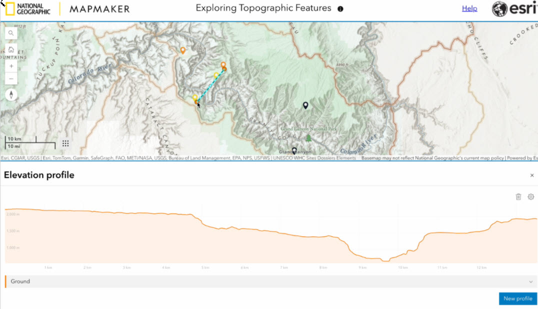
Discover how landscapes take shape 🌍 Explore topography, landforms, and Earth’s forces with this interactive MapMaker activity.
ow.ly/HpTq50Z9Ilh
1
1
11
612
Jun 9
Managing 11.5 million sqft. of space across 10 global campuses requires a robust, modern solution. Here's how the University of Notre Dame partnered with Cloudpoint Geospatial to migrate to ArcGIS Indoors 🗺️ ow.ly/wep650Z9qiq
1
5
207
Jun 7
Interested in drones and GIS? Hear from Jeremiah Johnson, Esri's lead solution engineer and drone technology expert, as he shares:
🚁 Insights into the drone industry
🚁 Career opportunities
🚁 Advice for aspiring drone pilots
Read the Q&A: ow.ly/cfvv50Z8gHP
4
4
332
Jun 6
Registration remains OPEN for the Esri Education Summit❗
Connect with educators, administrators, and GIS professionals to get best practices in geospatial learning 🙌
📍 San Diego, CA
📅 July 11–12, 2026
Register: ow.ly/Zo0u50Z8gA8
1
2
231
Jun 5
The UCGIS Symposium is right around the corner happening June15-18 in College Park, MD.
We will be hosting a session "Developing Your GIS Professional Ecosystem: Associations, Networks, and Career Pathways" 💼
More event details: ow.ly/Q4ax50Z8guv
2
2
191
Jun 4
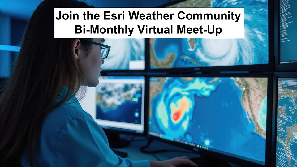
Join the Esri Weather Community for their bi-monthly virtual meet-up 🖥️ It's a dedicated hour for ocean-focused GIS professionals, enthusiasts, and community members to connect and collaborate.
Sign up 👉 ow.ly/5w7E50Z7M7Z
3
5
244
Jun 3
Artificial Intelligence is inundating many fields of study.
Take our survey so we can better understand what is being planned, taught, and areas of opportunities/concerns 👉 ow.ly/7mxP50Z7nbU
1
4
246
Jun 1
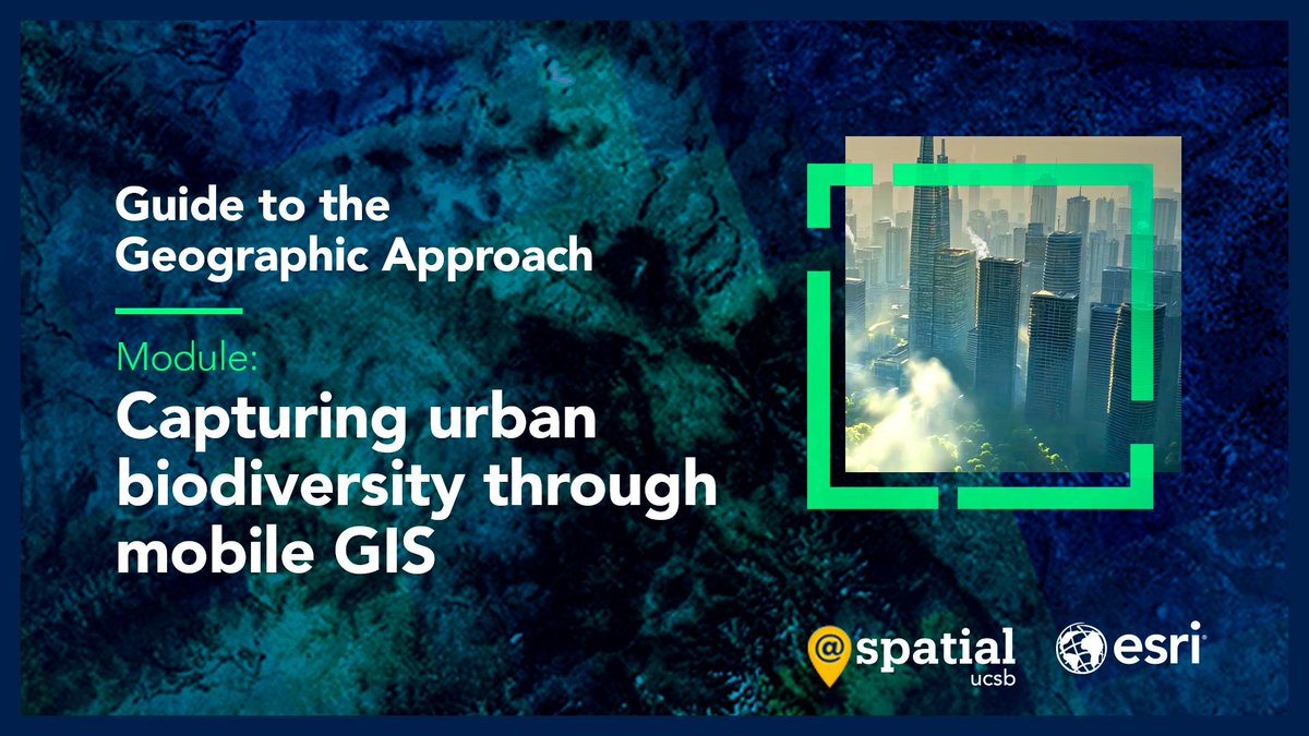
Build more resilient cities with the Guide to the Geographic Approach 👇
🔸Use Survey123 and Field Maps to capture and visualize urban species data: ow.ly/wvPb30sWbbT
Use mobile GIS to identify ecological hotspots and guide equitable green infrastructure planning 🌿📊
3
11
581
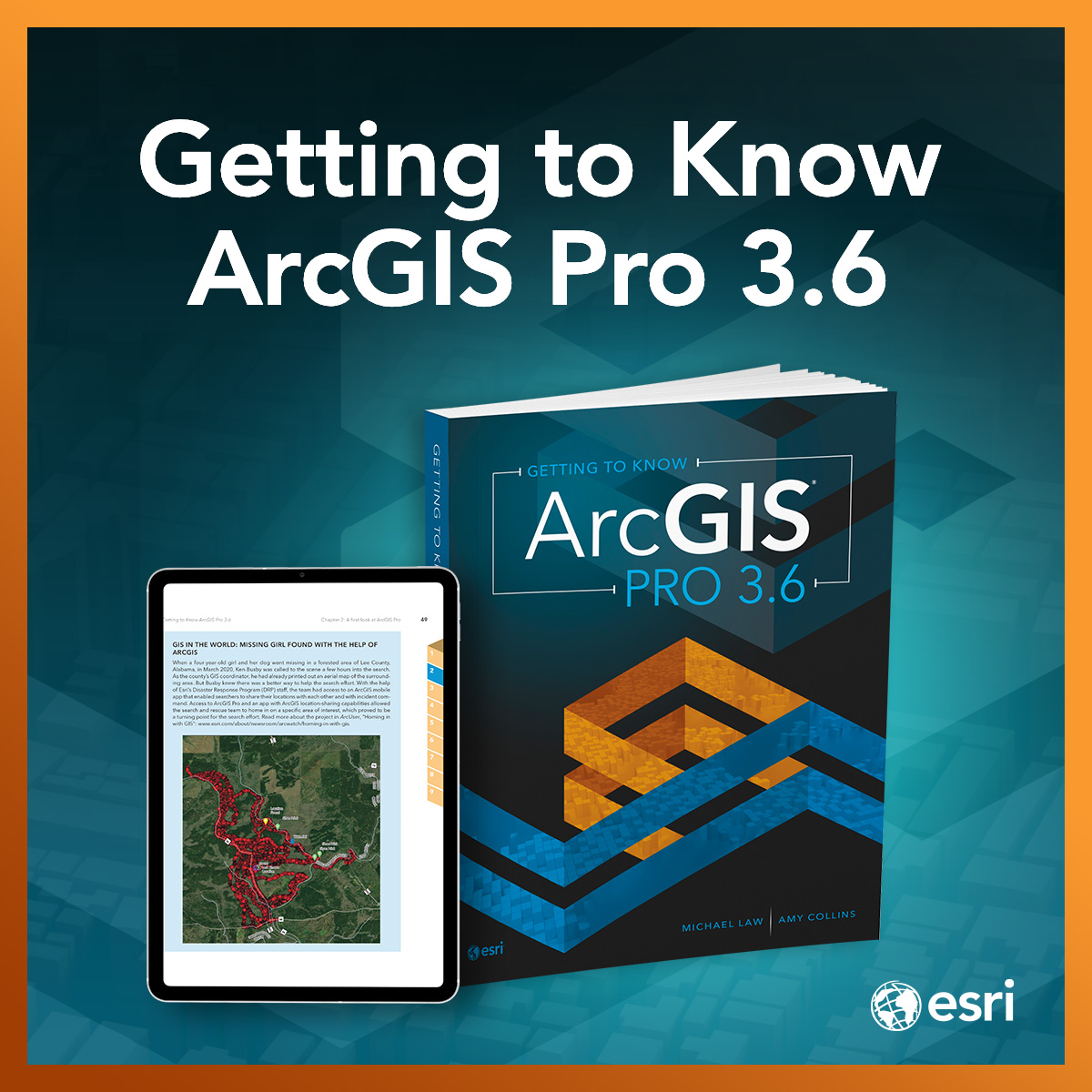
May 31
The wait is almost over! 📚 The new edition of the best-selling workbook, Getting to Know ArcGIS Pro 3.6, drops June 2nd. Perfect for students, self-learners, and professionals looking to master the latest in desktop GIS. 🗺️🚀
Pre-order your copy: ow.ly/ai0F50Z5Qfo
1
1
2
340
May 31
Big news for schools and universities: the ArcGIS Reality suite is coming to Esri Education programs! 🎉 Get ahead of the update with this free 1-hour seminar. Learn how to use these accessible tools to turn drone data into 3D meshes. 🗺️🛸
Start today! ow.ly/NgxL50Z5Qcv
3
6
360
May 30
Heading to Orlando for #ISTELive 2026 next month? ✈️ Stop by booth #1659 to connect with the Esri K-12 team! Let's chat about digital mapping, AI in geography, and new ways to spark student creativity. 🗺️✨
Read more details on our blog: ow.ly/9Cwo50Z5Qcm
3
299
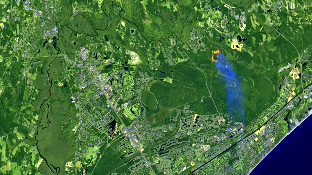
May 30
Need imagery for your GIS workflows? The Image Collection Explorer in ArcGIS Living Atlas makes it easy to explore, filter, and select imagery from continuously updated datasets to create imagery layers tailored to your project needs 👉 ow.ly/ieNn50Z5JF0
1
2
28
1,195