
The fastest growing brand of surveying instruments in UK and Ireland. Outstanding GNSS, Total Stations, Lasers and Software for Surveyors and Civil Engineers.
Joined March 2018
- Tweets 1,930
- Following 3,840
- Followers 1,169
- Likes 422
1,562 Photos and videos


25 Aug 2025
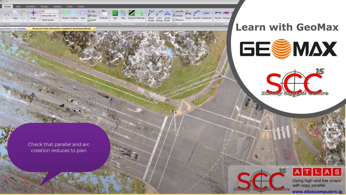
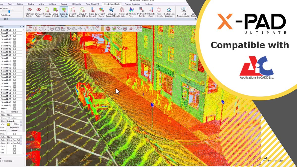
Learn with GeoMax - How to use point cloud snap low and snap high in conjunction with the copy parallel option when creating kerbs / curbs
loom.ly/dJ5c_u4
#SCC #XPADUltimate #Surveying #GeoMax #construction #landsurveyor #CivilEngineer
87
22 Aug 2025
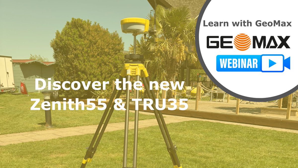
Learn with GeoMax 👉 Discover the new Zenith55 & TRU35
Watch the webinar on-demand
loom.ly/JKGLVEY.
#GNSS #XPADUltimate #XPAD365 #GeoMax #construction #landsurveyor #CivilEngineer
1
19
20 Aug 2025
Managing a lot of Floorplans? Need to comply with BIM regulations?
Export your data directly from X-PAD into BricsCAD a professional DWG-based CAD platform with modelling tools
loom.ly/GL7vy9M
#BricsCAD #CAD #GeoMax #construction #landsurveyor #CivilEngineer
1
13
18 Aug 2025
Learn with GeoMax - Learn how the new reporting and export functionality for extracted point features such as trees works in the new software.
loom.ly/NP-azC4
#SCC #XPADUltimate #Surveying #GeoMax #construction #landsurveyor #CivilEngineer
110
15 Aug 2025
Learn with GeoMax - Mastering IMU: Boost Your GNSS Job Efficiency in the Field
Watch the webinar on demand
loom.ly/UKEPpEk.
#GNSS #XPADUltimate #XPAD365 #GeoMax #construction #landsurveyor #CivilEngineer
15
13 Aug 2025
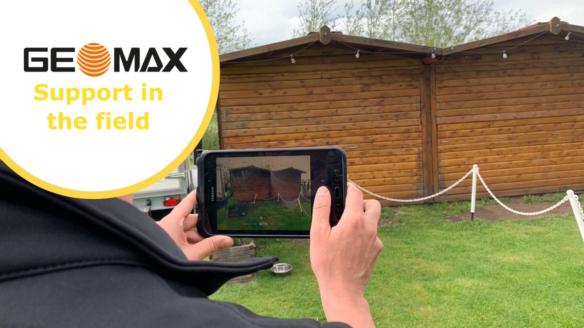
Ever felt stuck in the field with no idea what’s gone wrong? It’s frustrating and costly
We uses TeamViewer to give you real-time support.
Book a demo
loom.ly/CRuIdEs
#GeoMax #construction #landsurveyor #CivilEngineer
15
11 Aug 2025
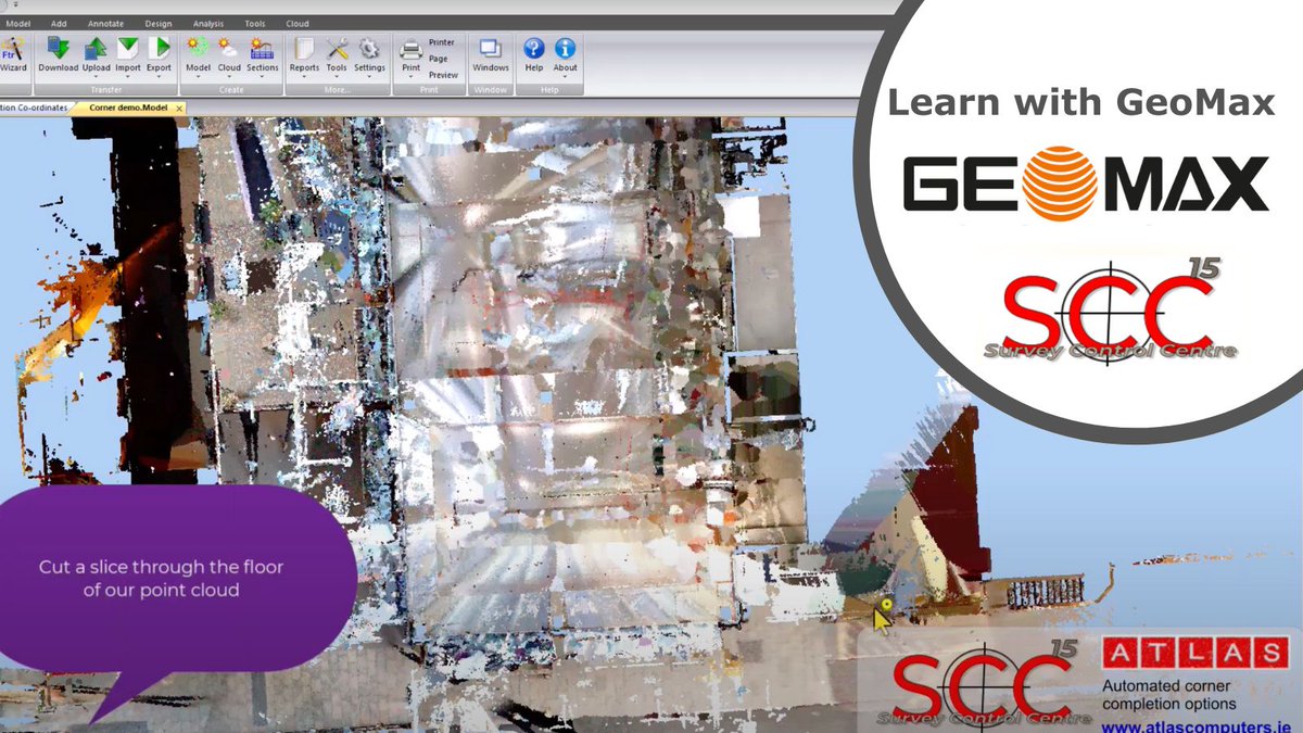
Learn with GeoMax - How to use automated corner completion with point clouds in SCC
loom.ly/DRMdl0U
#SCC #XPADUltimate #Surveying #GeoMax #construction #landsurveyor #CivilEngineer
141
8 Aug 2025
Learn with GeoMax - Discover the powerful new features of the latest X-PAD Suite
Watch the webinar on demand
loom.ly/jwYjelo.
#XPADUltimate #XPAD365 #GeoMax #construction #landsurveyor #CivilEngineer
1
14
6 Aug 2025
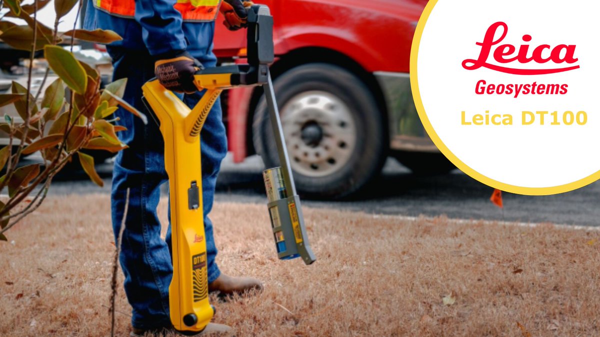
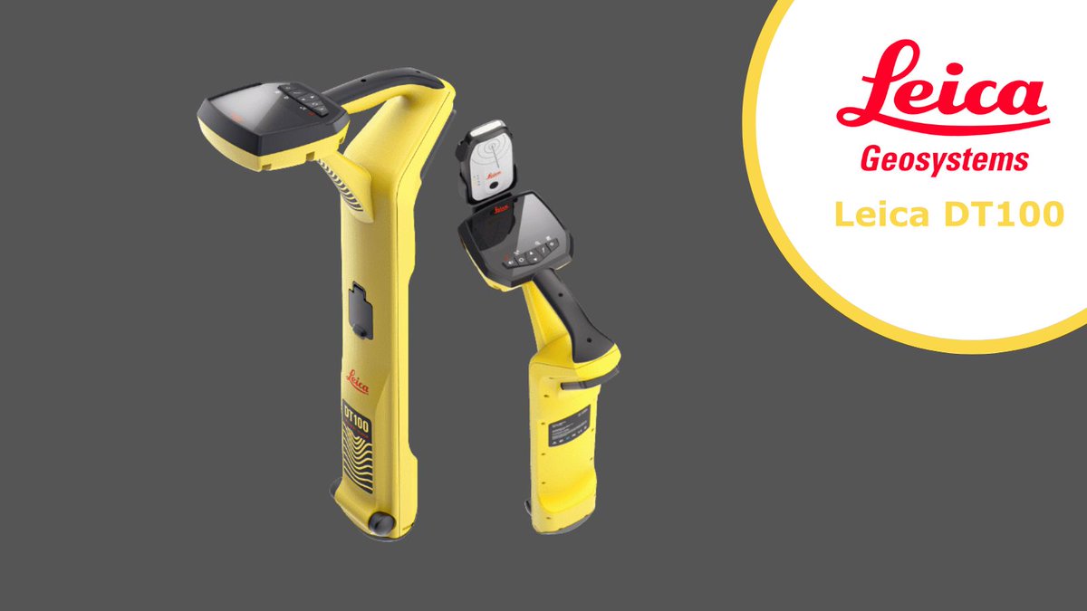
Crouched in the mud, adjusting your locator for the 10th time because it demands millimeter-perfect alignment?
#LeicaDT100 works with reality, not against it. Accurate readings even when you're slightly off-center
Book a demo
loom.ly/CRuIdEs
#utilitysurveying
1
14
4 Aug 2025
Tough terrain? No problem
The #Zenith60Pro thrives where others struggle. From urban canyons, dense canopy or remote sites. Paired with the Zenius08 and X-PAD 365, you'll be equipped with a reliable, rugged field solution
Talk to us for a bespoke solution
loom.ly/CRuIdEs
1
16
1 Aug 2025
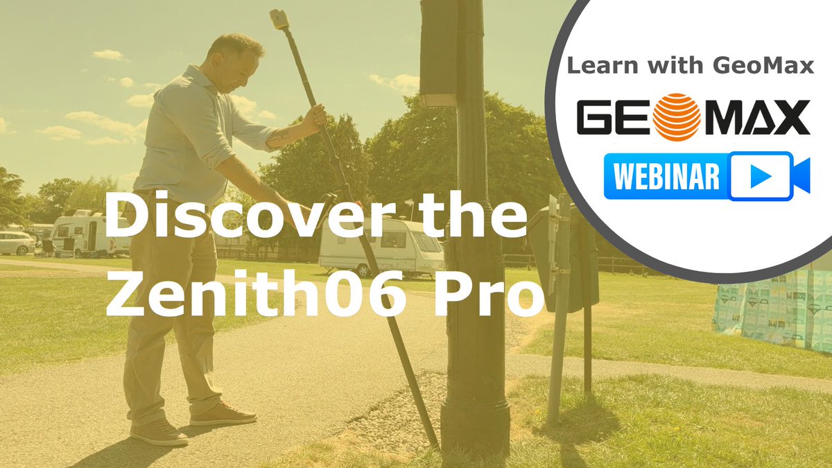
Learn with GeoMax 👉 Discover the Zenith06 Pro
Easy-to-Use, Compact GNSS Receiver with Tilt Compensation
Watch the webinar on demand
loom.ly/5HvL9rk.
#GNSS #XPADUltimate #XPAD365 #GeoMax #construction #landsurveyor #CivilEngineer
7
30 Jul 2025
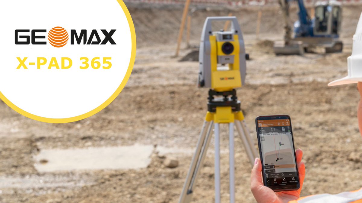
Did you know you can download all your surveying measurements from X-PAD Ultimate into n4ce using the .raw or .exp format?
Contact us for more info
loom.ly/t7Wa5OQ
#n4ce #SurveyingSoftware #CivilEngineer
3
28 Jul 2025
Traditional workflows, transferring field data back to the office is slow, clunky, and vulnerable to human error
#Zoom95 #XPAD365 All you collect data, it’s automatically synced, backed up & accessible in real time.
Find a dealer
loom.ly/rCwuiT4
11
25 Jul 2025
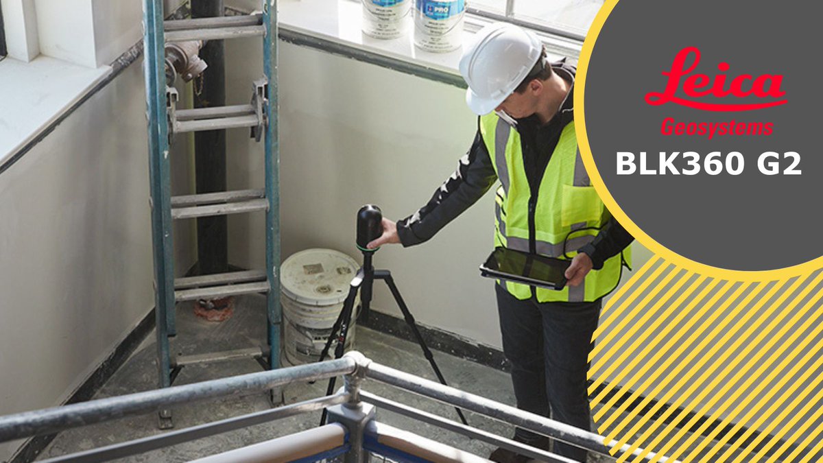
Using the #BLK360 enables you to create rapid and flexible workflows in the field. With instant feedback on your mobile device, you can confidently ensure that you've captured all necessary data
More info
loom.ly/ZA4j5Ys
#XPADFusion #Leica #3DLaserScanning
1
11
23 Jul 2025
Protects your #utilitysurveying team with the #LeicaDT100 DE100 system
It has:
👉 Built-in hazardous voltage alerts
👉 Real-time current, voltage & impedance monitoring
👉 Precise detection reduces utility strike risks
More info
loom.ly/CRuIdEs
7
21 Jul 2025
BricsCAD, a division of Hexagon, offers a unified platform built on the native-DWG format. It encompasses five product levels, covering various areas such as 2D drafting, 3D modelling, BIM, and mechanical design toolsets.
More info
loom.ly/HzLKRbU
#BricsCAD #CivilEngineer
16
18 Jul 2025
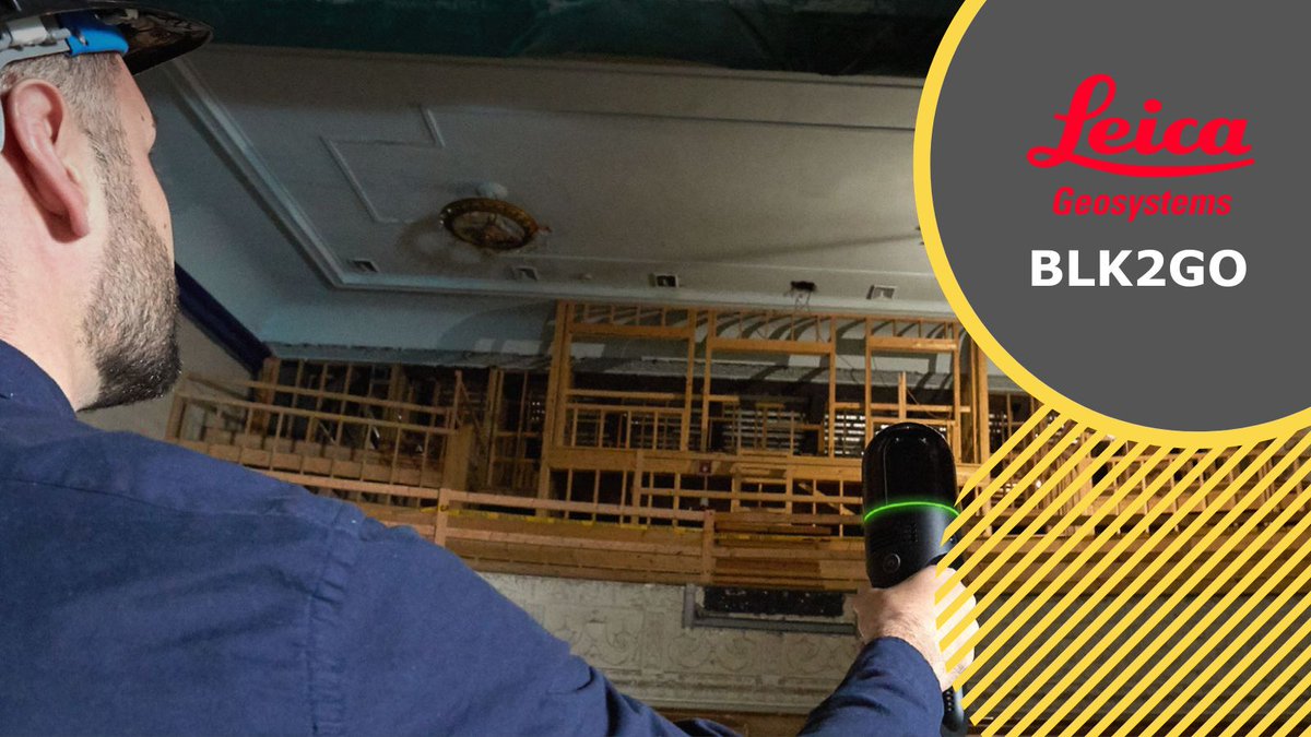
The BLK2GO handheld imaging laser scanner reconstructs 3D spaces in real-time as you navigate. It captures images and precise point clouds instantly, utilising SLAM technology to track your movement path
More info
loom.ly/ZA4j5Ys
#XPADFusion #Leica #3DLaserScanning
9
16 Jul 2025
Can you describe what’s on your screen?
You’ve probably been there, on-site, under pressure, trying to explain a tech issue over the phone.
We can securely view your device in real time, guide you through fixes
💻 Learn more
loom.ly/CRuIdEs
#landsurveyor #CivilEngineer

16
14 Jul 2025
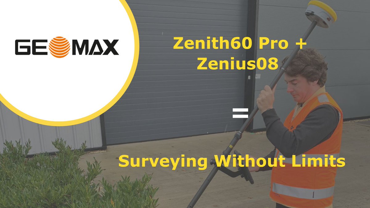
#Zenith60 Pro #Zenius08 = Surveying Without Limits
With tilt compensation, 800 GNSS channels, a rugged 8" controller & real-time cloud sync you will have the perfect field-to-office solution that can be tailored to your workflow
Talk to us
loom.ly/CRuIdEs
12
11 Jul 2025
#Leica #BLK autonomous sensors seamlessly transmit data directly to Reality Cloud Studio. This includes user-friendly features such as auto-register and auto-mesh, simplifying complex tasks
More info
loom.ly/ZA4j5Ys
#Leica #3DLaserScanning

7