
The GRI (at University of Canterbury, New Zealand) provides a unique opportunity for all branches of the geospatial community to communicate and collaborate.
Joined February 2017
- Tweets 331
- Following 116
- Followers 345
- Likes 95
166 Photos and videos


We are excited to invite you to our upcoming GRI seminar featuring Astronaut Katherine Bennell‑Pegg. She will be giving a talk called “Two Nations, One Orbit: How Australia and New Zealand are making their mark in the global space sector”. events.humanitix.com/katheri…
1
22
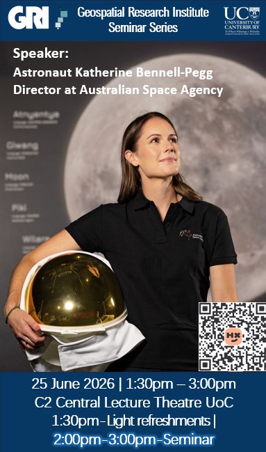
We are excited to invite you to our upcoming GRI Seminar Series on Thursday, June 25 featuring Astronaut Katherine Bennell‑Pegg, Director at Australian Space Agency. Register for free at: events.humanitix.com/katheri…
44
Researchers from the Geospatial Research Institute, led by Professor Matthew Wilson and Xander Cai, are developing a cutting-edge AI-driven system to help farmers better understand and manage one of their most critical resources: water. canterbury.ac.nz/news-and-ev…
37
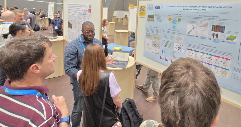
Congratulations, Clevon Ash on presenting your poster, "Communicating Flood Risk Uncertainty for Decision-making in Aotearoa New Zealand" at the EGU 2026 in Vienna Austria. Clevon will also be at BOKU University in Vienna as part of a short knowledge exchange
43
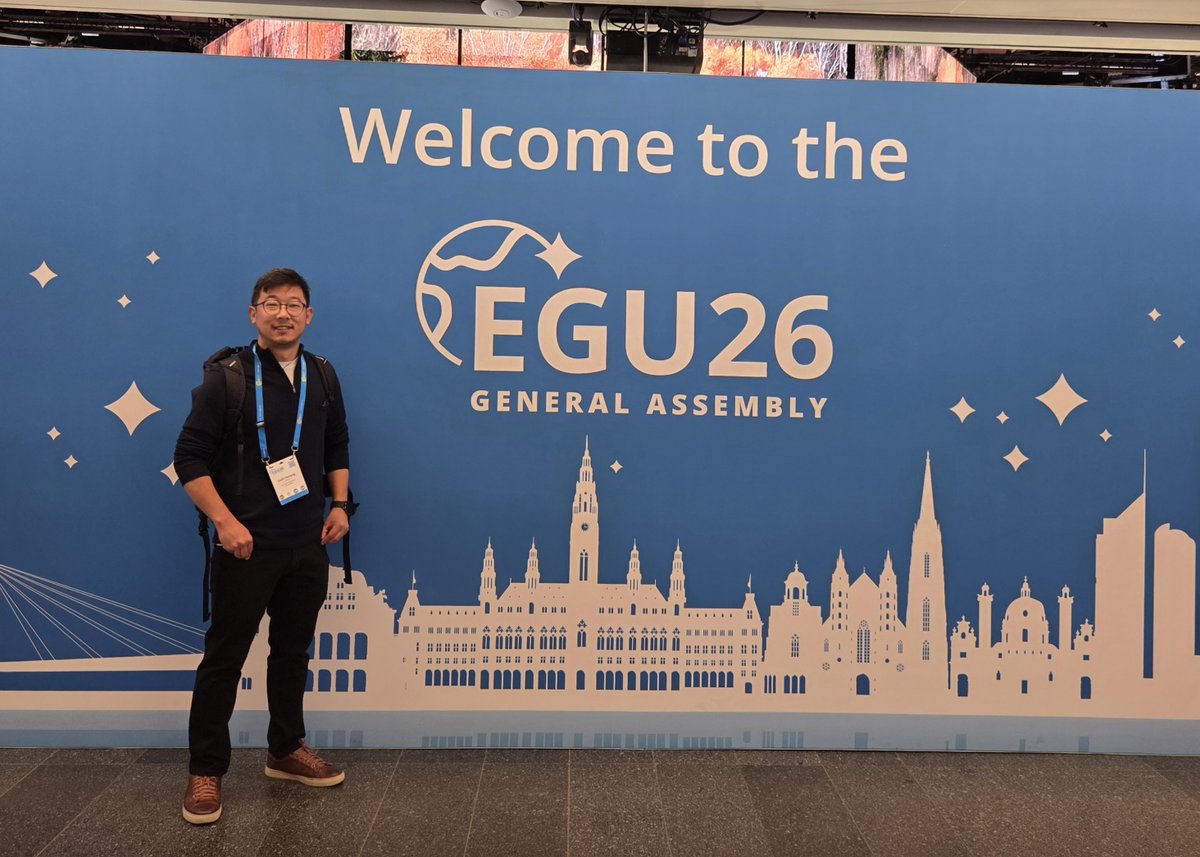
Sunil Tamang is currently participating in the European Geosciences Union (EGU) General Assembly 2026 in Vienna, Austria. On Tuesday, he delivered an oral presentation titled “Mapping the Margins: Evaluating Accuracy and Ambiguity in Automated Rock Glacier Delineation"
1
62
Join us for a GRI Seminar with Sara Mikaloff-Fletcher on Thursday, May 7th at 1pm at UC or via zoom. Learn more and register for free:
events.humanitix.com/methane…
33
Please come in person or online to our next GRISS seminar. It will be on Thursday, May 7th at 1pm, featuring Sara Mikaloff-Fletcher, Principal Scientist at Earth Sciences NZ. She will be giving a talk Quantifying agricultural CH4 events.humanitix.com/methane…
#methanesat
1
44
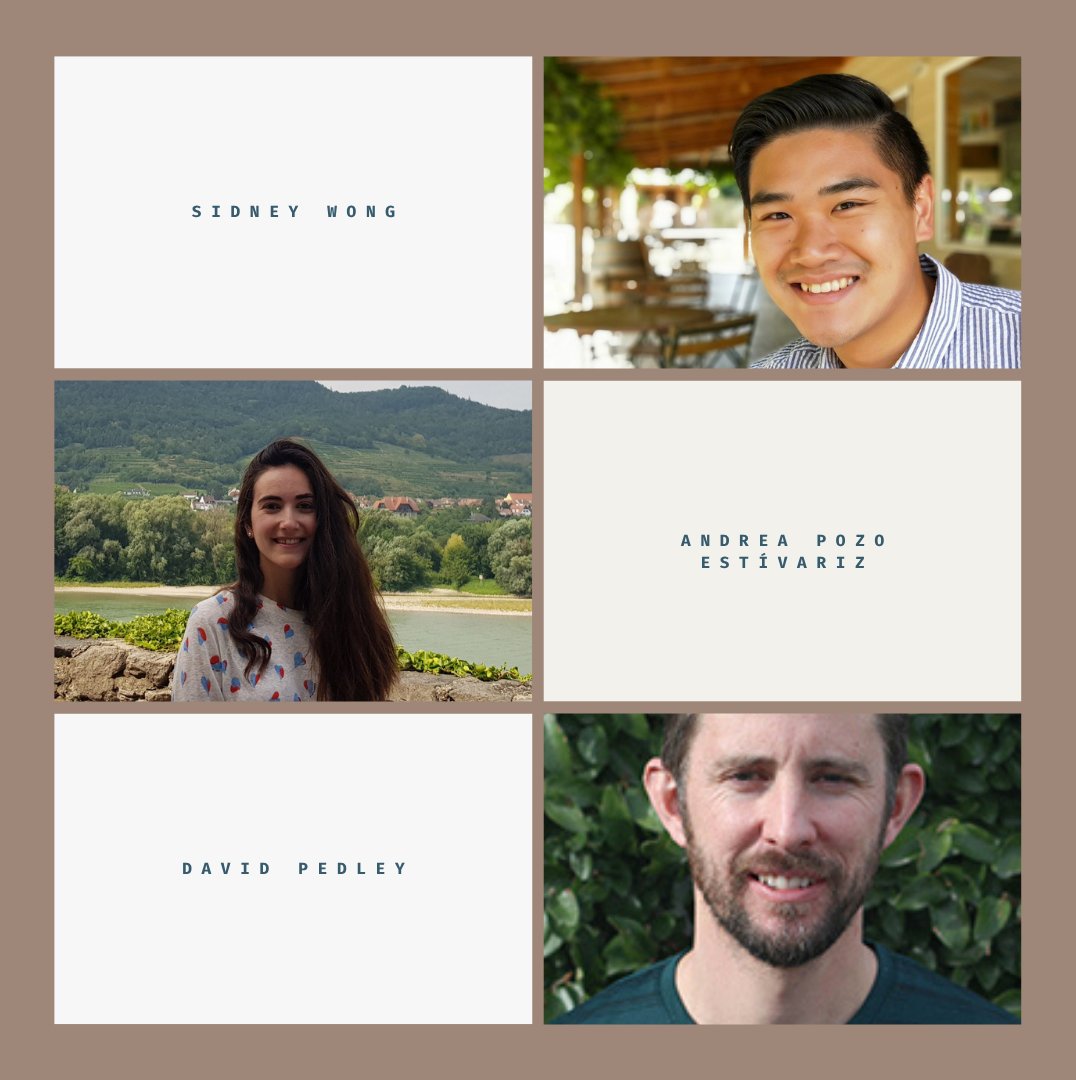
What exciting times for the GRI. In 2026, we've already had 3 PhD students pass their oral exams. Congratulations Sidney Wong, Andrea Pozo Estívariz, and David Pedley.
2
27
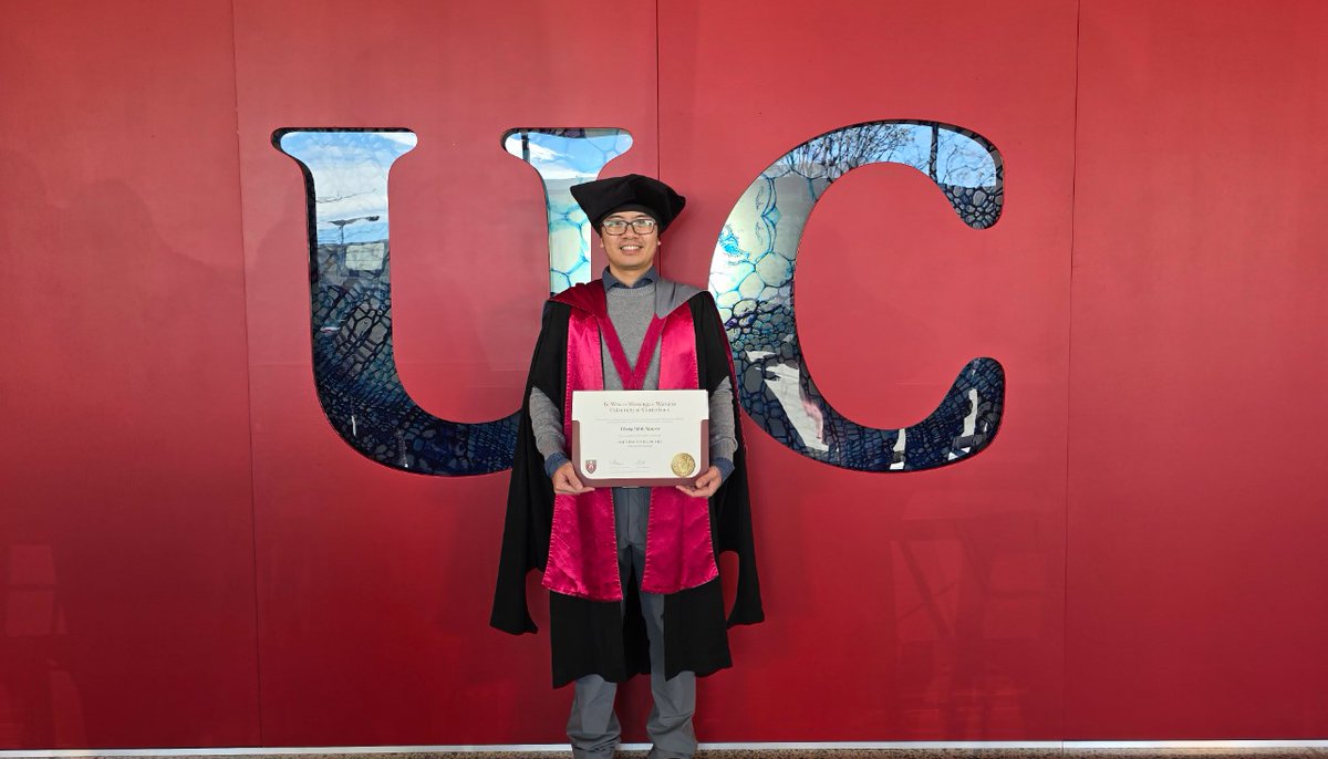
A huge congratulations to Martin Nguyen for earning his Doctor of Philosophy from University of Canterbury!! We at the GRI are very proud.
1
38
Today we kicked off the Second New Zealand Radar Remote Sensing School. It is organised by Geoscience and Remote Sensing Society (GRSS) New Zealand Chapter and the Geospatial Research Institute (GRI) supported by the Institute of Electric and Electronic Engineering (IEEE), USA.

40
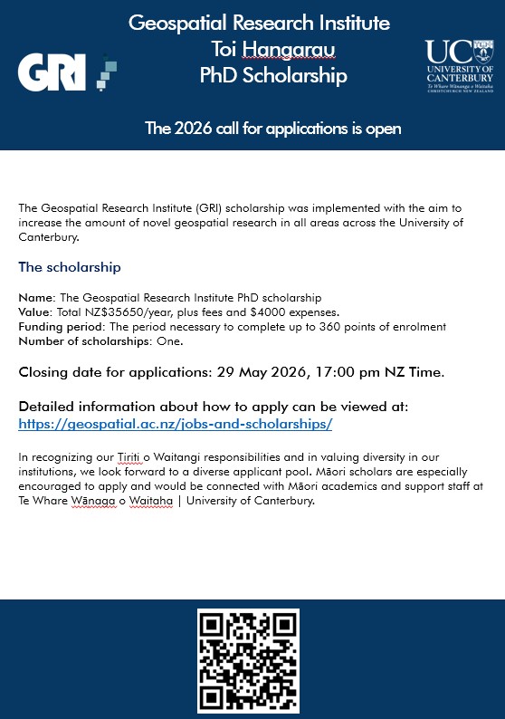
We are excited to announce the Geospatial Research Institute Toi Hangarau PhD Scholarship 2026! Total NZ$35650/year, plus fees and $4000 expenses. To apply visit: geospatial.ac.nz/jobs-and-sc… #phdscholarship #geospatial #scholarship Please share with your networks!
63
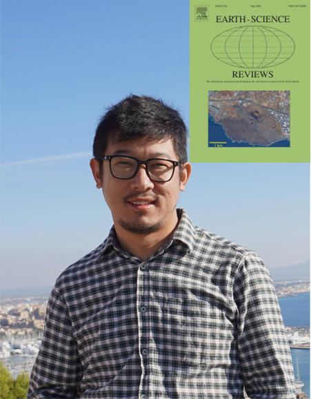
We wish GRI Scholarship recipient, Sunil Tamang a big congratulations for getting his paper: "A review of evolving remote sensing and automated techniques in rock glacier mapping" published in Earth-Science Reviews doi.org/10.1016/j.earscirev.…
64
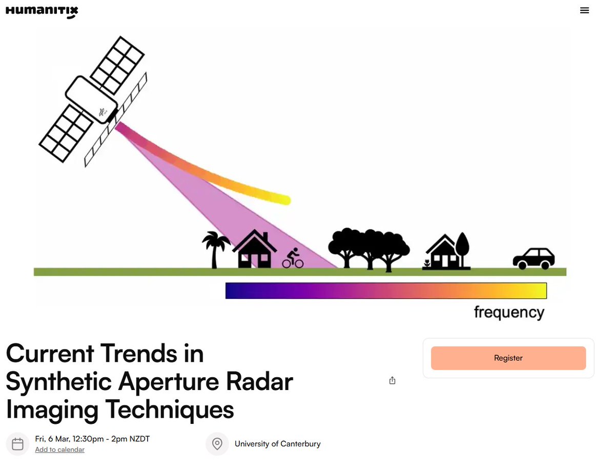
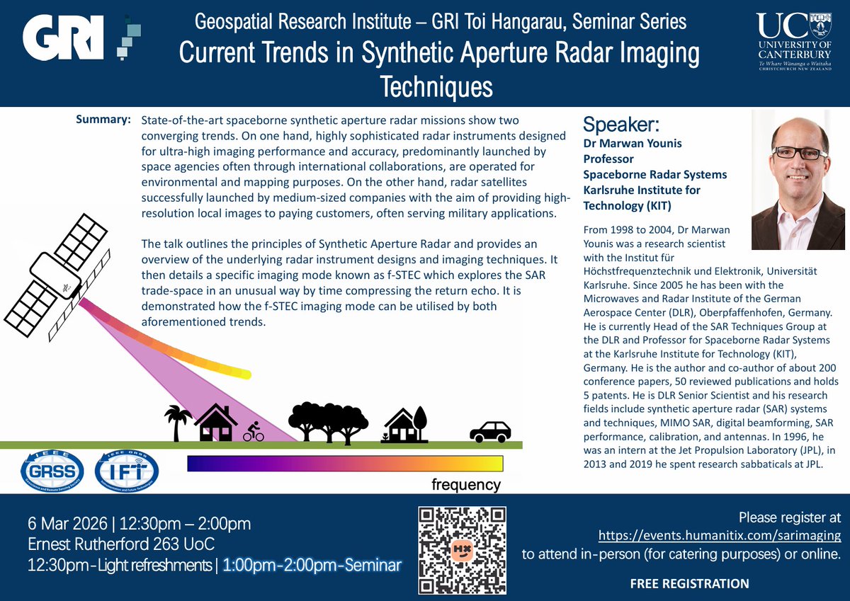
Please join us this Friday, March 6th for a GRI Seminar 6th featuring Professor Marwan Younis. He will be giving a talk called “Current Trends in Synthetic Aperture Radar Imaging Techniques” events.humanitix.com/sarimag…
32
Come watch the first GRISS talk of 2026 and learn about Current Trends in Synthetic Aperture Radar Imaging Techniques. The seminar is led by Professor Marwan Younis Spaceborne Radar Systems, Karlsruhe Institute for Technology (KIT). events.humanitix.com/sarimag…
41
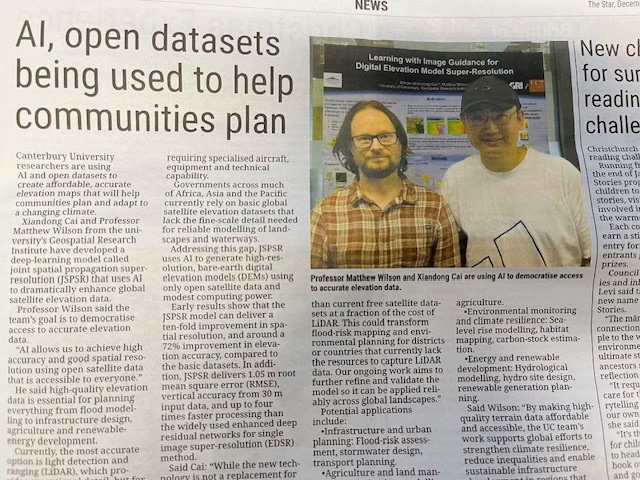
On December 4th, 2025 the Star, page 17, put out an extensive article, entitled “AI, open datasets being used to help communities plan.” The article features Geospatial Research, Xander Cai and Professor Matthew Wilson.
1
45
We had a great turn out to the annual GRI Holiday Party! Nearly forty GRI staff, students, family, and friends came for an afternoon of sun, lemonade, BBQ, pavlova, and secret Santa.
1
41
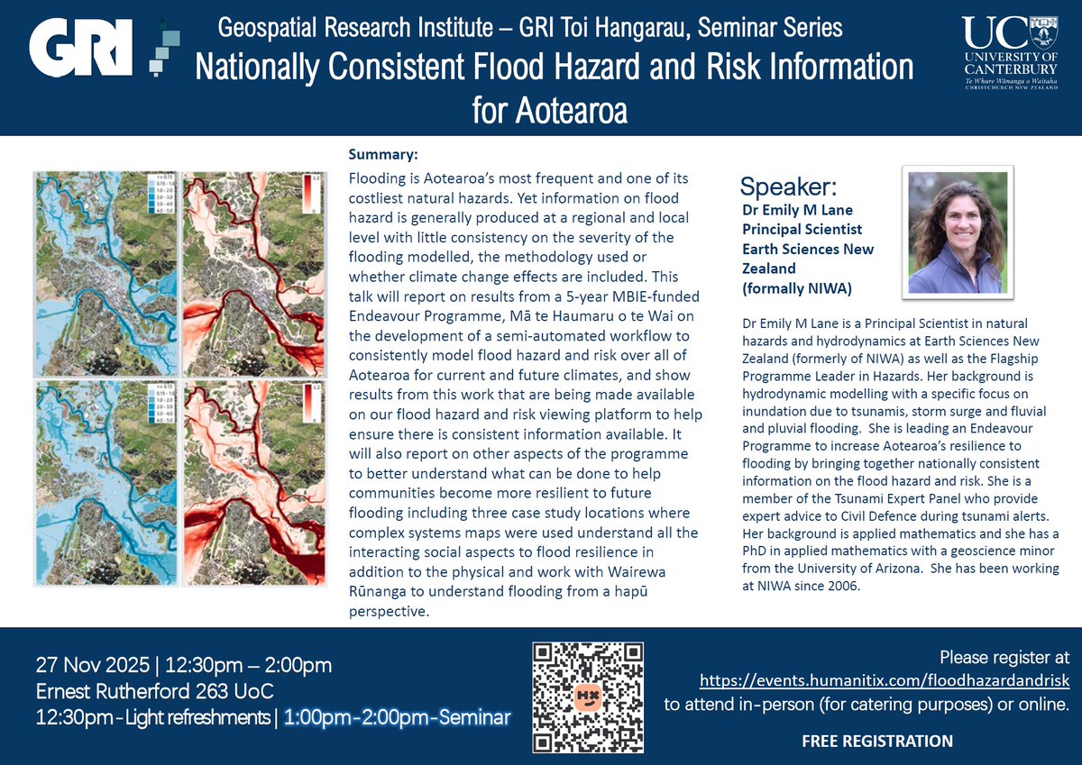
Join us: 27th November for an exciting talk coming up for GRI Seminar Series entitled: Nationally Consistent Flood Hazard and Risk Information for Aotearoa by Earth Sciences New Zealand's Principle Scientist Dr Emily M Lane. In person and on Zoom. events.humanitix.com/floodha…
46
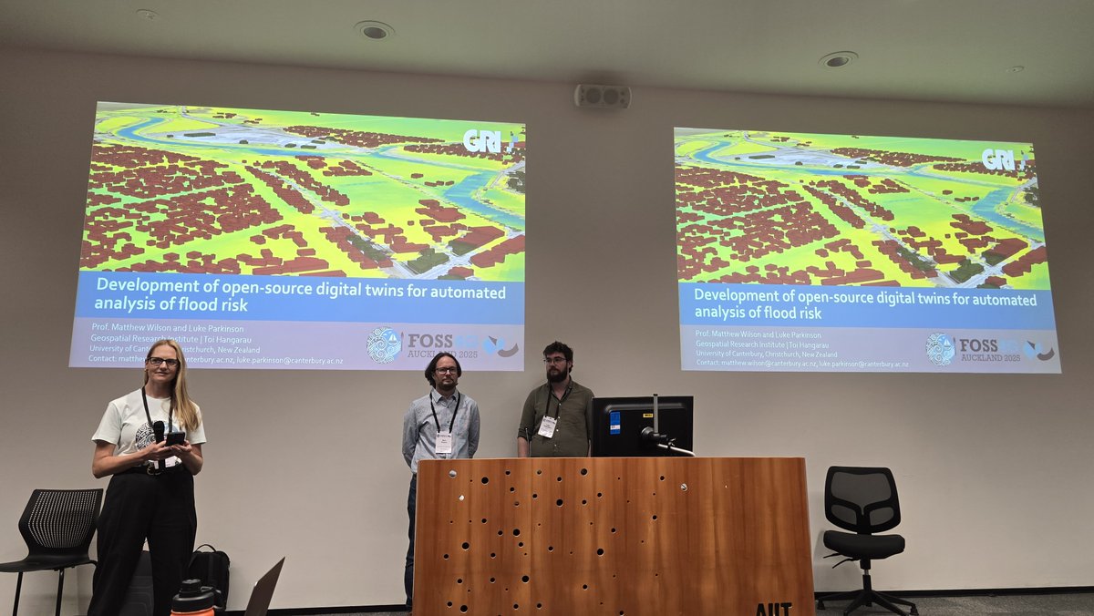
GRI Director, Matthew Wilson and GRI Geospatial Developer, Luke Parkinson gave a talk entitled Development of open-source digital twins for automated analysis of flood risk at the #FOSS4G 2025 this week in Auckland #opensource #geospaital #digitaltwin
1
2
251
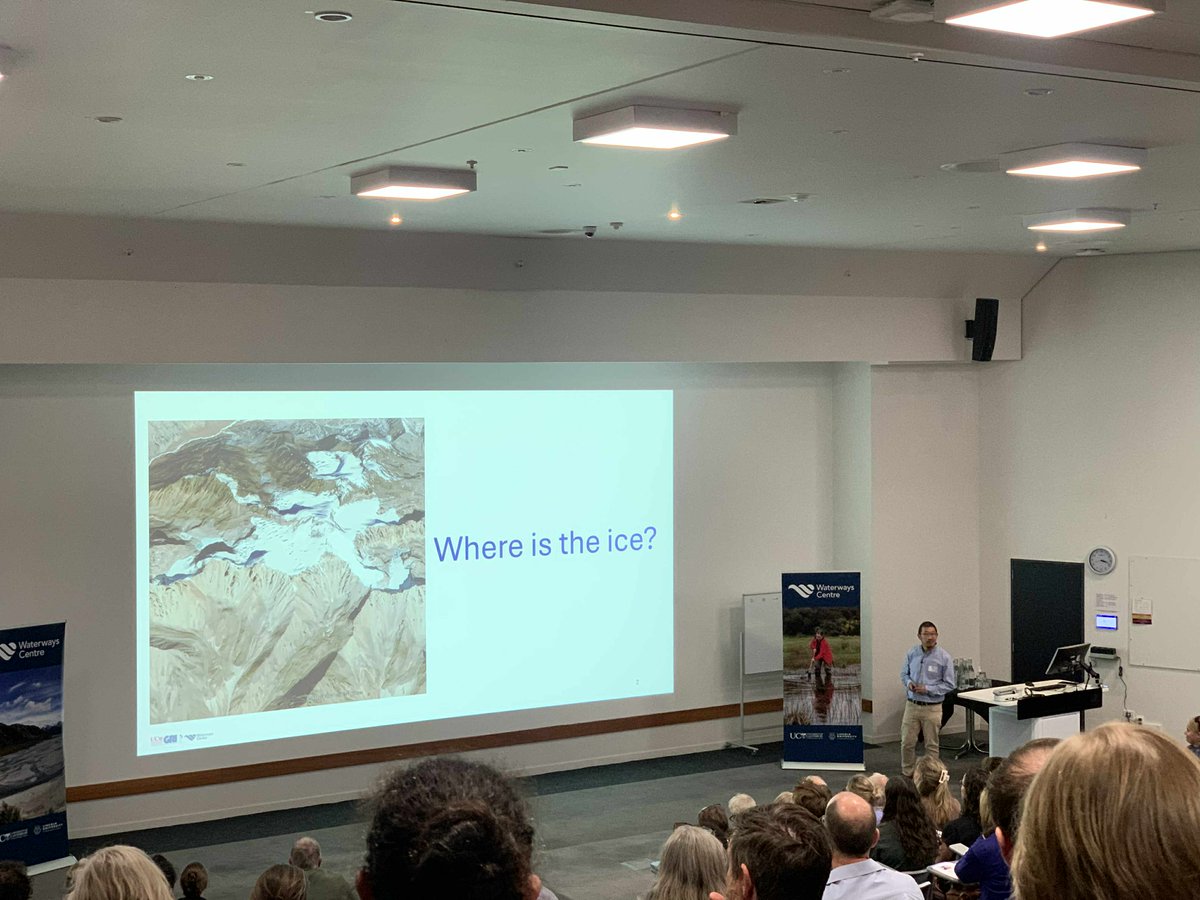
Yesterday at the Waterways Conference 2025, held at Lincoln University, New Zealand, Sunil Tamang delivered an insightful oral presentation titled: “Automating the outline: How accurately can deep learning delineate rock glacier extent?” #geospatial
94
The GeoHealth Lab's Malcolm Campbell is featured in a UC article: "UC launches interactive tool to guide low-carbon urban planning" canterbury.ac.nz/news-and-ev…

38