
Open source. Fast geoprocessing framework. Map Algebra.
Joined February 2012
- Tweets 256
- Following 59
- Followers 703
- Likes 307
16 Photos and videos


GeoTrellis retweeted
27 Jan 2020
Astraea EarthAI is made possible by @locationtech #RasterFrames, @GeoTrellis, JTS, #GeoMesa, Proj4j and SFCurve. Check out the full suite at
projects.eclipse.org/project… via @EclipseFdn Also empowered by @ApacheSpark
27 Jan 2020

Astraea Data Scientist, Courtney Whalen, used EarthAI to predict food insecurity in Zambia using #SatelliteImagery and wrote about it in her recent @Medium post. Thanks to @TDataScience for the support!
#DataScience #ClimateChange #Malnutrition #Geospatial
towardsdatascience.com/predi…
3
7

22 Jan 2020
Love to see powerful visuals built on top of GeoTrellis. Especially examples that leverage the expertise of several great companies and organizations.
@orbital_insight @openstreetmap @planetlabs
21 Jan 2020

We partnered with @orbital_insight to compare building coverage in OpenStreetMap with data they extracted from @planetlabs imagery in cities around Cambodia. Pretty nifty tool you can play with here: demos.azavea.com/orbital-ins….
More at Orbital's blog here: medium.com/@orbital_insight/…
1
1
8
5 Dec 2019
We are excited to see a closer integration between GeoTrellis and @databricks.
Check out the blog DB just published: databricks.com/blog/2019/12/…
We are working together to make it easier to get started with GeoTrellis and the ecosystem of big data geo tools leveraging @ApacheSpark
10
20
GeoTrellis retweeted

1 Nov 2019
We spruced up rasterfoundry.azavea.com and added some previews of the internal tools we've been building for doing machine learning. More to come!
4
17
30 Oct 2019
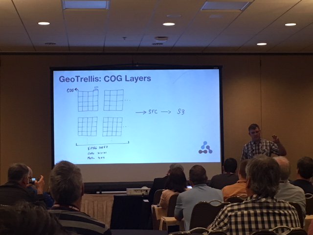
🎉Very excited to announce the release of GeoTrellis 3.0 🎉
We are focused on making it easier to work with Cloud Optimized GeoTIFFs (#cogs) and are working towards closer #STAC integration.
Read about the changes here:
azavea.com/blog/2019/10/29/g…
Let us know what you think!
10
20
GeoTrellis retweeted
26 Sep 2019
I'm sure every industry has powerful people behind the scenes making things happen, but holy cow @opencholmes is on another level. @USGS announced they're going to be publishing Landsat data in STAC & COGs! h/t @mcraddock for tipping me off. usgs.gov/land-resources/nli/…
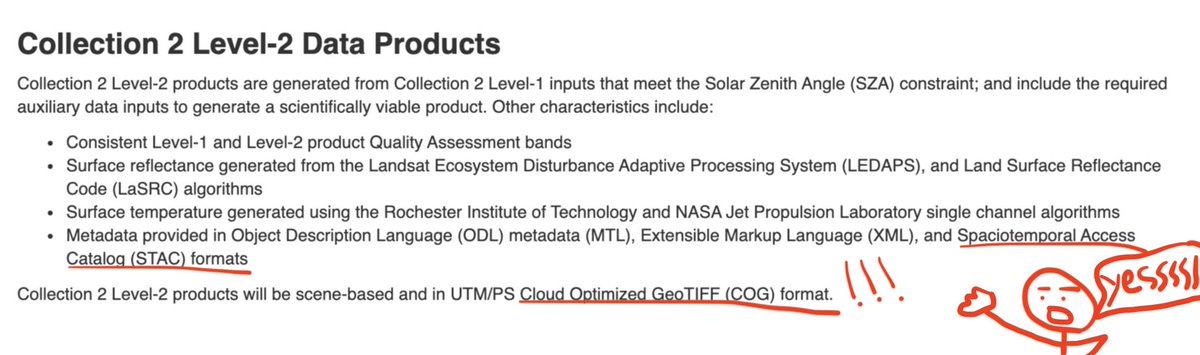
4
9
45
11 Sep 2019
Thanks for getting these videos up so quickly! And thanks again to all of the organizers. It was a great conference.
Two GeoTrellis related talks from State of the Map US:
2019.stateofthemap.us/progra…
2019.stateofthemap.us/progra…
11 Sep 2019

Couldn't make it to State of the Map US this year? Have no fear, videos are here! #SOTMUS #OpenStreetMap #OSMUS 2019.stateofthemap.us/progra…
4
GeoTrellis retweeted

11 Sep 2019
Couldn't make it to State of the Map US this year? Have no fear, videos are here! #SOTMUS #OpenStreetMap #OSMUS 2019.stateofthemap.us/progra…
11 Sep 2019

We just posted the videos for #sotmus. Browse them via the schedule on our website:
2019.stateofthemap.us/progra… (they're embedded on each talk's page)
Watch them all in the playlist:
youtube.com/playlist?list=PL…
1
11
6 Sep 2019
If you are at State of the Map (@sotmus) in
@CityMinneapolis, say hi and check out two talks about GeoTrellis @openstreetmap from:
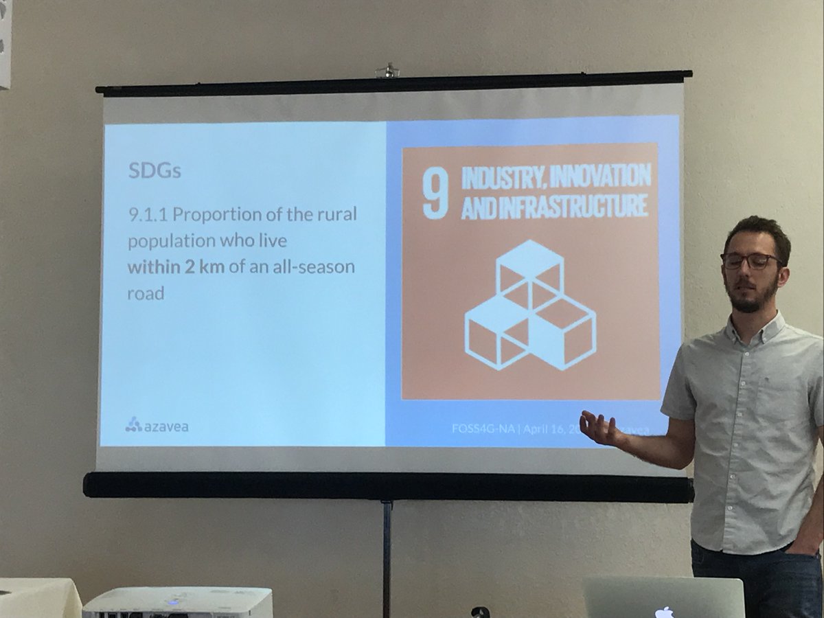
- @rosszb: 11am Friday: How OSM can support the #SDGs
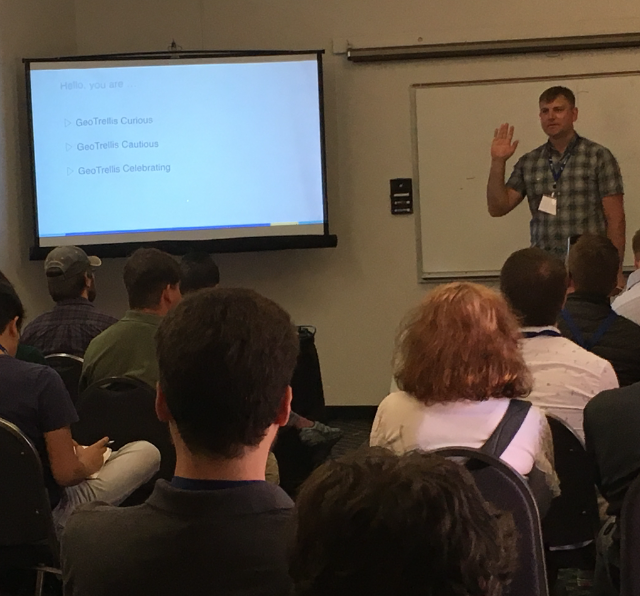
- @echeipesh: 2:55pm Friday: National scale comparison OSM @BingMaps
@azavea #opendata
2
3
GeoTrellis retweeted

3 Sep 2019
Learn more about the work we do in @Geoworldmedia exclusive interview with our CEO, @rcheetham! #opendata #opensource #bcorp #rastervision #bigdata #machinelearning @rasterfoundry @geotrellis @districtbuilder @openapparelreg
3 Sep 2019

. #Innovation advances more rapidly and with greater #public trust when the core #technology is based on a shared intellectual commons, says @rcheetham President and CEO of @azavea in an exclusive interview with us. click the link to read more. buff.ly/2ZMWc8a
4
8
19 Aug 2019
Thanks for sharing. Would love to hear more about how you are using GeoTrellis!
15 Aug 2019

The context that #location brings to a data-set is essential to get rich insights. Locstat ('Location Status'😉) brings together Graph, Event & #Geospatial Processing into our solutions. Here is a screenshot of Locstat's 'Common Operating Picture' interface. @CesiumJS @geotrellis
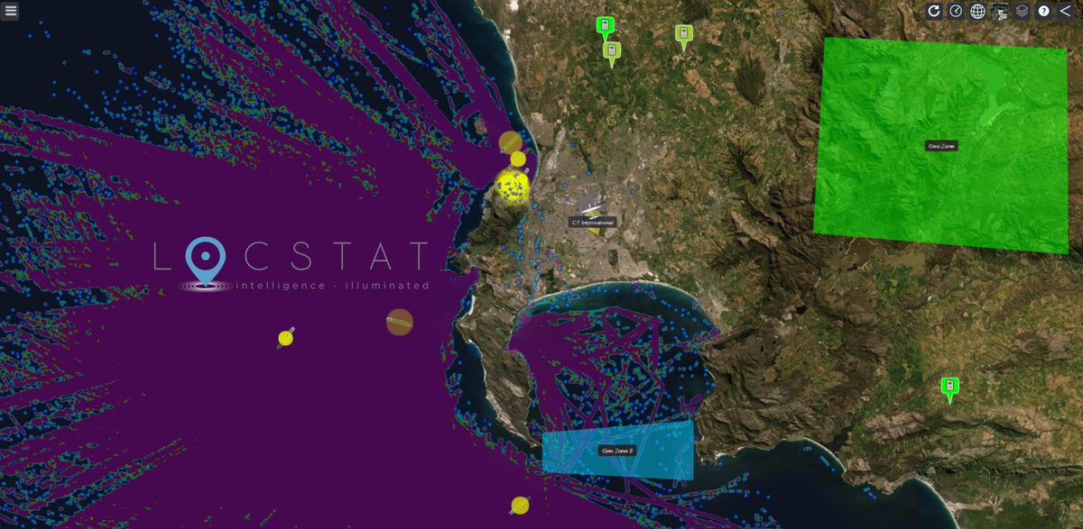
5
31 Jul 2019
Just got two speaker tickets for @sotmus. @echeipesh and @rosszb will both be presenting @azavea's work with @openstreetmap: including #vectortile analysis & generation and expanding our work with #SDG 9.1.1 Looking forward to seeing some of yall there!
2019.stateofthemap.us/
5
11
30 Jul 2019
Love to share job postings that mention GeoTrellis. This one seems great:
nature.com/naturecareers/job…
> The applicant will [...] develop interoperable geospatial decision support platforms for smart city energy applications as well as environmental crisis and disaster management
3
GeoTrellis retweeted
25 Jul 2019
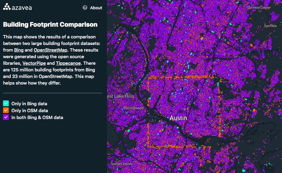
Yooo big news! @azavea just published a countrywide comparison of @bingmaps 100M building footprint dataset with an extract of all of @openstreetmap's data for the U.S. Thanks to @jharpster and the team that open sourced this data! Go have fun with it: demos.azavea.com/building-fo….
8
41
118
24 Jul 2019
This visualization and analysis was made possible because of open source; open tools, open data.
With special shoutout to @Mapbox
github.com/mapbox/tippecanoe
github.com/mapbox/mapbox-gl-…
github.com/geotrellis/vector…
#GIS #opensource #vectortiles
24 Jul 2019

Last year, @bingmaps released 125 million U.S. building footprints derived from #MachineLearning models. @openstreetmap currently has about 38 million buildings in the U.S.. Check out this visualization from our @geotrellis team to see how they compare bit.ly/2Mci5dO
1
8 Jul 2019
Pleased to announce support for #wms and #wcs in GeoTrellis @rasterfoundry.
Tested, reliable standards are essential for geospatial interoperability.
Thank you @nrcan for supporting the effort, it'd been on the roadmap for too long!
azavea.com/blog/2019/07/03/i…
@opengeospatial
10
18
7 Jun 2019
Exciting to see this develop, glad that @azavea was able to support and could send a couple folks from the @rasterfoundry team to contribute. James S built a quick prototype tms viewer for STAC items with geotrellis server.
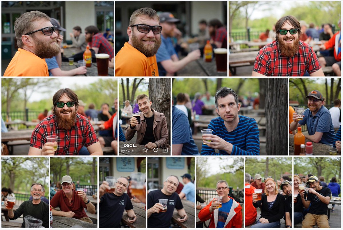
7 Jun 2019

Thanks for coming! And thanks @climatecorp for hosting a great happy hour and @OurRadiantEarth for convening us. Plus @AstraeaInc @CosmiqWorks @azavea and @Element84 for sponsoring!
1
1
6
GeoTrellis retweeted

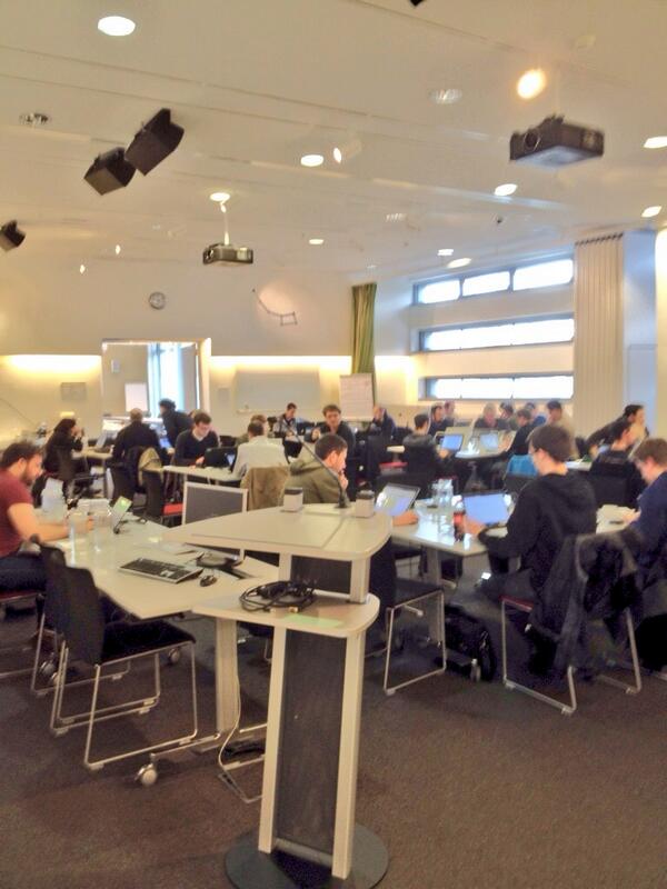
28 May 2019
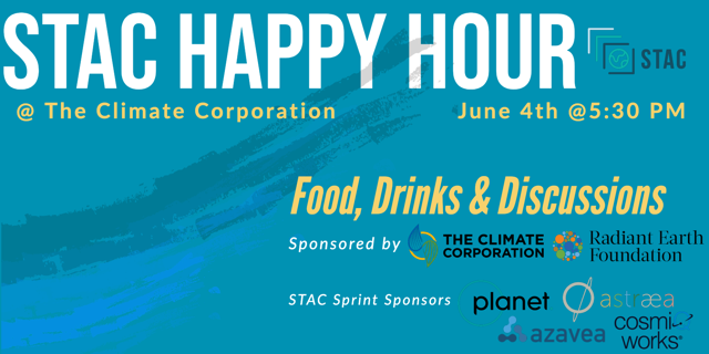
Excited to see everyone in San Francisco next week! Sprinting @planetlabs on STAC, and then sharing what we're up to with a broader audience @climatecorp. If you're in SF and want to share drinks and learn about STAC then please RSVP at eventbrite.com/e/stac-happy-…!
28 May 2019

Heard about SpatioTemporal Asset Catalogs (#STAC) & want to learn more? Join us at @climatecorp's San Francisco office at 5:30 pm on June 4th for an evening of learning, sharing & drinks.
👇🏾medium.com/radiant-earth-ins…
5
19
20 May 2019
Thanks for organizing!
Happy that GeoTrellis team's @daunnc was able to attend and contribute to @pointcloudpipe JNI bindings github.com/PDAL/java
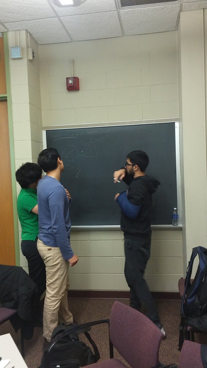
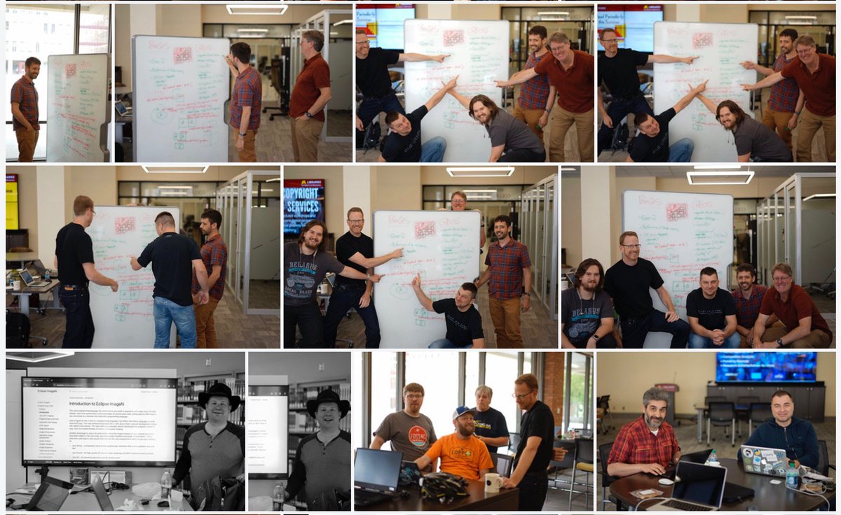
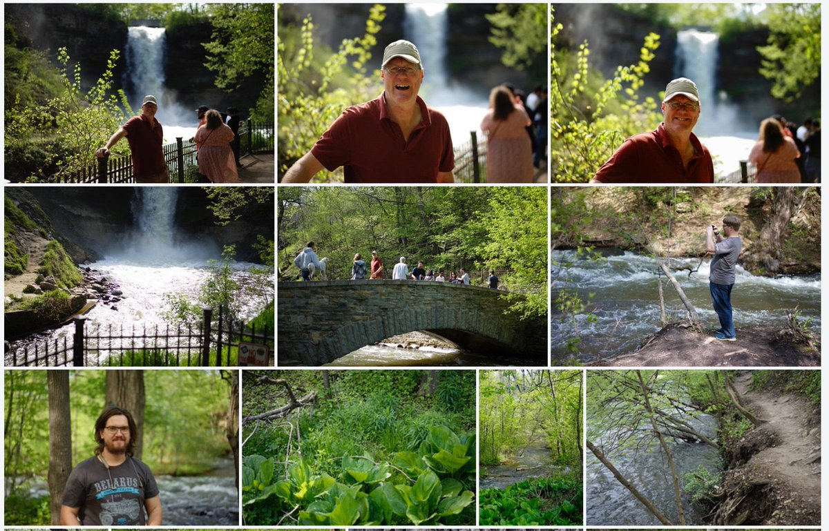
18 May 2019

Cheers from @osgeo community sprint participants!
Thanks to event sponsors, it was a very productive week and we appreciate your support.
The Twin Cities were beautiful and we thank you for hosting us!
#OSGeo flic.kr/s/aHsmDv6FwQ

1
1
5