
Your trusted knowledge source for all things geospatial. We delve into tech convergence and pivot to Industry 4.0 via Digital Transformation and Sustainability
Joined November 2008
- Tweets 27,392
- Following 2,506
- Followers 32,356
- Likes 17,738
6,010 Photos and videos


May 29
#Intelligence. #Awareness. #OperationalReadiness.
At #IPGF2026, @suhoratech will showcase #SPADE - its flagship multisensor data ordering and analytics platform, along with #MIRKA - their ISR platform delivering actionable intelligence for modern defence and security operations.
What to expect at #booth:
• SPADE - Advanced Earth Observation & Analytics Platform
• Maritime and terrain ISR capabilities for strategic situational awareness
• #Live demonstrations of SPADE in action
Join global defence leaders, armed forces, intelligence agencies, and technology innovators at the Indo-Pacific GeoIntelligence Forum 2026 on 2–3 June at the Manekshaw Centre, New Delhi.
Experience the future of geospatial intelligence - live at Indo Pacific GeoIntelligence Forum 2026.
Register Now: geospatialworld.net/geointel…
#IPGF2026 #SUHORA #SPADE #GeoIntelligence #ISR #DefenceTechnology #Geospatial #SituationalAwareness #DefenceInnovation #IndoPacific
3
2
204
Geospatial World retweeted

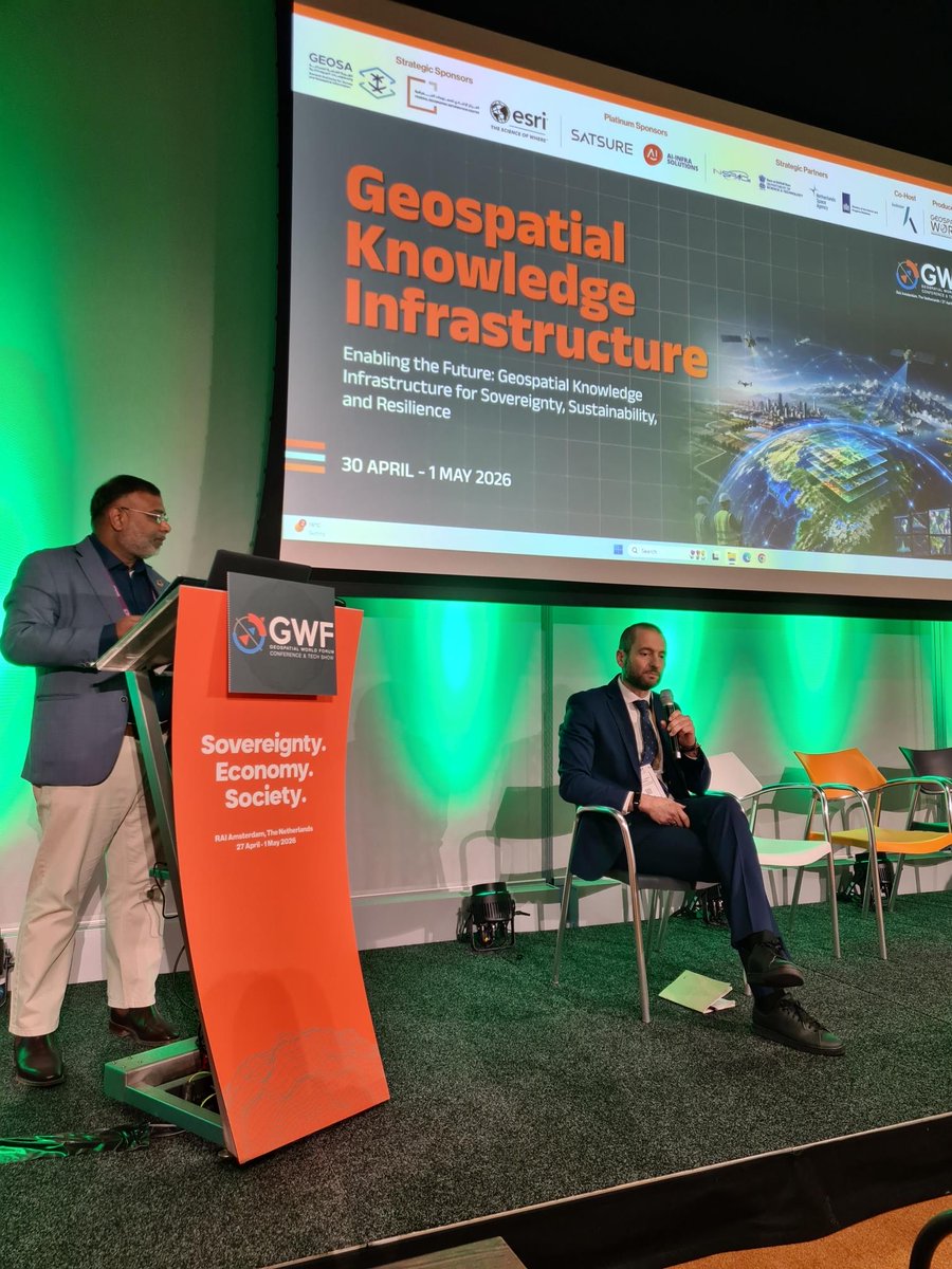
🌐 Esta semana se está celebrando el Geospatial World Forum 2026 #GWF2026 en Ámsterdam.
En la jornada de hoy ha participado en la sesión 3 "Infraestructura de TI para una GKI moderna: plataformas en la nube, interoperabilidad e IA" el director del #CNIG, Emilio López Romero.
Más información: geospatialworld.net/gwf/2026…
#IGNSpain #GWF #GeospatialWorld @geospatialworld @GeospatialM @transportesgob
2
2
727
Apr 22
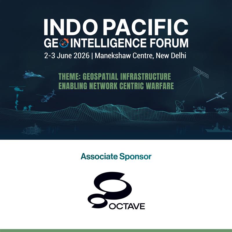
We’re pleased to welcome Octave as an Associate Sponsor of the Indo-Pacific GeoIntelligence Forum 2026.With decades of enterprise software expertise, Octave transforms complex data into actionable intelligence—empowering smarter decisions and resilient infrastructure.#IPGF2026 #GeoIntelligence #DataDriven #Geospatial
3
7
317
Apr 13
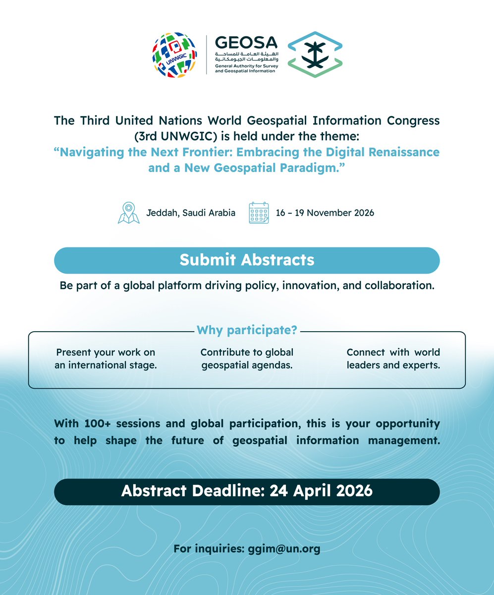
Submit your abstracts and be a part of a pivotal global event.
Be part of a distinguished group of leaders, experts, professionals, and practitioners to shape the future of the geospatial domain worldwide at the Third United Nations World Geospatial Information Congress, hosted by the Kingdom of Saudi Arabia represented by the General Authority for Survey and Geospatial Information. under the theme: Navigating the Next Frontier: Embracing the Digital Renaissance and a New Geospatial Paradigm.
To submit: docs.google.com/forms/d/e/1F…
Abstract Submission Deadline:24 April 2026
When: 16-19 November 2026
Where: Jeddah, Saudi Arabia
For inquiries: ggim@un.org #UNWGIC2026
2
401
Apr 13
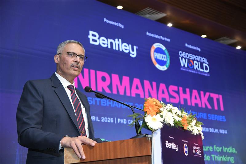
#NirmanaShakti | It was a privilege to have 𝐌𝐚𝐣 𝐆𝐞𝐧 𝐑𝐚𝐣𝐞𝐬𝐡 𝐁𝐡𝐚𝐭, 𝐒𝐌, 𝐃𝐢𝐫𝐞𝐜𝐭𝐨𝐫 𝐆𝐞𝐧𝐞𝐫𝐚𝐥, 𝐂𝐨𝐦𝐛𝐚𝐭 𝐄𝐧𝐠𝐢𝐧𝐞𝐞𝐫𝐬, 𝐄-𝐢𝐧-𝐂 𝐁𝐫𝐚𝐧𝐜𝐡, deliver a special keynote address on “Technology-Enabled Subsurface Intelligence for Safer and Resilient Infrastructure” at the NirmanaShakti – Viksit Bharat 2047 Infrastructure Series.
Organized by Geospatial World, powered by @BentleySystems, with the @phdchamber as the associate partner, the half-day symposium brought forth critical conversations on building resilient infrastructure for India’s future.
Maj Gen Bhat’s address stood out for its clarity and depth, highlighting some pressing challenges and opportunities:
- The persistent disconnect between infrastructure creation and its long-term management, often handled by different agencies
- The critical gap in awareness of subsurface asset locations, posing risks to safety and efficiency
- Insightful parallels from military operations, where working across complex terrains and uncertain conditions is the norm
- The urgent need for geotagging infrastructure to enable accurate data, seamless coordination, and safer execution
His perspectives underscored the importance of integrating technology, data intelligence, and cross-agency collaboration to strengthen infrastructure planning and lifecycle management.
We sincerely thank Maj Gen Rajesh Bhat for gracing the occasion and sharing such valuable insights that will undoubtedly shape future conversations around subsurface intelligence and resilient infrastructure.
#NirmanaShakti #ViksitBharat2047 #Infrastructure #SubsurfaceIntelligence #Geospatial #DigitalTransformation #ResilientInfrastructure #BentleySystems
2
3
6
400
What LiDAR is and why it matters?
#LiDAR #Geospatial #GIS #MappingTechnology #3DMapping #RemoteSensing #SmartCities #AutonomousVehicles #ClimateTech #EarthObservation #FutureTech #GeoSpatialIntelligence
2
4
18
1,901
17 Sep 2025
Satish MV from @larsentoubro reveals how digital tech is reshaping construction at AEC Forum 2025 🚧💡
From automated design & BIM (3D–7D) to geospatial tech, AI, and digital twins—building smarter, safer, & more sustainable infrastructure 🌍🏗️
#DigitalTransformation #SmartInfrastructure #AECForum2025
1
3
5
917
16 Sep 2025
🚨 At #AECForum2025, Amit Prothi, DG of @CDRI_World, explains why disaster resilience is urgent in 2025. 🌍
💡 Digitalization, AI & innovation are transforming how we build, protect & recover infrastructure.
🌐 50 member countries. Global impact.
Watch now ⬇️
2
3
3
786
15 Sep 2025
At AEC Forum 2025, Eric DesRoche from @Autodesk shares how #BIM, #AI, and data-driven collaboration are transforming design, construction & operations 🌍
From India’s infrastructure boom to outcome-based project delivery—building smarter, faster, and sustainably 🚀
#Infrastructure #DigitalTransformation #AECForum2025 #India #ViksitBharat2047
2
3
643
15 Sep 2025
#announcement | SPACETIDE at IAC 2025 in Sydney!
We’re excited to share that our partner SPACETIDE Foundation will be participating in the 𝐈𝐧𝐭𝐞𝐫𝐧𝐚𝐭𝐢𝐨𝐧𝐚𝐥 𝐀𝐬𝐭𝐫𝐨𝐧𝐚𝐮𝐭𝐢𝐜𝐚𝐥 𝐂𝐨𝐧𝐠𝐫𝐞𝐬𝐬 (𝐈𝐀𝐂) 𝟐𝟎𝟐𝟓, this September end in Sydney. They will be represented by:
Masayasu Ishida – President & CEO
Masashi Sato – Director & CSO
Daisuke A. – General Manager
If you’re attending IAC and would like to learn more about SPACETIDE’s activities or explore opportunities for collaboration, please don’t hesitate to reach out to Atarashi-san to arrange a meeting.
Space is more than ever a key element in the toolbox of Geospatial Intelligence, and understanding how the industry will shape new capabilities in the coming decade is essential. Come and learn more about the APAC space ecosystem with SPACETIDE at IAC 2025 Sydney!
#SPACETIDE #IAC2025 #sydney #space #business #GlobalCollaboration
3
5
1,021
12 Sep 2025
At AEC Forum 2025, Maj. Gen. Sameer Srivastava, AVSM, VSM, Additional Director General, Land Works and Environment, Indian Army, shares how the Army is reimagining infrastructure for the future.
With initiatives like net-zero cantonments, geothermal systems, #BIM, #IoT, and digital twins, the Army is transforming military infrastructure into a force multiplier for national security and resilience.
Watch this exclusive address from #AECForum2025 to understand how technology, sustainability, and strategic planning are shaping the Indian Army’s infrastructure of tomorrow.
#IndianArmy #MilitaryInfrastructure #DigitalTwins #SmartCantonments #SustainableInfrastructure #NetZeroCantonments #GeothermalEnergy #GreenEnergy #DefenseTechnology #InfrastructureInnovation #NationalSecurity #FutureOfInfrastructure
1
538
9 Sep 2025
At the AEC Forum 2025, Srikant Sastri , Chairperson of the Geospatial Data Promotion & Development Committee (GDPDC), Government of India, highlighted how India’s National Geospatial Policy aligns with the new Digital Twin Strategy. He pointed out real challenges like traffic accidents, urban floods, infrastructure misalignments, and poor property tax collection that digital twins can help solve.
The success of this strategy depends on three key factors: seamless data accessibility & interoperability, strong collaboration across government initiatives, and clear user education to prevent misinformation. Pilot projects have already shown the potential of bringing diverse datasets into a unified, real-time framework.
He concluded with a call for #AI readiness in digital infrastructure to enable smarter urban planning and predictive solutions. The message is clear: digital twins are not just important—they are urgent.
#DigitalTwins #Geospatial #SmartCities #AECForum2025 #DigitalIndia #SmartCities
1
3
405
8 Sep 2025
In his opening remarks at #AECForum2025, Sanjay Kumar, Founder & CEO of Geospatial World, emphasized the urgent need for resilient & sustainable infrastructure.
🌍 Geospatial tech, BIM & Digital Twins are key to transforming infrastructure in the 2020s.
📊 70% of Infrastructure by 2050 is yet to be built.
📢 He also called for a National Digital Twin Policy for India.
#Geospatial #BIM #DigitalTwin #SmartInfrastructure #Infrastructure2050 #SustainableInfrastructure #ResilientInfrastructure #GeospatialWorld #ViskitBharat #AEC
2
4
512
12 Aug 2025
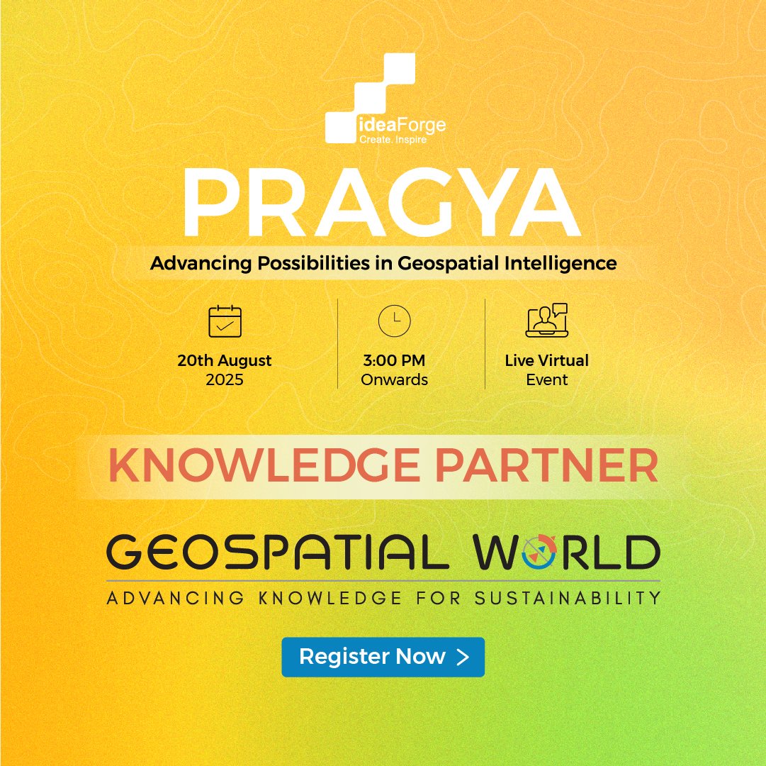
We’re pleased to be the Knowledge Partner for #PRAGYA2025 – @ideaforge_tech's inaugural summit on Advancing Possibilities in Geospatial Intelligence.
Request your invite to join industry leaders to explore next-gen UAVs & the future of drone-powered GIS shorturl.at/sg9X2
5
3
7
1,120
30 Jul 2025
As @NASA and hashtag @ISRO are ready to launch the #NISAR satellite from Satish Dhawan Space Centre, Sriharikota, India, this joint mission marks a significant milestone in Earth observation and international collaboration.
NASA-ISRO Synthetic Aperture Radar (NISAR) will use advanced dual radar technology to provide 3D views of Earth’s surface, helping monitor natural disasters, track ecosystem changes, and deepen our understanding of climate impacts.
Watch the video to learn 5 key things you should know about this groundbreaking mission!
#NASAISRO #EarthObservation #SatelliteLaunch #SpaceTechnology #ClimateScience #NewSpace #RemoteSensing #India #USA
1
2
3
509
25 Jul 2025
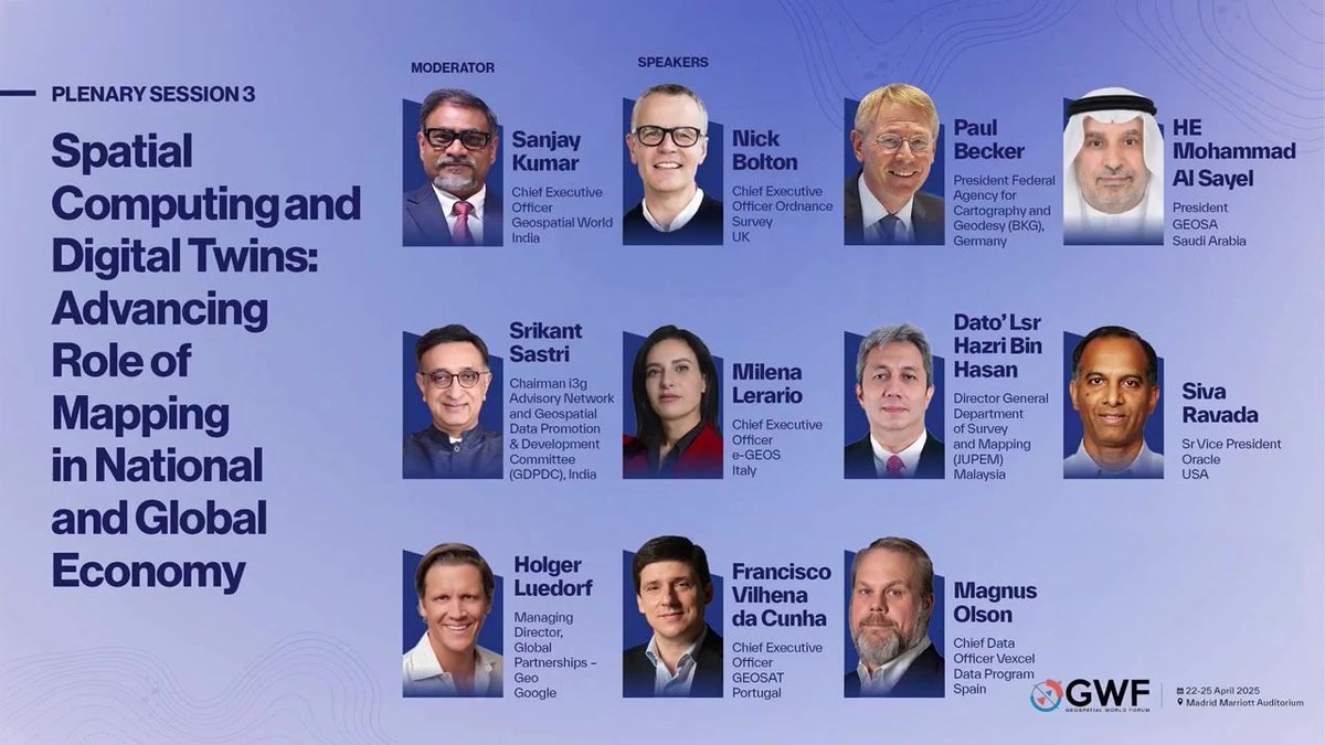
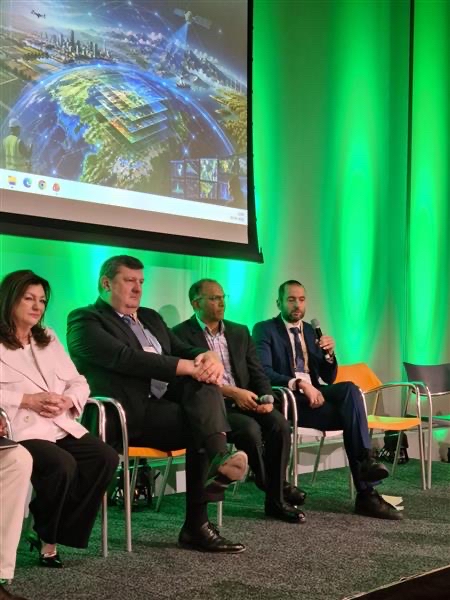
At #GWF2025, experts from 🇬🇧🇩🇪🇸🇦🇮🇳🇮🇹🇲🇾🇺🇸🇵🇹🇪🇸 explore how spatial computing is transforming national digital twins, AI-ready data, and geospatial sovereignty.
🔗Collaboration. 📡Integration. 🌐Innovation.
🎥 Watch video here 👉 geospatialworld.net/videos/s…
#DigitalTwin #SpatialComputing #Geospatial #AI #Mapping
2
5
485
24 Jul 2025
At #GWF2025, Claire Milverton, CEO of @1Spatial, shows how geospatial automation is powering smarter infrastructure.
🎥 Watch now ↓
#DigitalTwins #SmartCities #GeospatialTech
2
4
425
23 Jul 2025
🌍 “We must build not just stronger, but smarter infrastructure.”
At #GWF2025, @WFEO President Seng Chuan Tan highlights how geospatial tech, AI & digital twins can power resilient, sustainable infrastructure. With $93T investment by 2040, the time to act is now.
#Infrastructure #DigitalTwins #GIS #SmartCities
1
3
3
469
22 Jul 2025
How India is Building Geospatial Knowledge Infrastructure for Economic Growth | GWF 2025
In this keynote address at Geospatial World Forum 2025, Srikant Sastri, Chairman of Geospatial Data Promotion & Development Committee, Government of India, outlines India’s ambitious vision to transform its geospatial ecosystem—from outdated infrastructure to a future-ready Geospatial Knowledge Infrastructure (GKI).
Discover how India is rolling out a National Geospatial Mission, establishing a data-sharing platform, and enabling public-private innovation through a National Geospatial Data Registry. The address highlights the strategic shift from fragmented efforts to a mission-driven, citizen-centric, economically impactful geospatial infrastructure.
#India #GKI #GeospatialIndia #GWF2025 #SrikantSastri #GeospatialTransformation #GeospatialEconomy #NationalGeospatialMission #GeospatialWorldForum #DigitalIndia #GeospatialInnovation #DataInfrastructure #GeospatialGrowth #PublicPrivateInnovation #GeospatialKnowledgeInfrastructure #LocationIntelligence #GeospatialFuture
3
397
18 Jul 2025
At the Geospatial World Forum 2025, H.E. Mohammad Al Sayel, President of GEOSA (General Authority for Survey and Geospatial Information), Saudi Arabia, outlines the bold strides Saudi Arabia is making in shaping the future of geospatial ecosystems.
From AI-driven mapping to regional leadership, this keynote explores Saudi Arabia’s Vision 2030, national geospatial infrastructure, partnerships with global bodies like the World Bank and OGC, and the launch of the Geospatial Academy to empower youth and women in the field.
Learn how Saudi Arabia is creating a resilient, interconnected, and AI-powered geospatial future.
@GEOSA_GOV_SA @GEOSA_P
#SaudiArabia #Vision2030 #GEOSA #MohammadAlSayel #GeospatialWorldForum #GWF2025 #GeospatialEcosystem #NationalGeospatialInfrastructure #AIinMapping #GeospatialAcademy #EmpoweringYouthAndWomen #GeospatialForDevelopment #SmartMapping #GlobalGeospatialPartnerships #GeospatialInnovation #SaudiArabia2030 #DigitalTransformation #GeospatialFuture
1
2
377