
One of only six meteorologists in the world ever named AMS Fellow, CCM and CBM. WDIV-TV meteorologist: 1983-2023. Lived my childhood dream for 40 years!
Joined July 2013
- Tweets 32,124
- Following 321
- Followers 13,471
- Likes 7,141
9,036 Photos and videos


(7:55am Sun) Many of us are dry to start the day…showers are mainly north of I-69. But shower and thunderstorm coverage will increase midday as a cold front approaches. No severe weather today…just routine stuff.


2
11
497
Can’t…have multiple commitments. Wish I could…


1
7
1,819

Jun 13
(7:30am Sat) If you have yard work or other outdoor stuff planned this weekend, today’s the day, as showers and thunderstorms develop overnight and continue into Sunday. Marginal severe risk tonight for the northern Thumb and southwest/west of there, but not the metro area.


4
17
1,473
Paul Gross retweeted

Jun 12
Timelapse shot of just a section of damage path north of Kouts, IN. This was a very violent #tornado with significant ground scaring.
@MyRadarWX #inwx
34
326
2,028
161,116
Jun 12
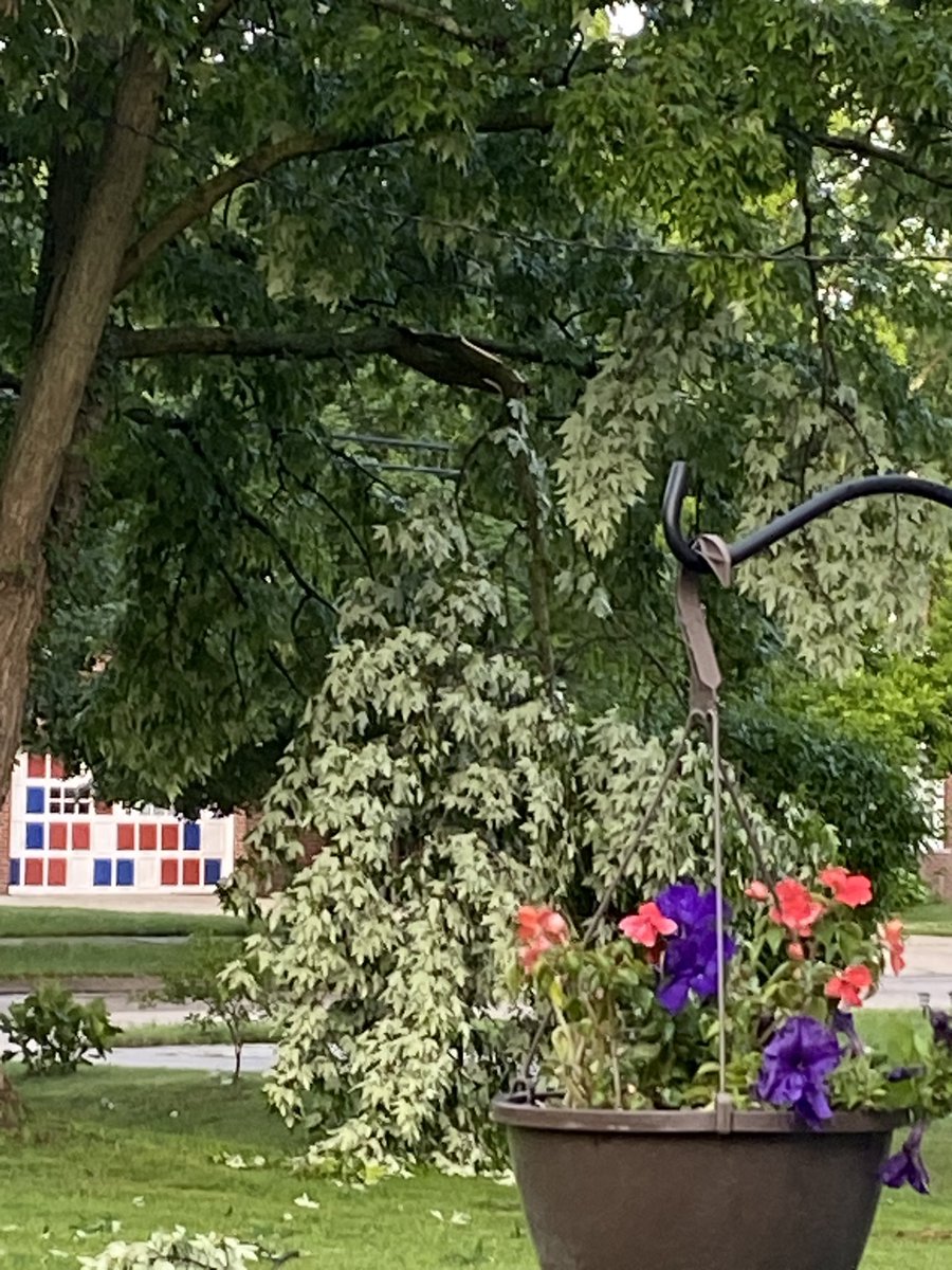
(8:30am Friday) TGIF…and boy do we need a Friday. Just checked the rain gauge, and I got 0.97” from last night’s storms here in Farmington Hills. @NWSDetroit
2
2
27
1,084
Jun 12
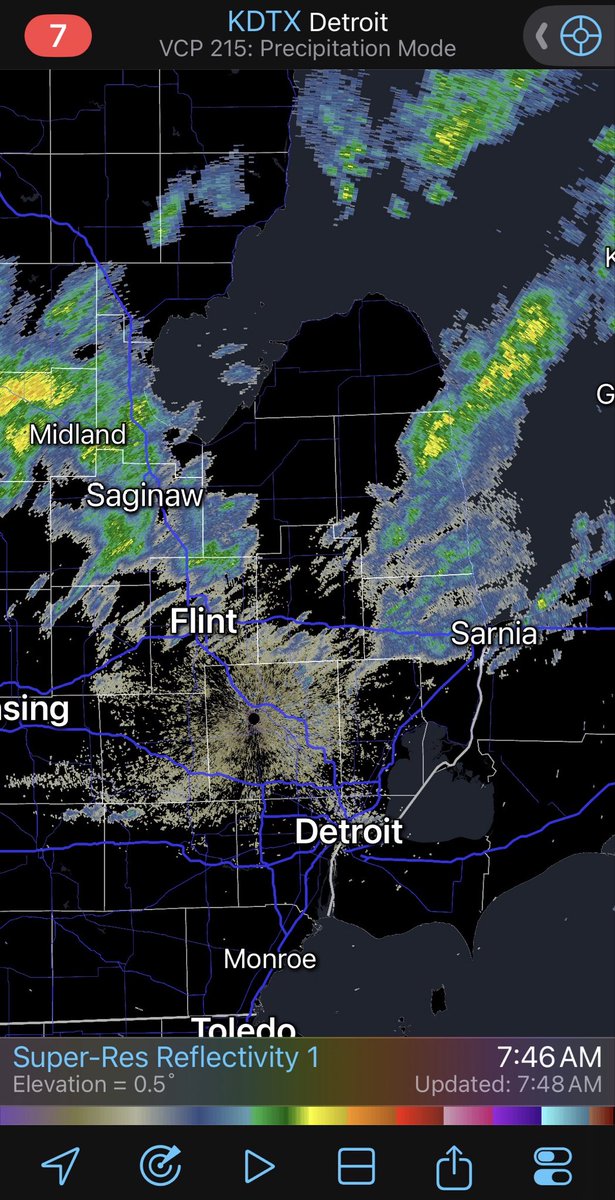
As I had mentioned, there were still some gusts approaching 50 mph. The minimum criteria for severe is 58 mph. You can still get isolated damage under 58 mph. City Airport reported a 53 mph gust at 1:11am…

1
12
1,607
Jun 12
(1:05am Fri) I’ve been watching the airport observations as the storm came through, and not one reported a severe gust. DTW had the strongest gust at 48 mph. I think we’re good for the rest of the night, as no warnings are in effect. I’m going to get some sleep…been a long day.
8
2
38
1,383
Jun 12
(1:00pm Fri) Environment Canada has issued a Severe Thunderstorm Warning for the part of SW Ontario inside the yellow polygon. 60 mph / 90 kph wind gusts are the primary severe threat. Warning is in effect until 3:00 AM.
1
2
6
801
Jun 12
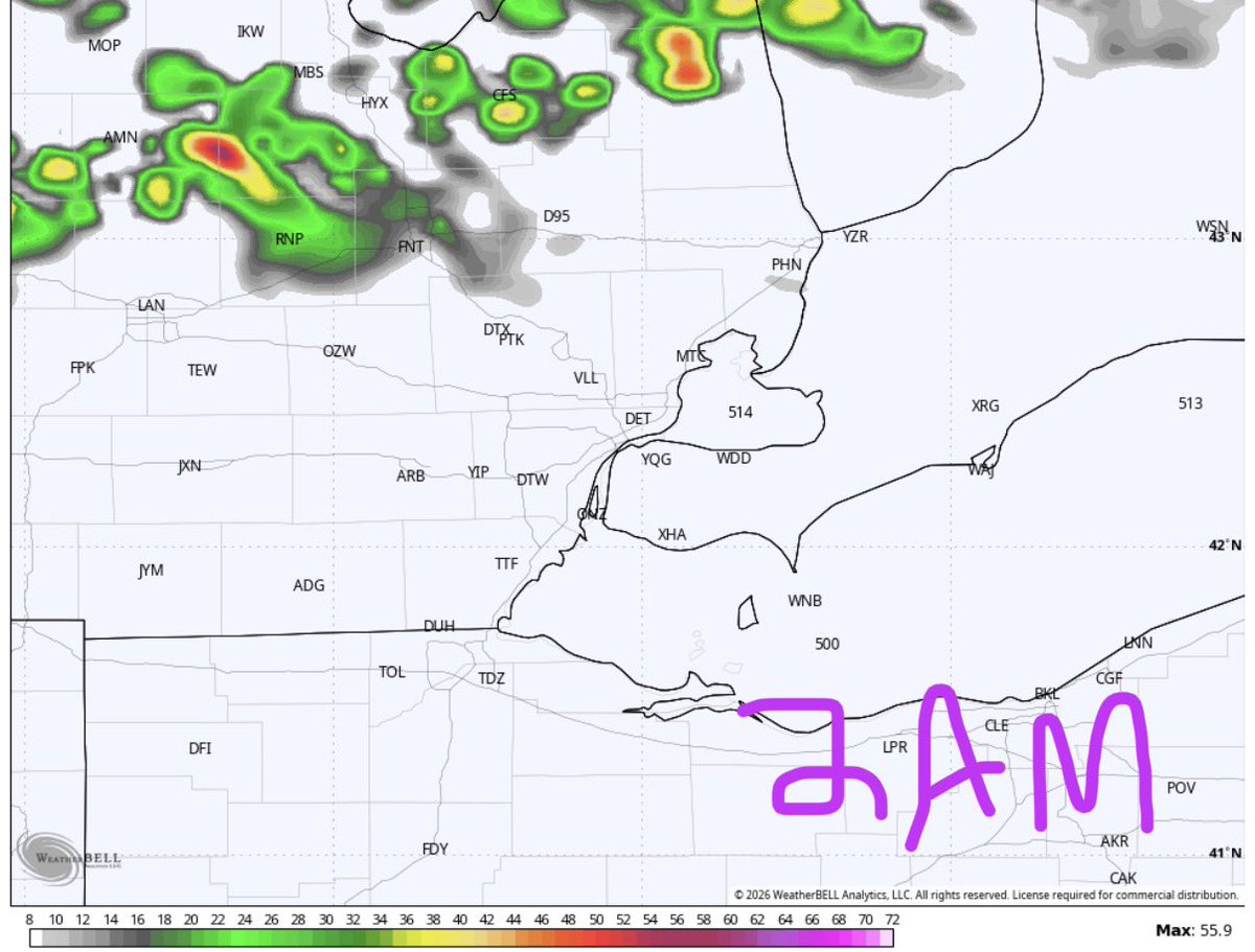
(12:25am Fri) Not being talked about much is the copious amounts of rain with the big batch of storms. You can see the prominent stripe of blue to our west - that’s radar estimated amounts over 3 inches.
1
2
9
1,420
Jun 12
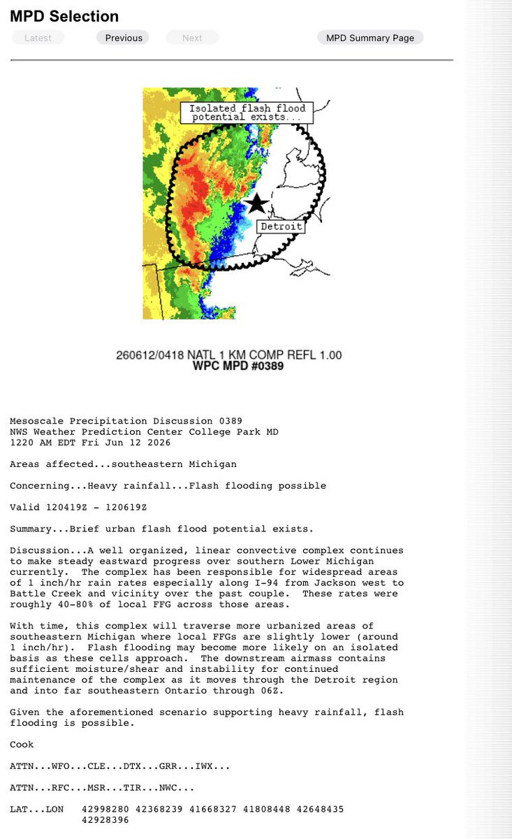
As I was looking at the radar data and typing my tweet, a Mesoscale Precipitation Discussion was issued specifically to address the potential for flash flooding in the Metro Detroit region…especially urban parts of our area.
4
860
Jun 12
(12:18am Fri) Radar indicating a particularly strong patch of wind entering Livingston County. #miwx
1
9
1,178
Jun 12
(12;15am Fri) Severe Thunderstorm Warning issued by @NWSDetroit until 1:15am for Washtenaw County. While 60 mph gusts are the primary threat, a spin-up tornado is still possible. #miwx
2
7
1,039
Jun 12
(11:56pm Thu) A wider view shows a new bow echo developing as it approaches Lenawee County. Could see some destructive wind - particularly near the apex of the bow.
1
3
8
983
Jun 12
(11:50pm Thu) Severe Thunderstorm Warning issued by @NWSDetroit until 12:45am for Lenawee County. While 60 mph gusts are the primary threat, a spin-up tornado is still possible. #miwx
1
1
8
1,930
Jun 12
(11:00pm Thu) There’s still some wind aloft to tap into, but the radar’s reflectivity data - basically, precipitation intensity - sure does show a weakening trend. I discussed earlier what a close call this would be with the timing of the weakening. Keep those fingers crossed.
2
2
26
2,477
Jun 12
Let’s hope for the same eventuality with the activity in SW Michigan…
1
11
991
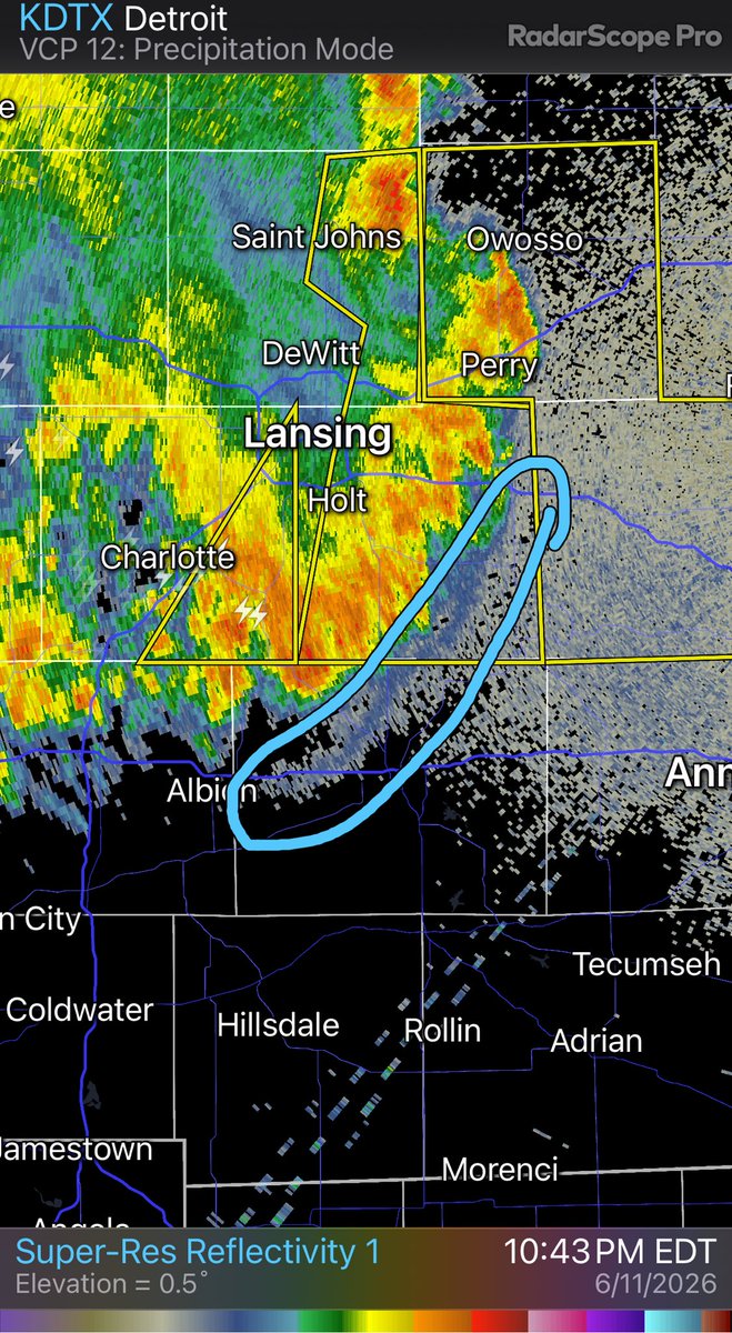
Jun 12
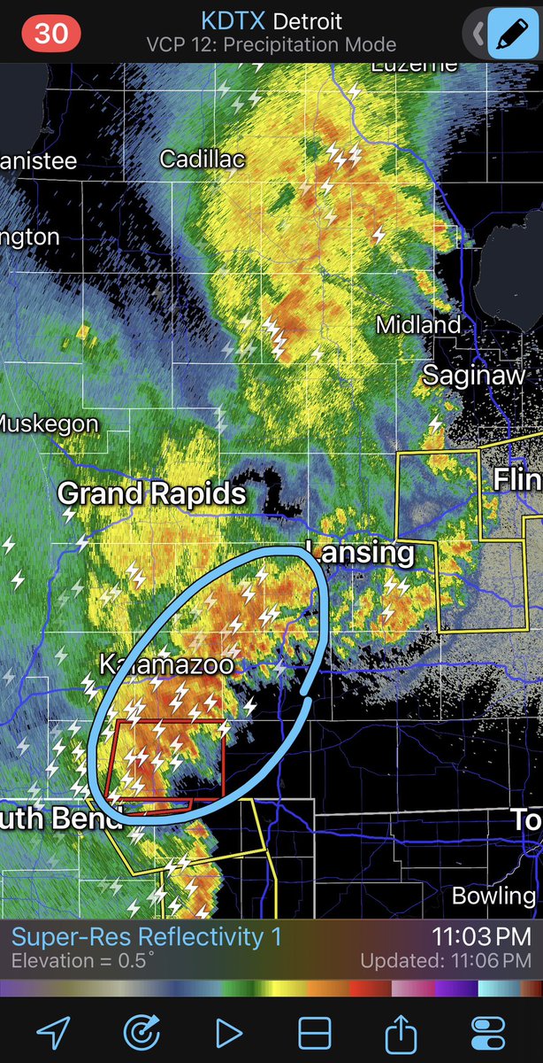
(10:55pm Thu) Meanwhile, back in SW Michigan, a tornado warned storm with a concerning circulation has passed just north of Three Rivers.
2
10
1,727
Jun 12
(10:47pm Thu) Severe Thunderstorm Warning issued by @NWSDetroit until 12:00am for most of Genesee County. While 60mph gusts are the most likely threat, a small spin-up tornado is possible due to rotation detected on radar. #miwx
3
13
1,427
Jun 12
(10:44pm Thu) Seeing our first signs of a gust front emanating from the bow echo. This is a gust of wind that can be of severe strength out ahead of the storm before the rain even starts. Gust fronts can also trigger additional storms if it’s unstable enough… #miwx
1
4
20
1,624