558 Photos and videos


Apr 10
During the off-season, HWind Analysts stay busy developing the HWind Enhanced Archive. We will be adding three impactful storms from the 2025 season: Melissa, Imelda, and Erick (EPAC).
3
177
6 Nov 2025
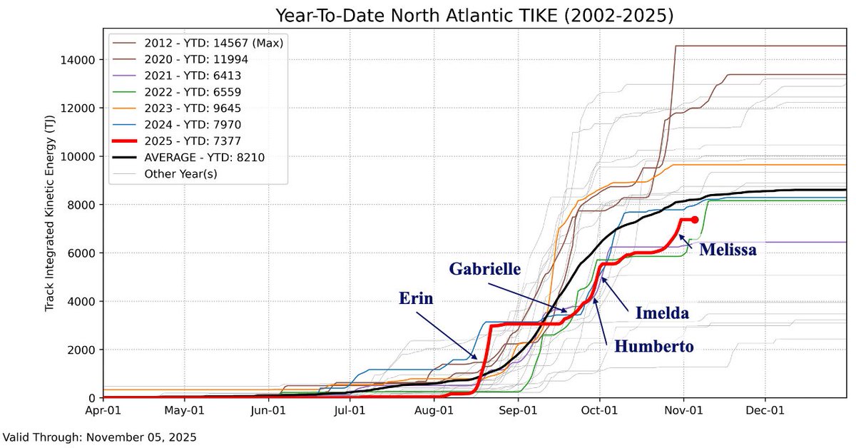
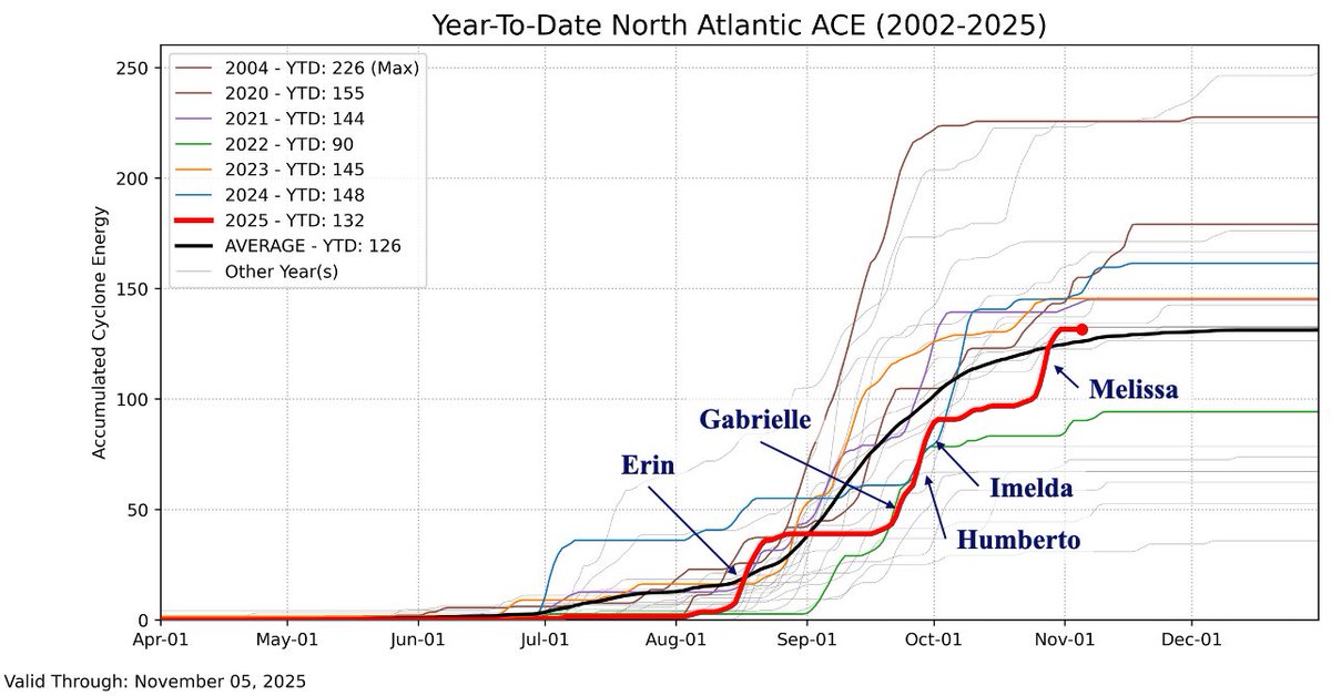
As the 2025 hurricane season winds down, here's another look at year-to-date TIKE and ACE compared to previous seasons back to 2002. Of the 5 hurricanes that occurred, 4 were major and 3 reached Category 5 intensity.
3
6
491
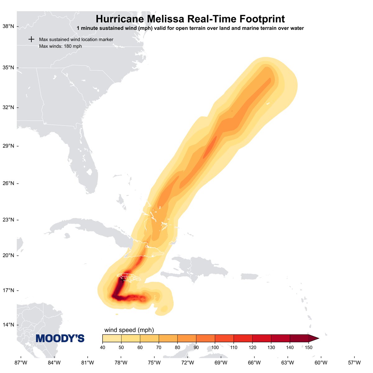
31 Oct 2025
We've wrapped up Snapshot coverage of Hurricane #Melissa now that it has cleared Bermuda. Our analysis features a peak intensity of 180 mph (156 kt) just before landfall in Jamaica.
1
3
11
957
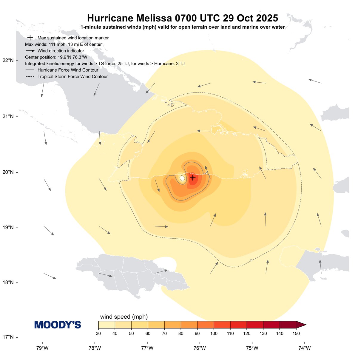
29 Oct 2025
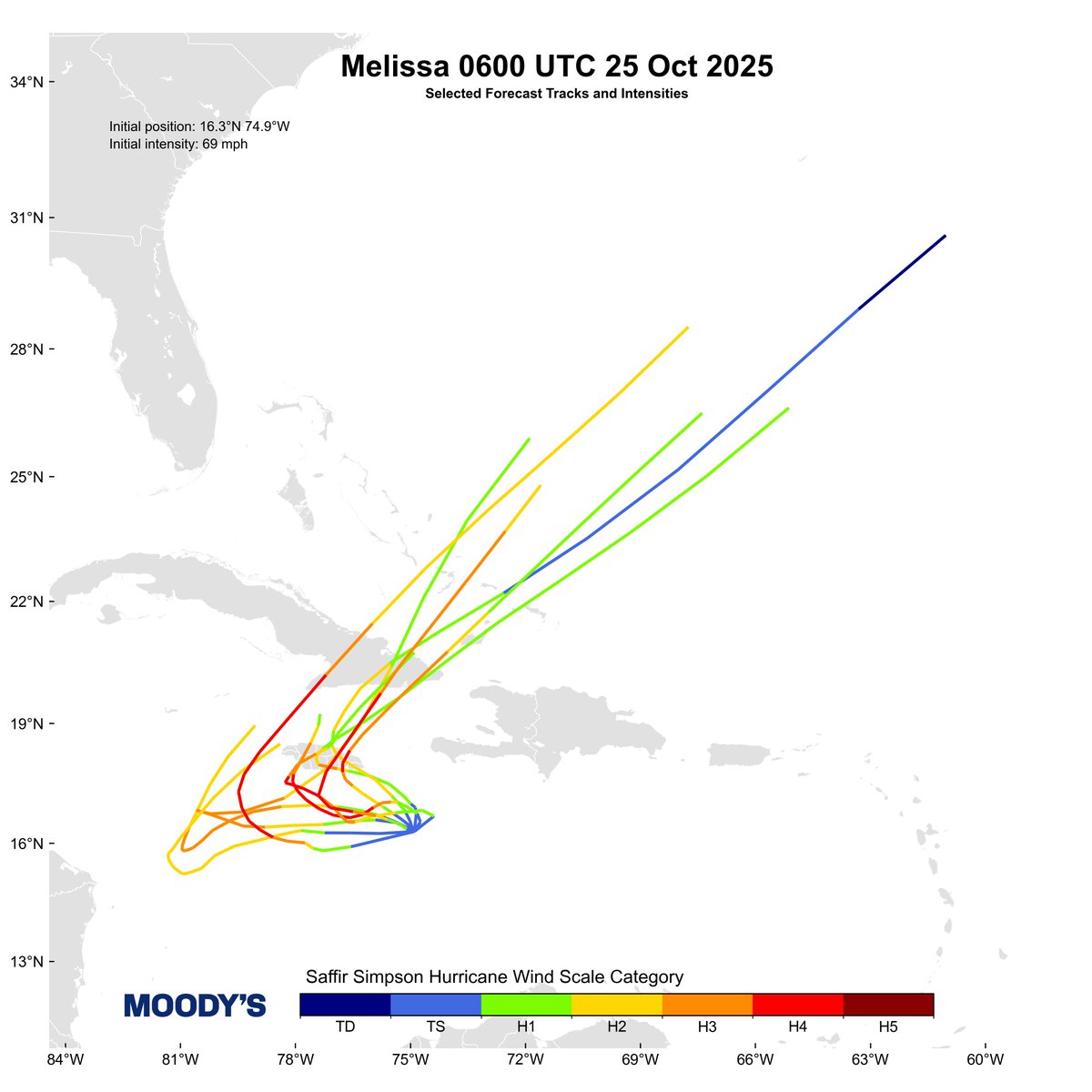
Hurricane #Melissa made landfall near Chivirico, Cuba earlier today at 0700 UTC with a Vmax of 111 mph (96 kt). With this wind speed, Melissa still qualified as a major hurricane (Category 3).
2
4
613
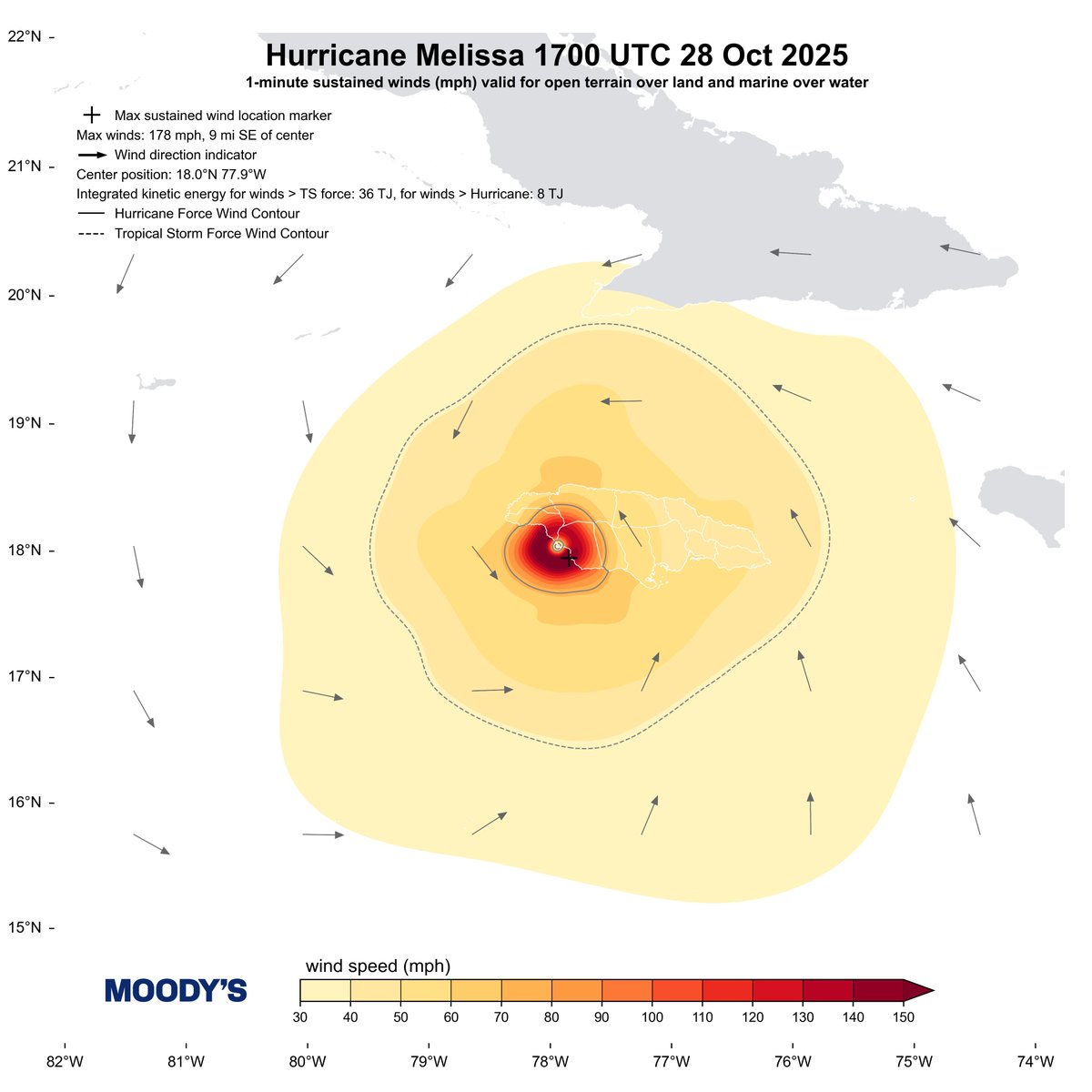
28 Oct 2025
Hurricane Melissa has made landfall at 1700 UTC 28 Oct with sustained winds up to 178 mph. The HWind snapshot shows a 9-mi radius of maximum winds and 36 TJ (8 TJ) of TS- (HU-) force integrated kinetic energy.
6
12
1,107
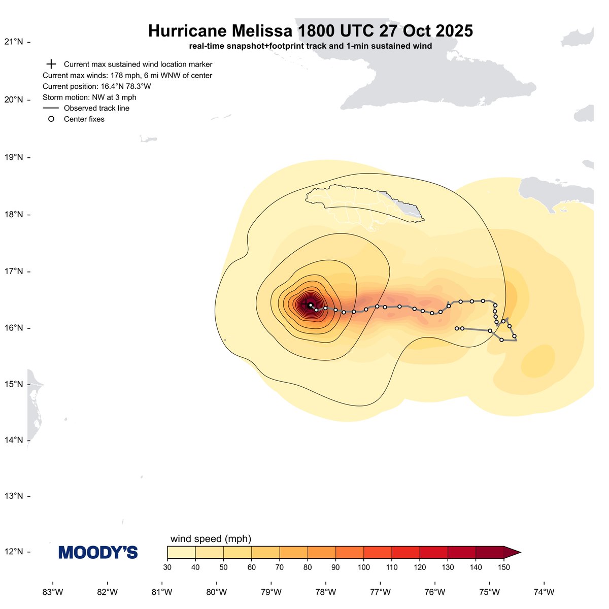
27 Oct 2025
Latest HWind snapshot shows further intensification of Hurricane Melissa. TS winds reach southern coast of Jamaica. Track begins to turn northward.
VMAX = 178 mph
TS IKE = 19 TJ
HU IKE = 7 TJ
4
6
870
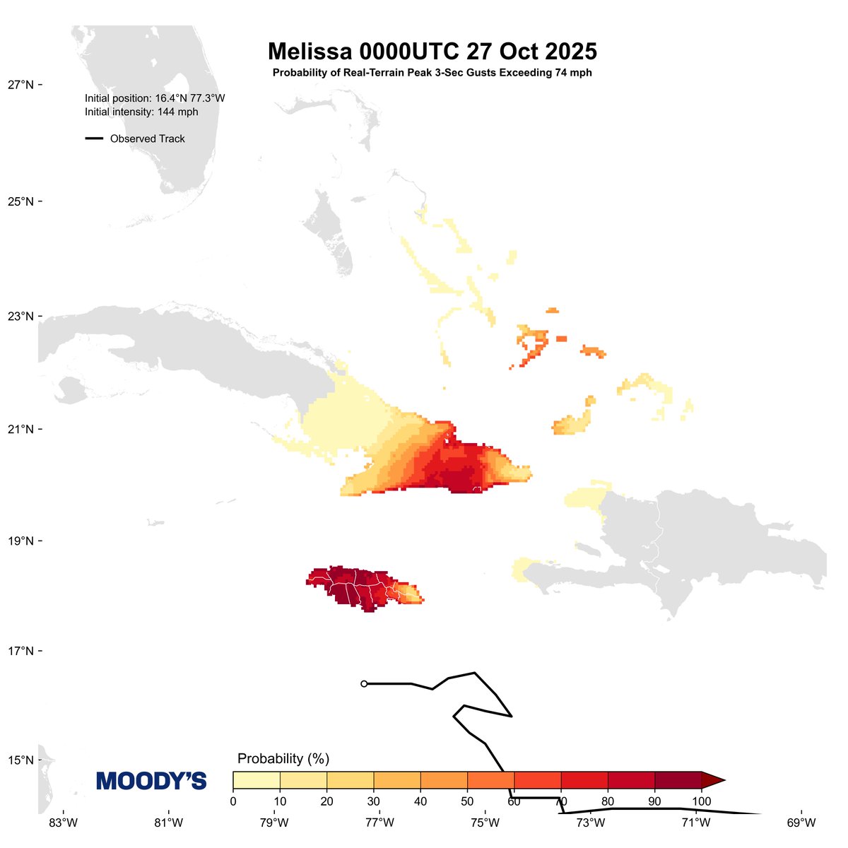
27 Oct 2025
HWind's 0000UTC 27 Oct Full Ensemble Forecast shows a widespread area likely to experience wind gusts in excess of hurricane-force (74 mph) from Hurricane Melissa in the next couple days. Significant impacts from winds, surge, and flood will occur.
3
5
700

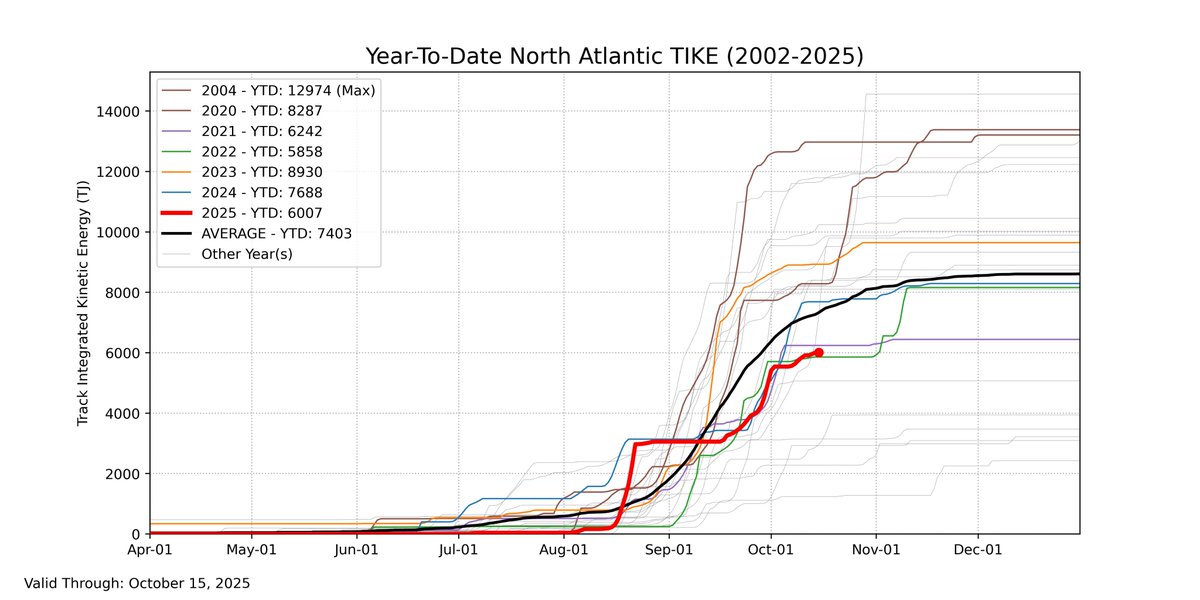
16 Oct 2025
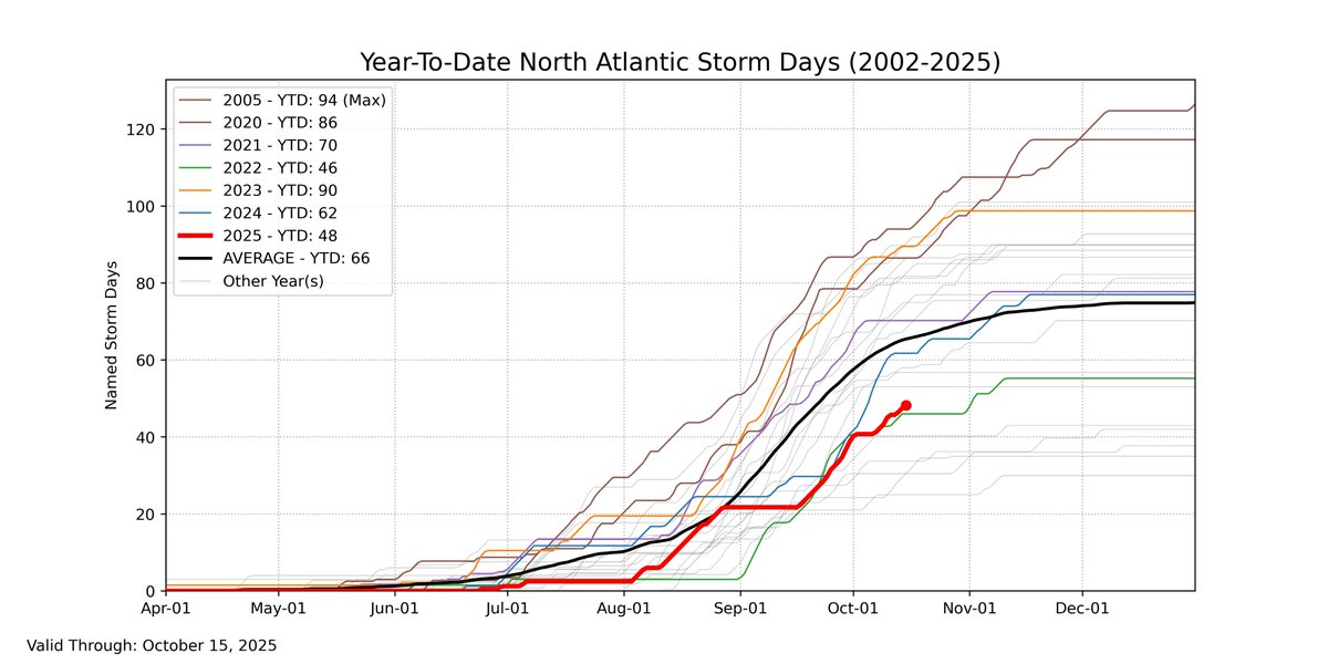
Here's another look of where we stand in terms of TIKE and number of storm days in the North Atlantic through 15 October. We're well below average in both metrics.
1
3
6
378
10 Oct 2025
Tropical Storm #Jerry has weakened since early this morning. The 18 UTC snapshot posts a Vmax of 44 mph (38 kt). This marks the end of our snapshot/footprint coverage for the event, though we will still issue forecasts.

2
4
431
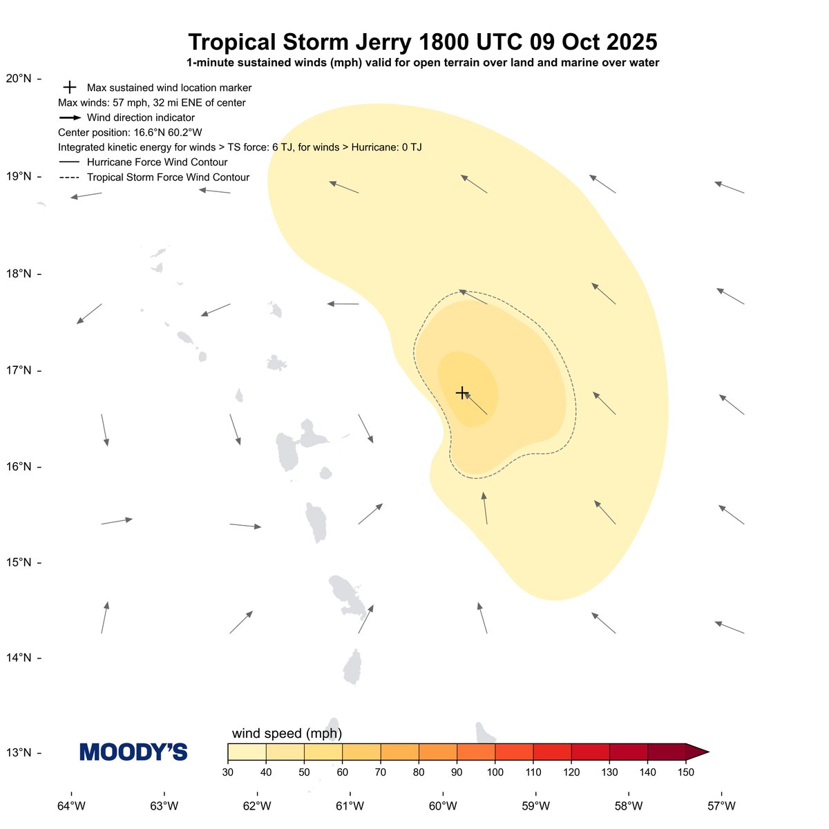
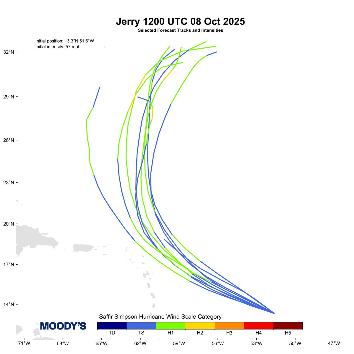
9 Oct 2025
The 18 UTC snapshot of Tropical Storm #Jerry depicts a Vmax of 57 mph (50 kt). The storm is moving NW and has TS-force IKE of 6 TJ.
2
10
1,584
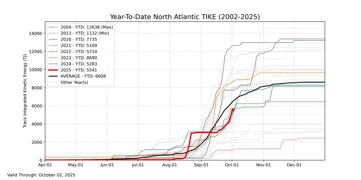
3 Oct 2025
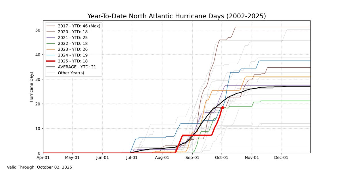
Here's where we stand in the North Atlantic through October 2 in terms of TIKE and hurricane days. We are slightly below average for each metric following Imelda and Humberto.
3
5
517
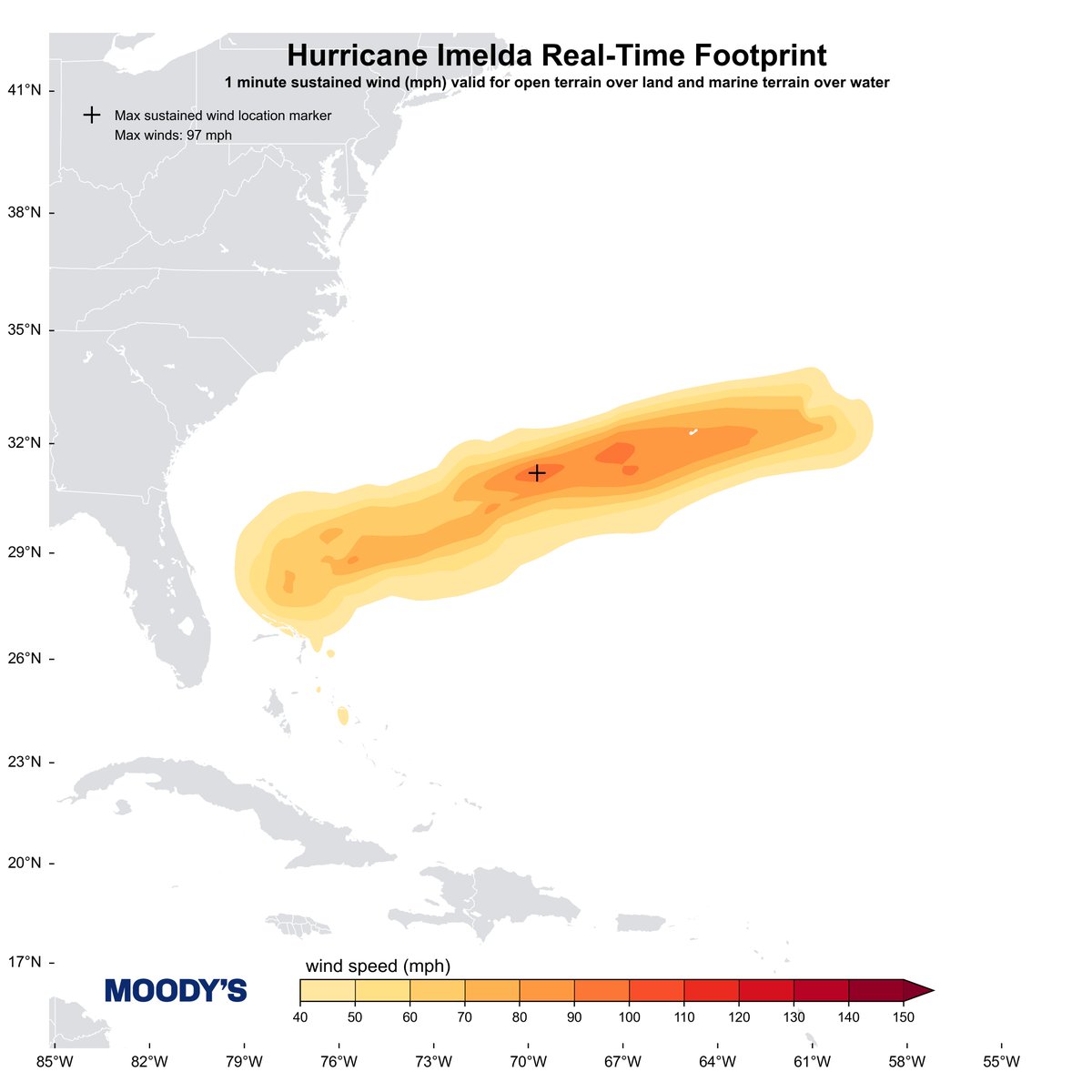
3 Oct 2025
The final footprint for Hurricane #Imelda, which saw a peak Vmax of 97 mph (84 kt).
3
8
589
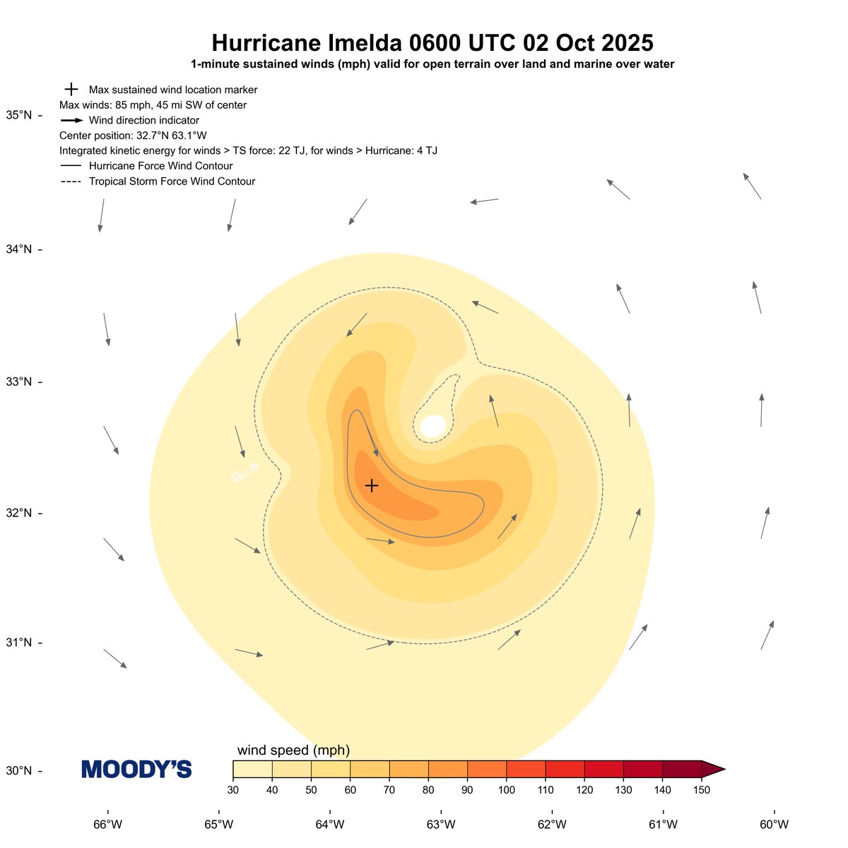
2 Oct 2025
Today's 00 and 06 UTC snapshots of Hurricane #Imelda as it moved past Bermuda this morning
2
2
420
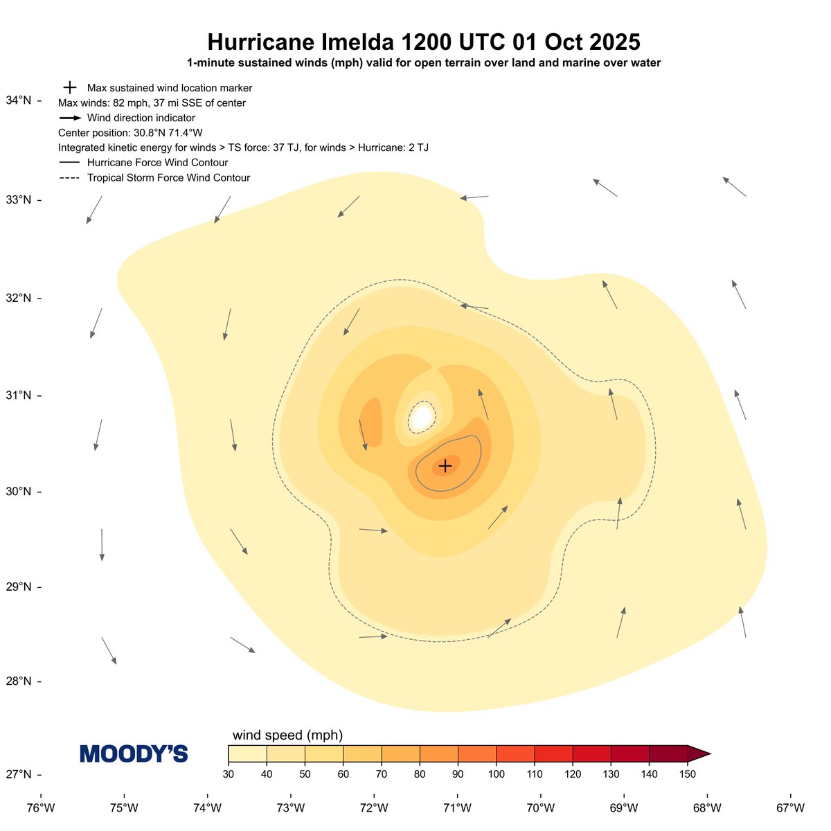
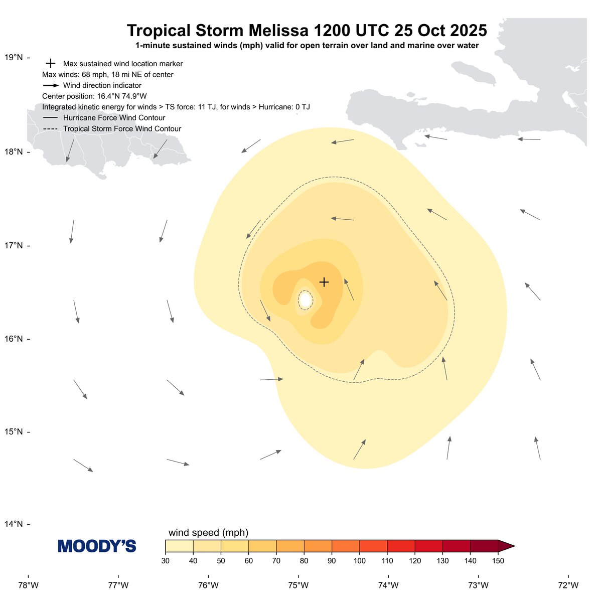
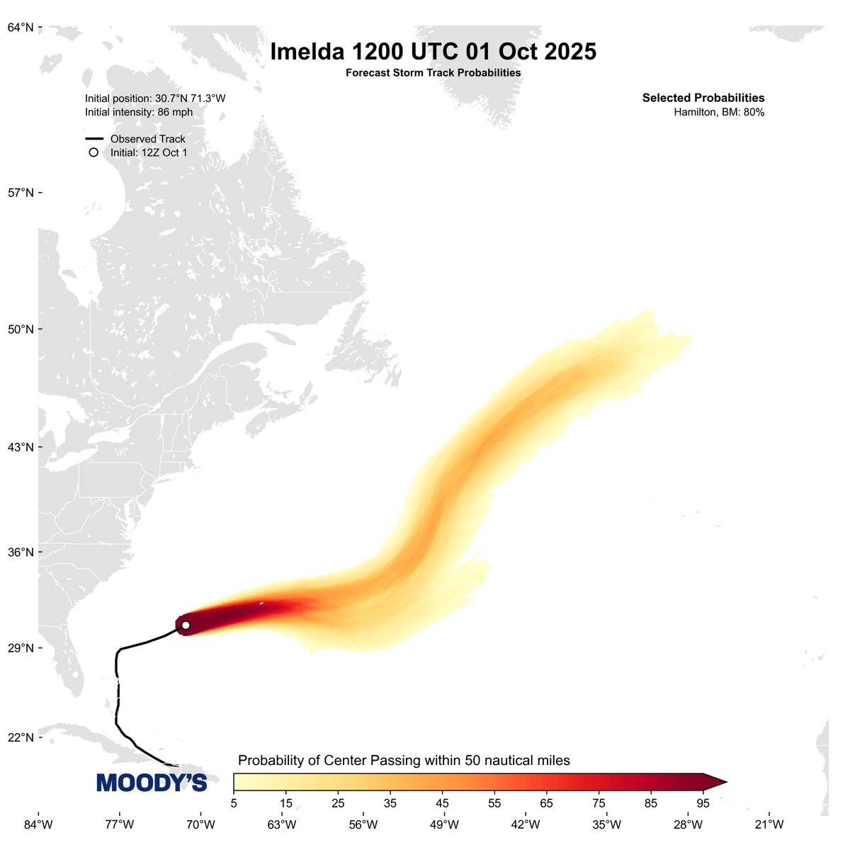
1 Oct 2025
The 18 UTC snapshot of Hurricane #Imelda features a Vmax of 97 mph (84 kt). It is accelerating towards Bermuda and little intensity change is forecast before it passes by the island early tomorrow morning.

2
5
604