
Richard is Senior Principal Research Scientist DPIRD responsible for water projects North to South WA. R&D researchgate.net/profile/Ric…
Joined September 2015
- Tweets 431
- Following 173
- Followers 575
- Likes 327
240 Photos and videos


28 Aug 2025
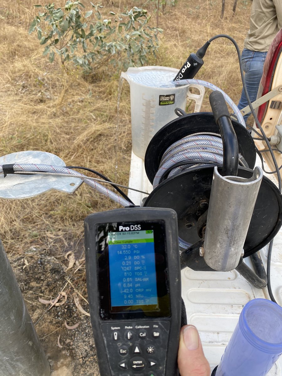
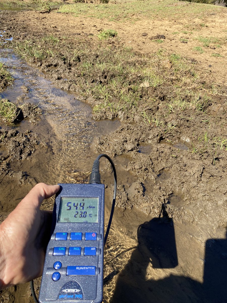
Spent a few days measuring subsoil drains last few weeks, removing excess water from crops in GtSthn & SW, to understand opportunities for water management. Two examples running well after strong rains @NikCallow
1
7
152
28 Aug 2025
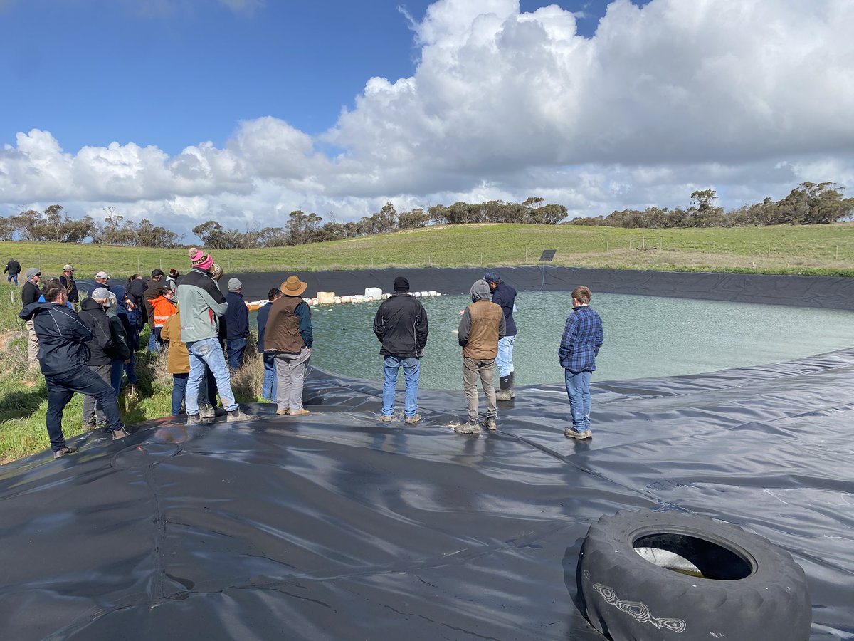
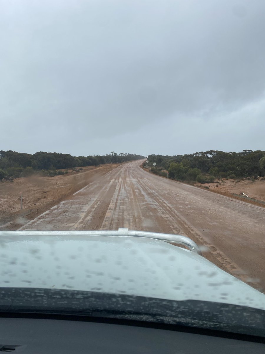
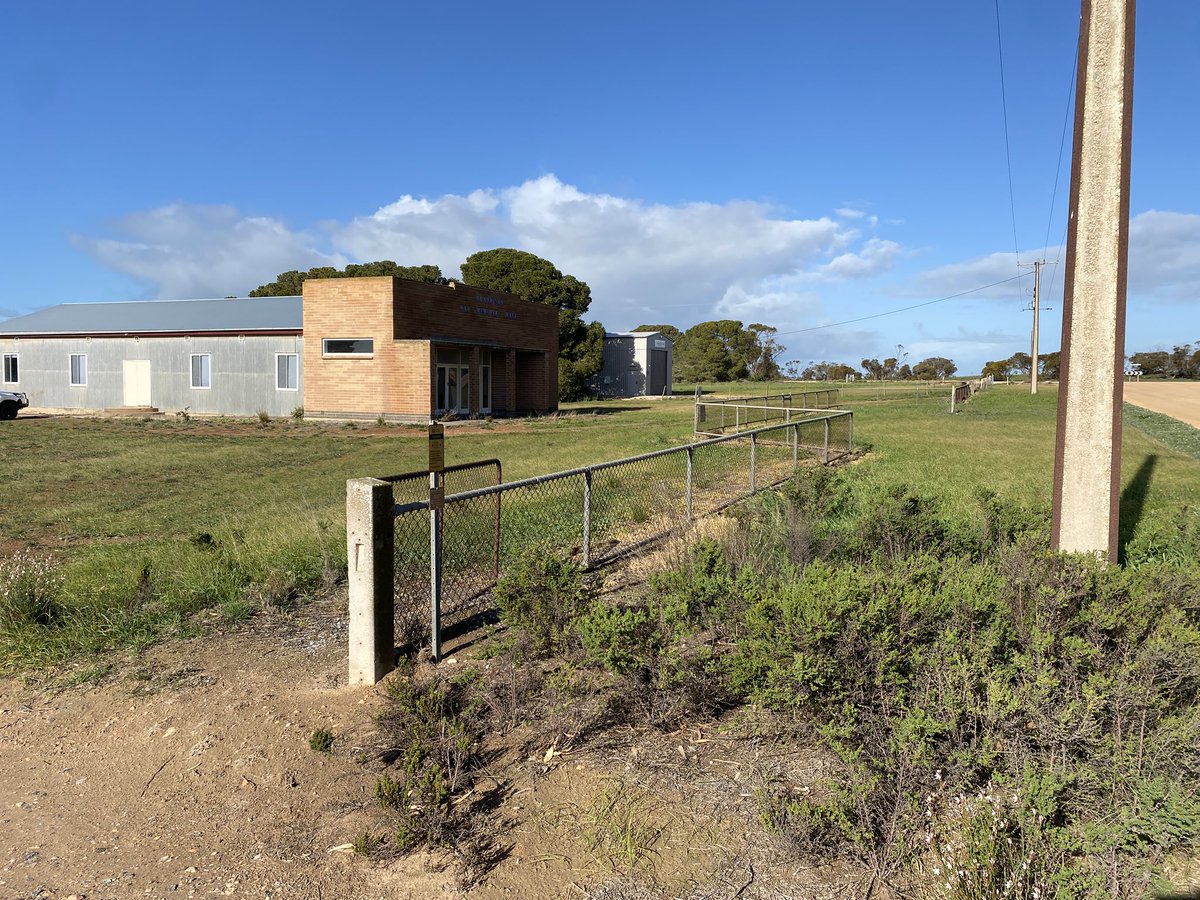
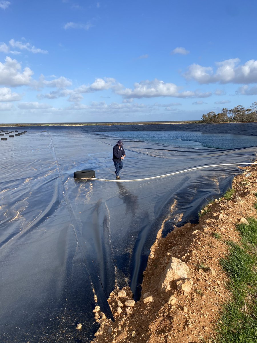
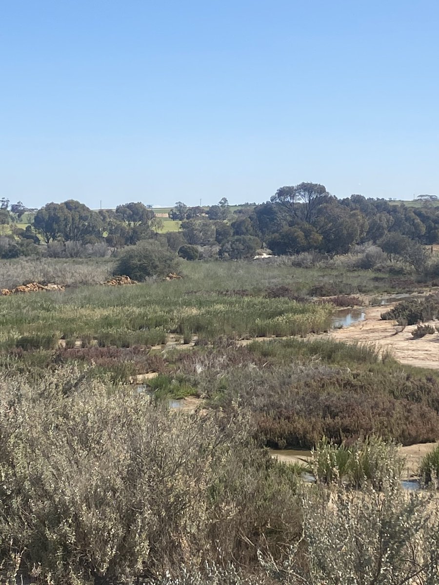
Last day with farmers in Eyre Peninsula at Warrminda with @jtelferoz 24 farmers talking water, salinity and WaterSmart farms. Impressive lined catchments being adopted to collect high quality and secure water despite availability of SAWater pipes nearby. Great group @NikCallow
2
12
876
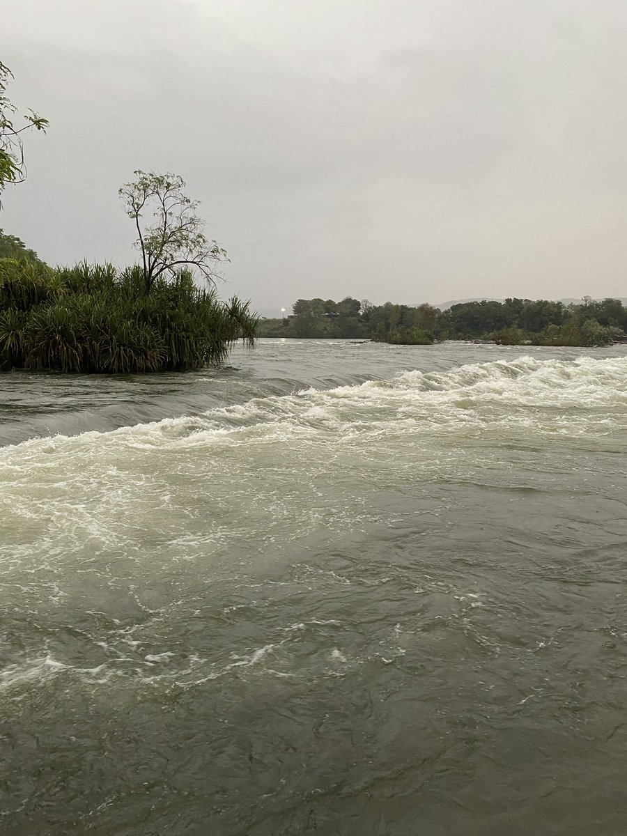
27 Aug 2025
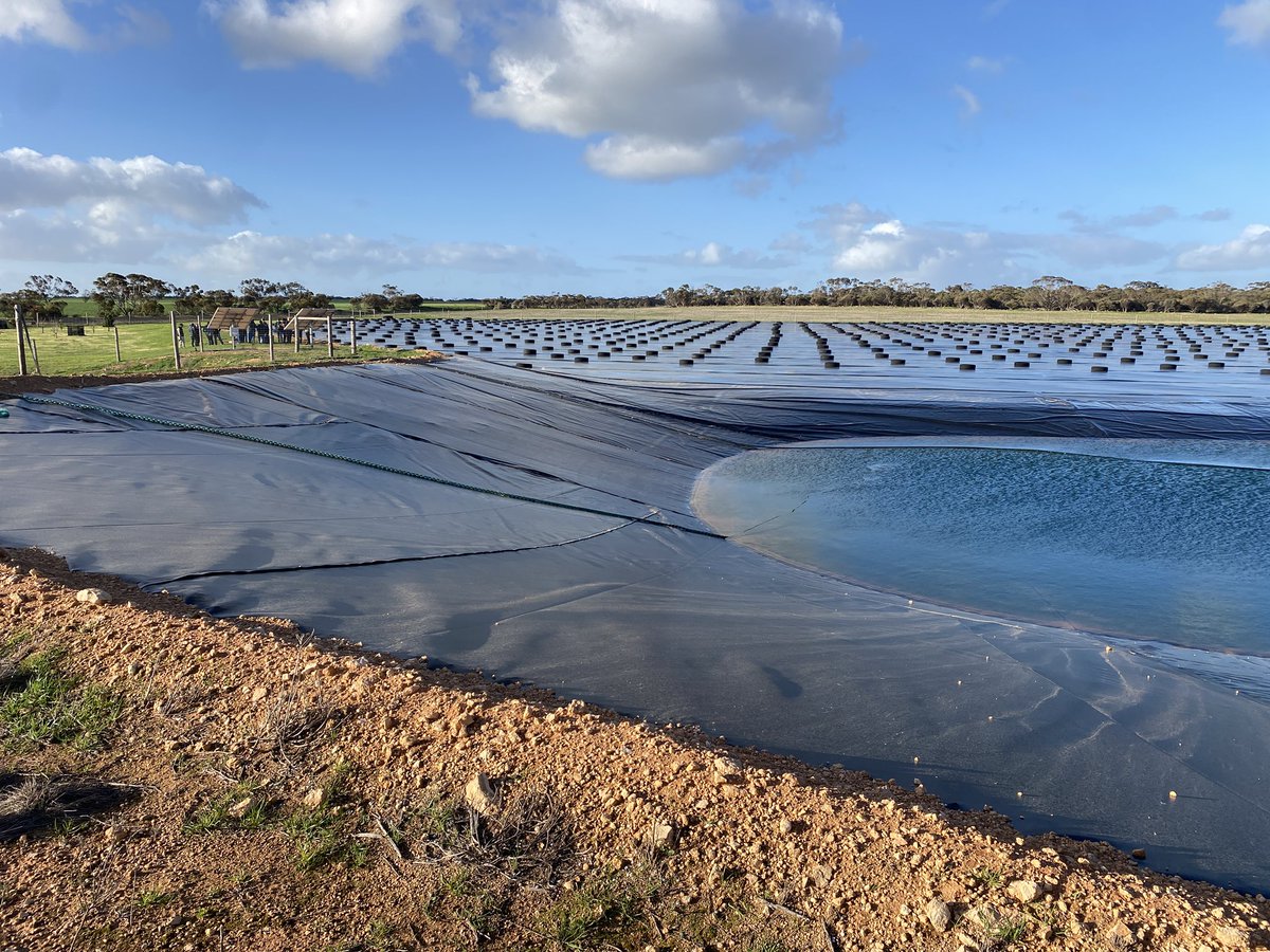
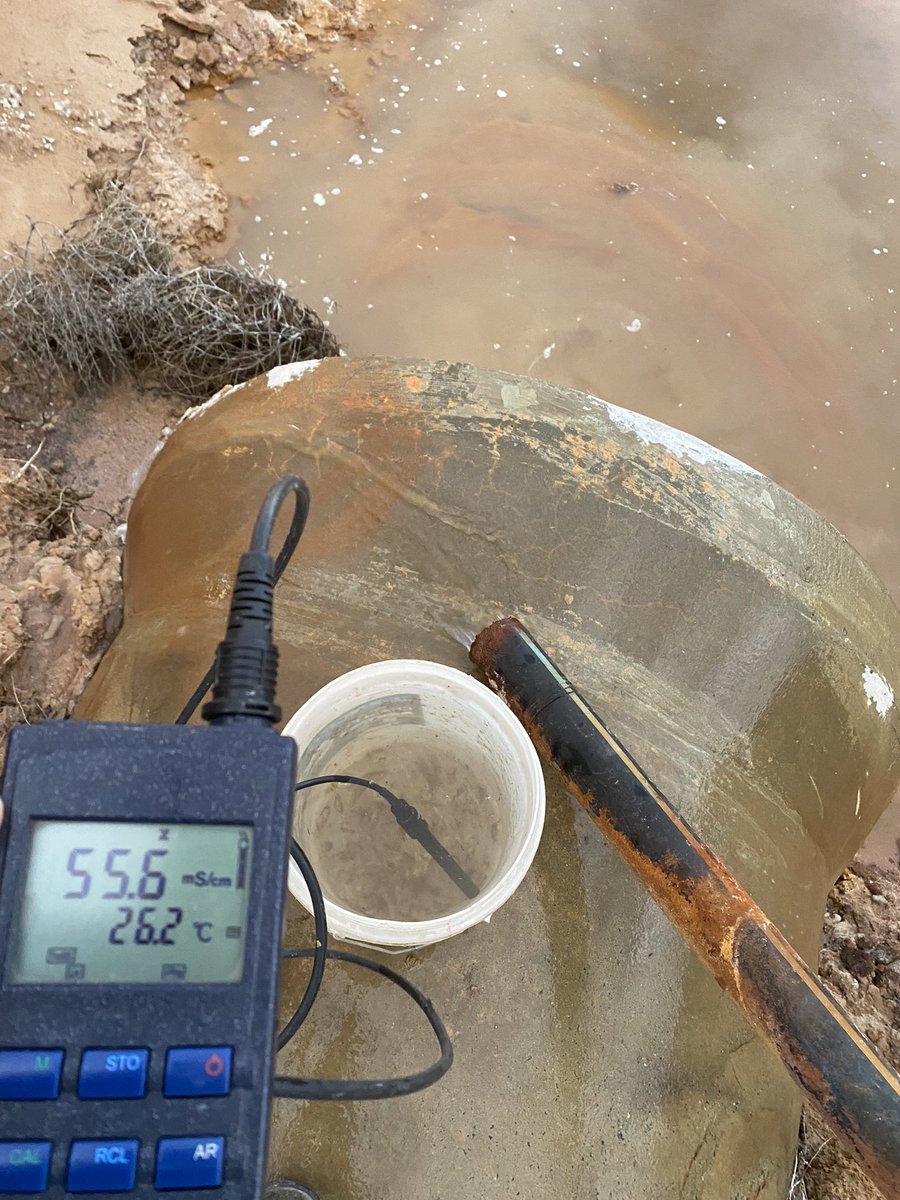
In Eyre Peninsular SA after long dry season talking desalination & looking at unconventional water sources. Seen several plastic sheeted catchments -2ha with 10 ML dams $100-200k built by #WaterSmart farmers @NikCallow
8
5
45
3,554
2 Apr 2025
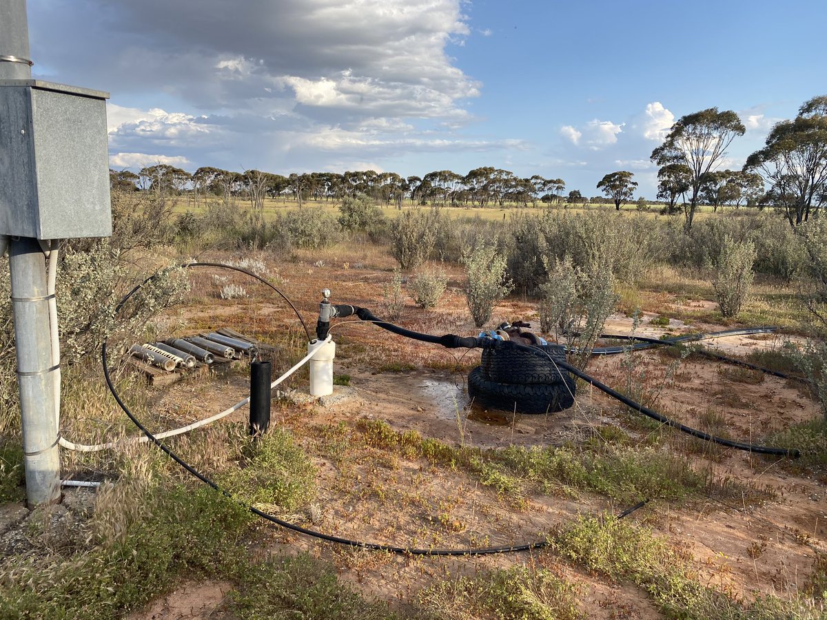
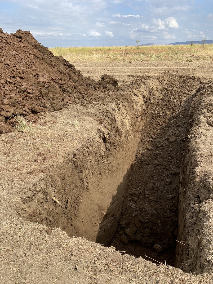
Last @WaterSmartFarm projects 89m deep bore being tested at 150,000 litres per day near Kojonup. Over 50% rate of success for bores of similar depth and salinity - from Merredin to Manjimup.

3
2
35
2,987
12 Nov 2024
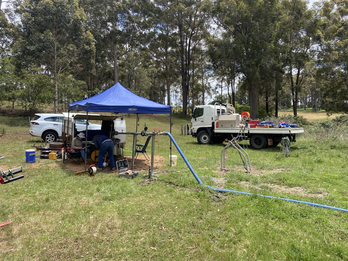
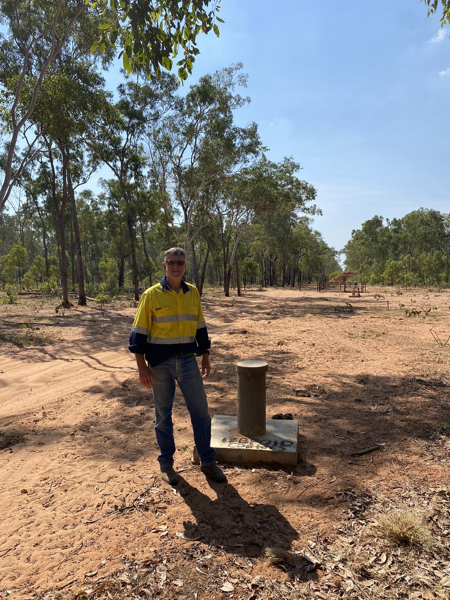
@DPIRDWA Water science team testing 2nd last bedrock drill hole (20 drilled) from Merredin to Manjimup (this site) to find water for agriculture. Yields average over 80kL/d from depths to 100m, stock quality or ready to Desal as part of #WaterSmartFarms
1
1
17
659
11 Nov 2024
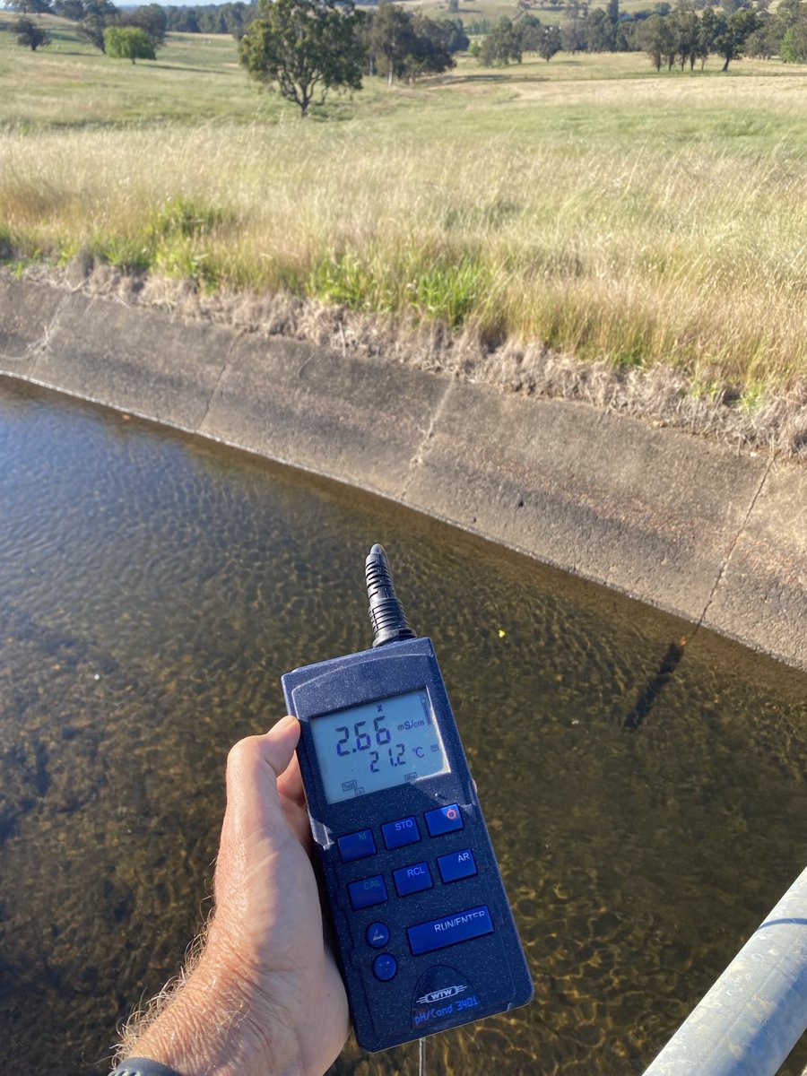
Our 2nd largest reservoir after Lake Argyle, Wellington Dams water quality is now almost 1500mg/L, feeding hundreds of SW farms. After 50 years of testing revegetation is it time for tools like desalination?
9
3
17
2,451
Richard George retweeted

Hear case studies on desalination, dam water capture and management, confinement feeding, natural capital and join the Q&A south of Boyup Brook on Wednesday 23 October @GGA_WA #DroughtHub @HydroFire60 @FaceyGroup #FDF events.humanitix.com/prepari…
1
6
9
3,518
28 Sep 2024
Not a dollar spent in 20 years as this and another line discharges dry sheep quality water from a hillside seep #gravitysiphoningsalt
1
9
1,341
28 Sep 2024
Recharge control of low production, wind-scalloped leaky wodjil sandplain is possible with targeted plantings. This one is a private carbon model that mitigates much of the farms emissions and along the way has seen an amazing regeneration of nature
5
324
28 Sep 2024
North of Kellerberrin a trial siphon has managed a 5ha saline hillside for over 20 years, with natural revegetation of 200m of creek lines downstream due to constant (35kL/d at 2000mS/m) flow. Discharges of groundwater need to be notified to ensure low impact (SLCAct).

11
859
28 Sep 2024
Managing salinity is long term, visited a multi-bore ~3L/sec pumping project Ive been involved with now 30 years on (two generations of effort) to see hectares of crop replacing patchy bare ground near Burakin. Water tables below 2m allowing leaching of excessive salt.
7
443
2 Aug 2024
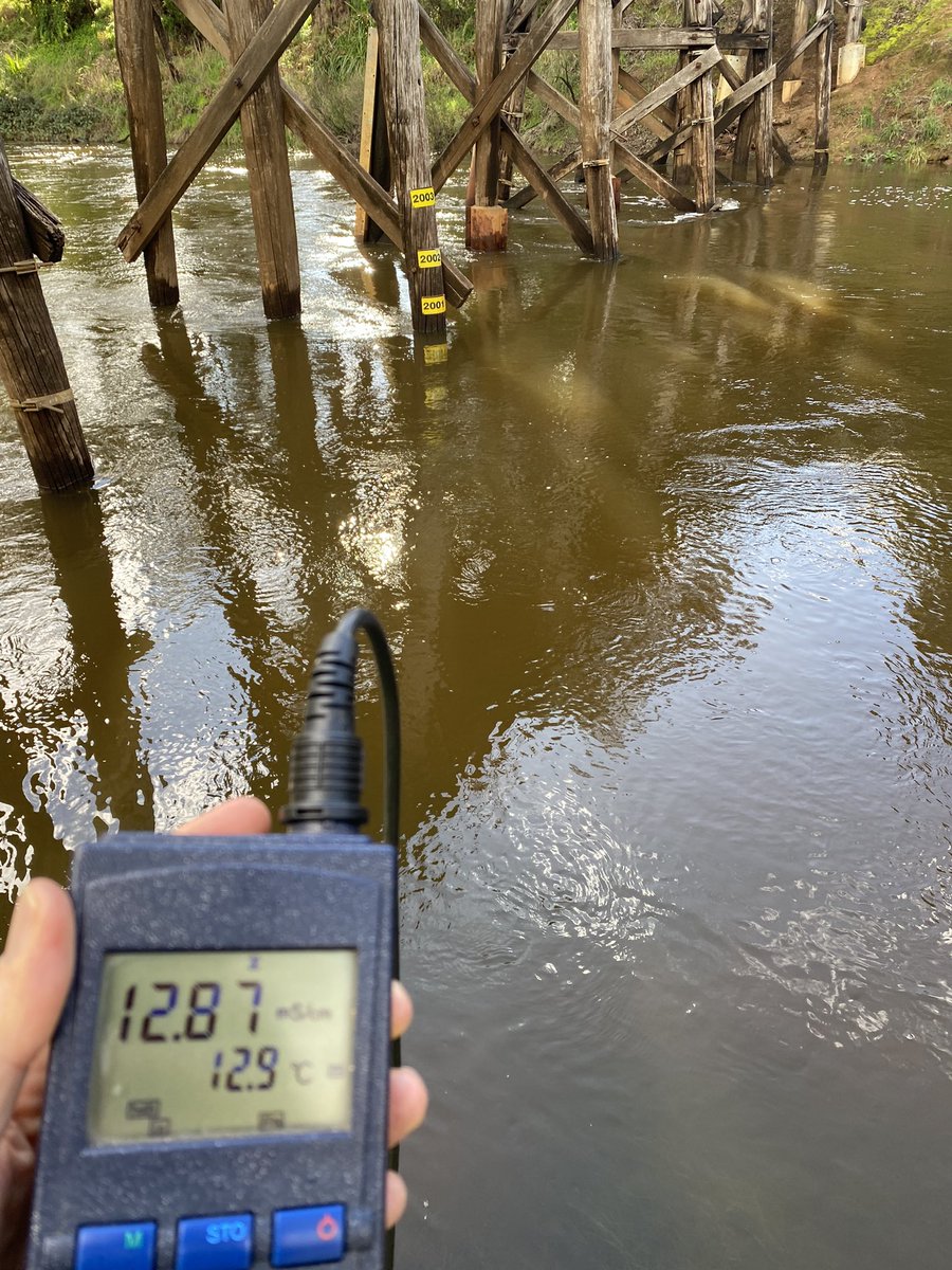
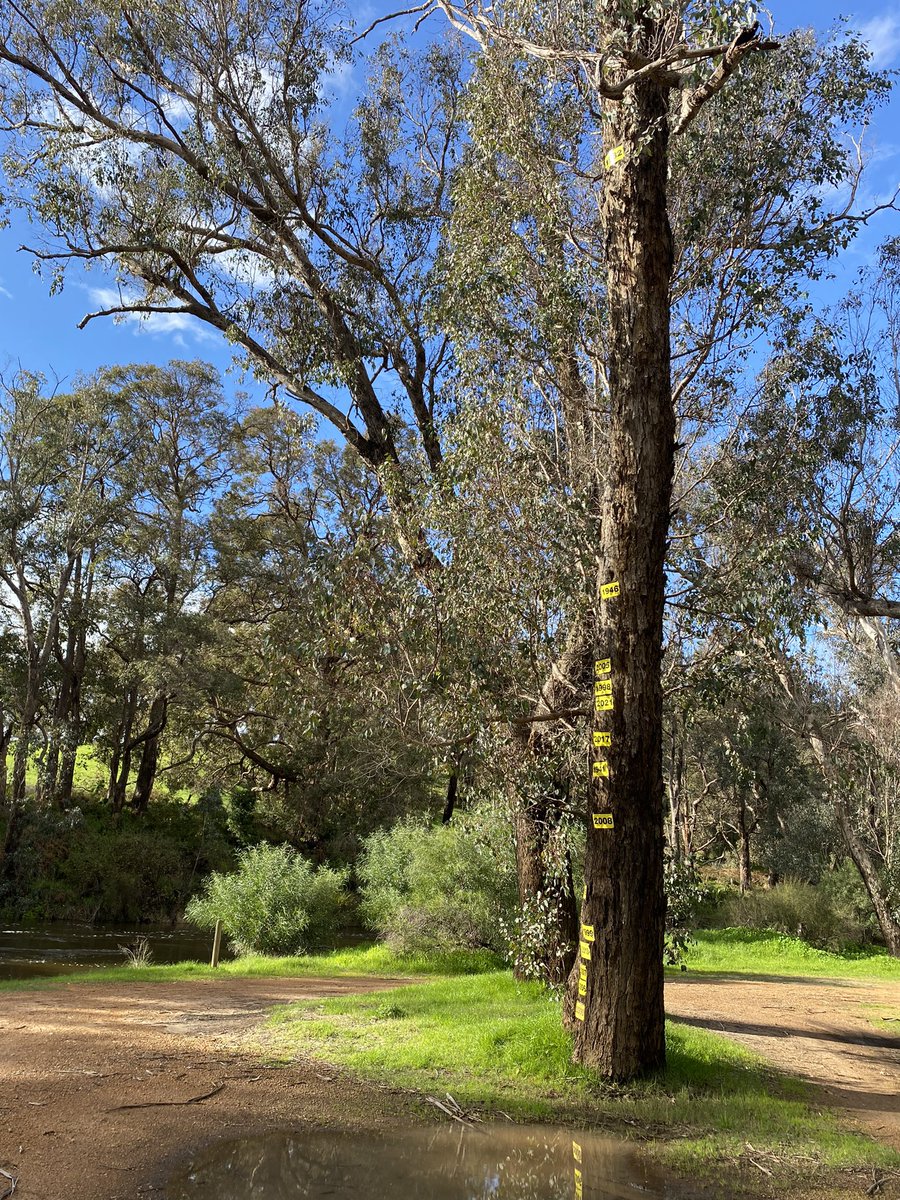
Blackwood River at Nannup flowing strongly and saline off now wet farmland (~6000mgL) at early 2000s river level, but look at 1982 (high in tree), 1946 (below) and recently.
1
1
2
339
10 Jul 2024
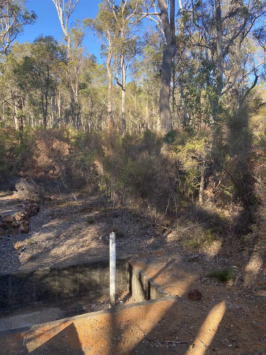
Finally, some mud and winter view from the office window south of Hyden
3
262
23 Jun 2024
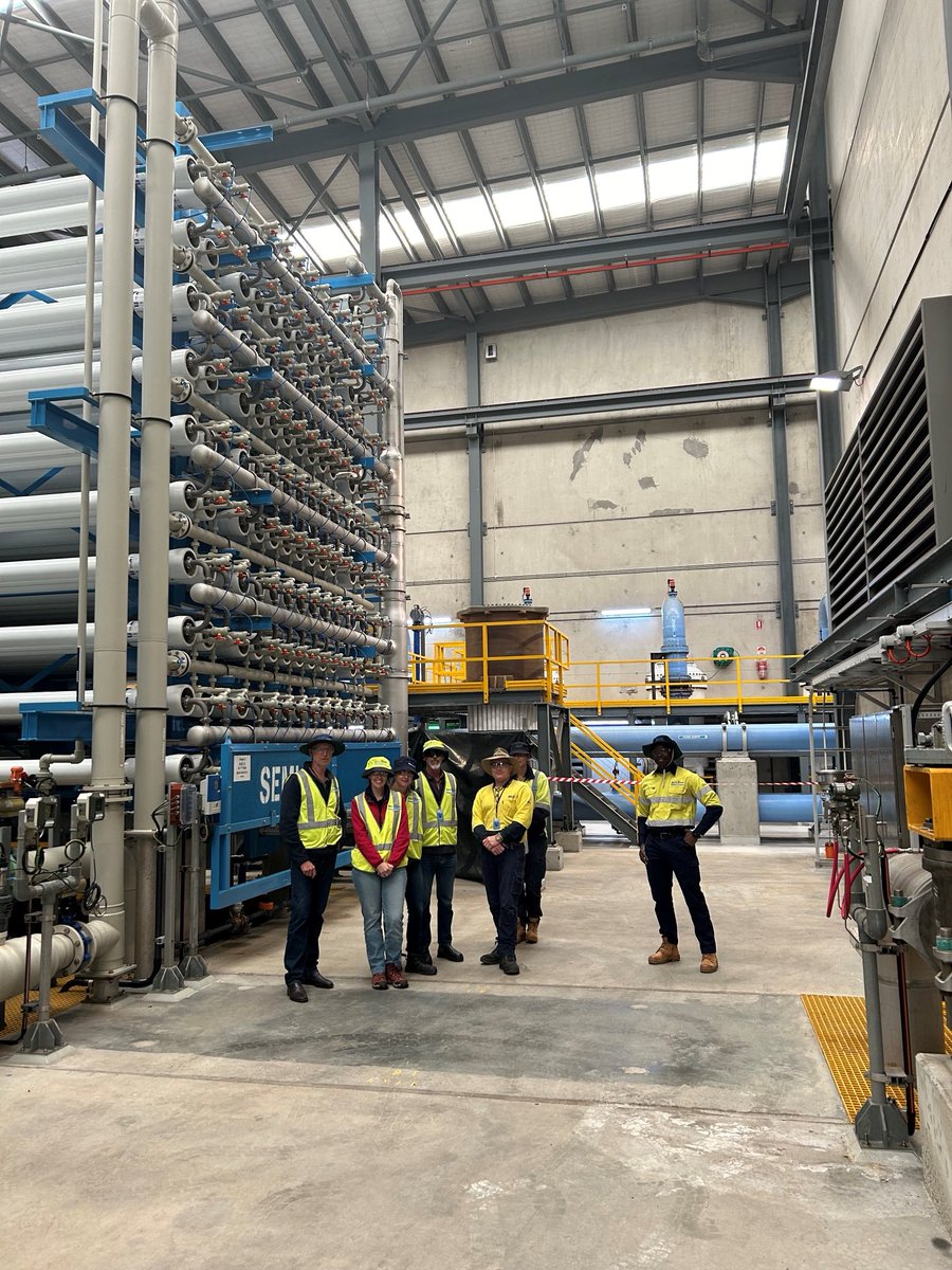
Talking desalination with Spanish company Sacyr & WaterCorp this week at 100GL RO plant near Myalup. Looking for lessons from industry that we can apply on our #WaterSmartFarms small RO systems. @DPIRDbroadacre @DPIRDWA
5
342
1 Jun 2024
Two seasons in a week, dusty trip to Bonaparte to get a decade of data monitoring of Cockatoo sands in dry, then danced on black soils after storms rolled in down the Keep #Kimberleys @DPIRDWA
5
379
31 May 2024
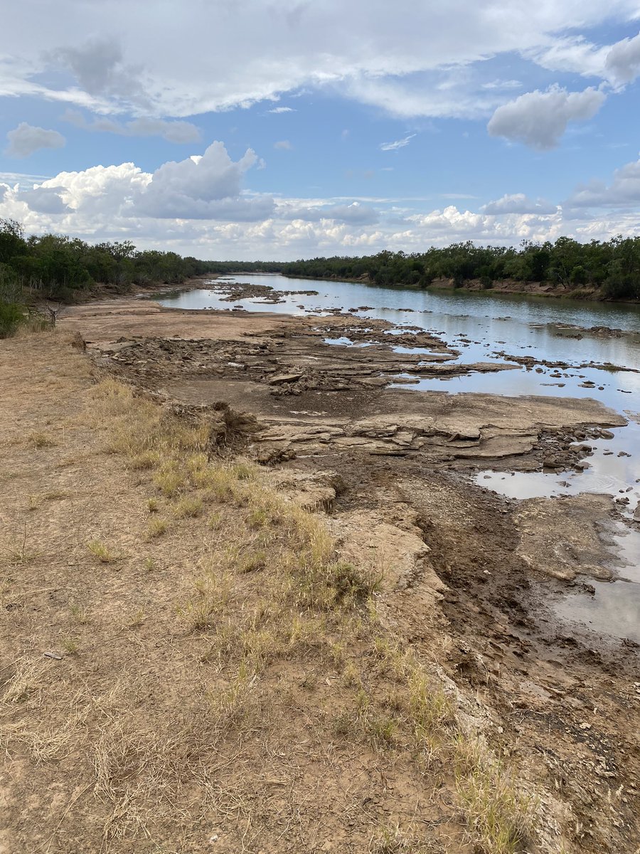
After this week up north working on Ord expansion, it’s apparent just how different an unregulated (Keep River) river is compared with the (larger) Ord below Lake Argyle, at Ivanhoe Crossing. Especially after a big wet season.
1
5
703
16 May 2024
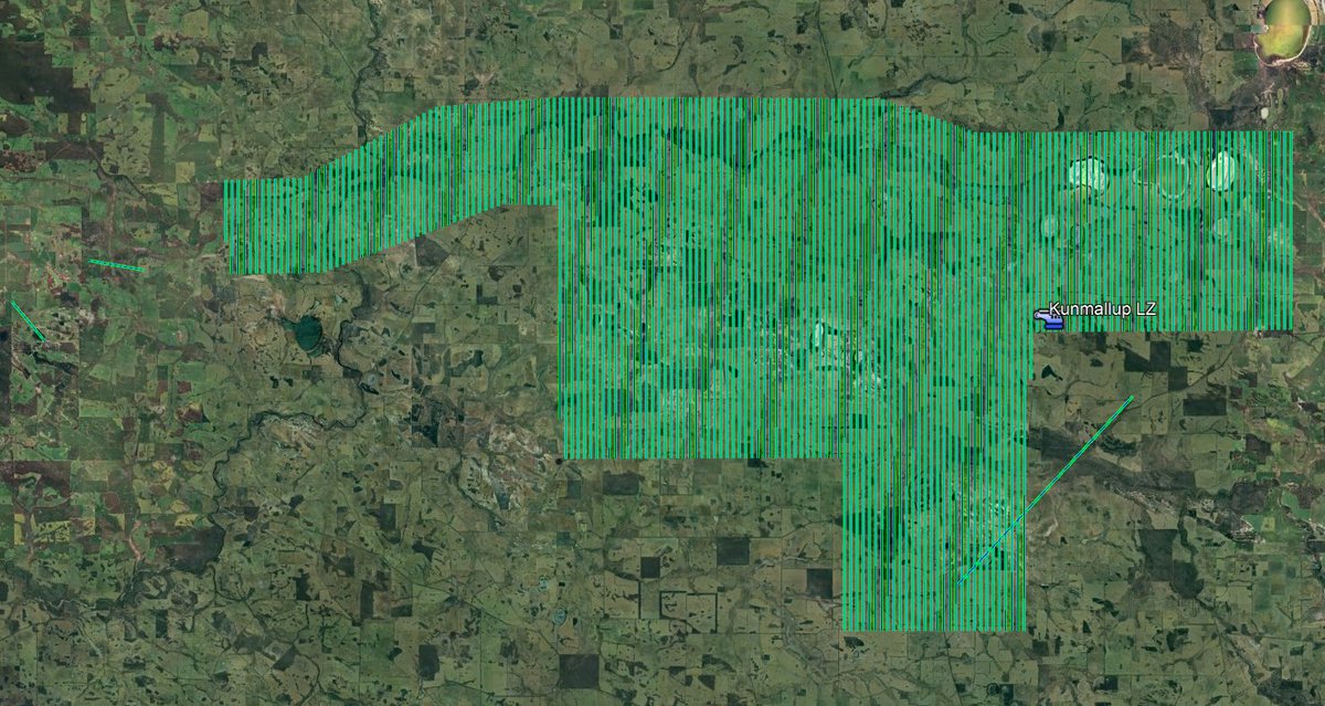
Just completed 80,000ha SkyTEM AEM survey of part of Great Southerns Beaufort palaeochannel to map water for future use by agricultural communities #WaterSmart Farms. Now we start interpreting results with @CSIRO @DPIRDbroadacre
2
3
21
1,160
7 May 2024
Spent a few days in the southern Murchison last week talking rehydration, carbon and rangelands plus mapping geology and NO3 alkaline aquifers. Amazing contrast from monitoring South-West in acid-saline eucalypt systems. Its called the Menzies line?
1
10
846
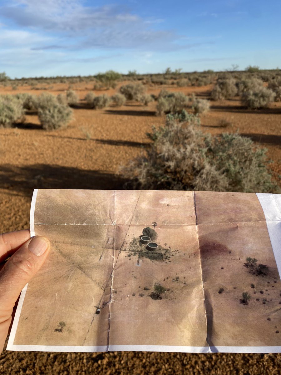
5 May 2024
Last #WaterSmartfarms bedrock drill hole testing a new site selection model to find groundwater for Wheatbelt farmers. This hole drilled to 80m and airlifted 3-4 L/second at 2750mg/L, east of Narrogin. @DPIRDbroadacre @GGA_WA @NikCallow
1
2
19
1,071
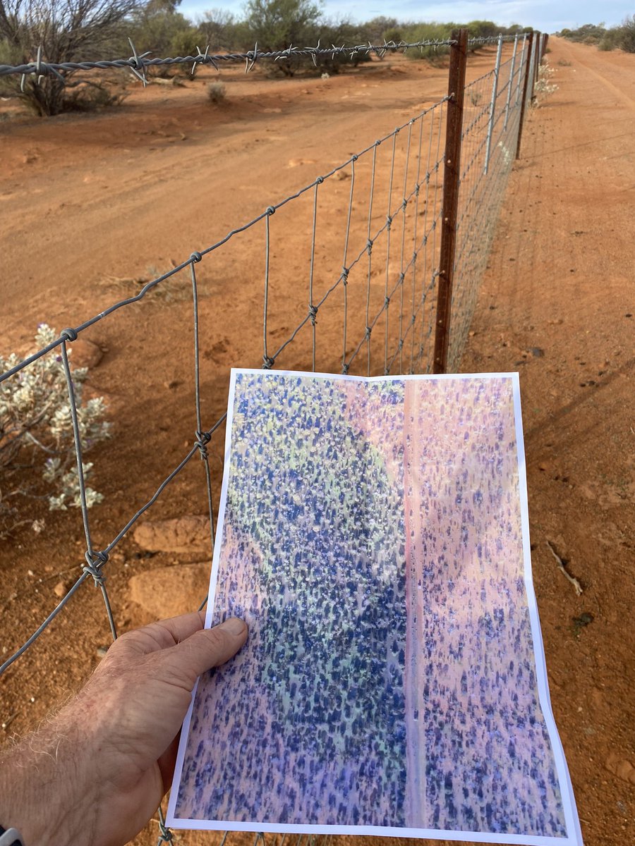
19 Apr 2024
Heres a gully near Manjimup flowing and a similar one in forest. We are testing new GeoMap tool to find fractures in the bedrock. Test drilling should finish ANZAC day, between Eastern Wheatbelt and Lower SW. Results looking good. #WaterSmartfarms. @DPIRDhort @DPIRDbroadacre
1
1
16
879