
Faster than the press. Tracking fires across the west coast year round. I also give forecasts regarding Santa Ana winds and off-season rain (SoCal specifically)
Joined September 2024
- Tweets 4,151
- Following 181
- Followers 809
- Likes 797
1,259 Photos and videos
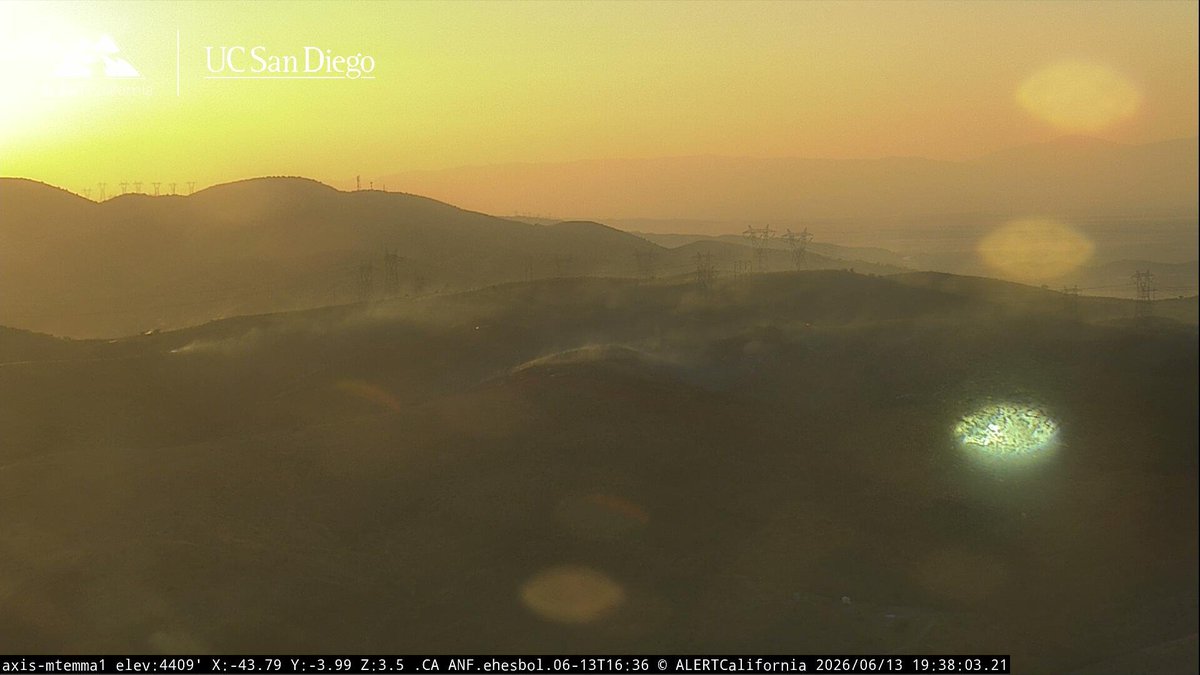


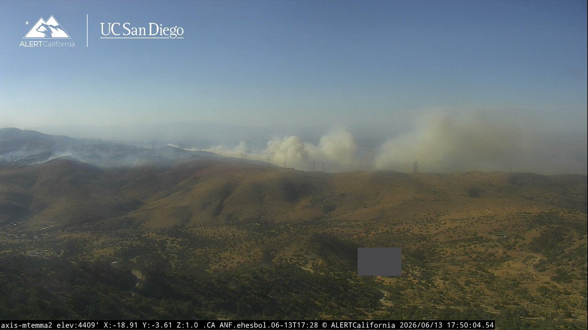

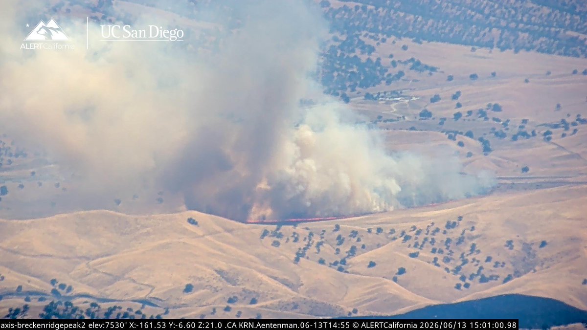


UPDATE (#GalsterFire): The fire is now about 15 acres with night flying helicopter making continued water drops through the night.
1
192
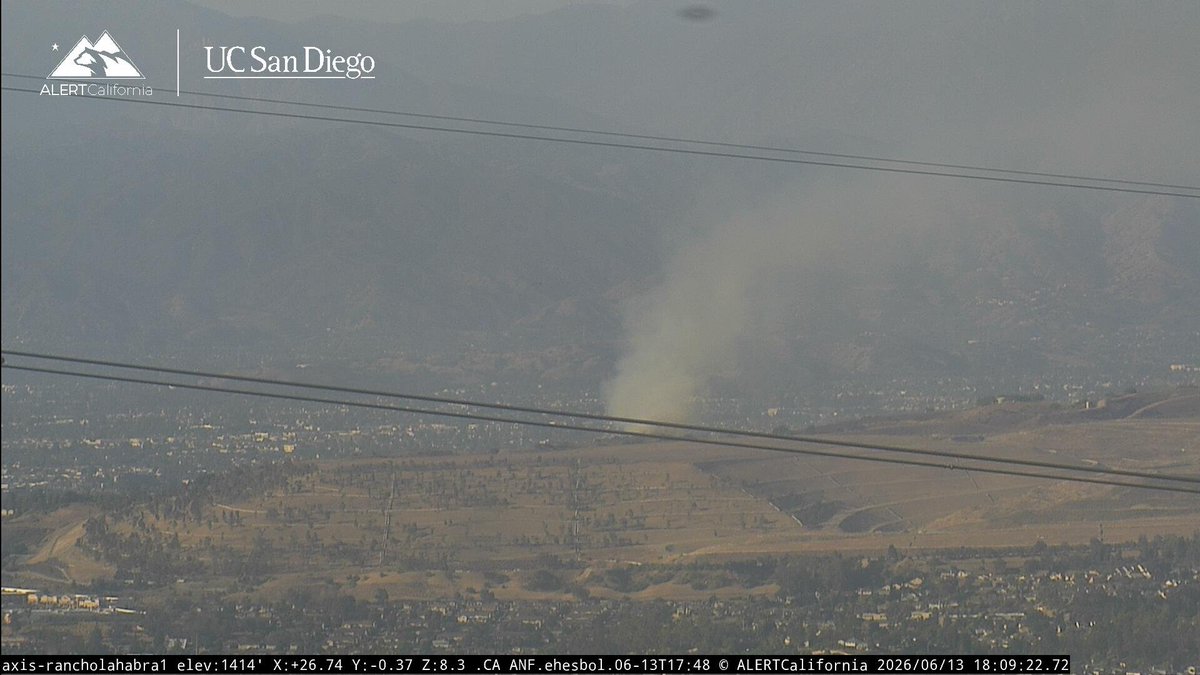
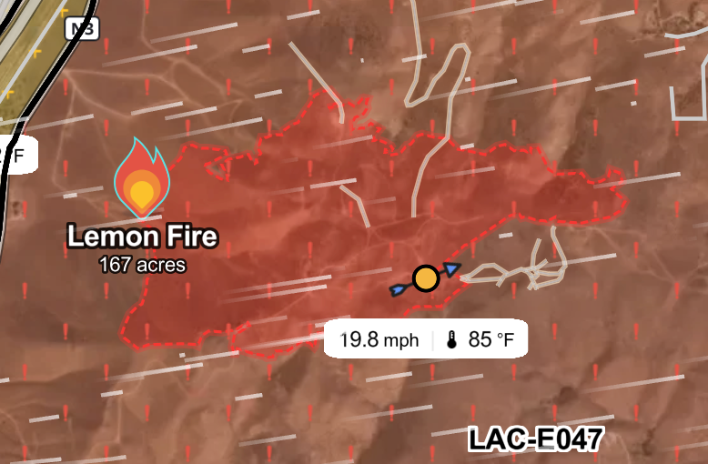
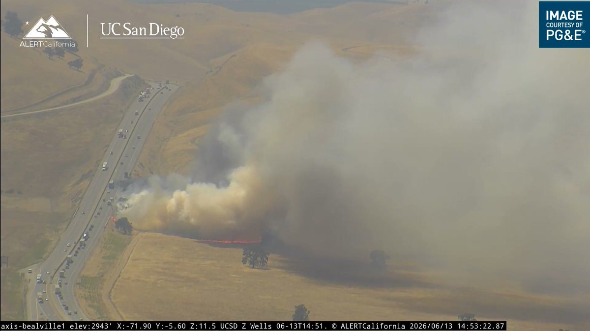
UPDATE (#LemonFire): Forward rate of progress has stopped at 300 acres.
3
4
230
UPDATE (#SouthForkFire):
Fire Update: South Fork Fire
Saturday, June 13, 2026
Rocky Mountain Complex Incident Management Team 2
Incident Commander Jay Mickey
Phone (public and media inquiries): 308-775-5438
Email: 2026.southfork@firenet.gov
Linktree: linktr.ee/2026southforkfire
A portion of the previous evacuation order west of the fire area has been elevated to Go status.
This includes the area south of Highland Rd. west of Hwy. 20 heading east back to Cottonwood Rd. as a result of strategic firing operations underway near the intersection of Hwy. 20 and Cottonwood Rd. Due to this, Hwy. 20 will be intermittently closed. Please be aware that closures may happen due to fire activity along the highway.
Current Conditions: Containment has jumped to 42%, while southwest winds increased fire activity on the north edge of the fire. The fire is now 32,818 acres with approximately 496 personnel assigned. The shifting wind conditions moved the fire yesterday to the north and east in the morning. Last night the wind shifted out of the northeast and pushed the fire to the west toward Cottonwood Road on the west side in Division Delta. Crews will be evaluating this area to find opportunities to contain the fire south and east of Cottonwood Road. Values at risk in this area have been identified and priorities continue to be on firefighter and public safety. Aviation assisting crews on the ground have contributed to strong containment lines in Division Zulu on the northeast section of the fire. Aircraft dropped 42 loads of retardant for a total of 170,000 gallons while scoopers made 36 water drops for a total of 58,000 gallons. A unmanned aircraft system (UAS) with infrared capabilities gathered heat signature data on interior pockets of fuel. Around the community of Crawford and Fort Robinson the fire activity is minimal and the containment is in this region of the fire.
Weather and Fire Behavior: Weather conditions are changing across the incident as an approaching cold front arrives, reducing temperatures by as much as 20 degrees and boosting relative humidities. These changes are expected to lower fire activity in most areas of the fire except in Division Delta on the northwest, due to the fuels there. Breezy winds will begin out of the northeast. Interior pockets of heat will continue to burn with creeping and smoldering in some areas.
Evacuations and Closures:
All previous evacuation orders are still in place including:
- White River Trail is closed from Crawford City Park to Fort Robinson.
- Go Status: Fort Robinson State Park and a portion of the city of Crawford. The evacuation area includes locations immediately north of Crawford, including areas south of Dodd Road, west of Dodd Road, and Dodd Road at Holmgren Road and the Ponderosa Villa assisted living facility. See also the header above. - Set Status: The city of Crawford. Residents west of Toadstool Road to Milford Road and south of Sand Creek Road and north of Cottonwood Road. June 13, 2026 Region 23 Emergency Management issued the following evacuation notice: The area north and west of the fire from Toadstool Road west to Orella Road to Hat Creek Road to Pants Butte Road down to Highway 20 are now in Set status excluding the new area in Go status as referenced above. “Set” means residents should be aware of the fire activity in their area and have a plan to evacuate if conditions change.
- Ready Status: Residents north of Crawford and south of Forest Service Road 928 west of Highway 2, to Toadstool Road.
22 structures and 95 people are under active evacuation orders. The Red Cross established community shelter options at Chadron State College–Andrews Hall and is supporting shelter operations. A preliminary evacuation notice has also been issued for the entire city of Crawford. Residents are encouraged to prepare for the possibility of evacuation. For guidance on how to prepare, visit Ready.gov.
Air Quality - An Air Quality alert has been issued for Dawes county from 12 a.m. Sun. through noon Monday associated with the South Fork Fire. The forecast indicates low windspeeds and the potential for elevated PM2.5 levels in this area. For more information visit forecast.weather.gov. Nebraska air quality information: dwee.nebraska.gov/smoke-and-….
Temporary Flight Restrictions (TFR): tfr.faa.gov The South Fork Fire is currently under a TFR. Please respect the fight restrictions including drones and unmanned aircraft systems. These pose a significant risk to our aviation safety.
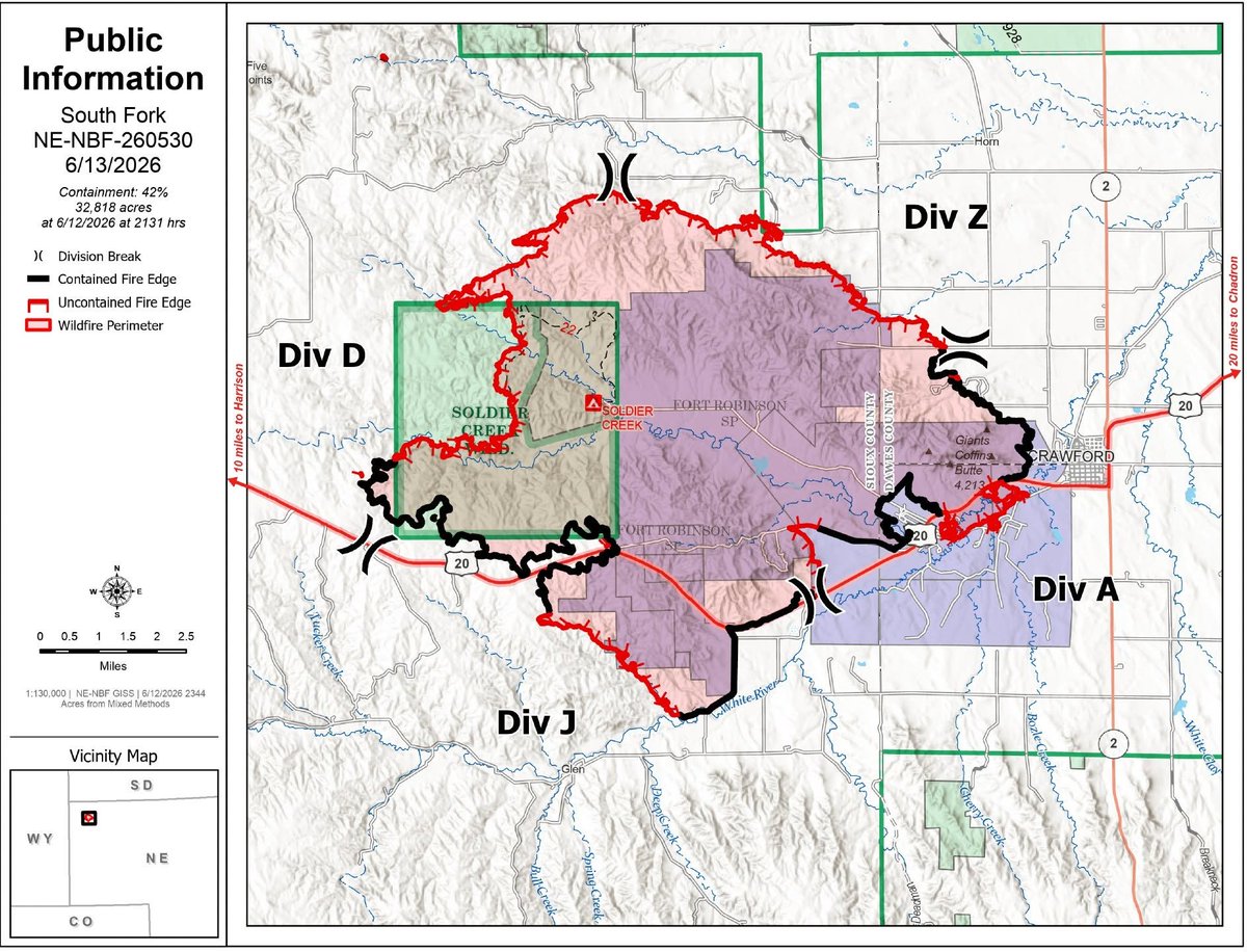
ALT Public Information Map for the South Fork Fire in both Dawes and Sioux Counties in Nebraska. SOURCE LINK: https://www.facebook.com/photo/?fbid=122111061975346130&set=pcb.122111062353346130
1
279
UPDATE (#SouthForkFire):
Afternoon Ops Update:
Highway 20 continues to experience intermittent closures due to ongoing firefighting operations. Motorists should expect delays and use caution when traveling through the area as crews continue suppression efforts.
On the northern portion of the fire near Cottonwood Road, three Hotshot crews are conducting firing operations to reduce the potential for the fire to make a wind-driven push to the west through steep, rugged terrain with deep drainages. As discussed during last night's community meeting, firing operations are a planned firefighting tactic often described as "fighting fire with fire." By removing fuels ahead of the main fire, firefighters can reduce fire intensity and limit fire spread when it reaches established containment lines.
The Cottonwood Road area continues to present challenges due to heavy timber, abundant fuels, and difficult terrain. Crews are working to create more favorable conditions for containment while taking advantage of current weather conditions.
Along the southern and eastern edges of the fire near Fort Robinson and Crawford, fire activity remains minimal. Firefighters continue securing existing containment lines, mopping up areas of residual heat, and utilizing infrared mapping to identify and extinguish any remaining hot spots. These efforts are helping strengthen containment and reduce the potential for future fire activity in those areas
An Interactive Evacuation Map is now available for this fire, per the update from the South Fork Fire Facebook page. Note: Crawford remains under a "Set" evacuation status, per the map.
Using the map, you can:
Search for your address
View current evacuation zones
See evacuation status boundaries at a detailed, address-level view
This tool provides a more user-friendly way to access evacuation information and can help residents make informed decisions during rapidly changing fire conditions.
To use the map, simply enter your address in the search bar and zoom in to view evacuation information for your area.
INTERACTIVE MAP LINK:
nifc.maps.arcgis.com/apps/in…
SOURCE LINK: facebook.com/SouthForkFireIN…
66
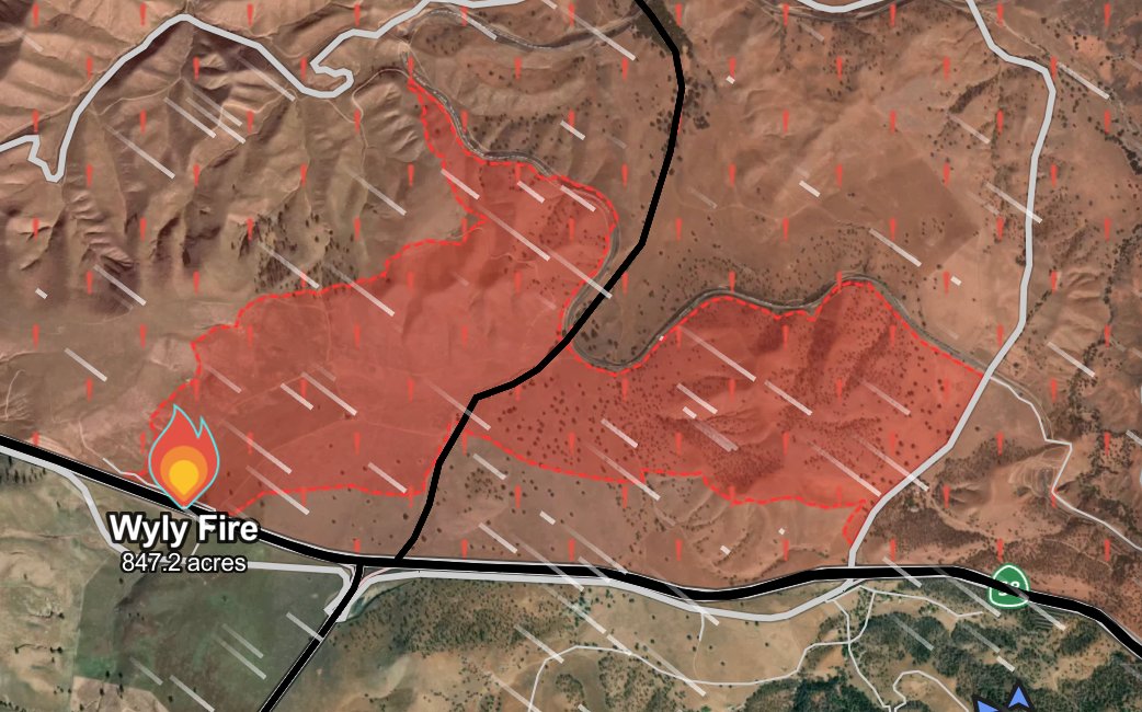
UPDATE (#WylyFire/#WileyFire): All evacautions on the fire have been lifted.
1
100