
Joined April 2023
- Tweets 36
- Following 36
- Followers 43
- Likes 63
16 Photos and videos


Pinned Tweet

30 Apr 2025
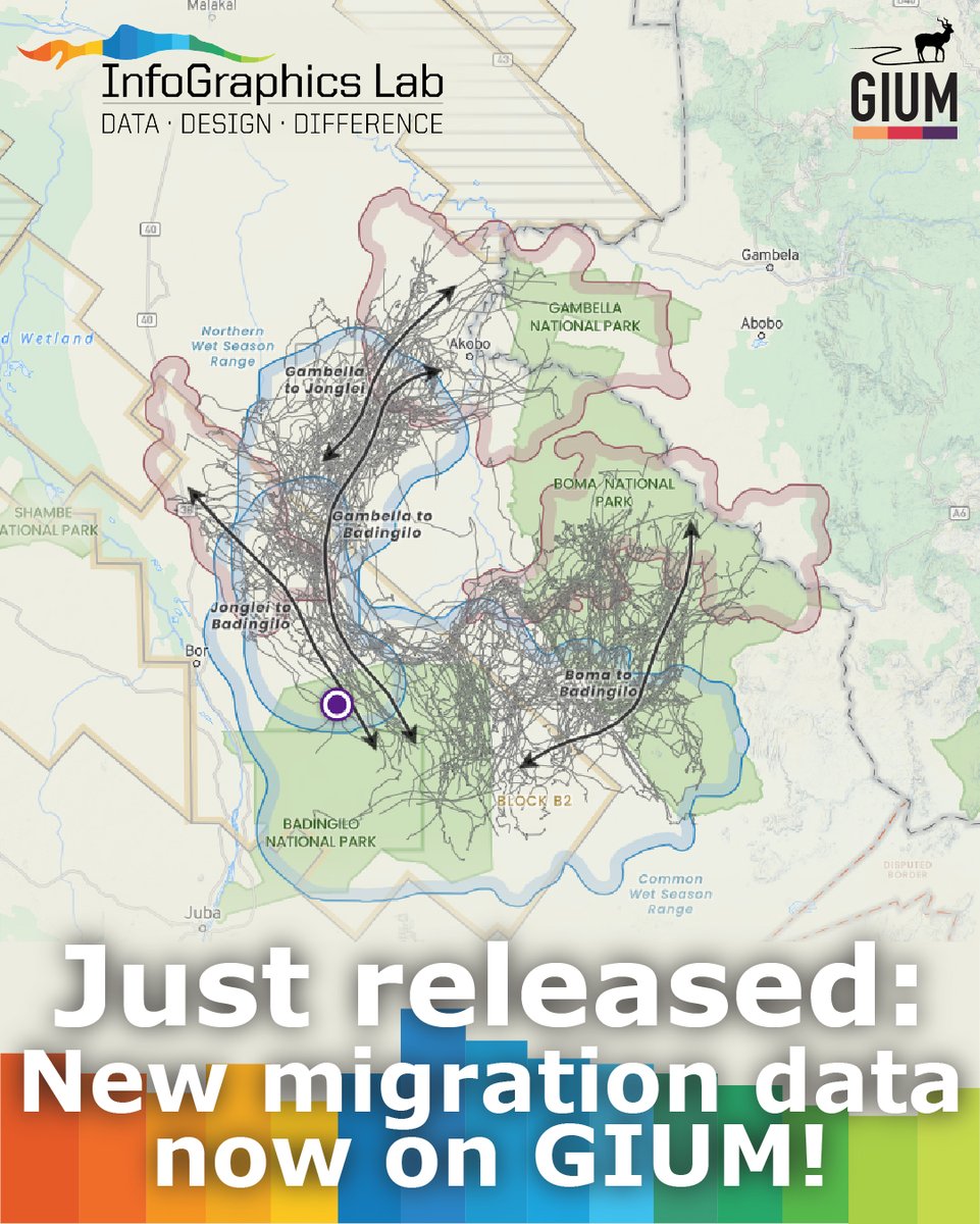
Just released! New interactive map features and two new migrations in the GIUM Atlas of Ungulate Migration: the white-eared kob and tiang in South Sudan and Ethiopia!
This is an ongoing collaboration with @migratinghooves and @gageCarto. cms.int/en/gium/migration-at…
2
47
InfoGraphics Lab retweeted

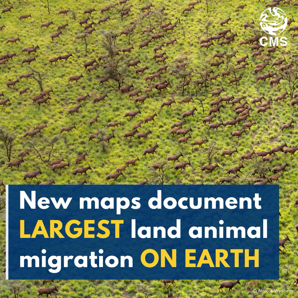
🚨 Just launched: new @migratinghooves maps of the Great Nile Migration, the biggest land-animal trek on Earth!
Over 5 million white-eared kob 400K tiang roam 100,000 km² between South Sudan & Ethiopia. 🐾
View the maps and discover how they can steer wildlife-friendly development: cms.int/en/news/new-maps-doc…
11
11
940
InfoGraphics Lab retweeted

We are excited to announce the newest maps in the Atlas of Ungulate Migration: the white-eared kob and tiang in South Sudan and Ethiopia! These maps will serve as tools in balancing the needs of both people and wildlife in this incredible region. shorturl.at/fFc4M
3
13
434
19 Nov 2024
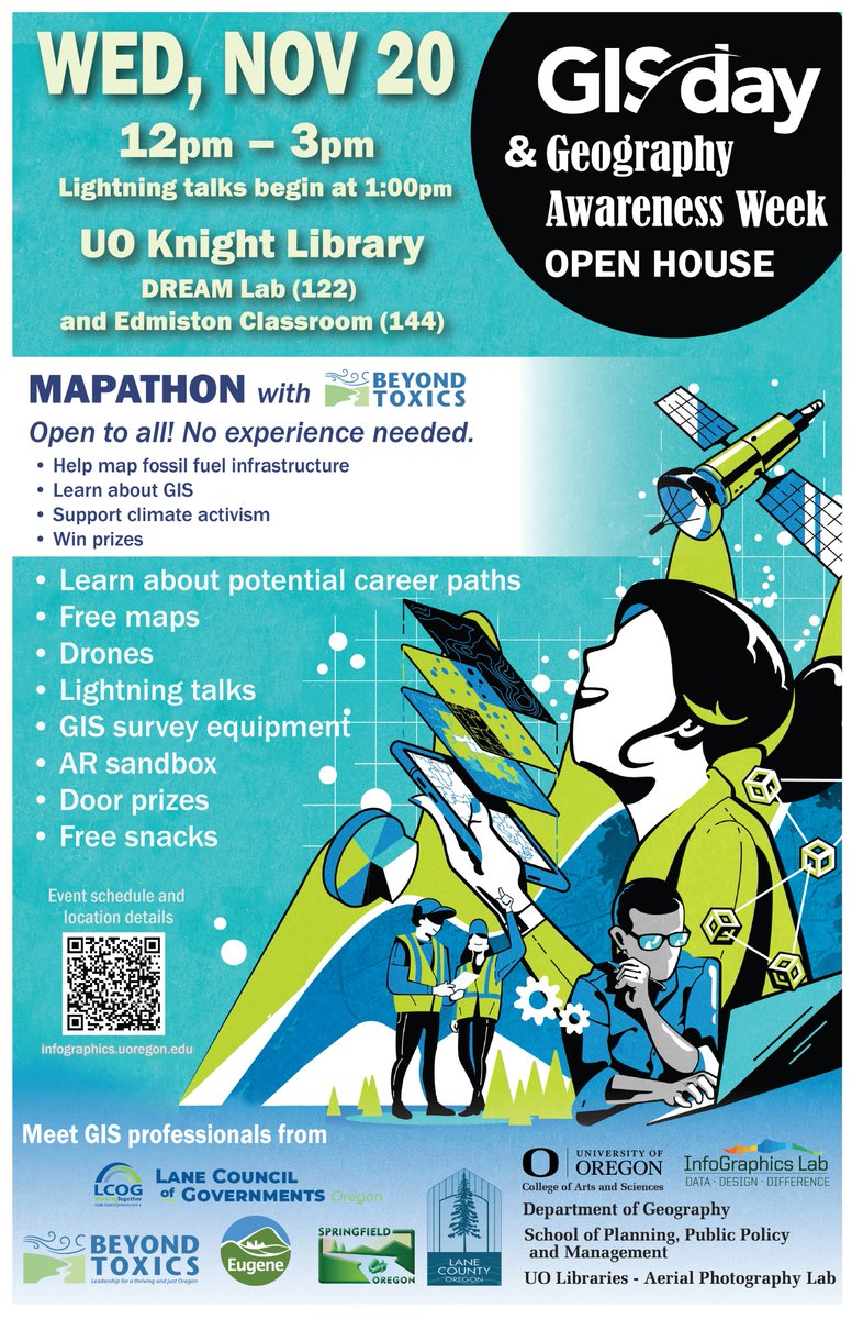
It's that time of year! GIS Day Open House at UO is tomorrow, Nov 20th!
1
1
1
116
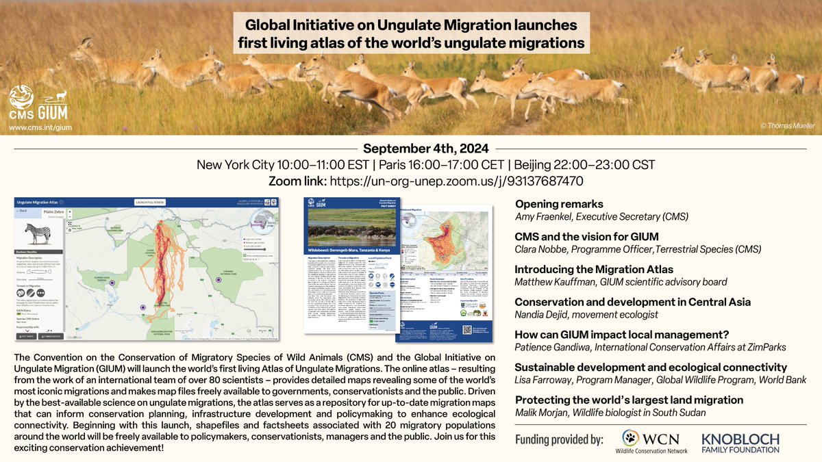
29 Aug 2024
Join us on Wed Sept 4th at 7am PT for the launch of the Atlas of Ungulate Migration! 🦌

Join us in one week for our online event launching the Atlas of Ungulate Migration! Time: Sept. 4th at 16:00–17:00 CEST | Beijing 22:00–23:00 CST.
Zoom link: un-org-unep.zoom.us/j/931376…
1
3
308

14 Apr 2024
We are happy to share that Volume 4 is out! This annual publication is one of the big cartographic efforts that the @InfoGraphicsLab collaborates on.
🦌 #migration @uoregon @uocas
11 Apr 2024

The 4th @USGS report on #ungulate migrations is LIVE! I am so proud to have contributed to this huge collaborative effort featuring 33 herds of deer, elk, & pronghorn migrating across the Western US! 🙌
Report: pubs.usgs.gov/sir/2024/5006/…
Press Release: usgs.gov/news/national-news-…
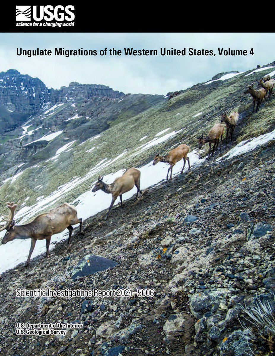
ALT Cover of a report that shows a herd of mule deer migrating down a rocky slope. Text at the top says USGS and Ungulate Migrations of the Western United States, Volume 4
3
5
780
InfoGraphics Lab retweeted

11 Apr 2024
The 4th @USGS report on #ungulate migrations is LIVE! I am so proud to have contributed to this huge collaborative effort featuring 33 herds of deer, elk, & pronghorn migrating across the Western US! 🙌
Report: pubs.usgs.gov/sir/2024/5006/…
Press Release: usgs.gov/news/national-news-…
ALT Cover of a report that shows a herd of mule deer migrating down a rocky slope. Text at the top says USGS and Ungulate Migrations of the Western United States, Volume 4
5
10
1,471
6 Apr 2024
On now, April 4 -7! Cartographies of Belonging: Visualizing Agency in a Fractured World in the @UO_EMU. This participatory mapping exhibit engages symposium attendees in creative visual arts exercises to explore their experiences of threat and freedom as writers and journalists.
1
2
73
6 Apr 2024
This work seeks record and reimagine how we confront and transcend barriers that restrict our movement, agency, and freedom. We invite participants to borrow from the cartography to represent these barriers through geographic and conceptual mappings. gsi.uoregon.edu/extra-extra-…
37
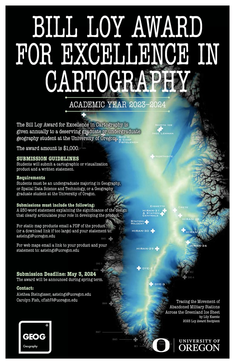
2 Apr 2024
📢Submissions for the Bill Loy Award for Excellence in Carto are open! It is granted annually to a @uoregon grad or undergrad in @uogeog or Spatial Data Science and Technology whose work demonstrates excellence in cartographic design and/or geographic vis. infographics.uoregon.edu/awa…
1
1
50
InfoGraphics Lab retweeted

1 Apr 2024
The School of Architecture & Environment has opened applications for Visiting Faculty Fellowships in Design for Spatial Justice at the rank of assistant, associate, full professor, or professor of practice.
careers.uoregon.edu/en-us/jo…
2
1
145
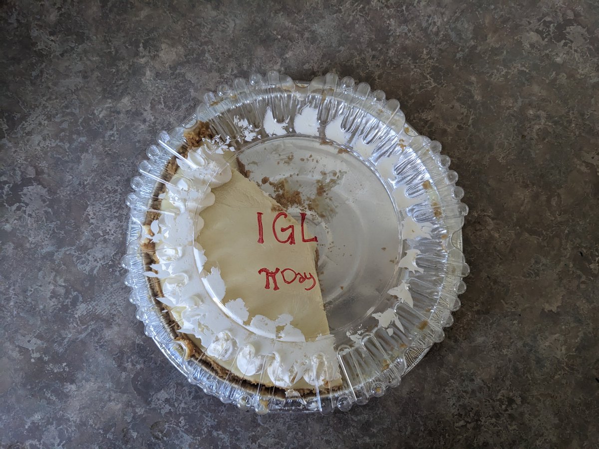
28 Mar 2024
Throw back Thursday to π day in the InfoGraphics Lab. We don't like 3D pie charts, but we sure do like pie.
39

📢 @NACIS is seeking a social media volunteer to boost outreach and connect better with our awesome members! Check out details here: docs.google.com/document/d/1…. Contact prez@nacis.org if you're interested in being our social media guru 🙌
3
7
1,190
21 Feb 2024
A sneak peek at one of our partnership projects with @migratinghooves: An interactive global atlas of ungulate migration!
"Tracking data allows us to literally ask the animals: where do you go and how do you get there?" @wyokauffman at #CMSCOP14. We believe data driven maps are a powerful tool for conserving wild migrations. Learn more here: cms.int/en/gium @BonnConvention

45
InfoGraphics Lab retweeted

18 Dec 2023
does anyone want a job careers.bloomberg.com/job/de…

3
9
38
11,752