
Cartography is the love for art and geometry. My mission is to make Swiss 🇨🇭 cartography known in Japan 🇯🇵 and to create new map series for Japan.
Joined February 2022
- Tweets 639
- Following 180
- Followers 437
- Likes 2,957
143 Photos and videos


Pinned Tweet

18 Jul 2022
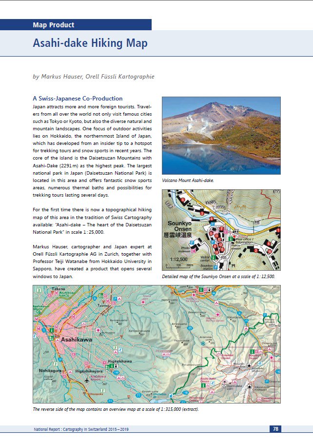
Still available from my Japanese distributor @alice_sha, the award-winning, first bilingual hiking map for Japan in Swiss map style of #Hokkaido's tallest mountain, "ASAHI-DAKE: The Heart of Daisetsuzan National Park".
alicesha.co.jp/books/0115/in…
16 Jul 2019

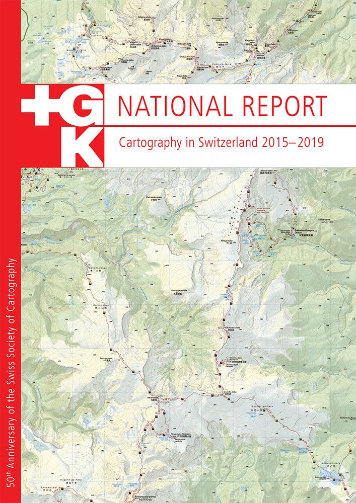
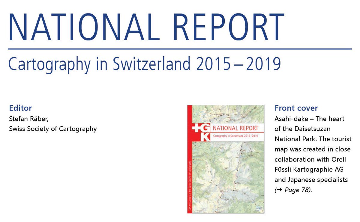
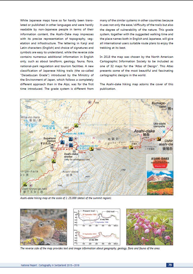
In honour of the host country of #icc2019tokyo, the cover of the "Swiss National Report - Cartography in Switzerland 2015-2019" features a Swiss-Japanese co-production: the map "Asahi-dake - The heart of the Daisetsuzan National Park" 1:25,000 @ICC2019TOKYO @asahidake_2291
6

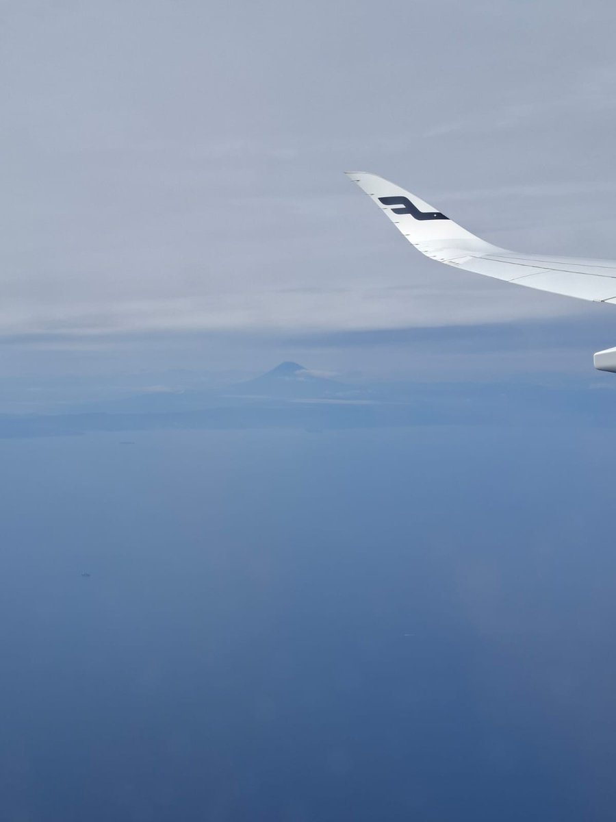
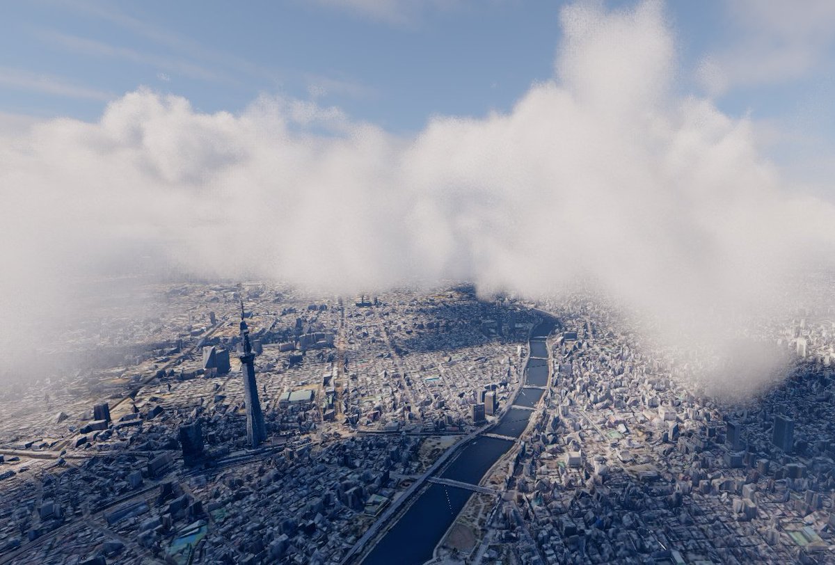
Back in Japan for 3 weeks. Beautiful approach with views of Itoigawa, Hayakawa Valley and Niigata Yake-yama I know very well.

2
117
The Hokkaido Cartographer retweeted

May 30
The Japan Hiking Field Guide – 160 hiking terms, phrases & glossaries in kanji and rōmaji, plus checklists, bear awareness, emergency contacts, and more. Folds to A7 pocket size. Built in Illustrator. No AI.
Available via Ko-fi from ¥300 👉 ridgelineimages.com/musings/…

3
12
774
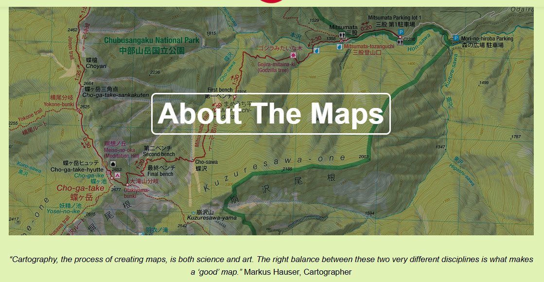
Welcome new followers! Check out this link to learn about my background and what I'm doing in Japan.
japanwilds.org/about-the-map…
7
74
4,262
The Hokkaido Cartographer retweeted

May 20
Things aren't looking good for Japan's izakaya dining scene. soranews24.com/2026/05/21/ja…
1
4
1,182
The Hokkaido Cartographer retweeted

For something a little different, the ryokan I work for in south Osaka will be putting on a Kyogen comedic play on June 20th
Seats are JPY 12,000 per person and include a seasonal kaiseki lunch
It will be in Japanese but I've found Kyogen enjoyable even with my limited ability!


2
5
33
1,341
The Hokkaido Cartographer retweeted

May 15
【#草津白根山 #噴火警戒レベル1 へ】草津白根山(白根山(湯釜付近))の噴火警戒レベルが1(活火山であることに留意)に引き下げられました。
活火山であることに留意いただき、地元自治体等の指示に従って危険な地域には立ち入らないでください。
data.jma.go.jp/vois/data/rep…


21
58
13,470
The Hokkaido Cartographer retweeted

Apr 13
The 2024 earthquake in Noto Peninsula was a blow to the area’s centuries’ old craft of Wajima lacquerware. A Kanazawa restaurant is promoting the lacquerware’s practical beauty by centering it in the meals it offers to diners.
nippon.com/en/japan-topics/g…
30
84
571
1,977,461
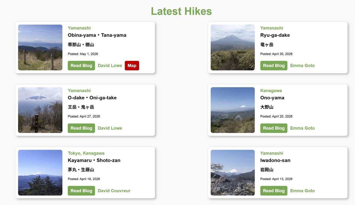
The last 6 blog posts from fellow hikers. Very much Mt Fuji focused! 🏔️
68
The Hokkaido Cartographer retweeted

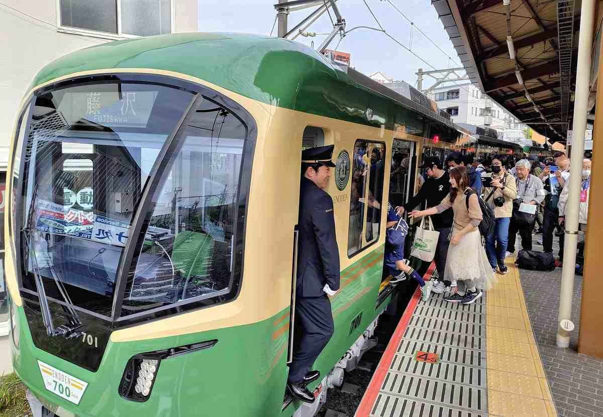
Enoshima Electric Railway Co. has started service of its first new model of train in 20 years. The seating arrangements have been designed to maximize the number of passengers and their views of the Shonan coast
japannews.yomiuri.co.jp/feat…
6
15
1,188
The Hokkaido Cartographer retweeted

上士幌町 “幻の橋”タウシュベツ川橋梁一部崩落 地震影響か(NHK)
news.web.nhk/newsweb/na/nb-7…
「壊れゆく橋ではあるが、この風景をいつまでも見せてほしい」
…補強が検討されたこともあるそうですけどね
1
10
11
1,892
The Hokkaido Cartographer retweeted

Mar 29
Can someone point me to Japanese cartography twitter? Anyone making beautiful maps over there? @JapanMapping ?
日本の地図作成(カートグラフィー)関連のTwitterアカウントをご存知の方はいらっしゃいませんか?あちらで美しい地図を作っている方はいますか?
2
2
13
1,222
The Hokkaido Cartographer retweeted

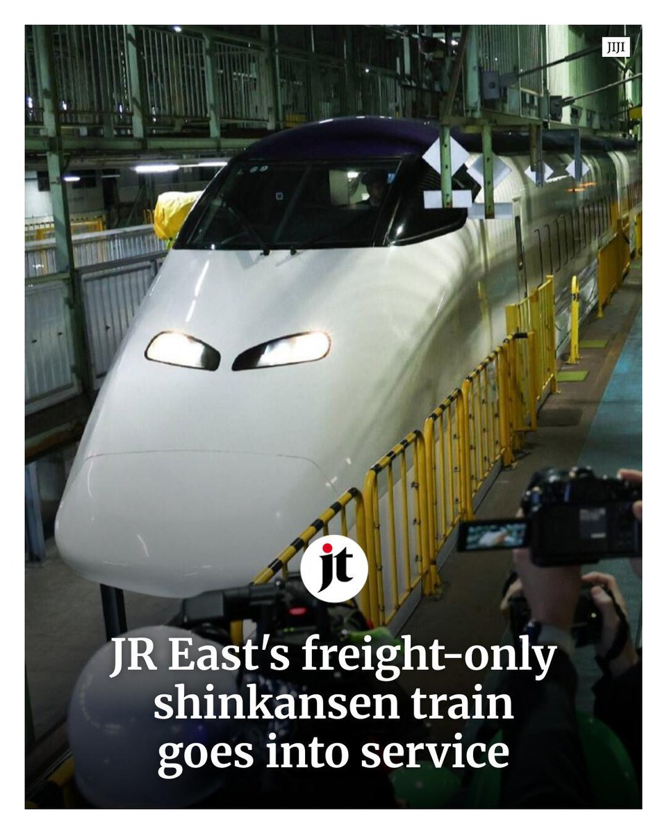
Mar 25
JR East has started operating a freight-only Shinkansen bullet train, transporting goods from Morioka, Iwate Prefecture, to Tokyo. 👉 ebx.sh/i6qwjJ
5
12
2,441
The Hokkaido Cartographer retweeted
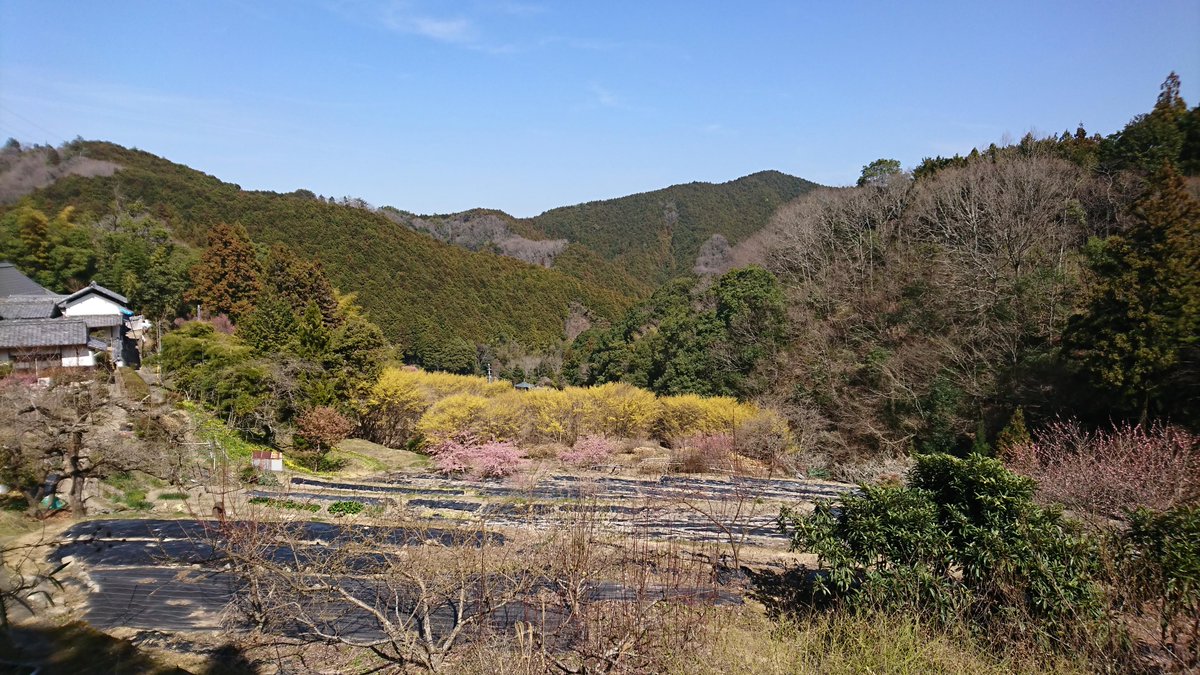
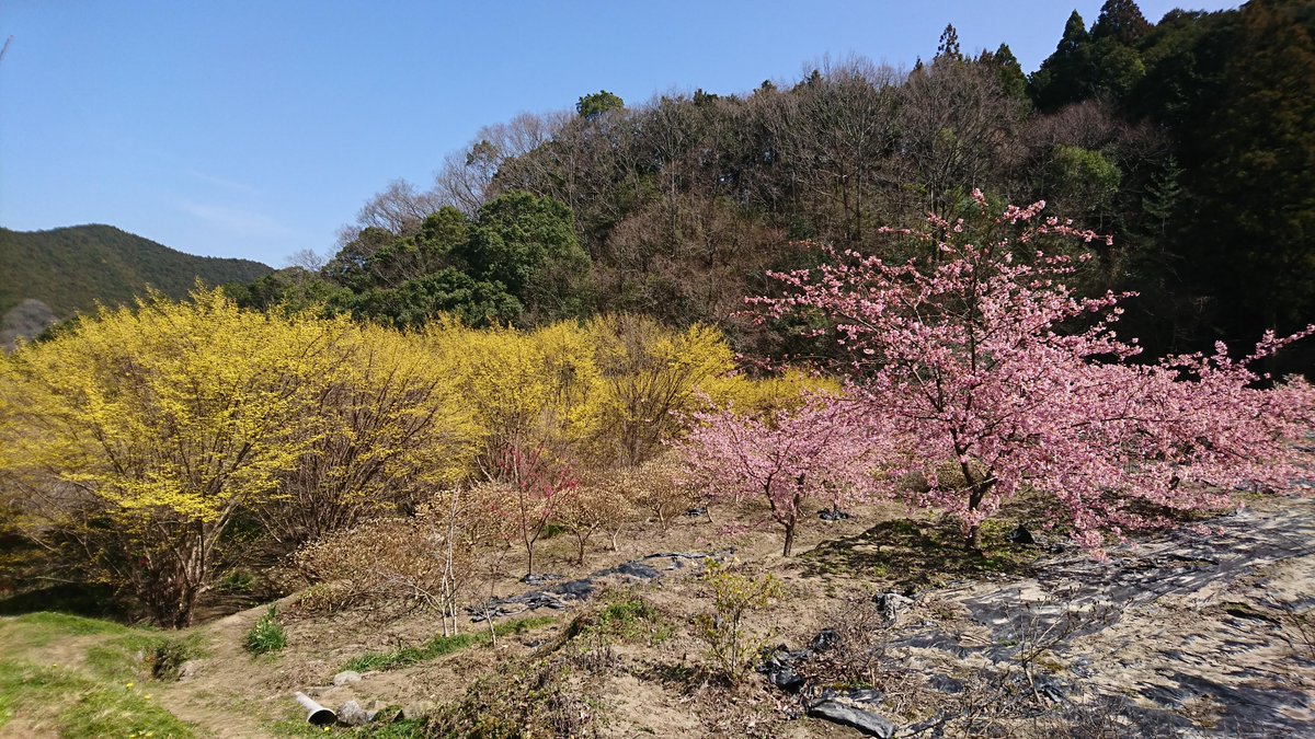
Back to the top of Nagaretani where the Kawazu-zakura and Sansho are both in bloom
In the woods above is a small Fudo-Myo, an early location for a Shugendo pilgrimage point that was destroyed some time after 1683
I then visited the new pilgrimage point established in the 1970s

1
12
621
The Hokkaido Cartographer retweeted
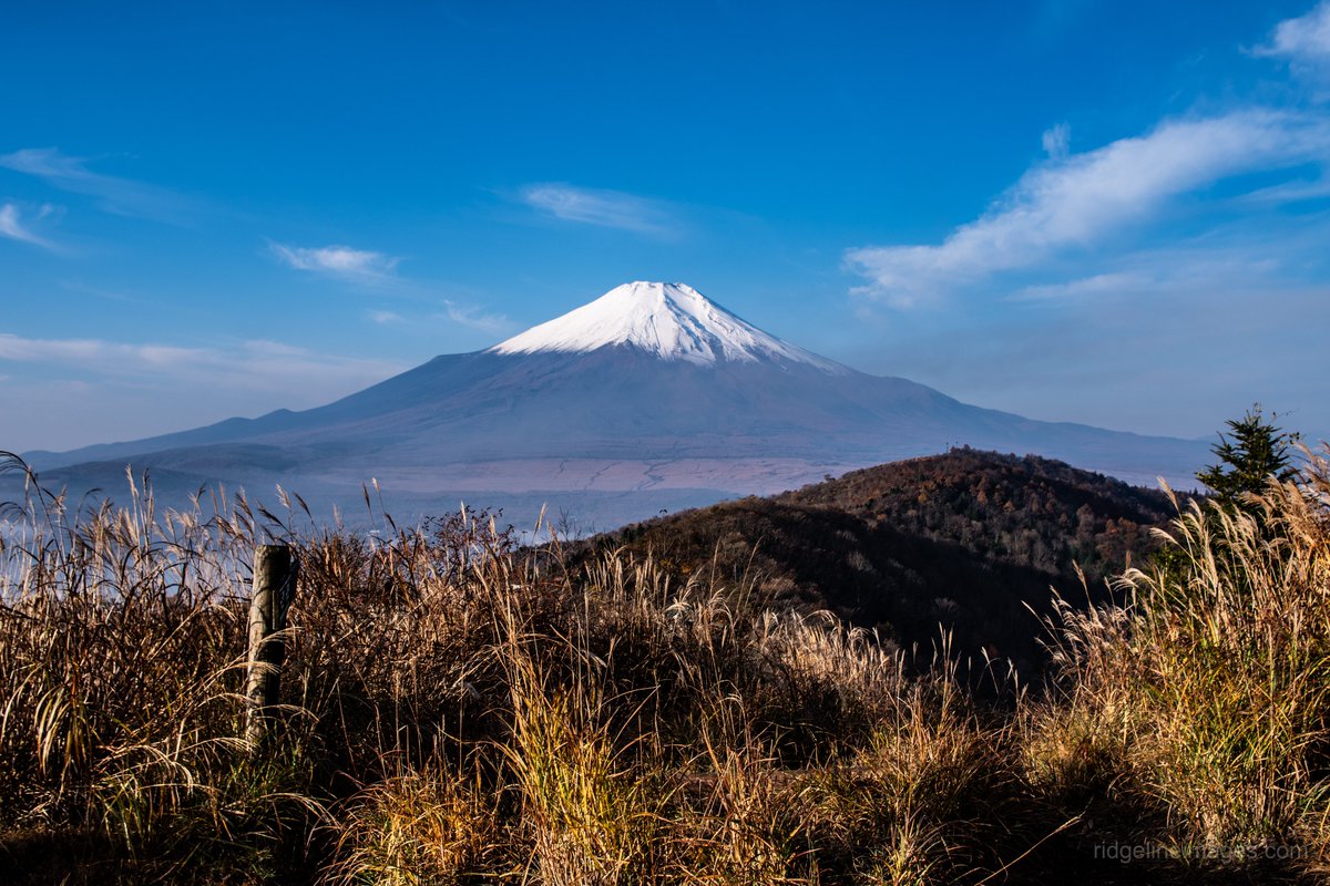
Mar 20
Here are 21 of my favourite hikes in Japan for Mt. Fuji views – ranging from easy half-day walks near Tokyo to a few remote ones in Yamanashi. 🗻
ridgelineimages.com/hiking/b…
1
3
135
The Hokkaido Cartographer retweeted
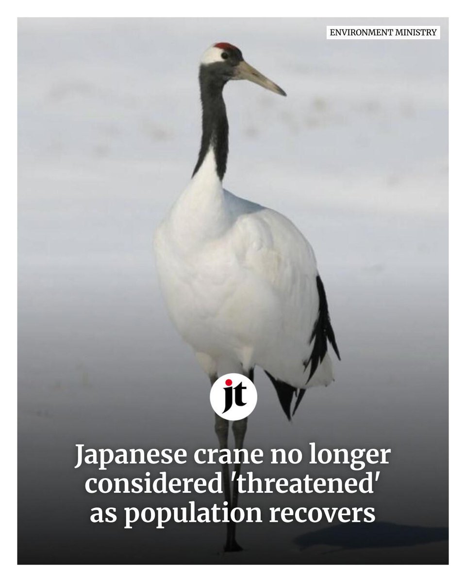
Mar 17
Japan has removed the red-crowned crane, also known as the Japanese crane and designated by the government as a special natural monument, from its list of threatened species thanks to a population recovery. 👉 ebx.sh/21Vz8h
1
52
218
4,566
The Hokkaido Cartographer retweeted

Feb 18
The head of our Geopark's Natural Resources Conservation Committee is giving a lecture about Itoigawa's biodiversity and how we can help protect it. Join us at Kitare on Feb 28!

希少野生動植物保護に関するセミナーが開催されます!
糸魚川ジオパークならではの生態圏の豊かさを一緒に守ってみませんか?
📅日時:令和8年2月28日(土)13:30-15:30
📌場所:駅北広場キターレ
📝申込:Google Form (参加無料)
docs.google.com/forms/d/e/1F…
詳細はこちら
geo-itoigawa.com/topics/2569…

1
2
155
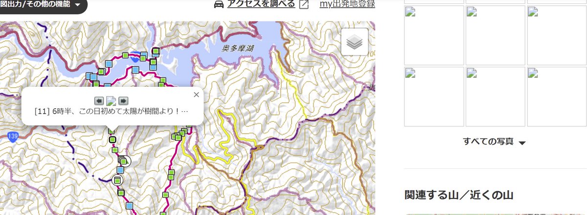
For a few days now, @yamareco (Cloudfare) has been requesting a security check, and then, when you're on the site, the photos are no longer displayed. Has anyone else experienced something similar? Is it because I'm accessing the site from abroad? (I'm Premium member)
1
350
The Hokkaido Cartographer retweeted
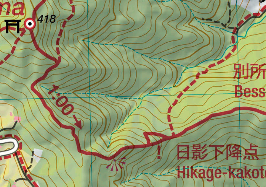
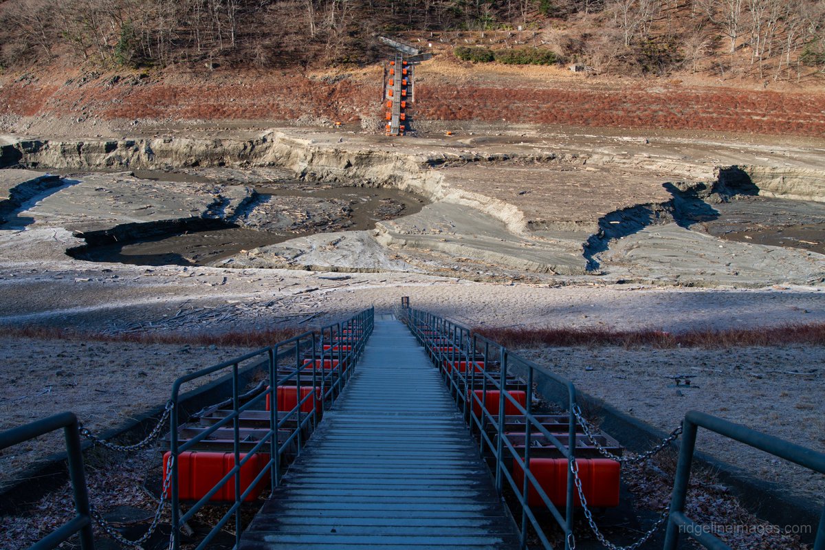
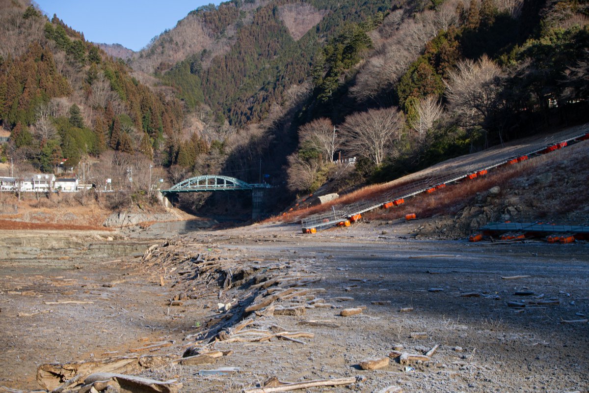
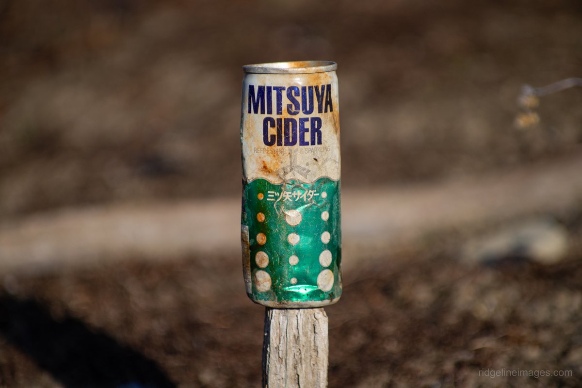
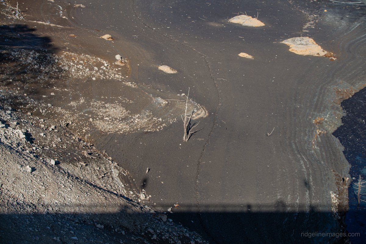
Feb 15
Lake Okutama is retreating 📉🌊
In my latest post, I compare photos from 2016 with today revealing re-emerging tree skeletons, exposed infrastructure, and Showa-era relics.
ridgelineimages.com/musings/…
#奥多摩湖 #小河内ダム
1
4
345
The Hokkaido Cartographer retweeted

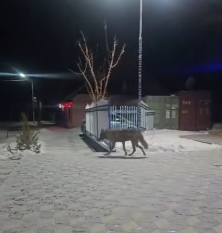
Feb 12
While in #Japan increasing numbers of bears are moving into populated areas, in #Tajikistan #Pamirs it’s the wolves. In both regions, wildlife appears to have largely lost its fear of humans.
facebook.com/reel/1962170808…
1
1
4
234