
Husband. Dad. @WTOV9 Chief Meteorologist for 28 years bringing you weather updates every weekday morning.
Joined April 2012
- Tweets 52,117
- Following 1,398
- Followers 6,835
- Likes 18,391
25,906 Photos and videos


Jeff Oechslein retweeted

57m
Morning Minute:
-Northern Parkway Project in Ohio County
-Steubenville Water Conservation Notice
-Belleview Pool Opening
1
1
3
208
Photos of the Day
End of the rainbow - Linda Mader
Sunset at Tappan Lake - Alicia Carlisle
Epworth Park Lake - Jean Daniels
wtov9.com/chimein


3
69
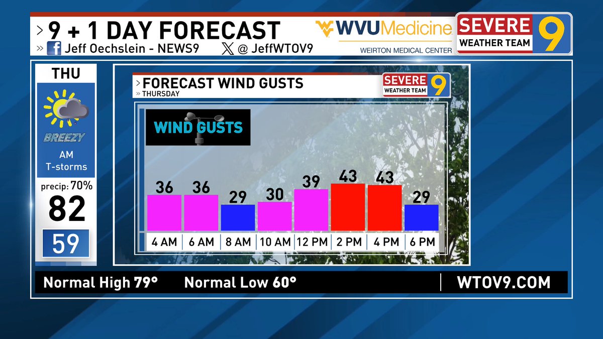
A couple more quiet weather days before it turns more active. There is the potential for strong storms late Wednesday night into Thursday morning. High wind gusts up around 40 mph will be felt Thursday afternoon.
3
102
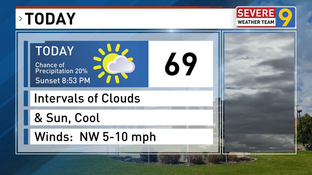
Following our cool morning with patches of fog near bodies of water we have a great weather day.
3
102
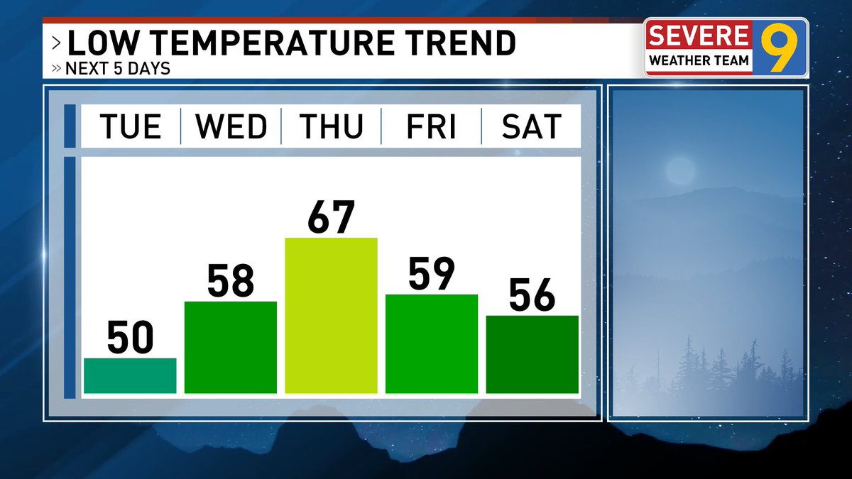
Good morning! Waking up to a chilly morning for mid June standards as temperatures reside in the upper 40's to near 50 degrees. Cooler air over bodies of water such as the Ohio River is responsible for patches of steam fog. A pleasant high of 75 is expected this afternoon.
3
277
Jeff Oechslein retweeted

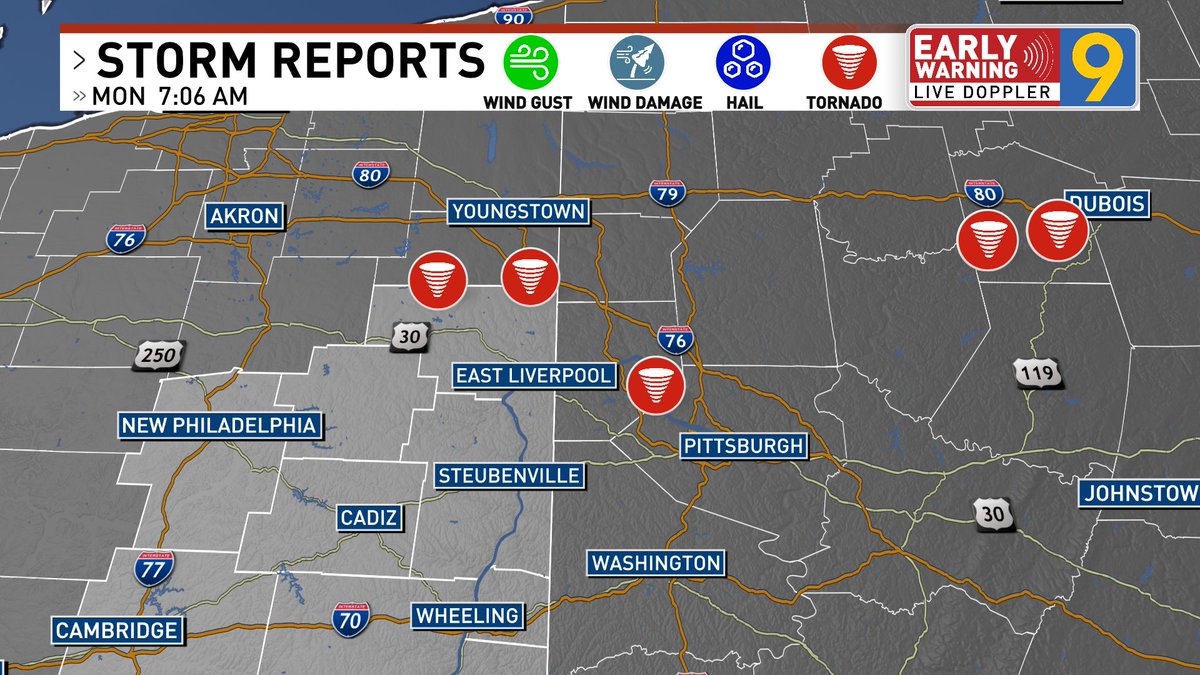
The Columbiana County tornado is the 23rd on record since 1880 - the last was an EF0 on June 11, 2021. The Jefferson tornado will be the 17th since 1880, with the last being an EF0 on October 16, 2021.
6
37
4,989
Jeff Oechslein retweeted

‼️ The National Weather Service has confirmed a tornado occurred in Columbiana County near Salem, OH. Further details will be available later today or tomorrow. This is the 22nd tornado on record since 1950 for Columbiana County with the last being an EF0 on June 11, 2021 ‼️
1
1
141

Jun 15
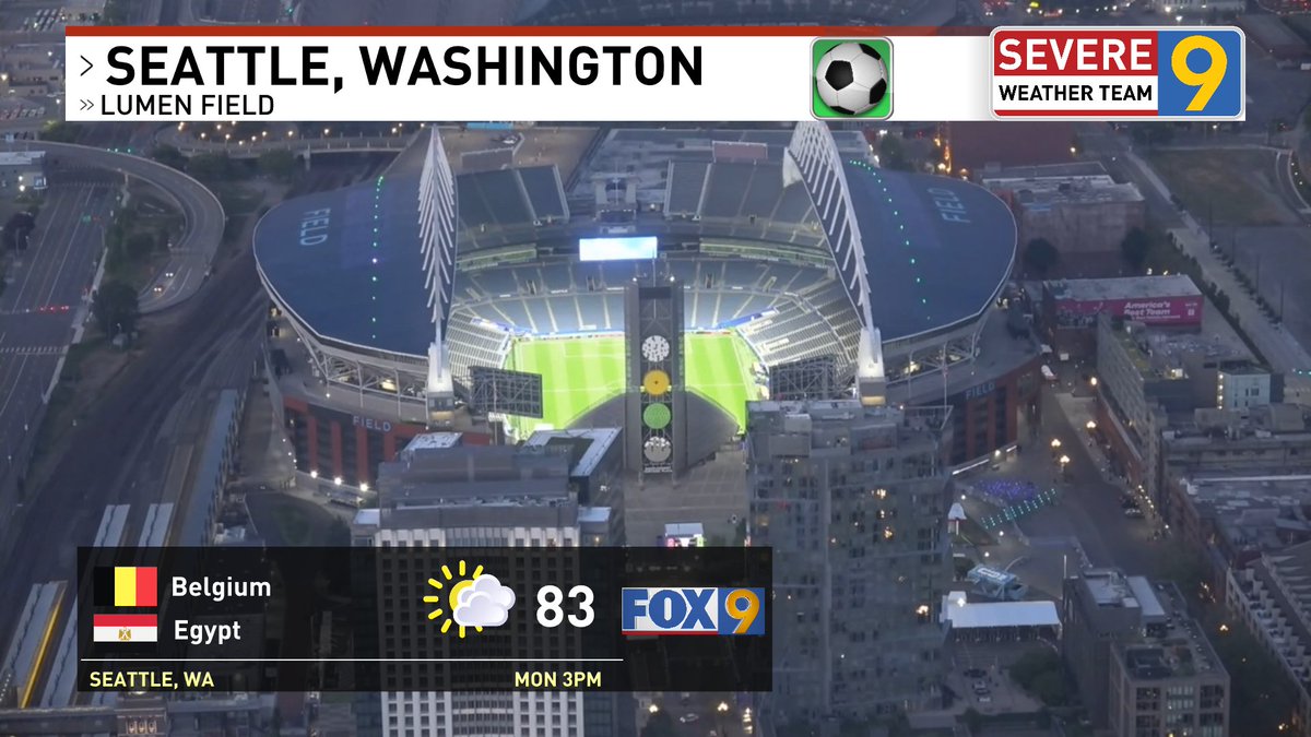
Seattle will be a lot warmer than the Ohio Valley today with a forecast high of 88. Catch World Cup soccer on FOX9 from Seattle today at 3 pm.
1
103
Jun 15
Severe thunderstorms Sunday afternoon with 5 repots of tornadoes which includes northern Columbiana county. The National Weather Service will conduct a tornado survey in these locations today.
1
3
315
Jun 15
Photos of the Day
She's beautiful - Janet Kendzierski
Dew drops - Heather Leigh
An awkward position - Greta Foose
wtov9.com/chimein


4
111
Jun 15
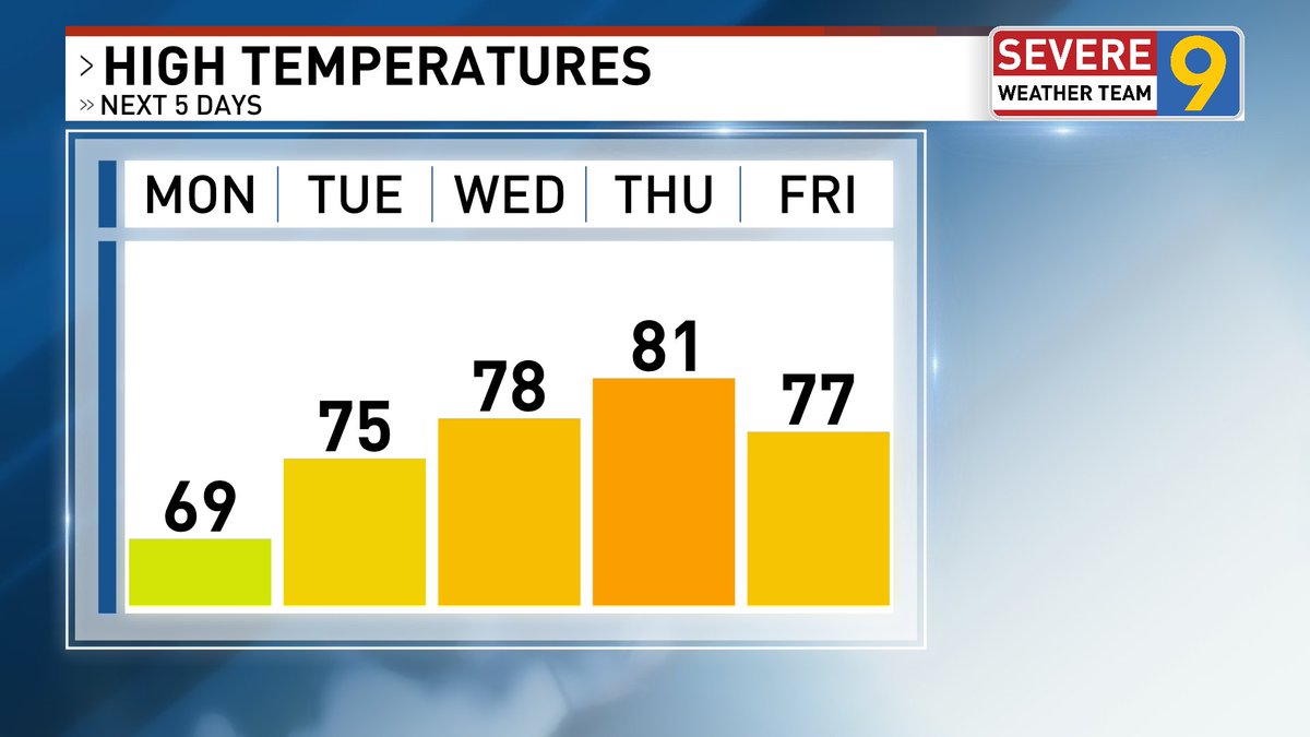
Good morning! We kick off a new week with cool weather for the middle of June. High temperatures struggle to reach 70 this afternoon & low temperatures tonight fall towards 50.

1
1
5
288
Jeff Oechslein retweeted


1
1
227
Jun 14
Severe thunderstorms are moving through the Ohio Valley late this afternoon. Take cover. High winds can result in power interruptions.
1
1
165
Jun 14
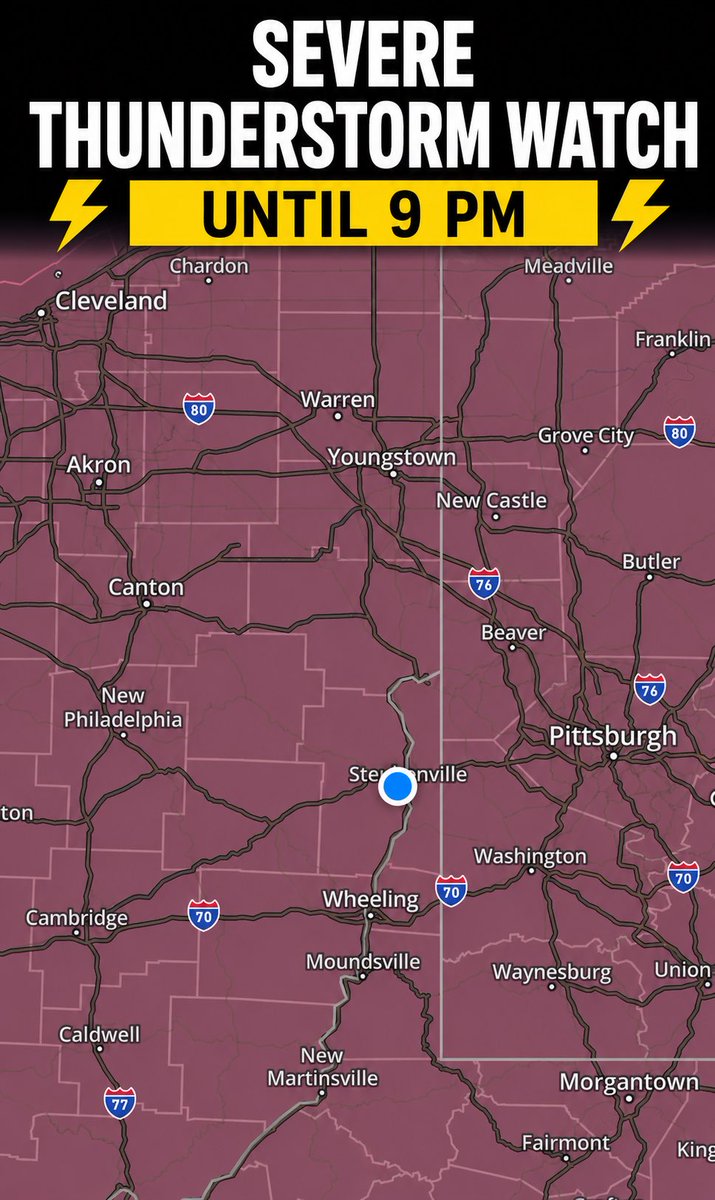
A Severe Thunderstorm Watch has been issued through 9 pm Sunday.
1
1
143
Jun 14
A round of morning showers gives way to a break in the rain. Thunderstorms develop later this afternoon into this evening.
1
3
152
Jeff Oechslein retweeted
Jun 12
Morning Minute: Steubenville mineral rights; Weirton oil and gas case; oil and gas prices drop
2
6
522
Jun 12
Garner Flener with a unique, slow motion view of the downpours that crossed the region on Thursday afternoon.
8
230
Jun 12
Photos of the Day
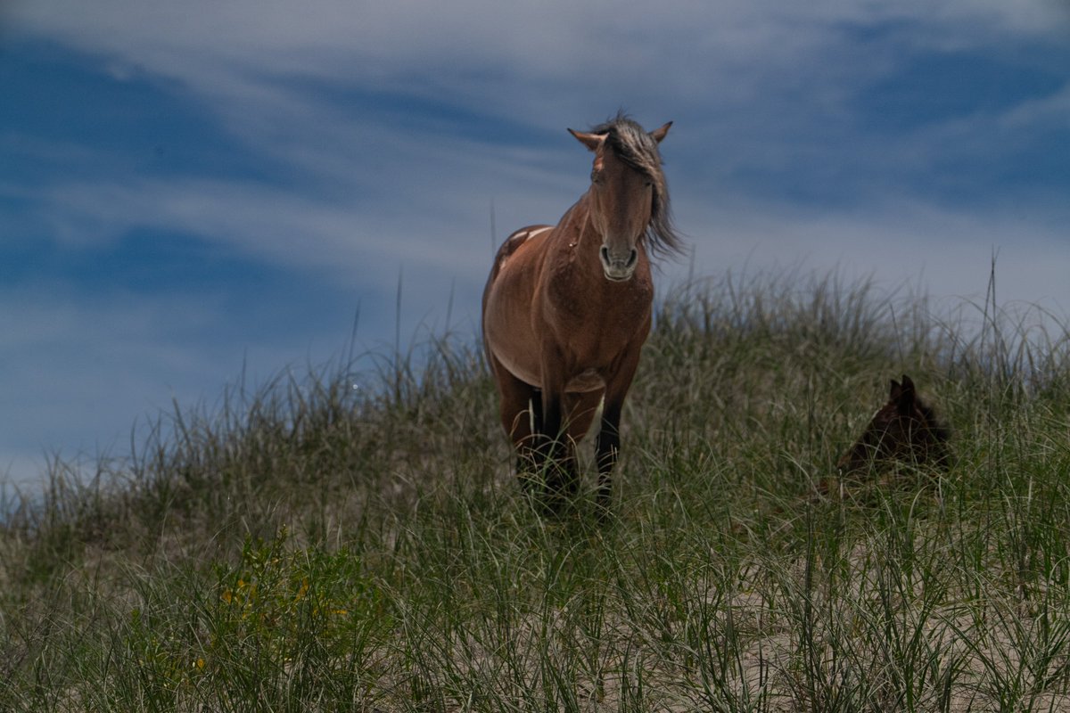
Wild horses at OBX - Dave Wodesky
Iris in the hay field - Valori Sprouse
Frank Lloyd Wright's Fallingwater - Suzanne Pubal
wtov9.com/chimein


4
117
Jun 12
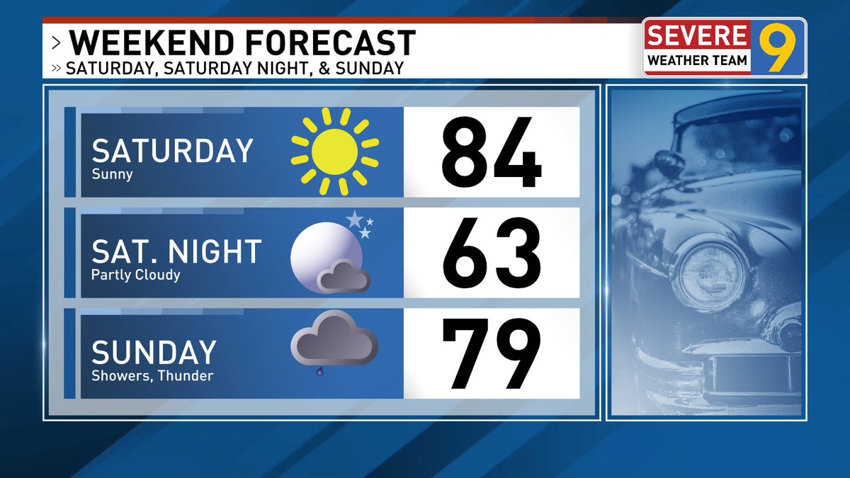
Weekend forecast . . . Saturday is the pick of the weekend as ample sunshine fills the sky, it will be warm but not as humid. There will be showers and perhaps an afternoon thunderstorm to dodge at times on Sunday.
4
215