Do you know where the coldest location on Earth is?
Check your knowledge in our latest blog post, "Extremities of the Earth: The Coldest Place on Earth."
The full post is available here: blogs.loc.gov/maps/2026/05/e…
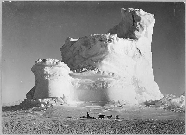
ALT Photograph shows a man on a dogsled in the foreground and a castle-shaped mountain of ice in the background, during the British Antarctic Expedition.
Join the Geography & Map Division online Tuesday, June 9, 2026 at 3:00pm (Eastern) to discover some of our many collection materials related to the 250th anniversary of the United States. Register here: loc.zoomgov.com/webinar/regi…
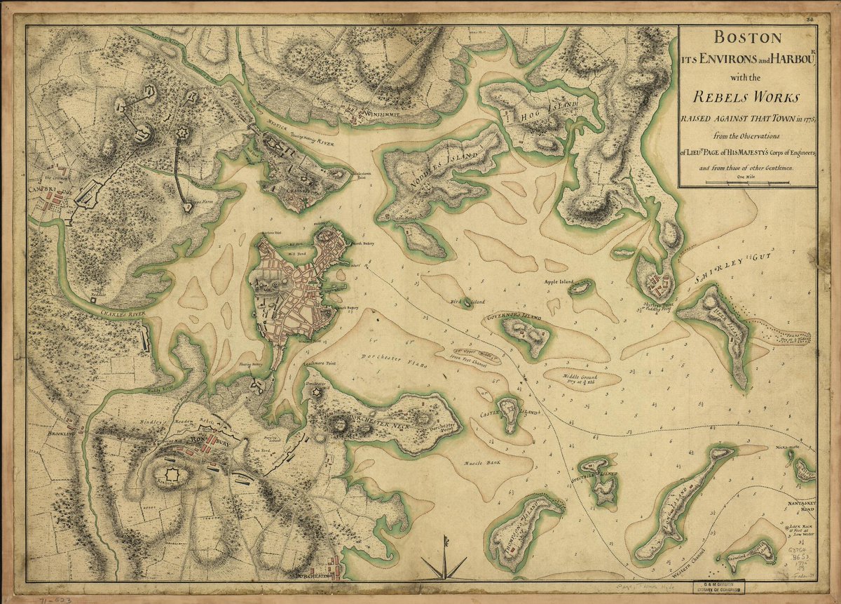
ALT hand-drawn map showing the Boston Harbor with soundings
This colorful 1831 map depicts the parishes of Rio De Janeiro, then the capital of the Empire of Brazil.
Take a closer look here: loc.gov/item/2001620476/?loc…
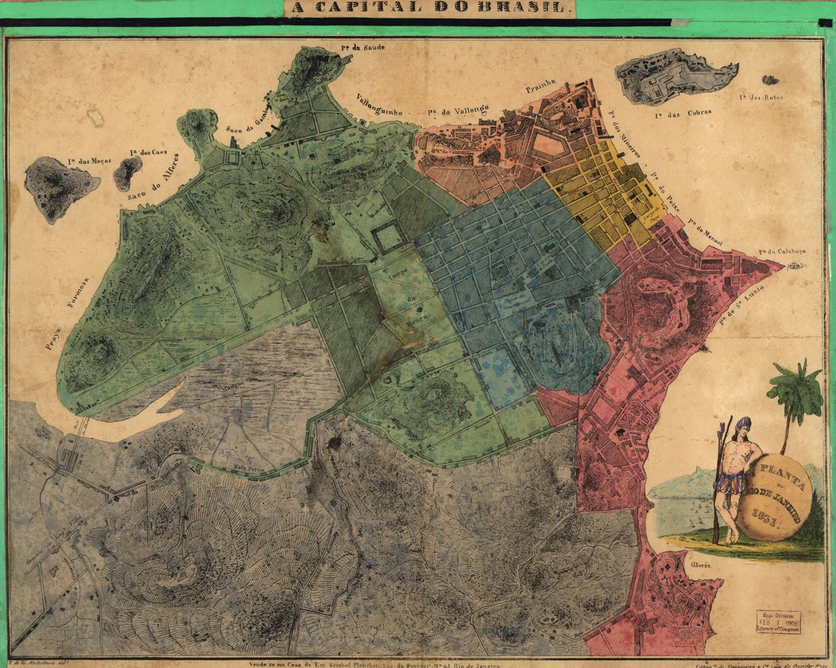
ALT Map of Rio De Janeiro with parishes color-coded and prominent topography and buildings illustrated.
Learn all about Europe's struggle to correctly trace the delta of the Niger River in our recent blog post, "The Elusive Delta of the Niger River."
The blog post is available online in full here: blogs.loc.gov/maps/2026/05/t…
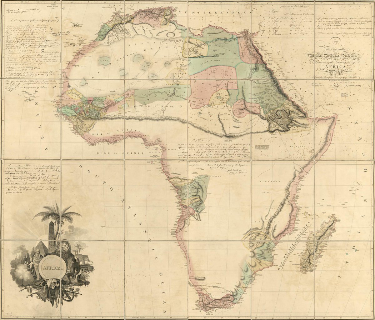
ALT Africa : to the committee and members of the British association discovering the interior parts of Africa this map is with their permission most respectfully inscribed. Aaron Arrowsmith, 1802. Geography and Map Division.
Learn all about our 2026 Philip Lee Phillips Society Fellows and how to apply for the upcoming application cycle in our latest blog post.
Applications for 2027 are now open!
The full blog post is available here: blogs.loc.gov/maps/2026/05/t…
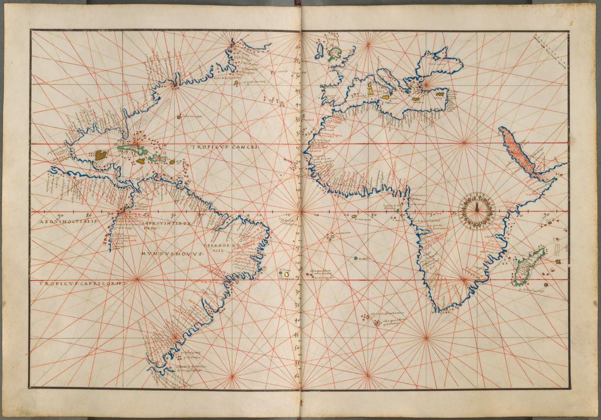
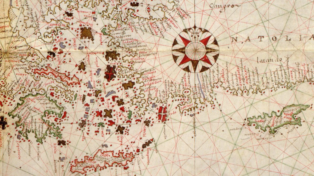
ALT Detail of [Portolan atlas of the Mediterranean Sea, western Europe, and the northwest coast of Africa], Joan Oliva, 1590, Geography and Map Division.
This panoramic map of Silver City in then-Idaho Territory was created by noted African-American lithographer Grafton Tyler Brown in 1866. The border features sketches of local mines and stamp mills.
See the full map online here: loc.gov/item/2022593552/?loc…
If you're interested in maps depicting continental drift, we have the blog post for you!
"A Drifting World: The Supercontinent of Pangaea" is available to read in full on our Worlds Revealed blog: blogs.loc.gov/maps/2026/04/a…
ALT black and white map showing movement of continents
Join us online Tues April 14 at 3:00 for an intro to the map collections at the Library of Congress! This session will highlight a wide range of cartographic formats and subjects. The focus will be on resources available to all patrons.
Register here: loc.zoomgov.com/webinar/regi…
This fascinating 1756 Philippe Buache map offers a topographic view of the world from the North Pole.
Take a closer look here: loc.gov/item/2013591466/?loc…
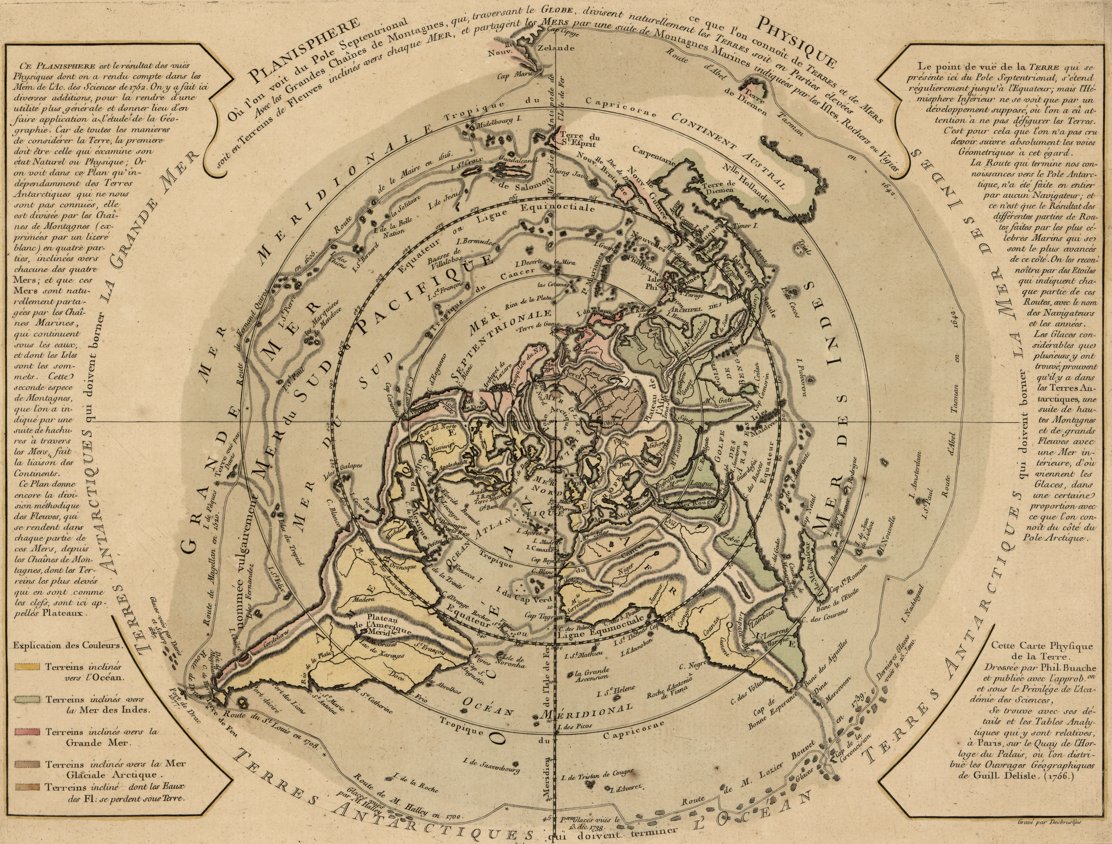
ALT World map from perspective of north pole, with continental topography prominently shown. A map legend and descriptive text in French surround the map.
Join us online Tues April 14 at 3:00 for an intro to the map collections at the Library of Congress! This session will highlight a wide range of cartographic formats and subjects. The focus will be on resources available to all patrons.
Register here: loc.zoomgov.com/webinar/regi…
Interested in maps of the moon? Don't miss out on "The Moon : a visual analysis of 1.3 million lunar craters" created by cartographer Joshua Stevens in 2024.
Take a closer look here: loc.gov/item/2024586051/?loc…
This 1858 geological map of Pennsylvania showcases a dizzying array of geologic strata!
Take a closer look here: loc.gov/item/89692855/?loclr…
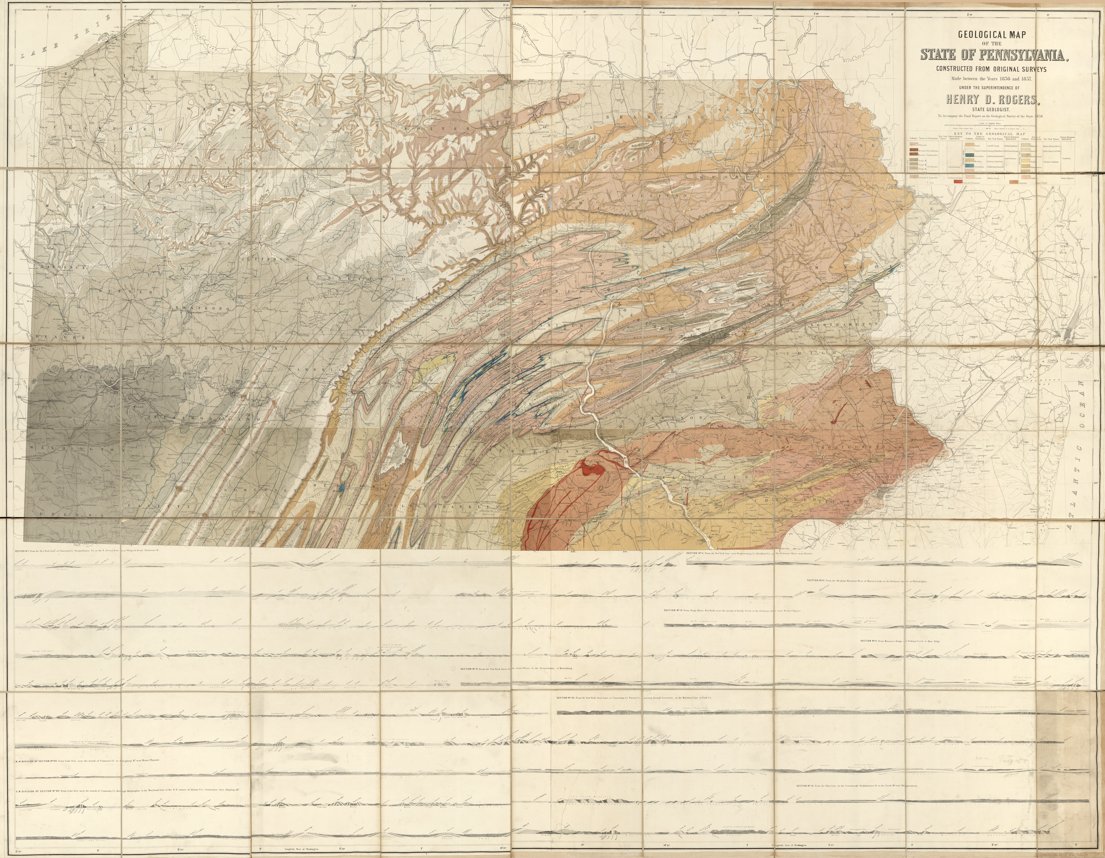
ALT Map of Pennsylvania geologic formations with map legend at top-right and a display of specific geologic cross-sections between different Pennsylvania locales at bottom.
ALT Close-in view of central Pennsylvania with color-coded, wavy geological strata shown with local towns and major roadways mapped over top.
Learn all about the history and geography of American whiskey regulation in our latest blog post, "Home Rule Comes for Home Brew: Mapping Whiskey Regulation in the United States."
You can read the post in full online here: blogs.loc.gov/maps/2026/03/m…
ALT Sanborn fire insurance map showing a distillery
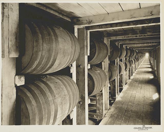
This fascinating mid-19th century Japanese map labels and charts the troops and samurai in charge of defenses along Tokyo Bay.
Take a closer look here: loc.gov/item/84697512/?loclr…
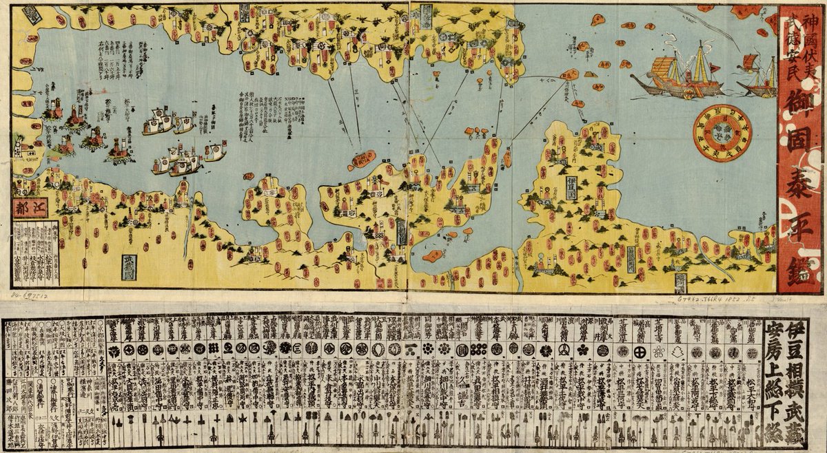
ALT Map of Tokyo Bay with villages shown along coastline. Ships are illustrated in the bay and below the map is a listing of troops and samurai, with symbols describing military units.
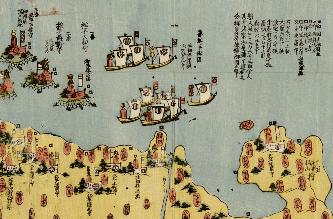
ALT Close-in view of illustrated ships in Tokyo Bay, near a coastline with pictorial representations of topography and villages.
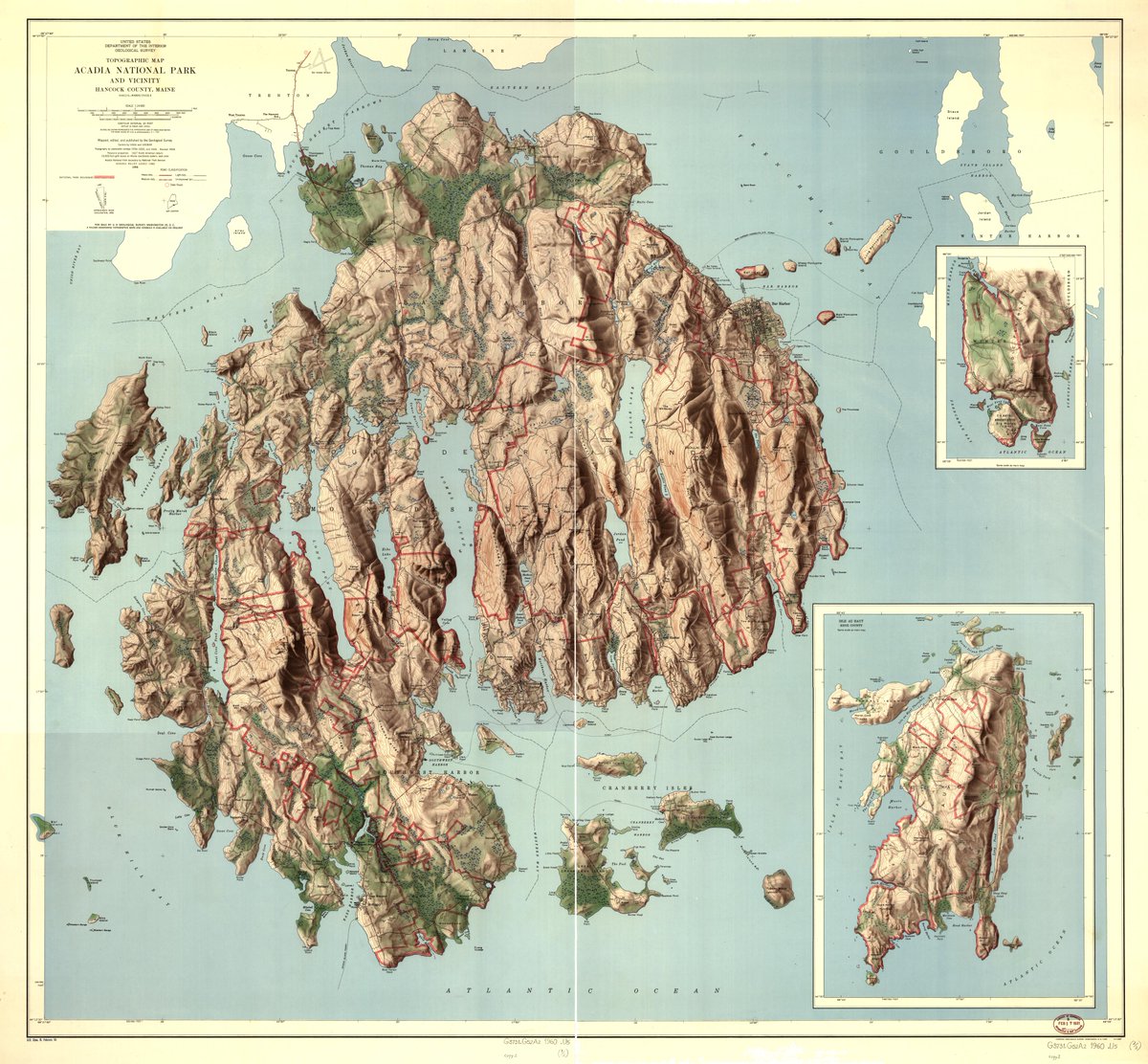
This 1874 map of the Chicago, Milwaukee, and St. Paul Railway features illustrations of natural landmarks along the route!
Take a closer look here: loc.gov/item/2006626044/?loc…
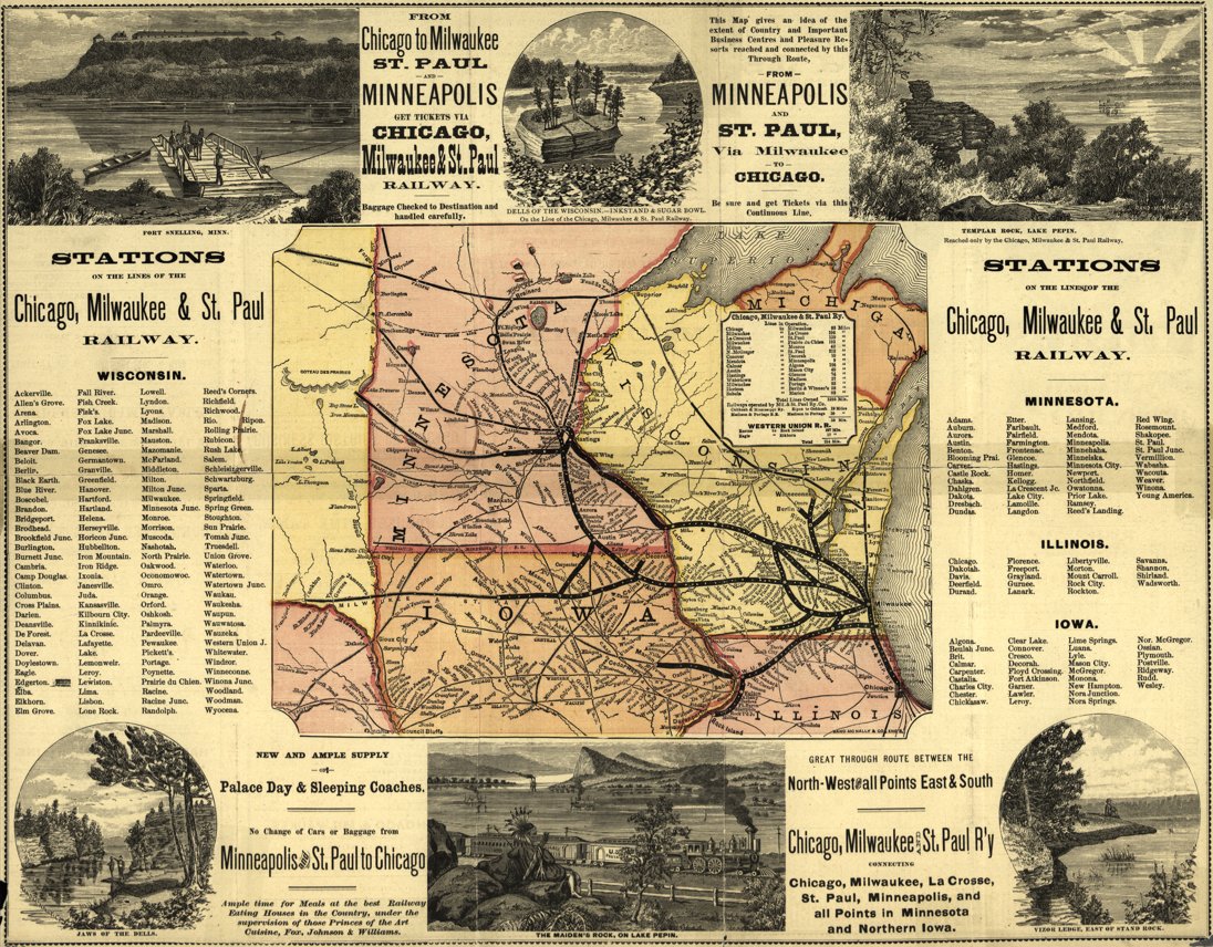
ALT Map of railway lines across upper Midwest, surrounded by illustrations of natural landmarks and lists of railroad stations along several routes.
This vibrant panoramic map covers the expansive grounds of the 1893 World's Columbian Exposition in Chicago!
Take a closer look here: loc.gov/item/98687181/?loclr…
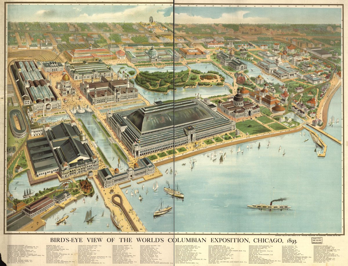
ALT Panoramic view of elaborate buildings of the World's Columbian Exposition, interspersed by waterways, green spaces, and prominent boats on Lake Michigan.
Learn all about the challenges that Sanborn Map Company surveyors faced when surveying buildings in our recent blog post "Sanborn to Run: Overcoming Workplace Obstacles for Fire Insurance Surveyors."
The full post is available online here: blogs.loc.gov/maps/2026/01/s…
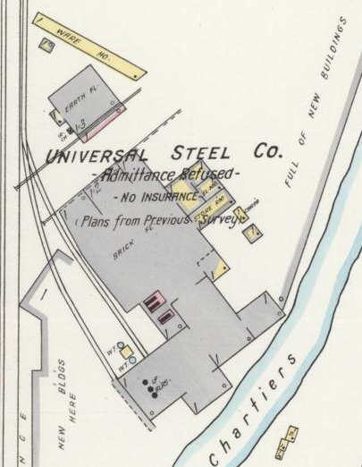
ALT Detail from plate 7 of a Sanborn Fire Insurance Map from Bridgeville, Allegheny County, Pennsylvania.
Interested in nautical navigation, portolan charts, & seafaring cartography? There's still time to register for our webinar this afternoon!
See more details and register here: loc.zoomgov.com/webinar/regi…
Curious about our nautical chart collections? Please join G&M staff on Feb 10th for a virtual orientation to our nautical charts and resources!
Date: Tuesday, February 10, 2026
Time: 3:00-4:00 pm (Eastern)
Register for this session here: loc.zoomgov.com/webinar/regi…