
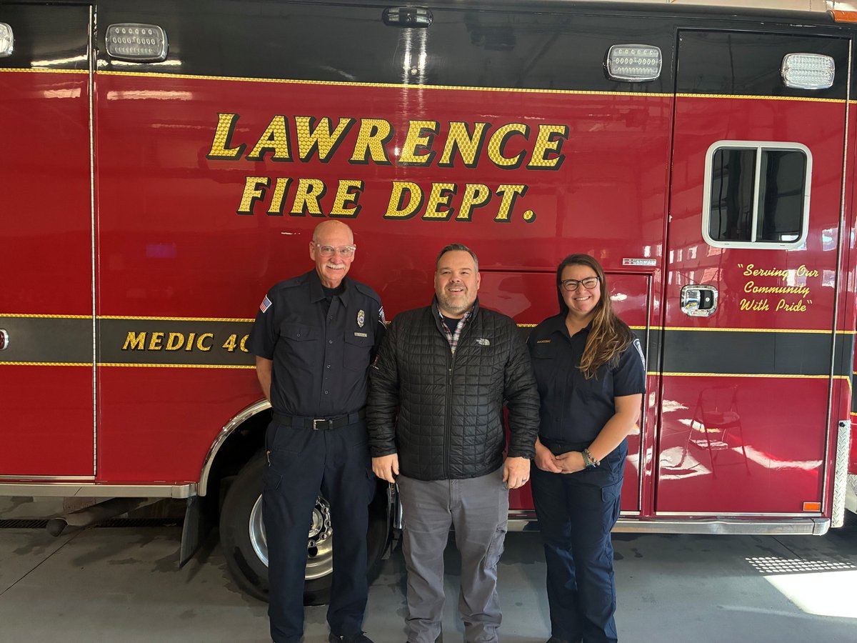
This is the official Twitter Page for the City of Lawrence Fire Department. It is not monitored 24/7. Please call 911 for emergencies.
- Tweets 6,668
- Following 793
- Followers 2,172
- Likes 8,432


ALT Protect yourself from heat and sun. Drink plenty of water and avoid alcohol. Beverages with electrolytes can also help protect against heat stress. Apply sunscreen, SPF 30 or higher, every two hours. Wear lightweight, loose-fitting, and light-colored clothing. Take regular breaks in the shade.


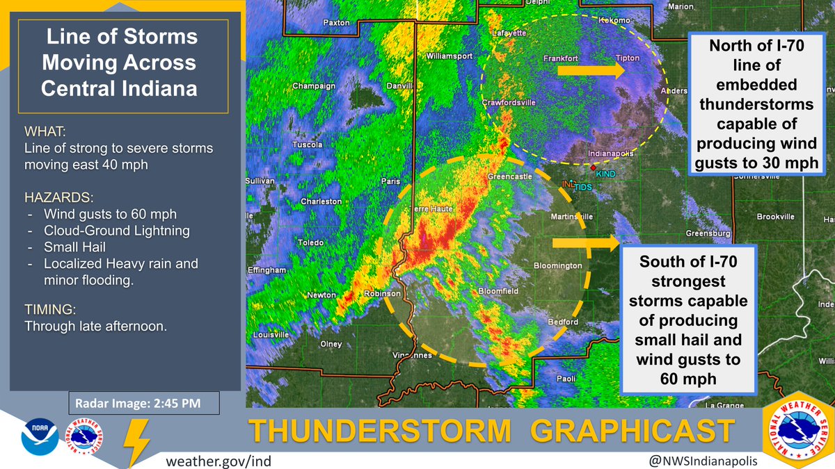
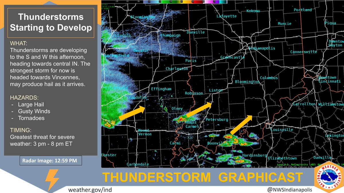
ALT Thunderstorms are developing to the S and W this afternoon, heading towards central IN. The strongest storm for now is headed towards Vincennes, may produce hail as it arrives. HAZARDS: Large Hail, Gusty Winds, Tornadoes. TIMING: Greatest threat for severe weather: 3 pm - 8 pm ET

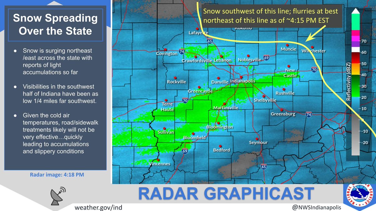
ALT Radar snapshot from 4:18 PM EST showing snow now reaching the ground over most of central and southern Indiana

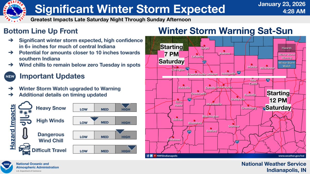
ALT A Winter Storm Warning will be in effect Saturday through Sunday evening. Much of the area is expected to get 6" of snow while there is a potential for amounts closer to 10 inches towards southern Indiana. Difficult travel is expected during this time.
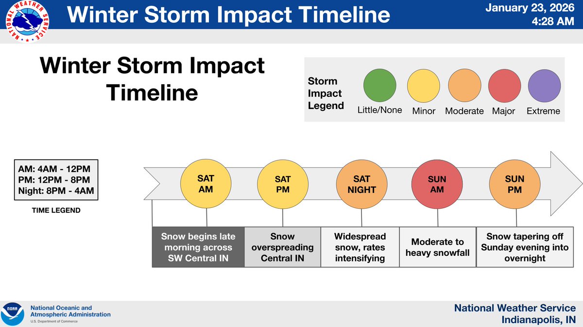
ALT Timeline of impacts for the winter storm this weekend. Minor impacts Saturday morning through evening with snow beginning from the SW and overspreading central Indiana. Moderate impacts Saturday night as snowfall rates intensify. Major impacts expected Sun morning with moderate to heavy snowfall. Moderate impacts Sunday afternoon to evening with snow tapering off.
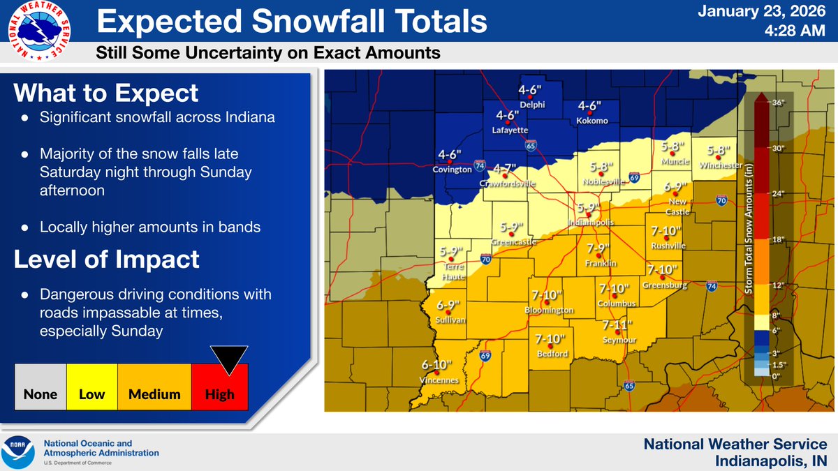
ALT Significant snowfall across Indiana. Majority of the snow falls late Saturday night through Sunday afternoon. Locally higher amounts in bands. There is a map of snowfall ranges across central Indiana: 4-6 inches possible in the north, 5-9 inches nearer to I-70, and 7-10 across the south.