
A father, husband, met. This is my personal X account - I don't just stick to weather. WI homer sports takes only. My happy place is anywhere on the water.
Joined February 2009
- Tweets 72,953
- Following 5,066
- Followers 8,203
- Likes 56,056
16,795 Photos and videos


Pinned Tweet

10 Dec 2021
If a meteorologist adjusts a forecast based on new data, that doesn’t mean said meteorologist is wrong.
That means the meteorologist is doing their job.
50
54
788

Luke Sampe retweeted

Jun 12
View of the wicked storm from northside of Kenosha!!!
2
43
396
20,252
Luke Sampe retweeted

Jun 12
This is from the Traffic camera in Somers Wisconsin where a tornado was observed and on the ground.
Jun 11

Here's a look inside the Observed #Tornado Warned Storm moments ago from a Somers, #Wisconsin Live Traffic Cam. 🥴 #wiwx @NWSMilwaukee
1
890
Luke Sampe retweeted

Jun 12
29
409
2,365
157,253

Luke Sampe retweeted

Jun 10
So sad. 😞
Photo credit WMTV15.

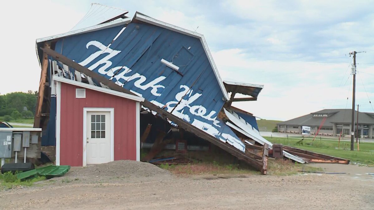
Jun 10

The big blue Culver’s barn on 151 near Beaver Dam has blown down.
😭😭
1
3
12
1,124
Jun 10
The big blue Culver’s barn on 151 near Beaver Dam has blown down.
😭😭
24
7
226
27,207
Jun 10
This was 13 minutes before the TOR was issued.
Trust your old local Mets. 😅
Jun 10
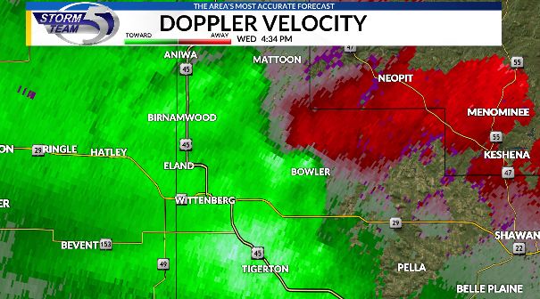
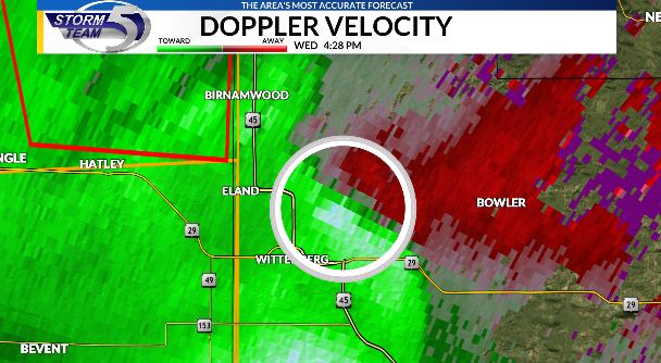
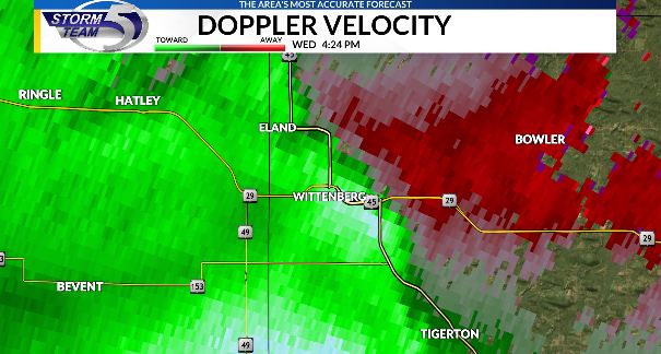
Area of tightening rotation near Wittenberg.
Take this storm seriously. Heads up along hwy 29 near/east of Wittenberg.
20
4,763
Jun 10
Very clear rotation near Bowler moving NE at 45 mph.
Take shelter in Blowler to Almon to Mattoon over to Neopit.
1
556
Jun 10
Seek shelter if you're just NE of Wittenberg and west of Bowler in western Shawano county.
1
2
845
Jun 10
Area of tightening rotation near Wittenberg.
Take this storm seriously. Heads up along hwy 29 near/east of Wittenberg.
1
4
5,783
Jun 10
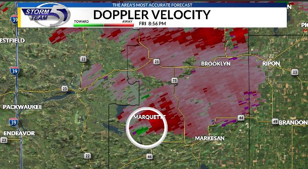
Arrival times of severe warned storm into Marquette, Green Lake, and Fond du Lac counties.
1
6
2,078
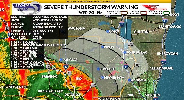
Jun 10
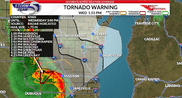
Estimated arrival times for strong/severe line of storms moving NE at 55 mph out of SW Wisconsin.
One tornado warning on this line in Iowa county.
2
2
14
4,075
Jun 10
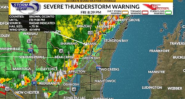
Strong storms moving into Titletown, USA.
This is not the main event expected later.
2
3
27
3,794
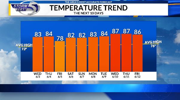
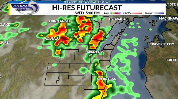
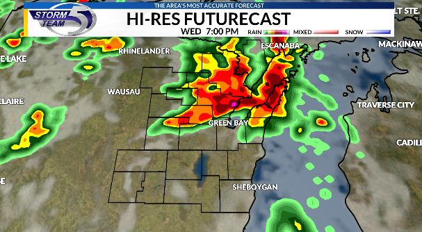
Jun 9
Wednesday and Thursday are days you need to be aware of the current weather conditions.
A hot and humid airmass will provide fuel and energy as a trough of low pressure moves in with a trailing cold front.
Need to watch 5-11pm window -- all modes of severe weather are possible.
Have a way to get warnings!

6
7
79
14,712