
Cartography and Data Visualisation by Maphustle
Joined September 2020
- Tweets 172
- Following 199
- Followers 829
- Likes 860
77 Photos and videos


Pinned Tweet

18 May 2023
I've made a website!
Early days - will be added to, refined and improved in due course.
Please check it out here:
maphustle.co.nz
3
4
26
2,903
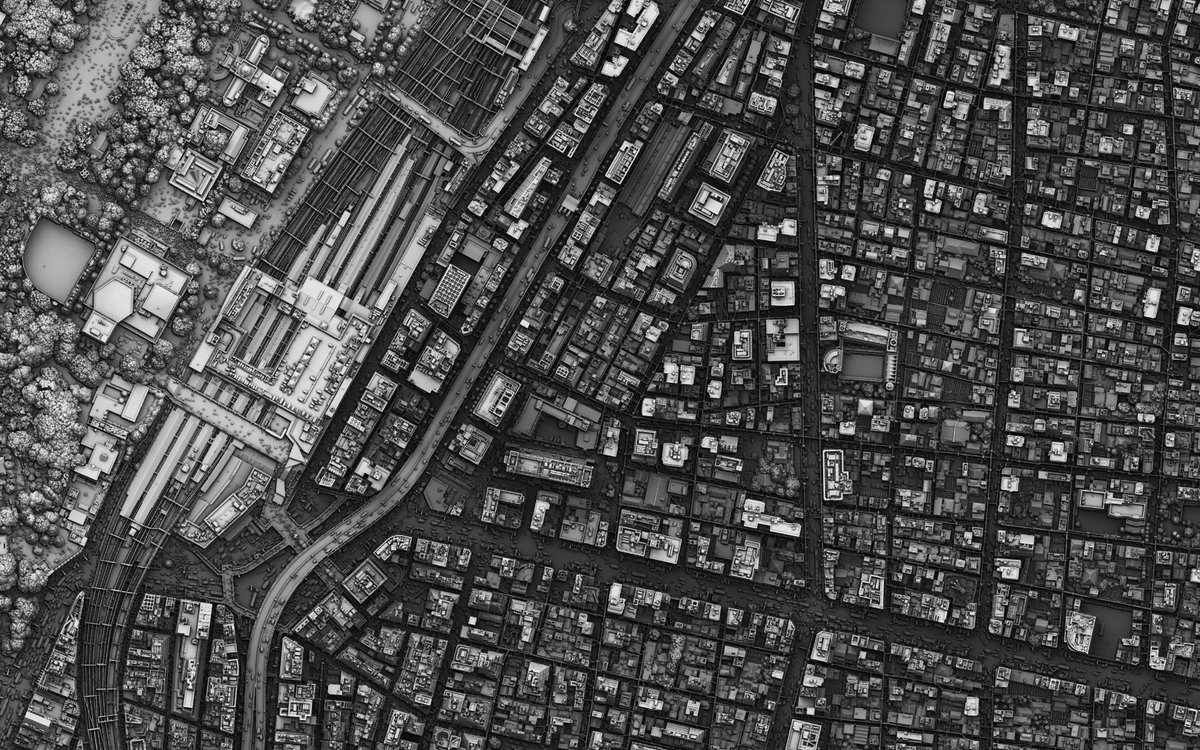
13 Dec 2025
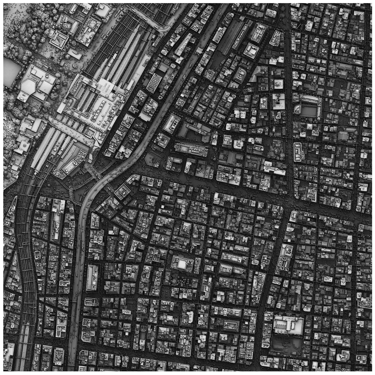
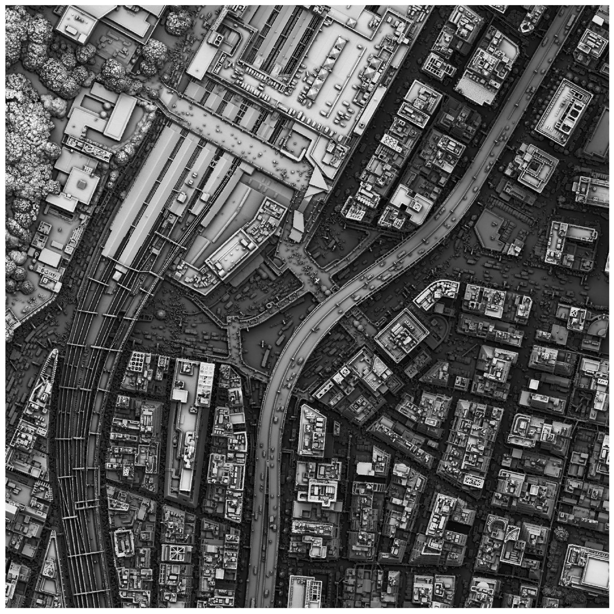
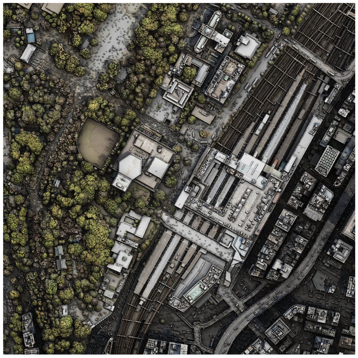
DSM of 台東区 (Taito City, Japan).
Made in QGIS (except for the last image).
Data source: Tokyo Digital Twin Project.
1
1
4
540
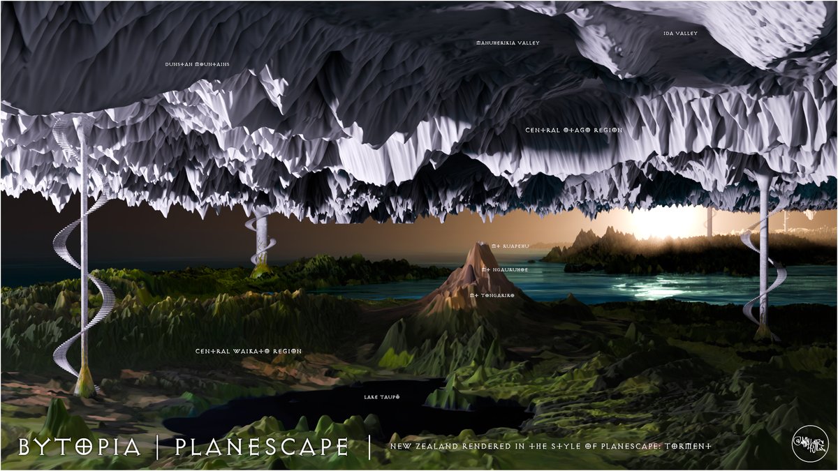
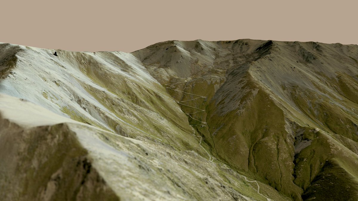
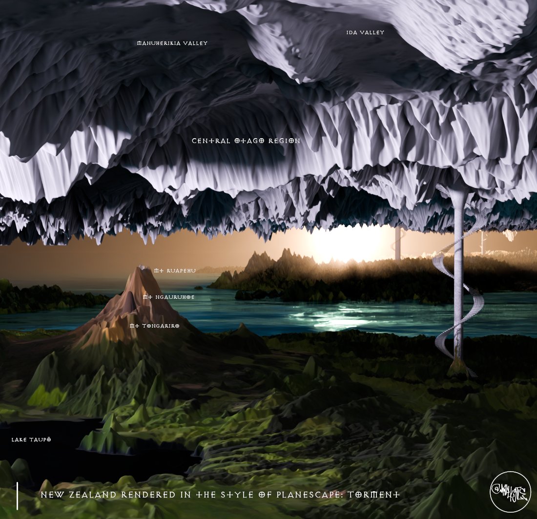
20 Nov 2025
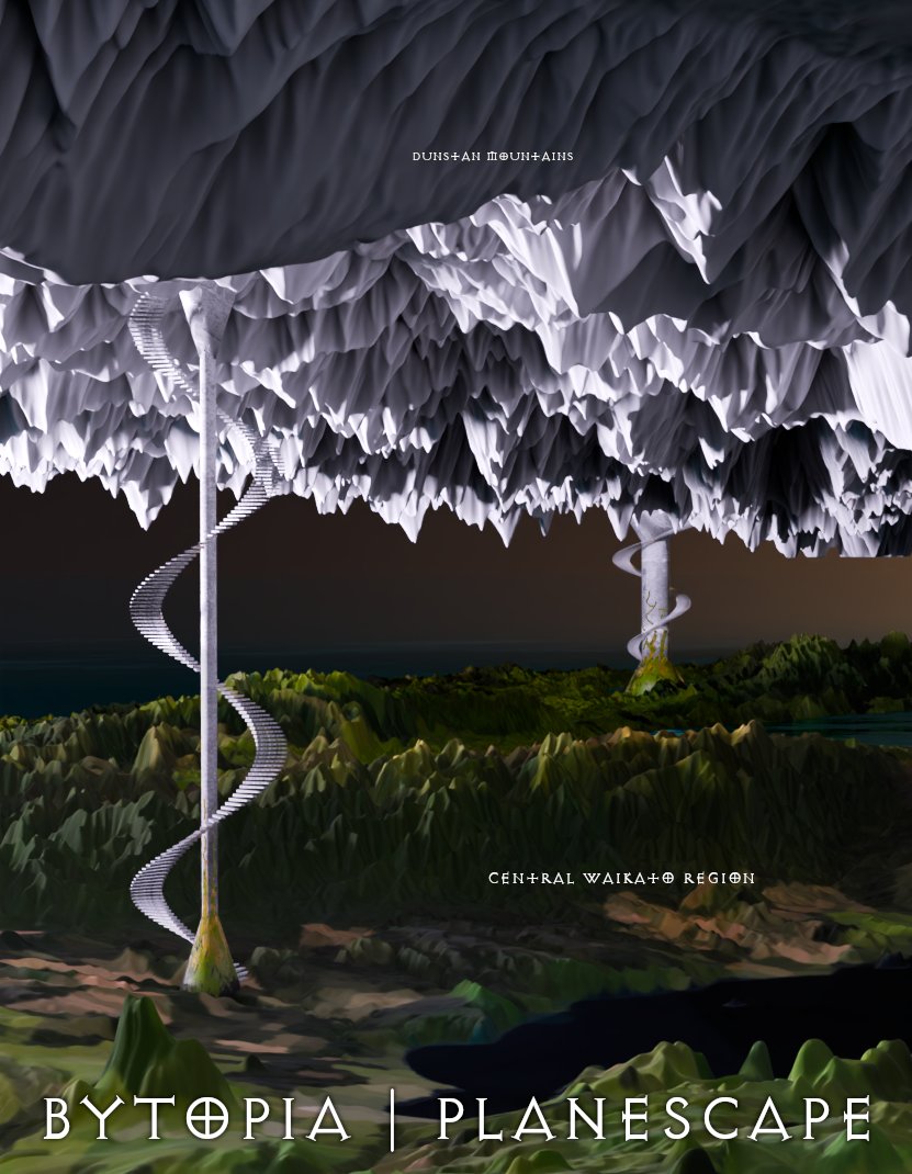
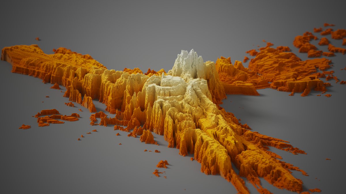
Experimenting with recreating the Planescape multiverse (2e AD&D) using real-world data. Inspired by Planescape: Torment and its low-poly charm. Just finished my first plane, a Bytopia reimagined from New Zealand terrain. It’s random, but a joy to build.
lnkd.in/gWNaeUVg
130
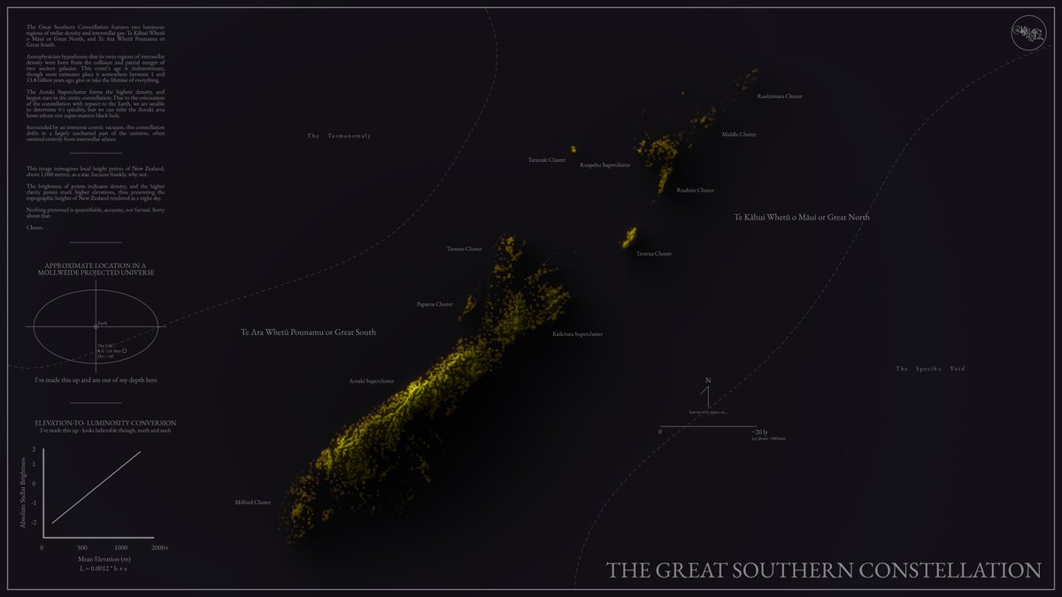
1 Nov 2025
#30DayMapChallenge
Day 1: Points.
This will likely be my only map and I've opted to make something for the fun of it, and as a bit of a joke. I'll let the map speak for itself. If one is unable to read the text, it re-imagines New Zealand's topographic height points as stars.
1
5
412
1 Nov 2025
It's a little hard to read so I've popped it on my website where you can zoom in further:
maphustle.co.nz/?gallery=645…
89
Emory Beck retweeted

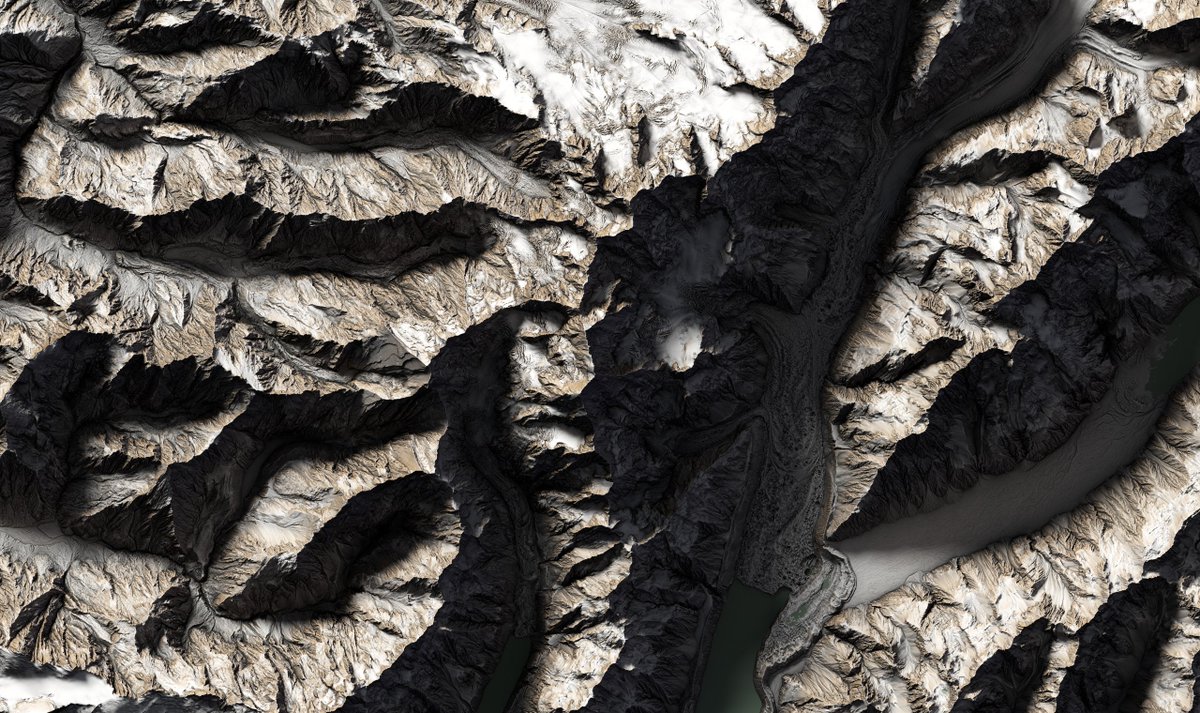
29 Jul 2025
🚨West Coast LiDAR is now complete! The final block of data has landed, bringing full regional coverage. And Aoraki/Mt Cook is fully captured across both West Coast & Canterbury 🏔️✨
Explore now👉data.linz.govt.nz/layer/1101…
Images: Top-down & Oblique views of Aoraki/Mt Cook
#OpenData


2
10
334
Emory Beck retweeted
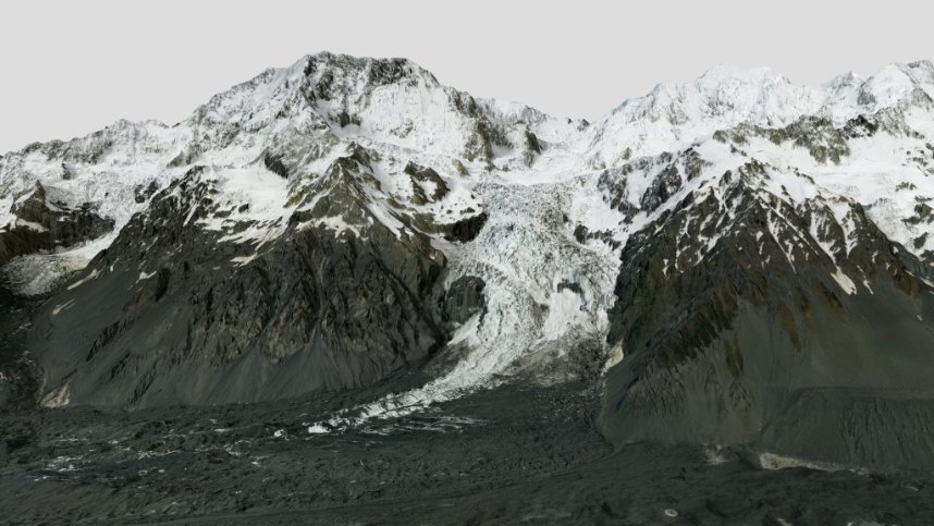
9 May 2025
🙌Day 3 of new data drops and we’ve saved a stunner. Feast your eyes on Aoraki/Mount Cook & Cameron Glacier in breathtaking detail👀 (images attached). This completes the final piece of the Canterbury LiDAR release! Dive into the data: data.linz.govt.nz/layer/1111…
#OpenData #LiDAR
3
10
449
Emory Beck retweeted
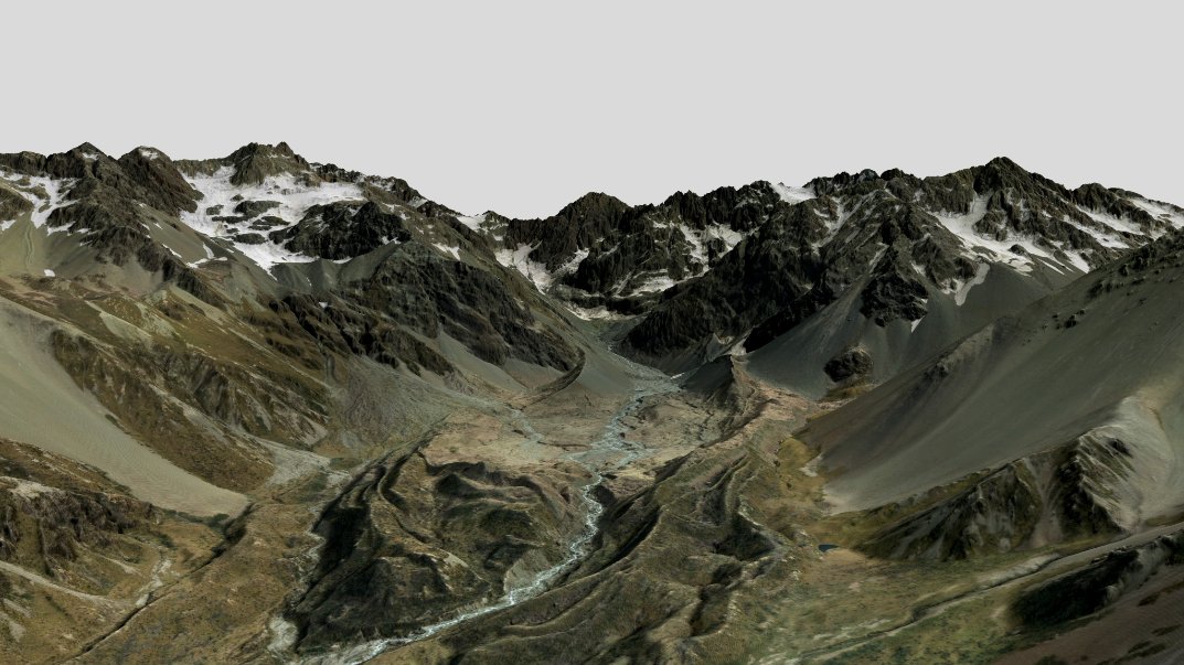
17 Feb 2025
🏔️We’ve updated our West Coast LiDAR dataset with a new block of data covering the Southern Alps, Mount Aspiring/Tititea, and the nearby areas that border the Canterbury Region. 🗺️Explore it at data.linz.govt.nz/layer/1101…
(Image: Mount Aspiring/Tititea) #OpenData


1
4
27
1,342
5 Dec 2024
Viewshed raster of incremental viewpoints along the Routeburn track, New Zealand. Turned 3D just for a bit of fun.
The lighter colours are visible by more viewpoints than the darker colours.
3
16
847
25 Nov 2024
Trying an idea of a virtual map/vis gallery. Here's my first attempt, showcasing Kaingaroa Forest, NZ.
maphustle.co.nz/blogs/kainga…
4
270
19 Sep 2024
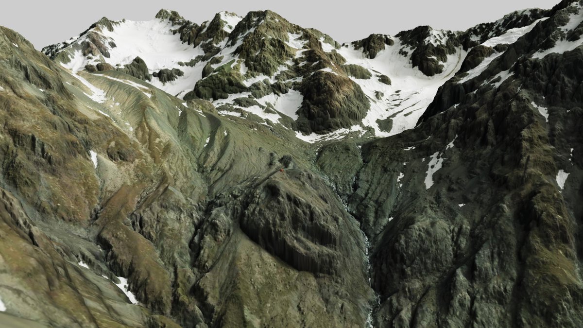
Barker Hut looking up at Mt Murchison, White and Marmaduke Dixon Glaciers, Canterbury NZ.
Data from LINZ Data Service. made using QGIS and AerialOD.
1
1
6
572
10 Sep 2024
Awakino Ski Field - Canterbury
DSM and aerial imagery
Made using QGIS and AerialOD
2
14
644
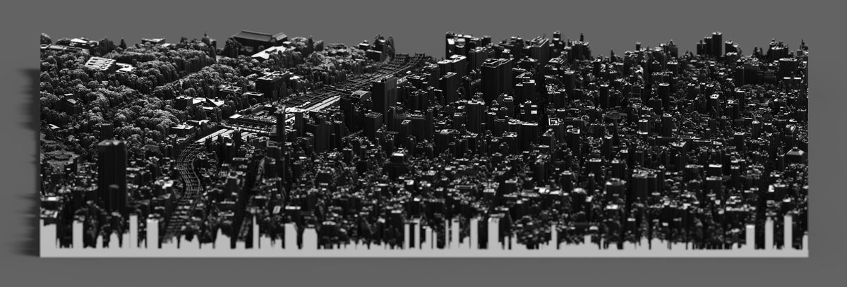
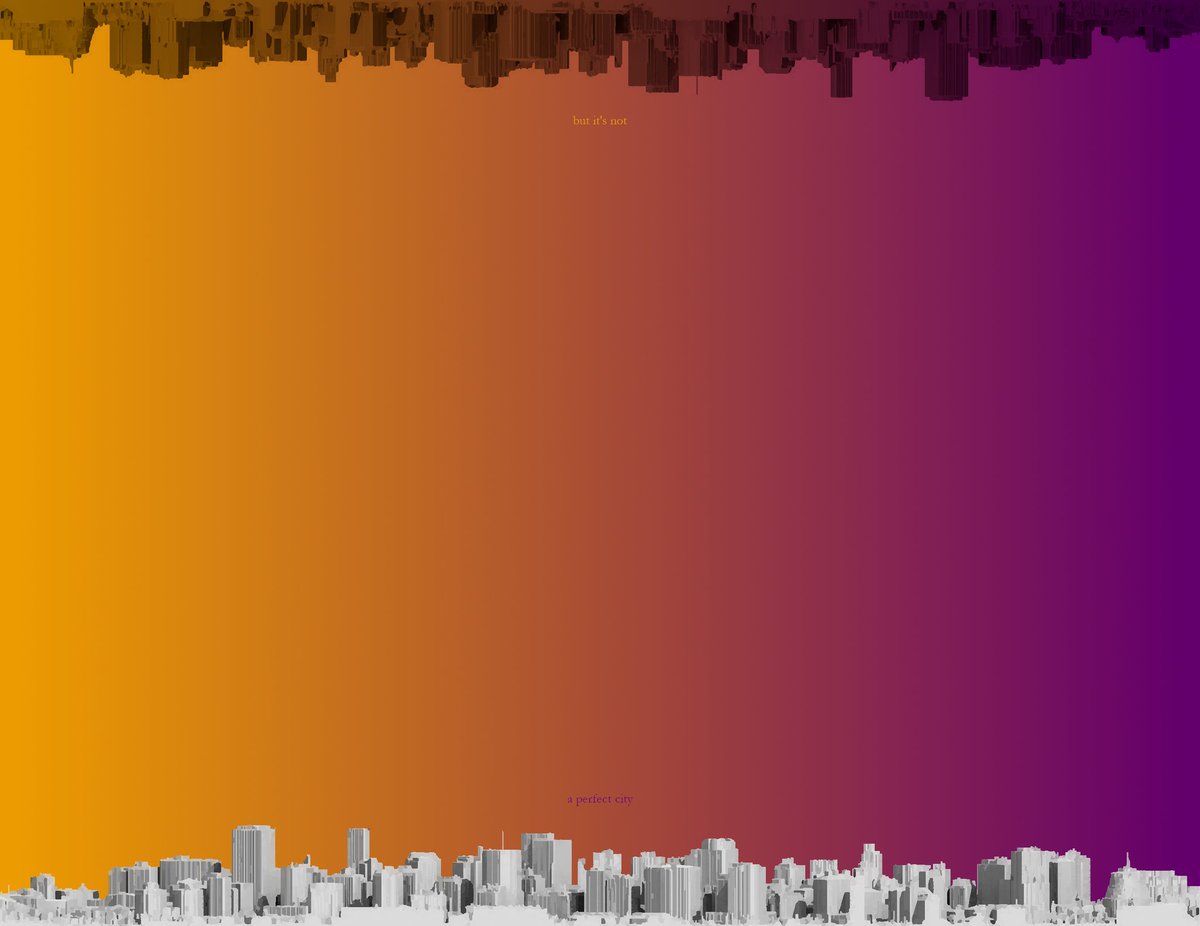
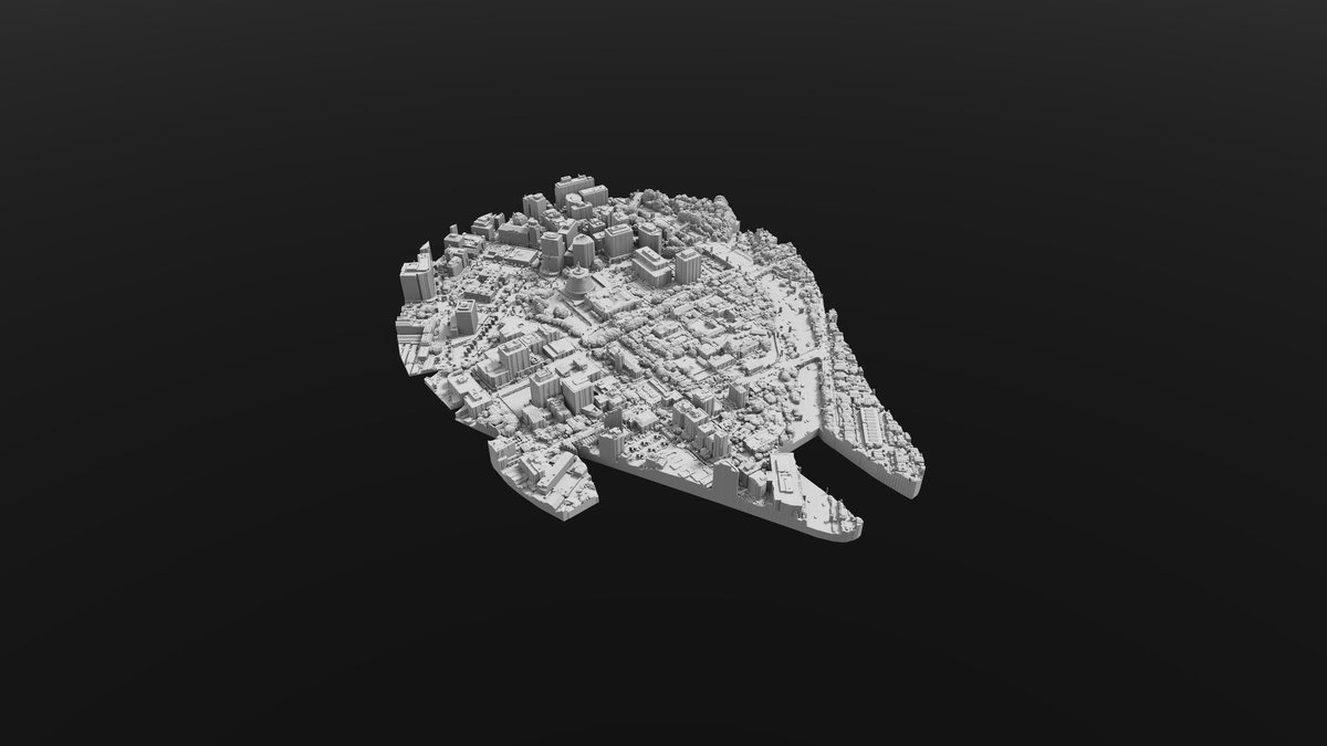
20 Aug 2024
My attempt at instagram-style inspo posting using the smallest amount of geospatial data.
Guess the cityscape.
1
1
4
375
Emory Beck retweeted

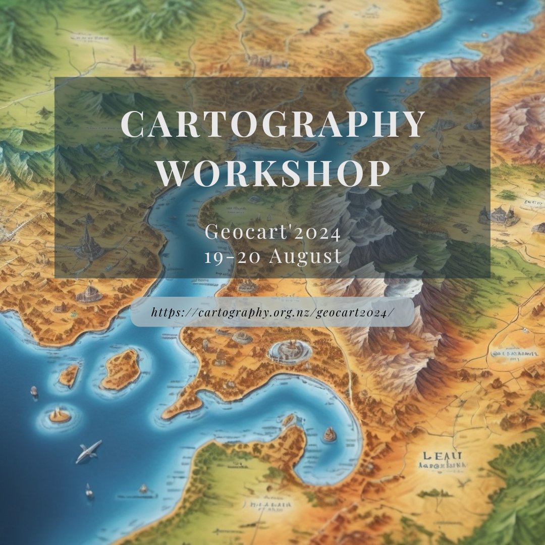
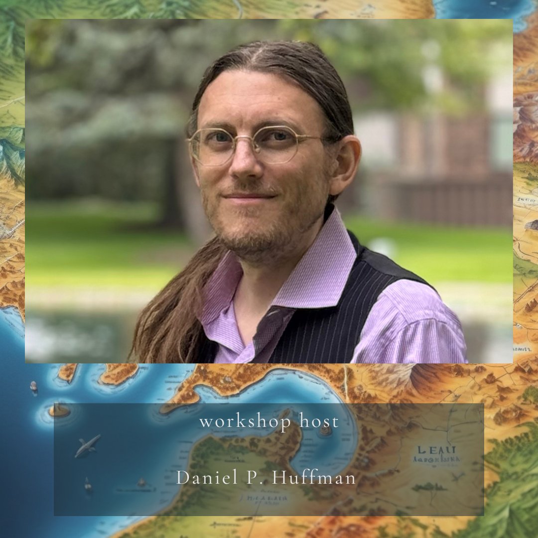
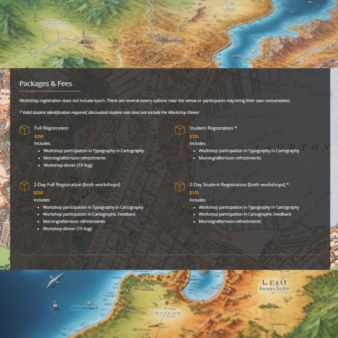
GeoCart'2024 is hosting 2 Map Design Workshops facilitated by freelance cartographer, Daniel P. Huffman. A special discounted rate is available for those who wish to attend both workshops as one package.
Typography in Cartography: 19 August
Cartographic Feedback: 20 August
1
3
5
432
18 Apr 2024
Mapping steep and flat relief together can be challenging. Often, one looses detail in flatter areas, like river plains, etc...
Here's an example where I have successfully mapped flat and steep relief, together. Tararua Ranges/Wairarapa region in NZ.
1
25
1,045
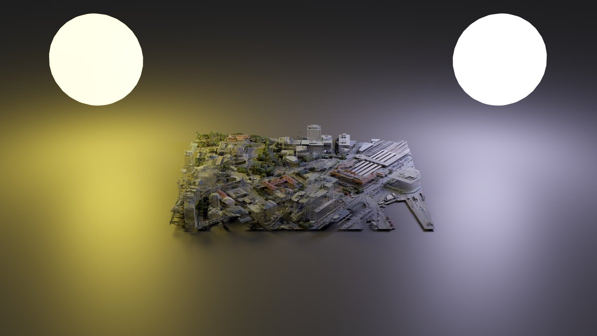
29 Feb 2024
I don't know what the point of these images are... But... woah, glowing spheres?
Point cloud of Wellington City, NZ.


2
1
17
1,401
22 Feb 2024
The start of the Milford great walk in New Zealand, aka, the mini-Milford.
The only part of the walk I was able to do due to heavy rain and track closures.
DSM and Aerial Imagery.
LINZ Data Service and OpenTopography.
1
1
27
1,299
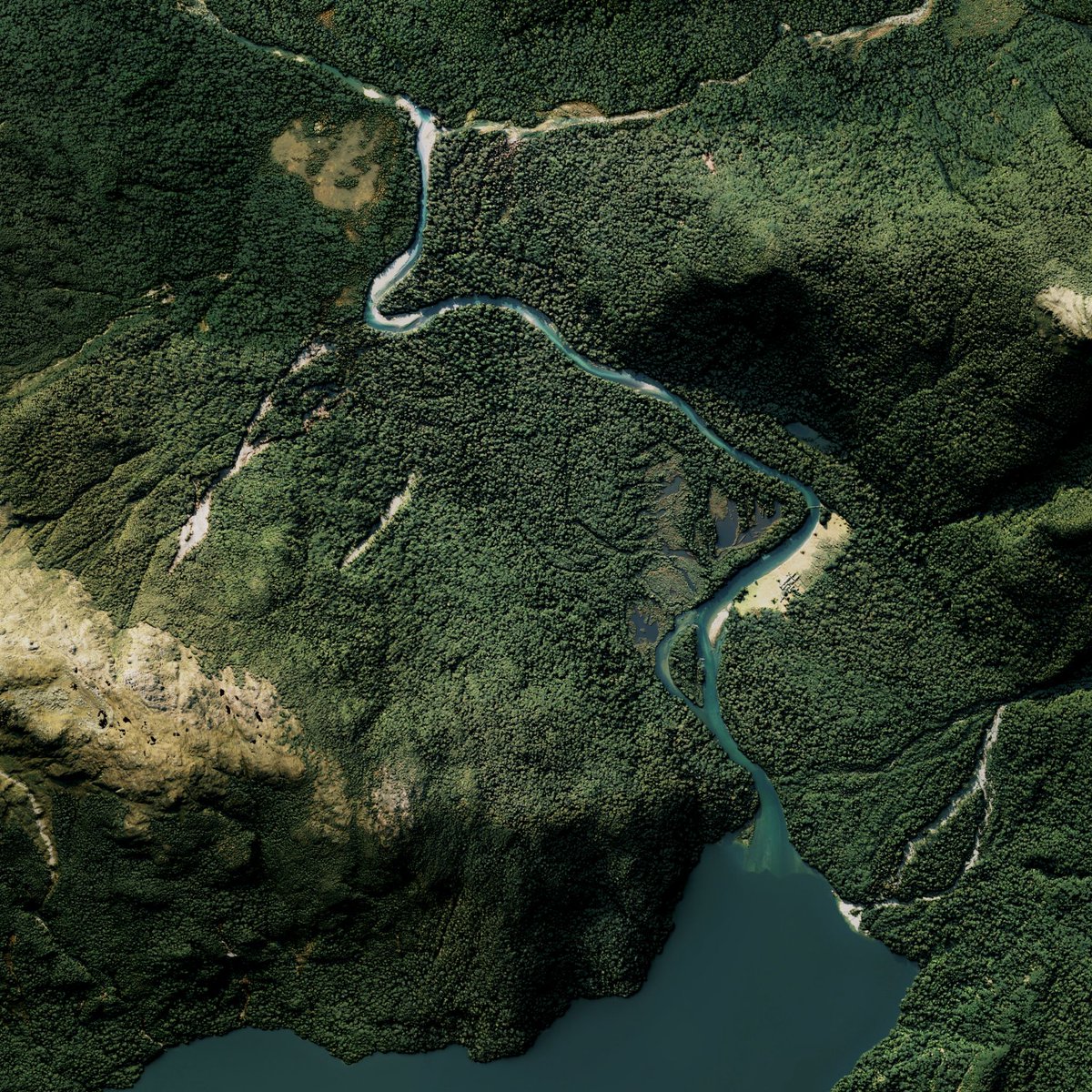
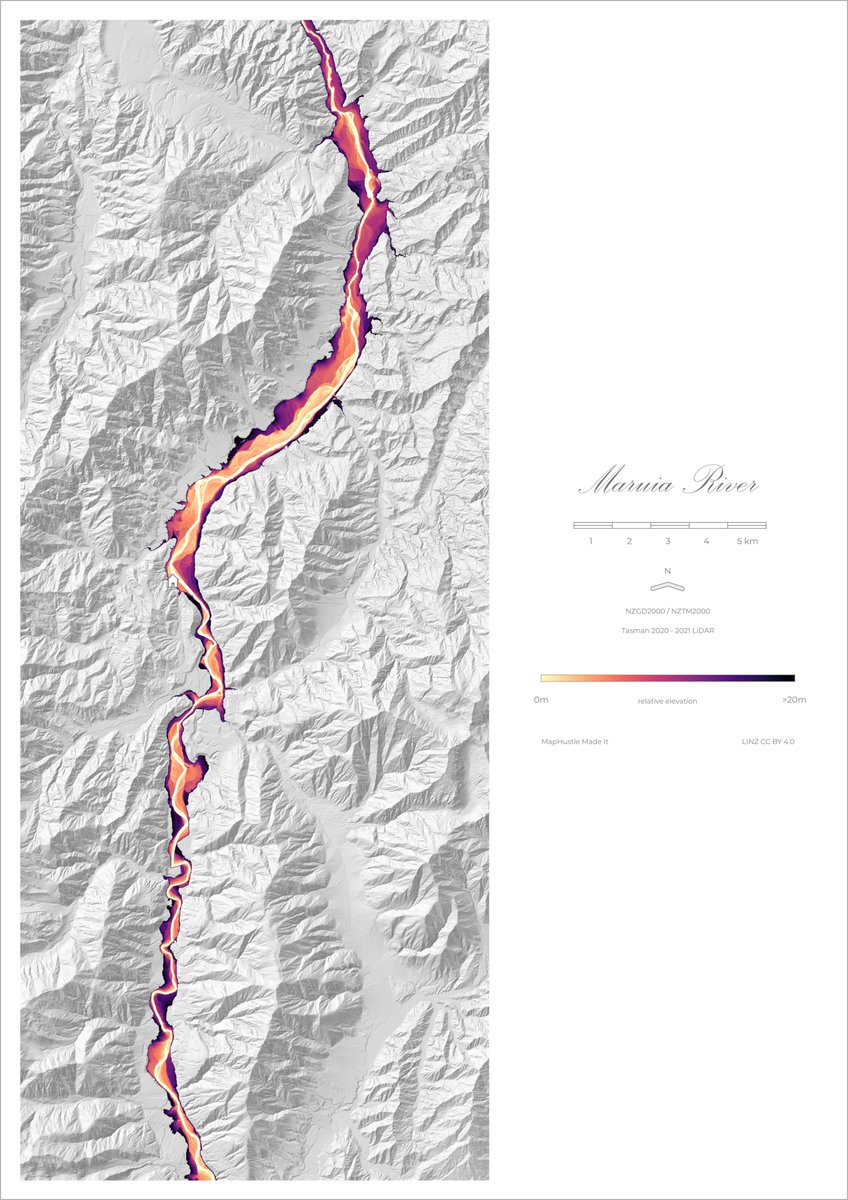
2 Feb 2024
REM of the Maruia River, Murchison - New Zealand.
Data from LINZ Data Service.
15
661