On the theme of spooky š» @levijohnwolf, @rsfrankl and myself have a brand new episode of #theGLaDpodcastš§š§š§This one, no less, on Digital Twins. You love them, you hate them, you can't ignore them...
š¢gladpodcast.podbean.com/e/epā¦
An unexpected diversion in this talk; Ian spoke very positively about @WalthamstowAcad which he had recently visited; I'm proud to be a school governor there
At @bspsUK conference, plenary discussion between @amrcampop and Sir Ian Diamond on future of population statistics, and Ian's career leading up to role as National Statistician #bsps
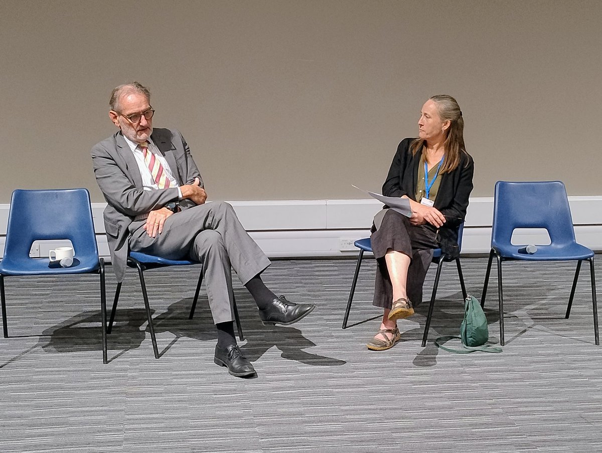
ALT Ian Diamond and Alice Reid, sitting at front of lecture theatre on rather utilitarian chairs
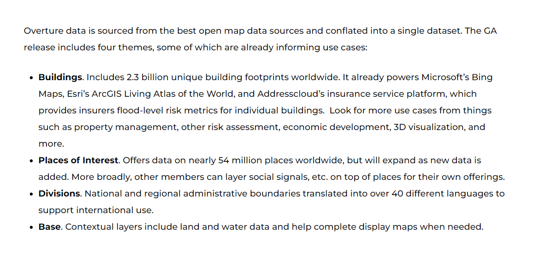
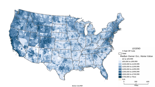
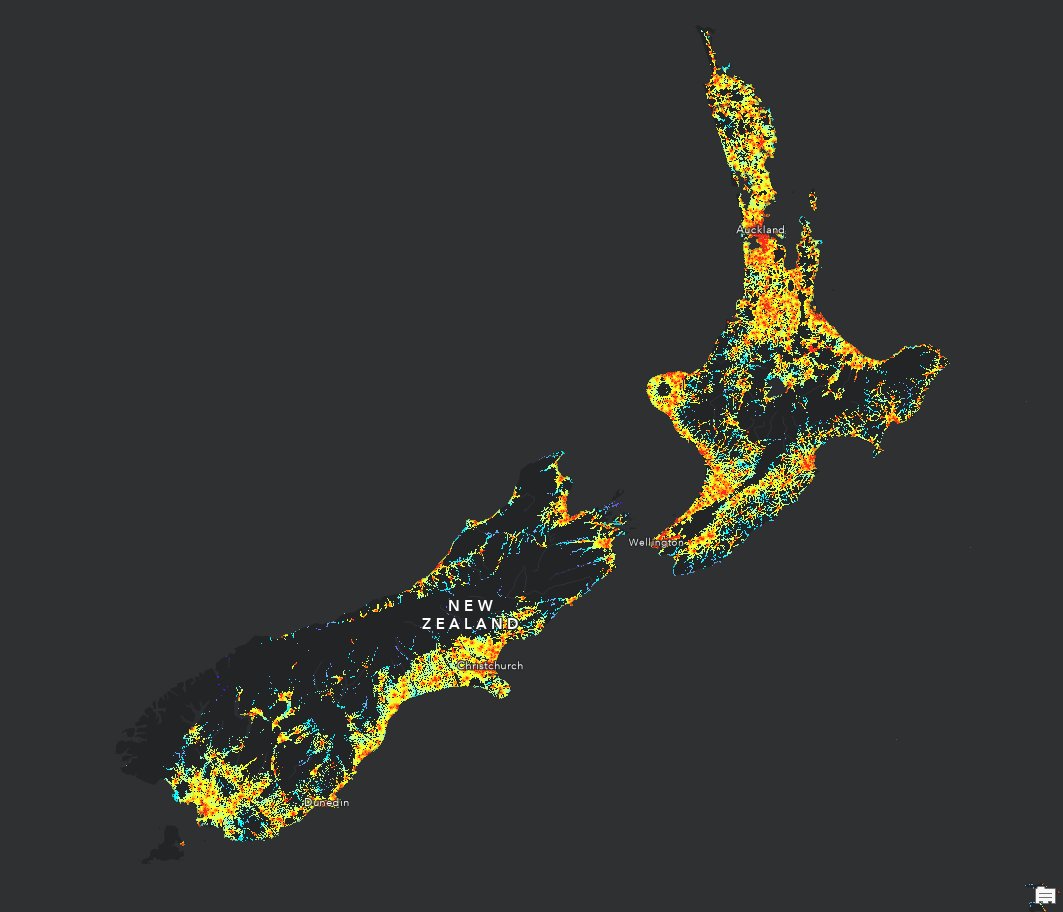
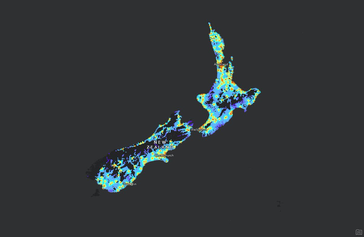
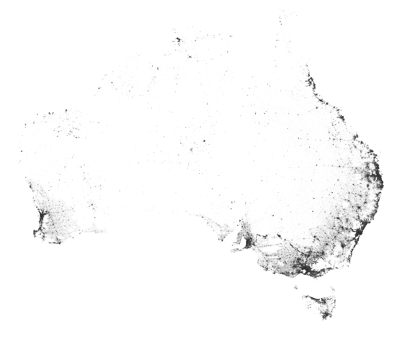
Given SEIFA is going on 40 years old, perhaps
@ABSStats should look at some more nuanced approaches. For example, the Alkire-Foster (AF) Method.
Technical introduction to the AF Method | OPHI ophi.org.uk/research/af-methā¦.
the new PySAL is out today! This release introduces the new Graph class and includes a *ton* of new stuff all across the metapackage
github.com/pysal/pysal/releaā¦
Overture Maps launched the Address Theme with over 200M addresses from 14 countries. š
Our goal is to build a single, conflated, global address dataset and we invite our community to provide feedback on the schema.
Read our blog for details: hubs.la/Q02H_5hx0
ALT ā¦
The GA release includes four themes ā¦
ā Buildings. Includes 2.3 billion unique building footprints worldwide. It already powers Microsoft's Bing Maps, Esri's ArcGIS Living Atlas of the World, and Addresscloud's insurance service platform, which provides insurers flood-level risk metrics for individual buildings. Look for more use cases from things such as property management, other risk assessment, economic development, 3D visualization, and more.
ā Places of Interest. Offers data on nearly 54 million places worldwide, but will expand as new data is added. More broadly, other members can layer social signals, etc. on top of places for their own offerings.
ā Divisions. National and regional administrative boundaries translated into over 40 different languages to support international use.
ā Base. Contextual layers include land and water data and help complete display maps when needed.
The most important geospatial concept?
The Modifiable Areal Unit Problem.
It can be the difference between reliable and deceptive results.
Hereās what you need to know about it:
The most important geospatial concept?
Spatial Autocorrelation.
It can make the difference between spurious and accurate results.
Hereās what you need to know about it:
We're excited to release Global Streetscapes - a massive open dataset of 10 million street-level images labelled with 300 attributes across 688 cities, supporting urban science and analytics! š£ļøš
I am proud of the team led by @yujun_hou@urbanalyticslab! ual.sg/project/global-streetā¦